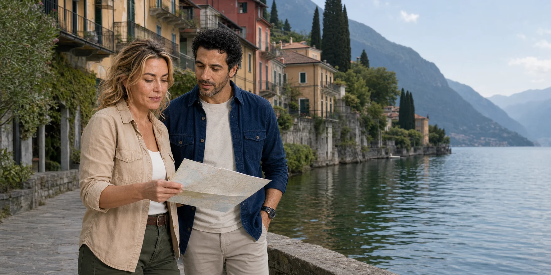
From Como, the lake first appears to offer an easy northward line. The city gathers around the lower end of the western branch; ridges hold the water in a long corridor; the villages seem to wait in sequence. A boat complicates that first impression. Nesso is not merely a waterfall beside the route. Varenna is not simply a coloured strip beneath a mountain. Bellagio is not just the most photographed stop. Each occupies a different relationship between rock, water, work and movement.
That is the real value of the waterline. From low on the lake, roads often disappear behind retaining walls. Landing stages become front doors. Houses reveal how little level ground the shore provides. Valleys announce themselves as cuts in the mountain, sometimes carrying the streams that once powered local industry. The central junction at Bellagio explains the lake’s famous shape more clearly than a postcard can.
The route considered here begins in Como, follows the eastern shore toward Nesso and reaches the central lake around Varenna and Bellagio before returning south. The order of the two village stops and the return shore depend on the service chosen. Three different days can share those place names: a continuous boat circuit, a public-navigation journey with independent land time, or a rail arrival at Varenna followed by a cross-lake sailing. Choosing among them starts with what deserves time ashore.

The lake is a branching basin, not a scenic corridor
Lake Como, or Lario, has the plan of an inverted Y. The long northern basin divides around the Triangolo Lariano: the western arm reaches Como, the eastern arm reaches Lecco, and Bellagio occupies the point between them. The Adda enters from the north and leaves through the Lecco branch. The Como arm ends at the city; it is not a river channel continuing south through the waterfront. The Consorzio dell’Adda’s account of the basin makes that distinction clear.
That geometry matters before any itinerary does. A departure from Como begins at a terminal arm rather than at the lake’s centre. Reaching the mid-lake villages means travelling north along a steep shore. A trip that adds Nesso on the eastern side of the Como branch, crosses toward Varenna, then reaches Bellagio is not a neat row of attractions. It moves between a city basin, a tributary gorge, a rail-and-ferry settlement and the hinge where the lake divides.
The basin is also a three-dimensional landscape. Its steep sides and deep water shape circulation below the visible surface. A 2012 study of Lake Como in the Proceedings of the National Academy of Sciences combined physical measurements, modelling and the knowledge of professional fishers to examine wind-driven motions in the Como arm. A boat’s apparent straight line crosses water whose movements can change with depth and position.
Temperature differences can separate warmer upper water from colder water below. Wind moves that layered system as well as making surface waves; some of the resulting movement is an internal wave rather than a wave a passenger can see. The Lake Como study describes stratification persisting through much of the winter. Its findings explain why surface appearance is a poor measure of the whole lake. ARPA Lombardia’s monitoring includes temperature, oxygen and other profiles alongside ecological and chemical assessment. Clear-looking water does not substitute for those observations.
The Adda also prevents a second mistake. The lake is not a closed bowl, yet its branching form means flow is not evenly expressed everywhere. Water arriving in the north ultimately leaves toward Lecco, while the Como arm communicates with that path through the central junction. Tributaries add local pulses after rain, carrying sediment and material from short steep catchments. Nesso’s streams are one visible example of a process repeated around the shore.
Glaciers gave the valley its broad structure, but “glacial lake” is only the beginning of the explanation. Tributaries have continued to cut short valleys and deposit material at the edge. People have then built on terraces, fans and narrow shelves, connecting them with stairs, roads, quays and boats. At water level, the shore reads as a negotiated boundary: rock, drainage, retaining wall, landing, house.
Wind turns the map into operating conditions
A route diagram cannot tell a skipper or ferry master what the surface will be like. Lake Como develops local wind systems shaped by the long valleys, slopes and differences in heating. Research combining physical measurements with local ecological knowledge identifies the best-known pair: the Tivano, associated with morning flow from the north in the Como arm, and the Breva, commonly developing from the south later in the day. Their timing and strength vary. They are patterns, not appointments.
The practical consequence is modest but important. A calm-looking departure does not guarantee a calm return. Wind opposing existing motion can steepen short waves; wakes can add another movement near landing stages; thunderstorms and rapid weather changes can interrupt the neat sequence shown on a booking page. The official public operator explicitly reserves the ability to suspend services for poor weather or strong wave motion.

This does not make the lake inherently dangerous, and it should not be used to dramatize an ordinary ferry journey. It means that navigation is an operation. Decisions about speed, route, boarding and cancellation belong to the responsible operator and the competent authorities, not to generic travel copy. The Lario basin authority publishes navigation rules and safety material; municipal port rules govern behaviour close to Como’s structures; staff instructions at the landing stage take priority over an old screenshot or an editorial route.
A traveller needs a simpler discipline: check the forecast and operator notices close to departure, listen at the dock, and keep the day flexible enough to lose a sailing without losing the trip. Protect a return connection and identify a workable land alternative before setting out.
The fishers in the 2012 study make this hidden geography concrete. Researchers interviewed 22 professional fishers and compared their observations with measurements and simulations. The fishers watched where drifting nets moved under different winds, using knowledge built through repeated work on the same water. Nets fishing below the surface could reveal circulation that the surface wind alone did not explain. The resulting study joined measured physics to accumulated local skill. For a passenger, it is a reminder that the lake has a working depth as well as a scenic surface.
Como is a working threshold, not a waiting room
Como’s waterfront is often reduced to the place where the boat begins. The city deserves more. Medieval walls, cathedral, civic buildings, railways, roads and industrial expansion meet the lake here. The public quays turn that long history toward movement. They are part of a transport system used by residents as well as visitors.
Silk is central to Como’s modern identity, but the phrase “silk capital” can hide the work. The Museo della Seta preserves machinery, samples, documents and the stages of an industrial production chain, especially from the nineteenth and twentieth centuries. Designing, preparing, weaving, dyeing and finishing cloth required specialized labour, factories, energy, trade and technical adaptation. Villas around the lake cannot simply be assigned to a generic class of “silk barons,” and the industry does not explain every estate. It does explain why Como should be read as a manufacturing and design city rather than as a lobby for luxury scenery.
That distinction improves the departure. Before boarding, look back as well as north. The cathedral dome and compact centre sit behind the transport edge. The railway connections place the lake inside a larger Lombardy network. Flood-control works and the low shoreline reveal the city’s exposure to water levels. The pier is not outside urban history; it is where the city changes mode.
The cathedral itself reinforces the point that Como is not a preface to the lake. Municipal interpretation dates the start of construction to 1396 and follows a building campaign that continued through late Gothic, Renaissance and later interventions before Filippo Juvarra’s dome brought the long project toward completion in the eighteenth century. A skyline glimpsed from the boat therefore contains several centuries of civic ambition and workshop labour. It deserves more than the label “departure backdrop.”
Water levels make the waterfront an active engineering edge. Downstream of Lecco, between the small lakes of Garlate and Olginate, the regulation structure described by the Consorzio dell’Adda has operated since 1946. Water leaving the lake supports downstream irrigation and hydroelectric uses as well as the river itself. The view at Como is therefore connected to decisions and demands well beyond this branch. Rainfall, inflows and wind still matter: regulation manages water rather than turning the shore into an unchanging line.
The exact step from street to vessel must still be verified. Como has more than one landing place and more than one kind of service. Confirm the departure pier on the booking or timetable, then check the walk, ticketing point, waiting area and boarding arrangements. Allow for luggage and assistance. The return pier and onward connection deserve the same attention as the outward departure.
The eastern shore is read through distance and interruption
North of Como, the eastern shore of the western branch alternates between settlements, wooded slopes, villas and cuts made by tributary water. The boat’s advantage here is continuous comparison. From the road, walls and curves break the view; from the lake, the eye can follow how buildings occupy ledges and how gardens use terraces.
But a water view has limits. Facades facing the lake do not prove that every historic property used water as its principal entrance. Architecture cannot be dated from a passing boat with confidence. A guide may distinguish a church tower, garden or villa, but the lake is crowded with names that travel marketing repeats loosely. The honest method is to identify only what evidence supports and to use the rest as morphology: shore, wall, opening, vegetation, settlement density.
This is also where speed changes ethics. A small craft can approach a shore more closely than a large ferry, but proximity is not entitlement. Navigation rules, marked areas, private property, swimmers, other vessels, erosion and wake all constrain the line. The most revealing view is not necessarily the closest one. A respectful waterline keeps enough distance to see relationships without turning homes and working landings into a theatre set.
Nesso turns falling water into a history of work
At Nesso, two streams—the Tuf and the Nosè—converge above the village and descend through the Orrido, a gorge that reaches the lake near the Ponte della Civera. The municipality describes roughly two hundred metres of difference in level and a long history of using hydraulic power. Mills, paper production, spinning, oil work and other activities occupied the watercourse at different times. Municipal historical records place paper mills in documentary sources by the late fifteenth century and enumerate a varied productive landscape in later centuries.

That record corrects the usual “hidden waterfall” framing. The sight and sound of falling water matter, but water here was also motive power. Buildings clustered where steepness could be converted into work. The bridge is not merely a foreground prop for the cascade; it is part of the village’s connection across difficult terrain. The gorge is not separate from the settlement. It helped organize it.
A boat offers a strong first reading because the ravine’s opening, the low bridge and the vertical village can be seen together. Details of channels, workshops, paths and the upper settlement require land time. Keep the water view at a safe distance: the skipper decides the line according to the craft, conditions and navigation rules. Standing up, approaching the bridge or seeking the waterfall’s spray is not part of a guaranteed route.
Nesso therefore provides a useful test for the whole itinerary. If the aim is orientation, a water view may be enough to reveal the system. If the mills, bridge and village are central interests, passing without landing is a preview. Compression is not automatically a flaw, but it must be named accurately.
The municipality’s local history gives the industrial landscape a useful sequence. A 1298 property record includes two mills and a pounding installation; a 1419 document records a machine for fulling cloth, the process that cleans and compacts woven wool. Paper production appears in evidence from 1493. Later inventories show multiple mills, presses, forges and other installations. This was not one timeless watermill beside a picturesque cascade: grain, oil, paper and textile work used the watercourse in changing combinations.
Water power also generated constraints. Useful head required channels, wheels, buildings and maintenance close to a force that could vary. Materials and finished goods still had to move through steep terrain and across the lake. The harbour, paths and bridge therefore belong to the industrial account as much as the falling water does. A diagram of “stream equals power” is only an entry point; settlement made the energy usable.
The public boats are part of the place
Navigazione Laghi’s Lake Como services are not background transport to be escaped. They connect Como, the central lake, Lecco and communities around the shore through ordinary ships, faster services and vehicle ferries on selected routes. Lombardy treats public navigation as local public transport. Visitors share an infrastructure whose first value is connection.

The distinction among service types matters. A slower ordinary boat gives time to see the shore but consumes more of the day. A fast service may cover distance with fewer views and different boarding arrangements. The central-lake ferry links Bellagio, Varenna, Menaggio and Cadenabbia in a working cross-lake circuit, while Como–Colico services connect the long axis. Not every sailing calls at every town, and published schedules change seasonally.
This network can be better than a private loop when the villages themselves are the priority. A traveller can reach Varenna by rail, cross to Bellagio by boat, and return by a route that does not retrace the entire western branch. It can also be less forgiving: ticket lines, capacity, missed connections and the last useful departure shape the day. The official advice is deliberately operational—arrive before departure, follow staff instructions, confirm the correct vessel and expect weather or strong waves to affect service.
A small-group boat offers a different value: lower eye level, a route chosen around water views, commentary and fewer transfers. It does not automatically offer more historical depth, more comfort, a toilet, weather shelter or easier access. Those features depend on the actual vessel and operator. “Private-feeling” is not a specification.
Public service also changes the social meaning of waiting. A missed ferry is not only a visitor inconvenience; capacity and reliability affect people travelling between work, school, appointments and home. Visitors occupy the same queue but often have more freedom to change the plan. That asymmetry supports a simple etiquette: keep luggage controlled, allow people to disembark, follow crew directions promptly and do not turn the gangway into a photography position.
The ferry deck is a legitimate observation platform, not an inferior substitute for a tour. Without exclusive commentary, the traveller must prepare the geography and identify features conservatively. In return, ordinary service reveals repetition: how landings are arranged, which settlements exchange people and vehicles, how the crew handles different ports, and how the lake functions beyond a single curated circuit.
Varenna is a vertical connection between rail and lake
Varenna’s appeal comes partly from how clearly it exposes the shortage of flat ground. The waterfront occupies a narrow edge. Lanes and stairways climb between houses. Gardens stretch along terraces. Above, the rail line makes the village a practical eastern-shore gateway from Milan; below, passenger boats connect the central lake.
Varenna’s verticality makes time and mobility inseparable. Stone surfaces, gradients and stairs affect travellers differently. A short stop can reveal the shoreline and central lanes; it cannot make every upper route, church, garden and castle equally accessible or equally worthwhile. Villa Monastero’s garden extends along the shore beyond the central village, rather than forming a compulsory uphill stage on the way to the railway.

Villa Monastero gives the shore a longer chronology. Its official history begins with a Cistercian women’s monastery at the end of the twelfth century. After the religious house was suppressed, the Mornico family developed a residence. Later owners remade the inherited complex; the German entrepreneur Walter Kees, who bought it in 1897, was particularly important to the villa and garden’s transformation. Marco and Rosa De Marchi’s donation brought the property into public cultural use in the twentieth century. It is now a house museum, garden and conference centre managed by the Province of Lecco.
The garden extends for roughly two kilometres along a narrow lakefront strip toward Fiumelatte. Its collection of plants belongs to a designed landscape of terraces, shelter, planting, soil, water and sustained horticultural care. Gardens on this shore take advantage of local conditions, but those conditions alone do not explain the composition. Walls hold the ground, paths stage the views and successive owners and gardeners decide which plants can thrive.
Inside the house museum, named rooms make changes in taste legible: the Sala Nera uses a neo-Renaissance vocabulary, while the Sala Rossa is neo-Rococo. These are later domestic interiors within a much older site, not surviving monastic rooms left untouched. Scientific use added another chapter. The conference centre opened in 1953; Enrico Fermi delivered lectures here in 1954. A lakeside residence became a meeting place for international physics without losing its house, garden or earlier history.
This chronology also guards against treating a garden ticket as a complete account of the village. Villa Monastero is a major institution with its own resources and access information. The waterfront, parish life, transport, housing and smaller businesses exist outside its gates. A focused visit can join one institution to the settlement; a rushed itinerary often makes the institution compete with the village until neither receives enough time.
Varenna’s practical chain should be tested in both directions. From rail to boat: station exit, gradient, pavement, luggage, ticketing, waiting area and gangway. From boat to village: step or ramp, crowd flow, surface, toilets, shade, seating, stairs and the time required to return. Villa Monastero’s own access guidance identifies a downhill entry that must be climbed on return, steps in the garden’s second part and gravel near the house and cafeteria. The institution describes lifts in the house and a mobility shuttle within the first part of its grounds. Ask about the assistance needed for your visit; the shuttle does not connect the ferry pier or station to the villa.
Bellagio occupies the hinge
Bellagio’s geography explains its fame better than a list of shops. The municipality sits at the northern tip of the Triangolo Lariano, where the lake divides toward Como and Lecco. From the water, the promontory is not an abstract Y on a map. It is a physical decision point: western branch behind one shoulder, eastern branch behind the other, northern basin opening ahead.

The municipality’s history follows ancient occupation, Roman presence, medieval fortification and conflict, then villas, gardens and the nineteenth-century growth of an international resort. During the struggle between Como and Milan, the promontory’s fortified position mattered. Later, Visconti power brought the dismantling of its fortifications. Ludovico il Moro subsequently granted the place to the Stanga family; ownership and influence changed again under the Sfrondati. Bellagio’s history moves through military and aristocratic power before leisure becomes its dominant visitor image.
The landing area and lower streets concentrate movement. Ferries unload, day visitors orient themselves, goods arrive and commercial frontage gathers near the water. Stairs and sloping lanes rise through the centre. A quick stop may be enough to see the branch point and understand the settlement’s position. It is not enough to treat the upper town, hamlets, gardens and working municipality as a decorative extension of the waterfront.
Fortification makes sense at this junction. Control of a promontory between branches carried military and commercial value before modern tourism. Later villa and hotel development used the same geography differently: access, prospect, climate and connection became assets for residence and leisure. The physical point stayed in place while the institutions around it changed. From the boat, the promontory supplies continuity; historical reporting supplies the discontinuities.
Bellagio’s resort identity also produces service work. Boats, accommodation, gardens, restaurants, shops, maintenance and waste management require labour that disappears from a panoramic view. The municipality is a place where people live and work as well as a destination. Its celebrated waterline is simultaneously a home, transport interchange and employment centre.
Time should therefore be allocated by purpose. For geographical orientation, protect time at the water and at a point where both branches can be understood. For architecture and gardens, choose one site and allow for entry, walking and return. For everyday settlement history, move beyond the first retail lanes without claiming to discover an “authentic” Bellagio hidden from other visitors. Residents do not exist to validate a traveller’s preferred version of the place.
Villa Melzi gives Bellagio another precise history to follow on land. Francesco Melzi d’Eril, a leading figure in Napoleonic Italy, commissioned the early-nineteenth-century complex. The Italian heritage catalogue names Giocondo Albertolli for the villa and Luigi Villoresi for the gardens. The white, restrained facade and composed lakefront landscape belong to that political and artistic world, rather than to an undifferentiated story of silk wealth. The institution’s visitor information distinguishes the garden, museum and chapel from the private villa, whose interior is not open to visitors. Choose it for a sustained garden and estate visit, with time to walk back to the landing, rather than fitting it between two imminent boats.
The western shore is more than villas and celebrity
On a southbound return toward Como, a route may pass the western side of the branch and, depending on its exact line, offer views toward the Lenno peninsula, Isola Comacina, Laglio, Cernobbio and other settlements. The names are easily turned into a catalogue of owners and film appearances. That is the least durable way to read them.
Villa del Balbianello provides a better model. FAI traces the site to a Franciscan presence and to Cardinal Angelo Maria Durini’s late-eighteenth-century transformation of the promontory into a place of study and retreat, including the loggia. Later owners changed the property. Explorer Guido Monzino filled it with collections and records of expeditions, then left it to FAI, which has managed it since 1988. The public value lies in accumulated architecture, collections, designed landscape and conservation—not in recognizing a screen backdrop.
Isola Comacina has a different scale and a much older political story. The municipality’s island history records its destruction in 1169 by forces from Como allied with Frederick Barbarossa. Twentieth-century excavations recovered the island’s early medieval religious and fortified landscape; the surviving remains of Sant’Eufemia are part of that archaeological account. Three artists’ houses designed by Pietro Lingeri and completed in 1940 add a sharply different layer of Rationalist architecture. From offshore, trees and a small landmass conceal these distinct histories. An island visit needs separate landing and walking time; passing it on a circuit is an orientation, not an archaeological tour.
At Cernobbio, Villa d’Este’s chronology begins with Cardinal Tolomeo Gallio’s sixteenth-century summer residence, originally named Villa Garovo. Caroline of Brunswick acquired it in 1815 and renamed it; conversion into a hotel followed in 1873. Its monumental lake-facing composition therefore predates the hospitality institution visitors know today. The shift from cardinal’s residence to royal retreat to hotel illustrates successive uses of one carefully positioned estate. A boat view does not confer access to its grounds or interiors, and the present hotel is not a public house museum.
Nearby Villa Erba records a different sequence. After a monastery on the site was suppressed in 1785, the Guaita family of wool manufacturers acquired the property and transformed it. Later Erba and Visconti ownership gave the estate its domestic and cultural associations, including summers spent there by the young Luchino Visconti. The modern exhibition and convention role followed a transfer in 1986; Mario Bellini’s Le Serre project added a greenhouse-inspired centre in 1988. Religious property, textile manufacture, family residence and contemporary event infrastructure meet in this one site. Cernobbio’s waterfront contains changes in ownership, design and use, rather than one uniform age of villas.
The same discipline applies elsewhere. A facade seen from the lake may reveal orientation, scale and the engineering of a terrace. It does not reveal the current owner’s life, the finances of maintenance or a simple line from Como’s silk industry to every garden. Celebrity property is private context unless it serves a documented public-history question; there is no reason to map it here.
Gardens along the lake are also labour. Stone walls stabilize slopes. Paths, drainage, pruning, planting and conservation preserve the composed view. Collections reflect selection and care as well as local growing conditions. The boat compresses these landscapes into a continuous panorama; spending time at one estate brings its particular architecture, owners and institutions back into focus.
A beautiful shore is also infrastructure under pressure
Lake Como is monitored water, not merely scenery. ARPA Lombardia assesses ecological and chemical status and maintains long-term observations, including temperature and oxygen profiles. Como is part of the European long-term ecological research network. Changes within a layered, deep lake cannot be understood from the surface alone, and a generous expanse of water is no reason to assume that every impact disappears immediately.
Navigation adds pressure and responsibility. Engines create emissions; hulls and propellers interact with shallow areas; speed creates wake; docks concentrate movement. The scale of each effect depends on craft, technology, route and operation. A blanket claim that one small boat is either harmless or destructive would be as weak as a blanket claim that public ferries are always the greener choice. The useful questions are occupancy, engine and fuel, distance, speed, wake management, maintenance and whether the trip replaces or adds to other transport.

Visitor pressure is visible in queues and crowded landing areas, but it is also structural. Public transport must serve daily mobility while accommodating seasonal demand. Waste, water, housing, road traffic and the management of public space do not disappear when visitors arrive by boat. A responsible itinerary does not solve those questions. It can reduce needless transfers, respect staff and marked areas, avoid turning private homes into attractions, and spend time with public institutions that maintain the landscape.
Tourism statistics can indicate growth but cannot by themselves explain pressure. A night in a hotel, a rail day trip, a coach group and a private boat place different demands on roads, water, waste and public space. The useful unit is often the chain of movements rather than the visitor count. Where did the trip begin? How many vehicle kilometres were added? Did the itinerary use public service or require an empty return? Which municipality carries the landing, sanitation and crowd-management costs? These questions rarely have a simple answer, but they are better than declaring one format sustainable by instinct.
Emissions are similarly comparative. A ferry burns fuel to move a scheduled load and may carry many passengers; a small craft may travel a shorter line with a much smaller capacity; an electric or hybrid system changes local emissions without erasing the energy and equipment lifecycle. Occupancy matters. So do wake, noise and the availability of a practical non-boat alternative. No green badge follows from a vessel description alone.
The waterline is most valuable when it makes dependence visible. The apparently effortless view depends on crews, port workers, timetables, engines, safety rules, quays, public funding, maintained gardens, wastewater systems and monitored water. Beauty is not the absence of infrastructure. It is often one of its outcomes.
Accessibility begins before the pier and continues after landing
Accessibility on Lake Como depends on the exact journey. Navigazione Laghi’s guidance for passengers with reduced mobility includes Como within its accessibility programme, alongside Maggiore and Garda. It also explains why the relevant vessel and port must be checked: gangway slope varies with water level, some landings or boats have constraints, and boarding remains subject to safe operating conditions and the captain’s decision. A programme covering the lake is useful context; the practical answer comes from the chosen sailing and each transfer.

The complete chain includes:
- Arrival: step-free rail or road access, distance to the correct pier, gradients, crossings, luggage and a realistic transfer margin.
- Waiting: shelter, seating, toilet access, ticketing method, crowd management and the ability to hear or see changes.
- Boarding: fixed or floating landing, gangway angle, gaps, steps, handrails, staff assistance and whether a mobility device can be carried safely.
- On board: stable seating, circulation width, weather shelter, noise, toilet availability, motion and a safe place for mobility equipment.
- At each stop: the same boarding questions in reverse, plus cobbles, stairs, steep lanes, rest points and the exact destination inside the village.
- Return: a protected sailing or rail connection and a contingency if conditions or capacity change.
This sequence also helps travellers with limited stamina, balance, low vision, hearing differences, sensory sensitivity, small children or heavy luggage. It avoids a common mistake: describing the street near a Como pier as easy to reach and inferring that the entire lake day is easy.
Time is an access feature too. A nominal hour in Varenna is not a full hour if disembarkation, orientation and reboarding consume part of it. Someone who needs a slower gangway, more rest or an accessible toilet should not have to treat that necessary time as failure. A strong itinerary builds a margin around the slowest required transition rather than asking the traveller to hurry through it.
Information has to travel across the chain. A railway assistance booking does not automatically notify a ferry operator; a boat operator’s acknowledgement does not guarantee a village route; an accessible attraction may sit beyond an inaccessible transfer. Confirm each responsible party and keep the answers in a form that can be shown at the point of service. If the exact assigned vessel can change, ask how assistance is protected when it does.
A short private loop can reduce transfers but introduce an unverified small-craft step. A public ferry can offer larger spaces and trained staff but still assign a vessel or port with constraints. A rail-based village day can avoid the long Como arm while adding station gradients. There is no universally accessible format. There is only an access chain that has been checked—or one that has not.
Choose the day by its central question
The right format depends on what must remain uncompressed. Four coherent days emerge from the evidence.

- Como and the lower branch: stay with the city, silk history, waterfront and a shorter navigation. Best when urban context matters more than collecting mid-lake names.
- A waterline orientation loop: use a verified small-group or private format to compare the shores, Nesso and the lake’s central hinge. Best when the continuous low viewpoint is the subject. Treat any village landing as a timed introduction unless the schedule proves otherwise.
- Varenna and Bellagio in depth: reach the central lake by rail or public boat, use the cross-lake network and give each chosen place real time. Best for lanes, gardens, churches and settlement morphology.
- A wider rail-and-lake comparison: connect Milan, Como, the border and Lugano only when the transport geography itself is the story. That is a separate two-basin question; it should not be stacked onto this waterline day.
None is the “ultimate” Lake Como experience. The orientation loop sacrifices depth on land. The village day sacrifices a continuous southern-shore reading. The city day leaves the mid-lake hinge for another visit. The broader cross-border day compares systems rather than dwelling on Nesso or the Como branch. A good plan names its omission.
Before paying for any boat service, confirm the operator and seller, departure port, route, duration, passenger limit and assigned craft. Ask about seating, shelter, toilets, lifejackets, boarding assistance, luggage, village stops and the return. Check cancellation and weather arrangements in the terms that apply to that booking. Compare the full payable total in live checkout, including any mandatory extras. If a feature is essential to your day, get an answer for the actual service before committing.
Listen: the Lake Como waterline field notes
The original episode explores what changes when the shore is seen from a small boat, whether Nesso is more than a brief spectacle, how short village stops feel and what boarding a moving vessel asks of the traveller. It provides a companion to this journey through the lake’s geography, places and practical choices.
For the trip itself, use the current timetable or booking confirmation for the departure, stops and return. Read the episode alongside the basin map, the village histories and the access chain before deciding which part of the lake deserves your time.
Leave the lake with relationships, not a villa checklist
Lake Como from the waterline is not a shortcut to total knowledge. It is a way of seeing connections that land routes interrupt. The Y-shaped basin becomes navigable geography. Como becomes a working threshold. Nesso joins falling water to production. Varenna shows rail, ferry, garden and stair occupying one steep edge. Bellagio becomes the hinge among three basins. The western shore becomes a record of reuse and conservation rather than celebrity trivia.
The best boat day keeps that explanatory power without pretending that motion equals depth. It respects the public network, checks current operations, leaves room for weather and traces access through every transfer. It knows when a water view is the story and when it is only the first page.
Reporting links
- Navigazione Laghi: Lake Como tickets, timetables and operating notices
- Navigazione Laghi: accessibility and passengers with reduced mobility
- Autorità di Bacino del Lario: navigation regulations
- Autorità di Bacino del Lario: Lario Sicuro
- Comune di Nesso: Orrido and Ponte della Civera
- Comune di Nesso: local history
- Villa Monastero: the villa, house museum and botanical garden
- Comune di Bellagio: landscape and history
- FAI: Villa del Balbianello
- ARPA Lombardia: lake monitoring
- Consorzio dell’Adda: basin and water regulation
- Laborde, Imberger and Toussaint: wind, circulation and fishers’ knowledge, PNAS (2012)
- Villa Monastero: site accessibility
- Italian Ministry of Culture: Villa Melzi heritage record
- Villa Melzi gardens: visitor information
- Isola Comacina: municipal archaeology and architecture
- Villa Erba: history and institutional reuse
- Villa d’Este: estate chronology
- Museo della Seta di Como
Operating conditions, timetables, assigned vessels, access assistance and weather change. Recheck the institution closest to each mutable fact near travel.