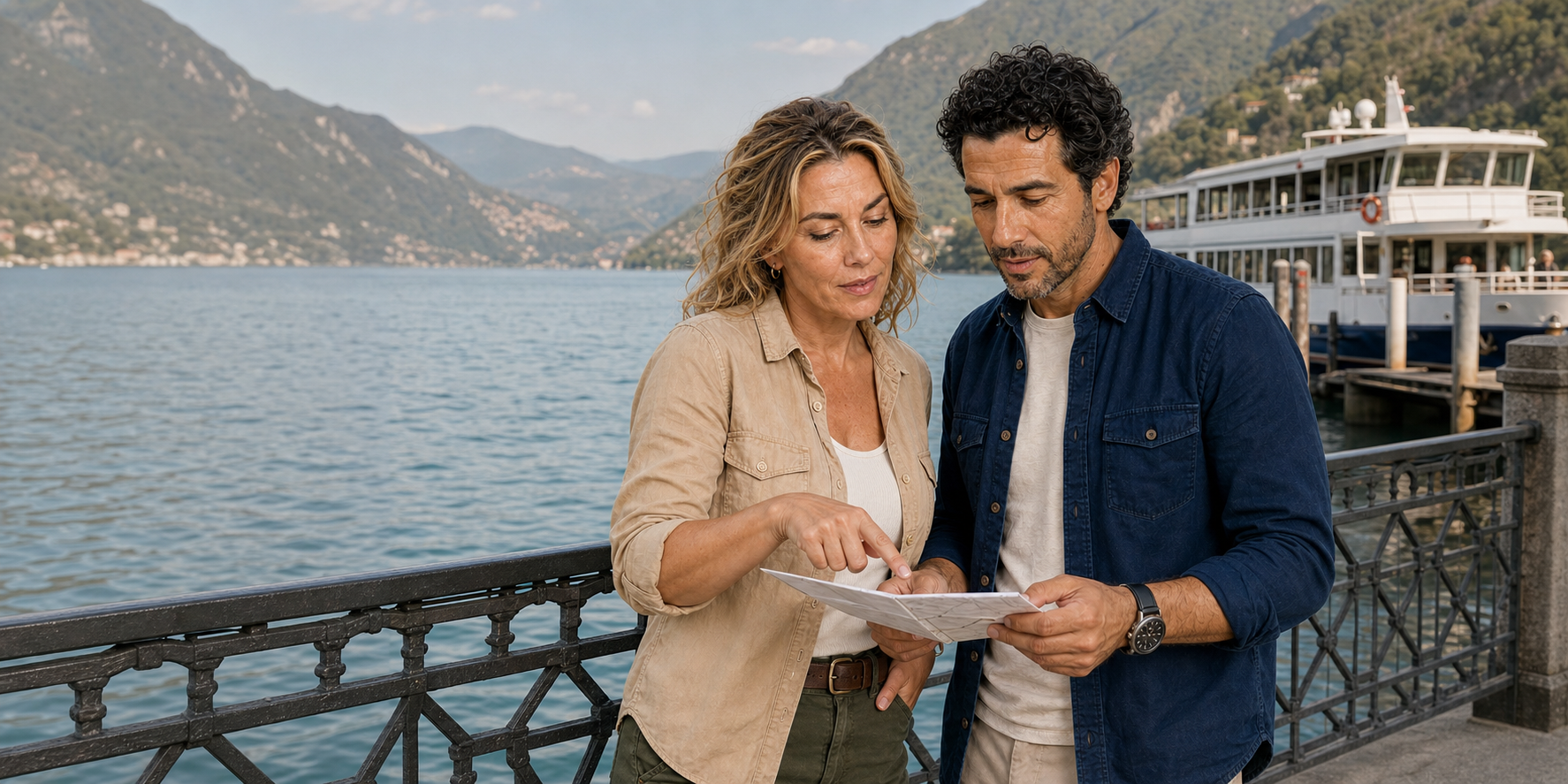
Lake Como and Lake Lugano are close enough to fit on one railway diagram and different enough to punish a careless comparison. Both occupy deep pre-Alpine basins. Both place an Italian-speaking city between water and steep ground. Both turned landing places into transport nodes and scenery into an international travel economy. Yet they are not interchangeable versions of “Italy” and “Switzerland,” and the border does not magically change the colour of the water, the manners of everyone on the platform or the pace of lunch.
A useful one-day journey therefore has two subjects. The first is physical: how ice, rivers, rock, settlement, railways and lake transport made two neighbouring basins readable. The second is practical: what happens when an itinerary tries to join Milan, Como, a boat, an international train, Lugano, a steep station-city connection and the return journey inside one long day. The beauty is real. So is the transfer chain.
01 · Two-lake field guide
Begin with a route, not a national stereotype
The quickest bad story says Como is warm and spontaneous while Lugano is clean and precise. It asks two places to perform national characters for a visitor. The geography tells a better story. Como grew at the southern end of the western branch of the Lario, where a small apron of flatter ground meets routes toward Milan and the Alpine passes. Lugano’s old centre formed around a landing place, while its railway station arrived uphill in the Besso district. One city is not “relaxed” because it is Italian and the other “orderly” because it is Swiss. Their shapes reflect shorelines, land ownership, state institutions, transport decisions and different moments of urban expansion.
The day also crosses more than a line on a map. Italy and Switzerland are both in the Schengen area, so a scheduled train may cross without a routine passport booth. Switzerland is nevertheless outside the European Union customs union. Immigration rules and customs rules are not the same thing. A traveller still needs the document appropriate to their nationality and must comply with Swiss rules for goods. “No border formalities” is therefore as misleading as promising a dramatic checkpoint.
The practical discipline is simple: keep a recognised, valid travel document available; check the Swiss entry rule that applies to your nationality; and treat customs allowances as a separate question. The Swiss State Secretariat for Migration and the Federal Office for Customs and Border Security are the current sources, not a tour anecdote about what happened on one train.

02 · Two-lake field guide
Two neighbouring lakes are two different water systems
Lake Como, also called the Lario, is a three-armed basin. The Adda enters the northern part, feeds the lake and leaves again from the Lecco branch. The familiar inverted-Y outline is not a decorative logo: it is the flooded shape of valleys enlarged and overdeepened by Alpine ice, then reorganised by river flow and deposits. The Como branch reaches remarkable depths. The Italian reference work Treccani records a maximum of about 410 metres between Cavagnola and Nesso, making the lake floor there far below sea level even though the surface sits in the pre-Alps.
Lake Lugano, or Ceresio, is not a simple oval next door. It is divided into connected basins and constricted arms shared by Switzerland and Italy. The international monitoring programme distinguishes a deep northern basin, a shallower southern basin and the small Ponte Tresa basin. Its 2022–24 report gives the northern basin a maximum depth of 288 metres and a theoretical renewal time of about 12.3 years; the southern basin reaches 95 metres and turns over theoretically much faster, about 1.4 years. These numbers explain why one lake cannot be read merely as a smaller, tidier Como.
Depth affects light, temperature, mixing, oxygen and the fate of nutrients. Shape affects travel: a shoreline village that appears close across the water may require a long road, a particular public boat or several transfers. A boat ride is therefore not just a view platform. It reveals that the settlement network was organised around water long before visitors treated the lake as a panorama.

03 · Two-lake field guide
Como is a city at the end of a branch, not a waiting room for the boat
Visitors often hurry through Como because famous villas and mid-lake villages dominate the destination image. The city deserves its own reading. The Roman street logic remains legible in the historic centre’s roughly orthogonal framework. Medieval walls and towers mark later limits. The lakefront, cathedral precinct, commercial streets and railway approaches show successive efforts to connect a constrained urban floor to regional networks.
Como’s location made it a communications node before tourism. Routes ran south toward Milan and north toward the passes. Textile work became central to its economy. Wool had an important early history; silk later became the defining industrial identity. The phrase “City of Silk” should not be reduced to a luxury-shopping caption. It refers to design, dyeing, printing, machinery, technical education, labour and trade. The Como Silk Museum preserves machines, documents, samples and tools because the product cannot be understood without its production system.
That industrial history also corrects the fantasy of an untouched lake. Como is a working provincial capital whose waterfront, roads, railways and services have been repeatedly built and rebuilt. The attractive nineteenth- and twentieth-century promenades belong to the same modernising history as factories and stations. A travel story that photographs only water and villas removes the people who made the city’s wealth and material culture.
Silk also changed the surrounding territory. Production linked drawing offices and finishing works in the city with mills, water, energy, chemical processes, transport and a dispersed skilled workforce. The finished scarf can hide that chain because it is light and visually self-contained. A museum machine restores weight, noise and sequence: thread must be prepared, controlled, woven, dyed, printed and inspected. Technical choices become pattern and surface.
For a short visit, use one silk object as a reading exercise. Identify whether the display explains raw fibre, weaving, dyeing, printing or design. Ask which part of the chain occurred in Como and which depended on wider trade. This is more useful than treating “silk city” as permission to shop. It also shows why Como’s identity belongs to networks that cross the same political border the day later crosses by train.
The piazza can become part of the lake
Como’s waterfront has another hidden system: water-level management. The Consorzio dell’Adda describes the regulating structure between the Garlate and Olginate lakes as operational since 1946. It controls the lake’s outflow below Lecco. Upstream reservoirs, incoming river water and downstream uses belong to the same system; the view from Como shows only its urban edge.
Regulation does not mean holding the lake at a decorative constant. Storing more water can serve irrigation, while releasing more can burden the downstream Adda. A study of the 1959–2000 record found that reservoir and lake regulation generally reduced the frequency, duration and severity of Como flooding. It did not eliminate it.
Como’s own ground complicates the problem. The study explains that Piazza Cavour subsided by about 65 centimetres between 1955 and 2000, changing the relationship between a measured lake level and actual flooding. Wind and the uneven surface of the square further complicate a single threshold. Those are historical findings, not a present-day flood prediction. The apparently simple line where promenade meets lake is a negotiated hydraulic and urban boundary.
This history has practical consequences. Check local notices, allow a route away from the immediate shore when water is high and never cross a flood barrier for a photograph. The Consorzio’s study of regulation and Como flooding explains why managing water and protecting a city are continuing responsibilities.
04 · Two-lake field guide
The cathedral records four centuries of decisions
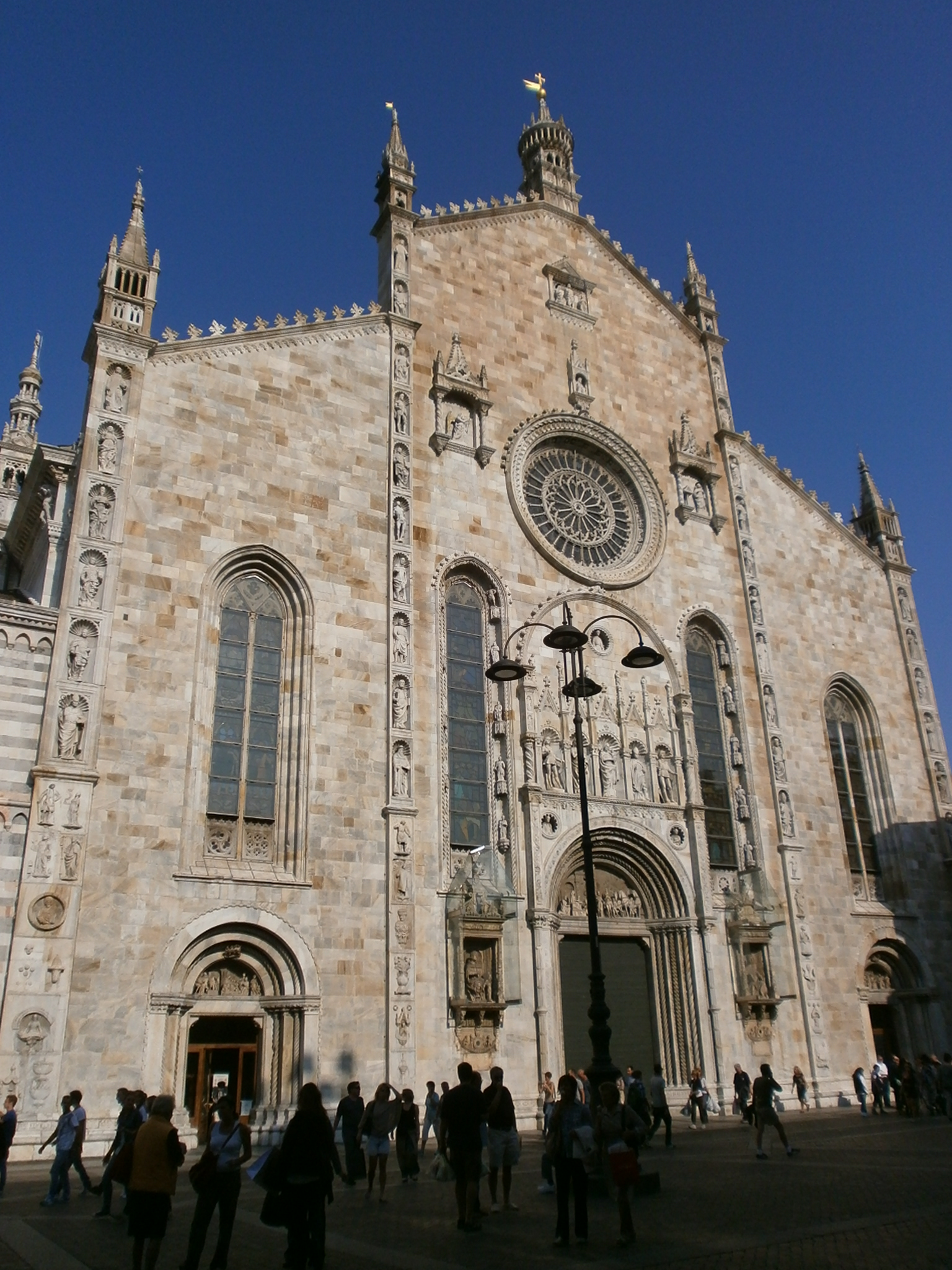
Como Cathedral stands close enough to the lake for the water-to-city relationship to remain immediate, but its façade leads away from easy scenery. Work began in 1396 on a replacement for an earlier church. According to the Municipality of Como, the late-Gothic façade was built largely between 1455 and 1486, while the dome designed by Filippo Juvarra completed the long campaign in the first half of the eighteenth century. “Gothic cathedral” is consequently true only as a starting point.
Read the façade from structure to detail. The broad gable establishes a northern-Italian church front; vertical sculpture bands, pinnacles and the rose window intensify it. Statues of Pliny the Elder and Pliny the Younger place two Roman authors from Como in a Christian civic façade. Their presence is not a secular accident. Renaissance cities used ancient learning to articulate local prestige, and the cathedral became a surface on which religious and civic identities met.
Inside, later spatial languages and furnishings accumulate rather than cancel the medieval beginning. The lesson is useful for the whole day: borders and period labels are analytical tools, not switches. The cathedral did not become one pure style, just as Lugano did not become culturally disconnected from Lombardy when its political history moved into the Swiss orbit.

05 · Two-lake field guide
What a Lake Como boat can explain
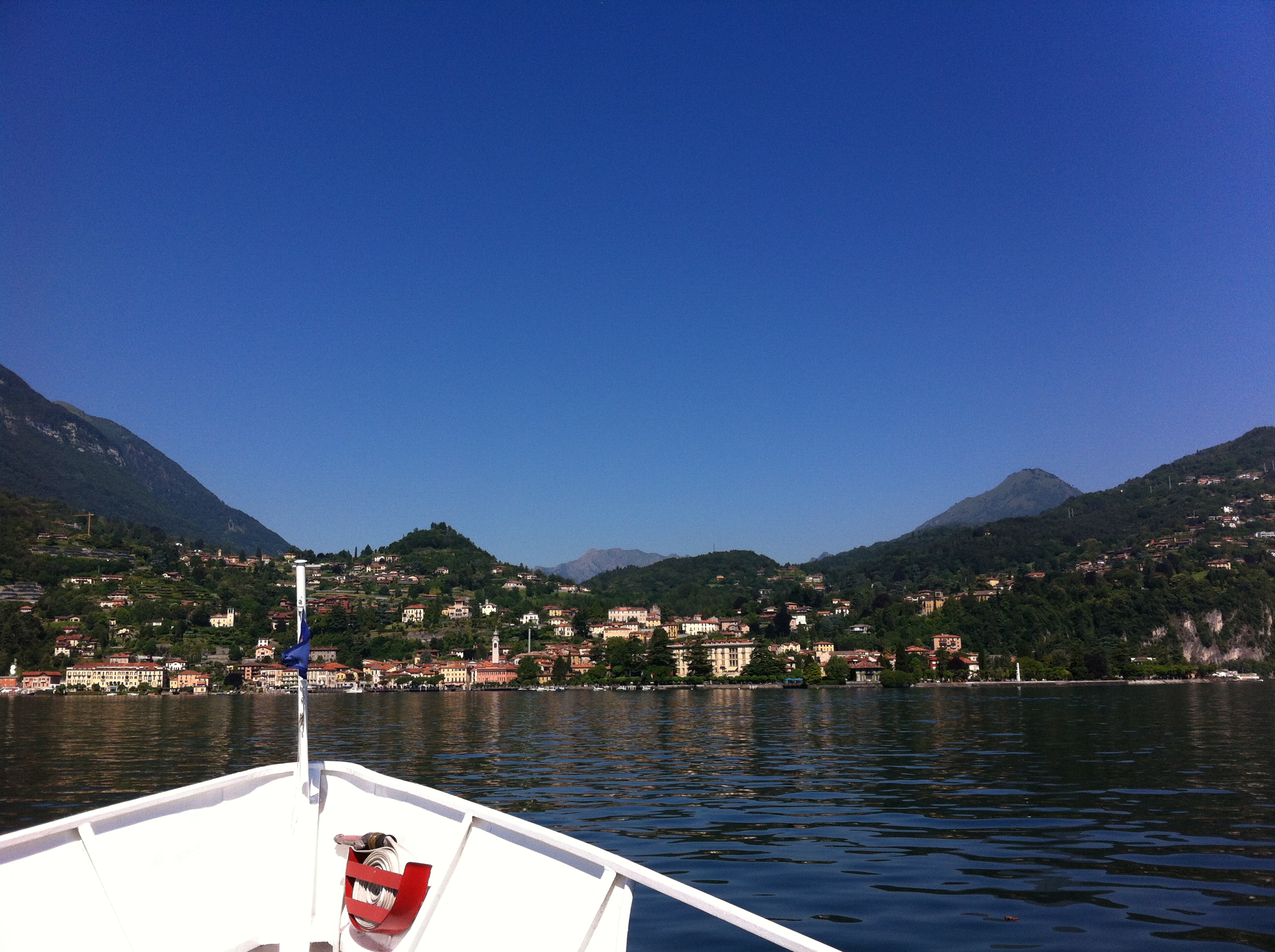
From the water, the steep relationship between settlement and slope becomes legible. Dense shore buildings occupy scarce level ground. Bell towers mark old centres. Roads and rail lines cling to narrow shelves or disappear into tunnels. Villas use terraces to manufacture gardens on difficult terrain. Retaining walls are as important to the view as cypress trees.
Public navigation is a transport network, not a single sightseeing loop. The government operator publishes seasonal timetables for ordinary ships, fast services and vehicle ferries. Its current information warns that weather and strong wave motion can suspend routes, recommends reaching the ticket office before departure and notes that ships and accessibility conditions can change. The live timetable separates the Como–Colico corridor from central-lake ferry operations; it does not prove that a private or guided cruise uses any particular village or public departure.
This distinction matters because short itineraries often name a cruise without identifying its stops. A one-hour southern-basin circuit, a scheduled public service and a point-to-point village landing are different experiences. If Torno or another village is decisive, choose a dated public sailing that names the stop or obtain a written route before committing to a guided day.
The view remains valuable without invented precision. On a short southern-basin cruise, watch how the city thins, how slopes close around the water and how transport infrastructure negotiates the edge. Use Navigazione Laghi’s live Lake Como page for independent travel, because timetables, vessel types and seasonal operations are mutable.
Two villas, two different kinds of wealth
Cernobbio’s Villa d’Este and Villa Erba make the shoreline’s social history more specific. Villa d’Este began as Villa Garovo: the estate’s own chronology dates Pellegrino Tibaldi’s summer residence for Cardinal Tolomeo Gallio to 1568. Caroline of Brunswick later acquired it and changed its name; its conversion into a hotel in 1873 gave an aristocratic lakeside property a new place in international tourism. The long façade and formal grounds express the ability to reserve a large, organised piece of a tightly constrained shore.
Villa Erba brings industrial capital and cinema into that landscape. Its heritage account preserves the rooms associated with Luchino Visconti, whose mother was Carla Erba. The family villa is now part of an exhibition and conference complex. A lake view can therefore contain church patronage, family wealth, film culture and modern event infrastructure at once.
These are buildings to understand if your sailing passes Cernobbio, not promised stops on every cruise. Seeing a façade from the water, entering a villa and walking its gardens are three different visits. A short cross-border day normally has room for the first; make a separate plan if an interior is your priority.

06 · Two-lake field guide
Shore villages are infrastructure stories
Torno is worth understanding whether or not a short itinerary calls there. Like other southern-basin communities, it occupies small pieces of buildable ground between lake and mountain. Stone lanes, landing points, churches and boat access record a time when water linked communities more efficiently than the difficult shore. Later roads changed that relationship without erasing it.
The point is not to collect villages as visual trophies. Ask what each settlement had to solve: drinking water, drainage, boats, paths, retaining walls, cultivation, burial, worship and movement to market. A villa’s garden may be famous, but the ordinary wall holding a terrace above the lake often tells more about the long human negotiation with slope.
Torno gives this reading a precise place. Its municipal account places Santa Tecla directly on the small harbour square. The church’s Renaissance marble portal bears the date 1480, while its bell tower also served a defensive role at the port. Worship, arrival and protection shared the same limited shore. Higher in the village, San Giovanni Battista has a late-Gothic interior and a late-fifteenth-century portal attributed to the Rodari school, connecting its sculpture to the cathedral in Como.
The same account records a wool-producing town involved in the wars around Milan, with Torno devastated by Como and Spanish forces in 1522. A picturesque landing sits inside that history of labour, rivalry and rebuilding. Neither church should be reduced to an unnamed chapel, and a promised village visit should specify which place is meant. Landing, climbing the narrow streets and reaching San Giovanni require different amounts of time and effort.
From the boat, choose evidence: a landing aligned with a church, a road cut into rock, roofs gathered on a small shelf, or a terraced garden whose geometry makes the hill usable. Those details explain why people live where they do.
07 · Two-lake field guide
The transfer between lakes is the real hinge of the day
A same-day Como–Lugano route is not simply “get back on the train.” Several chains are possible. Milano Centrale connects directly with Como San Giovanni on the international corridor; Milano Cadorna connects with Como Lago on a different network. Lugano lies on the north–south railway through Ticino. A guided or independent day may sequence these stations in more than one way, and a boat dock may be closer to one Como station than another.
The hinge therefore consists of walking time, platform access, group regrouping, ticket validity and recovery margin. The beautiful parts do not pause the railway. If the lake vessel is late or suspended, someone must decide whether to shorten Como, remove the cruise, change the international train or abandon Lugano. A guide can manage communication and choices; no guide can make infrastructure disruption disappear.
Trenord's route pages place the Milano Centrale–Como San Giovanni journey at about 40 minutes on regular direct services and the Milano Cadorna–Como Lago journey at about 60 minutes. Those figures are orientation, not a dated timetable. Check the exact train and station in the official planner; confusing the two Milan origins or the two Como stations can consume the margin intended for the lake.
08 · Two-lake field guide
The quiet border still changes the rules
Schengen normally removes systematic immigration checks at an internal border, but it does not remove the border as a legal fact. Police may conduct lawful checks. Switzerland applies its own entry and customs rules. EU and EFTA citizens generally enter with a valid identity card or recognised passport; other nationalities need to check document and visa requirements individually. A residence card, driving licence or photograph of a document is not universally interchangeable with a travel document.
Customs remains relevant even on a short visit. Personal effects used during the stay and taken back out are generally duty-free. Purchases, gifts, food, alcohol and tobacco have separate value and quantity rules. Check the Swiss customs authority’s current allowances before shopping: the value limit and the quantity limits for particular goods answer different questions. A silent crossing is not permission to ignore either.
Currency changes too. Ticino uses Swiss francs. Cards are widely useful, but a card’s exchange rate, foreign-transaction fee and dynamic currency conversion are financial decisions rather than local colour. If a terminal offers to charge in your home currency, compare the disclosed conversion rather than assuming it is helpful. A tour that includes transport and the funicular may reduce cash needs, but meals, toilets, small purchases and independent changes remain your responsibility unless explicitly included.
09 · Two-lake field guide
Lugano is Italian-speaking Switzerland, not Italy with Swiss signage
Italian is an official language of Switzerland and the principal public language of Ticino. That linguistic continuity is one reason the border can feel visually subtle. Political history, however, changed the institutional frame. The district around Lugano passed under Swiss rule in 1512 and remained a common bailiwick until 1798. It briefly formed a canton under the Helvetic Republic, then became a district of the new Canton of Ticino in 1803. The Historical Dictionary of Switzerland supplies the dates and administrative context.
This history resists two errors. Lugano is not a recent imitation of an Italian lakeside city; its architectural, religious and commercial ties to Lombardy predate the modern border. Nor is it merely a Lombard city placed under a different flag. Centuries of Swiss government, cantonal institutions, finance, transport policy and federal law shaped the place residents use today.
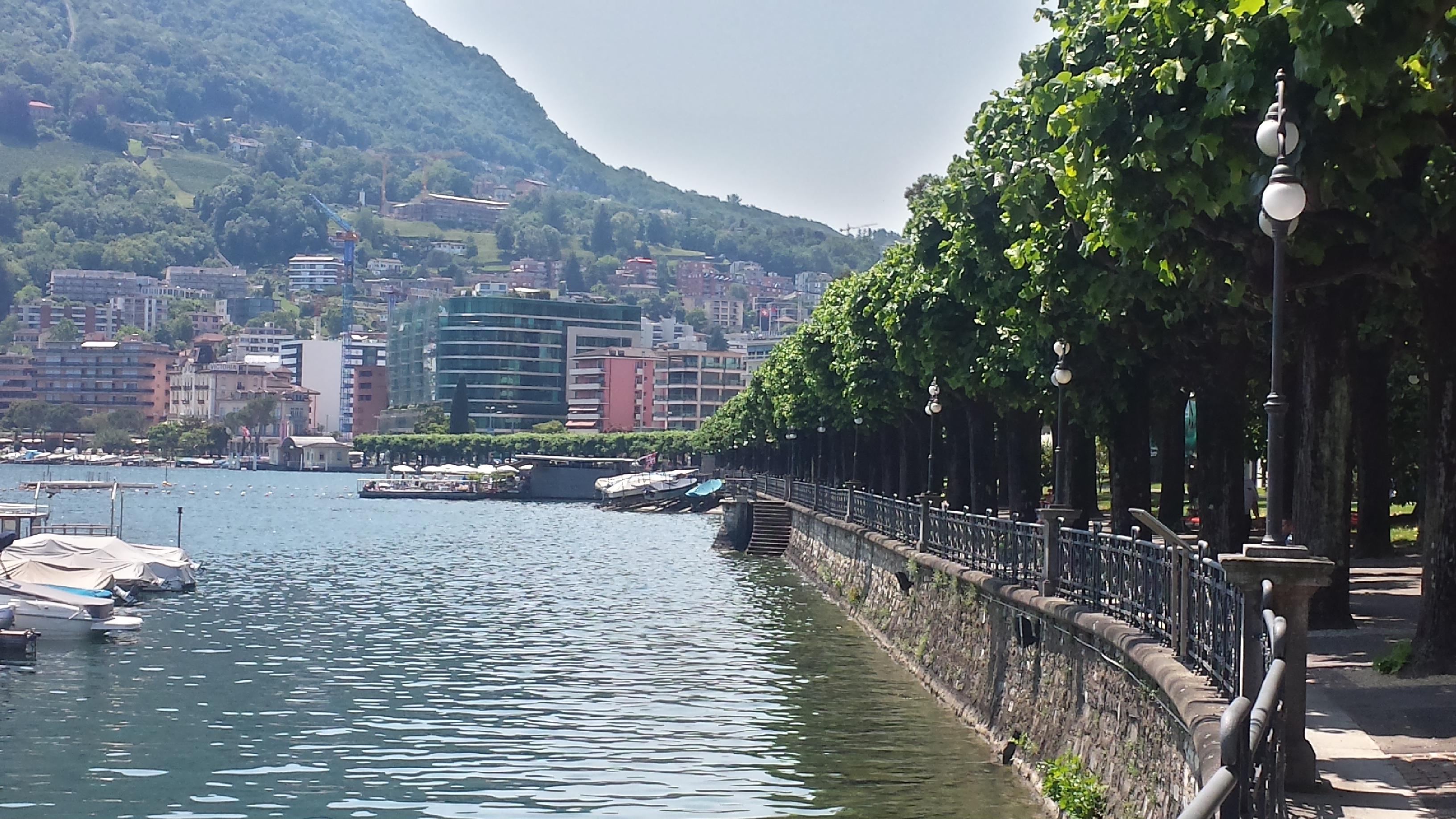
The old town’s scale helps make this legible. Streets converged on the historic lakeside landing between today’s Piazza Manzoni and Piazza Rezzonico. The railway’s arrival in the second half of the nineteenth century pulled growth uphill and into Besso, Cassarate and Molino Nuovo. The station-city funicular exists because the modern railway solved a regional connection while creating a local vertical problem.
10 · Two-lake field guide
Read Lugano from the landing uphill
Begin at the water and look back. The lakefront is not simply a promenade placed in front of a finished old town. It is an engineered edge, a public room and a transport frontage. The historic street network points toward it. Nineteenth-century hotels and villas helped turn climate and landscape into a tourism economy. Later offices, cultural buildings, apartments and road infrastructure changed the scale again.
Piazza della Riforma works as a civic centre away from the immediate shore. Via Nassa preserves a narrow commercial line, but the luxury shop is only one layer. Arcades, passages and level changes expose the older grain. Climb visually toward San Lorenzo and the railway station: the distance is short on a plan and consequential on foot.
The City of Lugano’s history page connects the largest urban transformation to the Gotthard railway. That is important. The railway did not just deliver tourists; it reorganised the city toward a new gateway above the centre. A modern visitor repeats that geometry in reverse, descending from the station to the old landing and returning uphill when time is tight.

11 · Two-lake field guide
The station funicular is a one-and-a-half-minute urban argument
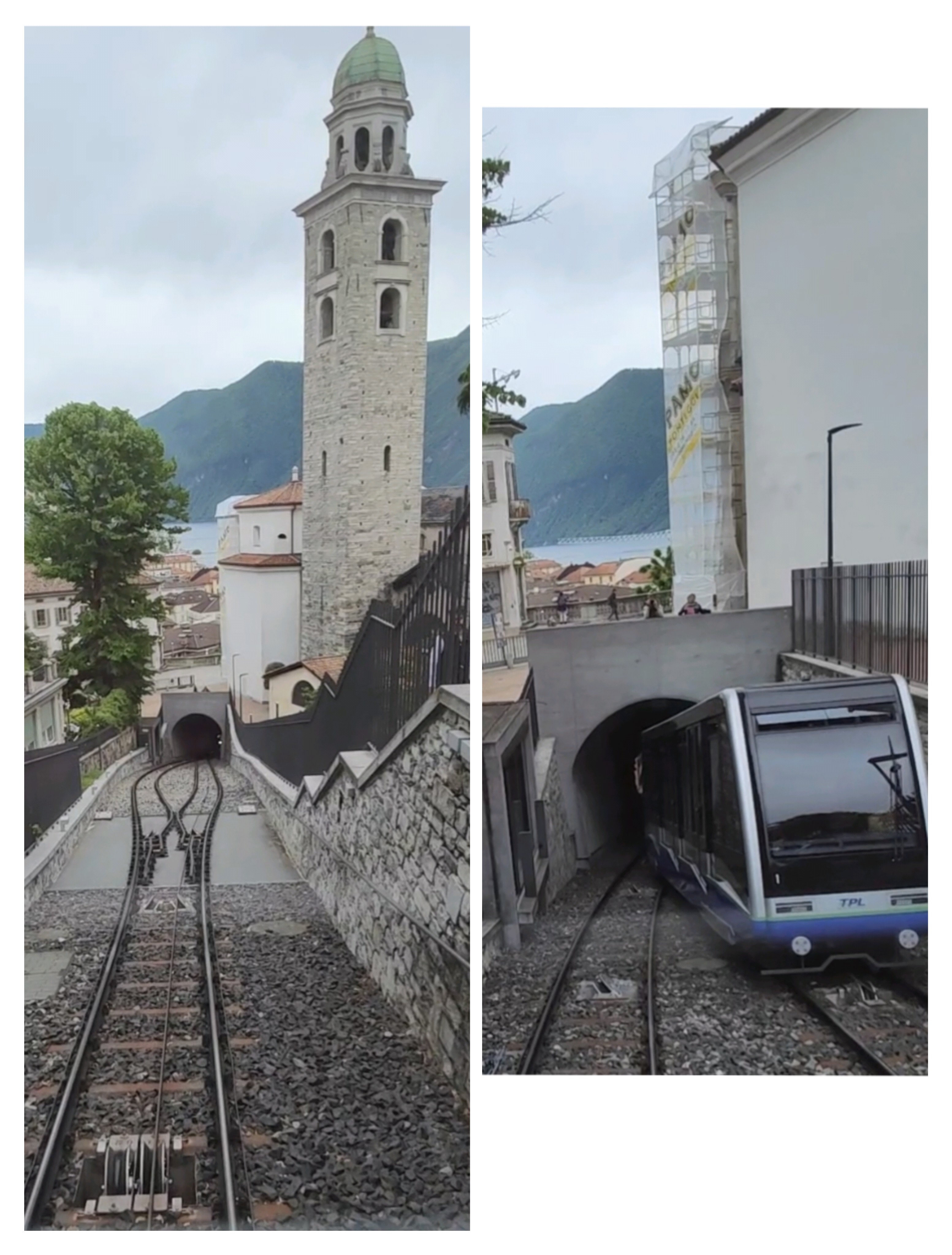
Lugano’s station funicular opened in 1886. It joins the SBB station in Besso to the city centre and includes an intermediate stop near the cathedral. A major 2014–16 renovation increased capacity and modernised the system. The City of Lugano currently describes a 100-person cabin, a journey of about one and a half minutes, continuous operation and access for wheelchairs and strollers, including the intermediate stop on request.
Those facts are more interesting than calling it “effortless.” Funicular engineering turns a steep gradient into a controlled railway. Two vehicles and the haulage system manage movement on an inclined track; the passing arrangement allows cabins to cross. Level interfaces and station design determine whether the system actually removes a barrier for a wheelchair user, stroller or traveller with luggage.
The funicular solves only one link in a cross-border day. It does not prove step-free access from a Milan meeting point, onto every train, between train and boat in Como, across every dock, through the Lugano route or back to the final station. Accessibility must be checked as a chain.

12 · Two-lake field guide
A Renaissance wall keeps Lombardy in the Swiss story
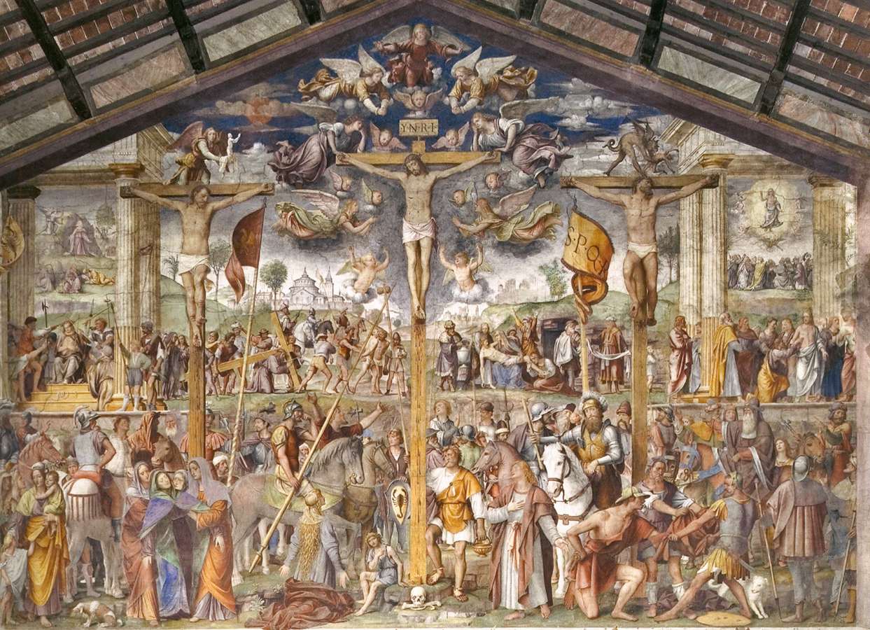
Santa Maria degli Angioli contains Bernardino Luini’s monumental Passion and Crucifixion fresco of 1529. It is an ideal place to correct border caricature. Luini worked in the Lombard Renaissance and is associated with the circle of Leonardo’s influence. His composition belongs to a religious and artistic geography that did not wait for modern nation-states.
The wall is crowded with episodes and bodies. The Crucifixion occupies the centre, while scenes unfold around it within an architectural frame. Read the density before searching for a famous name. Viewers once used the arrangement to move between narrative episodes, devotion and collective memory. The painting’s scale transforms a church wall into a public field of attention.
The church was part of a Franciscan monastery and stands on Piazza Bernardino Luini at the end of Via Nassa. The Lugano Region cultural account also identifies a Last Supper on the left wall and a Virgin and Child at a side altar, both attributed to Luini. Look first at the whole Passion wall, then at a smaller work: the change of scale moves attention from a collective narrative to an intimate grouping. The neighbouring LAC cultural centre places this former monastic site within the city’s contemporary cultural waterfront. Allow time for the church as a place of worship; a quiet, close reading is more useful than treating its famous fresco as another item to collect.

13 · Two-lake field guide
Lake Lugano's beauty includes an unfinished environmental recovery
Lake colour seen from the promenade cannot diagnose ecological health. Lake Lugano suffered severe eutrophication in the second half of the twentieth century. Wastewater treatment and phosphorus controls produced substantial recovery, but the international CIPAIS monitoring programme does not describe a problem that has simply ended.
The 2024 campaign found unusually high external nutrient loads after heavy precipitation: about 35 tonnes of phosphorus to the northern basin and 39 tonnes to the southern basin, both above recovery objectives. Winter mixing was weak and incomplete. Oxygenation reached only about 50 metres, with anoxia below roughly 70–75 metres in parts of the basins. Surface waters became very warm during summer heat. Long-term synthesis describes two speeds: phosphorus loads have been reduced, while warming, deep-water oxygen and ecological condition remain serious concerns.
This is not a reason to label the lake dirty or unsafe. Ecological status, chemical status and bathing-water hygiene are different measures. Swiss authorities report that bathing-water quality is generally good nationally, while canton specialists monitor individual sites. The responsible reader checks the current local site before swimming and does not infer safety from a photograph.
The lake is also transboundary. Italian and Swiss catchments, tributaries, wastewater systems, weather and the Tresa outlet belong to one hydrological problem. The border can change law and administration; it cannot divide moving water into two independent ecologies.
The monitoring architecture is itself part of the story. CIPAIS exists because observations made on one shore are incomplete without compatible sampling and shared interpretation elsewhere. Its stations distinguish Gandria in the deep northern basin, Figino in the south, Melide at the connecting channel and secondary gulfs and tributaries. Those named points prevent “Lake Lugano” from becoming one average value.
They also explain why a single water-colour impression is weak evidence. In 2024, average Secchi transparency was about 6.1 metres at Gandria and 5.3 at Figino, while deep circulation remained poor. Clearer-looking surface water can coexist with oxygen problems far below. Environmental reporting must keep the vertical lake in view.

14 · Two-lake field guide
One day works only when priorities are explicit
A combined day has a strict attention budget. Como can support a full day of cathedral, silk history, Roman and medieval fabric, lakefront and boat travel. Lugano can support a full day of old-town form, railway history, art, lake ecology, parks and hillside systems. Joining them necessarily selects.
The useful question is not “Can it be done?” Trains make it possible. Ask instead what you want the crossing to reveal. If your priority is the physical difference between two basins and two cities, a guided sequence can work. If you want a villa interior, a long mid-lake cruise, a silk-museum visit, a mountain funicular or a deep art visit, the combined day becomes too compressed.
Weather changes the balance. Low cloud can flatten the large view while improving attention to stone, streets and museums. Heat increases the cost of walking and waiting. Strong wave motion can alter boats. A rail incident can remove the margin between countries. The best itinerary contains a hierarchy: essential stop, useful stop, optional stop and first element to cut.
15 · Two-lake field guide
Build the day from independently verifiable pieces
A workable combined day needs five anchors: the exact Milan departure station, the Como arrival station, a dated boat sailing or clearly described cruise, the onward rail connection to Lugano and a return journey with usable margin. None of those anchors is difficult to name. Leaving one vague makes every later promise less useful.
Begin with the official rail planners and Lake Como navigation timetable. Mark the walk between station, cathedral, lakefront and dock rather than treating Como as one point. In Lugano, include the vertical connection between the centre and the SBB station. Then assign time to the things that matter: a city reading, a water segment, a meal, one cultural stop and the return.
A guide can add interpretation, keep a group together and make decisions during disruption. Independent travel makes the transport pieces more visible and gives the traveller control over depth. In either format, ask the same questions: which stations, which vessel or sailing, which village stops, how much unscheduled time, and what is removed first when a delay occurs?
Treat any advertised duration as a container, not an itinerary. A long day includes check-in, trains, walking, boarding, regrouping and the return. The useful measure is not how many names fit in the description but how much attention remains after the transfer chain has taken its share.
16 · Two-lake field guide
Reconstruct the whole day before committing
Do not check only the departure time. Reconstruct the entire day from the dated information supplied for the journey.
- Identify the exact Milan station, meeting point and check-in lead time.
- Record every train station and whether the group uses Milano Centrale, Milano Cadorna, Como San Giovanni, Como Lago or another interchange.
- Identify the Como boat operator, dock, route, boarding process and whether the cruise is circular or point-to-point.
- Confirm whether the boat lands anywhere, especially if Torno is part of your decision.
- Separate included transport from free-time choices and meal time.
- Check the border-document advice against your nationality, not against another guest’s experience.
- Decide what happens if the boat is suspended or a train is delayed: which stop is shortened, what ticket is accepted and who communicates the change?
- Keep the cancellation and delay terms that apply to the dated reservation available offline.
If those answers remain absent, the journey cannot yet be compared responsibly with mobility needs, non-negotiable attractions or an onward commitment. Choose a clearer guided itinerary or assemble the day independently from official transport legs.
17 · Two-lake field guide
Accessibility is the sum of every link
Rail and funicular systems can remove large physical barriers, but the chain still includes pavements, station lifts, platform-train gaps, boat gangways, cobbles, gradients, toilets and time under pressure. A generic wheelchair icon on one component cannot certify the whole day.
Trenord asks passengers who need organised assistance to contact its reduced-mobility service in advance; station support on the RFI network is coordinated with Sala Blu. SBB’s timetable can filter for accessible connections and indicates whether boarding is independent, requires train-crew help or requires advance registration. Navigazione Laghi asks wheelchair users to enquire about the specific vessel and sailing, because substitutions and safety decisions can affect boarding. Lugano’s city funicular states wheelchair and stroller access, but the intermediate stop works independently only on request.
For any guided day, request a written response covering the actual departure rather than a general assurance. Include wheelchair dimensions and weight, transfer ability, companion requirements, walking tolerance, hearing or visual support, cognitive needs, toilets and emergency alternatives. If the organiser cannot map the chain, an independent visit using confirmed accessible services may be safer and more enjoyable.

18 · Two-lake field guide
Build slack where the system can actually use it
Slack is not merely an extra thirty minutes added to the beginning. It must sit at decision points. Arriving early at a Milan station helps only before the first train. It cannot absorb a late boat if the onward international service is fixed. Useful slack appears before a transfer, beside an alternative service or inside a stop that can be shortened without destroying the reason for the day.
Independent travellers should use the official rail planners close to travel. Current operator pages describe frequent Milan–Como links, but engineering work, strikes and seasonal demand alter the lived timetable. SBB explicitly tells passengers to check the online timetable before international travel when works affect Italy. Navigazione Laghi publishes seasonal, not permanent, lake schedules.
For a guided departure, ask who holds the train tickets and what happens if the group is split. Keep the guide’s contact method available offline. Carry enough battery for changing platforms and receiving messages. Do not schedule an inflexible evening event immediately after the advertised return. These are not signs that the trip is unsafe; they are the ordinary discipline of a multi-mode international day.
Make the return part of the itinerary
Day-trip copy usually ends at the second lake, as though arriving in Lugano completes the transport problem. In reality the return contains the day’s most fragile combination: accumulated fatigue, a fixed international service, an uphill station connection and any delay inherited from the morning. The final free-time instruction should identify not only a meeting place but the latest safe moment to begin the climb or take the funicular.
Independent travellers should save the return journey before leaving Milan and again after reaching Como. A screenshot is useful when data coverage changes, but it is not a live disruption feed. Keep enough knowledge to name the next major interchange to staff. If the international train is cancelled, do not improvise a border taxi or local bus chain without checking ticket acceptance and operating hours.
A guided itinerary needs the same clarity. “The guide handles delays” is not a plan. A plan identifies who contacts the transport operator, whether tickets are flexible, what happens to a missed reserved service, and whether a guest can leave the group independently.
19 · Two-lake field guide
Choose the format that matches the question
Choose the combined guided day if you want a comparative introduction, value interpretation at transfers and accept that each city will be selective. The guide’s greatest value is not reciting facts on a platform; it is making the route coherent and adjusting priorities when conditions change.
Choose Como alone if the lake is the main subject. Add the cathedral, silk history and a boat whose live timetable you can control. A longer stay can move beyond the southern basin without pretending every famous village fits between trains. For the lake as navigated geography, continue with our water-level reading of Nesso, Varenna and Bellagio.
Choose Lugano alone if Ticino’s political history, urban slope, art and environmental story matter. The station funicular, old landing, Santa Maria degli Angioli and lakefront already create a strong route; a mountain funicular is a separate excursion, not the same included ride.
Choose an overnight crossing if you want both cities without making transport the dominant rhythm. The border becomes part of the story rather than a deadline. You can experience evening and morning uses of the waterfronts, when they belong more visibly to residents.
20 · Two-lake field guide
A disciplined sequence for the combined day
In Milan, begin with logistics: document, meeting point, first train and disruption contact. On arrival in Como, establish the city’s position at the end of the branch before entering the historic centre. Read the cathedral as a four-century structure, not a photograph stop. Use the lakefront to connect Roman and industrial Como to its transport edge.
On the boat, photograph one piece of evidence for settlement on steep ground rather than ten generic villas. Back on land, note the physical transfer between dock and station. At the Swiss crossing, keep the document ready without staging a border drama. In Lugano, descend from the railway into the old landing logic, then use the funicular as evidence of how the station altered the city.
Make one cultural stop and one ecological observation. Luini’s wall explains cross-border artistic continuity; the lake monitoring story explains why shared scenery requires shared institutions. Return with a specific answer to the title question: the border changes law, administration, currency and transport systems, but it does not sever geology, language, art or water.
21 · Two-lake field guide
Listen to the original field notes
The podcast proposes an appealing human route: morning train from Milan, Como, a one-hour boat, free time, the international crossing, Lugano and its station funicular. Its most valuable contribution is the question of compression—whether interpretation and transfer support can make two lake cities intelligible in one day.
Listen for the route and the travellers' decision points, then use the official links in this guide for dated transport, border and access information. Use a dated itinerary for stations, sailings and village stops, and check the official entry rules for your own circumstances.
Hear “Lake Como & Lugano Day Trip by Swiss Train & Boat” on RSS.com.
Continue · Italy
Continue the Italy desk
Pair this cross-border route with Lake Como at water level for a slower reading of Nesso, Varenna, Bellagio and the public navigation network. Milan Cathedral’s continuing construction story explains the city from which the day departs; the Pompeii field guide offers a different relationship between landscape, labour and access.