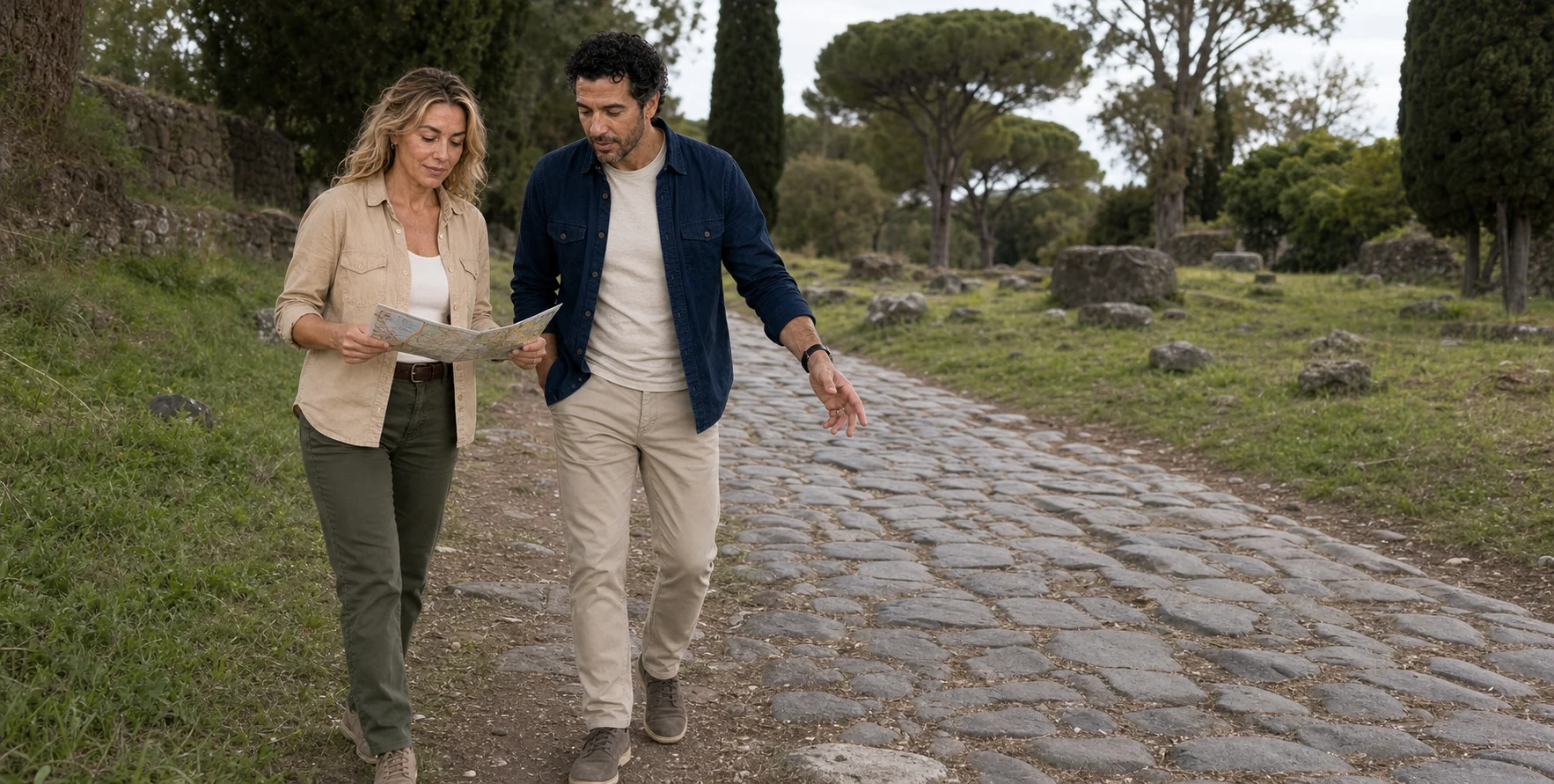

A vehicle can shorten the distance between central Rome, the Via Appia and an underground cemetery. It cannot make those places simple. This route is best understood as a sequence of thresholds: city and suburb, road and burial ground, daylight and tuff, mobility aid and architectural barrier.
01 · Via Appia field guide
The first lesson is a change of scale
The journey begins with an apparently modest logistical problem. Central Rome and the most legible stretch of the ancient Appian Way do not sit neatly beside one another. A traveller can stand near the Circus Maximus, where the road once left the city at Porta Capena, yet still be several thresholds away from the dark basalt paving, funerary monuments and quieter archaeological landscape that have come to represent the Via Appia Antica. The distance is not enormous on a regional map. At street level, however, heat, crossings, traffic, irregular surfaces and the sheer density of Rome turn it into a consequential part of the day.
That is why a small electric vehicle is an interesting editorial question rather than a novelty. It changes the proportion of riding to walking. It may let a guide connect the urban departure, the Aurelian Wall, a stretch of the old road and a catacomb visit in a compact window. It may reduce sustained standing and the distance covered on foot. But it also frames the city through motion: some places become drive-bys, some become brief stops, and the passenger depends on the guide's route, audibility and willingness to pause. The vehicle removes one kind of effort while introducing questions about boarding, exposure, traffic and how much can actually be understood from a moving seat. Rome's street-scale electric-vehicle story asks the same question inside the historic centre; on the Appia, the test extends to exposed road, protected landscape and an underground institutional handoff.
Before treating any compact route as an accessible route, ask how the surface ride joins the underground institution. A vehicle label alone cannot establish the visited complex, meeting and boarding conditions, restraints, walking required at stops or the meaningful alternative for someone who cannot descend. The complete journey—not the convenience of one segment—has to withstand scrutiny.
The central-city approach is worth reading before the countryside begins. The Circus Maximus occupies the long valley between the Palatine and Aventine. Its open ground preserves the scale of a chariot-racing venue even where seating, barriers and the racecourse's fittings have disappeared. Looking from a vehicle can establish that vast footprint; understanding the contest requires imagining repeated laps around the central barrier, organised factions and a crowd whose presence made racing a public institution. Near Porta Capena, this valley supplies a useful starting relationship: spectacle gathered people inside Rome while the Appia carried people and resources outward.
The Baths of Caracalla, farther along the southward approach, show another kind of public scale. Built in the early third century CE, principally between 212 and 216, the complex organised hot, tepid and cold bathing rooms, an open swimming pool and exercise spaces around a symmetrical plan. A branch of the Aqua Marcia supplied its water. The great walls are therefore the remains of a working hydraulic and social system, not simply large ruins beside a road. A drive-by reveals their height; entering and tracing the bathing sequence reveals how rooms, water and movement depended on one another. Allow separate time for that reading if the baths are a priority.
Two other central landmarks answer different questions. At Santa Maria in Cosmedin, the Bocca della Verità is an ancient carved marble disk whose original purpose remains debated. The tale that its mouth punishes liars belongs to its later legend, not to demonstrated Roman technology. A photograph at the mouth and a visit to the church are distinct activities, with their own pedestrian approach. At Piazza Venezia, the palace commissioned by Pietro Barbo, later Pope Paul II, faces the monumental setting of Italy's modern capital beneath the Capitoline. Here a vehicle may connect several eras in one view, but that broad view is different from visiting a museum or examining a building. Choosing a few places to enter often gives more substance than expanding a list of places passed.
These landmarks are useful orientation for a centre-to-Appia journey. They do not form one inevitable route: traffic, start location and the time spent underground change the day. Separate an exterior view, a photo stop and an admission when comparing formats, and decide which subject deserves your longest pause.

02 · Via Appia field guide
Porta San Sebastiano makes “outside Rome” visible
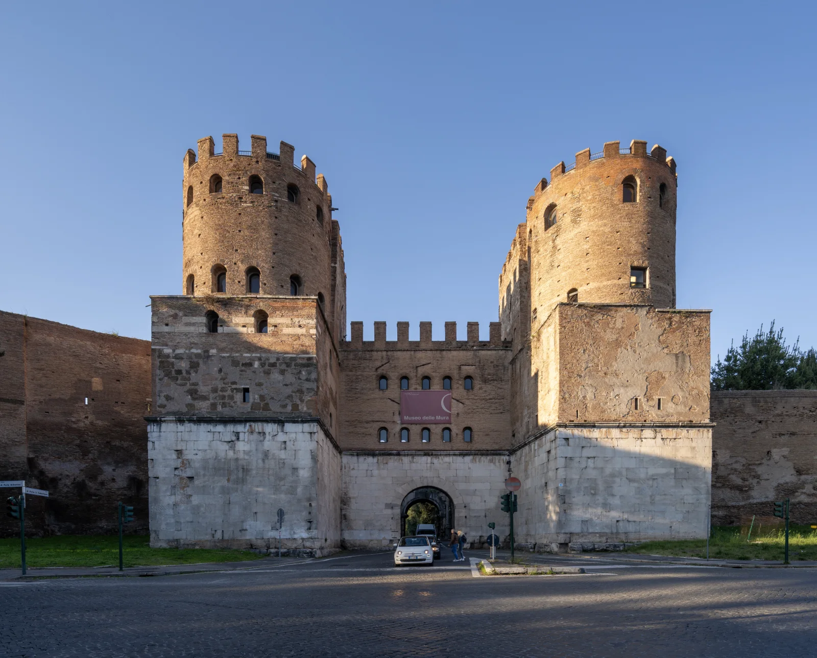
The ancient road began at Porta Capena, close to the Circus Maximus. The gate no longer survives as a standing portal, and the road out is now entangled with the modern city. The most emphatic visible threshold comes farther south at Porta San Sebastiano, the monumental gate through the Aurelian Wall. Its towers are not a relic from the Appia's foundation in 312 BCE. They belong to a much later defensive system begun under Emperor Aurelian in the third century CE, then enlarged and altered. Road and wall meet because a durable route remained valuable long after the political world that built it had changed.
Passing through the gate should not be narrated as an instant escape into countryside. The first Appian section remains a modern street. Pedestrians and cyclists can share narrow space with authorised and, depending on the day and exact segment, other motor traffic. The regional park's route guidance explicitly treats this as a safety issue and suggests an alternative through the privately controlled San Callisto road when it is open. The archaeological landscape is real, but it is not sealed under a museum dome.
The gate also corrects an easy misconception about Roman boundaries. The pomerium, Rome's ritually defined civic boundary, the line of walls and the practical extent of the inhabited city were related but not identical in every period. A traveller moving from Circus Maximus through an imperial wall toward roadside cemeteries is crossing several historical definitions of “inside” and “outside,” not one timeless border.

03 · Via Appia field guide
A pyramid beside the route is a Roman biography, not an Egyptian shortcut
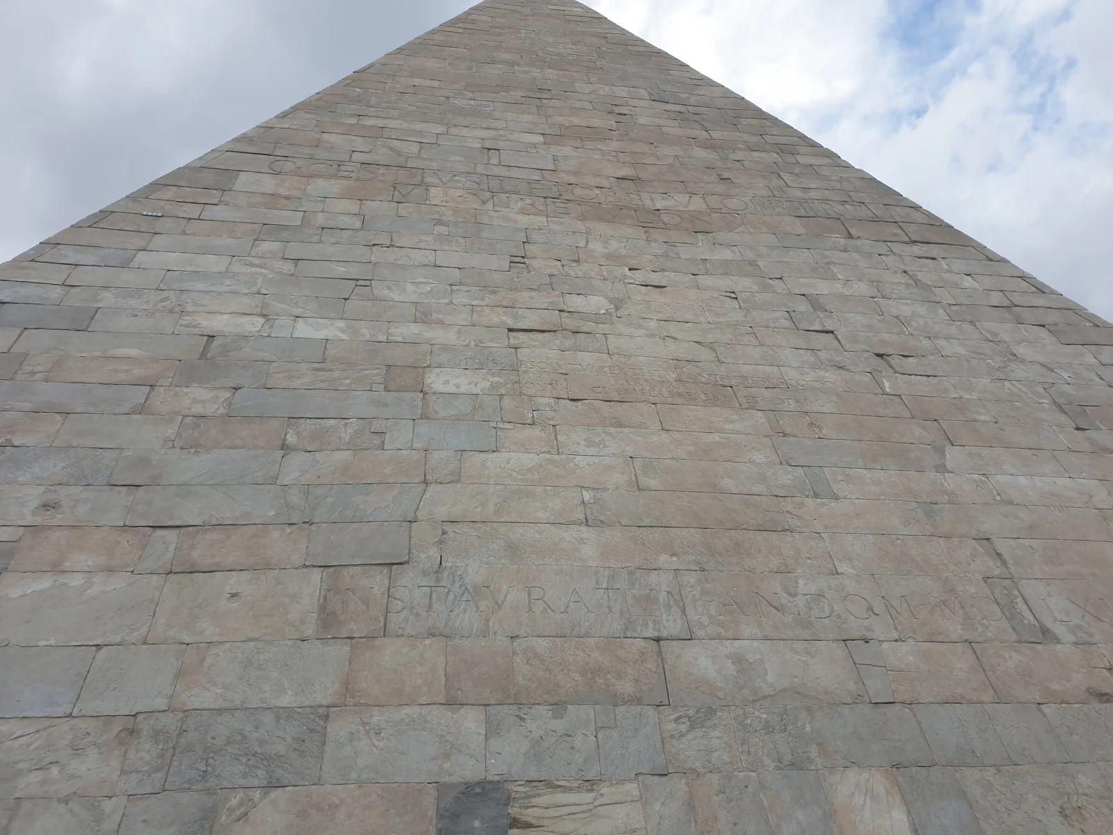
The Pyramid of Cestius stands beside the Via Ostiense and Porta San Paolo, southwest of the Appian approach. A city route may connect the two roads, but the pyramid is not an Appian tomb. It offers a compact lesson in how readily Rome adopted foreign forms and made them local. The white, steep-sided monument is the tomb of Gaius Cestius, identified by the inscription on its face as a praetor, tribune of the plebs and member of a priestly college concerned with sacred feasts. It is usually dated between 18 and 12 BCE. Another inscription records that the work was completed within 330 days under the terms of Cestius's will.
Those facts are more revealing than a label such as “Egyptomania.” Rome had annexed Egypt after the defeat of Antony and Cleopatra in 30 BCE, and Egyptian images and materials acquired fresh political and fashionable charge. Yet Cestius's monument is not a miniature copy of one named pyramid on the Nile, still less proof that its owner held a single attitude toward Egypt. Its brick-faced concrete core, clad in pale marble, used contemporary Roman building technique to produce a foreign-looking silhouette. Its sharp angle has often invited comparison with Nubian pyramids, but visual resemblance alone cannot recover the patron's exact model or intention.
The monument survived in part because the Aurelian Wall later absorbed it. A private funerary statement became useful defensive fabric. Medieval observers misidentified it, early modern artists drew it, vegetation and pollution affected the cladding, and conservation repeatedly changed what could be seen. Read this way, the pyramid is not a whimsical detour. It introduces the Appian landscape's governing pattern: tombs were visible public architecture, and later societies kept adapting them.

04 · Via Appia field guide
The Appian Way began as a political instrument
In 312 BCE the censor Appius Claudius Caecus put his name on a new public road connecting Rome with Capua. The context was Rome's struggle for power in central and southern Italy, particularly the Second Samnite War. A more direct, reliable route helped move soldiers, messages and supplies. Calling the Appia a “superhighway” catches something about strategic ambition but risks flattening what the road actually was: a long work assembled over time, extended as Roman control moved, maintained unevenly and used by far more than armies.
Read beside the Colosseum, Forum and Palatine, the Appia reveals the other spatial language of Roman power. Arena, civic centre and palace concentrated spectacle, government and imperial presence; the road projected administrative capacity outward through distance, labour and repeated maintenance.
The road eventually reached Beneventum, Tarentum and Brundisium, the Adriatic port from which travellers and goods could continue toward Greece and the eastern Mediterranean. Military conquest, trade, migration, administration, pilgrimage and everyday local movement shared the same line. UNESCO's statement of outstanding universal value stresses this combined role: the Appia enabled movement, encouraged settlements, carried ideas and acquired roadside facilities and funerary landscapes. The 2024 World Heritage inscription includes 19 separate component parts along a road system extending for more than 800 kilometres. It encompasses the Appia and the later Via Traiana, inaugurated under Trajan in 109 CE to provide an easier route from Beneventum toward Brundisium along the Adriatic side. The Roman park is one portion of that much larger system. A visit here can explain the road's logic without pretending to cover its complete geography.
The word “public” matters. The road was an instrument of Roman state power, but once territories were controlled it also supported toll-free circulation and commercial development. Milestones organised distance. Stations and water points served travellers and animals. Bridges, cuttings, embankments and drainage answered different ground conditions. A ruler's desire to move troops created an infrastructure that merchants, messengers, farmers, mourners and pilgrims could use for purposes of their own.
Appius Claudius himself resists the role of one-dimensional engineer. He belonged to an aristocratic family and used the censorship, an office concerned with the census, public morals and state contracts, with exceptional ambition. The same tenure is associated with the Aqua Appia, Rome's first aqueduct. Later tradition also remembers him as blind and as an elderly opponent of peace with Pyrrhus; the survival and reshaping of those stories make it difficult to recover a private personality. What can be seen is a political programme in which infrastructure attached a magistrate's name to the future of the city.
That name was an innovation. Earlier roads could be known by destination or function; Via Appia advertised the official who caused it to be built. The road turned public works into reputation. Yet Appius did not design, survey, quarry and lay hundreds of kilometres alone. Surveying, quarrying, transport, contracting and the physical work of construction disappear behind the magistrate's name. Later censors, emperors, local officials and communities extended and maintained the line. To call it Appius's road is historically useful only if it does not erase that distributed work.
Nor was the road's straightness absolute. Surveyors sought direct lines where the terrain and strategic purpose allowed, but water, mountain passes, property, settlements and later extensions required choices. In the Pontine Marshes, for example, the road's relationship with drainage and a parallel canal became part of movement. Elsewhere bridges and cuttings answered obstacles. “Roman efficiency” was not a magic preference for straight lines; it was administrative capacity applied to different landscapes, sometimes successfully and sometimes through costly maintenance.
This long life explains why authenticity cannot mean returning the Appia to one perfect date. The route was repaired in antiquity, redirected in places, used in the Middle Ages, fortified around large tombs, celebrated by Grand Tour travellers and pulled into modern suburban traffic. Its continuity of movement is part of its significance. Conservation must protect archaeology without pretending that the road stopped being a road.
05 · Via Appia field guide
The roadside carried ordinary lives as well as monuments
The Appia's grand structures can make the route appear to belong only to generals and elite families. In practice, a road depended on a much wider human system. Drivers managed animals and loads; innkeepers and vendors served travellers; surveyors and maintenance crews dealt with water and broken surfaces; farmers used access to fields; messengers counted miles; mourners returned to family plots. Inns and stations leave less spectacular traces than marble tombs, but they explain how a long-distance line functioned from day to day.
Literary journeys preserve fragments of that life. Horace's account of travel to Brundisium in the first century BCE is full of delay, food, companions and the uneven tempo of movement rather than imperial abstraction. The apostle Paul later approached Rome along the Appian route and was met by believers at places identified in Acts 28:15 as the Forum of Appius and Three Taverns. Medieval pilgrims and crusaders reused the road; landholding and religious institutions transformed its buildings. These episodes are valuable not because every modern visitor can stand in an exact footprint, but because they restore waiting, hospitality and encounter to a monument usually photographed empty.
The road also materialised coercion. After the suppression of Spartacus's revolt in 71 BCE, ancient accounts say thousands of captives were crucified along the route from Capua toward Rome. The event should not become a lurid roadside anecdote or a generated reconstruction. It reveals how the state used the same corridor that moved armies and trade to stage punishment over an enormous distance. A road can enable exchange and display domination at once.
Later reuse did not simply cover antiquity with decline. Churches gathered communities around martyrial sites. Towers and castles protected property and controlled passage. Quarries and lime burning consumed ancient material; antiquarians and landowners preserved or rearranged it. In the twentieth century, urban expansion and traffic threatened the corridor while campaigners including Antonio Cederna argued for a unified public archaeological landscape. Today's parks are outcomes of that unfinished civic struggle, not neutral containers that always existed around ruins.
For the reader, these lives change the visual hierarchy. A drainage edge may say more about continued maintenance than a picturesque pine. A medieval wall attached to a mausoleum may explain control better than an isolated Roman inscription. A bus stop and a farm gate are not necessarily visual intrusions; they can show that the Appia remains a negotiated route. The task is to distinguish evidence of living continuity from development that damages the relationships the park exists to protect.
06 · Via Appia field guide
The stones underfoot are an archive of repair
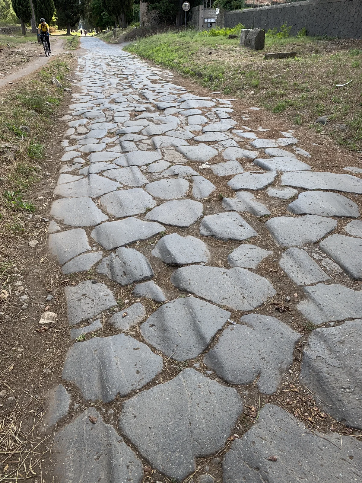
The most photographed surface consists of great dark volcanic blocks, usually called basoli. Their irregular polygons fit into a hard carriageway whose slightly raised profile and margins helped shed water. Wheel wear, broken edges, replacement blocks and vegetation make the surface visually persuasive. They do not prove that every visible stone was laid by Appius Claudius in 312 BCE.
Ancient literary evidence and archaeology point to phases. The Appia archaeological park notes Livy's report that the earliest road used squared stone, perhaps peperino, and that later work introduced the hard lava blocks that became characteristic. Different terrain demanded different preparations. Excavated road sections can reveal bedding, aggregate, retaining work or drains, but a diagram from one trench should not be promoted into a universal Roman formula repeated identically from Rome to Brindisi.
The better question is what a road surface has to do. It must distribute loads, survive water, keep a usable width, negotiate slope and be repairable. The Appia's directness could require major earthwork or drainage. On a living road, maintenance continues the engineering story. A patch of small modern stone, an ancient block reset at a different angle and a verge worn by cyclists may all occupy the same view.
For a visitor, the material is also a practical fact. Large smooth blocks can be slippery when wet and punishing for small wheels. Gaps and camber affect balance. Cyclists may choose the dirt margin; pedestrians watch both their footing and traffic. A cart absorbs distance but not every vibration. The ancient surface is not theatrical roughness arranged for authenticity. It is infrastructure with consequences.

07 · Via Appia field guide
Tombs turned movement into memory
Roman law placed burial and cremation outside the city, a rule conventionally traced to the Twelve Tables. The reason should not be reduced to hygiene. Death had ritual and legal consequences; fire, land ownership, civic order and religious ideas all mattered. Nor should pomerium, walls and urban fabric be casually treated as synonyms. Scholarly work on life and death in the Roman suburb shows how much interpretation hides inside the apparently simple phrase “outside the city.”
The result was a funerary landscape built where people travelled. A tomb beside a road addressed passers-by. Its inscription named the dead, family and status; its scale competed for attention; its enclosure could host commemoration. Wealth produced marble towers and sculpted façades. More modest burials occupied shared monuments, columbaria, surface cemeteries and, later, extensive underground networks. Visibility and memory were distributed unequally, just as property was.
Cremation and inhumation overlapped for centuries. Romans did not collectively abandon one rite on the day Christianity arrived. Preferences varied by period, community, status and family. Inhumation became more common across the empire during the second and third centuries, among people of several religions. Christian belief in resurrection gave burial a particular meaning, but it does not by itself explain every change or every catacomb.
The roadside therefore offers a social history that a fast overview can easily miss. It is possible to admire a circular mausoleum as an isolated ruin and never ask who could afford such permanence, who maintained the estate around it, who performed the rites or where people without monumental resources were buried. The Appia becomes more legible when its road engineering and funerary claims are read together: movement created an audience for memory.
08 · Via Appia field guide
Cecilia Metella became far more than one woman's tomb
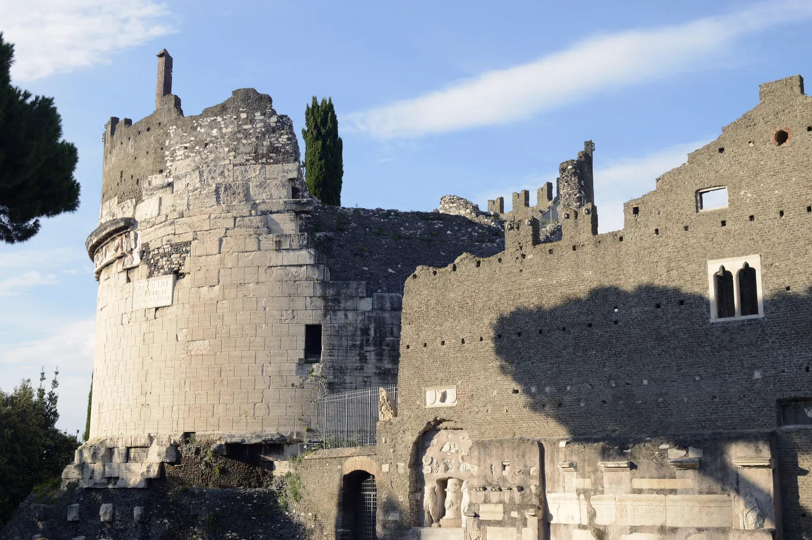
The Mausoleum of Cecilia Metella, near the third Roman mile, commands attention through a cylindrical drum set on a square base. Its surviving inscription identifies Cecilia as the daughter of Quintus Metellus Creticus and wife of a Crassus. Those relationships place her inside powerful late Republican families, but they do not supply a detailed biography. The archaeological park places construction between about 30 and 10 BCE and describes her probable connection by marriage to the family of Marcus Licinius Crassus. That range and the inscription's kinship terms give firmer limits than an invented personal story. The building tells us more securely about the resources her family could mobilise and the visibility they wanted along the road.
The monument's later life is just as important. In the Middle Ages, the Caetani family incorporated it into a fortified complex with walls, towers and the church of San Nicola. Marble was lost or reused; battlements changed the profile; domestic and defensive needs settled around a Roman grave. What appears from a moving vehicle as a single ancient landmark is actually a funerary core, medieval castle and modern conservation site.
This layering should change the pace of looking. The inscription is not merely a label. The travertine-clad drum, the concrete core of the square base and the marble frieze belong to the Roman funerary programme; the upper battlements and attached palace belong to later fortification. The frieze's ox skulls explain the local name Capo di Bove. Inside, the burial chamber rises in a cone toward an opening at the top. This combination of mass, cladding and interior space makes the tomb a more complicated object than its cylindrical silhouette suggests. The surrounding road surface and sightlines explain why the tomb was valuable both to an elite family seeking remembrance and to a baronial family controlling territory centuries later.

09 · Via Appia field guide
Underground Rome begins with geology, labour and property
Catacombs were possible because parts of Rome's suburb contain workable volcanic deposits. The Alban Hills southeast of the city produced extensive pyroclastic material over a long geological history. “Tuff” is a broad family name, not one stone with one behaviour. Different deposits vary in grain, porosity, cementation, moisture response and strength. The abundance and workability of coherent tuffs made them valuable as building stone; softer deposits could also be excavated.
Excavation may expose material that is easier to cut than dense lava, but stability depends on the particular geological unit, the geometry of galleries and pillars, water, cracks, weathering, previous quarrying and later intervention. Research on Roman tuffs emphasises variation in mechanical characteristics. Collapse risk, consolidation and environmental monitoring belong to the history of these spaces as surely as picks and lamps.
Labour matters too. Specialist workers known as fossors excavated corridors, opened burial niches, handled spoil, maintained access and worked within cemeteries administered by communities. A typical wall of loculi—long rectangular slots for bodies—represents repeated measured labour. Larger cubicula created rooms for families or groups; arcosolia used an arched recess above a grave; inscriptions, plaster, paint and small objects individualised places within a repeating system.
Property shaped growth. Underground cemeteries could expand beneath estates outside the city while surface entrances, shafts and buildings remained controlled. Quarries, water channels, tombs and catacombs sometimes occupied related strata. A multi-level plan is therefore not a city designed all at once but the outcome of acquisition, demand, geology, community organisation and the need to preserve enough rock between galleries.
10 · Via Appia field guide
The catacombs were cemeteries, not a permanent hiding place
The enduring image of Christians secretly worshipping in tunnels during persecution is dramatically useful and historically misleading. Catacombs were principally burial and commemorative spaces. Christians did suffer periods of persecution, and cemeteries associated with martyrs became powerful places of memory. That does not mean large communities normally lived or held all worship underground, hidden from Roman police.
The practical evidence argues against the cinematic version. Galleries are narrow, access is limited, ventilation is poor and many corridors were organised around burials rather than assembly. Christian communities gathered above ground in houses and, after imperial toleration, in basilicas. Underground rooms could receive funerary meals, prayer and commemoration; pilgrims later visited martyrial places. The word “secret” should be used only for a documented event, not as the default atmosphere of every passage.
The misconception also obscures diversity. Rome has Christian catacombs with different patrons and histories as well as Jewish underground cemeteries. Pagan mausolea and burials share the suburban landscape. Images such as fish, anchors, shepherds, biblical scenes and inscriptions acquire meaning from their precise context; they should not be treated as a single encrypted codebook.
When bones have been moved, niches opened or surfaces restored, present emptiness is part of the site's later history. Pilgrimage, relic translation, abandonment, rediscovery, excavation and conservation all altered the galleries. The visitor is not entering a perfectly sealed third-century moment. An internal site guide is valuable precisely because the visible fabric needs chronological discrimination.
11 · Via Appia field guide
San Sebastiano shows how one site accumulated meanings
San Sebastiano brings several of these histories together in one place. The corridor includes several catacomb systems with different closing days, stairs, languages, routes, art and histories. A traveller must know the named institution before applying any site-specific rule.
At San Sebastiano, the site developed around pre-existing Roman burials and mausolea. In the mid-third century a courtyard and covered meeting structure known as the triclia formed part of the Memoria Apostolorum. Graffiti invoke Peter and Paul and ask for intercession. Many scholars connect the complex with a period of apostolic commemoration, while claims about the physical transfer of relics remain matters of tradition and interpretation rather than a simple documented itinerary.
The name itself carries a local history. The site authority explains ad catacumbas as a place near a quarry; that particular name later became a general term for underground cemeteries. Marks on tomb closures—a name scratched in mortar or a recognisable small object—could distinguish an individual burial within repeated rows. The galleries' apparent sameness did not erase the community's need to identify and remember people.
Sebastian's burial and cult later reshaped the site's identity. A fourth-century circiform basilica honoured the apostles; over time the name and devotion of the martyr Sebastian prevailed. The surviving church was substantially remade from 1608 under Cardinal Scipione Borghese, with Flaminio Ponzio and Giovanni Vasanzio among the designers. The remaking occupied the nave of the older circiform basilica rather than retaining the complete late antique footprint. Parts of the former ambulatory survive beside the present church, making that reduction of scale legible. The carved wooden ceiling and Baroque setting are part of the site's history, just as the Roman burial structures are. Thus even before a visitor descends, Roman mausolea, late antique pilgrimage, medieval devotion, Baroque patronage and modern archaeology occupy the same place.
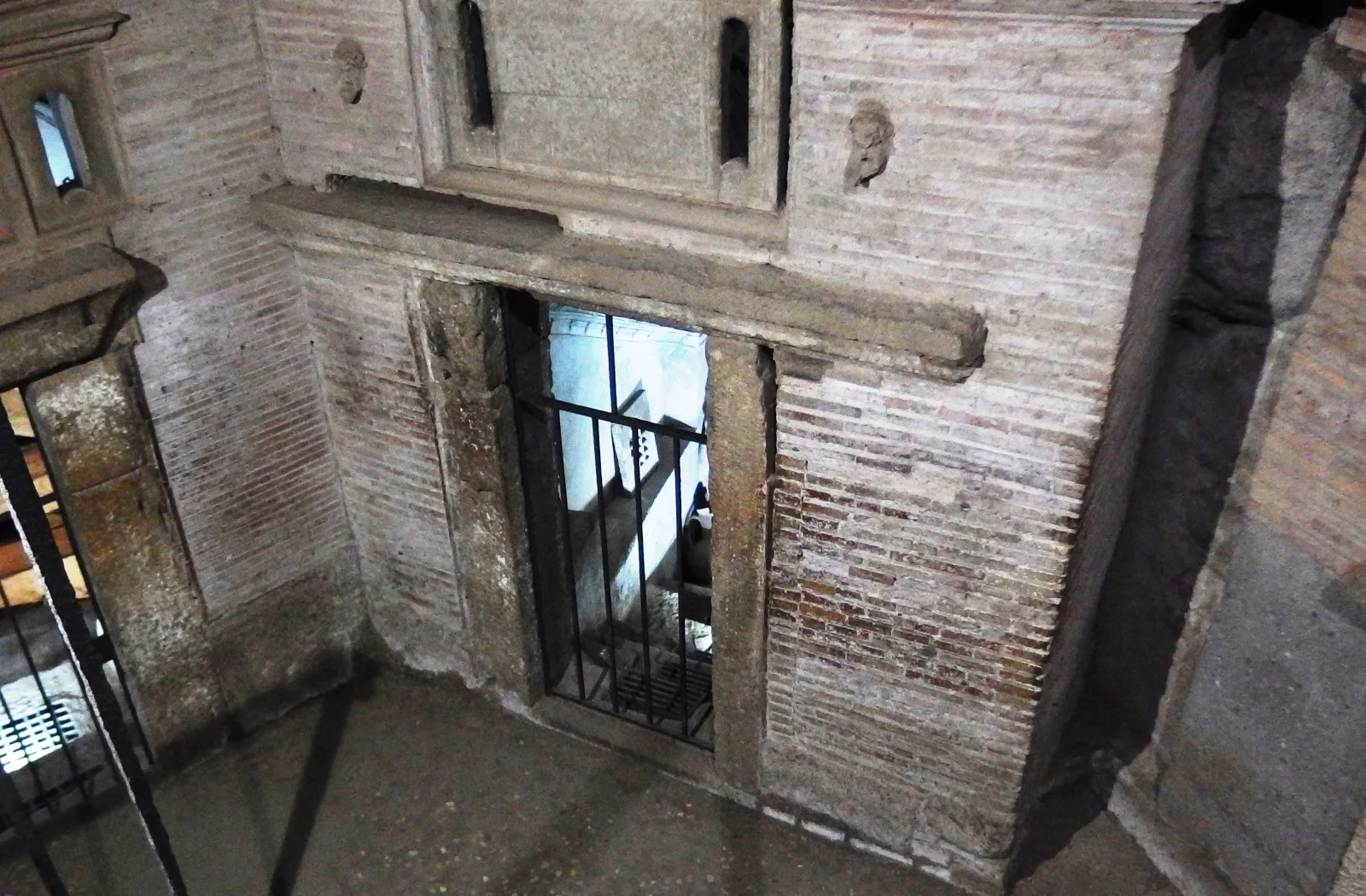

San Sebastiano's current visitor regulation makes the physical transition unusually clear. The visit is guided by internal staff, lasts about 40 minutes and includes roughly 70 irregular steps across the descent and ascent. There is no lift and no opportunity to sit on the underground route. The site gives a temperature of about 17°C with high humidity, advises against the visit for people with serious walking difficulty or claustrophobia, prohibits bulky objects and does not admit wheelchairs below ground. These are exact site facts, not generic rules for all catacombs. At San Sebastiano, photography and video are prohibited underground, as are private earphones and radio transmitters. Keep hands away from the displayed fabric and follow the internal guide's route; a street-tour audio system does not carry over automatically to the catacomb.

12 · Via Appia field guide
Preservation changed what a catacomb visit can show
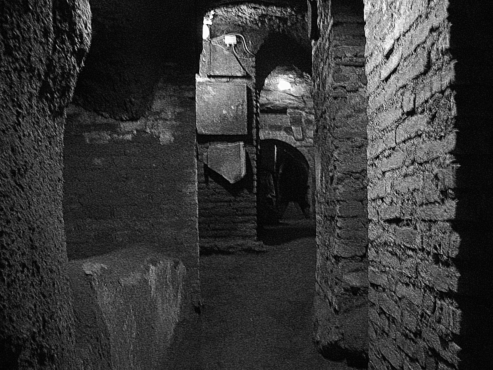
Catacombs are vulnerable environments. Human breath, changes in temperature and humidity, touching, light and microbial growth can affect plaster and paint. Visitors require controlled paths not only for safety but also to reduce physical and environmental stress. Closed corridors may protect fragile surfaces or reflect instability; photography restrictions can defend the site and the dignity of burial spaces.
Rediscovery has its own history. Early modern visitors, relic hunters, antiquarians and archaeologists entered subterranean Rome with different methods and assumptions. Giovanni Battista de Rossi's nineteenth-century work helped establish Christian archaeology as a discipline, while the Pontifical Commission for Sacred Archaeology developed institutional responsibility for research and conservation. Classification, clearance and restoration made sites legible but also changed them.
This matters when a guide points to a niche, inscription or repaired wall. “Original” is not a sufficient description. A closing slab may be ancient but moved; a gallery may be ancient but reinforced; a painted surface may survive in fragments under modern environmental controls. Good interpretation names the object, its archaeological context and the limits of what it proves.
The best underground experience is therefore not the longest or most theatrical. It is the one in which a manageable group can hear, see without crowding and respect the site's religious and funerary character. A resident guide is not a decorative second voice. That handoff marks a change of expertise and authority: the road guide yields to the institution responsible for the monument.
13 · Via Appia field guide
What the cart changes—and what it cannot solve
Physical effort is not a certificate of authenticity. A traveller does not understand Roman infrastructure more deeply merely by arriving dehydrated. Reducing a long approach can preserve attention for material that matters. Shade and intermittent airflow can help in warm weather; sitting can reduce sustained load; a headset can make commentary audible in traffic if the equipment works.
Comfort, fatigue and attention interact, but a cart does not guarantee learning. It can be noisy and exposed. Rear-facing or sideways seats change sightlines. Vibration over uneven surfaces may be uncomfortable. Rain, wind, sun and traffic remain present. A guide who talks continuously while moving may deliver more information and less understanding than one who stops at a useful relationship between road, tomb and landscape.
The cart's compact scale may enter streets unavailable to a coach, yet it is still a motor vehicle operating among pedestrians, bicycles and other traffic. Its environmental advantage cannot be inferred from the word “electric” alone: vehicle manufacture, charging, route, occupancy and the conservation impact of access all matter. Within restricted zones, the exact authorisation matters. A responsible operator balances reach with the purpose of the protected landscape.
The format works best when it admits its limits. The vehicle is a connector between slow-looking moments, not a moving grandstand from which every ruin becomes content. A passenger should know which places are viewed in motion, which include a stop, how long the road section lasts, how far walking is required and whether the return repeats or adds a different route.
14 · Via Appia field guide
Traffic is part of the conservation story
The Appian parks are not interchangeable institutions. The state archaeological park manages monuments and cultural property; the regional park protects a much larger living landscape of archaeology, ecology, farms, neighbourhoods and roads. Private property, churches, catacombs, residents and public transport occupy the same corridor. Rules that look untidy from a visitor's perspective reflect this complicated ownership and governance.
The regional park currently states that motor traffic is restricted on Sundays and holidays along the Appia, with authorised exceptions, and that a permanent restriction operates beyond Cecilia Metella for residents and other authorised users. Consult Roma Mobilità for the municipal traffic framework as well as the park's route advice. These arrangements can change, and signs or enforcement on the day govern. They also explain why an operator cannot promise spontaneous access everywhere simply because its cart is small.
For walkers and cyclists, a quieter Sunday can make the road easier to experience, but popularity brings its own concentration. A shared path needs courtesy, predictable speeds and attention to the basalt surface. For residents and institutions, access cannot simply be abolished. Conservation is therefore an argument about who moves, when, in what vehicle and for what purpose.
The landscape beyond the headline monuments includes verges, trees, drainage, agricultural plots, archaeological fragments and modern boundaries. Treating it as an empty corridor between photo stops misses the point of World Heritage inscription. The road's influence reached outward: it organised property, settlements, cemeteries and exchange. The protected landscape must preserve those relationships as well as individual stones.
15 · Via Appia field guide
Accessibility is a chain, not a vehicle label
A surface cart can be helpful without making the complete product accessible. The chain begins before boarding: can the traveller reach the meeting point over smooth, continuous surfaces? Is there a kerb or road crossing? Are accessible toilets nearby? Does the operator give a precise landmark and assistance contact?
Boarding then requires exact information. “Golf cart” does not specify step height, door opening, transfer space, seat orientation, back support, handhold or restraint. Families must ask whether children are permitted in the exact vehicle, whether an approved seat is supplied or accepted, how it is secured and whether every child occupies a booked seat. Confirm the arrangement for each child before departure: the approved seat, its attachment and the passenger place must fit the vehicle actually used. Count children when describing the travelling party, and ask the operator to explain the permitted configuration.
During the ride, wind, rain, sun, vibration, traffic noise and headset fit can affect comfort or sensory access. At stops, the relevant facts are surface, gradient, crossing, distance, seating, shade and time allowed. A wheelchair user may be able to transfer into one vehicle but have no safe storage for the chair; another may not transfer at all. “Wheelchair accessible” is meaningless without this chain.
The catacomb handoff is the sharpest break. Stairs, narrow passages, uneven floors, low light, humidity and claustrophobia can exclude a traveller who completed the surface ride. The next question is not merely “can you descend?” It is what meaningful alternative exists. Is there an accessible basilica, museum display, model or surface interpretation? Is there a sheltered waiting place? Can a companion remain? When and where does the group reunite? A route is not accessibly described until those questions have answers.

16 · Via Appia field guide
A practical visit begins with the institution closest to the fact
Begin with the official park's open-site information and the named catacomb's own rules. If you choose a commercial cart, obtain written confirmation of the exact meeting point, visited catacomb, route and stops, vehicle and seating arrangement, walking required, languages, admission and internal-guide handoff. Ask how the plan changes in difficult weather and what meaningful alternative exists if someone cannot complete the underground visit. If the provider cannot identify those fundamentals, choose an independently planned or institution-led alternative.
For the underground visit, confirm steps, bags, photography, clothing, language and accessibility with the named catacomb. If it is San Sebastiano, the site's own information—not a generic tour description—should govern: guided-only access, an underground visit of about 40 minutes, high humidity, approximately 17°C, 70 irregular steps, no lift or seating and no wheelchair access. Other complexes have different weekly closures and arrangements.
Wear shoes that can handle smooth basalt, loose verge and stairs. A light layer can be useful below ground even on a hot day. Carry water while respecting the rule against eating or drinking inside the catacomb. Keep bags compact. People sensitive to confined spaces should ask about corridor width, lighting, group size and exit procedure rather than relying on a romantic description of a “labyrinth.”
Use the archaeological park's current information for the live list of open sites, hours, tickets and route notices. Check the sites you intend to enter shortly before travel, leaving time to change the sequence if necessary.
17 · Via Appia field guide
Choosing a format means choosing what to omit
No single format reveals all of the Appia. The useful comparison is not luxury versus authenticity but the kind of attention each day permits.
- A compact cart plus catacomb visit suits travellers who want the centre-to-suburb transition and an underground component within a limited window. Confirm every access link, exact stops and how much interpretation happens while moving.
- Public transport plus a focused walk can deliver more time on the road surface and at selected monuments. It requires route planning, safe navigation through the traffic-exposed first section and realistic limits on distance.
- A bicycle or e-bike day expands range and makes the road's gradient and continuity legible. Basalt, shared space, traffic, weather and confidence on irregular surfaces are decisive. An e-bike assists effort but does not supply handling skill.
- A catacombs-only visit gives more control over the site's language, reservation and institutional interpretation. It omits the designed comparison between city gate, road and roadside burial unless the traveller adds that context.
- A surface-only accessible route may be the strongest choice when underground stairs exclude someone. It should be built around verified drop-offs, smooth viewpoints, an accessible museum or basilica and enough interpretation to make the alternative substantive rather than apologetic.
- A slower archaeological-park day allows Cecilia Metella, Villa dei Quintili or another open site to be read in depth. The open-site list and opening times determine the route. This format best reveals how tombs, villas, farms, fortifications and conservation occupy one corridor.
The cart earns its place when it connects stops that deserve attention and states honestly what the passenger will not do. Walking earns its place when contact with surface, distance and changing land use advances understanding rather than merely exhausting the traveller. A good decision begins with the body, time and question of the actual visitor.
18 · Via Appia field guide
The useful pause is where two histories meet
The strongest moments on this route happen at a junction. At the wall, an older road passes through a later defensive system. At Cecilia Metella, the fabric of a grave supports the architecture of a medieval estate. At San Sebastiano, a burial landscape becomes a place of pilgrimage and then an object of archaeological study. Even the uneven paving is a junction between ancient engineering, later repair and present movement.
A vehicle can make those junctions easier to reach. It still takes a pause to read them. Look for the join between materials, the change in floor level, an inscription that names a person or the difference between the modern church and the older footprint. Those details put dates and institutions into relationships that an isolated landmark cannot explain.
This is also where the practical choices become historical ones. Descending into a cemetery offers a different kind of evidence from staying on the road. A surface-only day can still be substantial if it follows the tombs, gate and land use closely. The measure of a successful visit is whether the format gives this traveller enough time and physical access to understand the chosen places.
19 · Via Appia field guide
Listen: Rome Catacombs and Appian Way Golf Cart Tour
The 20-minute, 26-second episode follows the city-to-Appia journey and asks how comfort, distance and an underground visit change a day in Rome.
20 · Via Appia field guide
Continue exploring Rome's systems
The Appian road belongs to the same city as the Colosseum, Forum and Palatine, but it shifts attention from the imperial centre to infrastructure, suburban land and burial. The electric tuk-tuk route through Rome's urban layers asks a related vehicle question inside the centre; read it beside this story to compare overview, stopping power and the risk that movement becomes a substitute for close reading.
Continue through the Rome destination desk and the Italy country edition. The Appia's lesson travels well: access, archaeology and mobility are never separate topics once a historic landscape is still doing the work of a road.