01 · Hoover Dam & Lake Mead field guide
The whole day is infrastructure
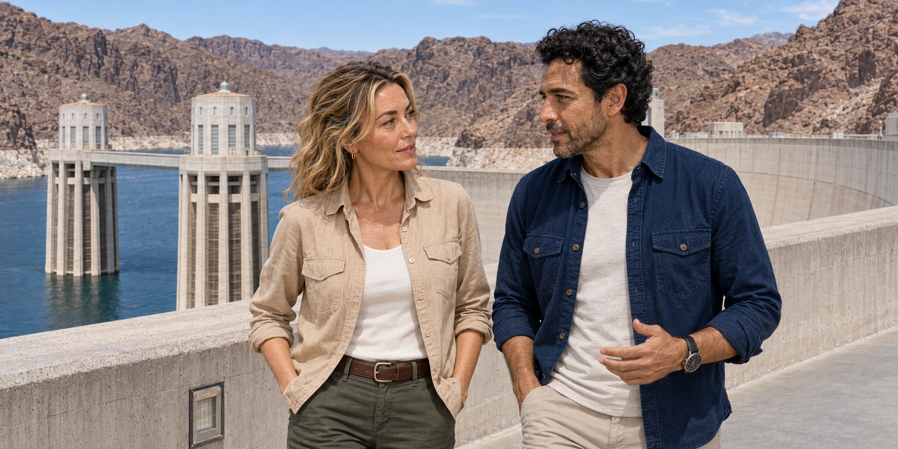
The useful way to approach Hoover Dam is not to ask whether it is impressive. At 726 feet high, curving between the dark walls of Black Canyon, it settles that question before a guide speaks. The harder question is what kind of control the structure actually represents. The dam checks floods, stores water, converts hydraulic head into electricity and helps order deliveries across a river basin. Yet storage depends on the water that reaches it, operating rules distribute competing demands, and the desert roads around Lake Mead remain shaped by heat, erosion and sudden water.
That tension gives the paired Hoover Dam and Callville Wash route a stronger story than the usual “engineering plus adventure” formula. The recorded itinerary begins in Henderson, reaches federal property at Hoover Dam, then turns north and east into Lake Mead National Recreation Area for a guided 4WD route associated with Callville Wash. The first half seems engineered; the second seems wild. In reality, both depend on controlled corridors, public rules, maintained machines, weather judgments and a clear division of responsibility.
Cooling coils and power penstocks make a good starting distinction. The small pipes embedded during construction took heat out of setting concrete; the enormous operating conduits carry water towards turbines. Galleries give people access to inspect the structure. Those three networks do different work, although a visitor sees them inside one monument. The desert has an equivalent distinction: a signed road is a permitted corridor through a landscape, while a wash is a drainage that can carry water across it. Understanding those separate functions makes both halves of the day more intelligible.
The route leads through a much larger subject: an arch-gravity load path, a vast concrete-cooling operation, dangerous Depression-era labour, racial exclusion, interstate and international water law, living Tribal rights, ecological transformation and a reservoir whose pale mineral ring records the movement of water.
02 · Hoover Dam & Lake Mead field guide
Four geographies, not “outside Las Vegas”
The day crosses four places that travel copy often collapses into one. Las Vegas is the lodging and tourism reference point. Henderson is a separate city southeast of the Strip and the recorded route’s starting area. Hoover Dam lies farther east in Black Canyon, where the Colorado River is the Nevada–Arizona boundary. Callville Wash and Callville Bay lie upstream within Lake Mead National Recreation Area, administered by the National Park Service, not by the city of Henderson and not by the Bureau of Reclamation visitor operation at the dam.
That matters because each transition changes the rules. Henderson should not be treated as shorthand for the Las Vegas Strip. The road journey passes onto the Hoover Dam federal reservation and through its vehicle-security approach. On the crest, crossing the Colorado also crosses the state line, although the visitor experience is one federal site. The later off-road portion enters a national recreation area where entrance requirements, signed routes, resource protections and current closures can matter.
A paired dam-and-desert day devotes time to transfers as well as interpretation. Security screening, federal tour inventory, road conditions, heat and group pace affect how much attention remains at each stop. The useful sequence is geographic: Henderson, Hoover Dam, the Callville country and return. The format suits curiosity about connected systems, but a traveller intent on the dam’s machinery or on learning to drive an unpaved route may prefer to give that subject a day of its own.

03 · Hoover Dam & Lake Mead field guide
What the paired format reveals—and what it compresses
Hoover Dam offers three distinct federal visitor experiences. The Bureau of Reclamation separates the on-site Guided Dam Tour, the reservable Guided Power Plant Tour and the self-guided Visitor Center. The Dam Tour reaches historic tunnels, an original elevator, inspection tunnels and a ventilation shaft, and includes the Power Plant Tour. The Power Plant route follows original construction tunnels to a platform above a 30-foot-diameter penstock and a view of eight Nevada powerhouse generators. The Visitor Center supplies exhibits, the observation deck and the regional dam-and-power model without an interior guided route.
The interior routes offer different depths of engineering interpretation. The extended Dam Tour is bought on site, with the group present, on a first-come basis. The federal visitor information explains ticket arrangements for each route. From the Mike O’Callaghan–Pat Tillman Memorial Bridge, the downstream face, powerhouses and canyon setting read as one composition. Inside, the Power Plant route brings the dimensions of a penstock and generator hall into human scale. Choose the view and route by what you want to understand, allowing enough time for each.
The Callville half asks for a different kind of participation. A guided 4WD convoy can add route interpretation, low-speed instruction and a shared safety system while keeping travellers on approved roads. A self-drive format also transfers real responsibility to the person behind the wheel: licence eligibility, seat-belt fit, vehicle spacing, traction decisions and obedience to a turnaround call are part of the experience rather than administrative details.
That is the central compression of a paired day. Dam interpretation rewards time spent inside a complex machine; desert-road judgment rewards a slow briefing and flexibility about conditions. Joining them produces a revealing contrast, but transfers and access constraints can leave less depth at each. Travellers who care most about engineering, accessibility, driving instruction or water history may learn more by choosing one specialist format and giving it the full day.
04 · Hoover Dam & Lake Mead field guide
How an arch-gravity dam holds a river
Hoover Dam is often called an arch-gravity dam, but the phrase becomes meaningful only when separated into two load paths. Gravity means the enormous weight and thick triangular section resist the reservoir’s push and transmit force down into foundation rock. Arch means the upstream-curving plan redirects part of the horizontal water load sideways into the canyon abutments. The structure is neither a thin arch suspended between walls nor a simple wall relying only on mass. Its geometry makes Black Canyon part of the system. Reclamation documents this system.
At the crest the dam is comparatively narrow; at the base it is 660 feet thick. That widening is a physical diagram of increasing hydrostatic pressure with depth. Water pressure acts across the curved upstream face. Compression moves through concrete toward the base and into the rock walls. Engineers excavated weathered material until they could key the foundation and abutments into competent rock. Drainage and inspection galleries inside let operators observe seepage and the structure’s condition; they are working access, not leftover cooling channels.
The four intake towers on the reservoir side admit water at selected levels. From them, large penstocks lead toward the powerplant. The spillways, set in the canyon walls, are separate high-flow safety works. They are not the normal route to the turbines. Outlet works provide additional controlled release capacity. An elevator carries people vertically through this system, but it is not the engineering principle that makes the dam work. The journey is memorable because it reveals scale; the structure survives because load, drainage, foundation and continuous maintenance interact.

The visible design is also an argument about modernity. Architect Gordon B. Kaufmann simplified proposed ornament into streamlined surfaces, integrated towers and emphatic shadows. Allen True brought regional geometric motifs into terrazzo floors; Oskar Hansen designed the Winged Figures of the Republic and the star map marking the sky at the 1935 dedication. The dam presents federal engineering as ordered, timeless and almost cosmic. The workforce, contested water and drowned landscapes sit outside that formal composition unless interpretation puts them back.
The floor has its own construction story. Joseph and John Martina, Italian immigrant brothers, installed the terrazzo in 1936–37 with a crew of about thirty countrymen. Marble chips set in cement were separated with metal strips and polished into a durable surface. True adapted geometric forms from Southwestern baskets, pottery and other designs; the federal building absorbed Indigenous visual language while Indigenous water rights remained a separate, contested question. Reclamation’s account of the dam’s art and craftsmanship names these contributors. Looking down at the floor reveals skilled work that disappears when the whole structure is credited to a single designer.
05 · Hoover Dam & Lake Mead field guide
First move the river
Before workers could build the dam in a riverbed, they had to send the Colorado elsewhere. Four diversion tunnels—two driven through each canyon wall—provided the temporary route. Their combined length exceeded three miles, and their diameter was large enough to move extraordinary flood flows around the work site. Cofferdams then isolated the excavation upstream and downstream.
This was not a quiet prelude. Drilling and blasting advanced through rock. Workers lined the tunnels with concrete and grouted voids. Reclamation’s history records temperatures reaching 140°F in the workings and a 1932 flood evacuation. High scalers suspended from canyon walls removed loose rock above the powerplant and outlet sites. The tunnel system, cofferdams and rock barrier had to be ready before the 1933 spring runoff. Engineering sequence was inseparable from exposure: a missed deadline could put the river back into the construction site.
After diversion, crews removed silt and weak rock to reach foundation. Aggregate for concrete came from an alluvial deposit upstream and was washed and sorted at a purpose-built plant. Railways, cableways, mixing plants, roads and a transmission line made the remote canyon into an industrial network. Boulder City was designed to house government and contractor staff. The dam was not one object delivered to a site; it was the final concentration of a temporary city, extraction landscape and logistics system. Reclamation documents this system.
Some diversion tunnels were later incorporated into outlet and spillway arrangements; others were plugged. That afterlife helps distinguish construction infrastructure from operating infrastructure. A visitor who walks an “original construction tunnel” is not walking the full path that carried the Colorado. A guide may point to history embedded in the present route, but the route has been adapted for controlled public access.
06 · Hoover Dam & Lake Mead field guide
The 582 miles of pipe were a temporary thermal machine
Reclamation reports more than 582 miles of one-inch steel pipe embedded in the dam’s concrete during construction. Those were cooling coils: a temporary thermal machine that removed heat as the concrete set. Their scale makes sense only alongside the much larger conduits that now carry water to turbines. Cooling coils, operating penstocks and inspection galleries served three different purposes.
Portland cement hydration releases heat. In a very large pour, the core stays hot while exposed surfaces cool and contract, creating damaging stress. Reclamation engineers calculated that an unbroken monolithic pour might take roughly 125 years to reach ambient temperature. That is a counterfactual illustrating the thermal problem, not the dam’s designed lifespan.
The solution was to build the dam as interlocking vertical columns placed in lifts, generally limiting a block to five feet of new concrete in a controlled period. River water first circulated through the embedded coils. Chilled water from a refrigeration plant completed the cooling. As the concrete contracted, crews pressure-grouted the cooling pipes and the keyed joints between columns, turning the system into a monolithic structural mass.
The sequence matters: place, compact, cool, contract, grout. Skip the cooling and thermal stress threatens cracking. Skip the grout and the cold joints do not behave as intended. The celebrated quantity of pipe describes process control during construction. Today’s operational water route uses intakes and four much larger penstocks. Treating both as “the pipes inside the dam” erases the distinction between making concrete stable and producing power. Reclamation documents this system.

07 · Hoover Dam & Lake Mead field guide
Labour, danger and the limits of a triumph story
Construction began in the depth of the Great Depression. Men arrived before Boulder City was ready, some with families, forming temporary camps on the river. A total of about 21,000 people worked on the project over its construction, with more than 5,000 employed at the peak. The promise of a wage drew people into a canyon where heat, blasting, falling rock, heavy equipment and carbon-monoxide exposure made the job dangerous.
The official count commonly memorialized is 96 industrial deaths, but Reclamation’s account explains the limits of that total. It excludes people who died away from the site of pneumonia and other illnesses, as well as some deaths outside the contracted industrial work. No worker is entombed in the concrete: the shallow lifts and work around each pour made that legend implausible. The real record needs no burial myth. It needs the people who drilled, scaled, mucked, drove, rigged, puddled and operated cableways under schedule pressure.
Six Companies, a consortium created by major contractors, won the federal contract and managed construction. Workers struck in 1931 over conditions and pay. The government’s presence did not make employment equitable. Reclamation’s history records a federal contract clause excluding “Mongolian” labour and common racial discrimination, particularly against Black workers. Boulder City’s manager barred Black residents; the few Black men hired had to live in Las Vegas and commute. Sustained NAACP pressure brought only a small number of jobs. Federal monumentalism and federal discrimination occupied the same project. Reclamation documents the employment history.
Racial exclusion continued into the visitor experience. On 22 April 1936, NAACP organiser William Pickens arrived with a party carrying special passes arranged by construction engineer Ralph Lowry. Pickens reported that an elevator operator ordered the Black visitors to wait for a separate trip. Staff disputed his account and accused him of pushing ahead. A ranger removed the party and detained Pickens and another man, taking them to Boulder City. Lowry’s assistant subsequently took the group back and conducted a tour.
The incident generated months of correspondence involving Roy Wilkins, newspaper publisher Carl Murphy and the Interior Department. Initial official conclusions blamed Pickens; the National Archives’ reconstruction from the correspondence preserves the conflicting accounts and continuing protest. The elevator is therefore more than a convenient descent into machinery. In this documented episode, admission to a public monument became a dispute over equal citizenship and the dignity of its visitors.
An independent Interior Department investigation eventually upheld Pickens’ complaint. Elevator operator Edgar Long resigned in June; ranger W. E. Lukens received a reprimand from Secretary Harold Ickes. In August, Ickes wrote to Pickens expressing regret over the incident. The surviving correspondence records more than competing accusations: sustained protest forced the department to acknowledge mistreatment at its celebrated public monument.
The name also moved with politics. “Hoover Dam” was used and legally recognized early, connecting the project to Herbert Hoover. Roosevelt’s administration and common usage favored “Boulder Dam,” and the 1935 dedication used that name. Congress formally restored Hoover Dam in 1947. The argument was more than a label: it decided which administration and political program could claim an immense public work. The National Park Service records the naming history.
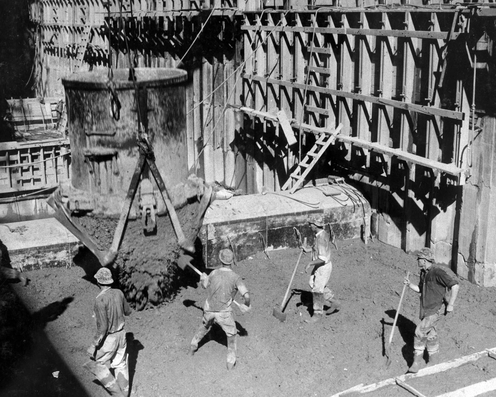

The completed architecture channels attention upward—to pylons, statues, intake towers and the curve of concrete. A responsible visit redirects some attention toward the floor: terrazzo laid by craftspeople, aggregate handled by crews, wages differentiated by job, memorial language that compresses varied deaths, and a town whose order depended partly on exclusion.

08 · Hoover Dam & Lake Mead field guide
From intake tower to socket
Hydropower begins with stored elevation. Water at Lake Mead has potential energy because it stands above the tailwater below the dam. Intake towers admit water into four penstocks, two on each side. Flow descends under pressure toward Francis turbines. Water turns the turbine runner; the shaft turns a rotor inside a generator; the rotating magnetic field induces current in stationary copper windings. Transformers and transmission equipment then step voltage for the grid.
Hoover has 17 main turbines—nine in the Arizona wing and eight in Nevada—and two smaller station-service units. Reclamation gives a nameplate capacity of roughly 2,080 megawatts. Nameplate is not a promise of continuous output. Available head changes with reservoir and tailwater elevations. Units come in and out for maintenance. River-release requirements, market schedules and system conditions affect dispatch. At lower reservoir levels, less head means less potential power per unit of water and can constrain effective capacity. Reclamation documents this system.
The power system’s purpose is larger than a city-lighting metaphor. Energy sales helped finance the Boulder Canyon Project, and federal power is allocated among public agencies, utilities, cooperatives and Tribal contractors in Nevada, Arizona and California. Generation is one part of integrated river operation: releases also serve downstream water orders, treaty obligations, reservoir coordination and environmental requirements. A megawatt-hour is not separate from the volume and timing of water that produced it.

The public Power Plant Tour makes this chain tactile. The viewing platform above a large penstock can transmit vibration. The Nevada powerhouse view shows eight commercial generators. Yet the route is a selected public window, not an operational audit. Security boundaries protect critical infrastructure, and maintenance can change what is visible. A responsible interpretation explains the missing links rather than implying “behind the scenes” means unrestricted access.
09 · Hoover Dam & Lake Mead field guide
Lake Mead is an operating condition, not a backdrop
The pale bathtub ring above Lake Mead records former water levels against rock. Minerals left along earlier shorelines make the contrast visible as storage changes. Elevation is more than a scenic measure: it affects hydraulic head, the position of boat facilities and the risk thresholds used in reservoir operations. Reclamation’s operating data gives the changing number; the enduring question is how that number alters what the reservoir can do.
Shortage rules translate declining storage into reduced deliveries and conservation obligations. The August 2025 determination for calendar 2026, for example, set a Level 1 Shortage condition, involving Arizona, Nevada and Mexico under the interim and drought-contingency arrangements then in force. That is a dated example of how rules work, rather than a permanent label for Lake Mead. A shortage tier allocates consequences among users; it cannot itself increase runoff or remove the basin’s imbalance.
Water governance is often summarized with the 1922 Colorado River Compact, which divided the basin at Lees Ferry and apportioned use between Upper and Lower Basins. The Compact did not allocate water among individual Lower Basin states, and Tribal representatives did not participate. Later compacts, statutes, court decrees, contracts, treaties and administrative rules formed what is often called the Law of the River. The Secretary of the Interior acts as lower-basin water master for mainstream deliveries below Hoover.
Mexico’s place is not a footnote. The 1944 treaty provides a basic annual Colorado River delivery, with later International Boundary and Water Commission minutes addressing shortage, storage, conservation and environmental cooperation. Reclamation’s 2026 determination included a Mexican reduction under Minute 323 and the Binational Water Scarcity Contingency Plan. Domestic post-2026 modelling does not itself settle the binational agreement; that work proceeds through the treaty framework. Reclamation explains the treaty and compact framework.
Tribal Nations have sovereign and legal relationships to this water. Federal reserved water rights can date to the creation of a reservation and remain senior to many later uses. A right established on paper does not automatically bring treatment plants, pipelines or affordable service to a community. Some rights remain unresolved; others are settled but need infrastructure to be used. The Ten Tribes Partnership water study treats those challenges explicitly, including the Tribes’ own accounts. A chart listing only states conceals legal positions and lived access that the reservoir’s monumental scale cannot show.
The successor regime is now more concrete than a set of draft alternatives. Reclamation issued a final environmental review in July 2026, followed in August by a decision adopting a framework for coordinated Powell–Mead operations through 2036 and the first operating guidelines for 2027–28. The framework sets principles, thresholds and a process; the first guidelines specify the initial two operating years. The decision documents distinguish those two layers. A ten-year framework does not mean identical releases for ten years, nor does a federal operating decision erase separate Tribal rights or the treaty relationship with Mexico. The dam remains a machine operated within several kinds of law.

10 · Hoover Dam & Lake Mead field guide
What the reservoir changed
Lake Mead created storage and recreation while submerging a river landscape. Fort Callville, a nineteenth-century settlement and steamboat landing, lies under the reservoir and accumulated sediment. The area now called Callville Bay reuses the name without preserving the original place at the surface. Upstream, parts of the Ancestral Puebloan complex once called the Lost City were excavated hurriedly as the reservoir rose; the National Park Service notes Hopi claims of ancestry to those communities. Archaeological salvage saved objects and records but could not save every site or relationship to place. NPS describes the submerged resources.
The human history reaches far beyond those two examples. Southern Paiute communities have longstanding ties to water sources, seasonal routes, agriculture and gathering across this desert. Their people and governments continue today. Mojave, Hualapai, Chemehuevi and other peoples have relationships along the lower Colorado and its tributaries. These histories belong to named communities; a general landscape view cannot identify or explain every cultural place. It can begin by recognising that a flooded canyon or dry wash was inhabited and valued before a reservoir occupied it.
Ecologically, the reservoir traps sediment that once moved downstream. U.S. Geological Survey mapping finds thick post-impoundment deposits along the drowned Colorado River valley and tributary floors, redistributed by turbidity currents. Deep-water withdrawal changes the downstream temperature regime. Daily and seasonal flows below the dam now follow operational decisions rather than the unregulated snowmelt and flood pattern. Native and introduced fish, riparian plants and invertebrate food webs respond to altered temperature, clarity, timing and channel form. USGS maps the submerged sediment landscape.
Lake Mead also supports new ecosystems and new pressures. Quagga mussels were detected in 2007 and spread through lakes Mead and Mohave. They filter plankton, alter food webs and encrust boats, pipes and underwater resources. Adults can travel attached to a watercraft; microscopic larvae can move in water held in equipment. Cleaning, draining and drying equipment interrupts those pathways, serving both infrastructure and biodiversity.
Downstream, the dam’s influence continues into Black Canyon and Lake Mohave. ExcursionPass’s Emerald Cave kayak guide follows that regulated tailwater in detail: cold releases, altered flow, spring habitat and a small optical attraction whose conditions cannot be guaranteed. The reciprocal connection is precise. Hoover’s turbines are not the end of the water story; a paddler below the dam travels inside it.
11 · Hoover Dam & Lake Mead field guide
Callville Wash is a drainage, not a playground surface
“Wash” is the decisive word in the second half of the day. In the Mojave, a wash is a drainage corridor shaped by intermittent flow. It may look broad, dry and convenient. During a storm—sometimes a storm over higher ground not visible from the vehicle—it can concentrate moving water, debris and sediment. The National Weather Service warns that Las Vegas-area flash floods run through normally dry washes, and the Park Service says never hike, camp or drive across flooded roads or low drainages.
Lake Mead National Recreation Area allows vehicles on an approved network of backcountry roads. The current park rule is explicit: approved roads are signed with yellow arrows and black road numbers; driving off road, cross-country or in washes is prohibited. That wording resolves a marketing ambiguity. A “Callville Wash off-road tour” may use an approved unpaved road associated with the drainage. The name does not grant permission to roam freely along the wash bottom.
Select the route using the National Park Service’s approved-road information. An old GPS trace cannot establish permission. Erosion, exposed rock, soft sediment and maintenance change a road’s surface, and a protected corridor has rules even when no ranger or other vehicle is visible. A legal unpaved road and an open dry wash can look similar from behind a windscreen; the signs and map distinguish them.
Soil and cultural resources add another boundary. Desert pavement, biological soil crust and sparse plants may look durable because they grow slowly; tire disturbance can persist for years. Archaeological objects and petroglyphs are not props or clues to a “hidden” empty landscape. Collection and removal of natural, historic or cultural material is prohibited. If a guide interprets a site, remain on the approved surface, do not touch markings and do not publish precise coordinates for vulnerable resources.

Callville Bay adds a second kind of change: the moving shoreline. As the reservoir retreats, a ramp may need extension, boat facilities may shift and new hazards may emerge. Those changes show why water access is infrastructure rather than a blue edge on a map. The park’s low-water access planning examines that moving relationship. Give desert reading and driving instruction their own value rather than judging the whole outing by how close the road comes to the water.
12 · Hoover Dam & Lake Mead field guide
What the Bronco changes—and what it cannot
A modern four-wheel-drive vehicle can reduce specific risks. Low-range gearing, selectable drive modes, suitable tyres, ground clearance and traction control can improve controlled progress on loose or uneven surfaces. Climate control reduces heat exposure while it functions and the cabin remains closed. A guide convoy can establish pace, point out a line and stop a driver before an obstacle becomes damage.
Recovery gear changes the options after traction is lost. A winch can pull a vehicle when the anchor, rigging, load direction and equipment ratings are appropriate. It does not automatically “multiply force”; a multi-line rig can change mechanical advantage, but it also changes loads on anchors and components. Untrained use can turn a cable, shackle or recovery point into a projectile. Travellers should follow the guide’s system, stand clear and never improvise from a video.
Radios help a guide set the convoy’s pace and coordinate stops, but terrain can interrupt a signal. A canyon wall that keeps the group out of sight can also complicate communication. Cellular service is limited in the backcountry. A useful plan therefore includes a missed-contact procedure, a way to account for every vehicle and an overdue-party response. Learn the stop signal and the communication fallback before the convoy leaves pavement.
No equipment makes all weather passable. Climate control fails if the engine stops. A high-clearance vehicle can be floated, undermined or rolled by moving water. Four-wheel drive helps controlled progress; braking on loose gravel still requires distance and a low pace. A winch cannot create a safe anchor everywhere. Recovery takes time, and emergency response in a backcountry corridor may be delayed.
The right safety briefing therefore covers more than which mode to select. It assigns drivers, seat belts and vehicle spacing; explains how to avoid dust blindness; establishes hand and radio signals; defines no-pass and no-detour rules; states the turnaround threshold for rain and heat; and tells passengers what to do if a vehicle stops. “All skill levels” should mean instruction adapts to beginners, not that consequences disappear.
13 · Hoover Dam & Lake Mead field guide
Heat and flood are decisions made before the trail
At Callville Bay, summer daytime temperatures commonly exceed 100°F. Shade, a cooler part of the day and a shorter exposed route are practical choices with consequences for everyone in the party. Check the National Weather Service forecast and park planning information before departure. Keep drinking water reachable by each passenger rather than stored only in a guide’s vehicle, and carry a reserve for delays.
Headache, nausea, dizziness, weakness or heavy sweating can signal heat exhaustion. Stop exertion, move to a cooler place, begin cooling and obtain medical help; do not leave the person alone. Confusion, slurred speech, a seizure or loss of consciousness may indicate heat stroke. Call 911 and cool the person rapidly while help is coming, using shade and cool water or wet cloths. Heat stroke can occur with sweating as well as dry skin. The CDC’s heat-illness guidance explains the distinction. Age, health, medication and acclimatisation affect risk; an air-conditioned cabin is only one protective layer.
Monsoon weather can be locally deceptive. Rain need not fall on the vehicle for a wash to rise. Thunder implies lightning risk. A darkening upstream sky, fresh debris, changing water colour, a sudden cool wind or distant roar should not become a dramatic moment for photographs. The route plan must reach high ground without crossing moving water. A guided convoy needs a clear turnaround decision, because social pressure can make the second driver follow the first.
A paved or developed stop, a shorter route or a turnaround may be the right outcome. Make that decision before the party is committed to a drainage. The choice protects people and leaves time for a different way of reading the same landscape.
14 · Hoover Dam & Lake Mead field guide
Accessibility is one continuous chain
Hoover Dam can be accessible while a combined dam-and-4WD day is not. The useful assessment begins with the whole chain: parking or transport, security, the selected federal route, restrooms, the second vehicle transfer, seat height, vibration, heat exposure and emergency exit. A single accessibility icon cannot describe all of those stages.
At Hoover, the Guided Power Plant Tour and Visitor Center have broad wheelchair, scooter and stroller access. The extended Guided Dam Tour has narrower limits: Reclamation says motorized wheelchairs and strollers are not allowed, and the ventilation shaft is not accessible to manually operated wheelchairs. Wheelchairs can be rented at the parking garage. Sign-language interpretation can be requested at least 14 days in advance, excluding holidays, and scripts are available. These site provisions do not obligate a private operator to provide personal transfer assistance.
Interior conditions matter beyond steps. Security screening can require queuing. Elevators and tunnels can feel confined. Machinery creates vibration and sound. Lighting changes. Toilets may not appear at each stage. A traveller with claustrophobia, sensory sensitivity, hearing loss or a medical device needs the exact route and security procedure, not a general accessibility icon.
The bridge alternative introduces distance, sun and grade on a paved pedestrian surface. A Callville 4WD portion introduces a higher transfer, sustained vibration, lateral movement, dust and heat. A person may comfortably use the Visitor Center and still find several hours in a high-clearance vehicle unsuitable. Another may skip the narrow ventilation-shaft section yet participate in the rest. The correct comparison is stage by stage, with essential assistance confirmed for the specific service chosen.
Children require the same end-to-end reasoning. Reclamation’s federal visitor products publish their own age categories, while a self-drive vehicle experience has separate passenger, restraint and driver rules. Admission to the visitor centre does not establish suitability for the road component.
15 · Hoover Dam & Lake Mead field guide
Choose the format by the responsibility you want
The combined format is strongest for a party with an eligible, comfortable driver who wants both an interior engineering route and coached unpaved driving in one day. Its weaknesses are dependence on federal tour inventory, high transfers, heat exposure and the possibility that each half becomes shorter than a specialist experience.
A dam-only visit gives more control over federal choices. The self-guided Visitor Center and observation deck suit visitors who want exhibits and broad views. The Guided Power Plant Tour adds penstock and generator interpretation with stronger accessibility. The Guided Dam Tour reaches inspection tunnels but is on-site, first come and more restrictive. These options can be paired with time in Boulder City instead of a backcountry drive.
The Mike O’Callaghan–Pat Tillman Memorial Bridge and public overlooks provide a low-cost structural reading without promising an interior. They are exposed to sun and require walking, but the bridge makes the dam’s curvature, downstream face and canyon depth comprehensible. The Historic Railroad Trail on the Lake Mead side adds a gentler industrial-landscape route through former rail tunnels; check current closures, heat and distance before treating it as universally easy.
An independent Lake Mead day offers flexibility at Callville Bay, developed picnic areas or a selected trail. It transfers weather, navigation, vehicle and park-entry decisions to the traveller. A guided 4WD trip without Hoover gives more time for instruction and desert interpretation. A Black Canyon kayak places the traveller downstream in the dam’s regulated water system, but adds cold-water immersion, paddling and marine-weather demands.
Use five questions:
- Is the interior Dam Tour essential, or would a Power Plant/Visitor Center route still satisfy the engineering interest?
- Does the party have a qualified driver who understands the chosen provider’s liability terms?
- Can every person complete the highest transfer, longest vibration segment and hottest exposed stop?
- Is one day of variety more valuable than deeper time at one system?
- Would the day still be worthwhile if security, heat, flood risk or a road closure removed one component?

16 · Hoover Dam & Lake Mead field guide
Plan the dam and the desert as separate systems
Use Reclamation’s visitor information to choose among the Dam Tour, Power Plant Tour and Visitor Center; then check Lake Mead backcountry rules and maps and the National Weather Service Las Vegas forecast office for the road portion. The three sources answer different questions: public access at critical infrastructure, lawful use of a protected desert corridor and current atmospheric risk.
For Hoover Dam, decide whether the interior is essential, whether the on-site first-come Dam Tour is realistic and whether every traveller can manage the selected route’s mobility and sensory conditions. Build in time for vehicle inspection and visitor-centre security. Weapons and knives of any size are prohibited in dam buildings. Bottled water is permitted; sealed food may be carried but not consumed inside.
For Lake Mead, use the current approved-road map rather than a remembered track. Carry water for people and vehicle, a map, spare tyre, jack and lug wrench when travelling independently. Stay on yellow-arrow routes, do not create a bypass around an obstacle and never enter flowing water. If a guide directs the drive, learn the convoy spacing, stop signal and turnaround rule before leaving pavement.
Treat cultural material as part of a living landscape. Photograph without touching or removing objects and do not geotag a vulnerable place. Pack out litter. Equipment that contacts lake water should follow clean-drain-dry guidance to reduce the spread of quagga mussels. The responsible departure is the one that can be shortened or abandoned without turning sunk cost into pressure.
17 · Water and walking
Another scale of managed water
Henderson offers a quieter continuation of the water story. The Bird Viewing Preserve has nine ponds supplied with reclaimed water, with a wheelchair-accessible paved path and mostly level soft-surface trails. It is not a fragment of untouched desert wetland. It is habitat created beside a municipal water-reclamation system, where operational choices about pond drainage and vegetation affect birds.
The preserve’s history records a practical negotiation, documented by the Environmental Protection Agency in 1999. Birdwatchers noticed that draining ponds and removing vegetation could disrupt nesting. The city and local birders worked towards maintenance that served both wastewater operations and habitat, leading to formal dedication in 1998. That sequence challenges a simple division between engineered water and nature: wildlife value emerged inside infrastructure, then depended on people changing how they managed it.
Henderson’s water-reuse explanation connects the ponds to a larger cycle. Highly treated wastewater supports irrigation and the preserve; water returned to the Colorado River system earns return-flow credits. Reuse is not an unlimited new source. It changes where a volume is used and whether it returns to the system. The contrast with Hoover is one of scale: a dam shifts water through a vast basin, while a municipal plant and a pond margin make that same dependence visible close to home.
For a separate walking day, Sloan Canyon National Conservation Area presents volcanic terrain and a protected rock-writing landscape. Routes to Petroglyph Canyon can involve uneven surfaces and scrambling; the Cowboy Trail offers an alternative around dry falls, not a guarantee of easy access. BLM describes the petroglyph trail as inaccessible to wheelchairs. Use its current trail map to choose a route that fits the party rather than assuming an old mileage or shortcut applies.
The designs on canyon rock are cultural resources, not decorations for a strenuous walk. Stay on the authorised trail, avoid touching or climbing beside panels, and leave any object where it lies. Sun exposure and the distance back to transport still govern a visit. Bird ponds and a walking route provide different kinds of attention from a convoy drive, but neither makes planning unnecessary. Choose between them by the surface, exposure and interpretive question you want to spend time with.
18 · Hoover Dam & Lake Mead field guide
Beyond the viewpoint
From the crest, Hoover Dam appears complete. The concrete has cured, the towers stand, turbines turn and a bridge carries through-traffic high above the canyon. But completion is the wrong final idea. Operators inspect galleries. Generators are maintained. Reservoir elevation changes daily. Shortage rules distribute loss. Operating frameworks turn changing storage into release decisions. Sediment accumulates in drowned valleys while cold regulated water leaves below. Visitors pass through a route that can close for the same reason the public is admitted carefully: this is still critical infrastructure.
Callville Wash provides the corresponding view from the ground. A dry channel records water even when no water is visible. A yellow arrow makes one line legal and leaves the crust beyond it protected. Climate control works until a machine or decision fails. A radio may connect a convoy and still be only one layer of an emergency plan. The most capable driver is the one willing to turn around.
The most useful outcome from the combined journey is a clearer measure of control. Concrete can redirect force but cannot create water. A reservoir shifts supply through time while losses, inflow and demand continue. Four-wheel drive improves traction but leaves route permission and flood risk unchanged. A guide adds instruction and judgment; the traveller still benefits from understanding the federal interior, the shoreline and the drainage as different parts of one day.
Hoover Dam deserves the view from the bridge and the vibration above the penstock. It also deserves the worker, the excluded applicant, the drowned site, the Tribal right, the treaty delivery and the changing number on Reclamation’s daily table. Callville deserves the driving lesson and the broad desert horizon. It also deserves to remain a drainage with rules, cultural memory and a surface that does not exist for tyres alone.
Seen together, the two places reveal a connected landscape. The concrete wall, a turbine shaft, a pond margin and a dry drainage all reward the same habit: noticing what a powerful system changes, what it depends on and where human judgment still matters.
19 · Field notes
Listen to the podcast episode
Episode details and transcript
The 21-minute-10-second episode follows the Hoover Dam visit, the transition to Callville Wash and the guided vehicle sequence. Treat its route observations as starting points, then use current federal conditions for the day you travel.