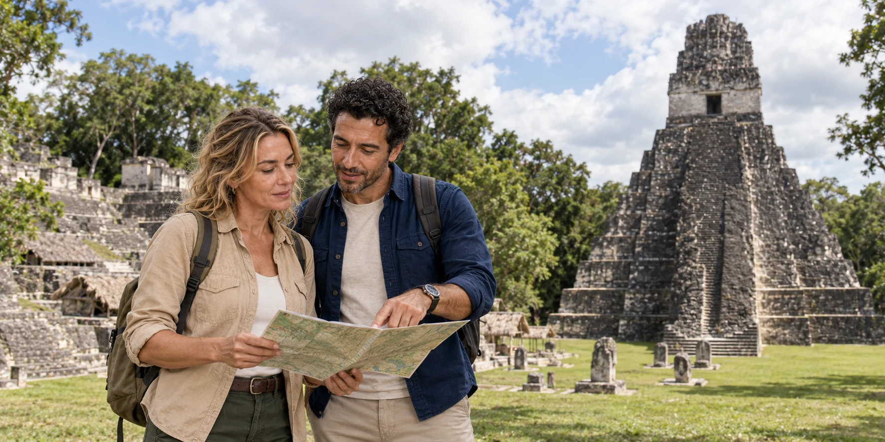

Tikal does not reveal itself in a single view. The familiar roof combs above green canopy are real, but they arrive late in a much larger story. The ground below once held a populous low-density city: households and gardens, quarries and plaster yards, reservoirs and causeways, ceremonies and disputes. Today the same landscape is an archaeological park, a forest core and a working conservation problem. Reading all three at once changes both the history and the visit.
The route begins well before the first pyramid. Flores occupies an island and adjoining shore in Lake Petén Itzá; Santa Elena and Mundo Maya International Airport form the modern gateway beside it. From there the road runs north through Petén toward Tikal National Park. Belize lies to the east, while the wider Maya Forest continues beyond Guatemala into Belize and Mexico. The modern journey is a road into a protected area. The ancient journey was movement through a settled and managed landscape whose roads, alliances and exchanges reached much farther.
That contrast supplies the method for what follows. Start with the region and the city beneath the canopy. Enter the monumental core through the evidence its builders left in plazas, inscriptions and architecture. Then follow water, labour and households back out into the urban landscape, before asking how forest succession, excavation and conservation made the place a visitor can enter now. The practical route belongs at the end of that chain because transport, heat, surfaces and current access only make sense once the scale of the city is clear.
Tikal National Park covers 57,600 hectares. It is one core zone within Guatemala’s Maya Biosphere Reserve, which exceeds two million hectares and includes core, multiple-use and buffer zones with different rules. The park is also a UNESCO World Heritage property inscribed for both cultural and natural values. None of those labels means untouched wilderness. They describe overlapping systems of archaeology, biodiversity, public access, law, employment, research and community relations.
The surviving monuments are similarly layered. Ancient builders enlarged earlier platforms. Later rulers placed new texts among older ones. Excavators opened some structures and left others closed. Conservators consolidated masonry and controlled vegetation. Modern stairs, paths, barriers and viewpoints direct today’s bodies. A visitor is never walking through an unedited ancient city. The useful question is not whether Tikal is authentic or restored. It is which part of the evidence is ancient, excavated, consolidated, reconstructed, protected, inaccessible or still unknown.

01 · Tikal field guide
1. Rebuild the city before entering the plaza
The classic Tikal photograph is usually made from height: forest to the horizon, several roof combs rising above it. The picture makes scale visible, yet it can also make the buildings look like isolated monuments that survived after forest “swallowed” a city. Archaeology gives a different starting point. Monumental groups occupy only part of a dispersed settlement. Residential compounds, terraces, quarries, reservoirs, fields, orchards and maintained woodland were interwoven across an inhabited landscape. The city was neither a compact stone downtown nor a few ceremonial buildings marooned in jungle.
Researchers describe this form as low-density agrarian urbanism. “Low-density” does not mean socially simple or lightly populated. It means that households, food production and managed green space were distributed among civic and ritual nodes instead of being packed behind one continuous wall. People moved between home, water, work, market, court and ceremony. Causeways made certain connections formal. Plazas created large gathering surfaces. Reservoirs concentrated a resource needed through the dry season. Public architecture turned collective labour into visible authority.
The number of inhabitants remains an estimate rather than a census. One widely cited environmental reconstruction proposes about 45,000 people in the sustaining area at the city’s height; other methods and boundaries produce different totals. The responsible conclusion is more important than a single figure: tens of thousands of lives cannot be understood from temple silhouettes alone. Every smooth plaster surface required limestone, fuel, water, skill and repeated maintenance. Every royal monument depended on producers, porters, masons, farmers, cooks, scribes and households whose names rarely entered dynastic texts.
The modern forest is not a passive curtain placed over that system. Ancient residents retained useful trees, cultivated house gardens and orchards, worked fields and wet margins, and altered drainage. Environmental DNA from reservoir sediments indicates that large and understory tropical forest trees grew near urban reservoirs even during the Late Classic period. Tikal could be green and urban at the same time. Forest clearance also intensified, especially where fuel was needed to burn limestone for stucco and construction. A managed mosaic, not a choice between pristine nature and total clearing, best fits the evidence. With that city in mind, the central monuments can be read as concentrated pieces of an urban system rather than as the system itself.
02 · Tikal field guide
2. Let the built layers establish the chronology
The city’s chronology is visible first as accumulation. Occupation at Tikal reaches deep into the Preclassic period, and settlement and public construction grew over centuries before the dates most visitors associate with towering temples. Early platforms were buried inside later ones; the North Acropolis accumulated buildings and burials through repeated episodes of construction. By the Classic period, rulers presented themselves within a dynastic sequence whose founder was remembered as Yax Ehb Xook, although the earliest centuries of that sequence are reconstructed partly from later inscriptions rather than contemporary records.
On 16 January 378, according to the correlation most scholars use, inscriptions record the arrival of Siyaj K’ak’—“Fire Is Born”—in the central Maya lowlands. Tikal’s ruler Chak Tok Ich’aak I died the same day. Soon afterward, Yax Nuun Ahiin I took the throne. Stela 31, commissioned in the fifth century by his son Siyaj Chan K’awiil II, shows Yax Nuun Ahiin with Teotihuacan-associated dress and places Tikal’s local dynasty inside a story of foreign connection and authority.
Those facts do not solve the event. “Arrival” might include diplomacy, coercion, military action and the installation or sponsorship of a new ruler; the precise ethnic identity and origin of Siyaj K’ak’ remain debated. Teotihuacan, more than a thousand kilometres away in central Mexico, did not simply colonise every Maya city that used its imagery. Material style, names, political theatre and personal movement need to be separated. Tikal’s inscriptions turn 378 into a decisive break, but archaeology cautions against making one text explain every household and neighbourhood.
During the sixth and seventh centuries, Tikal’s position was challenged within a network led by the Kaanul or Snake dynasty, later based at Calakmul. A defeat associated with 562 begins the famous “hiatus” in Tikal’s dated monuments. The term can mislead: a gap in the carving of royal stelae is not proof that the whole city stopped. Excavation shows continued occupation and building. Elite conflict, factional change and the deliberate damage or suppression of monuments are among the explanations considered.
Jasaw Chan K’awiil I acceded in 682. His victory over Calakmul in 695 and the building programme associated with his reign mark a powerful renewal. His successor, Yik’in Chan K’awiil, extended that success and campaigned against important Calakmul allies. Temples I, II and IV belong to this era of reconstructed royal authority. Their height was political memory in stone: proof that a dynasty could mobilise labour, command routes and place ancestors within the city’s most visible spaces.
By the ninth century, that system was changing again. Severe droughts intersected with warfare, political fragmentation, exchange disruption, forest and fuel pressures, and problems in water storage. Reservoir pollution and toxic cyanobacteria probably made particular central basins less reliable. No one mechanism “killed Tikal.” Monument production diminished, the royal court contracted and people moved toward places with more dependable water and opportunity, including the Lake Petén Itzá region and areas in present-day Belize. That is urban diaspora and political transformation, not the disappearance of Maya people. The timeline becomes most precise where rulers fixed selected events in stone, which is why one stela deserves a close look before the route opens into the Great Plaza.

03 · Tikal field guide
3. Stela 31 turns chronology into evidence
Stelae are upright stone monuments, often paired with low circular altars. Calling them billboards captures only their public visibility. They combined portraiture, names, titles, calendrical dates, ritual events, ancestry and political claims. Their texts were not neutral archives, but neither were they interchangeable propaganda. A stela was activated in a plaza, placed in relation to older monuments and ceremonies, and read by audiences with different levels of literacy and memory.
Stela 31 is especially useful because it turns a broad story into an object. Siyaj Chan K’awiil II appears on the front. His father, Yax Nuun Ahiin I, appears on the sides with weapons and clothing associated with Teotihuacan. The monument reaches backward to the upheaval of 378 and forward through a son asserting legitimate succession. It does not let a modern reader watch the takeover. It shows how a later Tikal ruler wanted the connection remembered.
The original is protected in the park’s museum rather than left exposed in the plaza. That move is part of the monument’s modern biography. Tropical rain, biological growth, salts, handling and vandalism threaten carved surfaces. A replica or cast may communicate form outdoors while a controlled interior protects detail. The choice can frustrate a visitor expecting every famous object to stand where it was found, but conservation sometimes requires separating context from material.
The same caution applies to names. Ancient inscriptions use a Mutul emblem and a fuller place name often read as Yax Mutul. The exact meanings and relationships between emblem, dynasty and place remain scholarly questions. “Tikal” is the modern archaeological name, first recorded in nineteenth-century outside documentation; popular translations such as “place of voices” are uncertain and should not be treated as an ancient caption. The modern name is useful. It is not a complete translation of how Classic-period residents identified their city. That evidence boundary matters in the Great Plaza, where an impressive composition makes simplified explanations especially tempting.


04 · Tikal field guide
4. Cross the Great Plaza as a sequence
The Great Plaza is the easiest place to mistake a composed scene for the whole city. Read it instead as a sequence of relationships. Temple I rises on the east and Temple II faces it on the west. The North Acropolis closes the plaza to the north; the Central Acropolis, a dense complex of courts and palace-like rooms, stands to the south. Stelae and altars occupy the paved ground. Ballcourts and the East Plaza extend the system beyond the postcard frame.
Temple I, commonly called the Temple of the Great Jaguar, was built around the beginning of the eighth century and rises roughly 44–47 metres depending on the measuring convention. Burial 116 beneath it contained an older man generally identified with Jasaw Chan K’awiil I, accompanied by jade, shell, ceramics and exquisitely incised bones. The tomb and carved wooden lintels make the temple a dynastic memorial, not a generic pyramid. Its steep original stair is not a modern public staircase.
Temple II, often called the Temple of the Masks, stands opposite and is lower, about 38 metres with its roof comb. Its dedication is associated with the same dynastic programme and commonly linked to Jasaw’s wife, although simple labels such as “her tomb” go beyond the evidence. The paired placement made the plaza a theatre of ancestry and rule. It did not create one universal Maya cosmic diagram that explains every terrace.
Sound offers another way to notice the plaza’s form. Stone, stairways and open ground reflect voices differently from foliage and enclosed rooms. At Chichén Itzá, acoustic experiments have examined a chirp produced by clapping before a stepped pyramid; that result does not establish the same effect at Tikal. Nor does a large plaza demonstrate that ordinary speech from Temple I reached every listener clearly. Source position, voice level, occupied space and reconstructed surfaces all change the result. The architecture gives a compelling setting for public ceremony without requiring a story about a perfectly engineered microphone.
The nine terraces of Temple I also invite a neat symbolic story about nine levels of an underworld called Xibalba. Maya texts, images and later sources contain layered concepts of earth, sky, caves, water, ancestors and dangerous otherworlds. One earlier interpretation of Temple I proposes an underworld reference, but the equation is not a universal rule for every pyramid or every period. Architecture carried political, mortuary, ritual and spatial meanings together. Uncertainty is more accurate than a single cosmic key.

05 · Tikal field guide
5. Follow the numbered temples out of the postcard
Temple III stands west of the central precinct and dates to the early ninth century. Its roof comb remains prominent above the forest, while much of the structure is unrestored. At roughly 55 metres high, it has a different silhouette and history from Temple I. A carved wooden lintel associates the temple with a late ruler sometimes called Dark Sun. The building marks continuing monumental ambition near the end of Tikal’s inscribed sequence; the ninth century began with construction and political statements rather than one simultaneous abandonment.
Temple IV is the tallest at Tikal, about 65–70 metres by different measurements. Yik’in Chan K’awiil commissioned it in the eighth century. Surviving carved lintels record victories and place the structure within the renewed dynasty’s political geography. A modern wooden stair system has enabled access to a viewpoint at times, keeping feet off the original steep masonry. That distinction—modern stair versus ancient stair—is essential. Current access can change for conservation, weather or maintenance and must be checked with park staff on the day.
Temple V, south of the Central Acropolis, is approximately 57 metres tall. Its date and patronage have been debated, and the building should not be assigned automatically to the same ruler as the better-documented temples. Look at its base before looking up. Seven stepped bodies and rounded external corners make its mass distinct; its principal facade faces north, unlike the east–west confrontation of Temples I and II. Archaeological investigation has had to distinguish the ancient outline from rubble and later intervention. The rounded outline distinguishes this building from square-cornered platforms; every temple did not follow one repeated design. Height remains a reason to look carefully, not an invitation to climb.
Temple VI lies southeast of the Great Plaza at the end of the Méndez Causeway. The building is lower than Temple IV, but its roof comb carries an unusually long hieroglyphic inscription. The text reaches into Tikal’s deep past and was renewed or recorded in the eighth century. Soldiers and Guatemalan researchers documented the temple in 1951, after local knowledge of the landscape had long preceded outside archaeological attention. A walk to VI therefore connects inscription, causeway, forest and the history of research.
Mundo Perdido, the “Lost World” complex, began much earlier than the great temples. Its pyramids and platforms were repeatedly rebuilt, and its spatial arrangement is often discussed in relation to solar observation. The phrase “E-Group” describes a recurrent architectural pattern, but precise astronomical intention and use can vary by place and phase. A western pyramid and an eastern range make the relationship between observing position and horizon visible. That does not make the entire group a single-purpose observatory. Excavation of its palace buildings has revealed successive changes in rooms, circulation and occupation. Ritual space and inhabited space developed together. The modern name can conceal that accumulated urban history: this was a changing part of the city, not a separate civilisation discovered within it.
Immediately east, the Plaza of the Seven Temples offers a different arrangement. Seven relatively small temples line its eastern side, three ballcourts occupy the north, and palace buildings define the south. Read across those edges instead of searching for one dominant tower. Oswaldo Gómez’s excavations revised an initially attractive account in which one ballcourt simply acquired two companions. The triple group was itself a planned construction, although an earlier structure survives beneath the central court. Shared plaza floors connect temples, palaces and courts, but do not prove that all were built on the same day. The sequence matters because architecture can preserve changing relationships between competition, ceremony, residence and public gathering.
The twin-pyramid complexes connect a repeated plan to the calendar. Paired platforms stand on the east and west of a plaza, with a long building to the south and a northern enclosure containing a dated stela and altar. Inscriptions connect these groups to endings of k’atuns: periods of 7,200 days, roughly twenty years. The recurrence turned time into a series of places. This is more specific than treating every pyramid as a generic cosmic diagram: the layout, carved date and repeated commission support the connection together. Choose an additional complex for the question it answers, rather than adding temple numbers to a tally. Moving between them also reveals slopes, causeways and drainage—the less spectacular works that made the city possible.

_-_Guatemala-1537.jpg)
06 · Tikal field guide
6. Water made the hilltop city possible
Petén has a pronounced dry season and Tikal has no dependable river beside its centre. Rainfall had to become infrastructure. Builders shaped plazas and roof surfaces to shed water, directed runoff through channels and gradients, lined basins with clay and stone, and linked reservoirs at different elevations. Quarrying created some of the depressions later used for storage. Causeways could also act as dams or control structures. The same public works that made a ceremonial centre impressive helped fill the tanks on which urban life depended.
Research identifies several central and peripheral reservoirs, including Temple, Palace, Hidden, Corriental and Perdido. Their placement suggests more than one scale of management. Water captured near elevated precincts could support court and residential needs; lower reservoirs served other neighbourhoods and fields. Control of maintenance and release gave political weight to a basic resource, but households also held knowledge and storage capacity outside a single royal system.
Corriental Reservoir preserves evidence of a filtration system using quartz sand and zeolite, minerals transported from outside the immediate catchment. Zeolite’s microscopic structure can trap particles and some contaminants. The discovery is strong evidence of deliberate water-quality engineering; it does not mean all Tikal water was always pure. Other basins accumulated mercury derived partly from cinnabar pigments and supported harmful cyanobacteria. Central reservoirs could become unattractive or unsafe, especially during drought.
Plant remains and environmental DNA add another layer. Reservoir margins could support wetland vegetation that stabilized soil, filtered water and created habitat. Large trees around some basins offered shade and reduced evaporation, though roots and leaf fall introduced trade-offs. A reservoir was not a blue rectangle isolated from the city. It was water, sediment, plants, microbes, labour and ritual meaning.
The collapse lesson is therefore institutional rather than melodramatic. Tikal’s residents sustained a large city through sophisticated capture and land management for centuries. Prolonged drought narrowed the margin for failure. Pollution, political conflict, forest pressure and an economy unable to import enough food or water compounded the problem. Resilience is real, but it is not infinite.

07 · Tikal field guide
7. Plaster, quarries, households and exchange
The pale surfaces that define Maya monumental architecture began with extraction. Limestone was quarried for blocks and broken for fill. It was also burned to make lime for mortar and stucco, consuming large amounts of fuel. Plastered plazas reflected light, shed rain and created clean ceremonial surfaces, but repeated resurfacing represented an environmental and labour cost. A ruler could make authority gleam because many people cut wood, carried stone, tended fires, mixed material and repaired cracks.
Quarries were not necessarily abandoned holes. Some were reshaped into reservoirs or integrated into construction sequences. This reuse makes it hard to divide the city into infrastructure and monument. A depression could supply stone, then hold water; a paved court could host ceremony and capture rain; a causeway could move processions and control runoff.
Households formed the city’s durable social units. Groups of buildings around patios accommodated cooking, sleeping, craft, storage, burial and family ritual. Differences in size and materials register inequality without turning every large group into a palace. Gardens and useful trees supplied fruit, leaves, medicines, fuel and shade. Fields at different ecological margins supported maize, beans, squash, root crops and other plants. No single crop or technique fed the entire urban population.
Exchange brought obsidian, jade, marine shell and other materials from beyond Petén. The jade and Pacific shell in Burial 116 made distant connections visible in a royal tomb. Everyday trade mattered just as much: food, salt, ceramics, textiles, tools and information moved through regional networks. The East Plaza has been interpreted partly through possible market activity, but identifying an ancient marketplace requires chemical residues, distribution patterns, architecture and comparison—not simply a large open area.
Ballcourts likewise resist one label. The ballgame joined sport, ritual, diplomacy, community gathering and political theatre in different combinations. Stelae and altars marked time and rulership. Palaces held residence, reception, administration and storage. Archaeological categories help a visitor read form; they should not freeze every structure into one lifelong function.

08 · Tikal field guide
8. Forest succession is history, not revenge
When maintenance stopped in a building group, tropical succession changed light, soil and masonry. Pioneer plants occupied open ground. Roots entered joints. Leaf litter accumulated. Larger trees established over time. That process did not “take revenge” on a failed civilisation. It created the forest now protected for its own extraordinary value while also weathering archaeological fabric.
Tikal National Park contains semi-evergreen and seasonal forest, wetlands and varied habitats. UNESCO records hundreds of bird species and a rich mammal, reptile and plant community. Howler and spider monkeys, ocellated turkeys, coatis and many other animals are associated with the park; jaguar and Baird’s tapir occur in the wider landscape. None is a scheduled sighting. Playback calls, feeding, crowding or leaving trails to pursue wildlife damage the encounter being sought.
The park sits inside a much larger conservation geography. CONAP divides the Maya Biosphere Reserve into core zones for conservation and low-impact use, a multiple-use zone where regulated forest concessions operate, and a buffer zone where agriculture and settlement pressures are managed. Community forest concessions in the reserve have linked local livelihoods, monitoring, timber and non-timber products, fire prevention and standing-forest value. They are not proof that every conflict is solved, but they disprove the idea that conservation requires removing people from the story.
Threats remain specific: wildfire, illegal extraction, poaching, looting, settlement pressure, ranching expansion, waste and wastewater, erosion at heavily visited monuments, and climate stress. Tourism creates employment and conservation revenue while concentrating bodies, vehicles and waste. The answer is not to call the forest aggressive or tourism automatically beneficial. It is to ask who governs access, where money flows, how rules are enforced and whether ecological and archaeological monitoring shapes capacity.
Living Maya people belong in that governance. Petén is home to Maya Itza’, Mopan, Q’eqchi’ and other communities alongside people with many identities and migration histories. Guides, workers, researchers and spiritual practitioners hold contemporary relationships to the landscape. CONAP notes that modern Maya ceremonies take place in the park. Ancient Tikal is not the property of an extinct people, and current culture is not a costume supplied for a tour.
ACOFOP, the Association of Forest Communities of Petén, gives that regional relationship an institutional form. Its membership includes peasant and Indigenous organisations working through community forestry in the reserve’s multiple-use zone and parts of its buffer zone. Monitoring, forest management, social organisation and community tourism are parts of the same livelihood strategy. These concessions are distinct from the national park: their existence does not authorise extraction or unrestricted access inside Tikal. It shows why a visitor should ask how a protected area connects to the people and economies around it. When a ceremony is taking place, follow the practitioners’ and park staff’s directions; a public visitor ticket grants neither participation nor permission to photograph people at worship.
09 · Tikal field guide
9. Excavation created the Tikal visitors see
Local people knew the buildings long before nineteenth-century officials and travellers published them abroad. In 1848, Modesto Méndez, a Guatemalan official, reached and documented Tikal with Ambrosio Tut and the artist Eusebio Lara. Later visitors copied inscriptions, photographed structures and removed material. The Swiss collector Gustave Bernoulli took carved wooden lintels from Temples I and IV in 1877; they are now in Basel. Their absence is part of the architecture’s history and of wider debates about collections and return.
Guatemala declared Tikal a national monument in 1931 and a national park in 1955. From 1956 to 1970, the University of Pennsylvania’s Tikal Project carried out large-scale excavation, mapping and conservation in collaboration with Guatemalan institutions and workers. The project revealed the Great Plaza, North Acropolis, residential structures, tombs and settlement patterns, and produced an enormous documentary archive. It also reflected the methods and power structures of its era.
The smaller discoveries can change the visit as much as a royal tomb. In 1959, Ann Chowning directed excavation of a residential group threatened by the project’s proposed sawmill and workers’ settlement. Burials within and around ordinary building platforms placed family history back into the city’s architecture. Salvage work required by a modern construction plan thus helped expose the people omitted from a temple-only account. It also illustrates a tension that continues: facilities serving research or tourism can endanger the deposits they are meant to help interpret.
Excavation is destructive in the technical sense: once deposits are removed, their original relationships cannot be recreated. Records, samples, drawings and publications become the evidence. Tunnels into pyramids expose earlier phases but can weaken buildings or alter moisture. Clearing vegetation improves legibility while changing shade, roots and surface stability. Reconstruction can help a visitor understand volume but risks making hypotheses look original.
Modern conservation therefore favours targeted consolidation and continuous maintenance over rebuilding every structure. The wet tropical climate makes that work relentless. Mortar washes out, plants colonise joints, wood decays and carved stone loses detail. Looting destroys context even when an object survives. Visitor feet erode stairs and plaster. A barrier is not an obstacle placed between a traveller and an authentic view; it is part of the system keeping material available to future viewers.
Temple VI makes this history visible. Its roof-comb inscription was documented in the twentieth century after the structure entered formal archaeological attention, but the building already stood in a landscape known and used by local people. What the public sees now combines ancient fabric, recorded text, cleared vegetation, structural intervention and a modern path.

.jpg)
10 · Tikal field guide
10. Return the city to the visitor’s body
After the city, forest and conservation systems are visible, the visitor’s day can be planned honestly. The main practical error is treating a headline duration as walking time. A Tikal day has components: pickup or self-drive origin, road transfer, park gate, ticket check, visitor centre, route to the archaeological groups, optional museum, food and water, rest, return to the vehicle and the road back. A tour described in hours still needs a clear explanation of which of those components fit inside the clock.
Surfaces vary. Maintained paths can include packed earth, grass, roots, mud, loose stone, gradients and long distances between groups. Tropical heat and humidity increase effort even on modest slopes. Rain makes limestone and wood slippery; lightning changes the safety of exposed viewpoints. Insects are part of the environment. Shade is uneven. Toilets, drinking water and food are concentrated rather than continuous.
That complexity makes a blanket “not wheelchair accessible” less useful than a component audit. Ask about the exact vehicle and restraint system, drop-off point, ticket queue, distance to the visitor centre, surface to the Great Plaza, gradients, path width, rest points, toilet access, whether a mobility aid can travel in the vehicle, and which viewpoints can be reached without stairs. An accessible first kilometre does not make an elevated temple platform accessible; an inaccessible viewpoint does not erase the possibility of a valuable shorter route.
The same principle applies to children, older visitors, pregnant travellers and people sensitive to heat or cardiac strain. An age band on a tour listing is not medical guidance. Families need verified child-restraint arrangements, supervision rules and a pace that preserves water and rest. Anyone managing a health condition should discuss the full chain with a clinician and the operator, then choose a route that leaves capacity for the return.
The Ministry of Culture and Sports lists general park access daily from 06:00 to 18:00, with separate sunrise access from 04:00 to 06:00 and sunset access from 18:00 to 20:00. Tickets are sold through the official CulturaGuate platform or at the gate. The Sylvanus G. Morley Museum near the visitor centre follows a separate 08:00–16:00 timetable. Check the official visitor information close to travel, including the ticket category and any guide requirement for special entry, then confirm the day’s route at the visitor centre.
11 · Tikal field guide
11. Choose a route, not a superlative
A focused first visit can connect the visitor centre, Great Plaza, North and Central Acropolises and one additional complex at a pace that leaves time to look. A longer circuit can add Mundo Perdido, Temple V, Temple IV and Temple VI, but the distances and heat compound. The best route is not the one with the most temple numbers. It is the one that keeps attention for the return.

Temple viewpoints must be treated as current privileges, not permanent rights. Use only official modern stairs and platforms that staff confirm open. Never climb original masonry, cross a barrier or assume yesterday’s photograph proves access today. A closed structure can still be read from placement, form and inscriptions.
The Morley Museum offers a lower-exertion interpretive option and protects objects that cannot safely remain outdoors. Its reproduction of Burial 116 and collection of ceramics, jade, obsidian, stelae and altars can give context that a fast plaza circuit misses. The site model helps convert temple silhouettes into an urban plan. A museum-plus-Great-Plaza route may be more meaningful than forcing a distant viewpoint.
Sunrise and sunset are separate permit and staffing products, not extensions a general daytime ticket automatically includes. Cloud can erase the promised colour. Wildlife may remain unseen. Night and dawn transfers introduce fatigue and road risk. Ask who holds the permit, which viewpoint is authorised, whether a certified guide is mandatory, what happens during lightning or closure, and how the return is handled.
A Flores-based guided transfer can simplify vehicle and interpretation, but confirm the exact meeting place and the length of the road journey. A private guide and vehicle may improve pacing and accessibility questions. Self-drive offers timing control but shifts fuel, navigation, parking and breakdown responsibility to the traveller. Packages from Guatemala City or Belize add flight, border and missed-connection contingencies. An overnight in Flores or near the park often creates more historical depth than a same-day flight designed around a single photograph.
12 · Tikal field guide
12. Questions that reveal the shape of a guided day
A useful Tikal booking confirmation should describe a route rather than rely on words such as “splendour,” “complete” or “all-inclusive.” The details matter because road time, park admission, walking, interpretation, meals, rest and the return compete for the same day. Before choosing a guided format, obtain written answers to these questions:
- Where exactly does the paid service begin and end? Name the hotel, public meeting point, airport or park gate.
- Is driving time inside or outside the advertised duration?
- Are park admission and any sunrise, sunset or museum tickets included? Who purchases them?
- Is the guide authorised for Tikal, and which language is guaranteed rather than “available”?
- What is the maximum paying group size, the vehicle capacity and the planned guide-to-guest ratio?
- Which groups are planned, how much walking is expected and which climbs depend on same-day opening?
- Is food included? Where and when can water be refilled or purchased?
- What vehicle and route components work for a wheelchair, cane, stroller or fatigue limitation?
- Which child ages are accepted, which restraints are provided and who controls the pace?
- What happens after park closure, lightning, severe rain, flight delay, vehicle failure or insufficient enrolment?
- What are the actual cancellation deadline, refund method and contact channel for the operating company?
Precise answers reveal whether the day matches the traveller’s body, interests and connection risks. Vague answers are a reason to choose a different format or arrange the park, transport and guide separately.
13 · Tikal field guide
13. A practical field chain
Buy through the current official park channel or confirm that the operator has done so. Save the receipt offline. Carry identification required by the ticket category and enough payment flexibility for services that do not share one till. Do not assume reliable mobile data at every stage.
Wear light, breathable clothing and footwear with tread that is comfortable for a long walk rather than a ceremonial stair. Bring water, sun protection and rain protection that can be deployed quickly. Use insect repellent according to its instructions. Keep hands free on stairs. A small bag is easier to manage, but current security and drone rules must be checked with the park; never launch a drone or professional production without explicit authorisation.
At the visitor centre, photograph the official route map and closure notices. Ask which modern stairs, viewpoints and trails are open, where the last toilets and water points are, and when you must turn back for your transport. If the route plan changes, notify the guide or driver rather than improvising a shortcut.
Keep distance from wildlife and never feed it. Food changes animal behaviour and creates conflict around paths. Do not promise children a monkey or toucan. Treat an encounter as possible, not owed. Stay on managed routes, carry waste out to designated bins and never touch carved surfaces.
For heat, choose a pace that leaves room for regular water and shade breaks. Headache, dizziness, nausea or unusual weakness are reasons to stop, cool down and seek help. Confusion, altered speech or collapse require urgent medical assistance and immediate cooling; they must never be treated as a normal part of the climb. Tell your guide or park staff immediately. Move the person into shade and wet their skin or clothing with cool water; keep someone with them while help is arranged. Rain can cool the air while increasing slip risk. Leave exposed viewpoints when staff direct you to do so; lightning is a reason to seek protection, not to wait for a photograph.
On return, leave enough daylight and attention for the road. The visit is not complete at the highest viewpoint; it is complete when the least mobile member of the party, the guide and the vehicle are safely back at the agreed endpoint.
14 · Tikal field guide
14. A city and forest held together
Tikal endured because generations coordinated water, forest, food, roads, ritual and labour. It changed because those systems operated within drought, rivalry and unequal power. The modern park endures through another set of institutions: Guatemalan heritage staff, rangers, conservators, guides, workers, researchers, communities and visitors deciding what use a protected landscape can bear.
From Temple IV, the forest can still look like the main subject and the buildings like interruptions. From the Great Plaza, stone can look primary and forest like background. Neither view is complete. Tikal is the relationship between them, made and remade over more than two millennia.
Listen
“TIKAL Mayan Splendor,” The Travel Podcast by ExcursionPass · 20 min 38 sec.
Plan your visit
- Tikal National Park, UNESCO World Heritage Centre
- Tikal visitor information, Guatemala Ministry of Culture and Sports, 26 May 2026
- Maya Biosphere Reserve zoning, CONAP
- Sylvanus G. Morley Museum visitor information, 3 February 2026
For current park hours, permits, structure access and trail conditions, use the official sources above close to travel and confirm the day’s route at the visitor centre.