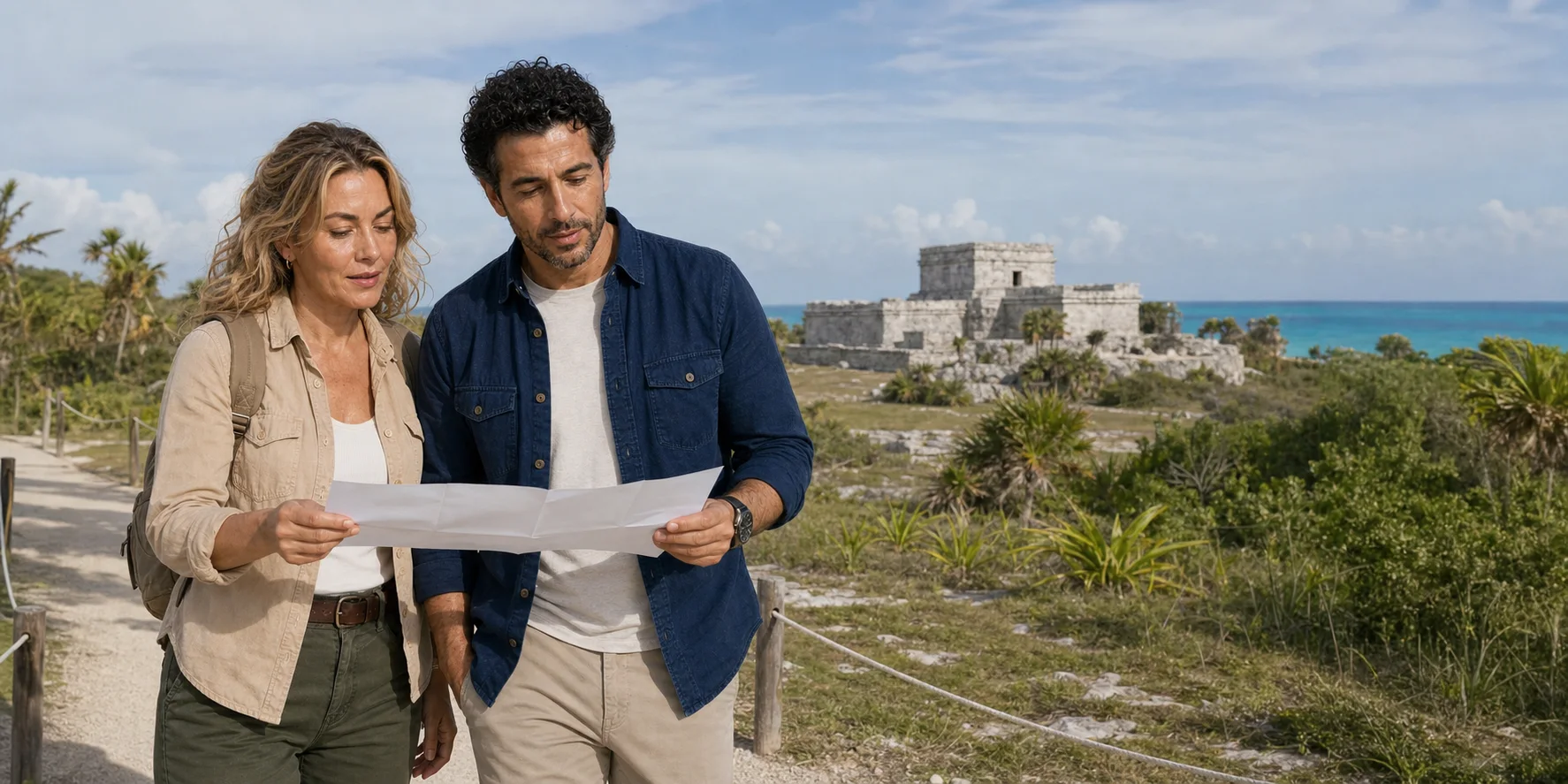

Tulum faces the Caribbean behind a landward wall. Cobá spreads inland from lakes along raised white roads. Put them into one excursion and the transfer can make them look like two versions of the same “jungle ruin.” Read the ground, water, buildings and people first, and a sharper story appears: two Maya cities solving different political, ritual and practical problems on the same porous peninsula—and a modern visitor industry deciding which differences to reveal, simplify or sell.
01 · Limestone-world field guide
The quickest road between two cities can hide the distance between them
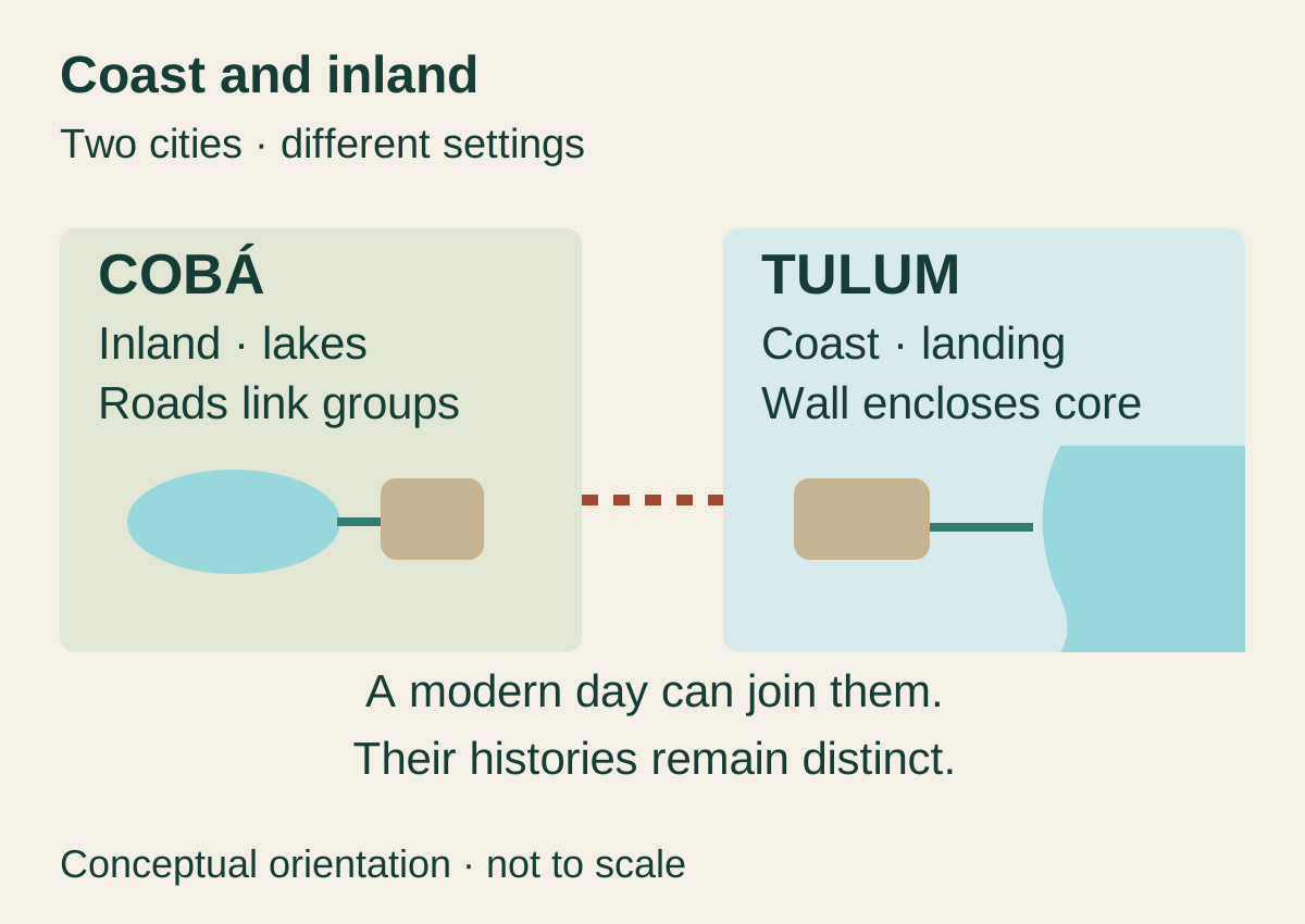
Tulum and Cobá sit close enough on a modern map to share a long day. That convenience produces a persistent optical illusion. Both have pale limestone buildings, tropical vegetation, Maya names and ticketed archaeological zones. Both can appear in an itinerary with a cenote, a zipline or a community meal. The excursion format encourages a traveller to remember one composite place: pyramid, jungle, cold water, lunch, return to the hotel.
The ancient cities did not form one attraction. Tulum's surviving monumental core stands on the east coast of the Yucatán Peninsula, its landward sides defined by a substantial wall and its seaward side open to a cliff and small landing beach. Much of what visitors see belongs to the last centuries before and after Spanish arrival. Cobá developed farther inland beside lakes. Its principal groups, roads, monuments and settlement spread through a broad landscape whose political weight was already substantial during the Classic period, centuries before Tulum's most visible fabric.
This is not a contest over which city is older, larger or more “advanced.” Those rankings usually flatten time and reward the building that looks most impressive in a photograph. The useful comparison is structural. How did people organize movement when the ground absorbed rain? How did rulers make authority visible across dispersed settlement? What did a wall include and exclude? What could a coastal landing connect? What work was required to quarry, raise and surface a road through low-relief forest? Why did water appear as lakes in one urban landscape and as hidden groundwater or collapse openings across the region?
The two podcast episodes approach that landscape through different days. One moves from Tulum's coast and ruins into a forest sequence. The Cobá episode starts with a village, lagoon and cenote encounter at Pac Chén before reaching the archaeological city. Together they raise the questions a traveller needs answered about chronology, access, interpretation, consent, activity safety and the aquifer beneath the itinerary.
Begin with the cities and the water that sustained them. A wall, a road and a flooded opening become more revealing when their construction, use and care are understood together. Adventure can then take a considered place in the day: an activity with its own responsibilities, within a landscape whose history continues beyond the visitor's arrival and departure.

02 · Limestone-world field guide
Start with the platform: rock that stores water by letting it move
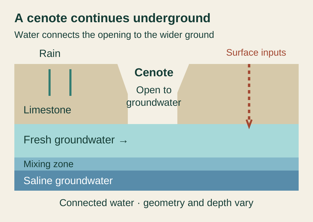
The Yucatán Peninsula is famous for looking flat. That apparent simplicity is the beginning of its complexity. Much of the northern peninsula is a carbonate platform: layers of soluble rock, especially limestone, through which rain can infiltrate. Water enlarges fractures and voids over long periods. Caves develop, ceilings can collapse, and openings known as cenotes expose parts of an aquifer that otherwise remains underground.
This geology changes the human map. In many regions, a settlement can be read from a surface river. On the Yucatán platform, surface drainage is limited across large areas because water enters the ground quickly. Access may depend on lakes, aguadas, wells, caves, cenotes, chultunes or other storage and management strategies according to local conditions and time. A building that appears to sit in “jungle” is part of a water landscape even when no blue water enters the frame.
The aquifer is not a series of sealed stone bowls. Water can move through connected fractures and conduits; near the Caribbean, fresher groundwater interacts with denser saline groundwater. The geometry changes by location and season. So does quality. Clear water can carry microbial or chemical contamination invisible to a swimmer. A busy cenote is not made ecologically harmless by the word natural, and a rope platform does not prove that wastewater, sunscreen, fuel, litter or surrounding development are well managed.
That system ties the whole feature together. Tulum's bluff, beach, reef-facing position and modern protected area belong to a coastal karst landscape. Cobá's lakes and road network belong to an inland one. A cenote stop between them is not an intermission from archaeology. It is a direct encounter with the material on which both cities were made—and with the environmental consequences of contemporary growth.
03 · Limestone-world field guide
Tulum is a recent name attached to a much older sequence
The name Tulum is commonly translated as wall, enclosure or palisade, a reference to the structure enclosing the main monumental group on three landward sides. INAH's current site page says sixteenth-century sources designate the place as Zamá, interpreted as morning or dawn. That evidence supports the ancient name more securely than a modern sunrise slogan would. It does not make every east-facing building a solar observatory, nor does it resolve every linguistic and local interpretation.
The distinction between names matters because it prevents a false frozen moment. Tulum was not built all at once under the label printed on today's road signs. Most buildings now visible belong to the Middle and Late Postclassic, roughly 1250–1550 according to INAH's archaeological interpretation. Yet the site contains evidence of earlier activity. Stela 1 records a date corresponding to 564, and Structure 59 preserves traits associated with an earlier architectural phase. The late city therefore occupied a landscape with a deeper history.
Tulum also belonged to a regional political geography. INAH places it within the late Postclassic province of Ecab and describes it as an important settlement on the northeast coast. The surviving city makes sense alongside nearby Tancah, coastal communities, inland production and routes to islands and other ports. Calling it “the only Maya seaport” would erase that network. It was a powerful coastal node, not a solitary exception floating outside Maya exchange.
Its greatest visible prosperity arrived late in the long Maya chronology. That timing corrects another familiar simplification: a single “Maya collapse” after which cities simply disappeared. Political centers changed unevenly. Some Classic dynasties lost power, populations moved, regional connections were remade, and Postclassic cities flourished. Tulum's monumental form belongs to that later world. Cobá's strongest centuries overlap only part of it.
04 · Limestone-world field guide
The wall is a machine for organizing approach
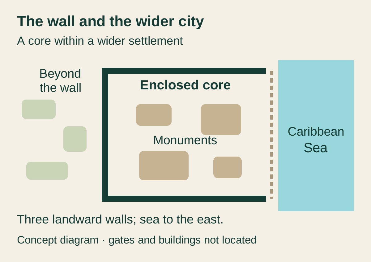
The wall is the first element to read because it is more than a defensive adjective. It runs along the north, west and south sides of the main group, with the coast forming the eastern edge. INAH identifies five gates and two towers. Passing through a narrow opening changes the visitor's field of view, just as it changed movement in the ancient city. The wall separated spaces, made entrances count and turned approach into a controlled sequence.
“Walled city” can still mislead if it makes the enclosure sound like the whole settlement. Residences, work, agriculture, exchange and other activity extended beyond the monumental core. The wall concentrated a privileged architectural and ritual zone; it did not contain every person who sustained it. A visitor who photographs only El Castillo sees the product of labor while easily missing the households, producers, porters, fishers, farmers, builders and traders on which public authority depended.
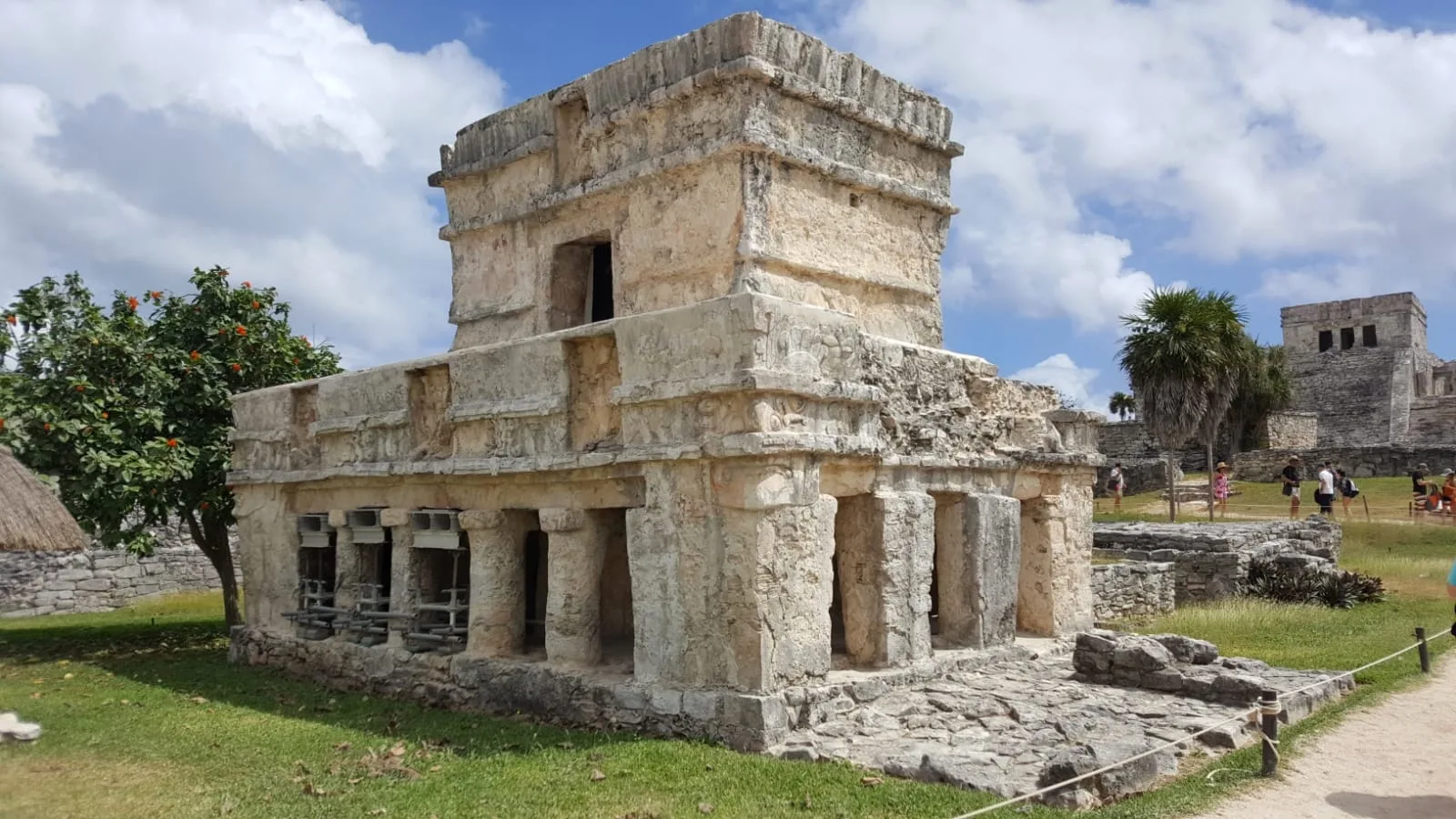
Inside, a principal street helps organize palaces, platforms, shrines and temples. Buildings now called the House of the Halach Uinic, House of the Columns, Temple of the Frescoes and El Castillo occupy a legible but altered landscape. Their present names are interpretive conveniences. Their masonry has weathered. Some fabric has been stabilized or reconstructed. Paths and ropes channel today's bodies differently from ancient ones. Reading the place requires holding original layout, later decay, twentieth-century intervention and current conservation in the same view.
The wall's thickness and towers have encouraged military readings. Defence is a reasonable part of the discussion, but a wall can signal status, regulate access and stage ritual as well as resist attack. It can protect stored goods or authority, divide social space and make a city recognizable from land. The safest account is functional plurality: the structure could perform several jobs across different moments.
The House of the Columns shows how a substantial hall could open toward public space: four columns divide its southern entrance into five openings, while a roofed sanctuary occupies the centre of the building. Its large L-shaped base and later attached rooms make expansion legible. The House of the Halach Uinic has a southern portico, central rooms and a shrine with a descending figure retaining traces of paint. Read those buildings as arrangements of movement, support and ritual, rather than trying to reconstruct the daily life of an unnamed resident from their modern labels.
A discovery inside the House of the Halach Uinic complicates the relationship between rooms and storage. In 2024, archaeologists reported a bottle-shaped underground compartment, or chultún, within the building. Unlike outdoor chultunes interpreted as water stores, this roofed example had no evidence of containing liquid. Project director José Antonio Reyes Solís proposed an earlier use for food and plants, followed by ritual reuse. That remains an archaeological interpretation, supported by the different deposits under investigation. The same kind of cavity could serve different purposes; its form alone cannot tell a visitor whether it held water, provisions or something else.

05 · Limestone-world field guide
El Castillo can guide a canoe without becoming a proven lighthouse
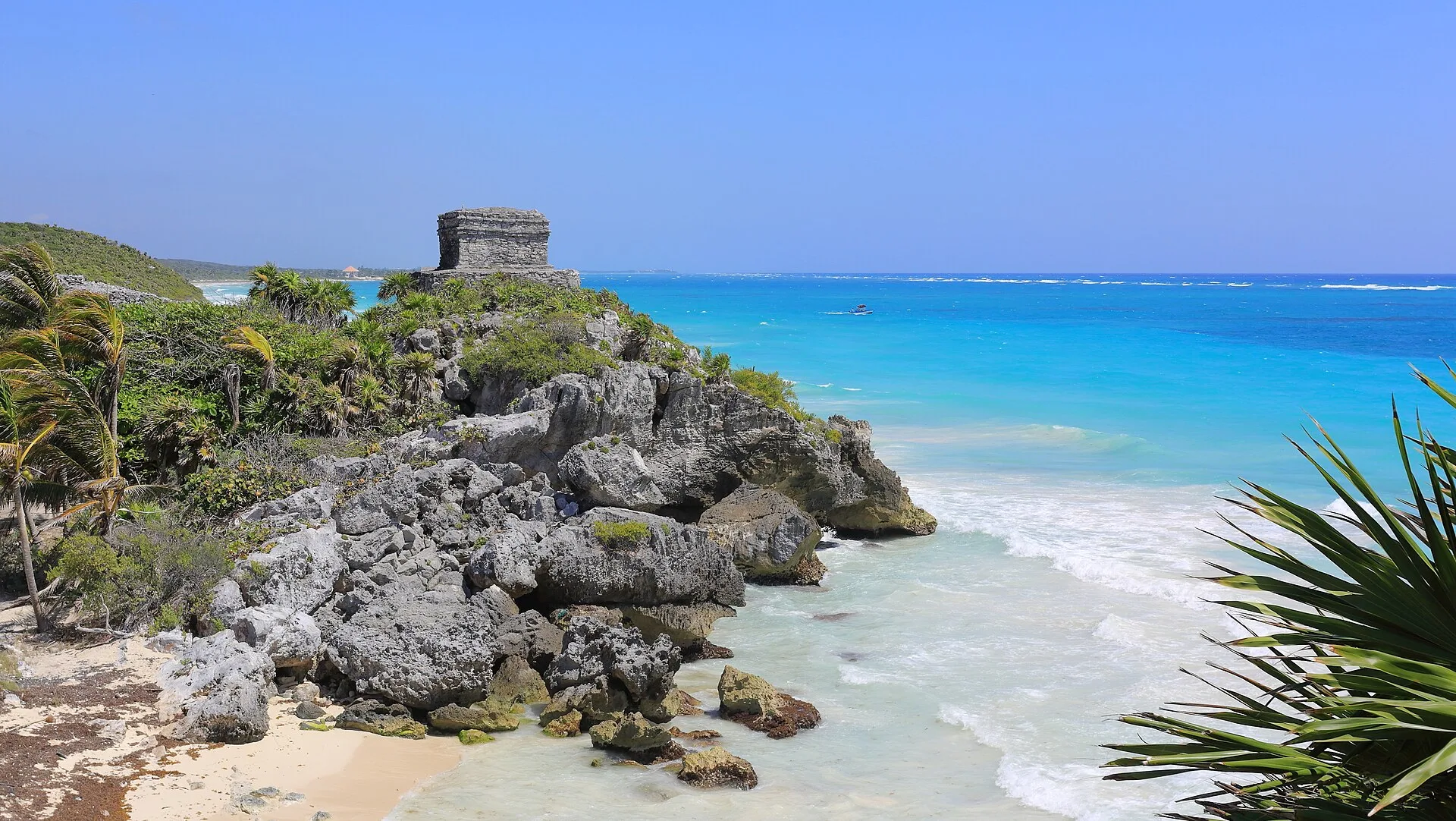
El Castillo is Tulum's visual anchor: a high platform and temple placed near the Caribbean edge. From land it organizes the central group. From water its mass and position would have been conspicuous. The coast includes a reef environment and a landing below the site, so navigation and exchange are essential parts of interpretation.
A popular story turns openings in the upper temple into an exact lighthouse system: two fires align for a canoe in the safe channel, while one light warns of reef. It is memorable, mechanically neat and often repeated as settled fact. The available official material supports the broader navigation context but not that precise apparatus as a demonstrated certainty. Fire, sightline and reef experiments would need archaeological, architectural and maritime evidence capable of distinguishing one use from many possible uses.
The responsible account is both less cinematic and more useful. Tulum's elevated buildings, coastline knowledge, daylight landmarks, oral instruction, sea conditions, celestial observation and practiced pilots could all help navigation. People who used the coast were not waiting for one architectural trick to make the Caribbean intelligible. The two-torch story can be mentioned as an attractive hypothesis; it should not replace the larger maritime skill system.
Exchange likewise needs specificity. Coastal canoes moved people, information and materials along the peninsula and beyond. Tulum's economy included marine and littoral resources as well as trade. Archaeological work summarized by Yale's eHRAF record identifies fishing and coastal subsistence evidence, reminding us that a port does not live on prestigious imports alone. Food, salt, fiber, stone, ceramics, tribute and everyday cargo make networks function.
The small beach below the cliff is therefore not a decorative strip of turquoise. It is an interface between sea and city, exposed to weather and constrained by rock and reef. Modern beach access, erosion, turtle nesting, protected-area rules and visitor management now add further layers. A traveller should never infer that a view from the archaeological zone guarantees a same-day swim or unrestricted descent.

06 · Limestone-world field guide
The Temple of the Frescoes preserves a designed surface, not bare stone
Tour photographs often make Maya cities look monochrome because limestone survives longer than paint. Tulum's Temple of the Frescoes resists that illusion. Its surviving mural program, modeled stucco and architectural detail show a building designed to carry color, imagery and controlled access. INAH's research history identifies figures and motifs associated with deities including Itzamnaaj and the Maize God, intertwined serpents and celestial imagery.
Those images do not turn the building into an open picture book. Conservation limits access because humidity, salts, microorganisms, wind, rain and human presence can damage fragile surfaces. Original colors have changed. Earlier documentation and restoration shape modern interpretation. A visitor may see less than a guidebook illustration and should understand that partial visibility is a conservation outcome, not a failure of the attraction.
Tulum is associated with an architectural vocabulary called the East Coast style: modest scale, columns, flat roof forms and distinctive façade details. Repeated images of a descending figure appear above doorways at several buildings. Popular writing often converts that figure immediately into one named “Diving God” with a single fixed meaning. Identification and function remain debated. The position is observable; the complete theology is not.
The uncertainty is productive. A close reader can compare repeated forms, building placement and thresholds without pretending to recover the thoughts of every participant. They can ask how an image worked when painted, how entering beneath it changed ritual movement and why later generations maintained or altered the building. Archaeology offers disciplined questions as well as answers.

07 · Limestone-world field guide
Spanish contact was a catastrophe, not the moment Maya history ended
In 1518, during the expedition led by Juan de Grijalva, chaplain and chronicler Juan Díaz described a large coastal settlement that may have been Tulum. INAH paraphrases the famous comparison to Seville and treats the identification with appropriate caution. The point is not the European superlative. It is that the city was densely inhabited when Spanish vessels reached this coast.
By 1579, a colonial description presented it as ruin. The interval includes war, coercion, political disruption, forced resettlement and epidemic disease. To call Tulum “mysteriously abandoned” is to make colonial violence disappear. It is also wrong to imply that the people disappeared. Maya communities continued across the peninsula, adapted, resisted, moved, maintained languages and social institutions, and formed new political and religious landscapes.
Tulum itself did not become culturally inert. The University of Arizona Press chapter on local interpretations traces continuing Maya relationships to the place and warns how national heritage narratives can marginalize living knowledge. Nineteenth-century explorers did not “discover” an unknown city. Local people knew the ruins, used the landscape and guided outsiders to it.
Formal archaeological and conservation work introduced another transformation. INAH records urgent stabilization beginning in 1938 and the first excavation aimed at establishing chronology in 1960. The archaeological zone opened to public visitation in the twentieth century. What appears timeless is the result of excavation choices, consolidations, cleared vegetation, repaired walls, paths, signage and constant maintenance.
That work creates an ethical obligation for photography and storytelling. Do not climb a restricted platform to simulate an explorer. Do not describe forest regrowth as if it had hidden the city from everyone. Do not use “lost civilization” when descendants are living in the same region. A ruin can preserve ancient fabric without turning contemporary Maya people into relics.
Mathieu Picas’s research places Tulum in Cruzo’ob sacred territory during the Caste War of 1847–1901. Pilgrimages and the worship of crosses connected the ruins with living religious and political geography. María Uicab, remembered as the Queen of Tulum, belongs to that later history rather than the ancient dynasty that built the temples. In the 1930s, restrictions on Maya access to El Castillo altered ritual practice as the site entered state archaeological administration. Pilgrimages continued to attach significance to the cliff and crosses beyond the restricted building. That history makes “abandoned” a poor description of the place’s entire life: a former monumental city could remain a meaningful landscape for people who did not inhabit its ancient rooms.
08 · Limestone-world field guide
Today's Tulum visit crosses several managed places
The archaeology now sits within a redesigned access landscape involving the archaeological zone, Tulum National Park, Parque del Jaguar and the Regional Museum of the Eastern Coast, known as Mureco. These are connected but administratively distinct. Tickets and charges have changed. Paths, transport and entry points have changed. A driver who once dropped guests near one gate may no longer follow the same sequence.
Tulum operates within a managed entry system, with a last-admission time earlier than closing. Plan around the official archaeological-zone information and confirm what the chosen admission includes: archaeology, park access, museum, internal transport and any separate beach arrangements. A single admission may bundle several services, while a tour may cover only some of them. Ask for the inclusions in writing and check the current entry arrangements shortly before travel.
The access chain matters physically. A traveller may face vehicle transfer, pedestrian paths, heat, limited shade, queues, toilets separated from the archaeological circuit and a substantial distance between transport and the most photographed building. “Accessible entrance” does not prove that every viewpoint, surface or transfer works for a particular wheelchair, cane, fatigue pattern or sensory need. Ask about the whole route, not one symbol at the ticket office.
Tulum National Park protects coastal forest, dunes, mangrove, cenotes, reef-facing water and turtle habitat alongside archaeological values. CONANP directs visitors to established paths, prohibits disturbance and requires attention to ranger instructions. The rule is conceptually simple: the land between car park, museum, wall and beach is not empty space available for shortcuts.
Heat and sun exposure can be intense even when the sea breeze is visible. Pale rock reflects light. Humidity limits evaporative cooling. Rain can arrive hard and briefly, while tropical storms can close the entire landscape. The Atlantic hurricane season conventionally runs from June through November, but a season is not a forecast. Use official Mexican weather and civil-protection alerts, and obey closures without trying to salvage a prepaid photograph.
The best Tulum visit begins early enough for attention, not only lower temperature. Enter knowing the wall is an argument about access. Follow the main street as an urban device. Let the Frescoes establish color and conservation. Read El Castillo from land and coast without forcing the lighthouse story. Then leave enough time to understand that the monumental enclosure is only one part of the settlement and the park.
09 · Limestone-world field guide
Cobá begins at water and expands along roads
Cobá asks the visitor to change scale. Tulum's wall and coastline make its main group relatively easy to frame. Cobá's interpreted monuments are distributed among forested groups connected by paths and ancient raised roads. Two lakes sit beside the central settlement. The visitor enters one portion of an urban landscape that extended far beyond the ticketed circuit.
INAH says inscriptions support Cobá as the ancient name and gives “choppy water” or “water stirred by wind” as a plausible interpretation. That is stronger evidence than a later picturesque invention, but it should still be presented as an interpretation of language and inscriptions rather than a transparent caption left by the city's inhabitants.
The lakes matter for more than the name. They created visible water margins on a peninsula where surface water is often scarce. Settlement, routes, public space and authority developed around access to a wider water system. The water was not automatically potable, permanently abundant or socially open to everyone. Seasonal change, shoreline ecology, sediment and management would shape its use.
Cobá's political growth accelerated during the Classic period. INAH's current chronology describes consolidation between about 300 and 600, major road construction and expansion between 600 and 800, a building peak from roughly 800 to 1000, and later change through the Postclassic. Those wide ranges resist a single golden age. Dynasties rose, alliances shifted, buildings were enlarged, monuments were reset and outside styles entered the city.
The site's broad footprint also corrects the pyramid habit. Nohoch Mul is visually dominant, but Cobá is not a staircase surrounded by anonymous trees. The Cobá Group near the lakes, ball courts, stelae, Macanxoc Group, road junctions, smaller platforms, residential areas and modified water landscape are parts of one political settlement. If an itinerary reserves forty minutes for the climb and ten for everything else, it has chosen height over city.
The larger city developed around five lakes; Cobá and Macanxoc are the two beside the principal public groups. Start at the Cobá Group, where La Iglesia rises above a cluster of patios, vaulted rooms, shrines and a ball court. Stela 11 stands at the foot of the tall building, linking a major architectural mass to a carved public monument. Farther along the circuit, the Pinturas complex takes its name from surviving mural painting in its upper temple. Xaibé’s rounded, stepped form offers another architectural contrast. Its often repeated identification as an observatory is an interpretation, rather than a purpose demonstrated merely by its shape. The Macanxoc Group gives stelae and their setting more attention than the climb-focused route does; ask whether your allotted time includes it.
10 · Limestone-world field guide
A sacbe is engineered ground and political speech
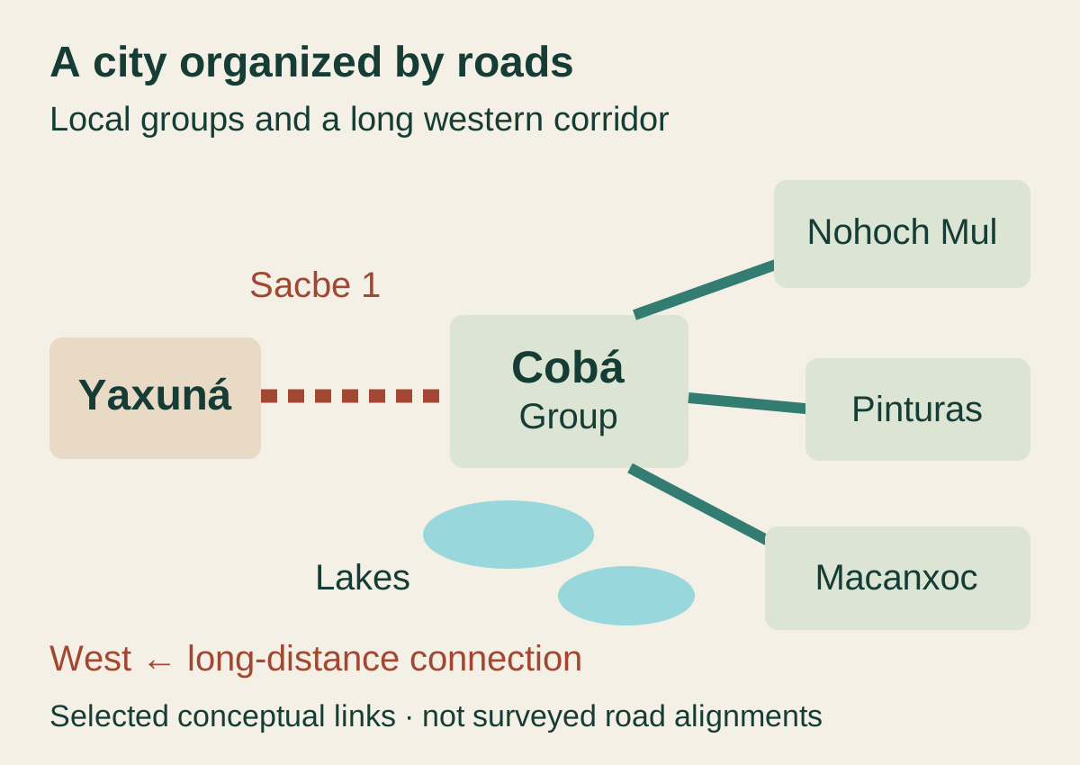
The plural of sacbe is often written sacbeob: raised “white roads” built from local materials and surfaced to create durable connections. Cobá has more than 50 recorded roads according to INAH. Some connect groups within the settlement. Sacbe 1 runs over a long distance toward Yaxuná. Together they make movement the clearest way to understand Cobá's power.
Calling them paths understates the work. Builders had to choose a line, clear vegetation, quarry and transport material, create retaining edges, fill low ground and maintain a usable surface in a climate where roots, rain and erosion continually act on construction. Height and width vary. A road could bridge wet or irregular ground, make travel more predictable and turn an approach into a statement visible under moonlight or sun. It did not float magically above the forest.
The labor was political. A ruler capable of mobilizing households to build and maintain roads could connect plazas, production zones, water, dependent communities and allies while displaying that capacity. The road channelled people and goods, but it also made relationships material. Who supplied fill? Who fed workers? Who controlled the surface? Which places did it connect directly, and which did it bypass? Infrastructure distributes advantage as well as movement.
New research makes Sacbe 1 more interesting than a straight ceremonial line. A 2025 study in Latin American Antiquity combines lidar, excavation and epigraphy to examine the Cobá–Yaxuná connection. The mapped road responds to settlements and resources across the landscape. Its enormous material demand supports an interpretation of state power and urban identity. Its construction date and exact political purpose remain research problems, not a one-sentence conquest story.
The popular image of a road glowing white through empty jungle is therefore incomplete. Forest cover has changed. Communities and managed land existed along the corridor. The road was used, repaired and reinterpreted. Moonlight may make a pale surface visible, but a romantic night scene cannot establish how or why every traveller moved.

11 · Limestone-world field guide
The surviving road surface is quieter than the construction story
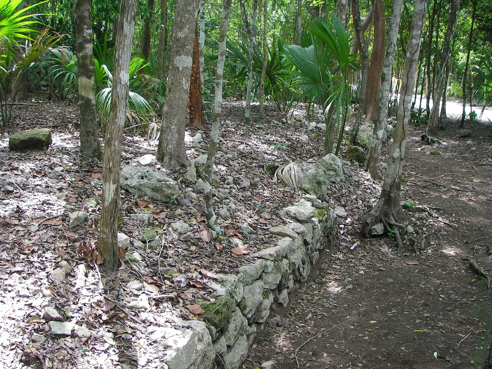
On the ground, a sacbe may be easy to miss. Vegetation, soil and centuries of reuse can soften an engineered edge. A low retaining course beside the visitor path may carry more historical information than a restored façade. The right question is not “Where is the perfect white road?” but “Which change in elevation, alignment or stonework made movement possible here?”
Road travel was social. People carried water, food, tribute, messages, ritual objects and building materials. Couriers and elites used the network differently from farmers or laborers. A raised surface could help during wet periods but offered little shade in an open state. Feet, litters and carried loads produced different speeds. There is no evidence that every road was reserved for one class or used for one ceremony.
The modern path creates a second infrastructure layer. Visitors walk, cycle or use locally offered transport where available and permitted. Services can change, and an old podcast's bicycle or tricycle detail is not a guarantee. Confirm the mobility option at the official entrance. A mechanical ride may reduce distance without solving a high step, narrow seat, transfer difficulty or the uneven walk from a drop point to a monument.
At Cobá, a retaining edge can hold its alignment even as trees, leaf litter and soil transform the surface around it. The photograph below records that contrast on a surviving sacbe. It shows one local piece of engineered ground, rather than the whole long-distance route to Yaxuná.

12 · Limestone-world field guide
Queens, monuments and the danger of a final answer
Cobá's stone monuments make dynastic history visible but difficult. Weathering, breakage and reuse can obscure carved texts. Recording technology, epigraphic knowledge and conservation continue to change what scholars can read. A name or date announced today may be revised tomorrow without making the research a failure.
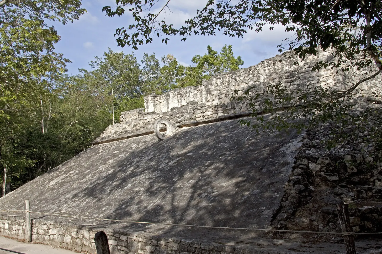
In October 2025, INAH reported a preliminary reading of the name Ix Ch’ak Ch’een. The woman ruler appears in several inscriptions, including texts associated with construction or rebuilding of a Group D ball court and the completion of a calendrical period on 8 December 573. The agreement between names, dates and places lets researchers connect separate monuments to one political life. Her accession date remains unclear, and the nature of a possible relationship with the powerful Kaanul ruler known as Sky Witness is unresolved.
The so-called Foundation Rock preserves 123 hieroglyphic cartouches on a large painted and incised surface. The recent reading links 12 May 569 to the establishment of the kaloomte’ institution, a form of high political authority, at Kehwitznal, the place of the deer mountain associated with Nohoch Mul. That is a more specific event than the birth of the entire city, which had an earlier settlement history. The same inscription connects dynastic authority with protective deities and a water feature beside the monumental group. Roads and pyramids were only part of the city's political geography; named water and sacred landscape also mattered.
Long Count inscriptions place events within Maya calendrical systems. A date can tie a ruler or dedication to a wider account of time, while an unusually distant date can express cosmological scale or enduring authority. The familiar claim that the Maya predicted the world's end in December 2012 was a modern distortion. Cobá's monuments record historical and cosmological relationships rather than that forecast.
Stelae were public media. Their position in plazas mattered. Carved rulers, captives, regalia, dates and texts could link ceremonies to genealogy and place. Weathering now makes many details hard to see, so good interpretation may require a diagram or raking-light photograph. Do not rub, wet, chalk or touch a monument to improve contrast. Conservation has priority over a legible phone image.
The ball court is similarly more than a sports venue. Its architecture structured movement and spectatorship; the game could carry political and ritual meaning. Meanings varied across time and region, and not every match ended in sacrifice. The newly interpreted dynastic text near a Cobá court is a reason to read architecture and inscription together, not to recycle a cinematic blood spectacle.
.jpg)
13 · Limestone-world field guide
Nohoch Mul is a current management decision as well as an ancient monument
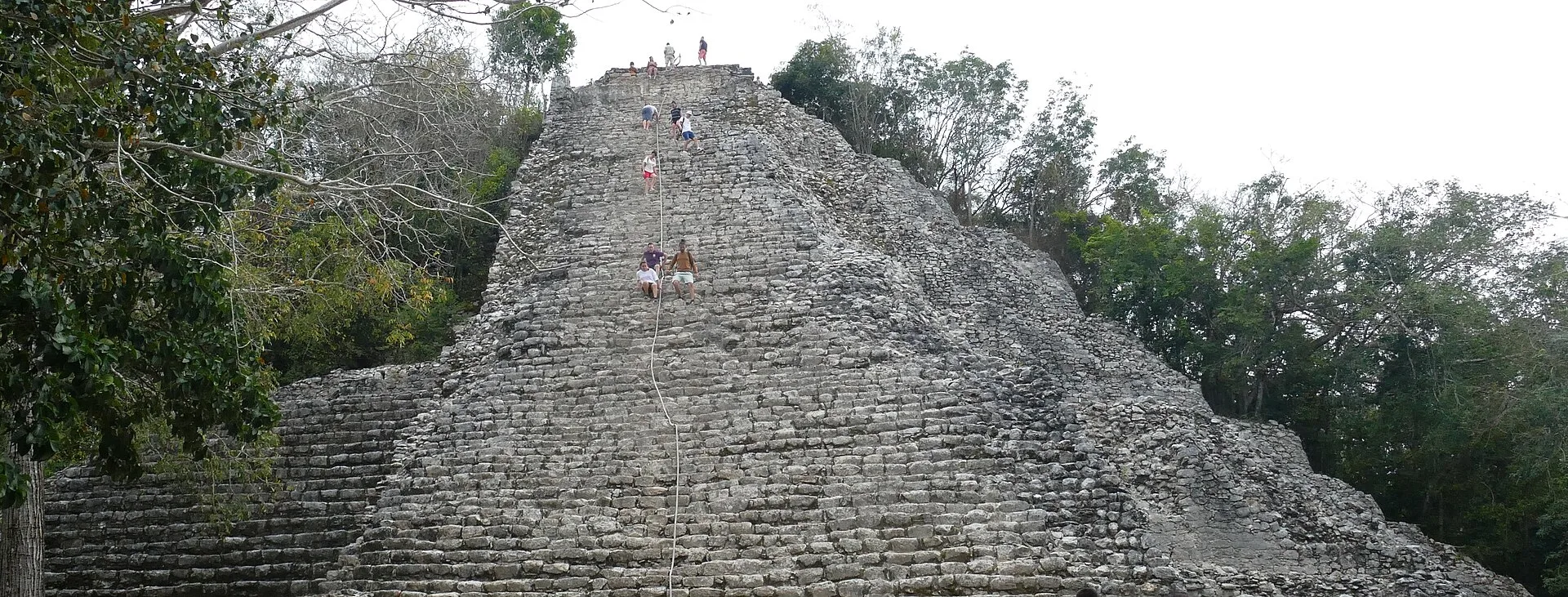
Nohoch Mul rises 42 metres above the surrounding forest. INAH describes a stepped mass with rounded corners, a stair rising toward the summit and another serving a lower vaulted space. Its upper temple belongs to the later East Coast architectural tradition. The building therefore holds several periods together: the great mass associated with the city’s inland power and the smaller temple that reflects later design. From below, look for the relation between platforms, stairs and room rather than treating the monument as one uniform flight of steps.
A modern wooden staircase was inaugurated in December 2025 to carry visitors above the original stone steps. INAH describes the conservation work: surveying the individual steps, consolidating vulnerable fabric and fitting a contemporary structure to the monument. Ejidatarios from Noh Bec built the stair with regional timber expertise. The intervention makes the tension visible. Visitors want access to the high view; archaeologists must protect the material that makes that view possible. The new structure addresses wear without turning the ancient pyramid into an unlimited visitor platform.
Ascent depends on the official controls in force on the day, including capacity and permitted times. Use the designated modern route and follow staff instructions. A long stair in tropical heat still requires balance, stamina and a comfortable descent; a handrail does not answer every mobility or vertigo concern. Staying below allows a different reading of the building’s mass and phases, and leaves time for the roads, courts and inscriptions around it.
Conservation limits protect finite archaeological fabric and keep movement manageable near the upper temple. Ask how an itinerary accommodates guests who stay at ground level, and allow the official site decision to govern any ascent. Cobá remains a road city with many places to examine whether or not a traveller chooses the summit.
The 2020 photograph below shows the exposed stone stair before the modern timber intervention. Its older access arrangement is part of the monument’s tourism history. Compare the great stepped form and summit temple with the contemporary structure encountered on site, while following the designated visitor route.

14 · Limestone-world field guide
A cenote is an opening, not a complete explanation
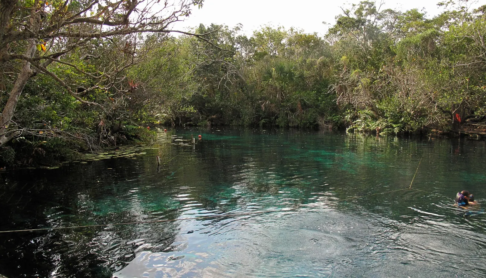
The word cenote covers varied forms: open pools, partly collapsed chambers, cave openings and deep shafts, among others. Some are connected to extensive flooded cave systems. Some are used for water supply, ritual, tourism, research or several purposes at once. Some permit swimming. Some do not. Their biological communities, depth, visibility, current, access and management differ.
The common tour story offers a single sequence: descend from tropical heat, enter impossibly clear cold water, learn that the place was sacred to “the Maya,” then emerge renewed. Every part requires qualification. Water temperature depends on source, depth, season and exposure; “freezing” is sensation, not measurement. Clarity is not purity. Sacred significance varies by period, community and individual place. Renewal is a visitor's metaphor, not an ancient fact that can be booked.
Caves and water did carry profound meanings in Maya worlds. They could be associated with rain, fertility, ancestors, emergence, offerings and access to other-than-human powers. Archaeological deposits show that some openings received offerings and human remains. The evidence demands place-specific interpretation. It does not prove that every modern swim basin was a sacrificial site or that one ceremony can reveal a universal Maya belief system.
Xibalba is best known through the Popol Vuh, a K’iche’ Maya text from the Guatemalan highlands. Yucatec Maya languages, histories and communities belong to a wider Maya world, but their traditions are not interchangeable with that highland text. Accounts of cosmological layers vary by source and context. A cenote’s significance comes from the particular place, its evidence and the people who hold knowledge of it; a single underworld story cannot describe every opening in Quintana Roo.
Ethnographic research adds another correction: communities do not treat every cenote identically. One opening can be a water source, another dangerous, another ritually important, another a place of recreation, and those relationships can change. “Sacred” should be reported with attribution and present consent, not applied as a generic tourism badge.
15 · Limestone-world field guide
What looks like a pool is part of a regional flow system
Rain falls through vegetation, soil and developed surfaces. In porous karst, it can enter the aquifer rapidly. Where thick soil and surface streams might slow or transform pollutants elsewhere, fractures and conduits can transport them through the subsurface. Wastewater treatment, septic leakage, rubbish, fuel, fertilizer and intense recreational use therefore matter well beyond the property where they originate.
A 2025 regional study in Communications Earth & Environment analyzed 1,528 samples and mapped salinization and contamination vulnerability. Other recent open research detected contaminants in ten cenotes and a submarine groundwater-discharge site. Nearby urban cover did not explain the measured contamination: connected groundwater can carry pollutants across the region. These findings do not mean every cenote is unsafe. They mean appearance cannot substitute for monitoring, management and current public-health information.
Near the coast, fresh groundwater can overlie saline water. Pumping, drought, sea-level conditions and land use affect that balance. The underground system ultimately connects inland decisions to springs, lagoons, mangroves, beaches and reefs. A traveller who chooses a cenote operator is therefore choosing a wastewater and watershed relationship, even if the booking page mentions only water color.
Responsible operation needs more than a sign requesting biodegradable sunscreen. “Biodegradable” does not mean harmless in every concentration, and asking guests to shower after applying a product is weaker than managing application before arrival. Operators should control sanitation, capacity, rubbish, fuel, changing areas, platform erosion and rescue without turning the cave into a theme park. Visitors should follow local rules on showering, products and equipment rather than inventing a universal no-sunscreen formula.


16 · Limestone-world field guide
Living Maya communities are not an optional cultural add-on
The people represented by Tulum and Cobá did not vanish into the masonry. The INPI ethnographic profile describes contemporary Maya communities across Yucatán, Campeche and Quintana Roo, with living languages, authorities, work, migration, religious practice and social organization. Those communities are internally diverse. No guide, ceremony, household or village can stand in for all of them.
This matters because “meet a real Maya community” is common tour language. Real implies that Maya identity must be proven through traditional clothing, a thatched house, a ritual or a meal performed on schedule. It makes a person who works in a hotel, studies engineering, uses a smartphone, speaks Spanish or lives in a concrete house seem less authentic. That is a tourist test, not a serious account of Indigenous continuity.
A community visit can be valuable when the community determines the terms. Governance should be visible: who owns the tourism enterprise, who approved the route, how households participate, how revenue is distributed and who can decline to be photographed. Employment alone is not the same as control. A private operator's donation is not the same as community ownership. “Benefits locals” needs an answer that can be checked.
Ceremony requires even greater care. A ritual is not automatically public because a ticket includes it. Ask who authorized it, whether it is created for visitors, whether photography is permitted and how guests may opt out without insulting anyone. An adapted welcome can be meaningful when named honestly. The problem is not adaptation; cultures are not static. The problem is selling access as timeless sacred authenticity while hiding the commercial arrangement.
Meals also carry history without needing to become theatre. Maize, beans, squash, chile and regional preparations can introduce agriculture, taste and labor. The cook, source of ingredients, water, dietary accommodation and payment matter. “Traditional” should identify a preparation or community relationship, not promise that every family eats one menu or that the meal has remained unchanged for a thousand years.
The strongest community encounter leaves the visitor with specific knowledge and limits. A person may explain their own language work, forest management, beekeeping, craft, tourism governance or water concern. That voice does not become a universal Maya view. Consent does not transfer forever to the visitor's social feed. The right to withhold a story is part of cultural authority.
The earth oven called a pib offers a concrete way to read a meal. Heated stones in a pit supply the cooking heat, and covered food cooks within that retained warmth. Cochinita pibil combines pork with an achiote and sour-orange preparation; its history includes both Maya technique and later cultural exchange. The word “traditional” describes a continuing practice that can adapt to ingredients and equipment. INPI also identifies maize foods such as atole, tamales and pozol, alongside preparations associated with particular festivities. A village lunch can open a conversation about cooking, agriculture and work without promising one recipe, an earth oven in operation or a ceremonial feast on every visit.
17 · Limestone-world field guide
Adventure becomes ethical when its infrastructure is visible
Ziplining, rappelling, kayaking and swimming can be legitimate ways to experience a forest and water landscape. They are not evidence of environmental virtue by themselves. A cable requires anchors, inspection and rescue planning. A rappel platform changes a cave edge. Vehicles compact routes and create noise and emissions. Lifejackets, helmets and harnesses need current maintenance. Changing rooms, toilets and lunch service produce wastewater and rubbish.
A credible operator should name standards and responsibility. Who designed and inspects the zipline? How often is the system checked, and by whom? What is the rescue plan if a guest stops midline? Which harness measurements actually control participation? Is the rappel a true descent requiring technique or a guided lowering system? What alternative exists for a guest who declines one element after arrival?
Eligibility is equipment- and operator-specific. Check age, pregnancy, neck or back conditions, alcohol rules and harness dimensions on the booking page, and ask what a person can do instead when one activity is unsuitable.
Cenote activities need an equally exact chain. Confirm whether swimming is optional; entry is by steps, ladder, jump or rappel; the water is shallow enough to stand; flotation is mandatory; a guide is in the water; currents or overhead cave sections are involved; and a non-swimmer can remain in a safe, shaded place. Snorkeling in an open pool is not cave diving. No standard day visitor should enter an overhead cave environment without the specialist training, equipment and plan that environment demands.
Vehicle language deserves discipline. A rough track is not automatically conservation. It may be rough because of drainage, maintenance, land tenure or deliberate thrill design. Ask whether seatbelts are provided, standing is prohibited, speed is controlled and the vehicle is appropriate for the route. An “all-terrain” label should not convert avoidable discomfort into proof of authenticity.
Environmental claims should reach the aquifer. Where does wastewater go? How are toilets managed? Is water quality monitored and by whom? Are capacities tied to evidence? How are sunscreen, insect repellent and cleaning products handled? Are platforms placed to protect roots and cave edges? What happens during heavy rain? A forest can look intact from a zipline while its groundwater absorbs the cost below.
18 · Limestone-world field guide
Choose the route by the kind of day you actually want
A Tulum-and-forest day makes sense for a traveller who wants the coast, a compact archaeological sequence and one carefully governed water or adventure component. Its weakness is compression: modern park access and hotel collection can leave less time inside the city than the headline implies. Ask for minutes inside the archaeological zone, not only the total tour duration.
A Cobá-and-water day makes sense for a traveller who wants an inland road city, more movement between groups and a named community or cenote with transparent governance. Its weakness is physical complexity: heat, uneven paths, optional activities, swimming interfaces and Nohoch Mul access all need separate answers. A long activity list is not evidence that each part is well explained.
A comparative Tulum-and-Cobá day can reveal the strongest historical contrast, but only if both sites receive enough interpretive time. It is a poor choice when the vehicle, ticket sequence and lunch turn the cities into hurried photo stops. If archaeology is the priority, remove one adventure layer before cutting the site time.
An independent visit gives the traveller more control over pace and interpretation, while transferring transport, ticket and recovery planning to them. Whichever format you choose, confirm the actual site order, inclusions and activity requirements with the current provider before payment. Reserve enough time and energy for the element that matters most to you, and build a day that still works when you decline an optional activity.
19 · Limestone-world field guide
A complete comparative day has a demanding sequence
A well-built Tulum–Cobá day begins before either gate. Confirm the actual pickup or meeting point, every admission included, travel time, site order, guide credentials, language and the amount of inside-site time at each city. “Full day” can hide hours of collection across hotels. A small advertised group can still join a larger archaeological guide group. Ask for the sequence in writing.
At Tulum, allow the modern access system to be part of the plan. Transport may stop outside Parque del Jaguar's internal movement network. Tickets may involve several entities. Toilets, museum, archaeological entry and return transport are not necessarily in one building. A guide should explain the wall and chronology before rushing to El Castillo, then make room for the Frescoes, coastal system and settlement beyond the enclosure.
The transfer to Cobá needs food, water and a realistic heat plan. A vehicle with air conditioning is not a medical guarantee; confirm it only from the provider. Lunch timing matters because a heavy meal immediately before a climb, zipline or swim can be uncomfortable. Hydration should be available throughout, not rationed to the restaurant.
At Cobá, the route should name the groups it reaches. A guide who promises only “the pyramid” may skip the lake edge, Cobá Group, ball court, stelae and road engineering that make the city distinct. Confirm whether movement is on foot or uses a current local service, whether that service accepts children or mobility equipment, and where it stops. Official Nohoch Mul access on the day overrides the brochure.
If a cenote follows, the operator should identify it before payment. “Private cenote” can mean exclusive access, private land or simply a marketing description; it does not establish community ownership, water quality or lower impact. The named site lets the traveller investigate entry, depth, current, cave configuration, toilets, wastewater, changing facilities, lockers, flotation, monitoring and governance.
Every activity transition needs an opt-out. A guest who declines the climb, zipline, rappel, ceremony or swim should know where they wait, whether shade and toilets are available, whether they remain with a guide and whether refusing one activity changes insurance or transport. Consent obtained under a harness platform after a long drive is weaker than consent supported by advance information.
The return is part of the safety plan. A day involving heat, stairs, swimming and transfers can leave a traveller exhausted. Confirm the arrival window, not a precise minute, and avoid scheduling a flight, ferry or nonrefundable dinner immediately afterward. Tropical weather, road congestion and site controls can change the sequence without making a responsible operator negligent.
The two recorded single-city routes arrange those transitions differently. In the Tulum episode, the coastal visit leads into the forest activities. In the Cobá episode, Pac Chén comes first: a zipline over a lagoon, canoe movement, a rappel into a cenote, a hosted ceremony and lunch precede the archaeological groups. The sequence explains why a traveller should distinguish paddling on a lagoon from entering an underground chamber, and ask how wet clothing, equipment changes and fatigue fit around the guided site visit. These are the episode’s narrated routes. Choose today’s itinerary by its named places and written order rather than assuming every Cobá or Tulum excursion follows them.
20 · Limestone-world field guide
Choose a format, not a maximum number of stops
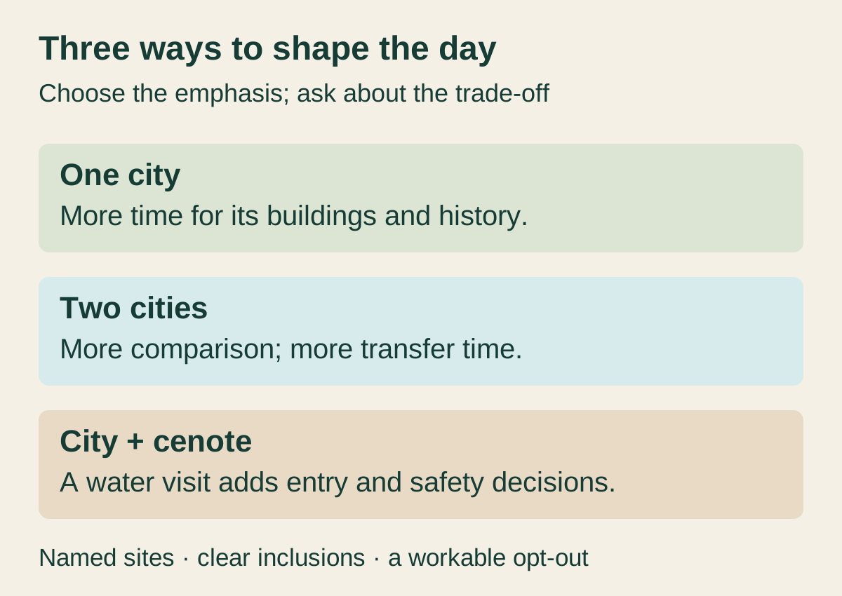
A focused Tulum day gives the wall, murals, coast, museum and protected landscape room to connect. It suits a traveller whose central question is how a late Maya coastal city organized authority and exchange. The modern park adds walking and logistics, but the day avoids the longest transfer.
A focused Cobá day gives the lakes, road network, dynastic monuments and multiple groups their necessary scale. It suits someone interested in Classic-period power, infrastructure and a dispersed inland city. It can still be physically demanding without a climb because distances, heat and uneven surfaces accumulate.
A two-city day creates the richest direct comparison: coast versus lakes, wall versus roads, late Postclassic fabric versus a deeper Classic political sequence. Its weakness is compression. It succeeds only if neither archaeological visit becomes a photo stop and if transport, food and entry are managed transparently.
An archaeology-plus-cenote day connects built stone to the aquifer. It may be the most conceptually coherent format when the cenote interpretation covers geology, water quality and local relationships. It becomes incoherent when the archaeological site is rushed solely to create time for adventure activities.
An adventure-led day may be right for a traveller who prioritizes movement, but it should be named honestly. Do not claim deep archaeological or community immersion if the city and village exist mainly as scenic prologues to a zipline. Depth and thrill are both legitimate; confusing them prevents informed choice.

21 · Limestone-world field guide
Practical fit is a chain, not a difficulty label
For Tulum, ask about the distance from vehicle to gate, the internal transport or walking segment, shade, seating, toilets, surfaces, barriers and whether beach access is separate. For Cobá, ask about total walking distance, current local transport, transfers, path width, roots, loose stone, seating and the exact monuments reached. For a cenote, ask about changing space, wet steps, railings, ladders, water entry, flotation and rescue.
Children experience the same chain at a different scale. Heat, attention span, toilet timing and harness fit matter more than a generic family-friendly badge. A child fare does not establish suitability for every activity. Confirm minimum age, fit and adult-supervision rules for each separate activity.
Older adults and disabled travellers should receive specific answers, not inspiration. A wheelchair-accessible museum does not make an ancient stair accessible. A tricycle transfer does not solve a high boarding step. A guide can adapt pace without changing heat or path geometry. Ask for photographs or measurements of critical interfaces when necessary, and obtain essential accommodations in writing.
Clothing should solve several environments without creating a costume. Use breathable coverage, stable closed footwear for archaeology and a secure water shoe if the named cenote requires one. Carry sun protection, rain protection, drinking water and any essential medication. Follow current park rules on bags, food and products. Do not bring a drone; archaeological and protected areas regulate professional equipment and aerial operation.
Photography should respect rope lines, other visitors, ceremonies and community consent. A long lens can record architecture without entering a closed area. Turn off geotagging when a community or sensitive cave site requests it. Never photograph human remains or offerings where prohibited. A phone is not a reason to delay a group at a narrow stair or underwater entry.
At an activity platform, camera rules also become equipment rules. Ask whether a phone, loose camera or mounted action camera is permitted, and where belongings remain during a zipline or descent. If photographs are offered, confirm permission, the delivery format and any charge beforehand. Check that downloaded files open and keep a second copy before relying on them as the record of the day. A guide’s help with a photograph should never require entering a closed area or delaying safe movement.
22 · Limestone-world field guide
Questions that reveal whether a route is ready for guests
Before payment, ask the current provider:
- What are the exact archaeological zones, cenote and community named in the itinerary?
- How much time is spent inside Tulum and inside Cobá, excluding transfers, tickets and shopping?
- Which admissions and park charges are included, and which must be paid separately?
- Who supplies archaeological interpretation, and what credential or authorization applies?
- Is Nohoch Mul ascent currently part of the plan, optional or never promised?
- What walking, cycling, tricycle or other transport is actually available at Cobá on this departure?
- Who owns and governs the cenote and community visit, and how is revenue shared?
- What activities may be declined, and where does a nonparticipant wait?
- What exact age, health, harness, swimming and mobility requirements apply to each activity?
- What equipment is supplied, how is it inspected and what is the rescue plan?
- How are toilets, wastewater, rubbish, sunscreen and water-quality monitoring managed?
- Are ceremony and photography optional, and who grants consent?
- What food is served, who prepares it and how are allergies handled?
- What are the weather, closure, rescheduling and refund terms in writing?
- What is the realistic return window after hotel collections and traffic?
Then check INAH Tulum and INAH Cobá independently. A provider cannot overrule an archaeological closure, capacity rule or access decision. Check official weather and civil-protection warnings again on the day. Current information should make the itinerary more precise; if every answer remains “subject to change” without a named decision process, the risk has been transferred to the guest.
23 · Limestone-world field guide
Listen for two different routes through the limestone world
The Tulum Jungle Maya episode, published on 5 July 2026, runs 20 minutes 8 seconds. It moves from the Caribbean coast and Tulum’s ruins into a faster forest sequence of zipline, rappel, vehicle, cenote, ceremony and meal. Listen for the change of pace and for the practical transitions that determine whether the archaeological visit remains the heart of the day. Open the episode and transcript
The Coba Mayan Encounter episode, published on 7 July 2026, runs 20 minutes 34 seconds. Its route starts at Pac Chén with a lagoon, zipline, canoe, cenote descent, ceremony and meal before moving to Cobá’s roads, Nohoch Mul, ball courts and stelae. That village-first order matters: activity transitions and lunch shape the time and energy available for archaeology later in the day. Open the episode and transcript
24 · Limestone-world field guide
What the limestone world finally asks of a visitor
Tulum and Cobá become clearer when neither is asked to impersonate the other. Tulum's wall gives approach a boundary. Its street, temples, murals and coast compress authority into a visible core whose prosperity belongs largely to the late Postclassic. Cobá's lakes and roads distribute attention. Its political history, dynastic monuments and engineered connections reach deep into the Classic period and across a much larger landscape.
Limestone links them without making them twins. It supplied masonry, absorbed rain, shaped caves, carried groundwater and created constraints that people answered with lakeside settlement, storage, roads, landing places and knowledge. The same porosity now carries wastewater and tourism pressure. A cenote swim enters that history whether or not the guide explains it.
Living Maya communities link past and present without serving as bridges staged for outsiders. Their authority appears in language, governance, work, consent and the right to change. A respectful visitor does not demand proof of antiquity from a modern person. They ask who controls the encounter and accept the answer, including no.
Adventure is not the enemy of understanding. It simply needs to expose its support system: trained people, inspected hardware, rescue, sanitation, community permission, environmental limits and honest opt-outs. Once those become visible, a zipline or swim can take its proper place inside the day instead of swallowing the landscape that makes it possible.
Leave Tulum remembering that the postcard is inside a wall, a park and a longer settlement. Leave Cobá remembering that the pyramid is inside a road city. Leave the cenote remembering that the pool continues underground. The best combined day does not deliver three isolated attractions. It teaches the traveller to see one limestone world holding many histories—and to move through it without claiming they are all the same story.
For a different karst-water relationship, compare Jamaica’s Martha Brae River. It is a surface river in another island’s limestone basin, not a Yucatán aquifer or cenote, yet it reinforces the same practical discipline: colour and clarity do not certify purity, visitor infrastructure belongs to a wider watershed, and cultural history must remain specific to the people and place that produced it.