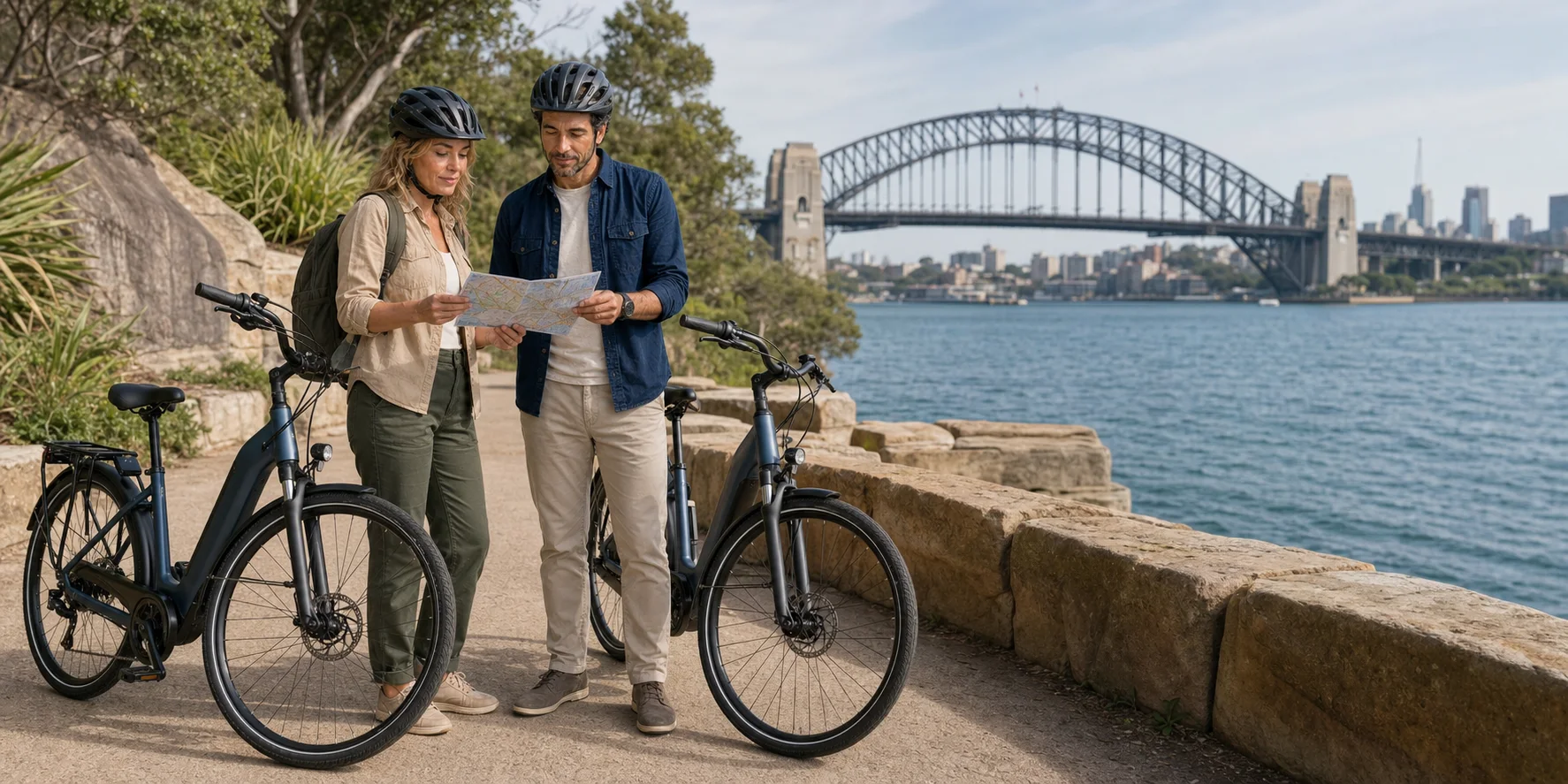
A half-day harbour circuit can join Surry Hills, Pyrmont, Barangaroo, the Harbour Bridge, Circular Quay, the Opera House and Darling Harbour without turning the day into an endurance test. The motor helps with effort. It does not solve traffic, crowded paths, historical amnesia or the temptation to treat a worked harbour as one seamless postcard.
Listen while you read
The harbour circuit · 21:21
The Travel Podcast follows the electric-bike route from fitting and helmet communication to Pyrmont, Barangaroo, the bridge and Opera House.
Sydney Guided Electric Bike Tour · episode and audio · Complete transcript.
01 · Sydney harbour circuit
The harbour changes when you can cross it under your own power
Sydney Harbour is usually sold as a view. From an electric bike it becomes a sequence of decisions.
The first is physical: how much assistance to select before a rise, where to hold a line on a street connection, when to coast, and when to dismount. The second is social: how slowly to pass people on a shared path, how much space to leave a child or dog, and whether a famous foreground is too crowded to ride at all. The third is historical: whether to see sandstone, steel, shells and planted headlands as scenery, or ask who shaped them, for what purpose, and at what cost.
That is why speed both reveals and conceals. A bicycle is fast enough to connect the western waterfront, the great bridge and Bennelong Point in one coherent circuit. It is slow enough to feel the grade, wind and surface change. Electric assistance makes those connections available to riders with different levels of fitness. Yet the same efficiency can flatten places into a checklist. If every stop lasts only long enough for a photograph, the rider sees the shape of Sydney and misses how the shape was made.
The useful route begins in Surry Hills, reaches Pyrmont and Pirrama Park, crosses Pyrmont Bridge, follows Barangaroo to the Sydney Harbour Bridge cycleway, returns through Circular Quay and the Opera House precinct, and closes around Darling Harbour. It is a coherent circuit, but not a single kind of riding: streets, separated cycleways, shared paths, crowded promenades and mandatory dismount areas each ask for a different pace.
The route poses a useful question: what kind of Sydney becomes visible from a bicycle, and where should a rider slow down enough to understand it?

02 · Sydney harbour circuit
First, understand the format you are choosing
A half-day guided electric-bike circuit can cover this broad harbour sequence while leaving time for fitting, instruction and interpretation. Before choosing one, confirm the meeting point, exact route, supplied bicycle, helmet system and rider requirements. Check that its access arrangements fit your needs; the landmarks alone do not establish suitability.
A half-day circuit is not uninterrupted pedalling. Allow for bike assignment, saddle and helmet adjustment, a controls briefing, a handling check, regrouping, road crossings and stops. The available time at each landmark depends on the group, traffic, path crowding and the guide’s interpretation. “See the Opera House” on a cycling itinerary normally means an exterior stop, not an interior architectural tour. “Cross the Harbour Bridge” means using the western-deck cycleway, not riding across its traffic lanes or pedestrian walk.
The Bluetooth helmet is useful when it keeps instructions audible without requiring riders to bunch around a guide. It does not turn a group into a private audio bubble. Riders still need to hear bells, traffic, emergency vehicles and other path users. Ask how the system balances guide audio with ambient sound, and say immediately if a fit or volume setting compromises awareness.
Before leaving, perform a plain-language check:
- Can you start, steer, brake and stop without looking down?
- Can you change assistance while keeping a stable line?
- Do both brakes engage progressively rather than abruptly?
- Is the saddle low enough for a confident stop but high enough for comfortable pedalling?
- Does the helmet sit level and snug, with straps clear of ears and jaw?
- Do you know what the display symbols mean, where the bell is and what happens when assistance is off?
- Has the guide described every street section rather than promising “almost all bike path”?
No amount of motor power compensates for an unfamiliar control layout. A two-minute handling loop is more valuable than beginning the route with a speech about the bridge.
03 · Sydney harbour circuit
What an e-bike helps—and what it cannot do
On a legal pedal-assist bicycle, the rider still pedals, steers and brakes. A sensor detects eligible input, a controller regulates the system, and the motor adds assistance according to the selected mode and the bike’s programming. The detection method varies. Some bicycles measure crank movement; some measure force; some combine signals. Without a model specification or operator confirmation, it is inaccurate to promise a particular sensor or a specific “natural” feel.
Assistance is most useful before the moment of strain. Select a modest level before a climb or a loaded start, keep an even cadence, and allow the bicycle to respond. Choosing maximum assistance after losing balance is not a recovery technique. On flat foreshore paths, a lower setting often gives smoother group spacing and preserves battery. On descents, the motor matters far less than line choice, braking and attention.
For a guided pedal-assist ride, the bicycle’s legal category matters. NSW currently allows eligible electrically power-assisted cycles with a maximum continuous rated power of 500 watts. Their assistance must progressively reduce as speed rises above 6 kilometres per hour, stop at 25 kilometres per hour, and stop when the rider is not pedalling above 6 kilometres per hour. That is an assistance ceiling, not a target speed for a crowded path. NSW also recognises a separate power-assisted pedal-cycle category capped at 200 watts, with its own construction requirements; the two categories should not be confused. From 1 March 2029, the announced transition requires e-bikes used on public roads and paths to comply with EN 15194, including its 250-watt maximum continuous rated power. Software-limiting a more powerful motor does not establish compliance. Ask what legal bicycle the operator supplies; then ride to the surface and the people around you.

The motor does not:
- judge whether a gap in traffic is safe;
- prevent a front wheel from slipping on paint, metal, leaves or sand;
- shorten the bicycle’s stopping distance;
- make a shared path a private lane;
- remove crosswinds from the Harbour Bridge;
- decide when an explanation deserves a ten-minute stop;
- make a nervous rider comfortable in mixed traffic.
A small motor can make hills manageable. It cannot manufacture street confidence. Before choosing the circuit, ask which segments run in traffic or on quiet streets, and what alternative exists if you are not comfortable there? A handling check and a clear answer about connecting streets are more useful than a broad claim that the ride is easy.
04 · Sydney harbour circuit
Surry Hills: the city before the postcard
Beginning in Surry Hills is editorially useful because it delays the harbour reveal. The neighbourhood’s lanes, converted warehouses, terraces, apartment buildings, workshops and hospitality businesses show a city of daily movement rather than a monumental waterfront. The ride begins with kerbs, driveways, delivery vehicles, intersections and people going to work.
That urban texture makes the first kilometre a better test than an empty park. It also means the group should not leave the briefing as a loose procession. The guide needs a clear order, a communication method, regroup points and an explicit instruction for what to do if a traffic signal separates the group. A rider should never accelerate through an amber light because the person ahead did.
Electric assistance is often most surprising at low speed. A strong setting can make a first pedal stroke more forceful than expected. On a narrow lane, that can push a novice wider than intended. Starting in a lower mode, covering the brakes and looking through the turn—not down at the display—creates a calmer first connection.
Surry Hills also prevents a false claim that the experience is one continuous waterside glide. Reaching Pyrmont requires negotiating the central city’s transport fabric. The exact alignment can change. Construction, events and cycle-network updates may alter the guide’s choice. That is a strength when the guide explains the decision and a weakness when marketing disguises every connecting street as a dedicated path.
05 · Sydney harbour circuit
Country is not a historical layer beneath the route
Before Pyrmont becomes quarry, port or apartment district, the route is on Gadigal Country. The City of Sydney identifies the Gadigal as the original inhabitants of the central Sydney area, with Country extending along the southern side of the harbour. That statement should not be reduced to a ceremonial opening line. The harbour remains Country: salt water, coves, sandstone, winds, plants, animals, paths, names and urban life are relationships in the present, not remnants of a culture imagined to have ended in 1788.
The harbour supported fishing, gathering, travel, exchange, ceremony and social connection. Eora women were renowned for fishing from small bark canoes, using lines and hooks while maintaining fires in their craft. Colonial violence, introduced disease, dispossession and the remaking of shorelines disrupted life profoundly. They did not eliminate Aboriginal presence. Gadigal and other Aboriginal people continued to live, work, organise, make culture and assert rights in Sydney.
The City’s Yananurala—Walking on Country project, curated by Emily McDaniel, traces roughly nine kilometres of the harbour foreshore from Pirrama to Woolloomooloo through Aboriginal stories and contemporary artworks. A bicycle tour is not a substitute for that cultural route. Its existence nevertheless changes how a rider should look. The western foreshore is not merely a convenient line between attractions; it is a place where Aboriginal histories have too often been hidden by industrial and property narratives.
Names matter, but they require discipline. Pirrama is an Aboriginal name associated with the Pyrmont waterfront. Barangaroo commemorates a powerful Cammeraygal woman who lived at the time of early British colonisation and opposed aspects of that intrusion. Tubowgule, the Gadigal name recorded for the land at Bennelong Point, precedes both Fort Macquarie and the Opera House. Repeating those names without their political and living context can become another form of decoration. Using them well means allowing them to interrupt the simple story of colonial city, industrial progress and global icon.

06 · Sydney harbour circuit
Pyrmont: sandstone, labour and a shoreline built more than once
Pyrmont makes Sydney’s material history unusually legible. Sandstone quarried from the peninsula helped build the colonial city. By the nineteenth and twentieth centuries, wharves, wool stores, mills, power infrastructure, rail connections and maritime businesses made the area a dense working district. Its waterfront was not a leisure promenade. It was a zone of noise, cargo, shifts, smoke, machinery and dangerous labour.
The suburb’s working-class population lived close to industry. That proximity supported employment and community while exposing residents to pollution, heavy transport and economic shocks. When port and industrial uses declined or moved, Pyrmont did not simply “discover” its harbour. Redevelopment converted valuable former industrial land, brought new housing and offices, and changed who could afford to live near the water. Some buildings and structures survive as evidence; others remain only in alignments, names and archaeology.
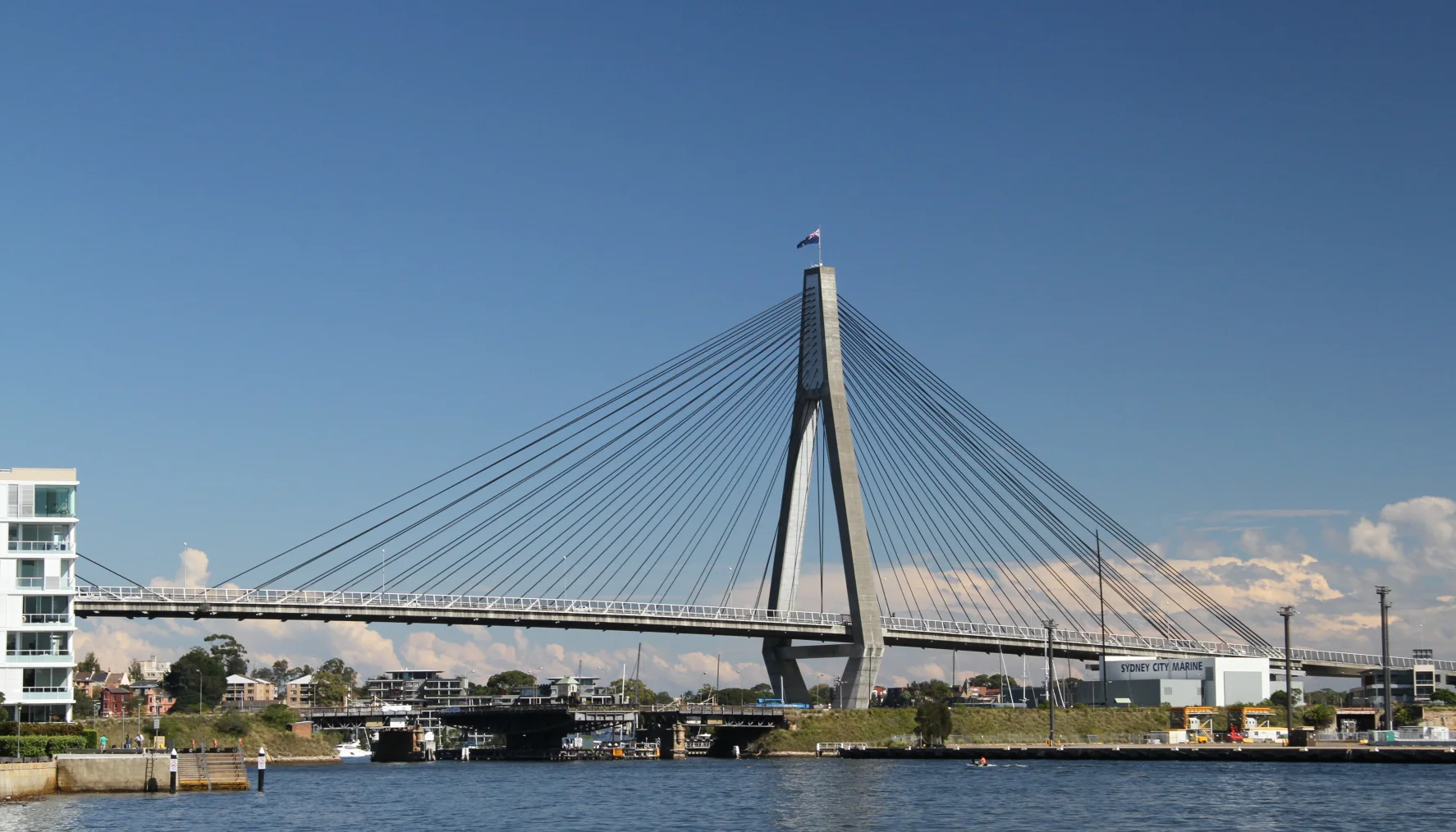
Pirrama Park occupies land once used for stevedoring. Its design deliberately responds to both the altered shoreline and the industrial past. Sandstone terraces, planted areas, open grass, water edges and retained or interpreted maritime elements compose a public landscape. Calling it reclaimed nature would miss the point. The park is designed, engineered and politically won public space on a shoreline already transformed many times.
.jpg)
For a cyclist, Pirrama Park is also a behavioural test. A broad, attractive surface may still be a shared path. NSW rules require riders on shared paths to keep left and give way to pedestrians. “Give way” is not satisfied by ringing a bell and maintaining speed. It means approaching at a pace that allows a stop, waiting when a person’s movement is uncertain, and passing only with space.
This is where the e-bike’s quiet acceleration can be deceptive. Assistance makes it easy to regain speed, so there is little practical reason to carry momentum through a family group. Slow first. The motor can help again afterwards.
07 · Sydney harbour circuit
Pyrmont Bridge: an old machine inside a new leisure district
Pyrmont Bridge carries the route across Darling Harbour, but it deserves more than the role of connector. The present bridge opened in 1902. Engineer Percy Allan designed a timber truss bridge with an electrically operated swing span that could open for vessels. Its combination of timber approach spans, iron and steel machinery, masonry piers and electrical operation made it an important piece of New South Wales engineering.
The bridge belonged to a working transport system. Road traffic, pedestrians and harbour navigation competed for space. The swing span solved a physical conflict: a fixed low crossing would obstruct taller vessels, while a continuously high bridge would demand much longer approaches. Machinery allowed the central portion to rotate and clear channels on either side. Its link to Sydney’s trams was electrical: Place Management NSW explains that the nearby Ultimo Power House supplied electricity and adapted tram motors drove the swing span. A technology developed for movement along streets was repurposed to let ships move through them.
As surrounding transport changed, the bridge’s role changed. It closed to motor vehicles in the 1980s and became part of the pedestrian landscape of Darling Harbour. The transformation saved a piece of infrastructure by giving it a new use, but it also changes how visitors read it. Flags, crowds, museums, restaurants and entertainment can make the bridge appear like a decorative boardwalk. The pivot, control house, trusses and surviving mechanisms reveal that it is still a machine.
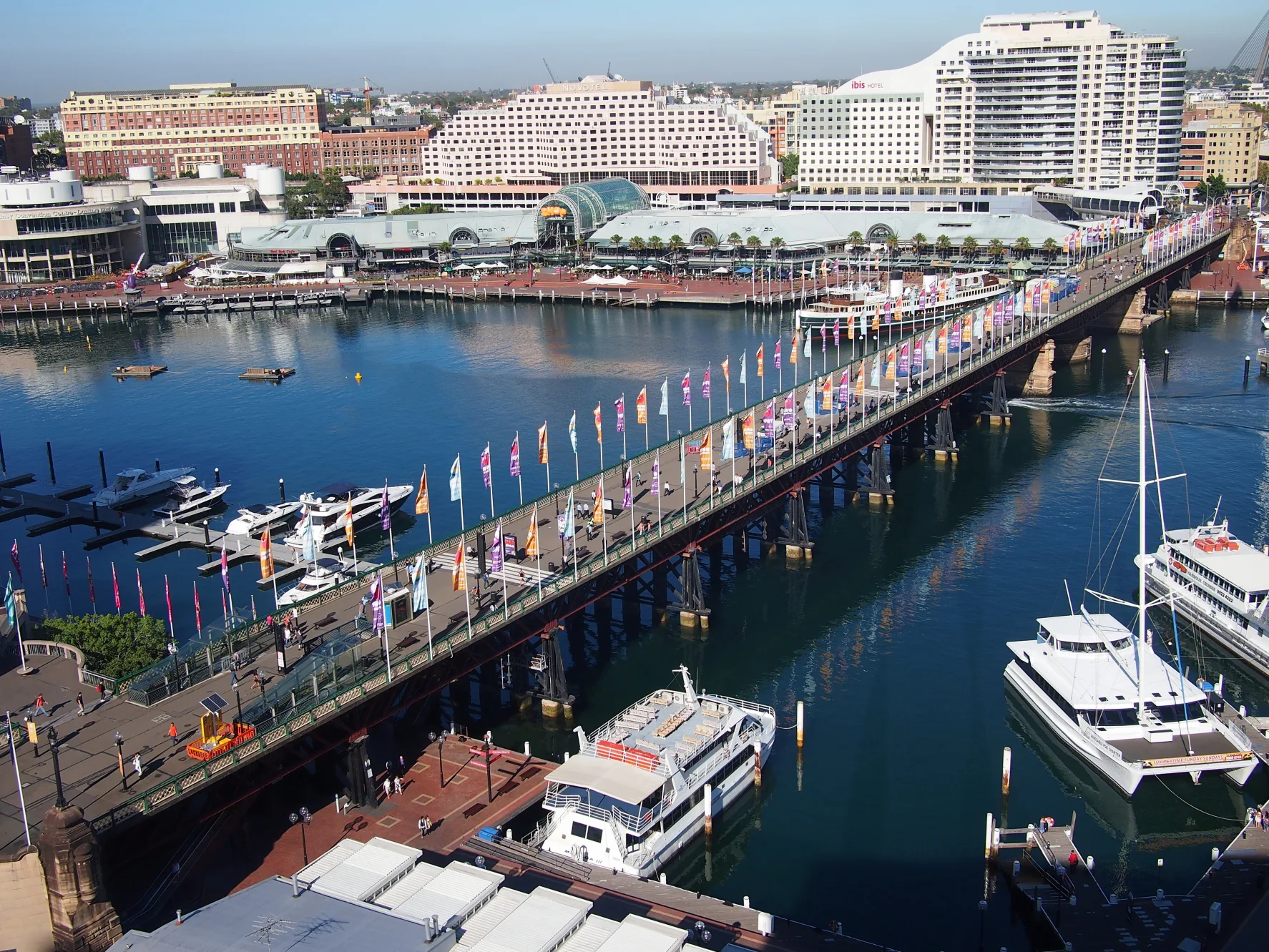

Cyclists need to read its present use, not its former roadway width. Pedestrians may stop, reverse direction or move laterally for photographs. Events can make the deck dense. The correct response is not a louder bell. It is a walking pace or a dismount when conditions demand it. A guide who treats the bridge as a timed bottleneck misses both its engineering and its social reality.
08 · Sydney harbour circuit
Barangaroo: reconstructed headland, not recovered wilderness
North of Darling Harbour, the route reaches the most consequential waterfront redesign of contemporary central Sydney. The Barangaroo precinct occupies land associated with generations of maritime work and, in its later industrial phase, a large container terminal. In 2003 the NSW Government announced the relocation of stevedoring facilities to Port Botany and redevelopment of East Darling Harbour. That announcement was the start of a transition, not a date on which every port activity stopped. The redevelopment introduced offices, housing, hospitality, cultural uses and public space, alongside arguments about height, private development, casino use, public benefit, heritage and the meaning of the name Barangaroo.
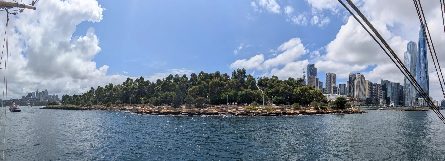
Barangaroo Reserve, opened in 2015, rebuilt a headland form at the precinct’s northern end. The project used about 10,000 sandstone blocks and planted some 75,000 native plants. Project records report that approximately 93 per cent of the sandstone came from the site, extracted beneath what became the Cutaway. The reserve was designed by Peter Walker’s PWP Landscape Architecture with Johnson Pilton Walker. Terraced foreshore, paths and planting make a public landscape where the container apron had created a hard industrial edge. The stone is therefore both construction material and an explanation of how the project was made.
Those achievements should be described accurately. The headland is reconstructed, not a remnant that survived intact. Its curves are designed; its blocks are cut and placed; its soil, drainage, paths and planting are engineered. The work creates habitat and public access, but it cannot reverse colonisation or reproduce a pre-contact ecology simply by using native species and sandstone.
The public-space debate extends beyond whether the planting is attractive. In their 2022 analysis, University of Sydney scholars Dallas Rogers and Cameron Logan argue that developer-led proposals and successive changes displaced the original competition’s wider planning logic. Their concern is accountability: who determines the use of public land when each building or amendment is negotiated separately? A visitor can appreciate the accessible shoreline while still asking that question. The reserve’s northern headland and the commercial towers to its south are related parts of the precinct, with different design purposes; a photograph of one does not settle the public value of the whole.

The name brings a person into this landscape. Barangaroo was a Cammeraygal woman, wife of Bennelong, remembered in colonial accounts for her independence, fishing skill and resistance to European clothing and customs. Those accounts were written through colonial observation and cannot provide a complete biography. Naming a vast redevelopment after her does not resolve the disparity between commemoration and Indigenous authority. It should prompt the question of how Aboriginal people participate in planning, interpretation and cultural use now.
On a bicycle, the reserve’s curving path can feel like release after street connections. Yet it is one of the points where a fast rider can become the problem. Sightlines narrow around vegetation and stone; people stop at the water; children move unpredictably. The place rewards a lower assistance mode and a higher level of attention.
09 · Sydney harbour circuit
The Harbour Bridge was a transport project before it became a symbol
From Barangaroo the steel arch grows across the view. Its image is so familiar that it can conceal the scale of the problem it was built to solve. Before the bridge, ferries carried people and vehicles across the harbour while rail and road networks terminated on opposite shores. Proposals for a fixed crossing circulated for decades. The final project had to span a deep, busy waterway, carry multiple transport modes and connect to approaches through established neighbourhoods.
Construction began in 1924. The bridge opened on 19 March 1932. The structural design is associated with engineer Ralph Freeman, consulting engineer to the British firm Dorman Long, which won the contract; John Bradfield, chief engineer for the Sydney Harbour Bridge and Metropolitan Railway Construction, shaped the scheme, specifications and integration into Sydney’s transport network. Workers contributed design, fabrication, riveting, masonry, transport and erection. A bridge of this complexity has no honest lone-genius story.
The arch was built outward from both shores. Steel truss halves were temporarily held by cables anchored through tunnels until they met over the water in 1930. Hangers support the deck from the arch. Granite-faced pylons give the crossing a monumental profile, but they are not the primary support for the arch. Their visual weight helps the engineering read as civic architecture.
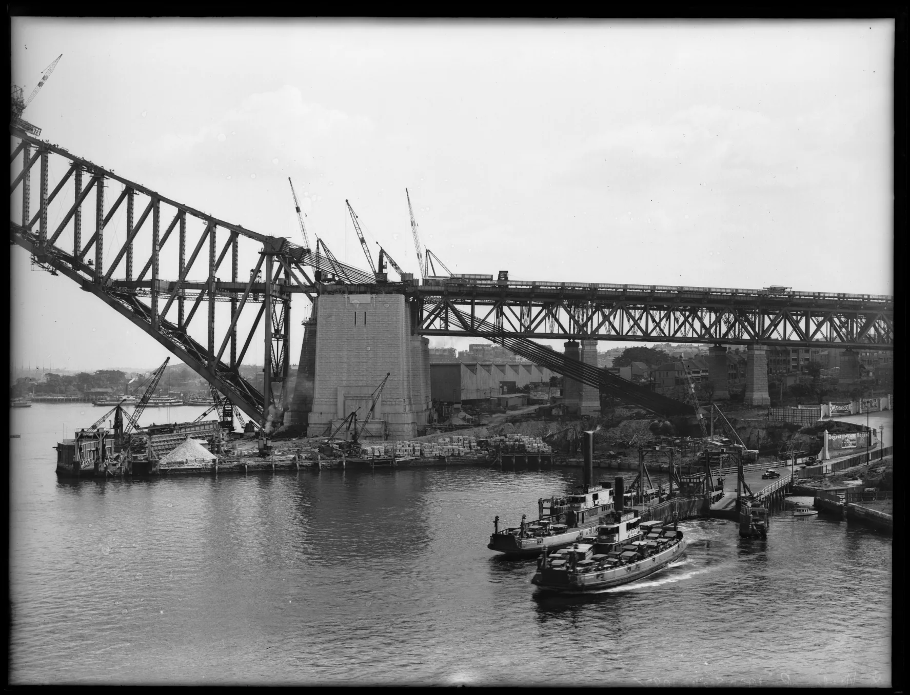

The project also had a human cost on land. The NSW heritage record identifies 438 houses demolished for the northern approaches at Milsons Point. The bridge’s approaches also reshaped the southern shore; the northern figure should not be mistaken for a count across both banks. The Australian Government’s national heritage account records sixteen construction deaths and describes the displacement of roughly 800 families across the bridge footprint without compensation. These are different measures—houses at one approach and families across the project—not interchangeable totals. The celebratory image of steel joining across water belongs beside labour, displacement and public risk.
When the bridge opened during the Depression, its rail, tram, road and pedestrian capacity changed the metropolitan map. The bridge did not merely offer a better view of Sydney; it reorganised commuting, commerce and development. Its transport mix has changed over time, with tram tracks converted for road use and cycling becoming a more visible part of the western side. The present e-bike ride belongs to that continuing history of reallocation.
Even the opening ceremony contained political conflict. Before Premier Jack Lang could cut the ribbon, Francis de Groot, a member of the right-wing New Guard who had joined the mounted procession, slashed it with a sword. He asserted that a member of the royal family should have opened the bridge. The national heritage history preserves the incident, but its meaning is more specific than a picturesque prank: the public celebration also exposed an argument over authority and loyalty during the Depression.
10 · Sydney harbour circuit
The cycleway’s most famous obstacle changed in 2026
The Sydney Harbour Bridge cycleway uses the western side of the deck, physically separated from motor traffic. For years, its northern access at Milsons Point contained a notorious break: riders had to manage 55 steps. That discontinuity was especially difficult for heavy bicycles, cargo bikes, adaptive cycles and riders with limited strength.
On 6 January 2026, New South Wales opened a new three-metre-wide ramp beside Bradfield Park and Milsons Point Station, connecting the bridge cycleway with the North Sydney network. The change matters beyond convenience. A route is only as accessible as its hardest interface. Telling someone that a bridge has a cycleway while omitting a flight of stairs had made the old description technically true and practically incomplete.
The approach is also a piece of contemporary interpretation. NSW’s opening account describes approximately 130,000 granite pavers forming intertwined eels, designed by First Nations artists Jason Wing and Maddie Gibbs. The work connects Gadigal and Cammeraygal Country across the harbour. The pattern sits in infrastructure used for an ordinary journey, placing continuing Country in the route itself rather than relegating it to a plaque beside an engineering monument.

The ramp connects the bridge deck to the northern street network without the old carry barrier. Check the current network information and follow the signs on the approach. A continuous connection is useful, but it does not by itself establish that a particular supplied bicycle or group format is suitable for every rider.
The deck itself deserves respect. The fenced cycleway is narrow relative to the speed difference between riders. Commuters may approach quickly. E-bikes can regain speed easily after slowing, which makes patience cheap. Keep left, maintain a stable line, look before passing and do not stop in the travel lane for a photograph. Crosswinds can be stronger than they felt at water level. Loose clothing, map pages and poorly secured bags become distractions. If a rider is nervous, the guide needs to create space rather than urging the group to keep an arbitrary schedule.
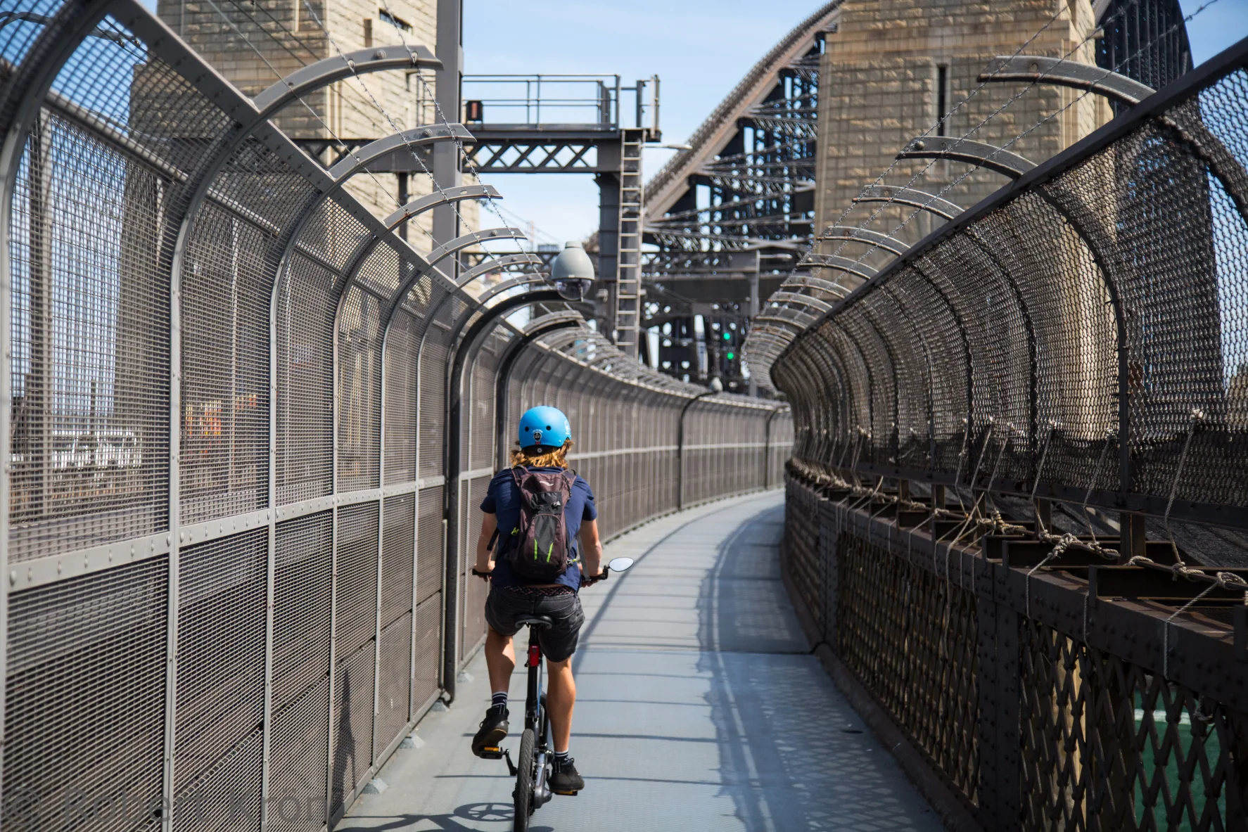

The crossing also creates a choice. Many tours reach the north side, pause for the reverse panorama, and return. The value is not simply having crossed twice. Travelling back changes the relationship among arch, water and city, and it exposes whether the group can share a linear facility predictably. The guide’s interpretation is best delivered off the moving path at a safe stopping place.
11 · Sydney harbour circuit
Circular Quay leads to Tubowgule
Returning south, the route moves toward Circular Quay, where ferries, trains, buses, walkers, workers and visitors compress into a narrow edge. The postcard language becomes most intense here: bridge to one side, Opera House to the other, ferries drawing white lines between them. The interchange is not visual clutter around the monuments. It is one reason the monuments occupy a living harbour rather than an isolated ceremonial basin.
The western side of the quay was once Sydney Cove’s working waterfront, shaped by wharves, stores and maritime exchange. Much of the present edge is engineered. Rail infrastructure passes above the concourse. Cruise ships can fill the Overseas Passenger Terminal. The quay’s geometry directs crowds across desire lines that do not respect a cyclist’s planned track.
This is a place to reduce assistance early. A shared-path bell communicates presence; it does not grant priority. A person looking upward at a ship or sideways at a child may not move predictably. If the route is dense, walking the bicycle is the efficient choice because it removes conflict and lets the rider observe.
At Bennelong Point, the deeper place name is Tubowgule. Sydney Opera House interpretation identifies it as Gadigal Country, associated with gathering, ceremony and fishing. After colonisation the promontory became the site of Fort Macquarie and later a tram depot. The Opera House did not rise on empty ground: it stands on continuing Country in a place also shaped by successive colonial transport and defence uses.
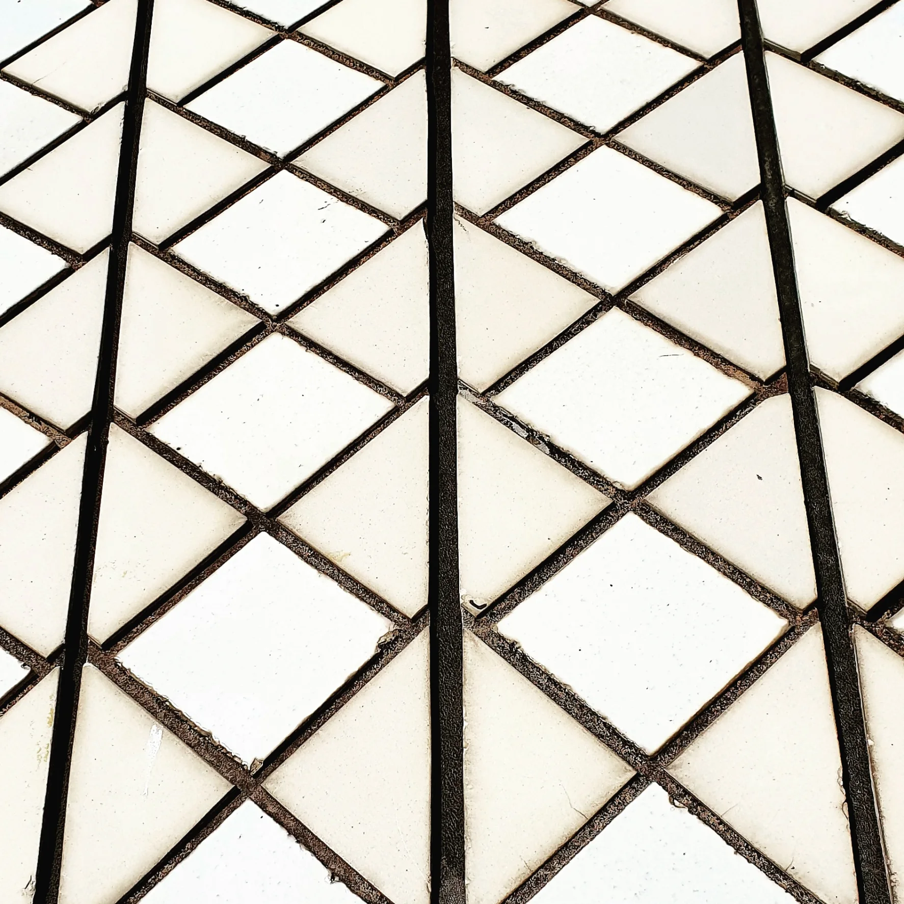
The Opera House’s visitor guidance requires all bicycles, including those on commercial tours, to be dismounted at the site boundary. Walk or carry the bicycle and park in the designated area beneath the Monumental Steps. A visitor with a disability who needs to use a bicycle for access can arrange an escort near the Macquarie Street Gatehouse through the accessibility team in advance; wheelchairs and mobility aids are permitted. Walking here also changes the pace of the visit, making room to observe the platform, shells and tile seams closely.
12 · Sydney harbour circuit
The Opera House is not a sketch that magically became shells
The familiar origin story is irresistible: in 1957 an international jury selects a dramatic proposal by young Danish architect Jørn Utzon, whose drawings promise sail-like forms on Bennelong Point. The real design history becomes more interesting when the myth of effortless inspiration ends.
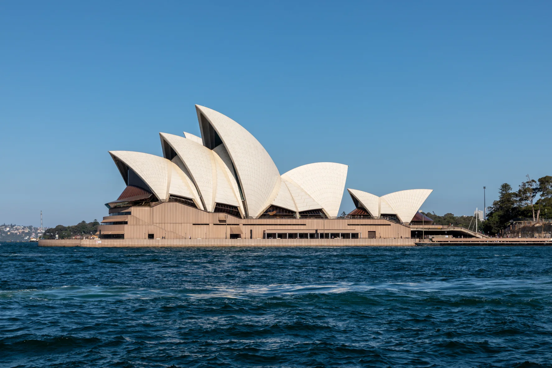
Utzon’s competition scheme captured a relationship between platform, harbour and rising roofs, but it did not yet contain a complete structural solution. Construction began in 1959 while major design questions were still developing. Engineer Ove Arup and his firm worked with Utzon through years of geometry, physical models, calculations and testing. Early roof forms were difficult to rationalise and fabricate. The breakthrough was to derive the shell segments from a common sphere. This allowed repeated ribs and panels to be manufactured from a coherent family of shapes rather than treating every curve as unique.
Calling them “shells” can also mislead. The roofs are ribbed concrete structures assembled from precast elements, post-tensioned and clad in patterned tiles. Their engineering makes the visual continuity possible. More than one million ceramic tiles, in glossy white and matte cream, create surfaces that respond to Sydney’s strong light without becoming a single blinding white mass. Prefabricated tile lids and chevron-shaped assemblies helped translate the geometry into a buildable skin.
,_Opera_House_--_2019_--_2130.jpg)
The spherical solution did not end conflict. Costs, programme changes, political pressure and disagreements over design and procurement intensified. In 1966 Utzon resigned and left Australia. Architect Peter Hall, working with Lionel Todd and David Littlemore, led the team that completed the interiors and adapted the building’s functions. The Opera House opened in 1973.
That succession remains contested. Utzon’s exterior concept and design method were extraordinary; his departure caused lasting regret and debate. Hall inherited an incomplete, politically charged project and produced the performance interiors under constraints he did not choose. Ove Arup’s engineers turned architectural ambition into calculable and manufacturable systems. The builders, fabricators, ceramic specialists and craftspeople made the object. A mature account can honour Utzon without erasing Hall, Arup or labour.

UNESCO inscribed the Sydney Opera House on the World Heritage List in 2007, recognising it as a major work of twentieth-century architecture and engineering. The designation does not mean the building is finished as a cultural argument. Performance needs, access, conservation, acoustics, tourism and the meaning of its site continue to evolve.
Conservation has to hold those meanings while allowing a performing building to work. Utzon re-engaged with the Opera House in 1999 to establish design principles for future changes. The room renamed for him opened in 2004, and his later western colonnade brought light and harbour views into foyers that had faced a solid exterior wall. The Opera House’s conservation account also places the Concert Hall’s July 2022 reopening within its wider renewal programme. Services, performance technology, acoustics and access can change without treating the heritage building as an expendable shell. From the outside, the familiar outline looks settled; keeping it useful involves continued design decisions behind that outline.
A bicycle stop can explain the platform, shell family, tile surface and design conflict from outside. It cannot replace an interior tour or performance. If architecture is a central reason for visiting Sydney, plan a separate entry rather than expecting a guided ride to secure bikes, cross site boundaries and provide meaningful interior access inside a four-hour circuit.
13 · Sydney harbour circuit
Darling Harbour completes the loop by returning to infrastructure
The route back through Darling Harbour can feel like an epilogue after the Opera House. It should instead complete the argument. The basin has been repeatedly remade for industry, rail, exhibition, entertainment and pedestrian use. Pyrmont Bridge reappears not only as something crossed earlier, but as a hinge inside the district’s transformation.
Darling Harbour’s current attractions and event spaces generate dense, irregular foot traffic. Waterfront paving may be visually continuous while legal and practical cycling conditions change. Temporary barriers, festivals, loading activity and construction can alter the line. The guide’s current route choice matters more than a static map.
Late in a ride, fatigue can appear as inattention rather than tired legs. Electric assistance may mask muscular strain, but four hours of decisions, wind, traffic, conversation and visual stimulus still consume concentration. Riders begin following the wheel ahead too closely. Braking becomes reactive. The final shared path is therefore not the place to relax group spacing.
The return to Surry Hills also removes the harbour from view. That is useful. It asks what remains when the icons disappear. Ideally the rider remembers the distinctions: a protected cycleway is not a shared path; a reconstructed headland is not untouched nature; an Aboriginal name is not branding; an Opera House exterior is not an interior visit; electrical assistance is not automatic safety.
14 · Sydney harbour circuit
A surface-by-surface plan is better than a landmark list
The most important practical information is not the number of stops. It is the transition between riding environments.
Quiet streets and traffic connections
Expect some degree of street riding unless the operator explicitly provides a different current alignment. Hold a predictable line, stay outside door zones where possible, signal only when doing so does not compromise control, and obey signals independently. Do not assume a group can legally or safely move as a single vehicle through an intersection.
For a left-side-traffic visitor, the mental load is real. Look in the expected direction and then verify the other. The guide should describe turns before the junction, not during it. If you have not ridden in traffic recently, disclose that before booking rather than discovering the mismatch after bike assignment.
Separated cycleways
These reduce conflict with motor vehicles but introduce riders travelling at different speeds. Keep left, scan before passing, call or ring once with enough distance, and return smoothly. Do not weave around a slower group. On the Harbour Bridge, preserve room from the fence and anticipate wind.
Shared paths and promenades
Pedestrians have priority under NSW shared-path rules. Slow for ambiguity. Dogs on long leads, children, phones, luggage and groups spread across the width are foreseeable features, not personal offences. The route’s busiest waterfront segments may be better walked.
Dismount areas
Walk where signs or site rules require it. The Opera House boundary is the clearest planned example. Event management may create others. A four-hour tour that includes several walking minutes has not failed; it has adapted to the public space it uses.
Stops and bike security
Ask whether a guide remains with the bicycles and how the group secures them. Do not leave a display, battery or bag exposed because the stop seems brief. Remove personal valuables. A helmet communication system is equipment, not a safe place to store a phone.
15 · Sydney harbour circuit
Who is likely to enjoy this ride
This format suits a rider who can already balance, start, stop, signal and look behind while holding a line. It is particularly valuable for someone who wants a broad geographic introduction without committing the day to a conventional endurance ride. Electric assistance can equalise hills and reduce the fitness gap between companions.
It may not suit someone who:
- cannot ride a conventional bicycle confidently;
- is comfortable only on completely separated paths;
- expects the motor to balance or brake for them;
- wants long, interior visits at each landmark;
- needs a guaranteed step-free or adaptive setup that the operator has not confirmed;
- cannot wear the supplied helmet safely or operate the available controls;
- is travelling with a child whose fit, legal eligibility and street skills have not been verified directly with the operator.
Age alone is a poor proxy for suitability. Marketing pages may publish minimums and maximums, but fit, legal conditions, handling skill and operator policy matter more. Do not rely on an age range repeated in a podcast. Ask for the current rider requirements, minimum height or bike-fit constraints, child policy and the exact equipment available.
Fit, balance and stamina need an individual assessment. If you have joint, balance, cardiac or mobility concerns, ask a qualified clinician about your own situation and ask the operator about frame design, bicycle weight, mounting, stops and assistance if you cannot finish. Confirm that the exact bicycle and route meet your needs before committing to a group.
16 · Sydney harbour circuit
Compare the e-bike with the alternatives honestly
Walking
Walking offers the deepest street-level attention and easiest stopping, especially around The Rocks, Circular Quay and the Opera House. It cannot efficiently reproduce the whole Pyrmont–Barangaroo–bridge–Darling Harbour circuit in four hours. Choose it when detail and interiors matter more than geographic reach.
A conventional bicycle
A standard bike gives the same route freedom with less weight and no battery system. It demands more effort on rises and into wind, which can widen gaps within a mixed-fitness group. It suits confident riders who prefer direct mechanical feedback and do not need assistance.
Ferry and rail
Public transport reveals the harbour as a working network. A ferry provides water-level geometry that no bicycle can reproduce; the train crosses the bridge efficiently. This combination is often better for a visitor who is uneasy in traffic or wants to spend longer at one or two precincts.
A bus or private vehicle tour
A vehicle protects from weather and covers distance with less physical demand. It separates the visitor from path texture and can lose time to traffic and parking. It is not made obsolete by e-bikes; it serves different access needs.
A self-guided e-bike
Independent riding offers flexible stops but transfers route, legal, navigation, charging and security decisions to the rider. A guide is most valuable when they know current connections, manage the group and interpret the harbour. If the narration is thin and the route is simply followed, self-guiding may offer more time—but only for a rider already confident with Sydney conditions.
17 · Sydney harbour circuit
Questions to settle before choosing a guided ride
Product pages can list inclusions; they rarely expose every transition. Ask the operator directly:
- Which parts of the current route use streets, separated cycleways, shared paths and dismount zones?
- Is the Harbour Bridge crossing guaranteed, weather-dependent or subject to route changes?
- What e-bike models and frame sizes are normally supplied, and is step-through equipment available?
- How is legal bike fit assessed for shorter or younger riders?
- Does the helmet audio preserve ambient sound, and can its volume be adjusted?
- What happens if a rider is uncomfortable after the handling check?
- Where are the longest stops, and is any interior admission included?
- How are bicycles secured during stops?
- What are the current cancellation, rain, heat, air-quality and mechanical-failure procedures?
- What water, clothing and closed-shoe requirements apply?
Do not infer lunch from the duration. Carry water according to the operator’s rules and plan food around the confirmed finish.
18 · Sydney harbour circuit
Before you set out
Check official sources for the conditions no operator controls:
- the City of Sydney cycling page and current map for network changes;
- Transport for NSW cycling updates for bridge and network information;
- NSW bicycle and e-bike rules for legal duties;
- Sydney Opera House riding guidance for the current dismount and parking rules;
- weather, heat, wind and air-quality alerts from the relevant official services.
Before booking, confirm the departure time, total duration, inclusions and cancellation terms. Leave time for an unhurried fitting session and make food plans around the confirmed finish. Once on the route, the useful habits remain simple: leave room, give way, stop to look and walk where riding is prohibited.
19 · Sydney harbour circuit
The right pace is the one that leaves the harbour more complicated
An electric bike is a powerful editorial tool because it reveals relationships. Pyrmont sandstone and Opera House shells belong to different centuries but to the same material city. Pyrmont Bridge and the Harbour Bridge show two generations of moving people while preserving navigation. Pirrama Park and Barangaroo Reserve turn industrial waterfronts into public landscapes through deliberate design. The western-deck cycleway places today’s rider inside infrastructure once allocated very differently.
The route also exposes the danger of connection without depth. A polished path can hide labour. A planted headland can hide the fact that it was reconstructed. A global icon can hide Tubowgule and the conflict that carried a competition sketch through engineering, resignation and completion. An Aboriginal woman’s name can be celebrated while questions of authority remain. A motor can hide fatigue until attention fails.
The solution is not to reject the broad circuit. It is to ride it in chapters. Fit the bicycle carefully in Surry Hills. Use the first streets to decide whether the format is right. Let Pirrama introduce the worked shore. Read the machinery of Pyrmont Bridge. Treat Barangaroo as landscape architecture on living Country. Cross the great arch as transport infrastructure with a labour and displacement history. Slow for Circular Quay. Dismount at the Opera House and look at the tile seams. Use Darling Harbour to recognise that the city never stopped rebuilding its edge.
Then the motor has done its proper job. It has helped connect the evidence without pretending to explain it for you.
20 · Sydney harbour circuit
Plan the route you actually want
For a deeper Sydney visit, combine the ride with one slower return: Yananurala on foot for Aboriginal foreshore interpretation, an interior Opera House tour or performance for architecture, or a ferry crossing for the harbour as a transport system. The bicycle provides the connective argument. The return visit supplies the time.
Place the circuit within the Sydney destination desk and the Australia country desk. Then compare three different Australian landscape responsibilities: Quandamooka Country and the sand-water system on Minjerribah, Yidinji Country on the Atherton Tablelands and Country, farming and wine in the Barossa. The routes are not interchangeable; the shared discipline is to keep living relationships inside the travel story.
Sources and further reading
Read the harbour in its own records
- NSW: choosing a legal e-bike
- NSW: e-bike categories and transition
- NSW: shared-path and footpath duties
- City of Sydney cycling network
- City of Sydney Aboriginal histories
- Yananurala: Walking on Country
- Dictionary of Sydney: Pyrmont
- City of Sydney: Pirrama Park history
- Place Management NSW: Pyrmont Bridge machinery
- Barangaroo maritime history
- Barangaroo Reserve landscape
- Barangaroo: sandstone and construction
- Rogers and Logan: the Barangaroo planning debate
- NSW Harbour Bridge heritage record
- National heritage: bridge construction and opening
- NSW: northern bridge ramp and artwork
- Sydney Opera House: Tubowgule
- Sydney Opera House: Jørn Utzon
- Sydney Opera House: spherical solution
- Sydney Opera House: Peter Hall and completion
- Sydney Opera House: conservation and renewal
- Sydney Opera House: bicycle access and parking