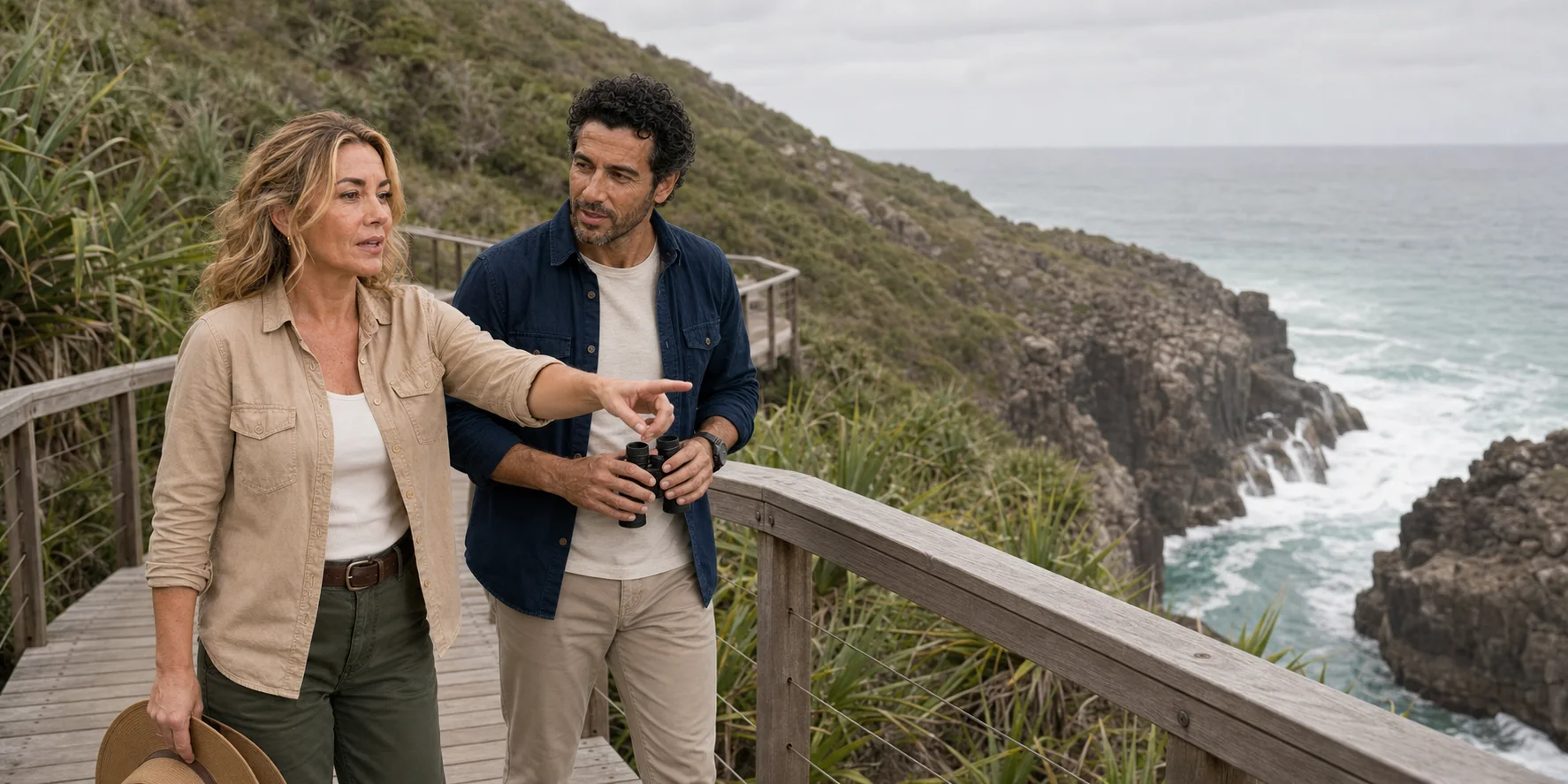
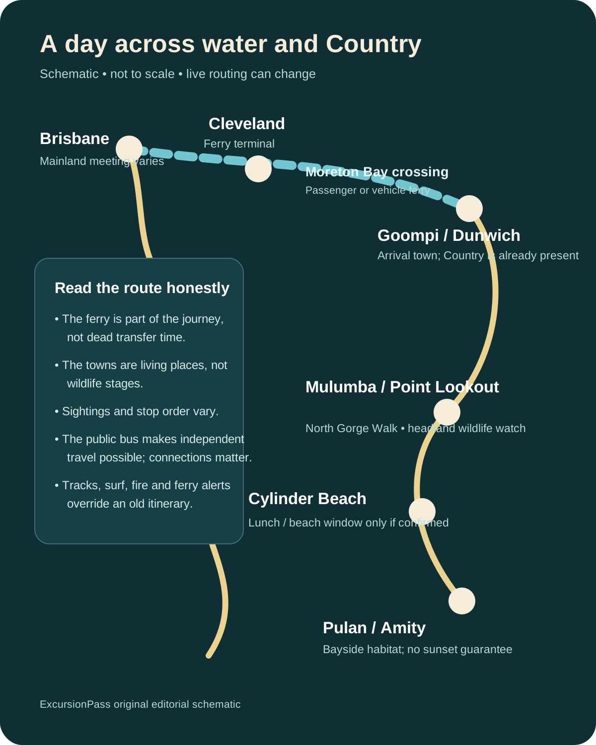
A day trip from Brisbane can cross Moreton Bay, walk the North Gorge, pause at Cylinder Beach and look for koalas near Pulan. The route is simple. Reading it well is not: Minjerribah is living Quandamooka Country, a vast and intricate sand-and-water system, a place shaped by colonial institutions and mining, and habitat in which every sighting remains an encounter rather than a promise.
01 · Minjerribah field guide
Cross the bay, but do not imagine you are leaving history behind
The mainland falls away quickly on a passenger ferry. Brisbane’s roads are replaced by a working bay: channels, banks, islands, wind and tidal water. It is tempting to treat that transition as an escape from the city into nature. Minjerribah asks for a better frame.
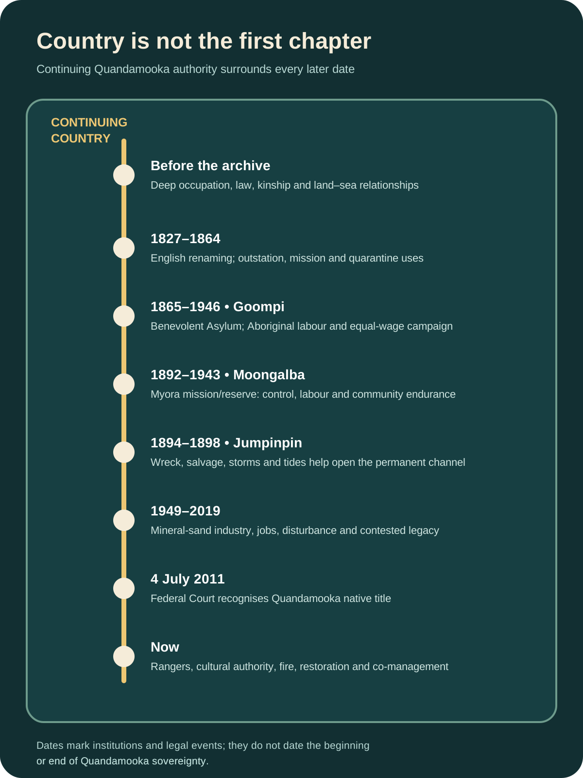
The island is Quandamooka Country. The Quandamooka people are the Traditional Owners of lands and waters in central and southern Moreton Bay, including Minjerribah, Mulgumpin and the southern bay islands. Their connection is not a heritage layer beneath the contemporary destination. It is an enduring system of law, family, knowledge, custodianship and authority. A visitor enters that present-tense Country before seeing a koala, before reaching a beach and before learning which English name appears on a road sign.
The recorded journey behind this story supplies a recognisable human route: a Brisbane departure, the bay crossing, an island circuit, Point Lookout and the North Gorge, beach time, wildlife searching and a final pause around Amity Point. It also exposes assumptions that can distort a wildlife day. Minjerribah is the island’s name. Point Lookout is a prominent open-ocean headland, not Queensland’s most easterly point. A small shared vehicle does not by itself prove ecological value, and a traveller’s exceptional wildlife count cannot forecast the next visit. Prices, pickup points, language availability, meals, vehicles and other booking terms belong to the live booking surface rather than an evergreen island guide.
The stronger question from the episode is ethical: can a trip make wildlife accessible without turning wild animals into inventory? The answer begins by changing what counts as a successful day. A successful visit is one in which the route, Country, habitats and decisions become clearer—even if the sea is empty when you scan it and every koala remains hidden in the canopy.
02 · Minjerribah field guide
Country supplies the first map
Minjerribah is often introduced through a sequence of translated names: North Stradbroke Island, Dunwich, Point Lookout and Amity Point. Using the island’s Quandamooka names changes more than vocabulary. Goompi is associated with the Dunwich area, Mulumba with Point Lookout and Pulan with the Amity area. The names locate a visitor within Country rather than at the edge of an empty landscape that began when Europeans charted it.
The Quandamooka Yoolooburrabee Aboriginal Corporation’s account of Country describes continuing cultural and spiritual connections across the bay’s lands and waters. In 2011, the Federal Court recognised Quandamooka native title over parts of Minjerribah and surrounding areas. The QYAC’s native-title account explains that the determinations include exclusive and non-exclusive rights across different parcels; they are not a simple transfer of every place a visitor can see.
Legal recognition matters, but it does not date the beginning of Quandamooka sovereignty or knowledge. Public interpretation does not reduce living culture to a list of “traditional uses.” Publicly shared interpretation can establish the essential frame: people have travelled, gathered, fished, cared for fire, maintained social and ceremonial relationships and read seasonal change here for countless generations. Restricted knowledge remains restricted. The visitor’s responsibility is to listen to authorised voices, follow access rules and resist treating cultural information as a souvenir.
That authority is active in land management. Quandamooka Land and Sea Rangers work across Country on fire management, cultural heritage, threatened species, weeds, marine debris and habitat. The work makes a useful correction to the familiar tourism image of an untouched island. Landscapes can be ancient, culturally governed and actively cared for at the same time.
03 · Minjerribah field guide
An island built by wind, sand and stored water
Minjerribah is commonly described as the world’s second-largest sand island. Scale is impressive, but composition is more revealing. The island is not a loose beach piled above the sea. It is an ancient sequence of dune systems, soils, wetlands, forests, wallum heath, lakes, swamps, beaches and rocky coastal interruptions. The visible coast is only the moving outer edge of a deep environmental archive.
Over long periods, winds carried sand and built overlapping dunes. Vegetation stabilised some surfaces; soils developed; later phases accumulated over earlier ones. Research into southeast Queensland’s giant sand masses describes multiple dune-building episodes across the Pleistocene and Holocene, shaped by aeolian transport, sea-level change, climate and vegetation. The result is not one dune of one age but a layered body whose surfaces have moved, weathered and supported different plant communities.
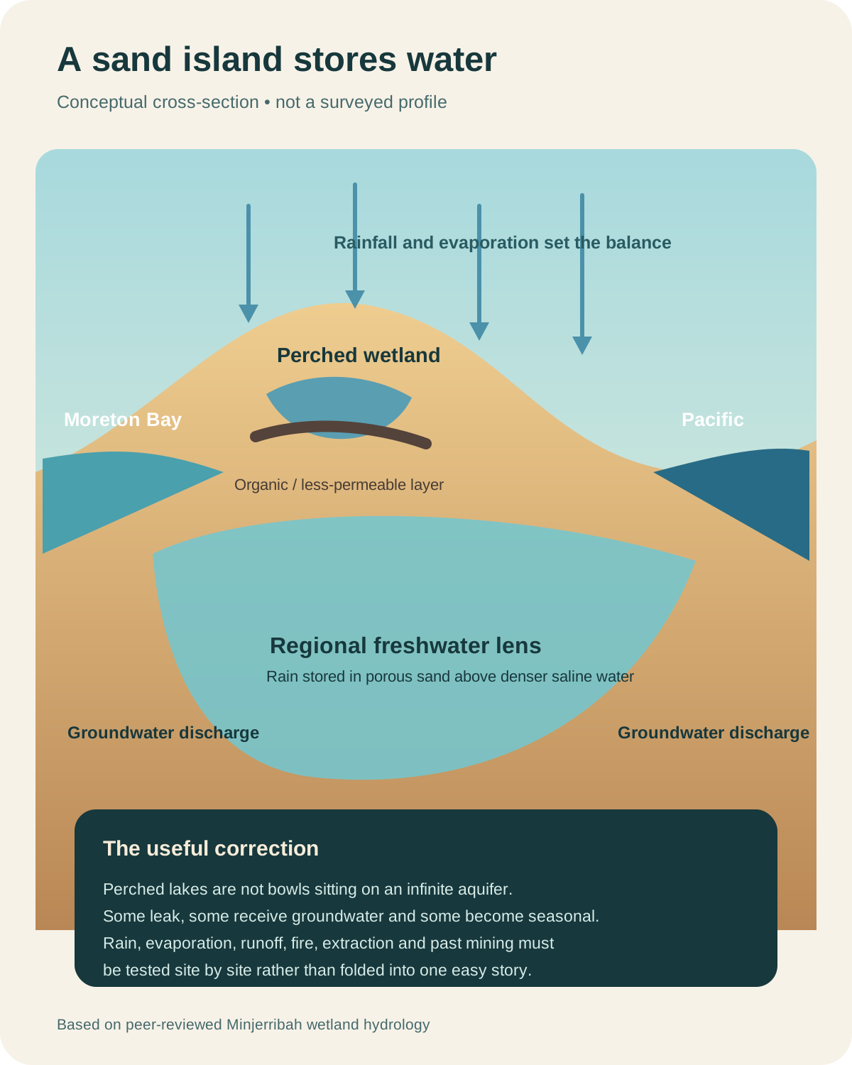
Water makes the system more intricate. Rain can infiltrate porous sand rather than immediately running into rivers. Fresh groundwater is stored within the island, while less permeable organic or mineral layers can hold water higher in the landscape and help form perched wetlands. Not every wetland behaves in the same way. Hydrological research on Minjerribah distinguishes different water bodies and shows why rainfall, evaporation, groundwater and local geology must be studied rather than reduced to the phrase “freshwater lens.”
This complexity matters to a day visitor. A dry lookout and a saturated wetland can belong to the same sand island. A lake can appear self-contained while depending on wider groundwater conditions. Vegetation is not merely scenery on top of sand: roots, litter, fire, water chemistry and dune stability are interconnected. Driving, track erosion, extraction, weeds, altered fire and climate pressure can propagate through a system that looks robust from the ferry.
Minjerribah’s wetlands also sit within the internationally significant Moreton Bay Ramsar site. Ramsar status does not turn every wet place into a visitor attraction. It recognises an ecological network important to migratory birds, marine life and wetland processes. The right scale of interpretation therefore expands beyond the day’s road loop: an island lookout belongs to a bay-wide system of seagrass, tidal flats, channels, mangroves, saltmarsh, beaches and islands.
Fire belongs in the same system. Some island vegetation is fire-adapted, but timing, frequency, intensity and patchiness matter. Too much fire, too little fire or fire in the wrong conditions can all change habitat. Quandamooka-led traditional burning work demonstrates that cultural fire is not a romantic synonym for any prescribed burn. It joins observation, cultural authority, ecological goals, training and risk management.
An ecologically literate tour should make these relationships visible. It need not turn a beach day into a geology lecture. A guide can ask three simple questions at each stop: what stores water here, what stabilises the surface, and what connects this place to the bay? Those questions transform sand from background into infrastructure.
04 · Minjerribah field guide
Goompi is a gateway and an archive of imposed institutions
Most visitors arriving by ferry encounter the Dunwich area as a transport interchange: a jetty, buses, roads, shops and the first practical decisions of the day. Goompi is more than the place between boat and lookout. It holds difficult evidence of how colonial Queensland used islands to isolate people, administer poverty, control Aboriginal lives and place institutions away from metropolitan view.
European activity around the bay brought shipwreck response, pilot stations, quarantine functions and mission activity. At Myora, an Aboriginal mission and reserve operated under changing colonial policies that restricted movement, labour and family life. Archaeological and documentary research, including work published by the Queensland Museum, must be read alongside Quandamooka accounts rather than treated as the whole story.
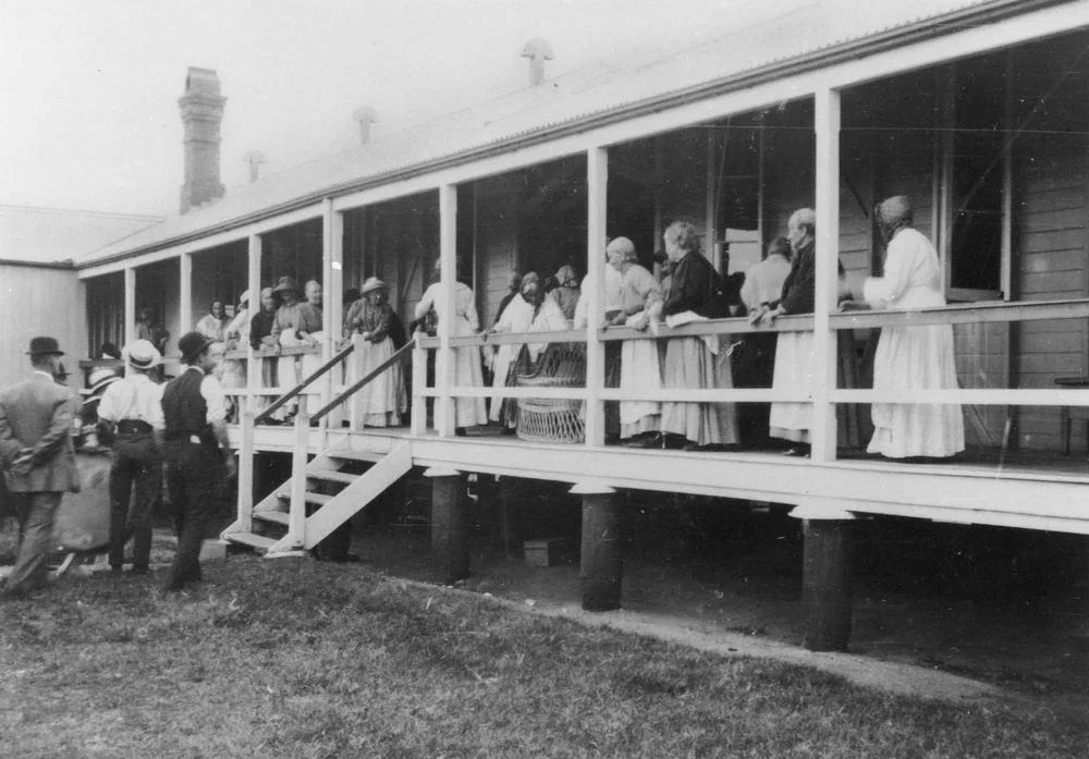
The Dunwich Benevolent Asylum operated on the island from the nineteenth century until its residents were transferred to Eventide at Sandgate in 1946. It housed people whom the colony and later state classified as aged, poor, disabled or otherwise dependent. The picturesque island location can obscure institutional conditions: segregation, discipline, inadequate resources, isolation and the loss of autonomy. The State Library of Queensland’s overview explains why the place is important evidence of Queensland’s welfare history.
Aboriginal labour was central to the institution. The “Aboriginal Gang” performed demanding work while being paid less than white workers. Their campaign led to equal wages in 1944, an early successful Aboriginal industrial action documented by the State Library. The result deserves precision. It was a victory by workers exercising agency inside an unequal system, not proof that the system had become just.
Surviving fabric, cemeteries and archaeology require care. They are not picturesque ruins for improvised exploration. Some places carry family grief, cultural restriction or physical hazards. A general wildlife circuit may pass close to this history without entering a heritage site. That is acceptable if the guide names the limits. Saying “we do not have time or authority to interpret this properly” is better than supplying a decorative anecdote.
The gateway also exposes the logistics that marketing sometimes erases. Passenger ferries and vehicle ferries have different crossing times and arrival points. Island buses connect ferry arrivals with settlements, but frequency varies by route and time of day. Groceries, shade, drinking water, toilets and mobile reception are practical systems, not guaranteed features of every scenic stop. A good day plan resolves those needs in Goompi instead of assuming they will solve themselves at a headland.
05 · Minjerribah field guide
The island was divided by weather, salvage and human action
North and South Stradbroke were not always separated by today’s Jumpinpin channel. In 1894, the cargo vessel Cambus Wallace grounded near the island’s southern end. Salvage operations removed cargo and reportedly detonated explosives; storms and tides then worked on vulnerable dunes. By May 1898, a permanent channel had opened. The Queensland State Archives account presents the separation as a process in which wreck, salvage, severe weather and coastal dynamics interacted.
That story is often simplified into “explosives split the island.” The cleaner line is memorable and misleading. Coasts are systems. A human disturbance can alter a weak point, but waves, currents, sediment supply and storms determine what follows. Jumpinpin is therefore not just a historical curiosity. It is a warning against treating sandy shorelines as fixed edges.
The same caution applies today. Beach profiles migrate. Access tracks erode. A route that was passable last month may close after weather or management work. Coastal hazard planning for the Redlands anticipates sea-level rise, erosion, storm-tide inundation and adaptation choices. The responsible traveller checks conditions and accepts closures as evidence of a living coast, not as a failure of the destination.
06 · Minjerribah field guide
Sand mining changed the island—and its ending remains a live transition
Commercial sand mining began on Minjerribah in 1949 and ended in 2019. Over seven decades, mining became part of the island’s economy and social life while removing and reworking dune landscapes. Any honest account has to hold both realities: employment and local dependence were real; so were ecological disturbance, cultural conflict and arguments over rehabilitation, water and the future of Country.
Mineral-sand operations separate valuable heavy minerals from the much larger volume of quartz sand. The industrial sequence can involve clearing, excavation, wet concentration, transport, tailings and reconstruction of landforms. “The sand was put back” is not an adequate measure of recovery. A rebuilt profile must drain and store water appropriately; soil horizons, organic matter, microorganisms and seed sources need to recover; plants must establish; fire regimes must be managed; and habitat structure has to develop over time. A landform can look green from a road while remaining ecologically young.
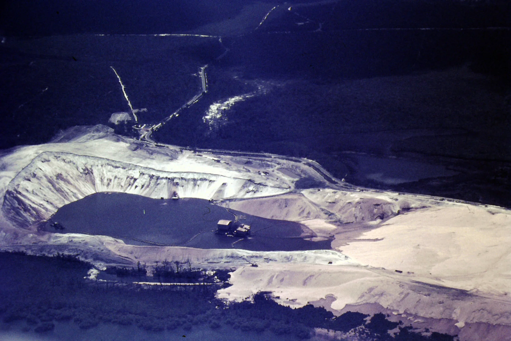
The end of mining did not close the argument. It changed its terms. Quandamooka authority, protected-area expansion, rehabilitation obligations, tourism, housing, employment and public access now meet on the same island. The Minjerribah Protected Area Expansion Strategy outlines a long transition of former mining land into jointly managed protected areas. Transfer dates and conditions differ across parcels; “the mine became national park” is too simple.
Tourism is frequently proposed as a replacement economy. It can support guides, accommodation, food businesses, transport and cultural enterprises. It can also concentrate seasonal work, traffic, waste, wildlife pressure and housing demand. The ethical choice is not between mining and tourism in the abstract. It is between specific forms of land use, ownership, employment, access and care. A visitor contributes most responsibly by choosing locally accountable services, respecting managed access and understanding that a cheap scenic loop does not pay every environmental cost it creates.
07 · Minjerribah field guide
Mulumba: the North Gorge teaches observation before identification
Point Lookout, or Mulumba, is the island’s best-known coastal viewpoint. It is sometimes marketed with geographical superlatives. The useful fact is simpler: the headland projects into the open-ocean side of Minjerribah and gives long views along a high-energy coast. It is not Queensland’s most easterly point.
The North Gorge Walk is a roughly 1.2-kilometre circuit of paths and boardwalk sections around a rocky coastal gorge. The upgraded walkway provides access to viewing points, but “boardwalk” should not imply level, step-free or effortless. Gradients, stairs, exposed sections, heat, wind, spray and crowding can affect the walk. A traveller with mobility, balance, sensory or heat concerns should ask the operator exactly how much of the circuit is expected and what a shorter alternative looks like.
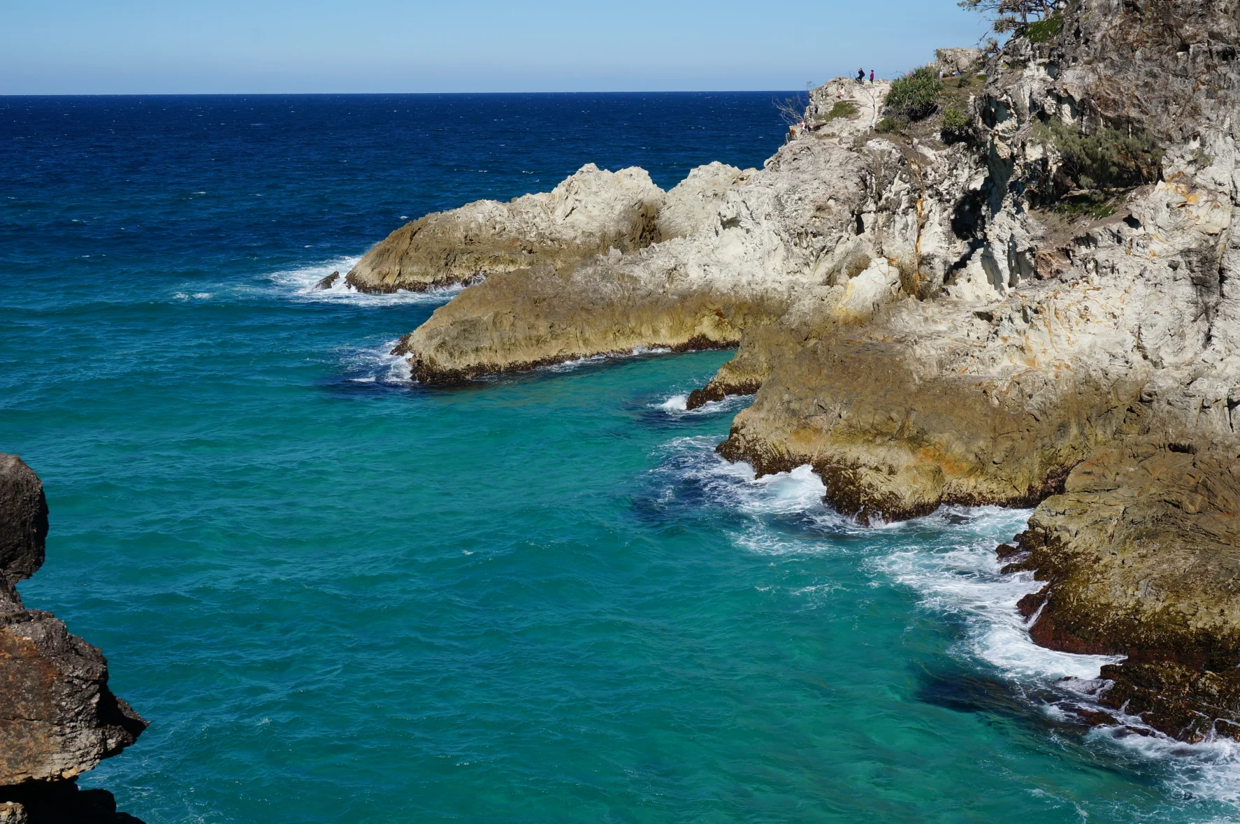

The gorge is a good place to learn the difference between scanning and chasing. Stand back from railings and edges. Begin with the structure: horizon, surface water, breaking zone, rock ledges, cliff vegetation, canopy. Then look for change. A whale blow is brief and vertical. Dolphins may make repeated low arcs. A turtle can surface once and disappear. A sea eagle’s flight differs from a gull’s. A kangaroo resting in shade can be almost invisible until it moves an ear.
Binoculars expand observation only when used safely. Find the animal with unaided eyes first, keep both feet stable and then raise the lenses. Do not walk while looking through them. Do not lean beyond a barrier for a clearer photograph. If a crowd has formed, ask what has been seen without pushing forward. The animal is not responsible for making the view available to everyone.
Noise changes behaviour. A group that shouts each time something surfaces may disturb wildlife and makes shared observation harder. Guides can establish a quiet signal, describe a clock-face direction and let the group watch before supplying identification. Uncertainty is part of good interpretation: “likely a green turtle, but too brief to confirm” is more trustworthy than turning every dark shape into a species.
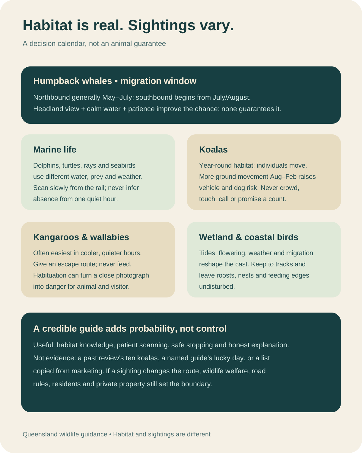
The open coast also supplies a lesson in scale. A large animal can be present and remain unseen. Humpback whales migrate past southeast Queensland seasonally, generally moving north from around May into July and south from July or August later in the year. These are broad patterns, not appointment times. Weather, distance, sea state, light and the duration of a stop determine whether a person detects one.
08 · Minjerribah field guide
Cylinder Beach is an ocean decision, not a scheduled swim
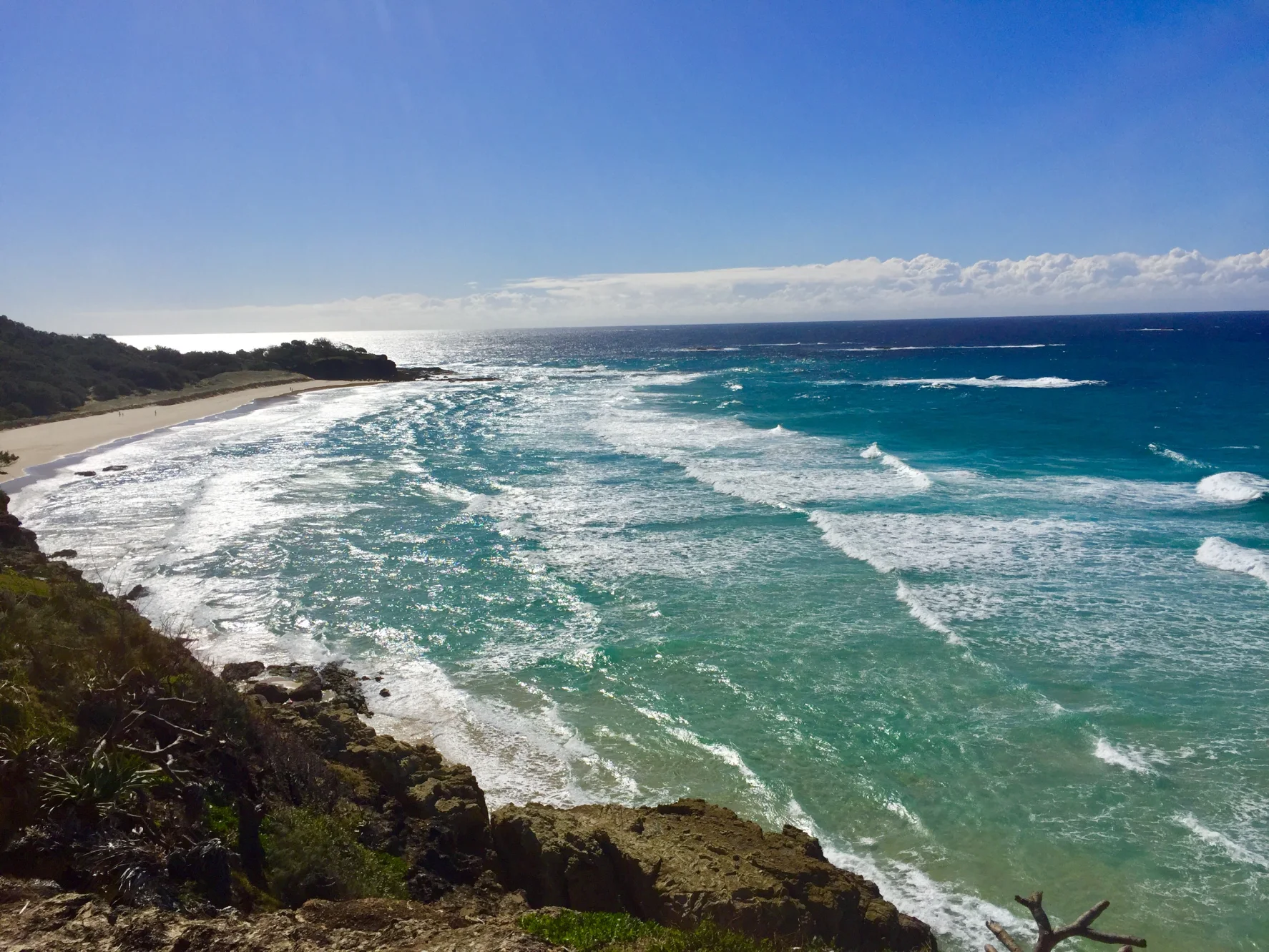
Cylinder Beach lies between headlands near Point Lookout and can appear more sheltered than long exposed stretches of the island’s eastern shore. Its sand, surf and backdrop make it an understandable tour stop. The existence of a famous beach does not guarantee safe swimming during a particular visit.
Waves, currents, wind, tide, sandbanks and patrol coverage change. Beachsafe’s Cylinder Beach guidance is the correct kind of source to check, together with the signs and lifesavers present on the day. Swim only between the red and yellow flags at a patrolled beach, and follow the lifesavers’ directions. Do not swim at an unpatrolled beach. If the beach is closed, conditions are unsuitable or the water is beyond a participant’s ability, stay on shore.
.jpg)
Beach time also exposes small practical gaps. Shade may be limited. Sand heats quickly. Salt and sun increase the need for drinking water. A towel, dry layer and sealed bag can make the return journey more comfortable. Reef-safe claims on sunscreen labels vary; the durable action is to use broad-spectrum protection, wear covering clothing, avoid litter and keep products out of the water as much as practical.
Lunch needs equal discipline. Unless a current booking explicitly includes a meal, plan to pay for food and tell the operator about allergies in advance. Do not assume that a cool box, picnic equipment or a café stop is included. Carrying water and a personal snack keeps an essential part of the day independent of the itinerary.
The beach has ecological limits too. Dunes are held by vegetation whose roots can be damaged by trampling. Use formed access paths. Do not climb foredunes for a better view, remove shells containing living animals or leave food where birds and wildlife can reach it. A short stop can be low impact when the group behaves as if the place continues after the vehicle leaves.
09 · Minjerribah field guide
Pulan: a koala is not a destination feature
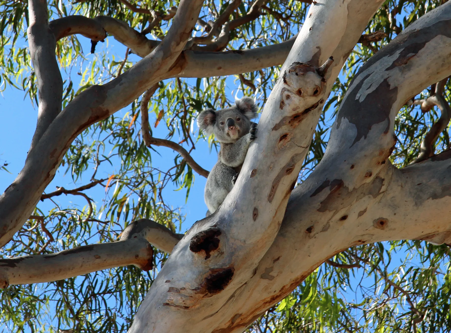
The Amity Point area, or Pulan, combines a bay-side settlement, trees, foreshore, jetties, roads and private homes. Koalas are often seen in and around the settlement because suitable eucalypts remain among human infrastructure. That visibility can create a dangerous misconception: that a known habitat patch operates like an exhibit.
Koalas spend much of the day resting. Their grey bodies can merge with branches; wind moves leaves; bright sky makes the canopy difficult to read. Search with a guide from paths and public areas. Look for a rounded shape at a fork, a limb outline that does not move with the leaves, or pellets beneath a feeding tree. Do not enter gardens, surround a trunk, imitate distress calls, shake vegetation or stand beneath an animal for an extended photo session.
.jpg)
Minjerribah’s koalas are described by Queensland Parks as a genetically distinct island population. Distinct does not mean insulated from every threat. Habitat fragmentation, vehicle strike, disease, fire, heat and domestic dogs can affect koalas. Queensland authorities identify dog attacks as a serious risk, particularly when koalas move on the ground. A visitor can help in unglamorous ways: observe speed limits, keep dogs controlled where permitted, never create a crowd that blocks an animal’s route and report an injured animal through the appropriate local channel.
Kangaroos require similar restraint. Animals grazing near roads or lawns are still wild. Feeding changes behaviour and diet, draws animals toward vehicles and can produce conflict. Give them space and an escape route. A large male does not need to be aggressive for a close approach to become unsafe; size, claws and powerful hind limbs are reason enough to remain distant.
The bay edge may offer dolphins, turtles, rays and birds, but a jetty or foreshore is not a guaranteed viewing platform. Fishing activity, boats, swimmers and wildlife can occupy the same water. Never throw food to attract an animal. Do not pursue it along the shore. If the observation depends on changing the animal’s path, it is already too intrusive.
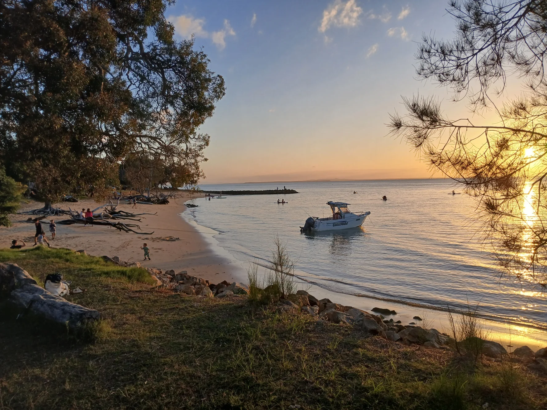

Sunset illustrates the difference between atmosphere and inclusion. A long summer day and a tour’s timing may align; in winter the sun may set earlier; an itinerary may return before or after the best colour. Cloud can erase the spectacle. The bay remains meaningful without a dramatic sky. Marketing should not convert the photographer’s luck into the customer’s entitlement.
10 · Minjerribah field guide
Wildlife watching works best as a sequence of ethical decisions
Species lists are useful for preparation and poor as performance targets. Minjerribah can support koalas, kangaroos, wallabies, dolphins, turtles, rays, seasonal whales, shorebirds, raptors and many smaller animals. Their detectability varies by season, weather, time, habitat, behaviour and observer skill. The more important list contains decisions:
- Use existing tracks, boardwalks and public viewing areas.
- Keep voices low and groups compact without surrounding an animal.
- Never feed, touch, bait, call, chase or reposition wildlife.
- Leave a clear route between the animal and shelter, water or canopy.
- Use optical zoom rather than physical approach.
- Do not publish precise locations for nests, dens or vulnerable animals.
- Accept a guide’s decision to leave before every participant has a photograph.
- Report injured wildlife; do not attempt an improvised rescue unless authorities direct it.
Photography deserves particular attention. A long lens can appear ethical while the photographer still blocks a road shoulder or remains too long beneath a tree. Flash can disturb nocturnal or shaded animals. Geotagging can concentrate future visitors. The test is not “did I touch it?” but “did my presence alter its choices or increase the next visitor’s pressure?”
Children often become excellent observers when the task is framed well. Give them habitat clues rather than promises: find a leaf with insect damage, notice which way the wind moves the canopy, count the seconds between whale blows, compare a bird silhouette. This replaces disappointment with attention. It also discourages adults from demanding that a guide manufacture excitement.
Guides have a harder duty. They must separate evidence from inference, correct a mistaken identification without embarrassment, manage roadside stopping, monitor group noise and know when an animal’s behaviour signals stress. A small group helps, but group size is only one variable. Ten disciplined people can have less impact than two who leave the path.
11 · Minjerribah field guide
A small minibus is not an environmental certificate
The podcast asks whether a wildlife day trip is ecotourism. The answer cannot be inferred from friendly guides, a modest vehicle or the number of animals seen. Environmental performance is a set of practices and outcomes.
Transport is one part. A shared vehicle can reduce the number of cars circulating among stops, especially when passengers would otherwise take separate vehicles on the ferry. It still uses fuel, road space and ferry capacity. The relevant comparison depends on occupancy, vehicle type, route length and how travellers reach the mainland departure. “Small group” is a comfort and management characteristic, not a carbon calculation.
Wildlife protocol is another part. Does the guide keep distance, control noise, avoid baiting, record sightings responsibly and leave when an animal is constrained? Habitat practice matters too: formed tracks, waste handling, biosecurity, fire restrictions and compliance with closures. Cultural accountability matters: are Quandamooka authority and intellectual property respected, and do local or Aboriginal-owned enterprises benefit? Economic language should identify who owns, works and makes decisions rather than vaguely promising support for “the community.”
Certification can provide external standards, but a logo should be checked rather than assumed. In the absence of a verified current certification, describe observable practices. Ask the operator:
- What wildlife-distance and no-feeding rules do guides enforce?
- How are sightings recorded without exposing sensitive locations?
- What happens when a site is crowded or an animal shows stress?
- Which parts of the experience are Quandamooka-led or formally authorised?
- How are waste, water and vehicle idling managed?
- What accessibility alternative exists at the North Gorge and beach stops?
- How does the route respond to fire bans, park alerts and coastal closures?
Answers can be concrete without being grand. “We switch off the engine at every stop and never leave the road to approach koalas” is more useful than “we love the environment.”
12 · Minjerribah field guide
Three ways to make the circuit—and the trade-offs between them
A guided day tour solves a coordination problem. Mainland departure, ferry movement, island transport and the order of distant stops are assembled into one booking. That can be valuable for a first visit, a traveller without a car or anyone who wants help seeing camouflaged wildlife. The cost is reduced control over duration, route and the decision to remain at one place.
A connected guided circuit is a full-day commitment. Use the live booking surface to confirm its departure location, ferry inclusion, vehicle, guide language, participant limit, minimum age, child restraints, mobility demands, meal arrangements, cancellation terms and return window. If any of those details determines whether the day works for you, obtain the answer before booking rather than inferring it from a general island itinerary.
Independent travel by passenger ferry and island bus is viable, contrary to claims that public transport makes the island almost impossible. The current island bus information says buses connect the settlements and meet passenger ferries; Point Lookout has more frequent service than Amity. Timetables and connections impose discipline. A missed bus can consume the margin needed for the return ferry, and combining the gorge, a beach and Pulan in one day may be inefficient.
Self-driving adds flexibility and equipment capacity. It also requires booking a vehicle ferry, navigating island roads, managing fatigue and parking, and understanding that ordinary road access is different from beach driving. Permits and four-wheel-drive requirements apply to designated beach and recreation-area access; a conventional car trip between settlements should not be confused with a beach-driving expedition. Never drive toward wildlife for a photograph.
An overnight stay changes the experience most. It allows the gorge, cultural interpretation, beaches and settlements to occupy separate periods rather than competing inside one circuit. It also creates accommodation impact and cost. Longer is not automatically more ethical, but unhurried time can reduce the pressure to make every animal appear on schedule.
Choose by the constraint that matters:
- Choose a guided circuit when interpretation, consolidated transport and wildlife-search skill are worth less autonomy.
- Choose ferry and bus when you are comfortable reading timetables and limiting the day to a few connected places.
- Choose a vehicle when equipment, accessibility or a dispersed itinerary justifies the additional logistics.
- Stay overnight when weather flexibility and depth matter more than maximum coverage per day.
13 · Minjerribah field guide
Practical planning begins with the least glamorous questions
The trip is often sold through koalas and beaches. Comfort depends on details that photographs omit.
The day is long. A mainland start, ferry crossings, road transfers and several stops can make the total duration tiring even when no individual walk is strenuous. Ask how many hours are seated, how often toilets are available and whether the vehicle has reliable climate control. Motion-sensitive travellers should consider both boat and winding road segments.
The North Gorge circuit includes uneven and exposed walking. Queensland Parks’ visitor-safety information says national-park tracks and facilities on Minjerribah are not wheelchair accessible. That does not establish the accessibility of every settlement, ferry or lookout. It does mean a generic “all abilities” claim would be irresponsible. Ask for exact surfaces, step counts, gradients, walking distances, transfer heights and alternatives. A person who skips part of a circuit should have shade, seating, communication and a dignified plan.
Heat and ultraviolet exposure can be substantial even under cloud. Carry water, broad-spectrum sunscreen, a hat that survives wind, and a light covering layer. Closed walking shoes are more dependable than sandals on steps and rough surfaces. A rain shell is useful because an island circuit crosses exposed and sheltered microclimates. In cooler months, wind at the headland and on the ferry can make the air feel much colder than Brisbane.
Families should confirm the current minimum age, seat-belt configuration and whether an appropriate child restraint is supplied. “Family friendly” does not answer those questions. Guardians also need a plan for cliffs, roads, jetties and water; a guide cannot replace direct supervision.
Food allergies and medical needs should be declared before departure. Carry essential medication with you rather than in a vehicle compartment you may not reach at a stop. If a schedule is tight, do not assume there will be time to buy a full lunch. Pack a modest snack and refillable water bottle unless the operator instructs otherwise.
Connectivity can fail. Save the booking voucher, operator contact, ferry information and return plan offline. Tell someone if you separate from a group. Do not rely on a live map to justify leaving a marked path.
14 · Minjerribah field guide
Check the live island, not yesterday’s itinerary
Mutable conditions deserve a final check as close to departure as practical:
- the exact mainland meeting point and pickup boundary;
- passenger or vehicle ferry timetable and check-in requirement;
- island bus timetable if travelling independently;
- Queensland Parks alerts, fire restrictions and track closures;
- Bureau of Meteorology forecast, wind and severe-weather warnings;
- beach patrol and conditions at the intended swimming stop;
- accessibility arrangements and any required assistance;
- tour inclusions, food, guide language, child restraints and return time.
Closures, fire restrictions, track works and beach warnings can begin or end after an itinerary was written. Check the live Queensland Parks alert page, follow instructions at the site and accept that a responsible route may omit an affected area. Check again on the day of travel: the route must respond to conditions at the time.
Ferry services are equally exposed to weather, maintenance and capacity. Consult the current SeaLink timetable and service-status page, confirm the ticket and check-in requirements for the service you intend to use, and preserve enough margin for the island bus or the return crossing.
Weather can alter the route without closing it. Strong wind may make exposed observation uncomfortable, rough water can reduce visibility, and rain may make steps slippery. Wildlife can also change the best order. An ethical guide may leave a crowded koala site, skip a roadside stop or delay a beach visit. Flexibility is not failure when the reason is safety or welfare.
15 · Minjerribah field guide
What the route can teach if no animal performs
Return across the bay and the island becomes smaller behind the ferry. A checklist might record disappointment: no whale, one distant kangaroo, a koala partly hidden by leaves. A deeper account has much more to carry home.
Minjerribah reveals a sand mass that stores and moves water; wetlands connected to an internationally important bay; continuing Quandamooka authority; colonial institutions that isolated people while relying on Aboriginal labour; an industrial landscape entering a long rehabilitation; a coast changed by wreck, salvage, storms and currents; and settlements where wildlife persists beside roads, dogs, gardens and visitors.

Those layers change the meaning of a wildlife encounter. A koala in Pulan is not simply cute. It is an animal using a culturally significant and socially inhabited landscape under modern pressure. A whale off Mulumba is not a product inclusion. It is a migratory life briefly detectable from a headland. A beach is not a blank leisure surface. It is dune vegetation, dynamic water, public safety infrastructure and Country.
The episode’s enthusiasm for the ferry, gorge, beach and wildlife is real. Keep that delight without turning it into entitlement: the island does not owe the visitor ten koalas, a sunset or a swim. It offers a chance to practise attention within limits.
That is enough for a full day. It may be the beginning of a longer relationship.
Listen · 10:32
Hear the island route
The field notes follow the ferry, gorge, beach and wildlife circuit. Hear them alongside the cultural, ecological and practical context in this guide.
16 · Minjerribah field guide
Continue across Australia
Continue through the Australia desk, then compare a different relationship between movement and landscape on the Sydney Harbour electric-bike circuit, read Country and rainforest together in the Yidinji Explorer, or examine land, labour and wine in the Barossa Valley.