01 · Atlantic memory coast
Begin with the coast, not the landing
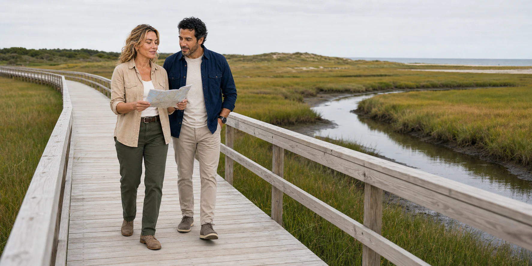
The clearest place to understand a Plymouth and Cape Cod day is not Plymouth Rock. It is a timber boardwalk in Sandwich, where a narrow human line crosses a salt marsh without making the marsh disappear. Twice each day, water works through creeks and grass. Sediment shifts. The bay seems broad and level, but the route underfoot depends on tides, storms, maintenance and civic decisions. The landscape refuses to behave like a fixed backdrop.
That is useful preparation for Plymouth. Its harbor also appears to offer a simple line: a ship, a rock and a story of arrival. Look longer and the line separates into different kinds of knowledge. The ship at the pier is a twentieth-century reproduction. The rock became a landing symbol through a tradition recorded more than a century after 1620. The grand granite monument on a hill expresses Victorian convictions. Across the road, a plaque and a continuing National Day of Mourning challenge the triumphal version of the same past. Beneath all of those commemorations is Patuxet, a Wampanoag place before it was an English settlement.
A good day from Boston therefore travels through more than distance. It moves between homeland, colony, museum, memorial, working coast and engineered channel. Every stop asks a different evidentiary question. What was physically present? What do written and archaeological records support? Who built the interpretation? Who was excluded from it? What continues in the present?
The route is long enough that selection matters. Plymouth can absorb a day on its own; Sandwich can do the same for a traveller interested in glass, waterpower and marsh ecology. Combining them is valuable when the journey has one argument rather than a list of photogenic stops. The argument here is that Massachusetts’ Atlantic edge was never empty, never simply “discovered,” and never finished. Wampanoag diplomacy and survival, English colonisation, industrial labour, navigation engineering and coastal change all remain legible—if the traveller knows which layer they are looking at.
The circuit can be read in either direction. The journey described in the accompanying podcast reaches the Cape Cod Canal first, then Sandwich’s mill, glass and boardwalk, before turning to Plymouth’s waterfront, Leyden Street and Forefathers monument. That order makes the working coast an introduction to the colony. Starting in Plymouth instead gives the museum and harbor more of the morning, then lets Sandwich broaden the story beyond a founding narrative. A two-place day needs that choice made deliberately: adding the main Plimoth Patuxet campus to every waterfront and Sandwich stop can leave little time to listen, look or rest.

02 · Atlantic memory coast
Patuxet comes before Plymouth
Calling Plymouth “the beginning” makes thousands of years disappear. Archaeological work on Cape Cod records human presence for at least ten millennia, and the town now called Plymouth lies within Wampanoag homelands. Communities moved through a coastal world of rivers, ponds, forests, fields, marshes and offshore waters. Seasonal movement was not aimless wandering: it was a knowledgeable way of coordinating planting, fishing, shellfishing, hunting, gathering, diplomacy and kinship across a living territory.
Patuxet was one part of that world. It was not an empty stage awaiting English history. European fishermen, traders and explorers had already been appearing along the coast for generations before 1620, bringing trade opportunities, violence and disease. In 1614, the English captain Thomas Hunt kidnapped Tisquantum of Patuxet and other Wampanoag men and carried them toward Europe. Tisquantum survived that forced Atlantic passage and returned home in 1619. He found Patuxet devastated.
Between 1616 and 1619, epidemic disease caused catastrophic loss among Indigenous communities in coastal New England. The exact disease and its effects varied across place and remain subjects of historical study; the essential fact is not uncertain. A population disaster preceded the Mayflower. It disrupted families, political relationships and the ability of communities to defend land. It also left Patuxet gravely depopulated when the English passengers chose it for their settlement.
That sequence changes the meaning of “available land.” Ground was not unowned because disease had killed or displaced many of the people who held relationships with it. A house site, planting field or burial place did not lose its history when an English observer failed to recognise the legal or cultural system that made it meaningful. The colony took shape inside a recent Wampanoag catastrophe, not beside it.
Wampanoag history also does not end at the colony’s edge. The Mashpee Wampanoag Tribe is a living sovereign nation; its public history follows Wampanoag governance and land through colonial pressure, conflict, state constraint, federal recognition and contemporary reservation status. The Herring Pond Wampanoag Tribe is a living community recognised by the Commonwealth of Massachusetts. Aquinnah Wampanoag people and other Wampanoag communities likewise carry distinct histories and present-day voices. “The Wampanoag” should never become a collective character introduced only to help the English survive and then dismissed from the story.
That present tense is a practical rule for visitors. A museum educator who is Wampanoag is not a person from 1620. A homeland is not synonymous with a vanished village. A cultural explanation is not a decorative counterpoint to the “main” colonial narrative. Start with those distinctions and Plymouth becomes harder to summarise—but much easier to understand honestly.

03 · Atlantic memory coast
The Mayflower arrived inside a crisis
The Mayflower was a cargo vessel, not a purpose-built passenger ship. In 1620 it carried 102 passengers across the Atlantic in a voyage of sixty-six days. Religious Separatists later celebrated as Pilgrims travelled alongside other passengers with different motives and obligations. Women, children and hired or indentured workers belonged to the community too, even when surviving political documents foreground adult men.
The voyage is often pictured as an arrow from England to Plymouth. Its actual geography was less direct. The venture aimed for territory farther south associated with the Virginia Company. Weather and navigation brought the ship to Cape Cod instead. After exploring the outer cape and taking corn and other resources from Indigenous storage, the English eventually crossed Cape Cod Bay and chose Patuxet. The harbor, freshwater and previously cleared ground made the damaged settlement useful to colonists; those advantages existed because Wampanoag people had already made a place there.
Before leaving the Cape Cod anchorage, male passengers signed the document now called the Mayflower Compact. Its language about forming a “civil body politic” has made it a recurring symbol in histories of American self-government. It was also an emergency agreement among a narrow group attempting to maintain authority after landing outside the patent under which they expected to settle. It did not include women. It did not ask Wampanoag consent. It did not turn occupied homeland into legitimate English property. The compact matters, but it cannot perform work the document itself never did.
The first winter brought severe illness, hunger and death to the newcomers. That suffering deserves recognition without becoming a claim to moral entitlement. Hardship did not erase the colony’s dependence on an Indigenous landscape or transform settlement into an innocent act. Nor did it make later dispossession inevitable. Historical actors continued to make choices under pressure, and the balance of power changed as English population, livestock and land demands grew.
Mayflower II helps make the crossing’s material difficulty visible. Its low decks, compact working spaces, rigging and relationship to the harbor can correct the clean silhouette of a ship on a logo. But the vessel at Plymouth is not the ship of 1620. It is a full-scale reproduction built for a commemorative project and brought across the Atlantic in 1957. It entered the National Register of Historic Places in 2020 because the reproduction has acquired a history of its own. That is not a defect. It is a reason to ask two questions rather than one: what can this object teach about the seventeenth-century voyage, and what does its twentieth-century creation reveal about the culture that wanted to rebuild the Mayflower?
A reproduction belonged to museum founder Harry Hornblower’s vision, and the ship also tells a story about post-war memory. In 1951, Plimoth commissioned naval architect William A. Baker to research a vessel of the original ship’s size and type. In England, Warwick Charlton’s Project Mayflower sought to honour the Anglo-American friendship forged during the Second World War. The projects joined forces, combining Baker’s research with an English building effort. The ship’s arrival in 1957 was therefore both an experiment in maritime reconstruction and a twentieth-century diplomatic gesture. Even its modern staircase and electric lighting remind visitors that historical interpretation accommodates a public that the original cargo vessel was never designed to receive.

04 · Atlantic memory coast
Ousamequin made an alliance, not a greeting card
In March 1621, Ousamequin—often called Massasoit in English accounts—entered an agreement with Plymouth. Tisquantum became an interpreter and intermediary. Popular retellings turn these events into a simple meeting between friendly Native people and grateful colonists. That frame removes strategy from Wampanoag action and danger from the political landscape.
Ousamequin led the Pokanoket and held relationships across a wider Wampanoag polity. Epidemic loss had weakened communities and changed the regional balance, including relations with the Narragansett to the west. A controlled relationship with the new English settlement could offer trade and a potential ally. For the English, Wampanoag knowledge, food systems, diplomatic access and tolerance were essential. The agreement’s mutual-defence language reflected interests on both sides, but it did not make the sides equal or guarantee a shared understanding of land.
Tisquantum’s position was equally complex. He could communicate in English because kidnapping had forced him into the Atlantic world. His knowledge of Patuxet and regional politics made him valuable; his mediation also served his own attempts to recover influence after the destruction of his community. Treating him as a cheerful guide converts coercion into a personal talent and strips diplomacy of conflict.
The 1621 harvest gathering later attached to “the first Thanksgiving” belongs inside this unstable alliance. Wampanoag men joined the Plymouth colonists for a multi-day gathering. The surviving English descriptions are brief. They do not provide a script for the modern family holiday, and they do not describe a founding ceremony in which Native people transferred a continent. The national story assembled around the event much later, selecting fellowship while muting epidemic, land pressure and war.
The better interpretation does not replace one morality play with another. It holds several facts together. The colonists were vulnerable. Wampanoag leaders exercised agency. Mutual assistance occurred. The colony occupied Wampanoag homeland. Interests diverged. Relations could be personal and diplomatic while the colonial system still expanded at Indigenous expense.
That is why Native Knowledge 360°, developed by the Smithsonian’s National Museum of the American Indian with Indigenous historical perspectives, is useful before a visit. It asks who the key actors were and why they acted. The shift from “Who helped the Pilgrims?” to “What choices did Ousamequin and Tisquantum face?” is small in grammar and enormous in consequence.

05 · Atlantic memory coast
Colony changed the balance of land and law
An alliance could manage immediate danger; it could not contain the consequences of a growing settler colony. English families expanded farms. Livestock crossed planting areas and damaged crops. Colonial courts and deeds increasingly translated land relationships into English legal forms. Missionary projects placed religious conversion beside political and cultural control. New towns, roads and property boundaries made the English presence harder to reverse.
Ousamequin maintained the relationship with Plymouth for decades, but the strategic world of 1621 did not survive unchanged. After his death, tensions intensified under his son Metacom, called King Philip by the English. King Philip’s War in 1675–76 spread across southern New England. Wampanoag and allied communities fought against expanding colonial power; Indigenous people also made different alliances, and English colonies mobilised Native allies. It was not a clean conflict between two unified blocs.
The consequences were devastating. The Mashpee Wampanoag Tribe’s own timeline emphasises extraordinary loss during the war and its aftermath. People were killed, displaced or captured; many captives were enslaved and transported out of New England. Colonial victory accelerated the seizure of land and the suppression of Indigenous political autonomy.
Yet “defeat” is not the same as disappearance. Wampanoag families remained in homelands including Mashpee, Aquinnah and Herring Pond. They adapted, resisted, maintained kinship and community institutions, pursued land claims, served in wars, navigated state guardianship systems and fought for recognition. The modern tribal-government record is not an epilogue attached for balance. It is evidence that the familiar narrative arc—contact, Thanksgiving, war, disappearance—is factually wrong.
This longer chronology also changes the emotional centre of Plymouth. The interesting question is not whether a visitor should feel pride or shame on command. It is whether the public landscape makes unequal power and Indigenous endurance visible. A monument can inspire and still omit. A museum can improve its practice and still carry the history of earlier interpretation. A traveller can recognise English suffering and aspiration without letting those experiences monopolise the shore.
06 · Atlantic memory coast
Plymouth Harbor is a laboratory of public memory
The waterfront compresses centuries into a walk short enough to finish before lunch. That convenience is deceptive. Each object belongs to a different moment.
Mayflower II is a reproduction that arrived in 1957. It can illuminate space, work and maritime technology, while its own construction belongs to a twentieth-century commemorative culture.
Plymouth Rock is a glacial boulder enclosed beneath a monumental canopy. Seventeenth-century accounts of the landing do not mention it. Pilgrim Hall Museum traces the rock’s public story to Thomas Faunce, who in the eighteenth century identified it through an oral tradition. In 1774, an attempt to move it split the stone. Parts were moved, reunited and repeatedly reframed; visitors also chipped souvenirs from it. The date “1620” was carved when the pieces were reunited in 1880. It dates the event being commemorated, rather than the carving itself.
Two important early accounts—William Bradford’s history of the colony and the 1622 account known as Mourt’s Relation—do not identify this rock as the landing place. Faunce’s tradition reaches us through later recollections; his father arrived in 1623, after the Mayflower. That chain does not make oral history meaningless. It makes the difference between an inherited tradition and a contemporary record visible. Read the engraved date, canopy and story together: the physical monument carries several centuries of interpretation.
The point is not to mock the rock for being small or to declare that symbols are useless. Its changing treatment reveals how later generations wanted a tangible national beginning. During the Revolutionary era, the stone could become an emblem of resistance and ancestry. During later periods, it could anchor heritage travel, civic identity and claims about who counted as an American. Its power comes from those repeated uses, not from archaeological proof that a passenger stepped there.
Leyden Street follows the line of an early colonial way rising from the harbor. Its buildings are later, its surfaces modern and its relationship to the waterfront transformed. It offers orientation rather than a preserved 1620 streetscape. Walk it as urban history: a route continually rebuilt by residents, commerce, commemoration and traffic.
The National Monument to the Forefathers, dedicated in 1889, stands apart from the harbor. The eighty-one-foot granite composition personifies ideals including Faith, Morality, Law, Education and Liberty. It is an ambitious Victorian argument about the Pilgrims’ legacy, created more than two and a half centuries after their arrival. Its iconography deserves careful looking precisely because it turns selective memory into a moral system. Ask who appears as a founder, who becomes an abstraction and which histories remain outside the granite programme. Designed by Hammatt Billings, the composition raises Faith above the other figures: one hand points upward while the other holds a Christian Bible. Morality, Law, Education and Liberty surround the base. Read the physical hierarchy before the inscriptions. The monument locates its civic ideals within a particular religious and national story; it does not offer a neutral diagram of the colony or of everyone who lived in the homeland.
Cole’s Hill and the National Day of Mourning marker introduce a different public language. In 1970, Aquinnah Wampanoag elder Wamsutta Frank James had been invited to speak during a state commemoration of the Mayflower anniversary. After organisers objected to his prepared account of colonisation, Indigenous people and supporters gathered in Plymouth and established the National Day of Mourning. United American Indians of New England has continued that intervention. It is not an “alternative attraction” to fit between monuments. It is a living political practice about survival, sovereignty, land and the damage done by celebratory myth.
Stand between the rock and Cole’s Hill and the landscape begins to act like an archive. One layer monumentalises arrival. Another contests the terms of remembrance. The harbor itself keeps working beyond both: ferries and fishing boats move, visitors queue, storms arrive, businesses open, and the shoreline is maintained. Plymouth is most revealing when no single object is allowed to close the argument.

07 · Atlantic memory coast
At Plimoth Patuxet, interpretation is the exhibit
Plimoth Patuxet Museums brings several different forms of interpretation together. The main campus includes a Historic Patuxet Homesite and a reconstructed seventeenth-century English Village; Mayflower II is at the waterfront. Calling all of it a “living-history village” can blur an important cultural distinction.
The museum explains that Native staff at Historic Patuxet are modern Indigenous educators. They speak from contemporary knowledge and community experience; they are not costumed characters pretending that Native life stopped in the seventeenth century. The English Village uses a different interpretive convention, including role-based historical performance. A visitor should understand those methods before asking questions.
That distinction protects more than etiquette. Reenactment works by inviting a performer and visitor to maintain a shared historical fiction. Requiring a Wampanoag educator to participate in that fiction would frame a living people as an exhibit from the past. Listen for present-tense language, ask how evidence and community knowledge inform the interpretation, and accept that some cultural knowledge is not owed to a visitor.
At Historic Patuxet, a wetu makes shelter legible as a relationship between woodland materials, seasonal conditions and household life. A mishoon is a wooden canoe shaped with controlled fire and shell scraping; its making connects craft to travel through local waterways. These are useful objects to ask about because their explanation leads back to the homeland rather than to an isolated “traditional” display. The museum’s Native educators come from living Indigenous communities, including Wampanoag communities, and their cultural clothing carries meaning. Ask about materials and knowledge respectfully; neither clothing nor the people wearing it are costume props. In the English Village, by contrast, role interpretation is set in 1627. A character’s answer belongs to that historical frame.
The site also rewards comparison. How do wetu materials respond to season and place? How did English house forms, livestock and field practices alter land use? Which foods depended on Indigenous knowledge? How does the museum distinguish documented practice from a plausible reconstruction? Where have earlier interpretations changed? Those questions turn a reconstruction into a method for evaluating evidence.
Plan the campus as terrain rather than one building. The museum describes roughly forty acres with sections of unpaved, sandy or steep path. Its mobility cart has limited scope, and the historic ship is not wheelchair-accessible. By contrast, the state-managed waterfront park describes accessible paths, parking and restrooms. These are separate access facts for separately managed spaces. A level harbor promenade does not prove that the ship or a commercial day tour is accessible end to end.
Use the museum’s current accessibility guidance and visit information when planning. That is not a disclaimer attached to the history. It is part of choosing which interpretation can be experienced well, how much time to reserve, and whether the group needs a different route through the same questions.
08 · Atlantic memory coast
Sandwich is not a decorative pause
Driving east from Plymouth toward Sandwich can make the second half of the day feel like an atmospheric release: older houses, a mill pond, glass displays and the coast. That is precisely when the route needs another correction. Sandwich is not just “Cape Cod charm.” It is a landscape of English settlement, waterpower, industrial capital, labour and material logistics.
The Dexter Grist Mill stands by Shawme Pond. A Town of Sandwich report places Thomas Dexter’s original construction between 1640 and 1646 and the beginning of historical restoration in 1961. The operating machinery makes a useful physical argument: stored water becomes controlled motion; gears translate motion; grain becomes meal. But a restored working mill is not untouched colonial fabric, and the surrounding village is not frozen in one decade. Read the pond, channel, wheel, building and interpretation as a reconstructed system. The mill operates seasonally; check the Town of Sandwich museum page when choosing a date.
Glassmaking transformed the town on a larger scale. Deming Jarves established the enterprise that became the Boston & Sandwich Glass Company in 1825. The most tempting origin story says that a Cape Cod glassworks naturally used Cape Cod beach sand. The Sandwich Glass Museum’s history says the opposite. Local beach sand was too impure for the required glass. The company brought purer quartz silica from New Jersey and New York and later from the Berkshire Hills.
That correction is not trivia. It reveals the factory as a regional supply system rather than a craft arising magically from local scenery. Wood initially fuelled furnaces; coal later changed the energy geography. Marsh hay helped pack glass for transport. Moulds and presses enabled repeated forms at lower cost, while skilled blowing, cutting, engraving and decoration continued. Rail, shipping, fuel, imported raw material, machinery and labour connected Sandwich to distant markets.
Pressed glass also changed who could own decorative tableware. A mould and plunger could produce repeatable forms faster than traditional hand methods, though design, mould-making, furnace work and finishing still required knowledge. The company employed hundreds of men, women and children at its height, and a factory community grew around production. Attractive objects in a case should therefore lead back to bodies, heat, skill, wages and household economies.
Competition moved as fuel and manufacturing advantages favoured other regions. The company shifted products and markets. In 1887, Sandwich workers joined a national strike; the furnaces went out in 1888. The closure damaged the town’s economy and pushed families toward migration or other work. This is not merely the end of a business timeline. It exposes the dependency hidden inside the picturesque factory village.
The museum’s glass is strongest when a visitor holds all those scales together: a tiny stipple that refracts light, a pressing machine that accelerates repetition, an imported mineral supply, a labour dispute, and a town reorganised around an employer. Sandwich then becomes central to the route’s larger question. Like Plymouth Rock, glass turns material into memory—but the glass can also reveal the production history that nostalgia prefers to polish away.

09 · Atlantic memory coast
The canal made a shortcut, not the Cape
At the Cape Cod Canal, geography and engineering can be mistaken for each other. The waterway cuts across the base of the peninsula, allowing vessels to avoid the long and hazardous route around the outer Cape. It makes Cape Cod function like an island in road and navigation terms. It did not create the Cape’s underlying landform.
Private interests opened a canal in 1914 after centuries of proposals. The early channel did not provide the dimensions or reliability its promoters had promised. The federal government acquired the canal in 1928. Enlargement between 1935 and 1940 produced a much larger navigation corridor: a channel 480 feet wide and 32 feet deep. The U.S. Army Corps of Engineers describes the modern project as a 17.4-mile waterway; that length includes approaches through the bays, rather than seventeen miles cut through dry land. The distinction matters when reading the scale of the engineering against the narrow neck of the peninsula.
The canal is not simply a blue trench. Tidal water moves through it with substantial current, linking Cape Cod Bay and Buzzards Bay. Bridges and approaches concentrate road and rail movement. Banks support recreation while the channel remains working infrastructure. A vessel’s shortcut can become a community’s transport bottleneck. Maintenance decisions affect navigation, emergency access, commuting and tourism at once.
That makes the canal a useful counterpart to the monuments in Plymouth. A monument tries to stabilise meaning. Infrastructure organises behaviour whether or not a traveller notices its story. The canal redraws daily life: where traffic converges, where goods move, how visitors imagine they have “crossed onto the Cape,” and which public lands line the water.
It also clarifies scale. A one-day route that touches Sandwich and the canal has reached the Cape’s threshold, not explained the whole peninsula. Provincetown, the outer beaches, kettle ponds, working ports and Wampanoag communities across the Cape require other journeys. “Cape Cod” should not become a scenic label pasted onto one village stop.

10 · Atlantic memory coast
A glacial coast is an unfinished coast
Cape Cod began as material carried and left by ice. Near the end of the last ice age, glacial deposits formed moraines and broad outwash plains. As ice retreated and sea level changed, waves and currents reworked those sediments into the hooked peninsula recognised today. The shape looks decisive on a map because a map stops time. The actual coast continues to move.
Sand cliffs erode. Bars and spits extend or breach. Storm waves pull sediment from one reach and deliver it to another. Wind moves dune sand. Salt marshes build where plants slow water and trap sediment, but their future depends on the relationship among sediment supply, sea-level rise, storms and room to migrate inland. An armoured road or dense development can protect one asset while interrupting another process.
The Sandwich Boardwalk crosses one of these negotiating zones. Its appeal comes partly from the visibility of the marsh: water and grass reach farther than the built path. But a boardwalk also concentrates feet, requires repair and expresses a public choice about access. The right question is not whether nature or people belong there. Wampanoag histories alone make that separation untenable. The question is how a community supports access without pretending that every shoreline can remain exactly where a visitor remembers it.
Fisheries and working waterfronts belong in the same system. Fish respond to water temperature, habitat and management. Harbors require dredging, maintenance and regulation. Tourism depends on the coast’s visual and recreational value while adding traffic, demand and seasonal pressure. Climate adaptation is therefore not an abstract environmental appendix. It is a negotiation over homes, roads, public beaches, marsh migration, heritage resources, insurance, livelihoods and whose losses receive public support.
The Cape Cod Commission’s resilience work and USGS coastal studies explain processes and compare choices. Protecting a fixed shoreline, adapting buildings and roads, and making room for water or marsh migration distribute costs differently. For a visit, choose an established public route, respect marked boundaries and consult town and site guidance: tides, wind and walking surfaces affect the experience even when a view appears calm.

11 · Atlantic memory coast
Build the day around an access chain
There is no single best format for this route. There are different questions, bodies and attention spans.
A guided day from Boston can solve the driving and parking sequence and help a traveller connect dispersed sites. It works when the interpretation is strong and the stops match the group’s priorities. It also places control of pace, route order, meal time, vehicle and site access in a commercial chain. Do not infer those details from a generic tour description. Confirm the actual meeting place, operator, vehicle, restraint requirements, admissions, cancellation terms, walking surfaces and return arrangements at checkout.
A self-drive day gives more control over time at Plimoth Patuxet, the waterfront and Sandwich. It also creates parking, bridge-traffic and navigation responsibilities. A traveller who wants the main museum, ship, rock, Cole’s Hill, Forefathers monument, glass museum, mill and boardwalk in one day has designed a checklist, not a visit. Choose fewer stops and give each enough time to change the question.
A slower Plymouth day is often the strongest option for deep history. The main museum campus and waterfront are separate. Add Cole’s Hill, the public monuments and a meal, and the interpretive day is already full. Sandwich can then become its own material-and-coast day rather than a closing hour.
Mobility is not one checkbox. It is a chain:
- transport from the starting point;
- curb, parking or drop-off;
- surfaces and distance at each site;
- thresholds, stairs and boarding systems;
- seating, toilets and weather shelter;
- the connection to the next stop;
- the return.
Pilgrim Memorial State Park describes accessible waterfront paths and facilities. Mayflower II is not wheelchair-accessible. Plimoth Patuxet’s main campus includes unpaved and steep sections. A mill, historic building or marsh boardwalk presents another set of conditions. None of those facts alone proves or disproves whether a person can have a valuable day. They show why the route must be designed at the level of the individual site and the connection between sites.
Check official sources close to travel: Plimoth Patuxet Museums, Pilgrim Memorial State Park, the Sandwich Glass Museum, the Town of Sandwich and the Cape Cod Canal. Check hours and admission with the sites, and choose clothing, footwear and pace for the shore and the season.

12 · Atlantic memory coast
Plymouth and Lexington ask different questions
Plymouth and Lexington are often placed in one sequence called “the birth of America.” That phrase compresses different centuries, conflicts and claims into a national preface.
Plymouth’s central chronology begins with Wampanoag homeland, epidemic disruption, English settlement in 1620, diplomacy, colonial expansion and the long construction of a founding myth. Its landscape is maritime and commemorative: harbor, reproduction ship, rock, hill, museum and Atlantic route.
The Lexington–Concord revolutionary road asks how alarm networks, local militias, British regulars and a sequence of encounters on 19 April 1775 turned an inland road into a revolutionary landscape. Its evidence sits in greens, bridges, taverns, houses, fields and a preserved road corridor. The immediate political conflict is between colonists and imperial government, though Indigenous land and slavery remain part of the wider world that a celebratory Revolution narrative can hide.
Read together, the routes expose a contradiction. Descendants and admirers of English settlers could remember a search for religious community and later claim liberty from British rule, while settler government restricted Indigenous sovereignty and sustained racial slavery. That does not make the Revolution meaningless. It makes freedom a historical claim whose boundaries must be examined.
Choose Plymouth when the question is colonisation, encounter, public memory and Atlantic geography. Choose Lexington–Concord when the question is mobilisation, road sequence, armed conflict and revolutionary commemoration. Visit both when there is time to let the contradiction remain visible.
13 · Atlantic memory coast
Listen: a day across the memory coast
The accompanying episode follows a Boston day through the Cape Cod Canal, Sandwich and Plymouth. Listen for the changing scale of the journey: a vessel’s shortcut, a town’s waterpower and glassmaking, a harbor’s monuments. Each stop becomes more revealing when you connect the object in front of you to the people and systems that made it.
Carry three questions into the day. What is original, and what has been reconstructed? Whose account does a memorial preserve? How does the coast keep changing while people try to hold a particular history in place? They work equally well on a guided circuit or an independent visit with more time at fewer sites.
14 · Atlantic memory coast
Leave with more than one origin
At the end of the Sandwich Boardwalk, the bay does not resolve the story. Water crosses a horizon; the marsh absorbs and releases the tide; a maintained path returns visitors to town. That is a better final image than a single landing stone.
Plymouth matters because English colonisation had enduring consequences, not because history began when a ship arrived. Patuxet matters because Wampanoag life made the place before Plymouth and continues beyond the colony’s attempted dominion. The alliance of 1621 matters because Ousamequin and Tisquantum acted strategically under dangerous conditions, not because it supplies a sentimental national tableau. Mayflower II, Plymouth Rock and the Forefathers monument matter because societies build objects to make memory tangible. The National Day of Mourning matters because Indigenous people have refused the role assigned to them by that memory.
Sandwich widens the lens. A mill connects water to food production. Glass connects imported silica, fuel, machinery and labour to objects that outlive their factory. The canal connects private ambition, federal engineering, shipping and road congestion. The marsh connects glacial sediment, Atlantic energy, habitat and civic access.
One day cannot exhaust any of those histories. It can still change the order in which they are seen. Begin with homeland. Separate evidence from reconstruction. Treat commemoration as a historical act. Follow material back to labour and infrastructure. End with a coast that is still moving.
That sequence does not diminish Plymouth or Cape Cod. It gives both places back their depth.
15 · Atlantic memory coast
Reporting links
- Mashpee Wampanoag Tribe: timeline
- National Museum of the American Indian: the key players and early encounters
- National Museum of the American Indian: Thanksgiving timeline
- Plimoth Patuxet Museums: presenting the story of two cultures
- Plimoth Patuxet Museums: Mayflower II
- United American Indians of New England: historical information
- Pilgrim Hall Museum: history of Plymouth Rock
- Massachusetts DCR: National Monument to the Forefathers
- Sandwich Glass Museum: about Sandwich glass
- U.S. Army Corps of Engineers: Cape Cod Canal history
- National Park Service: Cape Cod geological activity
- Cape Cod Commission: Resilient Cape Cod