At first light, Lexington Battle Green looks almost too composed to hold the event that made it famous. Roads meet around clipped grass. A stone monument, a boulder and a bronze captain tell visitors where to look. Yet the most important feature is less photogenic: this was a working junction on the road between Boston and Concord. People arrived here tired, uncertain and at different speeds. Some had imperfect intelligence. Some expected an arrest or a search, not a war. Within minutes, eight Massachusetts men were dead and ten were wounded. The British column continued west.
Several hours later, at Concord's North Bridge, organized colonial companies advanced and returned fire under orders. By noon, the British expedition had begun a punishing retreat east. Militia companies converged from town after town. The road narrowed, bent, crossed wet ground and passed walls, houses, orchards and wooded slopes. By evening, an operation intended to seize military supplies had become a sixteen-mile running fight. The regulars reached Charlestown under the protection of naval guns; thousands of armed New Englanders followed toward Boston.
The old shorthand—Paul Revere, the first shot, the Old North Bridge—turns this sequence into three isolated icons. The ground tells a better story. The alarm succeeded because it was redundant. The colonial response grew because local government and militia organization already existed. The fighting changed because terrain gave different advantages at different moments. Civilians, including women, children, enslaved people and Loyalist families, had to make decisions while armed men moved through their homes and fields. The evidence we inherit is also layered: witness accounts, taverns, archaeological finds, a reconstructed bridge, nineteenth-century monuments and museums that continue to revise the public story.
This is how to follow that system from Boston's edge to Lexington, Concord and the Battle Road—and how to distinguish what the landscape demonstrates from what later generations wanted it to mean.
Before the alarm: a province already organizing
The road to Concord did not become politically charged overnight. By 1774, Parliament's coercive measures had altered Massachusetts government and reinforced royal authority after the Boston Tea Party. Many towns responded through institutions they already knew: meetings, committees, elected delegates and militia companies. When the royal governor, General Thomas Gage, effectively displaced the elected assembly, Patriot delegates organized a Provincial Congress outside Boston. Its surviving journals and records show political resistance becoming administrative capacity: committees gathered supplies, coordinated towns and prepared men.
That matters on the ground. The people who assembled on April 19 were not an improvised crowd summoned from a blank map. Under Massachusetts practice, most able-bodied white men of military age owed militia service, subject to exemptions. A typical town company might contain roughly sixty men. In late 1774, towns also began selecting volunteers for minute companies, paying them to train more frequently so they could respond quickly. “Minute Man” was therefore a functional designation, not a synonym for every colonial fighter that day. The National Park Service's account of the militia is useful here: militia and minute companies overlapped, but they were not identical.
The system was unequal. Colonial law excluded Black and Indigenous men from formal training even while communities could still impose alarm duties. Slavery existed throughout Massachusetts. Political language about liberty coexisted with bondage, racial restriction and the displacement of Indigenous people. The later national habit of picturing only white yeoman farmers obscures people who were present and the freedom they did not equally possess.
Gage also faced an intelligence problem. He knew provincial leaders were gathering weapons, powder and provisions beyond Boston. Earlier British searches had shown how quickly rumors could bring armed country people onto the roads. For the Concord expedition, his orders were limited but provocative: regulars were to seize and destroy specified military stores, avoid plunder and unnecessary damage, and return. Lieutenant Colonel Francis Smith led roughly 700 men. Major John Pitcairn commanded the advance companies. Operational secrecy was meant to preserve surprise.
It failed. Boston was a port town dense with observers, labor, ferries, stables, wharves and political networks. Preparations for a night movement could be noticed, interpreted and passed on. The expedition's military objective was Concord, but the province's social infrastructure determined what it would meet along the way.
The alarm was designed not to depend on one hero

Joseph Warren, a Boston physician and Patriot organizer, sent both Paul Revere and William Dawes toward Lexington on the night of April 18. They traveled by different routes. Revere crossed the Charles and rode from Charlestown; Dawes left by Boston Neck. The lantern signal from Old North Church—two lights because the regulars were moving by water—served as another path of communication to Charlestown, not as Revere's private cue. One tinned-iron lantern traditionally associated with that signal survives at the Concord Museum, an object whose small scale is a useful corrective to the enormous story placed upon it.
Revere later described the mission in a letter to Jeremy Belknap, written around 1798. It is indispensable testimony, but it is retrospective: a participant reconstructing a dangerous night more than two decades later. Reading it beside local records and other accounts reveals a web, not a solo performance. Revere and Dawes warned houses and contacted local riders. Dr. Samuel Prescott joined them after Lexington and, when a British patrol detained Revere and separated the group, Prescott escaped and carried the warning toward Concord. Other couriers rode outward. Bells rang, signal guns fired, drums beat and neighbors knocked on doors.
Redundancy was the network's strength. A rider could be captured. A horse could fail. A family might misunderstand a knock after midnight. A lantern could communicate direction but not a complete order. Local relays translated uncertain news into a town decision: assemble, wait, march, protect stores, evacuate a household or seek more information. The warning spread faster than the British column could march.
It did not produce one simultaneous wave. Companies arrived at different times from different distances. Some marched toward Lexington and found the first fight over. Some concentrated around Concord. Many encountered the regulars only on the retreat. That staggered arrival helps explain why the day's combat changed character. It also explains why the correct map is not a line with one horse upon it. It is a network converging on a road.
Lexington: three minutes and an unresolved first shot
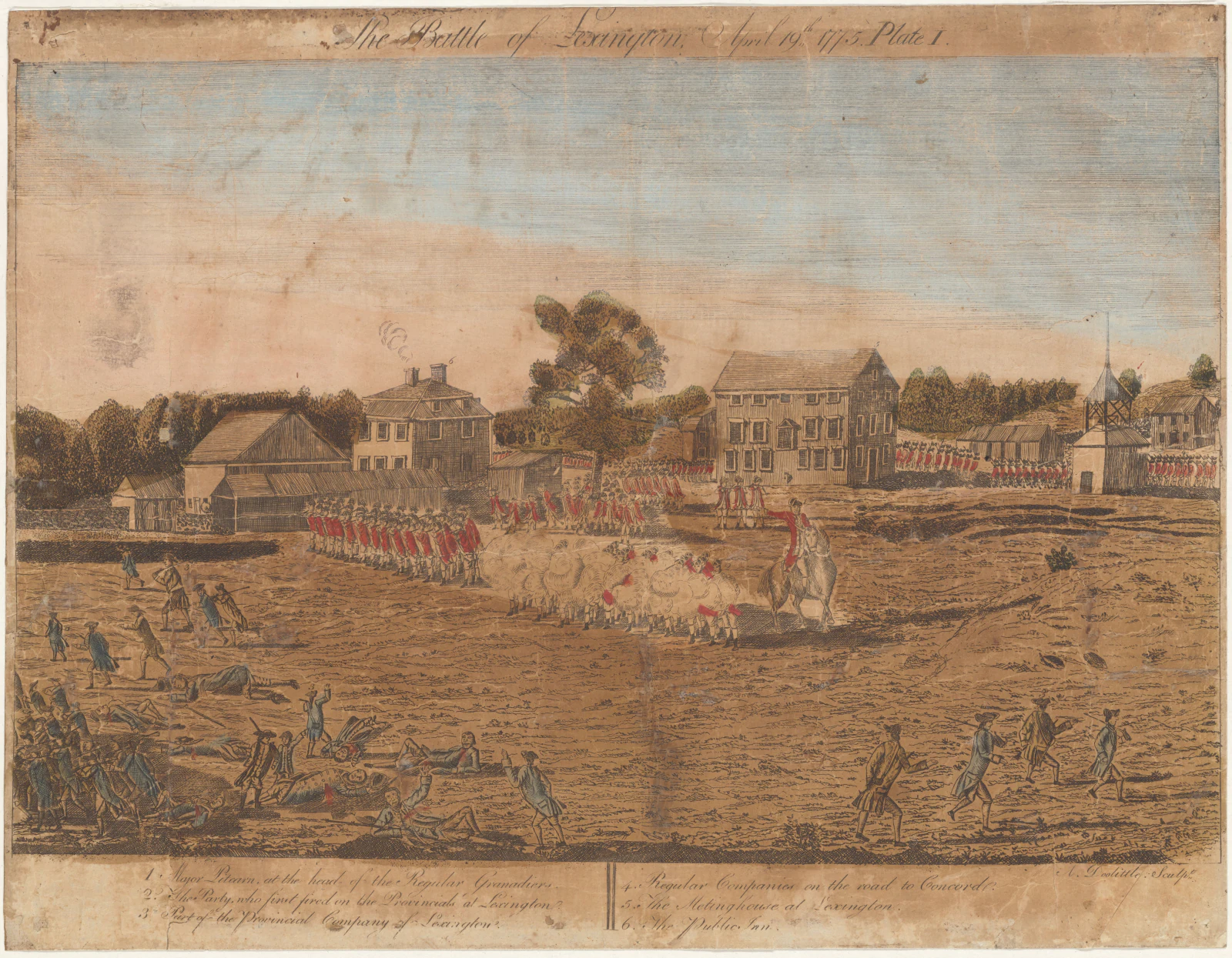
Captain John Parker assembled seventy-seven Lexington militiamen on the common before dawn. They were local men standing at the center of their own village, not a field army occupying a prepared battlefield. Parker did not intend to block a column several times larger. The militiamen formed up, then waited as the British advance approached.
What happened next has been argued since 1775. Pitcairn's regulars moved onto the common. Officers issued commands. Parker attempted to disperse his men. A shot sounded, but the evidence does not securely identify who fired it or from where. British soldiers then fired a volley and charged. The encounter lasted only a few minutes. Eight Lexington men were killed and ten wounded. One British soldier was wounded. The NPS chronology of April 19 preserves the uncertainty rather than manufacturing a clean beginning.
That restraint is important. “Who fired first?” became a political question immediately because responsibility for beginning a civil war mattered. Depositions were gathered. Competing narratives circulated across the Atlantic. Later monuments gave moral clarity to an episode that participants experienced through smoke, noise, fatigue and conflicting orders. A responsible visit does not solve the mystery by choosing the most satisfying version. It asks why a single unidentified shot carried so much explanatory weight—and why the lethal volley that followed is not mysterious at all.
The common itself also needs decoding. It remains a municipal green at a road junction, but the landscape visitors see is the product of two and a half centuries of commemoration. The 1799 Revolutionary Monument is one of the country's earliest war memorials; remains of the Lexington dead were reinterred beneath it. The Old Belfry nearby is a reconstruction of the structure whose bell helped sound the alarm. Henry Hudson Kitson's Captain Parker statue, erected in 1900, fixes a confident armed figure in bronze. None is neutral. Together they show how Lexington turned a village disaster into a usable national origin.
The best indoor counterweight is Buckman Tavern, built around 1710. Militiamen waited there during the cold, uncertain hours before the column arrived. A tavern was a place of food and drink, but also of information, exchange and local politics. Standing inside restores the duration that the green's monuments compress. The battle was three minutes; the waiting was hours.
Houses were part of the event, not scenery beside it
Lexington's preserved buildings widen the cast. At the Hancock–Clarke House, John Hancock and Samuel Adams had been staying with relatives. Revere's warning helped send the two Patriot leaders away before the regulars arrived. The site's longer household history also includes Jack and Dinah, enslaved by the Hancock family. Reverend John Hancock purchased Jack in 1728 with money supplied by the town; Jack's age, origins and later life remain incompletely documented. Elizabeth Hancock freed Dinah in her will in 1760. The Clarke household subsequently paid for Dinah's board, and town research places her with the Bowman family from March 30, 1775. She is not believed to have been in the house during the alarm. These different lives expose the gap between liberty's political language and its household practice, without inventing either person's presence that night.
At Munroe Tavern, the perspective reverses. British troops used the building during the afternoon retreat, when Lord Percy's relief force paused in Lexington. Wounded soldiers needed care. Officers needed space. A civilian household became military infrastructure without choosing to do so. Visiting both taverns—rather than treating only the Patriot waiting room as authentic—makes the day less symmetrical in a productive way. One preserves the anticipation of local militia; the other preserves the exhausted invading column and a disrupted home.
Across the route, noncombatants had to read incomplete signals. Some women moved children and valuables away from the road; some protected houses, livestock and food; some cared for wounded people or buried the dead. The NPS account of women's lives in 1775 stresses labor and household responsibility rather than inventing a single representative heroine. Women were not enrolled in militia companies, but the fighting passed through an economy sustained by their work.
Political allegiance did not map neatly onto geography. Patriot-leaning families often moved away from Boston and the approaching regulars. Loyalist-leaning civilians sometimes sought safety toward the British-held town. Others tried to remain uninvolved. “Civilian” is not a synonym for “Patriot,” and “Loyalist” does not mean a person was safe once a retreating army and pursuing militia entered the same narrow road. Homes could be searched, occupied, damaged or caught in fire regardless of the political language later attached to them.
The preserved route contains at least eleven structures known as April 19 witness houses. Their value is not that every room holds a dramatic anecdote. It is the opposite: survival makes the ordinary built environment visible. The day's infrastructure was domestic—wells, kitchens, barns, doors, fences and rooms—until military movement repurposed it.
Concord: a search, a smoke plume and a shifting balance
Smith's column reached Concord around 7:30 a.m. The village's militia had gathered, but their leaders initially withdrew across North Bridge as British strength became clear. Regulars entered the center and divided into detachments. Their task was to find provincial military stores: cannon, gun carriages, flour, ammunition and other material that local committees had been dispersing and concealing.
The search was only partly successful. Some equipment was found and destroyed; much had already been moved. A detachment continued beyond North Bridge toward Colonel James Barrett's farm, where officers believed additional stores were hidden. The mission consumed time and stretched the British force across unfamiliar ground. At the bridge, a small guard separated the village from a growing body of provincial companies on the high ground to the west.
Smoke rising over Concord center altered the colonists' understanding. The regulars had set captured material on fire near the courthouse. Town residents helped control the blaze, but from a distance the smoke suggested that homes might be burning. The question for provincial officers was no longer simply whether to observe an official search. It was whether an armed force was destroying their town.
By then, companies from Concord, Acton, Bedford, Lincoln and elsewhere had increased the colonial force to roughly 400. Colonel James Barrett ordered an advance toward North Bridge but instructed his men not to fire unless fired upon. Major John Buttrick led from the front. Captain Isaac Davis brought his Acton minute company into the leading position; his men were equipped with bayonets, which mattered if the column had to cross a defended bridge.
The numbers, ground and purpose were now different from Lexington. The provincial force was larger than the British bridge guard. It advanced in formation under officers. A narrow crossing focused both sides. The confrontation that followed was not a repetition of the dawn encounter.
North Bridge: return fire becomes a collective decision
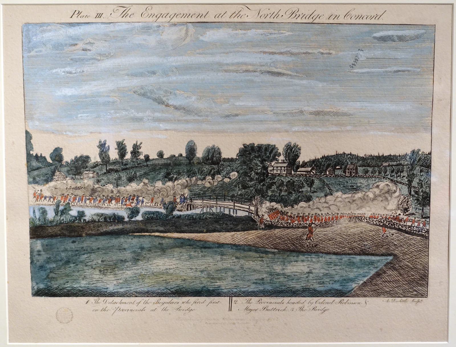
About ninety-six British soldiers held the east side of the bridge. As the provincial column approached from the west, some regulars began pulling planks from the crossing. Colonial officers interpreted that act as an attempt to prevent passage and ordered their men forward at a faster pace. British companies crossed back to the east bank and formed imperfectly on the narrow ground.
Initial British shots splashed into the river. Further firing struck the head of the provincial column. Isaac Davis and Abner Hosmer of Acton were killed; others were wounded. Buttrick ordered the provincials to return fire. For perhaps a minute or less, smoke and projectiles crossed the river. British soldiers were killed and wounded. Their companies withdrew toward Concord center, while the provincials did not immediately pursue.
This is why the bridge is historically distinct. At Lexington, an unknown first shot was followed by a British volley against men who were dispersing. At Concord, colonial officers moved a formed column forward and, after receiving fire, ordered a coordinated response. Political resistance became organized lethal force in public, under command.
The phrase “shot heard round the world” came from Ralph Waldo Emerson's 1837 “Concord Hymn,” written for a bridge monument ceremony more than sixty years later. It captures the scale later assigned to the event, not the soundscape of one projectile. The consequential act was collective: companies assembled through a regional alarm, officers debated, men advanced, regulars fired and Buttrick ordered return fire.
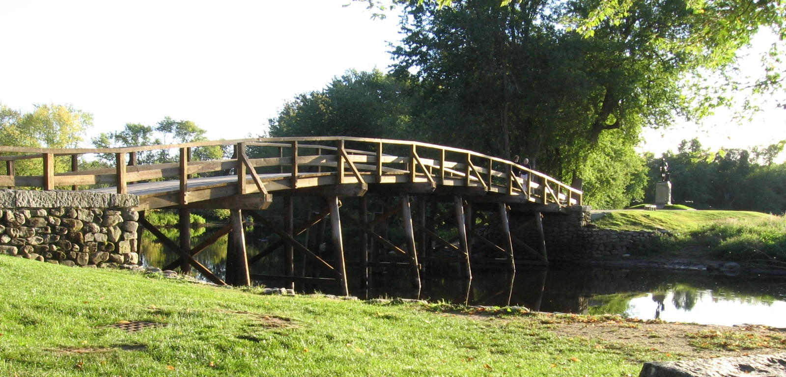
The current bridge is an interpretive reconstruction, not the original fabric. The 1775 bridge was removed in 1788. The structure crossed today is the fifth bridge on the site, restored in 2005 from a 1956 design. That does not make the place false. It changes the question. Visitors should use the crossing to understand alignment, river width, banks, approach and visibility while recognizing that a later design frames those observations.
On the east bank, the 1836 obelisk stands near the British position. On the west, Daniel Chester French's Minute Man faces the bridge from the provincial side. The two monuments create a spatial argument across the river: an early memorial marking the engagement and a centennial figure embodying the armed citizen. The battle itself took place between those later statements.
Five musket balls and the discipline of context

In early 2023, archaeologists working ahead of preservation activity found five fired lead musket balls near the North Bridge battle site. Their locations, deformed shapes and trajectories were consistent with colonial fire toward the British position. Different calibers also fit the varied privately held weapons carried by provincial companies. The NPS account of the discovery is unusually valuable because it shows historical interpretation being tested by material evidence rather than simply repeated.
The finds do not identify individual shooters or replay the firefight shot by shot. They narrow possibilities. Archaeological context connects an object to soil layer, position and surrounding evidence. A loose musket ball without a recorded findspot is largely a lead sphere; these five became evidence because professionals mapped and conserved them.
That distinction matters throughout Minute Man National Historical Park. Metal detecting and artifact removal are prohibited. A wall, depression or object may be part of a documented landscape even when it looks ordinary. Responsible curiosity means leaving evidence in place and reporting a possible find to park staff.
The musket balls also help correct the false competition between Lexington and Concord. Lexington remains where blood was first shed that morning. North Bridge remains where organized provincial companies deliberately returned British fire. Evidence can sustain both claims without forcing either town to surrender its place in the chronology.
The retreat: when the road becomes the battlefield

After North Bridge, the provincial companies paused while Smith regrouped his expedition in Concord center. British detachments returned from the search. Around noon, the column began moving east. At first, the same road promised a way out. Within minutes, its geometry began working against the regulars.
At Meriam's Corner, the road crossed a narrow bridge and bent sharply. British flank guards had to rejoin the main column before crossing. Colonial companies approaching by field routes and side roads found positions on the higher ground. As the rear of the column cleared the bridge, firing intensified. NPS interpretation at Meriam's Corner treats this as the transition from intermittent contact to a sustained running battle.
The road then passed wooded slopes, wet ground, farms and stone walls. At Elm Brook Hill, an S-curve exposed parts of the column while high ground concealed approaching militia. Companies from Woburn and other towns—perhaps 180 to 200 men in that local action—could fire from positions on both sides. British light infantry tried to drive opponents away from walls and woods; officers struggled to keep exhausted men moving. The landscape study at Elm Brook Hill shows how topography can corroborate testimony without pretending that every wall is untouched since 1775.
Farther east, fighting continued through places later named the Bloody Angle and Parker's Revenge. The names can make separate set pieces out of what was actually fluid combat. Militia men often fired, withdrew before a British charge and reappeared farther along. Some used field routes to get ahead. The regulars were trained and repeatedly aggressive, not helpless figures in a shooting gallery. Their flankers contested high ground; their officers maintained enough cohesion to prevent complete collapse. But they were short of rest and ammunition, carrying wounded men and moving through a countryside where new opponents kept arriving.
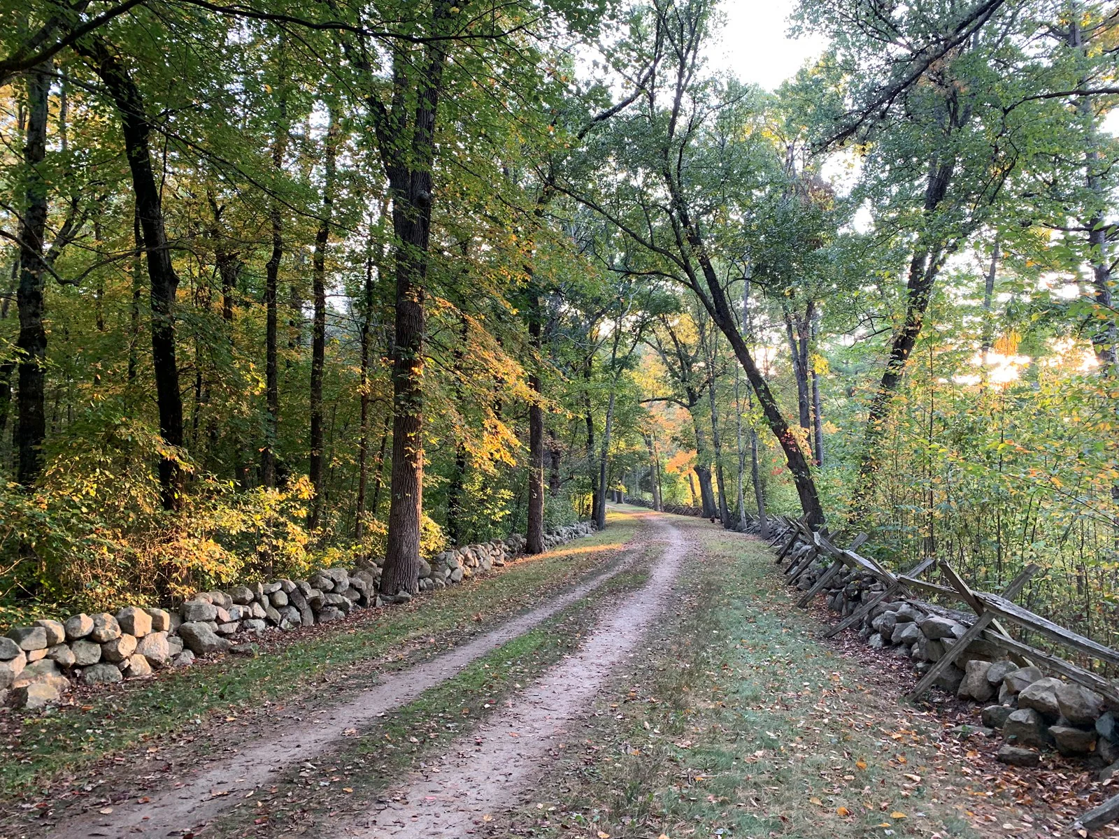
Near Lexington, the British expedition was in severe danger. Lord Hugh Percy's relief column, about 1,000 men with artillery, had marched from Boston. It met Smith's exhausted troops around mid-afternoon. Percy formed a defensive position and allowed them to rest, while cannon and fresh infantry held colonial companies at distance. The combined force—about 1,700 regulars—then resumed the retreat.
The relief did not end the fighting. In Menotomy, today's Arlington, combat became especially costly and intimate as the road passed closely spaced houses. Militia fired from buildings and enclosed ground; regulars cleared positions. Civilians were exposed. The column finally reached Charlestown around 7 p.m., protected by British naval power and defensible ground. Provincial forces gathered outside Boston, beginning the siege that would define the next phase of the conflict.
Across the expedition, British losses were 273: 73 killed, 174 wounded and 26 missing. Colonial losses were 95: 49 killed, 41 wounded and five missing. Those totals include very different encounters spread across hours and miles. They should not be used to flatten the route into one battle. Lexington, North Bridge, Meriam's Corner, Elm Brook Hill, Menotomy and the final approach each involved different forces, terrain and decisions.
Walls, wetlands and houses: how to read the surviving road
The Battle Road unit is not preserved as a single untouched corridor. Modern Route 2A, residential roads, airport land and park paths intersect the historic route. Some original road traces survive; other segments have shifted or disappeared. The five-mile Battle Road Trail, running between Meriam's Corner and the eastern park boundary, connects many of the clearest pieces.
Walking reveals relationships that a windshield compresses. A modest rise can hide people from a column below. A bend can delay the moment when the front of a formation sees danger. A wet meadow can restrict lateral movement. A bridge can force flank guards to collapse inward. A stone wall can provide partial cover but can also trap a defender when light infantry charges. Distance accumulates: a location that appears close on a regional map feels different after several miles in heat, mud or rain.
Not every visible feature dates exactly to 1775. New England walls were rebuilt. Forests expanded over former fields. Houses acquired additions. Roads were graded. The correct method is comparative: use park maps, archaeological interpretation, documented witness structures and topography together. Where evidence is uncertain, say so.
Hartwell Tavern is an excellent test. The house was built in 1732–33 and licensed as a tavern in 1756. Three Hartwell sons served on April 19. Later additions remain, and NPS restoration preserves a building estimated to retain 60 to 70 percent original material rather than presenting a falsely pristine 1775 shell. The result lets visitors ask how a roadside business connected travelers, news and a family to the alarm.
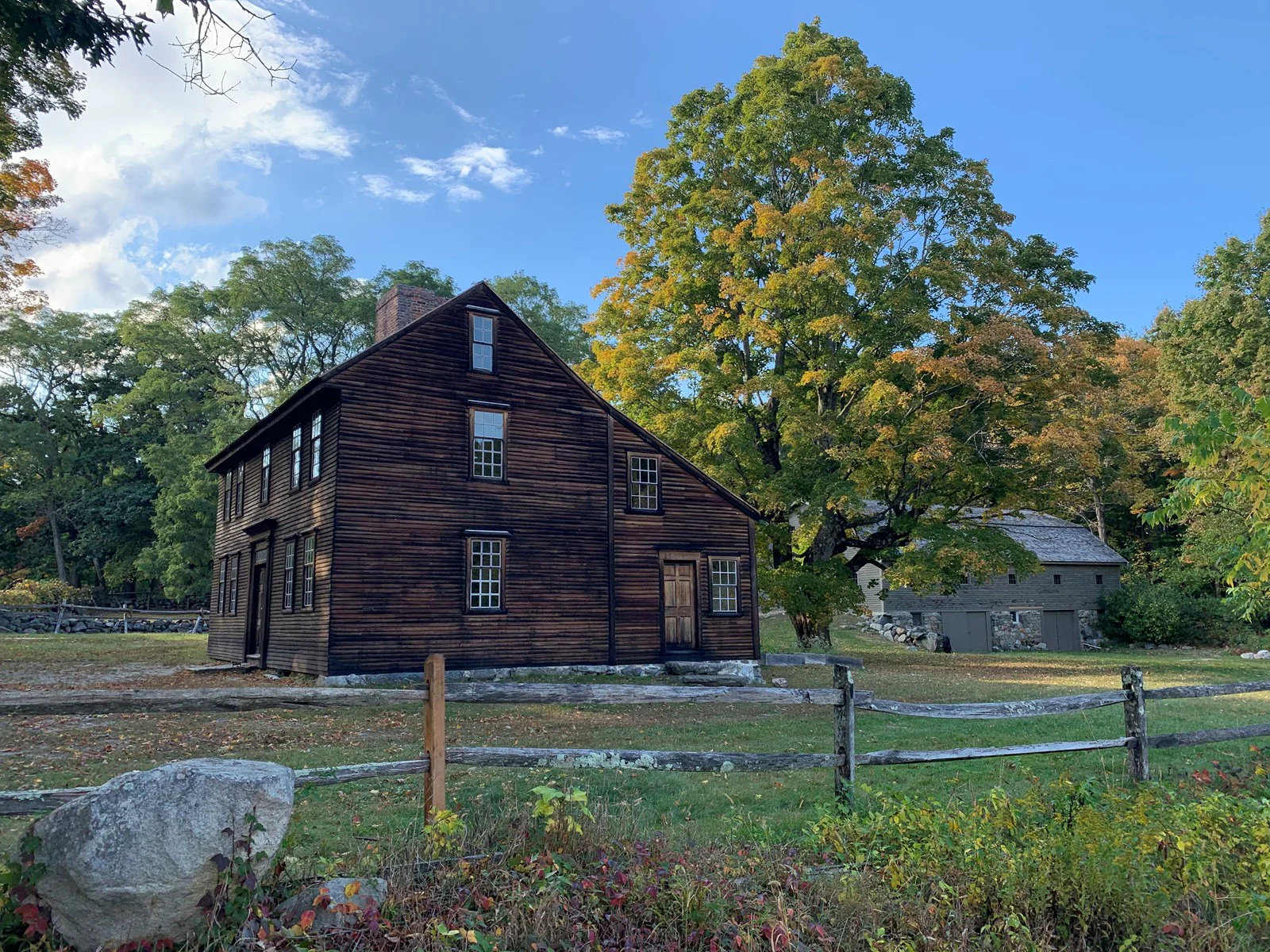
Later Hartwell family tradition gives the alarm a domestic relay. It suggests that Prescott warned Ephraim Hartwell, who sent Violet, a woman he enslaved, next door to awaken his son Samuel. Samuel's wife Mary was Ephraim and Elizabeth's daughter-in-law. The warning then moved toward Captain William Smith of the Lincoln minute company. The park's account records differing family versions rather than claiming a proven sequence. Violet's role matters, but certainty about her words or every step would go beyond the evidence. The distinction demonstrates how community memory can preserve a consequential participant while leaving details unresolved.
The same discipline should govern battle reenactments, dramatic tours and anniversary stories. A scene can help people imagine pace, equipment and confusion. It cannot create a quotation, assign a shooter or settle an argument that the sources leave open.
Who stood in the ranks—and who remained unfree
The provincial ranks included men of African and Indigenous descent. NPS research estimates that roughly twenty to forty Black or Native men fought with Massachusetts forces on April 19. The range itself is meaningful: records classified people inconsistently, used racial labels imprecisely and sometimes omitted service that later historians must reconstruct from local documents.
Their presence does not prove that the Patriot movement offered equal liberty. Massachusetts still held people in slavery. Free Black men faced racial restrictions. Indigenous communities lived with generations of colonial land loss, war and coercion. The Patriots of Color research project places military participation beside that contradiction. Lemuel Haynes, who served in a later Lexington alarm and became a minister, would develop an antislavery argument from revolutionary language: natural liberty could not logically stop at a color line.
The route therefore holds two truths at once. Armed resistance to imperial rule became a revolutionary struggle with worldwide consequences. The society making that claim denied freedom and political power to many people within it. A complete story neither dismisses the political rupture nor lets patriotic vocabulary erase unequal lives.
This is also why household interpretation matters. Jack and Dinah belong to the longer history of the Hancock–Clarke House, including enslavement, emancipation and dependence; their lives cannot simply be placed in the room with Hancock and Adams on April 19. Women who moved children, prepared food or managed farms are not background atmosphere. Loyalist families seeking British protection are not errors in a unanimous town. Expanding the cast changes the causal story: revolution was produced through households, work, law and local authority as much as through volleys.
The dead, the grave and the ethics of memory
Near North Bridge, a marker identifies the grave of British soldiers killed in the engagement. The site has been reshaped repeatedly: a nineteenth-century stone, a later fence and a 1910 inscription successively formalized the place. The individual identities attached to the grave are not completely secure. That uncertainty should remain visible.
A lurid claim that a British soldier had been scalped circulated after the battle and served propaganda. Contemporary burial testimony contradicts the broad accusation, although evidence indicates that one wounded soldier may have suffered a hatchet injury. The NPS history of the grave separates the treatment of remains from the stories mobilized around them.
This is more than a factual footnote. Both sides understood that reports of cruelty could recruit sympathy and harden resolve. How the dead were described became part of the war. Today, annual remembrance at the British grave places former enemies inside a shared commemorative landscape. It does not erase responsibility or equivalence; it recognizes that historical care includes people who died on the losing side of a particular encounter.
At Lexington, the Revolutionary Monument and grave make the colonial dead foundational ancestors. At North Bridge, the British grave interrupts a purely triumphant route. Visiting both produces a more honest emotional sequence than posing only beside the victorious Minute Man.
How commemoration edited the battlefield
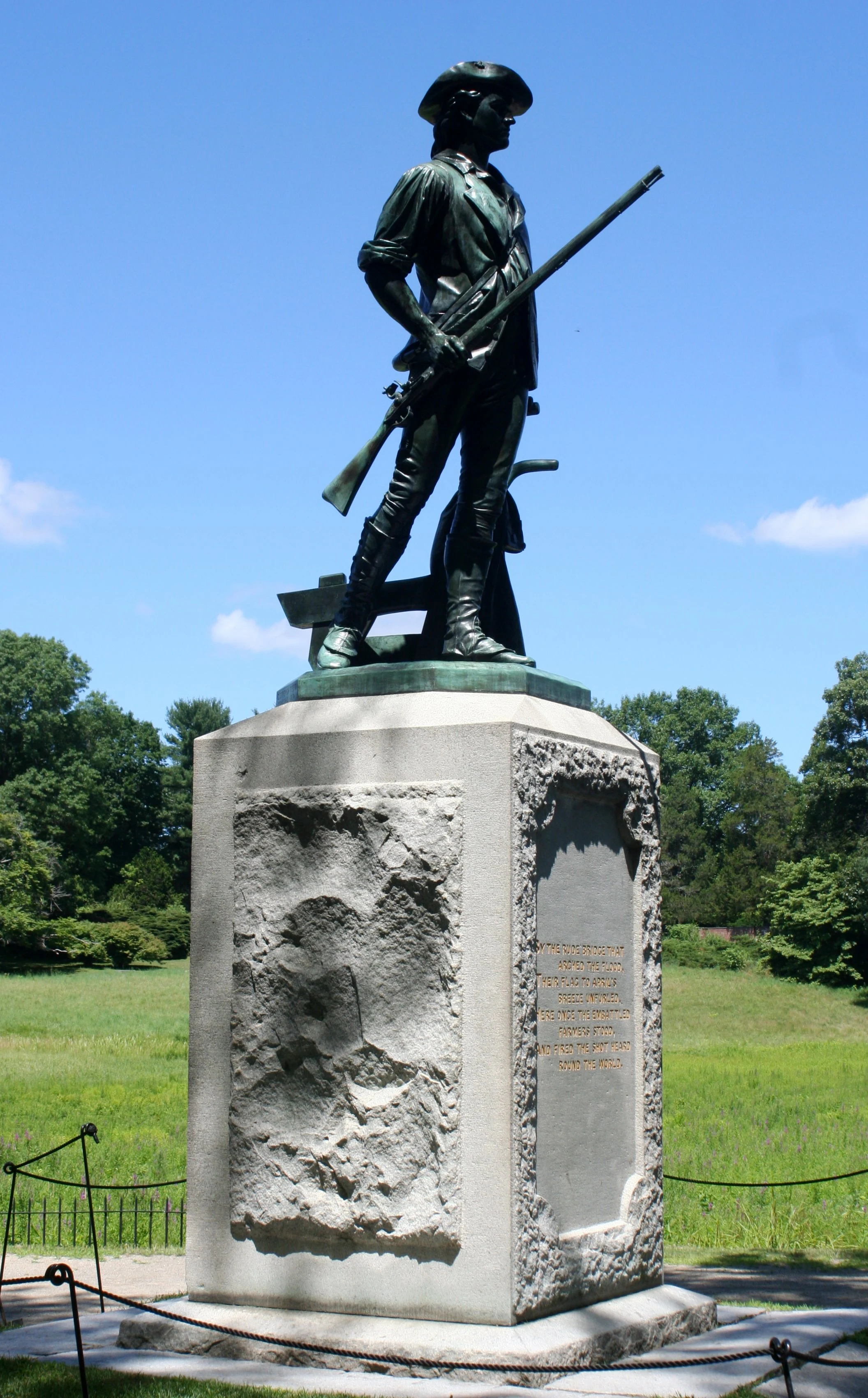
Daniel Chester French was twenty-four when his Minute Man was unveiled for the battle's centennial in 1875. The bronze came from melted Civil War cannon supplied by Congress. The plow at the figure's side turns Emerson's poetic farmer-soldier into anatomy: one hand leaves agricultural labor while the other holds a musket. A time capsule placed at the centennial joined one from the bicentennial in 1975. The monument is therefore a stack of anniversaries—1775 interpreted through 1875, 1975 and the present.
The statue's fame encourages visitors to treat it as a generic portrait of every colonial fighter. It is not. No single model can represent town officers, laborers, farmers, artisans, Black and Indigenous soldiers, older militia members and younger minute men. Nor can bronze convey the provincial force's varied clothing and weapons. The sculpture's value lies partly in revealing what the centennial generation needed the Revolution to look like.
Doolittle's four 1775 engravings perform an earlier edit. Amos Doolittle traveled to the sites with portrait artist Ralph Earl soon after the fighting and turned sketches and interviews into publishable scenes. Their proximity to the event makes them crucial. Their medium still required choices: compressing distance, ordering ranks, selecting viewpoints and clarifying smoke so buyers could understand an unfamiliar landscape. Use the Lexington and Concord plates as arguments informed by observation, not photographs.
The National Historical Park itself is another layer. Established in 1959, it preserved key portions of a landscape already crossed by modern development. Restoration removed some later structures, reconstructed others and selected a narrative path. The park's work now increasingly incorporates archaeology, ecological management, witness houses, civilians and people of color. Public history is not weakened when interpretation changes. It becomes more accountable to evidence.
Concord Museum's anniversary interpretation makes the same point through objects and changing displays: 1824, 1875, 1975 and 2025 each framed the Revolution for a different public. The lesson extends beyond any exhibition calendar. Every generation inherits a road and decides which people, objects and phrases will guide the next visitor across it.
Museums: move from landscape to objects, then back again
The route is strongest when outdoor observation and collections correct each other. The Concord Museum holds the lantern traditionally associated with the Old North signal, along with material from Indigenous history, the Revolution, abolition and Concord's literary culture. Its permanent galleries can turn a familiar phrase into a physical question: who made this object, who handled it, how was its provenance established, and why was it saved?
The museum's April 19, 1775 gallery gathers objects whose meanings are difficult to see on a roadside. Allow roughly one to two hours rather than squeezing it between photographs. The museum is wheelchair accessible and offers a digital guide; its visit page carries current opening days, admission, reservation guidance and bag rules.
Lexington History's three houses form a complementary sequence. Buckman Tavern interprets the militia's wait before dawn. Hancock–Clarke connects political leadership to a household that included enslaved people. Munroe Tavern turns toward the British retreat and civilian disruption. Seasonal days, tour formats and physical access vary, so use Lexington History's live visit information instead of relying on an old itinerary.
If this road leads you toward original documents, ExcursionPass's journey through Washington's Capitol, Library of Congress and National Archives explains how later federal institutions preserve and stage founding-era evidence. The connection is methodological: landscapes and archives both require provenance, context and skepticism about neat national stories.
Planning the route: the geography comes before the schedule
Minute Man National Historical Park is fragmented. The North Bridge unit lies in Concord; the Battle Road unit stretches east toward Lexington; Lexington Battle Green and the historic houses are managed locally rather than by NPS. Concord Museum is a separate institution. A plan that treats “the park” as one parking lot will waste time and miss the sequence.
For a full first visit, think in three movements:
- Lexington before dawn: Begin at Battle Green, then add Buckman Tavern and, if open and relevant to your interests, Hancock–Clarke House. The point is to understand the alarm, the village junction and the first encounter before driving west.
- Concord and North Bridge: Use Concord center and the museum to establish the search for stores. At North Bridge, walk both banks, locate the obelisk, British grave and Minute Man, and compare the modern alignment with Doolittle's print.
- The road east: Return along Battle Road in the direction of the retreat. Walk a meaningful section rather than stopping at every marker. Meriam's Corner, Hartwell Tavern and the terrain around Elm Brook Hill reveal more when treated as connected problems of movement.
Reversing direction can still work, but it changes comprehension. Driving from Boston to Concord, then casually stopping in Lexington on the way home, makes the retreat feel like an appendix. Following the chronology gives each location a question produced by the one before it.
NPS grounds are generally open from sunrise to sunset year-round, with visitor centers, restrooms and programming operating seasonally. The park charges no entrance fee, but partner museums and guided programs may charge admission. Confirm the current hours, fees and facility status close to departure.
Summer can be hot and humid, with thunderstorms and ticks; winter brings ice, short daylight and closed seasonal facilities. Bring water, weather protection and shoes suitable for uneven dirt and grass. Conduct a tick check after walking field edges. Phone coverage should not replace a downloaded map, because the historical route and modern road network diverge.
Accessibility is location-specific
“Historic site” is not a useful accessibility specification. The main park visitor centers, designated parking and restrooms include accessible facilities, but trail surfaces range from paved to unpaved, narrow and uneven. Fiske Hill includes steep grades and steps. North Bridge approaches, historic-house thresholds and seasonal conditions create different constraints.
NPS provides captioned films and an audio-described brochure, and its accessibility page was updated in January 2026. Consult it by site, then contact the park or museum for the feature that determines your visit—wheelchair route, seating, captioning, sensory load, service animals or an accessible drop-off. Concord Museum identifies itself as fully wheelchair accessible. Lexington's house museums publish building-specific notes and guided-tour requirements.
A mixed group may get more from one accessible landscape stop, one museum and a slow meal than from ten rushed pull-offs. Historical completeness is not measured by the number of plaques reached.
Guided day, self-drive, long walk or transit: choose the constraint
Each format solves one problem and creates another.
A guided small-group day
A guide can hold the chronology together while someone else handles Boston-area traffic, fragmented parking and the westbound/eastbound logic. That is valuable for a first visit, especially when the group wants both museums and landscapes without researching every jurisdiction. Before choosing a guided day, compare the promised stops with the chronology you want to follow and ask how much time is spent walking Battle Road, inside the museum and at North Bridge. Confirm the vehicle, meeting or pickup arrangements and any access requirement directly with the provider for the specific departure.
The trade-off is pace. A long van day concentrates a lot of interpretation, but time at one house, trail segment or gallery may be shorter than an enthusiast wants. Ask how much of Battle Road is walked, whether the museum visit is guided or independent, and how the itinerary handles seasonal closures. Do not assume that “Lexington and Concord” guarantees every named site.
Self-drive
A car offers the best control for historic houses, North Bridge, Concord Museum and multiple Battle Road stops. It is also the easiest way to lose the story by chasing parking icons. Download the NPS directions and transportation guidance, choose a few anchor stops, and preserve chronological direction. Never stop on a shoulder simply because a marker appears; use designated lots and crossings.
Self-drive is strongest when one person has already mapped the sequence and the group accepts that it will not see everything. It is weakest when the driver must interpret, navigate and search for parking simultaneously.
Walking and cycling
The Battle Road Trail provides about five connected miles of historical landscape and is the best format for understanding terrain. It does not connect every major attraction into one effortless pedestrian day. Lexington center, the eastern park boundary, Concord center, North Bridge and the museum create longer distances and modern-road gaps. A bicycle expands the range, but riders must plan for surface changes, road crossings and where bikes are permitted or secured.
A productive hybrid is to walk one trail section in retreat direction, then use a car or ride service to reposition. Arrange the return before setting out; a linear historical route can leave a modern visitor far from the vehicle.
Public transit and ride services
The MBTA Fitchburg commuter-rail line reaches Concord. North Bridge is roughly 1.5 miles from Concord station, and Concord Museum and the town center can be combined on foot by visitors comfortable with the distance and road conditions. Lexington can be approached by bus from Alewife, but service patterns—including Sunday availability—change. The national park recommends designated locations for ride-service pickup because units are dispersed.
Transit can support a satisfying Concord-focused day. It is not, by itself, an efficient way to reproduce the entire British route. Check current MBTA schedules, last trains, walking conditions and ride availability rather than inheriting exact times from a travel article.
A field method for the day
At each major stop, ask the same four questions:
- Who had arrived? Numbers and units changed throughout the day.
- What did they know? A smoke plume, rumor or messenger could change a decision before its meaning was verified.
- What did the terrain allow? A common, bridge, bend, hill and house produce different tactical choices.
- Which layer are you seeing? Original fabric, restored landscape, reconstruction, archaeological evidence, monument or museum interpretation.
Those questions keep the route from becoming a patriotic scavenger hunt. They also make uncertainty useful. The identity of Lexington's first shooter is unresolved; the sequence and lethal result are not. Hartwell's alarm story is family tradition; the tavern's fabric and roadside function are documented. North Bridge is reconstructed; its river crossing and battlefield alignment remain interpretable. A musket ball is small; its mapped archaeological context can test a large claim.
The same field method operates at a different scale in Normandy’s U.S. D-Day sector. Lexington and Concord ask how a common, bridge, bend and road changed an eighteenth-century expedition; Omaha asks how water depth, obstacles, draws, bluffs and hedgerows changed an amphibious assault. Reading the two together makes terrain evidence, not scenery, while keeping the wars and their politics distinct.
For families, give each traveler one evidence type to follow: roads, houses, objects, signals or monuments. For experienced history travelers, compare Doolittle's 1775 engravings with the park's modern maps: locate the river crossing, distinguish the bridge from the road, and notice how each image selects a different story. For everyone, resist reenacting combat in a place that is also a burial and remembrance landscape.
The road's real legacy
The April 19 expedition did not produce American independence by sunset. It did something more immediate and irreversible. British authority attempted a limited military seizure. A provincial political network converted warning into armed mobilization. At Lexington, people died in an encounter neither side could narrate neutrally. At North Bridge, colonial officers ordered return fire. Along the retreat, thousands of militia men transformed a country road into a moving front. By night, British troops were contained around Boston and the provincial rebellion had become open war.
The total colonial force across the route rose above 4,000. That scale was not the work of one famous rider. It grew from village government, trained companies, family labor, local knowledge and repeated decisions made under uncertainty. It also grew inside a society whose declarations of liberty exceeded its practice.
For the earlier Atlantic chronology, the ExcursionPass journey through Plymouth and Cape Cod begins with Wampanoag homeland, English settlement at Patuxet and the later construction of a founding landscape. Read beside Lexington–Concord, it separates colonisation in 1620 from revolution in 1775 while showing how both routes turned selective memory into public geography.
The best visit therefore ends not with a claim about where America “began,” but with a better causal picture. Lexington shows the danger of an armed encounter whose first instant cannot be recovered. Concord shows deliberation under fire. Battle Road shows how geography and a distributed response can reverse the balance of an expedition. The houses reveal that war enters domestic space. The monuments reveal later generations selecting heroes. The museums and archaeology reveal interpretation still moving.
Cross North Bridge, but do not stop the story there. Turn east. Follow the old road as far as time and mobility allow. Every bend asks how news became movement, how movement became combat, and how combat became memory.