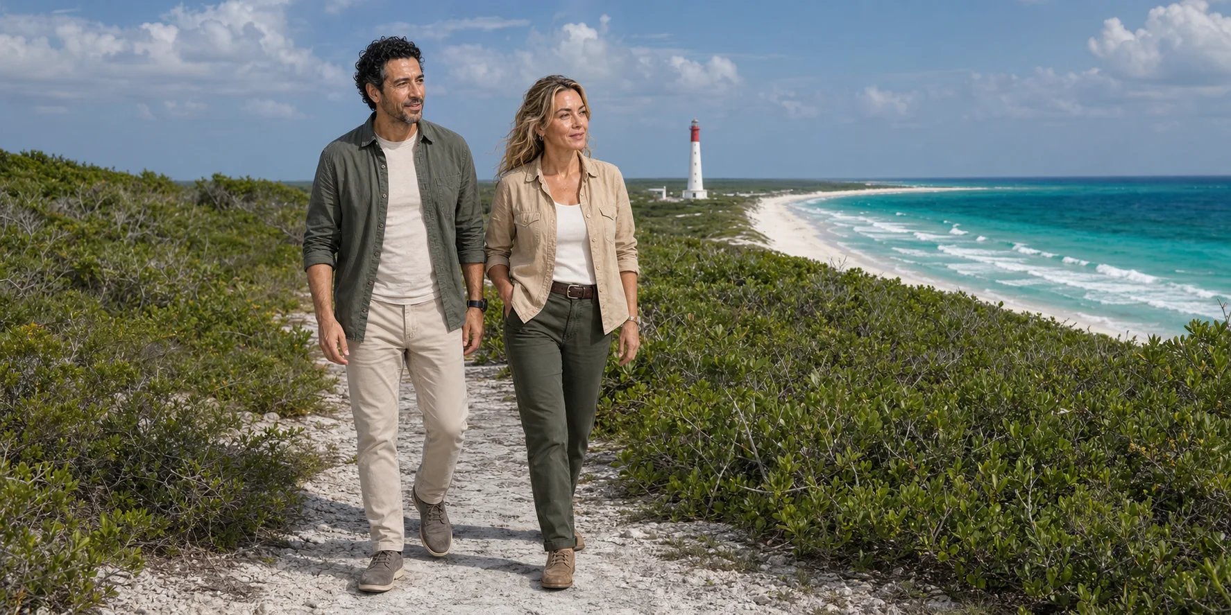
Cozumel is often compressed into a cruise call, a diving label or a loop-road excursion. The island makes more sense as one limited, inhabited system: Maya settlements and sea routes, a modern city and working port, a rain-fed limestone aquifer, mangrove lagoons, seagrass and coral reefs, hurricane exposure, protected areas and a visitor economy all occupy the same ground.
01 · Cozumel as one island system
Begin with an island, not an excursion
Cozumel sits off the north-eastern Yucatán Peninsula, separated from Playa del Carmen by the Cozumel Channel. Its urban centre, San Miguel de Cozumel, faces the comparatively sheltered western water. The eastern shore meets the open Caribbean. Between them lies a low limestone interior with no large surface river, a road crossing the island, forest and scrub, archaeological sites and a freshwater supply stored largely out of sight. To the south, mangrove-fringed lagoons and shallow marine habitats connect with part of the Mesoamerican Reef.
That geography is the argument of this story. A port passenger can step ashore, cross the island, visit a staged cultural attraction, stop near archaeological fabric, look over a lagoon and reach a beach within hours. The route can feel like a series of unrelated attractions because the transport product sells stops. In ecological and historical terms, however, it passes through one constrained system. Roads change drainage and access. Wastewater can enter permeable limestone. Coastal development affects vegetation, seagrass and reef water quality. Cruise and ferry timetables create intense pulses of demand. A hurricane can rearrange the shore and the economy at once.
The UNESCO biosphere reserve profile captures that larger scale. The reserve, designated in 2016, includes terrestrial forest, mangroves, coastal and marine environments and part of the Mesoamerican Reef; UNESCO also notes the island's tourism economy and extensive archaeological record. A biosphere reserve is not a promise that every place is pristine. It is a framework for thinking about conservation, livelihoods, research and use across an inhabited landscape.
The first discipline, then, is to resist three reductions. Cozumel is not an empty paradise waiting for visitors. Maya history is not a costume added to a beach day. The reef is not a blue backdrop isolated from decisions on land. An honest route keeps community, archaeology, infrastructure, water and sea in the same frame.
02 · Cozumel as one island system
Read the map before choosing the road

San Miguel occupies the west coast. Passenger ferries connect its central waterfront with Playa del Carmen, while cruise infrastructure extends south along the same urban shore. The airport lies north of the centre. These gateways are not interchangeable. A ferry traveller begins in the town grid and is tied to a return crossing. A cruise passenger starts at whichever terminal the ship uses and must work backwards from the vessel's all-aboard time. An overnight visitor has more freedom to let weather or fatigue change the order of a day.
The transversal road runs east across the island's middle. San Gervasio lies north of that axis in the interior rather than on the common southern coastal loop. Reaching the open east shore changes both exposure and mood: development thins, surf is usually more evident and safe swimming cannot be assumed from appearance. The paved route then turns south and west toward Punta Sur and the developed western coast. Cozumel is not ringed by one continuous visitor road, and a vehicle itinerary should not imply access everywhere around the island.
Punta Sur is the southern protected landscape associated with Colombia Lagoon, the Celarain lighthouse and El Caracol. Consult the official municipal tourism entry and the park manager when planning access and activities. Offshore, the Arrecifes de Cozumel National Park protects major reef areas along the south and south-west rather than drawing a neat conservation circle around every kilometre of coast.
This map changes route planning. San Gervasio plus Punta Sur plus snorkelling is not a compact triangle; it is a long movement between the interior, south coast and marine access. San Miguel, a cultural performance, the east road and a beach are another sequence. When a seller combines all of them, the question is not merely whether each stop appears on a list. It is how much time remains to understand any one place after transfers, admissions, equipment, meals and the return to port.
03 · Cozumel as one island system
Maya Cozumel was a network of communities and sea routes
Human history on Cozumel is much deeper than the Late Postclassic buildings most visitors see. The INAH guide to San Gervasio describes occupation beginning around 200 BCE and a settlement that eventually covered roughly two square kilometres. More than thirty archaeological sites are known across the island. That distribution matters: one ticketed zone cannot stand in for every settlement, harbour, household, field, shrine or route.
Sea travel was ordinary infrastructure, not an exotic flourish. Maya communities occupied islands and coastal settlements, moved salt, food, ceramics, cloth and other goods, and connected the Caribbean shore to wider political and exchange networks. INAH's account of navigation and commerce places island settlement within a long maritime history. Cozumel's narrow separation from the mainland made it accessible by canoe while still giving the island distinct social and strategic qualities.
During the Late Postclassic period, roughly the centuries before and during Spanish arrival, Cozumel held prosperous coastal communities and a significant position in regional exchange. The surviving archaeology is relatively low in scale compared with the monumental skyline of Tikal or the highly photographed buildings of Tulum. That difference is not evidence of cultural insignificance. Architecture answers local materials, political organisation, ritual needs and settlement history; monument size is a poor universal measure of importance.
Nor is Maya identity a finished archaeological category. Maya peoples and languages continue across the Yucatán Peninsula and beyond. The National Institute of Indigenous Peoples' Maya ethnography describes living communities, agricultural knowledge, ritual practice, language and changing livelihoods. Maaya t'aan, Yucatec Maya, is spoken in the region alongside Spanish. A visitor who refers to ancient builders and present residents as if they were unrelated populations repeats the old tourism habit of admiring stone while making Indigenous people disappear.
Continuity does not mean that every present performance, recipe or story is unchanged from the fifteenth century. Living cultures innovate, borrow, debate and respond to an economy in which visitors pay for recognisable symbols. The responsible question is not whether contemporary Maya expression is perfectly ancient. It is who is speaking, what evidence or community authority supports the interpretation, how participants are credited and paid, and whether a staged experience is honestly described as staged.
04 · Cozumel as one island system
San Gervasio is a settlement, not proof of every pilgrimage claim
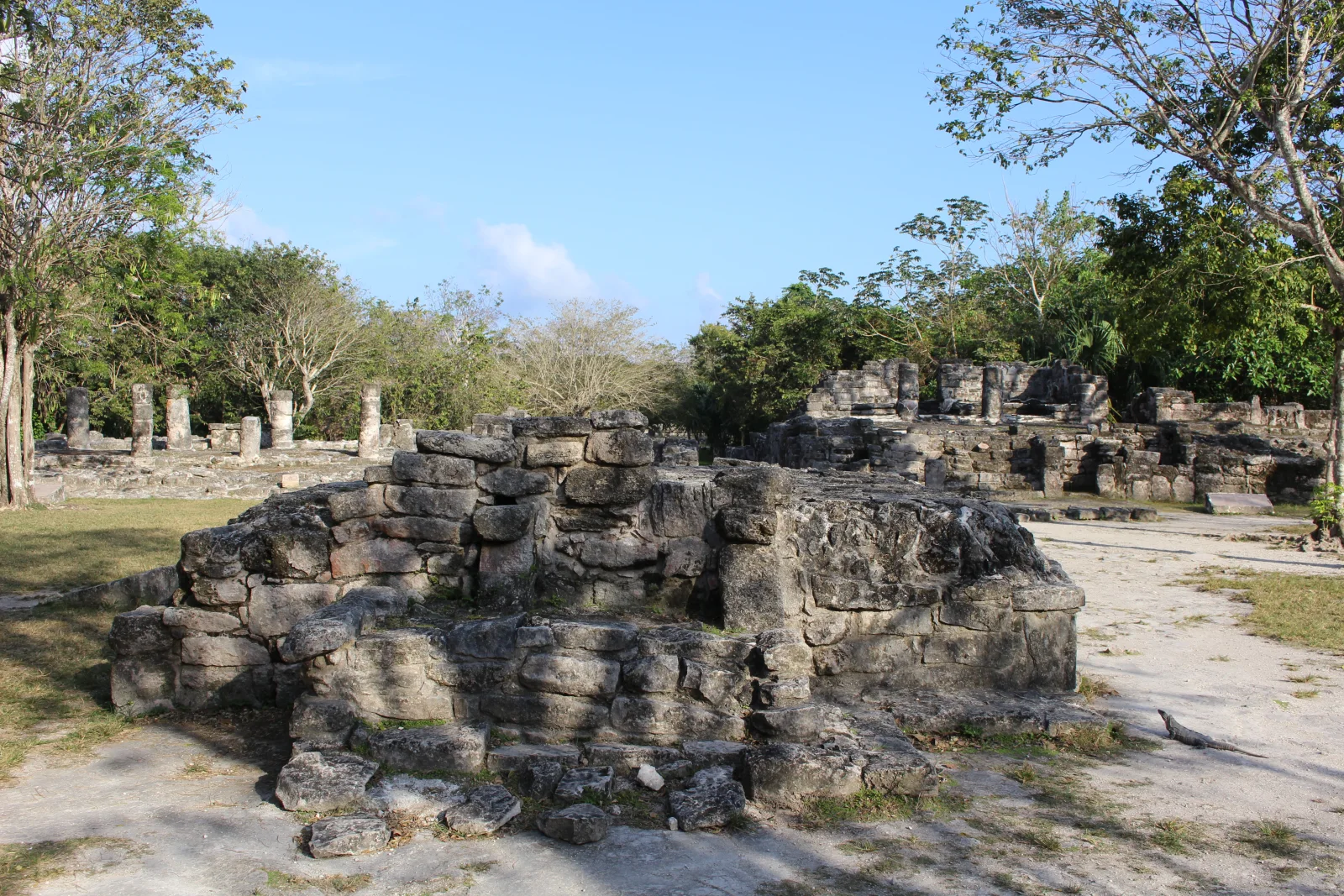

San Gervasio lies inland, reached from the transversal road, and expanded over many centuries. Its architectural groups were connected by raised paved roads, or sacbeob. The network joined plazas, residences, ritual buildings and dependent areas; it should be read as evidence of movement and organisation rather than as a random scatter of photogenic ruins.
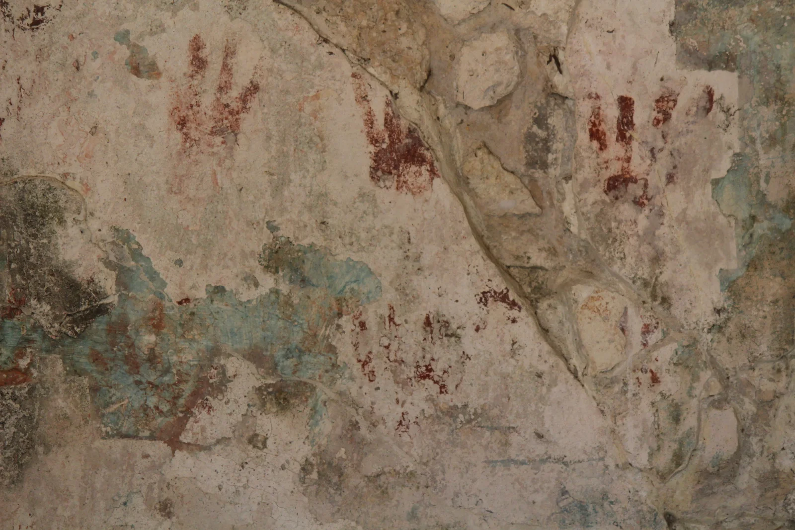
The central plaza contains structures conventionally named El Altar, Las Columnas and Los Nichos. Elsewhere, Las Manitas preserves painted handprints; Ka'na Nah is among the more imposing surviving buildings. Visitor names help orientation, but names assigned by archaeologists or later interpreters do not automatically reveal a building's original Maya name or single function. A doorway, platform, bench or patch of pigment can narrow an interpretation without making it certain.
The INAH walking guide makes those details legible. At Manitas, a front room with a bench served as a porch, while the rear room is interpreted as a sleeping space. The nearby Chichán Nah is a small temple. In the plaza, El Álamo, El Palacio, Los Murales, El Osario and Las Pilastras formed a palatial and ceremonial centre. An arch at its north-west edge marks a sacbé leading to Nohoch Nah, a temple retaining fragments of mural painting. Murciélagos preserves an earlier building, dated around 700 CE; Ka'na Nah has a stepped platform and a two-chamber temple.
Read that sequence at different scales: household rooms, a public plaza, connecting paths and changing construction. Stone buildings were surrounded by houses of wood and palm that survive less visibly. An empty-looking space can therefore be part of the former settlement. Keep to the visitor route and let the guide explain which building phases overlap.

Cozumel is frequently marketed as the island of Ix Chel, a Maya deity associated in different sources and periods with medicine, weaving, childbirth, the moon and other powers. Colonial chronicles do support an important oracle and pilgrimage tradition on the island. The leap from that evidence to “San Gervasio was the temple of Ix Chel” is less secure. INAH's current San Gervasio site page explicitly says there is no archaeological evidence tying San Gervasio itself to the cult of Ix Chel. It notes that Spanish accounts place the famous oracle at another site destroyed beneath modern San Miguel.
This is not a reason to erase pilgrimage. It is a reason to locate certainty correctly. INAH's interpretive essay describes Cozumel as a prosperous community with several coastal settlements at Spanish contact and reviews the pilgrimage and port interpretation as a subject still being studied. The sound formulation is that Cozumel held regional religious importance and that San Gervasio was a major settlement; the precise location and archaeological signature of the oracle remain debated.
That distinction improves the visit. Instead of asking a guide to point to “the goddess's temple,” ask how archaeologists date construction, how the sacbeob changed movement, what household and trade evidence has been found, which claims come from colonial texts and which come from excavation. Uncertainty is not a failure of interpretation. It is the boundary that keeps attractive stories from replacing evidence.
05 · Cozumel as one island system
Invasion transformed a populated island
Cozumel entered Spanish narratives early. Juan de Grijalva's expedition reached the island in 1518; Hernán Cortés arrived in 1519 on the campaign that moved from the Caribbean coast toward central Mexico. Francisco de Montejo used Cozumel during the later invasion of Yucatán. These arrivals are sometimes packaged as a peaceful “meeting of two cultures,” a phrase that flattens the military, religious and epidemic transformation that followed.
Spanish forces did not conquer the entire Maya world in one encounter. Maya polities made different decisions, resisted over generations and sometimes allied against rivals. Yet European invasion brought demands for tribute and labour, Christianisation and attacks on religious practice, warfare and introduced disease. A study published by INAH on the conquest and transformation of eastern Yucatán places depopulation within the violent reorganisation of land, labour and belief. Epidemic disease, war and displacement belong to that colonial history; disease alone cannot explain the new social order.
Cozumel's communities suffered severe demographic loss. The archaeological landscape therefore does not record a civilisation that naturally faded before Europeans arrived. Prosperous towns were present at contact; invasion changed the conditions under which people could remain, reproduce community life and maintain buildings. Nor did Maya history end with population decline. People moved, survived and formed new communities across the peninsula.
The island's nineteenth-century resettlement is especially important. During the Caste War, which began in 1847 as Maya communities rose against Yucatecan political and economic domination, refugees and migrants reached Cozumel. San Miguel was formally constituted in 1849. The municipality's historical overview and an INAH study of Yucatecan migration itineraries trace how modern population, memory and identity were rebuilt through movement from the peninsula.
That chronology refuses a convenient gap between “ancient Maya” and a modern tourist town. Cozumel's present community includes families shaped by nineteenth- and twentieth-century migration, fishing, agriculture, trade, military and aviation infrastructure, mainland connections and tourism. An archaeological stop and a conversation in San Miguel belong to one history, even though they provide different kinds of evidence.

06 · Cozumel as one island system
San Miguel is the island's working gateway
San Miguel is easily treated as the part to escape. Its waterfront shops, taxis and excursion dispatch can seem less “authentic” than forest or beach. That reaction mistakes tourism infrastructure for the whole town and scenery for social truth. San Miguel is where many residents live, study, work, shop, organise, worship and cross to the mainland. It is also where the island absorbs the most visible pressure from visitors.
The passenger ferry lands near the town centre. Cruise ships use separate terminals, including Punta Langosta near central San Miguel and larger facilities farther south. The airport adds another arrival rhythm. Each mode produces a different geography of time. Ferry operations are sensitive to the channel and connections on the mainland. Cruise passengers move in concentrated waves tied to ship calls. Air travellers may stay overnight and spread demand across more hours.
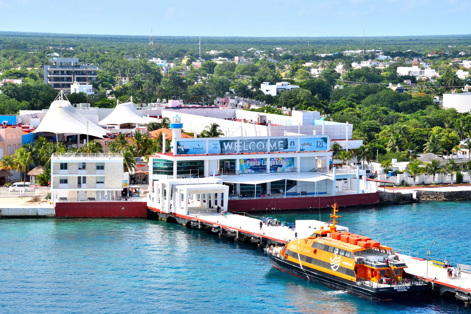

A dated snapshot gives the scale without pretending that traffic never changes. The municipality reported more than four million cruise-passenger arrivals and more than 1.7 million passenger-ferry movements during 2025. These are counts of movements, not a census of unique people, and they should not be used to infer exactly how crowded a future date will feel. They do show why ports, roads, water, waste systems, labour and public space cannot be separated from conservation.
Tourism employment reaches well beyond guides and dive boats. Drivers, dispatchers, cleaners, cooks, retail staff, maintenance crews, port workers, photographers and performers make the visitor system function. Some residents benefit more than others; some costs are carried collectively. A traveller cannot solve that distribution through one purchase, but can at least ask who operates an experience, whether local interpretation is credited, how staff are treated and what part of the fee supports the site or protected area.
The best reason to spend time in San Miguel is therefore not to hunt for a supposedly untouched quarter. It is to see Cozumel as a contemporary community. The Museo de la Isla, municipal cultural programming and the street grid can help connect archaeology, migration, navigation and tourism. Check the museum's exhibitions and hours when planning, and allow time in town beyond the transfer between pier and vehicle.
07 · Cozumel as one island system
The transversal road reveals the island's unequal exposure
Leaving San Miguel eastward, the transversal road crosses low interior terrain. The change can feel abrupt because the visitor economy is concentrated along the western shore and at selected attractions. Yet the forest is not vacant space between sellable stops. It covers thin soils over porous limestone, provides habitat and helps regulate water, heat and storm effects. Cut roads, tracks and cleared parcels alter that fabric even when the canopy still looks continuous from a moving vehicle.
At the east coast the sea has a different character. The west side lies in the island's lee under many common wind conditions; the east faces open Caribbean swell and persistent trade winds. That is why a beach that photographs beautifully may not be a safe swimming place on a given day. Flags, surf, lifeguard or local authority guidance and the abilities of the actual swimmer matter more than a route description. A route description cannot guarantee calm water, a fixed snorkel stop or a drivable sand track.
The coast road is also a lesson in asymmetry. Development, port works and intensive marine tourism cluster mainly on the west and south-west, where access and water conditions favour them. The east has different pressures: road-edge visitation, beach use, waste, erosion and storm exposure. “Undeveloped” does not mean unused or automatically protected. Nor should the apparent wildness be used to market risky driving as freedom from rules.
A self-drive day transfers responsibility from an operator to the traveller. The rental contract must match the driver; insurance exclusions, alcohol rules and vehicle condition require current confirmation; phone coverage and breakdown response should not be assumed; and every driver needs to remain sober. A branded Jeep adds no historical value by itself. The useful question is whether independent transport creates enough unhurried time to read the places, or merely turns the island into a faster photo circuit.
08 · Cozumel as one island system
Punta Sur joins archaeology, lagoon and navigation
Punta Sur is often sold as the scenic reward at the end of the loop. Its value lies in the way several systems converge. The southern landscape includes coastal dunes and scrub, mangroves, Colombia Lagoon, marine habitat, navigation infrastructure and archaeological fabric. It also includes managed visitor roads and facilities. The view is neither untouched wilderness nor a theme park; it is a protected cultural and ecological landscape under use.
El Caracol is a small Late Postclassic Maya building near the lagoon. INAH describes a miniature temple later enclosed on three sides by a larger construction. Above it sits a small square element with openings, topped by a shell-shaped finial decorated with natural shells embedded in stucco. That upper feature explains the modern name, “the snail.” The coastal position and openings have encouraged a popular story that it whistled as a hurricane alarm. INAH's El Caracol site record says this interpretation lacks concrete supporting evidence. It also finds no basis for assigning the building to Ix Chel.
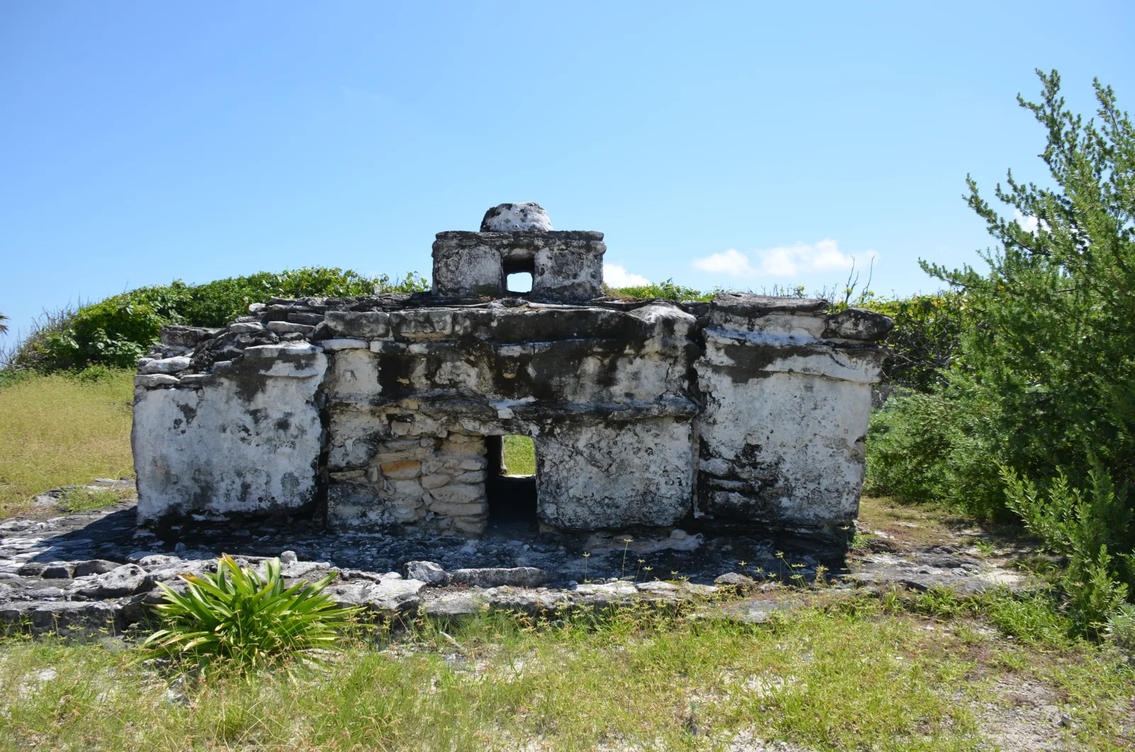

Those corrections do not make the structure uninteresting. A small building near a lagoon and coast raises strong questions about surveillance, ritual, route marking, weather knowledge and the movement of people and goods. Embedded shells demonstrate an intentional material relationship with the sea. What the evidence cannot yet support should remain a question rather than hardening into a clever tour anecdote.
The Celarain lighthouse belongs to a later navigation regime. A lighthouse makes reefs, shoals and shorelines legible to mariners through an engineered signal; it also embodies the expansion of formal maritime infrastructure. Seen together, El Caracol and the lighthouse do not prove an uninterrupted single-purpose line from Maya warning system to modern navigation. They show that different societies repeatedly had to understand the same exposed coast using different institutions and technologies.
Colombia Lagoon should not be reduced to a wildlife checklist. Crocodiles use the island's wetland habitats, but no sighting is guaranteed and close approach is not responsible. A lagoon visit is more useful when it reveals salinity, water exchange, mangrove edges, bird habitat and the separation between visitor movement and sensitive areas. Follow current park instructions on boats, platforms, distance and photography; the animals do not owe an appearance to the ticket.
10 · Cozumel as one island system
Mangrove, lagoon, seagrass and reef form one system

Mangroves slow water, trap sediment, build organic soils and create nursery and feeding habitat. Their roots dissipate some wave energy, although no mangrove belt makes a coast invulnerable to a major hurricane. Lagoons mix fresh and saline influences and can be connected to the sea through channels and porous ground. Seagrass beds stabilise sediment, store carbon and provide habitat. Coral reefs build complex three-dimensional surfaces that shelter organisms and alter wave energy.
These functions overlap without making the habitats interchangeable. A mangrove is not simply a baby reef, a lagoon is not a decorative pond and seagrass is not empty sand spoiled by plants. Each responds differently to turbidity, nutrients, physical disturbance, temperature, salinity and storms. Conservation that focuses only on charismatic coral while removing mangroves or degrading groundwater protects the photograph rather than the system.
The national park's 1998 management programme describes karst, mangrove species, coastal vegetation, seagrass communities and southern lagoons. Read it as a documented ecological and management baseline, with the park's present channels supplying current visitor rules. Its habitat descriptions explain why protecting a reef also requires attention to the shore and the water arriving from land.
The direction of influence is not always land to sea. Storm surge and saltwater move inland. Reef shape and condition affect wave behaviour. Marine species use multiple habitats over a life cycle. Boats connect ports, shallow grounds and dive sites through anchors, propellers, fuel and human movement. The system is best understood as circulation rather than a row of zones.
This also corrects the lazy phrase “nature untouched.” Cozumel's habitats have histories of use and protection. Fishers, land managers, researchers, tourism operators and residents possess different kinds of knowledge and different stakes. Conservation is a continuing negotiation over access, livelihoods, evidence and enforcement, not the discovery of a world without people.
11 · Cozumel as one island system
The reef is living infrastructure under stress
The reefs off Cozumel are part of the Mesoamerican Reef system. Currents through the channel, clear oceanic water and complex reef topography helped make the island internationally important for diving. That reputation can obscure variation: reefs differ in depth, exposure, coral community, traffic and condition, and visibility changes with weather and water movement. A single photograph cannot stand for the reef today.
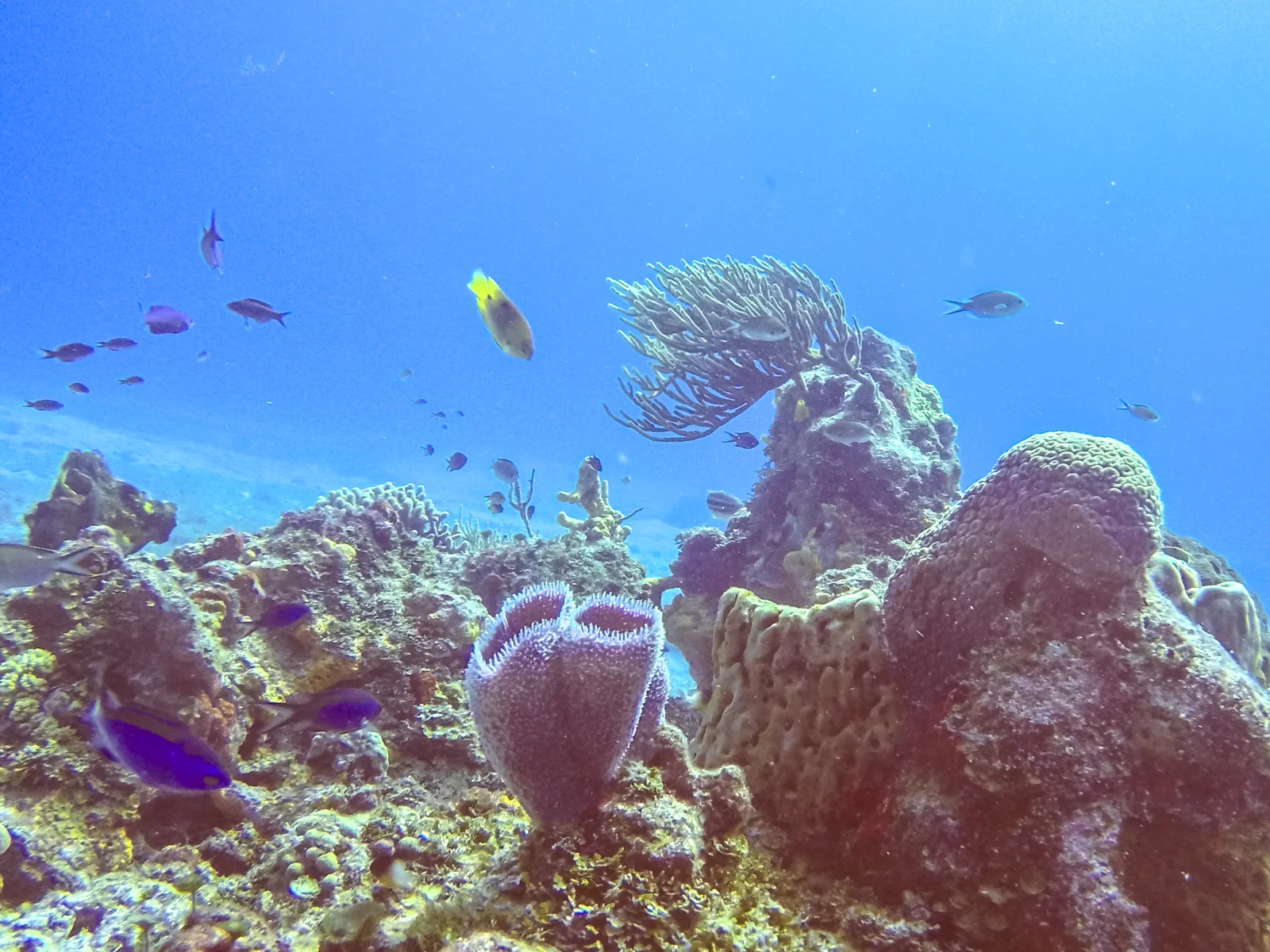

Arrecifes de Cozumel National Park was declared in 1996 and covers roughly 12,000 hectares along the southern and south-western marine zone. The park's official profile describes monitoring, public participation and vessel management as core work. Protection does not mean that all activity stops. It means activities need zones, permits, moorings, capacities, guides and enforcement appropriate to a shared protected area.
Coral reefs face interacting pressures. Heat stress can cause bleaching; disease can spread across susceptible species; hurricanes can break colonies and shift sediment; poor water quality can favour algae or pathogens; anchoring and contact cause local damage; and intensive vessel use adds cumulative pressure. A peer-reviewed study of stony coral tissue loss disease at Cozumel documented rapid spread and substantial mortality after the disease reached the island. That historical finding justifies monitoring, not a claim that every reef currently looks the same.
CONANP's monitoring programme uses physicochemical measurements and photographic transects. This is the difference between evidence and reassurance. Reef health cannot be inferred from turquoise water, a seller's adjective or the number of fish seen during one swim. Long-term measurements are needed to distinguish seasonal variation, disturbance and recovery.
For a snorkeller or diver, responsible behaviour is concrete. Use authorised operators and park access; accept site changes when conditions or management require them; never stand on, hold or chase living organisms; keep fins and equipment under control; use fixed moorings rather than expecting an anchor; and follow current park rules on sunscreens and products. As the US National Park Service's sun-protection guidance explains, UV-rated swim clothing helps protect skin while reducing the amount of sunscreen entering the water. A “reef-safe” label alone cannot guarantee a harmless product.
12 · Cozumel as one island system
Hurricanes are part of the landscape, not tour drama
The Caribbean cyclone season is a recurring environmental fact. Travellers should consult Mexico's meteorological and civil-protection authorities for the dates of their visit. The durable pattern is clear: a low limestone island with exposed coasts, shallow aquifer, ports and reef-dependent economy is vulnerable to wind, rain, storm surge, waves and prolonged service disruption.
Hurricanes Emily and Wilma both affected Cozumel in 2005. Cozumel's municipal risk atlas records their island context and impacts. A 2012 study of reef-associated habitats after Emily compared west-coast sites before and after the storm: sand cover increased, while seagrass and hard-coral cover decreased, with effects varying by depth and location. Those measured changes show why recovery cannot be reduced to one photograph or assumed to follow the same course everywhere.
Reefs, dunes, wetlands and vegetation can reduce some wave and erosion energy, but protection is conditional. It depends on storm track, bathymetry, habitat width and condition, coastal construction and many other factors. Human safety relies on forecasts, evacuation plans, building standards and competent public authority as well as ecosystems. A tour guide's confidence or a capable vehicle is not a substitute.
Storms also expose social dependence. If ferries stop, residents as well as visitors lose a link. If a cruise pier, airport, water network or power system is damaged, employment and essential services are affected together. Recovery resources are uneven. The most useful traveller response is not disaster voyeurism; it is to follow official instruction, avoid burdening emergency systems and make flexible, insured arrangements appropriate to the season.
In ordinary conditions, east-coast surf and rain still require respect. A brief tropical downpour can reduce visibility and make roads slick. Wind can change a boat plan. Heat and humidity can turn a packed itinerary into an endurance test. Leave enough time and flexibility to respond without rushing the journey back to the gateway.
13 · Cozumel as one island system
Tourism conservation claims need measurable questions
Cozumel's economy and conservation institutions are deeply entangled with visitors. Park fees, permits, guiding, research partnerships and public attention can support protection. The same volume of travel increases vessel movements, waste, freshwater demand, development pressure and the temptation to market fragile places beyond their capacity. “Ecotourism” describes an aspiration only when governance and practice give it content.
A useful evaluation begins with specific questions. Does a marine operator use authorised sites and moorings? How are group size and guide ratios set? What happens when weather or park management changes the route? Is wildlife approached or fed? How is wastewater handled at a beach facility? Does a road operator keep vehicles on permitted surfaces? Are protected-area fees explained and remitted? Are reef and lagoon claims linked to current monitoring rather than vague sustainability language?
Water-quality research makes the land-sea link measurable. A 2025 Coral Reef Alliance policy brief for the Mexican Caribbean synthesised monitoring that connected water-quality deterioration with seasonal and tourism-related patterns. It should not be used to diagnose a particular beach on a particular morning. It does show why sewage treatment and development decisions belong in the same conservation conversation as coral disease.
Cruise tourism creates a special timing problem. Thousands of people may seek transport, beach access and marine activities within a short call. Capacity is therefore not just an annual visitor total; it is a pulse through terminals, roads, boats and sites. An itinerary that appears spacious on paper may coincide with several ships. Check the port day, but do not treat a schedule as a guarantee: ship calls and berths change.
Independent travellers also create impacts. Renting a vehicle or booking directly does not make a visit low-impact by definition. The relevant measures are distance, surface, fuel, waste, water, behaviour, local economic distribution and compliance with protected-area rules. Good intentions do not cancel a tyre on vegetation or a fin on coral.
14 · Cozumel as one island system
A cultural attraction must identify performance as performance
The podcast route included Pueblo del Maíz, a private visitor attraction on the transversal road. Its own website describes a sensory journey using music, food, stories and Maya culture. The municipal tourism directory lists it as a visitor business. Those descriptions support one clear statement: it is a contemporary staged cultural experience, not an excavated ancient village and not direct evidence of how every Maya community lived.
That category is not an insult. Theatre, demonstration, dance and food can communicate knowledge powerfully. The ethical and factual questions concern authority and representation. Who developed the script? Which Maya scholars, speakers, cooks, artists or community organisations participate? Are different periods and regions distinguished? Are sacred or private practices withheld? Do visitors receive photography guidance? How are performers named, credited, employed and paid? Does revenue support cultural work beyond the attraction?
Look for named interpreters, credited sources and a clear account of what is demonstration, adaptation or historical reconstruction. A performance can be enjoyable and informative while remaining a present-day interpretation. Judge the explanation and the treatment of participants on their own terms; scenery and costume alone cannot establish archaeological accuracy or community authority.
The same care applies to food. Grinding maize, preparing cacao or showing a pib oven can open a discussion about labour, agriculture, trade and living cuisine. It cannot demonstrate that one recipe has remained unchanged for a thousand years. The milpa is a sophisticated and evolving agricultural system, not a prop; maize carries economic, social and sacred meanings that vary among Maya peoples and through time.
Photography deserves an explicit decision. The fact that a performance is sold to tourists does not make every person, ritual gesture or object available for unrestricted capture and publication. Ask before close portraits, ceremonies or food preparation. Follow a no-photo instruction without bargaining. Cultural respect is not measured by whether an image would improve a social feed.
15 · Cozumel as one island system
Choose a format by what you want to understand
A guided island loop can solve transfers and admissions and give first-time visitors an orientation. Its risk is compression: archaeology, ecology, performance, lunch and swimming become short modules while the guide's script carries more authority than the evidence. Ask for the actual sequence, time at each place, vehicle and group format, protected-area access and the operator responsible for each component. Treat every current inclusion as a live product fact.
A private guide can change pace and pursue a question in more depth, but “private” is a commercial format, not an expertise credential. For San Gervasio, ask about archaeological training and sources. For living Maya culture, ask about community relationship and language. For reef activity, require the appropriate marine permissions and safety competence. One person need not be expert in every domain; a strong itinerary uses the right interpreters.
Self-driving creates control over pace and enables an early archaeological visit or a longer stop in San Miguel. It also transfers navigation, insurance, parking, heat, road and sobriety responsibilities. Do not assume an open-top vehicle is comfortable or safer, and never treat minor roads, shore tracks or protected land as an invitation to improvise a route.
Boat-based days are best understood as a different story, not an add-on that completes the island. Marine access depends on conditions, authorisation, equipment, ability and park decisions. A boat cannot explain San Gervasio on the way to a reef; a road loop cannot promise the state of the sea. Separating days can preserve depth when time allows.
The strongest first visit may be deliberately incomplete: one cultural-historical sequence and one ecological sequence, each with time to think. Completion is not the number of stops photographed. It is whether the route answers the questions that brought you to the island without pretending that everything else was covered.
16 · Cozumel as one island system
Build a practical day around margins, not promises
- Identify the gateway. Confirm the exact ferry pier, cruise terminal or accommodation start. “Cozumel port” is not a sufficient meeting point.
- Set the hard return first. Cruise all-aboard time and ferry or flight connections need a generous margin that the seller acknowledges in writing.
- Choose the day's thesis. San Gervasio and island history, Punta Sur and linked habitats, or a marine day are coherent; forcing all three weakens each.
- Verify current authority. Use INAH for archaeological access, CONANP or the protected-area manager for marine and park rules, and official transport sources for crossings.
- Identify each provider. Confirm who supplies the vehicle, guide, meal, equipment and each ticket, and which admissions are included.
- Plan for bodies, not averages. Heat tolerance, shade, steps, uneven limestone, boat boarding, motion sensitivity, swimming competence and toilet access differ by person.
- Carry margin. Water, sun and rain protection, required medication, stable footwear and time for delays matter more than an extra photo stop.
- Let conditions change the route. A substituted site is acceptable when safety or conservation requires it, but the traveller should know who decides and what refund or alternative policy applies.
Accessibility must be site-specific. Archaeological paths can be uneven; a high lighthouse viewpoint may involve stairs; boats require transfer and balance; beaches vary in surface and facilities. “Suitable for everyone” and a broad age range are not access information. Ask for step counts, distances, resting shade, toilet type, wheelchair surface, vehicle step height, boat boarding method and whether a companion or staff member is expected to assist.
Families need the same precision. Child restraints, vehicle seating, life-jacket fit, heat, swimming supervision and attention span matter independently. Ask which activities are suitable and permitted for each child's age and abilities. Travellers with pregnancy, back conditions or other medical considerations should discuss the proposed activities with an appropriate clinician and the actual operator.
Food and alcohol should remain secondary to the route. Confirm allergies and cross-contact directly with the kitchen or operator. Anyone driving, swimming or boarding a vessel should avoid alcohol, and drinks should never be treated as part of cultural interpretation. Carry enough water even when a meal is advertised.
17 · Cozumel as one island system
Listen to the Cozumel field notes
The 17-minute episode follows the idea of an island road day linking Maya heritage, coastal scenery and Punta Sur. Hear the Cozumel field notes or read the episode transcript, then use the route choices above to give archaeology, town life and linked habitats the time each deserves.
18 · Cozumel as one island system
Leave with the systems still connected
Cozumel does not need a single definitive label. It is a Maya island with archaeological and living histories. It is a town rebuilt through migration and connected daily to the mainland. It is a port economy and an international diving destination. It is a limestone aquifer, forest, wetland, lagoon, seagrass and reef system. It is exposed to hurricanes and shaped by conservation institutions. All of those statements can be true without one becoming scenery for another.
The traveller's job is not to solve the island in a day. It is to recognise the boundaries of evidence and the consequences of movement. Read San Gervasio as a settlement, not a goddess slogan. Treat a performance as contemporary interpretation, not archaeology. See the port as part of San Miguel, not a door floating outside community life. Follow water from rain through stone to mangrove and reef. Leave enough margin for the island's conditions and rules to overrule the itinerary.
For regional context, continue to Tulum and Cobá for a mainland comparison of coastal power, inland roads and groundwater, or to Tikal for a very different Maya city and forest conservation landscape. The links enlarge the map; they do not collapse distinct periods, polities, peoples or environments into one “Maya world” product.
That is what it means to travel beyond the port. The destination is not a longer stop list. It is a more accurate relationship among place, people and the systems that make a visit possible.