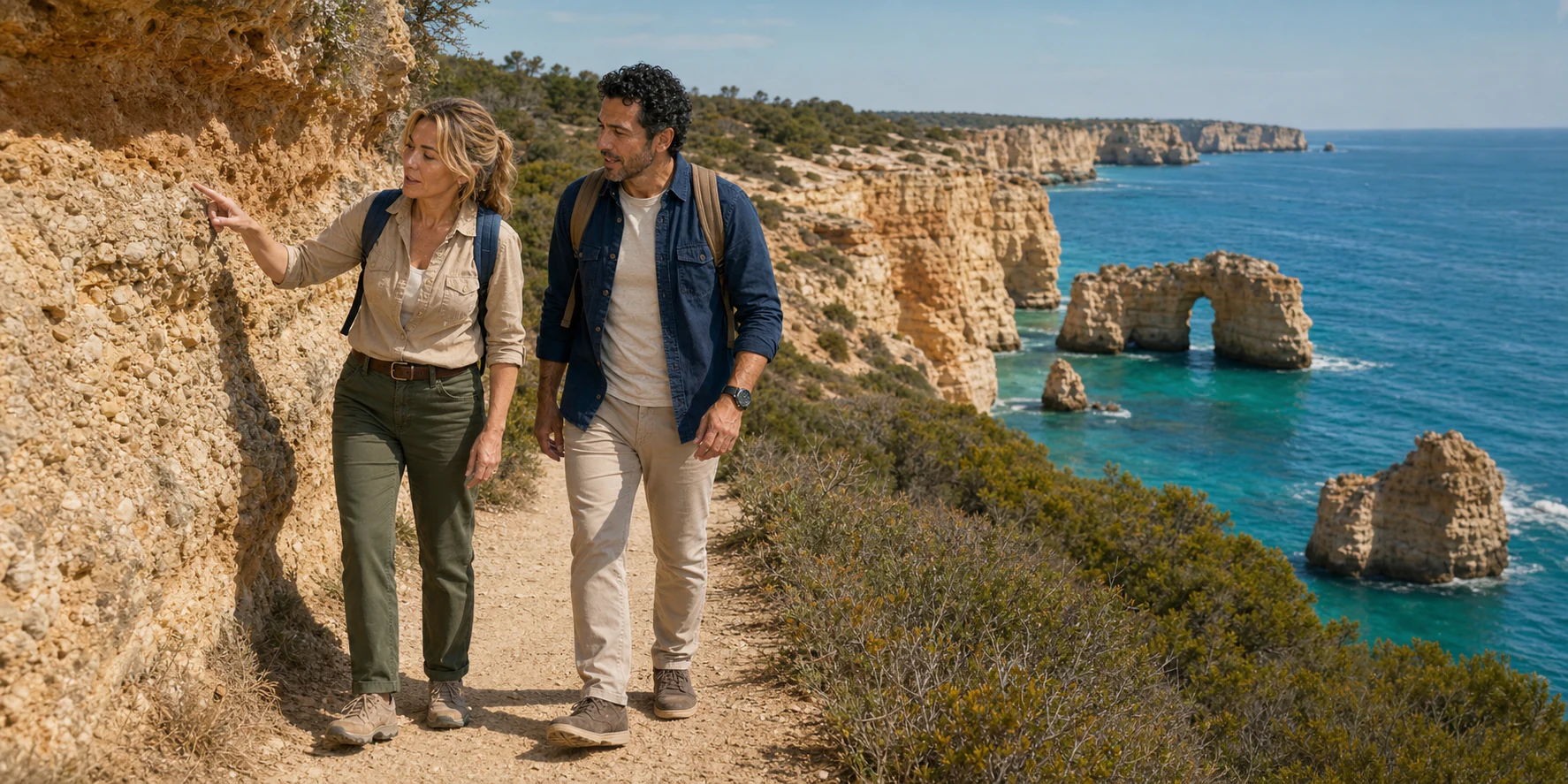
The most revealing view of Benagil is not necessarily the one that fills a phone screen. Stand on land near the circular opening in the cave roof and the famous chamber becomes an absence: a hole through a limestone ceiling, a beach you must not descend to, two sea entrances partly concealed below. The missing rock is the subject. It explains why the Algarve has arches and stacks, why the official path keeps bending inland around ravines, why a beach can be inviting and hazardous at the same time, and why access to the cave is now managed rather than improvised.
That is the better way to understand the central Algarve coast. It is not a line of permanent ochre scenery assembled for photographs. It is a working margin between land and Atlantic water. Some of its rocks began as sediment and the remains of organisms on an Early-to-Middle Miocene shelf. Later fractures, dissolution, waves, groundwater and gravity produced a deeply indented edge. The visible sequence—cliff, notch, cave, arch, isolated stack, fallen block—is not a tidy conveyor belt, yet every form records an argument between rock strength and exposure.
The Seven Hanging Valleys path gives that argument a human scale. It links Praia de Vale Centeanes and Praia da Marinha across 5.7 kilometres, according to the Municipality of Lagoa. Walk it out and back and the distance roughly doubles; walk only the Marinha–Benagil portion and you receive a concentrated chapter, not the complete route. A day that also starts in Faro, pauses at a beach and reaches Algar Seco cannot be judged from a list of names alone. The real questions are which segment is walked, where the vehicle meets it, how exposed the path is, what the sea is doing, and whether the traveller wants the coast from above, from water level or both.
A good coastal day leaves room for different scales of attention: the broad line of a cliff, a fossil within a bed, the crossing of a dry valley and the small window of rock at Algar Seco. Start with the actual walking segment, then decide whether beach stairs or a separate sea visit add something you want. A shorter route with time to read the landscape can reveal more than a hurried circuit of every famous name.

01 · Algarve coast
Faro is the gateway, not the trailhead
Faro and Benagil belong to the same Algarve, but they occupy different coastal worlds. Faro faces the Ria Formosa lagoon system and functions as the region’s air, rail and administrative gateway. The cliff route lies west in Lagoa municipality, beyond the flatter coast and the urban corridor served by the A22 and EN125. The official airport transport guide explains the bus connection from the airport to the city and onward rail, coach and road links. None of that turns Faro marina into a natural continuation of the Seven Hanging Valleys path.
This distinction matters because a Faro-origin day has two itineraries. The first is the transport chain: accommodation or airport to meeting point, transfer west, trail drop-off, later pickups and return. The second is the landscape chain: a chosen path section, viewpoints, beach access and perhaps Algar Seco. A seven-hour headline includes both. Every extra stop or beach pause reduces the walking time available, while summer traffic, parking controls and a delayed rendezvous can reshape the sequence.
Travellers planning independently should resist the fantasy that a single regional bus or train deposits them at every cliff. Public transport can carry a visitor toward Lagoa, Carvoeiro or other hubs, but the last kilometres, changing timetables and the linear trail’s two different ends require current route planning. A taxi, transfer or two-vehicle arrangement may solve that discontinuity. A one-way walk with a confirmed pickup avoids retracing the whole path; a return walk avoids a transport handoff but makes the route roughly 11.4 kilometres before beach stairs or detours are counted.
Faro itself should not be reduced to a car park. Jardim Manuel Bivar, beside the marina and Ria Formosa, is a legible meeting district, and the historic centre can support a separate city day. The coastal hike answers a different question. It crosses the limestone Barlavento, the western/south-central Algarve of cliffs and pocket beaches, rather than the lagoon islands visible from Faro. Seeing that geographic change through a vehicle window is not filler: it explains why a traveller can begin beside tidal wetlands and arrive at a high, rock-bound shore.
The guided-format advantage, when the operator is competent, is therefore not magical access. It is coordinated discontinuity. Someone aligns the Faro departure, the linear walk and the pickup. That has value for visitors who do not want to manage several transfers, but it does not prove a particular trail length, vehicle, stop duration or safety protocol. Ask for those details before paying rather than inferring them from the destination names.
02 · Algarve coast
The cliffs began as a shelf, not a wall
The yellow and pinkish rock between Lagos and Olhos de Água belongs largely to the Lagos–Portimão Formation, deposited during the Early and Middle Miocene. A peer-reviewed synthesis of Algarve geological heritage describes biocalcarenites rich in molluscs, bryozoans, echinoids and other marine remains, with different facies representing parts of a cool-water carbonate shelf. The popular phrase “ancient ocean floor” is directionally useful, but it can conceal the important detail: this was not one homogeneous slab.
Beds formed in different water depths and energy conditions. Some are coarse concentrations of skeletal grains; others contain more siliciclastic sand or finer material. Cementation varies. Discontinuities separate episodes of deposition. Later joints, faults, karst openings and surface deposits cut across that layered inheritance. The cliff face is therefore a stack of materials with different strengths, drainage paths and responses to salt, rain, waves and gravity.
That complexity corrects two common simplifications. First, the coast did not rise because one dramatic tectonic push lifted an intact seabed directly into today’s cliff. Regional deformation, changes in sea level, erosion and long intervals missing from the rock record all contributed. Second, weak carbonic acid in rainwater is only one agent. Water follows cracks and dissolves carbonate, but waves undercut the foot of the cliff, spray and salt exploit pores, roots enter fractures, runoff cuts gullies and the weight of an unsupported block eventually matters.
The geological review describes strata with different strength and permeability, groundwater held above more clay-rich layers, karst openings and marine undercutting. That is why two adjoining sections can weather differently. A harder bed may project while a weaker layer recedes. A cave can enlarge beneath apparently solid ground. A sinkhole can connect the surface to an unseen cavity. The geometry, not the colour, reveals the risk.
Fossils help the reader reconstruct the shelf, but they are evidence rather than souvenirs. Shell fragments embedded in calcarenite do not prove that every visible mark is an identifiable species, and a guide’s label is not a palaeontological determination. Look closely where the path and signage permit; photograph rather than pry; do not climb an exposure or lean into a cut face to touch it. The most respectful tactile lesson is often supplied by loose path gravel underfoot, while the scientific record remains in place.

03 · Algarve coast
Why the valleys hang above the Atlantic
The trail’s name describes a mismatch in elevation. A normal stream valley continues toward its receiving water. Along this retreating coast, several small drainage lines end above the present sea because cliff recession outpaced the valley’s ability to cut down to the new edge. The Municipality of Lagoa’s planning study identifies about nineteen such forms in the municipality, while the formal route carries the memorable name Seven Hanging Valleys. “Seven” is the trail identity, not a promise that a walker will tick off seven identical notches.
On the ground, each crossing changes the rhythm. The path approaches the cliff line, turns inland around the head of a dry ravine, drops or rises over an uneven surface, then returns to a viewpoint. Short distance on a map can accumulate effort through repetition. The shade that appears within a valley may disappear on the next headland. A sea breeze can cool one exposed section and destabilise balance on another. These changes are more useful than a single difficulty label.
The valleys also interrupt sightlines. Benagil may look near from one promontory but require an inland loop. A beach below does not imply a direct descent. Some coves have formal stairs; others are separated from the path by unstable faces or private/managed access. Cutting across scrub to shorten a bend damages vegetation and may move a walker toward an algar whose opening is difficult to see until close.
The cliff-top vegetation is not empty rough ground. Lagoa highlights relic juniper scrub, seabirds using the walls and bats using karst caves. Low plants survive thin soils, salt, wind and summer drought. Their root systems and ground cover are part of the living surface, though no vegetation can be treated as a safety barrier. Staying on the established line protects habitat and makes rescues and wayfinding more predictable.
For the traveller, a hanging valley is therefore three things at once: geological evidence of coastal retreat; an ecological corridor; and a practical unit of effort. Count time in crossings, not only kilometres. A 5.7-kilometre linear route on exposed, broken ground is not equivalent to a level urban walk of the same length, while a shorter Marinha–Benagil section can still provide a coherent lesson if the full route is neither promised nor pretended.

04 · Algarve coast
Read the formal path before improvising a route
PR1 LGA is a linear municipal nature trail between Praia da Marinha and Praia de Vale Centeanes. Official material describes it as 5.7 kilometres, signposted and equipped with information/rest points. Older regional nature guidance gives approximately ten kilometres for the return journey; the difference is a reminder to distinguish a route description from a GPS trace, access detours and the distance recorded by a particular device.
The headline landmarks do not all sit on one simple chain. Praia da Marinha and Benagil lie on the eastern part of the formal route. Farol de Alfanzina and Vale Centeanes lie farther west. Algar Seco and Boneca are closer to Carvoeiro, beyond the formal western endpoint, reached through a separate coastal access system. A tour advertising Marinha, Benagil, Seven Hanging Valleys and Algar Seco almost certainly combines walking with vehicle transfers or selected segments. Ask for the actual trace.
Direction changes the experience. Starting at Marinha gives immediate access to high-value geology and reaches Benagil relatively early, but a full westbound walk still ends away from the starting vehicle. Starting at Vale Centeanes postpones Marinha and can place the most photographed landscape near the finish. Neither direction guarantees fewer people, cooler weather or a better view. Departure time, season, wind, cloud, group pace and parking management matter more than a universal rule.
The trail surface includes compact earth, loose stone, eroded steps and constructed timber elements. It repeatedly approaches exposed terrain. Railings and fences mark selected hazards; their absence is not an invitation to the lip. The Portuguese Environment Agency’s cliff-risk guidance defines a risk band at the base of a cliff as 1.5 times its height because debris can travel beyond the vertical face. On top, signed setbacks around crests and algares should be treated as minimum boundaries, not photography suggestions.
Weather is part of route selection. Rain can make carbonate dust and polished stone slippery. Strong wind affects exposed headlands. Hot, still air increases water demand. Check the municipal trail information, IPMA forecast and civil-protection guidance close to departure, then choose a segment with a realistic return. A clear sea view does not establish suitable walking conditions.
Carry enough water for the route and a delay, sun protection, food that works for the walker and shoes with grip. An included bottle or snack does not define adequate preparation. Plan toilets before the path, identify formal beach facilities, download a map without assuming signal, and set a turnaround time that protects the return connection. The guide can reduce decision load; the coast still sets the conditions.
Carvalho: a valley, a tunnel and another climb
Between Benagil and Alfanzina, Praia do Carvalho gives the route another change of scale. A small cove sits below high limestone walls, approached through a hand-cut tunnel rather than by a straight descent from every clifftop position. EuroVelo Portugal’s place account notes marine fossils in that passage. The access itself lets a visitor read the material of the coast at close range, but narrow steps and the return climb are additional effort, not a shortcut through the trail.
Look inland as well as out to sea. Carvalho’s valley shelters juniper, mastic and dwarf palms; its wetter lower ground and the salt-exposed rock support different plant communities. The contrast explains why the route’s ravines matter beyond the photographs. A sheltered patch is not the same habitat as a dry headland. Keep to the marked line rather than spreading into the scrub to find a private viewpoint.
A westbound walker encounters Carvalho before Alfanzina; in the other direction it follows the lighthouse. Decide whether to descend before using the beach as a rendezvous or rest stop. A clifftop arrival, tunnel passage, sand-level pause and climb back up are four movements. Someone who remains on the formal path can still understand the valley without adding all four.
Alfanzina: a working signal above the reef
The white lighthouse and red lantern at Alfanzina add a human time scale to the geological one. The National Maritime Authority’s lighthouse history traces the proposal to the national lighting plan of 1883, the site decision to 1913 and the opening to 1 December 1920. Its first light used incandescent petroleum illumination and a clockwork system. This was a working aid to navigation, built for vessels negotiating a rock-bound coast, rather than a scenic ornament for the path.
The changes came in stages. Generators electrified the light in 1950; a road reached the station in 1961; the electricity grid arrived in 1980 and automation followed in 1981. The authority also records an extra residence built in 1952 because two lighthouse-keeper families had shared one house. Those details make the headland a place of work and domestic life, not just an isolated tower. Walking past does not guarantee entry to the working compound.
Alfanzina also marks the western boundary used in the marine park’s coastal description. From the path, the same headland therefore joins navigation, protected water and the route toward Vale Centeanes. Pause where the marked trail allows: the useful view is the relationship between tower, cliff and sea, with the lighthouse understood as part of an inhabited coastal system.

05 · Algarve coast
Benagil’s opening is a viewpoint and a warning
Algar de Benagil is often described by its ceiling opening, but the Portuguese word algar carries the more useful idea: a vertical karst opening or shaft. From above, the circular void reveals that the cave is connected to the land surface. From the sea, two openings lead into a domed chamber. The internal sand is not an ordinary public beach, even though photographs once made it look like one.
The cave’s architecture is the combined result of geological inheritance and ongoing erosion. Bedding and fractures set possible pathways. Dissolution enlarges voids. Wave energy enters at the cliff foot. Roof span and thickness change as material is removed. Rockfall does not need a dramatic storm or visible crack on the day a visitor arrives; gravity works on a structure already prepared by other processes.
The safe land view therefore requires restraint. Do not stand on the rim, cross a barrier, fly a drone into a crowd without the necessary authority, or treat the opening as a place to drop objects. A top-down photograph cannot show the entire chamber, and that is not a failure. It shows the connection between surface drainage and marine erosion more clearly than an interior image can.
The viewpoint also corrects the idea that “seeing Benagil” has one definition. A walker reads plan geometry: cliff line, roof opening, vegetation, the relation to adjacent valleys and the impossibility of a legal descent. A kayaker or boat passenger reads volume, reflected light and water-level entrances. Neither perspective cancels the other. The question is which evidence and bodily experience the traveller values, and whether the sea conditions and regulated operator make the second perspective available.
Land access does not make the cave risk-free, nor does maritime regulation make every authorised trip appropriate for every person. The clifftop adds exposure, loose ground and heat. The sea adds boarding, motion, cold water, collision and rockfall zones. A thoughtful comparison names those different chains instead of declaring the land “superior” or dismissing boats as congestion.
06 · Algarve coast
Sea access is a managed visit, not a swim to a secret beach
The current maritime rules are unusually specific because the old free-for-all produced incompatible uses in a small, rockfall-prone space. The National Maritime Authority’s 2024 Benagil notice prohibited landing on or using the internal sand, swimming into the caves, using flotation aids to enter and hiring unguided kayaks in the regulated area. A 2025 amendment refined circulation, protective equipment, group sizes and visit duration.
The amended system separates powered craft from non-motorised platforms and assigns different entrances. Powered visits are limited to five craft simultaneously and two minutes inside. Guided non-motorised platforms operate in groups of six plus a guide, with no more than fourteen platforms simultaneously inside and a visit of no more than eight minutes. Lifejackets are required; helmets are required near designated rockfall-risk bands. The master or guide must still assess conditions and abort when necessary.
These rules make three reader decisions straightforward. First, do not plan to swim from Praia de Benagil to the cave, however close it appears. Distance is not the only risk: vessel traffic, sea state, cold, rockfall and the law all matter. Second, do not expect to land for the famous internal-beach photograph. Third, choose an authorised format whose protective equipment, guide qualification, communications and boarding arrangements match the current edital.
Time limits also change the comparison. A powered visit is designed for circulation, not lingering. A guided paddle visit may allow a longer interior reading, but requires a different water-entry and balance capacity. Both remain conditional on weather and authority. A land day offers duration and regional context; it cannot reproduce the view from inside. The honest choice is not postcard versus authenticity. It is viewpoint, time, motion, regulation and access.

07 · Algarve coast
Praia da Marinha is a beach below a cliff system
Praia da Marinha earns its visual fame honestly. Headlands frame a small sandy bay; an offshore double arch and stacks show the same erosion discussed on the trail; clear water can reveal submerged rock when conditions align. Yet the beach is not a fixed reward at the end of a hike. Tide, wave direction, seasonal sand, water quality, lifeguard coverage and crowding change the usable space.
The Portuguese Environment Agency treats Marinha–Albandeira as a monitored bathing water and publishes current-season information through InfoÁgua. The latest published water result, flags and lifeguard instructions should decide whether to swim. A blue-looking surface in a photograph does not establish water quality or safe conditions, and a calm morning does not guarantee a calm return.
Cliff safety continues at sand level. The attractive shade at the base of a wall may sit inside a rockfall band. The Environment Agency maps crest, foot, ravine and endokarst safeguards around Marinha; the National Maritime Authority advises visitors not to remain beneath or close to unstable cliffs. Choose an open position outside signed risk areas even if it is less shaded. Never use a recent fall scar as a souvenir shelf or a route into a small cave.
Beach access adds stairs and gradient after the cliff walk. A person who has managed the path comfortably may find the descent, hot return climb and time pressure harder than the swim. Conversely, a traveller who does not want the trail may enjoy the upper viewpoint without descending. Keep those as separate decisions.
The Environment Agency publishes each season’s recognised accessible beaches and their facilities. Do not assume that a famous cove has step-free access: at Marinha and Benagil, beach stairs and uneven coastal ground need separate assessment. Carvoeiro is another coastal base to investigate through the current services list. Confirm parking bay, surface, gradient, toilets, beach equipment and assistance for the exact date, and choose the complete chain that works for you.
Swimming is never the automatic climax of a land tour. Some people will prefer to rest, eat, study the arch or remain at the upper viewpoint. Children need direct supervision. Cold shock, rip currents and breaking waves do not care that the walk was hot. The bathing guidance is deliberately plain: use guarded beaches, respect flags and lifeguards, stay clear of unstable cliffs, hydrate and avoid peak solar exposure.

08 · Algarve coast
Algar Seco brings the coast close—but not under control
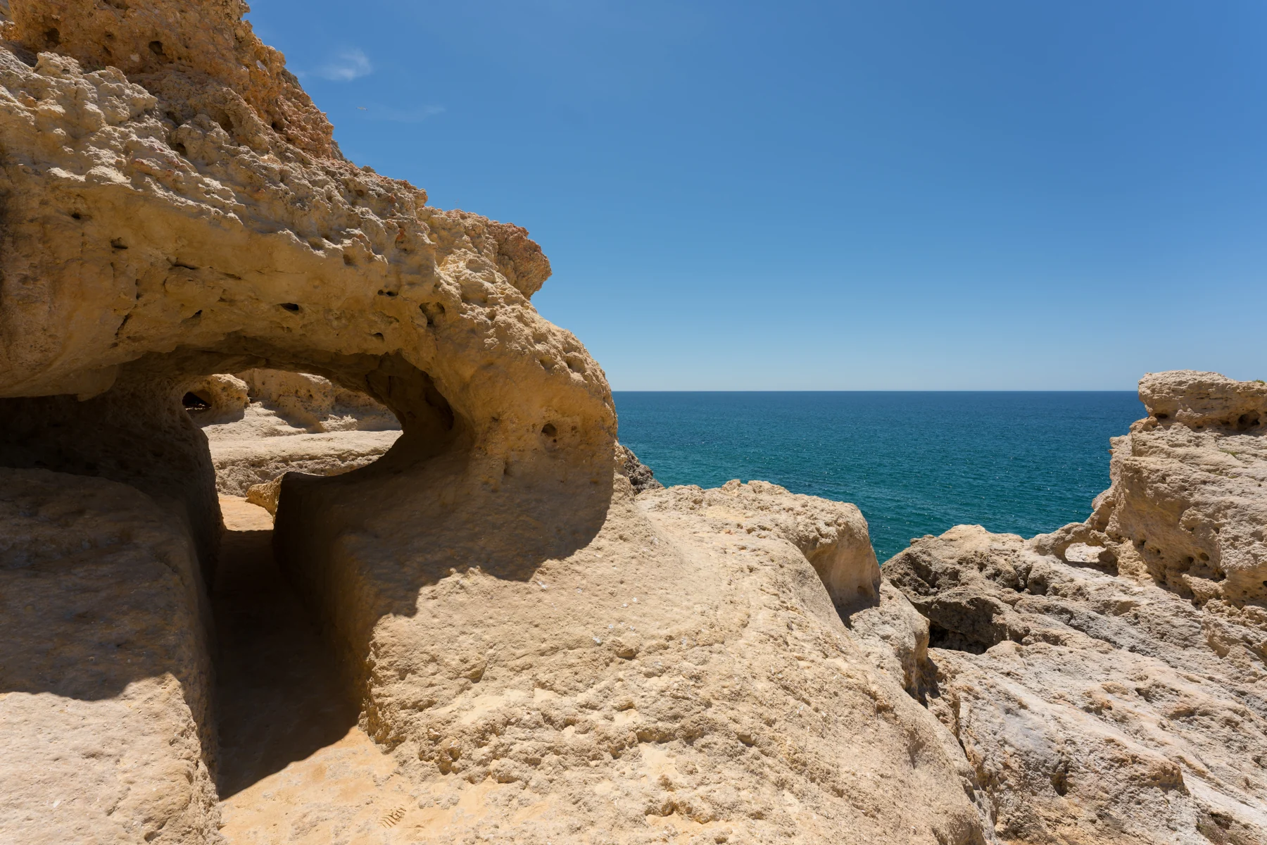
Algar Seco, on the eastern side of Carvoeiro, compresses the coast into passages, terraces, openings and views near sea level. Boneca is the best-known window: a narrow rock passage leading to two openings that frame the Atlantic. The municipal account of Algar Seco describes a limestone labyrinth shaped by rain and sea, where vertical karst cavities widened and joined. Its roughly 600-metre boardwalk gives a distinct coastal approach; it does not extend the formal Seven Hanging Valleys trail.
Here bedding, cemented grains, cavities and weathered surfaces sit within arm’s reach. The forms feel intimate after the broad PR1 headlands. That intimacy can create false confidence. A constructed boardwalk or stair does not stabilise every adjacent ledge; a dry platform at one tide may receive spray at another; a narrow passage creates two-way friction when people stop for photographs.
Treat Boneca as a small shared space. Wait for room, do not climb through an opening, keep children close and let the viewpoint go when wind or crowding makes it awkward. The image is optional. The geological lesson—selective erosion enlarging openings along weaker material—exists throughout Algar Seco.
Algar Seco is also separate from the Seven Hanging Valleys route. It can complement the walk because it changes scale from aerial to close reading, but a vehicle or an additional coastal link is normally involved. This is another reason to obtain a real itinerary rather than accepting “Seven Valleys plus Algar Seco” as one continuous hike.
Carvoeiro offers a practical contrast. It is an inhabited town and managed bathing place, not a geological prop. Restaurants, homes, local fishing memory, visitor services and coastal infrastructure meet at the cove. A day that uses Carvoeiro only as a pickup point misses how tourism lives with the landscape: through access works, seasonal labour, cleaning, rescue, waste, parking and the demand for views from fragile ground.

09 · Algarve coast
The sea below is a protected living landscape
The view from the cliff naturally privileges rock. Below it lies the Parque Natural Marinho do Recife do Algarve – Pedra do Valado, classified in January 2024. The founding resolution defines roughly 156 square kilometres between Alfanzina lighthouse and Albufeira marina, extending to about the 50-metre depth contour.
The protected area exists because the reef is ecologically exceptional and heavily used. The founding resolution recorded 889 fauna and flora species there, out of 1,294 reported for the Algarve coast, including invertebrates, fish and algae. That is a baseline inventory, not a permanent ceiling: CCMAR researchers subsequently reported more than a thousand species. Seahorses and dusky grouper are among the conservation concerns. A submerged ridge between roughly 13 and 25 metres records an older shoreline. The coast’s history is therefore not confined to the rock above water.
Protection was built through a community process involving scientists, municipalities, fishers, tourism businesses and civil society. That origin matters. Small-scale fishing is not simply “pressure” to remove, and maritime tourism is not automatically conservation because it uses a kayak. Fuel, noise, anchoring, wildlife disturbance, crowding, waste, site concentration and compliance determine impact. Land walking likewise erodes paths and vegetation when visitors spread beyond the formal line.
The responsible traveller does not need to perform conservation. Stay on route, carry waste out, avoid feeding wildlife, keep sound and drones within rules, and choose licensed maritime activity that follows zoning and equipment requirements. Do not treat a clear-water view as an ecological diagnosis. Visibility changes with light, particles and sea state; it does not reveal the status of a reef community.
The park also gives Benagil’s regulation a wider meaning. Limits inside one cave protect people from collision and rockfall, but they also help manage a destination embedded in a living marine area. The two goals are not opposites. A safer circulation pattern can reduce chaotic concentration, while effective conservation still requires monitoring beyond the cave entrance.

10 · Algarve coast
Tourism pressure is a systems problem
Benagil’s popularity is visible in queues and parked cars, but those are symptoms rather than the whole story. The 2024 maritime edital described an exponential increase in tourism, recreational navigation and bathing use, concentrated around small beaches and a busy water column. On land, Lagoa has installed stairs, walkways, guards and improved access in part to direct movement and relieve pressure on informal traces.
The management challenge is to distribute access without pretending that infrastructure can freeze the coast. A larger parking area may reduce illegal roadside stopping but attract more vehicles. A photogenic boardwalk protects vegetation only if people remain on it. A guided group reduces individual navigation decisions yet still occupies path width and transport capacity. A boat concentrates visitors in the cave for a short time; a walker remains longer across a larger surface.
This makes moral rankings unhelpful. Self-drive is not inherently selfish, boats are not inherently destructive and small groups are not inherently sustainable. Ask measurable questions: Is the vehicle full or running for one party? Does the operator hold current authorisation? Does a route use formal paths? Are waste, water and toilet needs planned? Does the format respect cave limits and abort conditions? Does it move pressure to another unprepared cove?
Residents experience the destination beyond the viewpoint. Road access serves homes, fishing and emergency services. Seasonal work supports tourism but can be insecure. Public cleaning continues year-round and intensifies during the long high-use season. Water demand, litter and path repair enter municipal budgets. A visitor who arrives informed is not solving those structural issues, but is less likely to add avoidable friction.
Time is another pressure tool. Travelling outside the busiest period may reduce heat and concentration, but winter brings shorter days, rain, wind and unguarded beaches. An early start can be pleasant, yet there is no guaranteed “crowd-beating” hour. The more durable strategy is flexible sequencing: choose a less congested formal viewpoint, keep an alternative walk, and let current conditions determine whether the beach or sea component happens.
11 · Algarve coast
Heat, wind and water decide the day before enthusiasm does
The exposed route offers little reliable shade. Summer sun, reflected light from pale rock and sustained walking increase heat load. A token “survival kit” is not the solution. Use an individual plan: sufficient water, sun-protective clothing, suitable food, rest, medication needs and a willingness to shorten the route.
Check the IPMA forecast for Lagoa, not only Faro. Regional weather can differ along the drive, and a coastal breeze can disguise how much water a walker is losing. Plan an earlier or shorter walk when heat would make the full route uncomfortable, and leave enough time for rest and the return climb. Current official weather and access information belongs in the departure decision; the itinerary should have room to change.
Wind deserves separate attention. It can reduce thermal comfort and increase trip risk near an exposed edge. A hat, loose item or phone is not worth a sudden reach. Rain changes grip. Marine conditions influence swimming and authorised cave visits, but a calm trail does not prove a calm cave entrance; the master or lifeguard decides operational safety.
Cliff jumping should not be part of a coastal walking plan. Portugal’s bathing guidance says never jump into water except at supervised places specifically built for it. A ledge above a cove is not such a facility. Neither a confident guide nor a calm surface establishes depth, submerged hazards or a safe exit. Keep a beach stop to activities compatible with the flags, lifeguard instructions and your own capacity. Watching the sea, resting or remaining at the upper viewpoint are complete choices.
An emergency plan begins with restraint. Keep location services available, know the European emergency number 112, identify formal access points and do not enter the water to rescue someone without training. On a linear trail, the nearest road may be behind or inland rather than at the next beach. A guide’s communication equipment and first-aid competence are material questions, not personality extras.
12 · Algarve coast
Accessibility is a chain of different coastlines
“Moderate fitness” tells little about access. A traveller needs to know where the chain breaks: curb height at the Faro meeting point; van step and seat transfer; restraint; space for a folding chair; toilet timing; trail width; loose surface; gradient; unguarded edge; stairs to sand; sound and heat; return pickup. One favourable link does not repair another.
The full PR1 trail is an exposed natural path, not a step-free promenade. Some visitors who use a mobility aid may still enjoy formal upper viewpoints reached by vehicle; others may prefer the accessible Faro city route or Carvoeiro’s current accessible-beach services. The correct question is not “Is Benagil accessible?” It is “Which viewpoint, surface and support can this person use today?”
Separate participation from proximity. Remaining in a vehicle while others hike is not an equivalent coastal experience. A clifftop viewpoint may provide real orientation without beach descent. A boat may remove walking distance but add gangway, balance, seating, motion, noise and emergency-transfer barriers. A beach-only plan may still involve stairs and unstable sand. Provide details early enough for the traveller to choose, not as a disclaimer after purchase.
Sensory and cognitive access also matter. Exposed height, crowd compression, a loud vehicle, forced group participation or a tight cave can change the day. Ask for a clear account of noise, space, assistance and alternatives. Singing, photographs and swimming should be optional, and a competent guide should accept a boundary without turning it into entertainment. Being able to say no is part of participating comfortably.
Before paying for any guided Faro departure, ask for the legal operator name, assigned vehicle and restraints, mobility-device storage, actual trail trace, cliff-activity protocol and assistance chain. A vague “moderate fitness” label cannot answer those questions. If a promised stop cannot be reached, ask what the complete alternative experience is—not where somebody will wait while the rest of the group continues.

13 · Algarve coast
Choose the format by the question you want the coast to answer
A guided land day from Faro suits a visitor who values coordinated transport, a selected geological walk and several land viewpoints more than full-route independence. It is strongest when the operator states the exact segment and support. It is weaker for someone who wants long, self-paced observation, a guaranteed cave interior or a fully documented step-free chain.
An independent full PR1 walk suits experienced walkers who can manage a linear route, weather and transfers. It gives the hanging valleys time to accumulate into an argument rather than a montage. Start from either official endpoint, carry the necessary supplies and avoid adding beach descents merely to maximise the checklist.
A shorter Marinha–Benagil section preserves the essential geological contrast with less distance. It still includes exposed ground and cliff risk, but it can leave time for careful observation. A viewpoint-only plan can be a serious visit for a traveller with limited mobility, heat tolerance or time, provided parking and surfaces are checked.
A beach day answers a different question: how sand, cliff shade, water, stairs and lifeguard systems shape use at the base of the coast. Praia da Marinha is not automatically the best choice for access. Carvoeiro or another monitored beach may provide a stronger current services chain.
A lawful guided sea visit supplies the interior scale that land cannot. Choose powered craft for a brief, movement-focused view; consider a guided non-motor platform only when balance, water confidence, equipment and the operator’s current authorisation align. Do not expect to land. Do not swim in. Accept cancellation or an aborted visit as evidence that the system is working.
The richest itinerary may combine perspectives on different days: a measured land walk, then a regulated sea visit if conditions permit. That removes the pressure to make one seven-hour excursion perform every role. It also gives Faro, Carvoeiro and Lagoa room to exist as places rather than transfer points.

14 · Algarve coast
Listen: the field notes behind the questions
The 13-minute episode begins with the practical appeal of a coordinated departure from Faro and asks what a land visit can reveal about Benagil. Hear it alongside the route: the roof viewpoint and the chamber seen from water answer different questions, while each hanging valley changes the effort of the walk.
Use the discussion to identify your own priorities before choosing a format. Do you want a complete linear hike or a shorter geological section? Does a beach descent suit your energy and access needs? Would a separate, regulated sea visit add the interior perspective you value? The map, weather and exact itinerary make those choices concrete.
A satisfying coastal day can include no swim, no cave entry and no full-distance hike. There is still a landscape to understand: marine sediment turned into cliff, valleys left above the water and a community learning to manage access to changing rock.
15 · Algarve coast
Leave with the missing rock
Benagil’s most famous feature is a hole, and that is why it can teach more than a solid monument. The opening reveals processes that normally remain hidden: groundwater entering fractured carbonate, waves attacking a cliff foot, roof span changing, gravity finishing work whose beginning cannot be seen.
The Seven Hanging Valleys extend that lesson across kilometres. Ravines stop above the sea because the land edge retreated. Arches preserve a temporary bridge. Stacks mark separation, not permanence. Pocket beaches collect sand beneath walls that continue to shed material. Paths, stairs, helmets, lifeguards, cave time limits and protected-area boundaries are human responses to a coast that cannot be made still.
Walk far enough to understand the system, not to win a distance. View the cave from above without leaning into it. Enter by sea only through the current rules. Swim only when the monitored beach and your own capacity agree. Choose an accessible viewpoint without apologising for the trail not completed. And let the missing rock do what the best travel reporting should do: turn a photograph into a durable way of seeing.
16 · Algarve coast
Reporting links
- Municipality of Lagoa: Seven Hanging Valleys route
- Municipality of Lagoa planning study: heritage and hazardous phenomena
- Portuguese Environment Agency: cliff-risk bands
- Portuguese Environment Agency: InfoÁgua beach planning
- Portuguese Environment Agency: Algarve bathing waters
- National Maritime Authority: Benagil navigation rules
- Portimão Harbour Master: 2025 Benagil amendment
- National Maritime Authority: bathing guidance
- Founding resolution: Pedra do Valado Marine Natural Park
- Algarve geological heritage: full open paper
- Algarve geological heritage review
- Faro Airport: city and onward transport
Current visitor conditions, flags, trail interventions, maritime restrictions and protected-area rules can change. Recheck the linked Portuguese authorities close to travel.