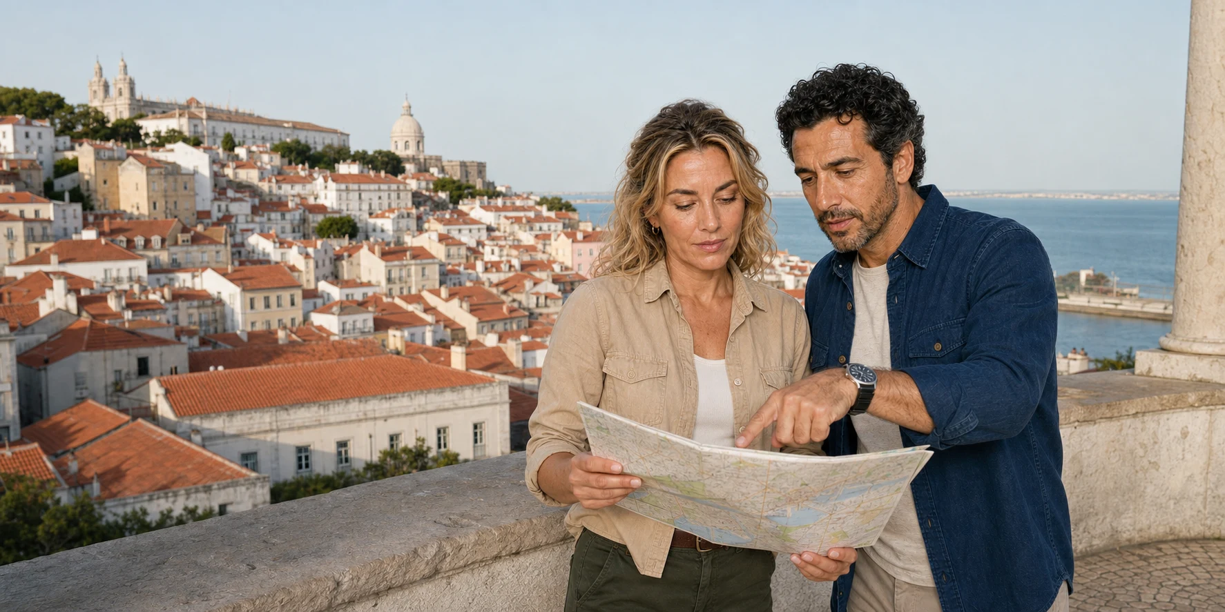

The walk from Saint Anthony's church toward Lisbon Cathedral, the castle hill and Portas do Sol is often sold as a climb backwards through time. The ground tells a better story. Iron Age trade, Roman urbanism, an Islamic citadel, a violent Christian conquest, royal residence, earthquake, military occupation, twentieth-century restoration, living neighbourhoods and mass tourism do not sit in a tidy vertical stack. They cross the same stones. To understand the hill, follow the route—but refuse the simple timeline.
01 · Lisbon urban layers field guide
The climb is not a timeline
A useful way to read Lisbon's castle hill begins at the Church of Saint Anthony, continues past Lisbon Cathedral and through Alfama, then connects the Castle of Saint George area with Portas do Sol. That sequence gives a traveller a practical spine. It is not a turn-by-turn itinerary, and it does not imply that any particular walk enters the cathedral or castle.
The route is tempting to narrate as a vertical journey into the past. At the bottom, an eighteenth-century church stands beside a cathedral whose present medieval appearance was strongly shaped in the twentieth century. A sixteenth-century Renaissance house sits over older riverfront occupation. Up the slope, streets preserve long-lived plot and wall relationships while façades, water, rails, utilities and residents belong to many later periods. At the top, the castle looks emphatically medieval because restoration removed a military complex and reinstated a selected medieval image between 1938 and 1940.
Height and age do not align. The oldest excavated evidence in the castle precinct is at the summit, but later rebuilding, destruction and conservation determine what a visitor sees. Lower Alfama preserves ancient and medieval relationships precisely because people continued living there. The 1755 earthquake did not flatten the entire hill into one rebuilding plan; its damage, fires and reconstruction varied by site. A good guide uses the ascent to compare layers. A weak one turns topography into a false chronological escalator.

That correction improves the walk rather than making it less dramatic. It changes the central question from “How old is this?” to “Why is this layer visible here?” A defensive hill explains surveillance of the Tagus estuary. A cathedral façade explains both medieval institution-building and modern ideas about what a national monument should look like. A viewpoint explains walls, roofs, water and trade. A castle tower explains not only warfare but restoration politics. The city becomes a set of decisions made on the same ground.
02 · Lisbon urban layers field guide
Saint Anthony: an eighteenth-century threshold to an older devotion
The Church of Saint Anthony introduces a distinction between a building's age and the age of the story attached to it. It stands near the place traditionally identified as the saint's birthplace. Born Fernando in late-twelfth-century Lisbon, Anthony became an Augustinian and then a Franciscan, preached in Italy and southern France, and died near Padua in 1231. His biography at the Basilica of Saint Anthony connects the two cities through a mobile religious life; the present Lisbon church is not a surviving room from his childhood.
The earlier sanctuary was largely destroyed in the earthquake of 1 November 1755. The present church was rebuilt from 1767 to a design by Mateus Vicente de Oliveira, close to the traditionally venerated birthplace, as Lisbon's church history explains. Its fan-shaped steps absorb the street's change in level before an uphill walk has properly begun. The building therefore joins medieval devotion to post-earthquake architecture and a modern meeting practice. It is a threshold made of several times at once.
This also changes how the saint's popular identity should be told. Anthony is associated in Lisbon with June festivities, marriages, neighbourhood decoration and a vast body of devotional and folk practice. Those traditions are real cultural histories, but they are not permission to repeat any miracle story as literal biography. The nearby Museum of Lisbon site exists precisely because the saint's afterlives—in images, objects, ritual and transnational devotion—are as historically revealing as the small number of secure biographical facts.
The Saint Anthony weddings give that devotion a documented social history. The newspaper Diário Popular began the initiative in 1958 to help couples with limited means marry. It stopped after 1974 and returned under the municipality in 1997, accommodating civil as well as religious ceremonies. What may look like timeless folklore is also a changing civic institution, organised through newspapers, local government and the material costs of setting up a household.
For a walking group, the meeting point needs practical clarity. “By the statue” is better than a vague district name, but a traveller still needs the exact side of the square, guide identification, check-in time, late-arrival procedure and nearest usable drop-off. The steps in front of the church are visible evidence that an accessible meeting place cannot be inferred from a map pin. The first task is not to romanticise the climb; it is to make sure everyone can begin it.
03 · Lisbon urban layers field guide
Casa dos Bicos: a lower-city detour that corrects the defence story
Casa dos Bicos is a worthwhile independent detour near the lower route rather than a necessary waypoint on every castle-hill walk. Its façade is valuable because it breaks the idea that every pointed stone on this route is defensive.
Brás de Albuquerque commissioned the house in 1523 after travel in Italy. The diamond-point surface recalls the Palazzo dei Diamanti in Ferrara and a wider Renaissance fascination with rusticated, faceted façades. Portuguese window forms and an Italianate skin meet in a merchant and elite riverfront environment shaped by Lisbon's imperial expansion. The “spikes” create light and shadow; they are not an armoured wall built to repel invaders.


The house also resists the fantasy of a perfectly preserved sixteenth-century object. The 1755 disaster damaged it; later uses and reconstruction altered it; the upper floors seen today were restored in the twentieth century. Since 2012 it has housed the José Saramago Foundation, while archaeology below connects the site to much older occupation. That biography—construction, damage, adaptation, reconstruction, literature and archaeology—is more Lisbon-like than an untouched monument would be.
The archaeology gives the riverfront connection a physical form. Roman fish-processing tanks, known as cetariae, belong to a waterfront economy in which preserving marine food mattered. Remains of successive city walls show how the defended edge changed. Later, the house itself served as a cod warehouse. The same address therefore joins elite Renaissance display, food production, storage, defence and a contemporary literary institution. Looking only at the façade misses the work that tied this part of Lisbon to the water.
Its location matters. The lower slope once met a busier, differently configured river edge. Markets, customs activity, warehouses, landing places and streets tied the hill to the estuary. The Tagus was not a scenic blue strip waiting to be viewed from above. It carried people, food, revenue, disease risk, naval power, imperial goods and environmental change. When the route turns uphill, it leaves the modern waterfront but not the river's influence.
04 · Lisbon urban layers field guide
The Sé is medieval, damaged, rebuilt and deliberately re-medievalised
Lisbon Cathedral appears almost immediately above Saint Anthony's church, and its twin towers make an efficient visual statement. The danger is to call that statement simple. Work probably began after the Christian conquest of 1147, using a Romanesque language related to Coimbra and Norman building traditions. The cathedral became an institutional marker of the new order: a bishopric, chapter, liturgy, property and authority, not just a stone announcement that one religion had replaced another overnight.
The building changed repeatedly. Gothic work added a cloister and ambulatory chapels. Later centuries altered chapels, surfaces, furnishings and circulation. Earthquakes caused damage before 1755, and the great earthquake and fire crisis added another destructive episode. Baroque interventions and repairs joined the fabric. What looks like a single medieval fortress-church is an accumulated and edited object.
Patrons made those changes for different purposes. Dinis's reign brought the cloister, while Afonso IV's ambulatory provided a setting for royal burial. Bartolomeu Joanes, a wealthy townsman, endowed a chapel: cathedral building was not exclusively a royal enterprise. The national heritage service's account of Lisbon Cathedral also traces a seventeenth-century sacristy and an eighteenth-century Baroque main chapel. A walk around the building becomes more revealing when Gothic circulation, funerary memory, private devotion and later ceremonial taste are treated as separate acts.
The most consequential editing for today's visitor came through twentieth-century conservation. State campaigns removed later work and strengthened a medieval atmosphere; the resulting neo-Romanesque appearance was ceremonially presented in 1940. This was not neutral cleaning. It reflected a period in which monuments were made to embody selected national histories. The crenellations, severe stone and symmetrical façade now feel inevitable because restoration was successful at making its argument visible.


The cathedral therefore teaches a method that will matter again at the castle: ask not only when a wall was first built, but when its current appearance was composed. Stones may be old while a silhouette is modern. A restored portal may preserve fragments and still create a new visual unity. Removing a later chapel can reveal earlier masonry and erase evidence of how the building lived in between.
The interior adds further complexity. Romanesque mass, Gothic spaces, tombs, chapels, treasury objects and archaeological evidence do not form a single route unless someone deliberately connects them. The cathedral's current visitor rules distinguish worship from the ticketed visitor circuit. A guided neighbourhood walk should never imply that passing the façade includes the whole cathedral. If entry matters, confirm the circuit, service times, group rules, accessibility and the time needed before the day begins.
What 1755 did—and what its images do
The earthquake struck on All Saints' Day, 1 November 1755, and was followed by fires and destructive waves along the waterfront. Downtown Lisbon suffered extensive destruction. Exact death counts remain uncertain and vary with the geographic scope and source. The disaster is best understood through the interaction of shaking, fire, water, building vulnerability, crowded religious observance and a capital's political and economic concentration.


The print of the ruined cathedral is evidence with limits. It records a near-contemporary attempt to make catastrophe legible and marketable through a dramatic view. It should not be treated as an exact engineering record of every collapsed bay. Its greater value in this walk is comparative: the ruined, irregular mass in the print and the coherent façade seen today reveal how many choices stand between disaster and heritage.
Pombaline rebuilding transformed the lower Baixa through a planned grid, standardised façades and structural measures intended to reduce earthquake and fire damage. Portugal's UNESCO tentative-list account of Pombaline Lisbon explains the integration of timber frames with masonry, drainage and a regulated street layout. Alfama and the castle hill followed a different pattern because damage, ownership, surviving structures and later intervention differed. The common phrase that “Alfama survived the earthquake” is too absolute. Parts survived better than Baixa; buildings and institutions were still damaged, burned, repaired or replaced. Survival is a gradient, not a miracle boundary.
05 · Lisbon urban layers field guide
Alfama's lanes were not designed as a military trap
Once the route leaves the cathedral, the street network narrows and turns. Alfama's lanes are often explained as a deliberate device to confuse invading armies, but their irregularity cannot establish that story. Dense premodern street patterns emerge from topography, property boundaries, drainage, access to gates and wells, incremental construction, social organisation and centuries of adjustment. Defensive conditions influence cities, but irregularity is not proof of a single military plan.
The hill itself constrains movement. Routes that climb directly become steep; routes that soften the gradient lengthen and bend. Buildings meet rock, retaining walls and earlier boundaries. A wall line may become a property edge. A gate channels movement; a market widens it; a religious building interrupts it. Later pipes, tram tracks, cables, waste collection, fire access and tourism all enter spaces not designed for modern service vehicles or large guided groups.
This is why a street can carry several historical functions at the same time. It may preserve a medieval alignment while its paving is recent. Its façades may be eighteenth- or nineteenth-century shells on older plots. A doorway may reuse stone. A stair may be a practical response to slope rather than a secret defensive device. Laundry, bins, scooters, air-conditioning units and key boxes are not visual pollution around “real history”; they show the continuing negotiation of a residential district.
The name Alfama is commonly connected to Arabic al-hamma, associated with springs or baths. Etymology helps retain the district's Islamic history, but it does not turn every present alley into an unchanged Moorish lane. Archaeology and documents show a Muslim city with walls, houses, streets, water and institutions. Later conquest, Christianisation, rebuilding, migration, earthquakes and infrastructure reshaped that fabric. Continuity is often a relationship of scale and boundary, not an intact surface.
06 · Lisbon urban layers field guide
Portas do Sol: use the view as a plan, not a postcard
Portas do Sol and neighbouring Santa Luzia convert the climb into a wide field of evidence. The Tagus opens behind roofs and church towers; the hill's steep fall becomes visible; Santa Engrácia's dome, Santo Estêvão and São Miguel help orient the neighbourhood. The view is most useful when a guide asks the group to locate relationships rather than simply take a picture.
Start with the estuary. Lisbon sits where river and Atlantic systems meet, beside a broad tidal water body. Upstream, the Tagus Estuary Nature Reserve protects wetlands, mudflats and marsh. The opposite bank makes the scale legible. The width helps explain why a high settlement could observe approaches and exchange, while the sheltered estuary supported movement and anchorage. The river's shifting edge, land reclamation and port infrastructure mean the ancient shoreline was not identical to today's.
Then read the roofs. Alfama is not a preserved model village below a castle; it is a neighbourhood of homes, religious buildings, hospitality businesses, schools, restaurants, workshops, short-term accommodation and public space. Church towers punctuate the slope because parishes and confraternities organised life as well as worship. Roof repairs, terraces and altered windows trace household change. The view makes the district look unified precisely because distance hides its conflicts.

Finally, notice what the panorama cannot show. It flattens gradients, hides stairs and makes walking distances look short. It cannot reveal whether a doorway is a resident's home or holiday accommodation, whether a pavement edge works for a mobility aid, or whether a small square can absorb another group. Orientation from above should lead to more careful movement below, not possession of the view.
07 · Lisbon urban layers field guide
Before the castle: a hill chosen for water, surveillance and exchange
The castle precinct contains the oldest excavated settlement evidence on the route, reaching back to the seventh century BCE. The castle's official archaeological interpretation describes a probably fortified Iron Age settlement on the summit and southern and southwestern slopes. Steep approaches, water sources and command over the Tagus estuary made the hill valuable. Regular contact with Phoenician communities linked local inhabitants to Mediterranean and Atlantic exchange.
Objects and techniques make that contact concrete: wheel-made pottery, storage and transport vessels, ironworking, new building forms and writing joined existing practices. Imported goods from the eastern Mediterranean, North Africa and other regions do not mean Lisbon was a remote colony receiving civilisation from elsewhere. They show local communities participating in networks, selecting technologies and living in a place where river and ocean routes met.
Roman Olisipo later occupied the hill and riverside, with walls, streets, public buildings, production and port activity. The Roman theatre below the castle is one of the clearest surviving markers of how the slope was organised toward the river. Yet the castle summit does not present a clean Roman layer. Rebuilding has removed, buried and incorporated evidence. Archaeology works through fragments and relationships rather than a complete city plan laid open for viewing.
The Roman theatre site rewards a lower-slope visit in its own right. Established under Augustus, it used the hillside for its seating and faced south toward the river. It fell out of use in the fourth century and disappeared beneath later occupation until its rediscovery in 1798, during post-earthquake rebuilding. Remains of the stage frontage and orchestra explain the organisation of performance and spectatorship. Here, a disaster that destroyed much of the city also helped expose an older one. The theatre and the hilltop excavation illuminate different pieces of Roman Lisbon; neither stands for the complete city.
During Islamic rule, al-Ushbuna was defended by walls descending toward the river. The hilltop citadel, or kasbah, concentrated political, military, religious and elite residential power. Excavated eleventh- and twelfth-century houses in the castle precinct include courtyards, rooms, storage and sanitation. This is crucial: the “Moorish castle” was not only battlements. It was an inhabited administrative quarter where families cooked, stored goods, used water and moved through streets.
Two excavated houses make domestic life unusually tangible. Their rooms faced inner patios that brought light and air into the buildings; kitchens, pantries and latrines served the households. Red and white finishes and geometric wall decoration show deliberate interior design. Food storage included underground grain pits and vessels partly sunk into the ground, while drains connected houses to the street system. These remains invite a different kind of attention from a wall walk: how a household cooled provisions, managed waste and arranged privacy inside a fortified quarter. The patios were working environmental and social spaces, not decoration added to soften a military story.
The exact appearance of the fortification in 1147 is not known. Official castle interpretation says so plainly. The present towers cannot be used as a stage set for a precise reconstruction of the siege. Some visible forms belong to later Christian medieval works; other parts were restored or rebuilt. The most honest view begins with uncertainty.
08 · Lisbon urban layers field guide
1147: siege, surrender and the violence after victory
The conquest of Lisbon joined Afonso Henriques's territorial expansion to a fleet of crusaders travelling from northern Europe during the Second Crusade. Anglo-Norman, Flemish, Rhineland and other contingents were not a single national army, and their motives were not uniform. Piety, crusading privilege, plunder, land, opportunity, coercion and royal negotiation coexist in the surviving record.
The central narrative source, conventionally called De expugnatione Lyxbonensi, is unusually rich and unusually interested. It was written from within the crusading enterprise. A modern scholarly edition records speeches, negotiations, religious arguments, military action and conflict among the victors, but it is not a neutral transcript. Medieval population numbers and rhetorical descriptions demand caution. The source becomes more valuable, not less, when read for what its author wanted readers to believe.
The siege lasted for months. Attackers used blockade, engines, mining and repeated assaults while defenders faced hunger and disease. The city's fortifications mattered, but so did supply, numbers, coordination and time. Calling the castle “impenetrable” makes the eventual fall sound miraculous and removes the material history of siege warfare. Calling every nearby lane a battlefield turns uncertainty into spectacle.
The surrender was negotiated. Accounts and recent scholarship on the violence after entry also record that crusaders looted and violated protections despite royal instructions. Muslim inhabitants were not an anonymous obstacle erased at the instant a gate opened. They included households, leaders, craftspeople, traders, religious figures and displaced people. Conquest redistributed property, changed institutions, expelled some people, killed others, subjected survivors to new power and created a Muslim community outside the reorganised centre. Christian triumphal history must be placed beside those human consequences.
Martim Moniz: a gate, a plaque and the manufacture of memory
The famous story says the knight Martim Moniz sacrificed himself by lodging his body in a closing gate so Christian troops could enter. It is powerful, visual and not securely documented by the contemporary siege account. The castle's history of its walls records the gate name in 1258; that early name alone does not establish the later account of the sacrifice. A plaque installed in 1646 at the initiative of the Count of Castelo Melhor, who claimed descent from Moniz, gave the tale a more explicit commemorative form. The memorial belongs to family prestige and the politics of restored Portuguese independence as well as to the memory of 1147.


The right way to tell the story is not to drain it of meaning. It is to explain why the city wanted the legend. A gate concentrates a long siege into one instant. One body turns a coalition and negotiated surrender into individual sacrifice. A named Christian hero displaces the defenders and the violence after entry. The legend reveals the politics of memory even when it cannot establish the mechanics of conquest.
At Santa Luzia, the tile panel gives that memory durable public form. Its armoured figures and dramatic gate belong to a later visual language. The viewpoint lets a guide put landscape, monument and representation together: the city below, the castle above, the siege text, the later plaque and the tile image do not all say the same thing. Their disagreement is the history.
09 · Lisbon urban layers field guide
The summit after 1147: bishop, king, archive and court
Christian conquest did not freeze the hill as a battlefield memorial. Land in the former citadel was transferred to the new bishop, and the cathedral, episcopal property and Latin Christian institutions helped reorganise power. Archaeology in the castle precinct preserves remains attributed to the bishop's palace and later elite residence. Floors, stairs, kitchens, pantries, stables, tiles and imported ceramics bring the summit back from military abstraction to household life.
The royal palace developed beside the castle. References from the thirteenth century and later court use show a place of residence, ceremony, administration and reception. Lisbon's rise as the kingdom's principal political centre increased the hill's importance. The royal archive occupied a tower; court festivities and visits used the complex; residential and service buildings accumulated around the fortification.
This is where the distinction between castle and palace matters. The fortified core, the palace of the alcáçova, episcopal and noble residences, squares, walls and service spaces formed a connected summit but did not share one function. A visitor who sees only battlements misses the kitchens and paperwork that made power durable. Defence was episodic. Administration, storage, worship, dining, maintenance and domestic labour were daily.
The royal centre eventually moved downhill. King Manuel I's early-sixteenth-century palace by the river better served a court oriented toward maritime empire, ceremony and port activity. The castle hill did not become irrelevant; it changed role. The old palace and fortifications increasingly served military, prison and institutional uses. That shift is another reason not to call every surviving wall “the medieval castle” without asking what happened beside and over it.
10 · Lisbon urban layers field guide
Earthquake, garrison and the castle that disappeared inside later buildings
By the early modern period, military occupation had expanded. Barracks, a soldiers' hospital, stores, kitchens, a jail, powder magazines, parade and training spaces formed a complex rather than one designed block. After the 1755 earthquake damaged and burned palace, hospital and other structures, military construction spread across much of the old summit. The ruins did not simply wait for archaeologists; they became foundations and material for new uses.
The hospital evidence is especially human. Archaeologists found objects among earthquake rubble, some distorted by fire: containers, lamps, tableware, pipes and medical or domestic equipment. These finds resist the monumental habit of describing 1755 only through collapsed façades. Disaster interrupted care, work, eating, smoking, storage and movement inside occupied buildings.
Casa Pia brought another institutional layer after 1780, providing shelter and education for orphans and abandoned children as well as confinement and discipline for people classified as beggars or vagrants. French troops occupied the complex during the invasion of 1807. Through the nineteenth century, the garrison dominated the hill. Lisbon residents looking upward did not see the clean medieval silhouette reproduced on today's postcards.
That lost density matters. Heritage restoration is often described as revealing a monument concealed by clutter. But the “clutter” was itself history: military labour, social welfare, prison, hospital, service buildings and adaptations after catastrophe. Their removal made the medieval castle easier to read and several later Lisbons harder to see.
11 · Lisbon urban layers field guide
The medieval castle seen today is also a twentieth-century argument
Between 1938 and 1940, the Directorate-General for National Buildings and Monuments carried out extensive works under the Estado Novo dictatorship. The castle's own account of buildings that disappeared records how later constructions were demolished, properties expropriated and a coherent medieval appearance reinstated. The castle returned to Lisbon's skyline as a national emblem at the same moment the regime celebrated an official story of Portuguese origins and imperial continuity.
This does not make the castle fake. It makes authenticity more demanding. Medieval masonry, later repairs, reconstructed sections, archaeological ruins and modern conservation coexist. A wall can contain original material and still owe its present height, crenellation or isolation to twentieth-century choice. Restoration can protect a monument while editing the sequence through which visitors understand it.


Look closely at joints, stone sizes, wall thickness, blocked openings and changes of surface. These details do more than authenticate age; they reveal intervention. The most regular battlements may be the least useful evidence for the siege. An awkward scar, buried foundation or fragment beside a path may carry a more complicated chronology. Good conservation interpretation teaches the eye to value difference rather than seamlessness.
The fortification's present arrangement is also worth learning. Eleven towers stand around a roughly quadrangular core with two courtyards. A lower outer wall, or barbican, adds a first defensive barrier on the southern and eastern sides; a detached tower connected by a bridge gives defenders another angle on approaches. The main entrance turns rather than opening in a straight passage, forcing an entrant to change direction beneath the gate's defences. These are spatial systems, not simply a row of picturesque towers. Bridges, gate details and wall tops were altered during restoration, so the legible geometry still needs to be read alongside the site's conservation history.
Individual towers acquired uses beyond defence. The tower associated with Ulysses held valuable stores and, later, royal records in the archive known as the Torre do Tombo. Today it houses the camera obscura. The change from guarded records to an optical view of the city is a useful miniature of the summit's larger history: a place once controlling information and access now helps visitors interpret the landscape. Ask which function a tower served at a particular date before treating its shape as a complete explanation.
The castle's name also belongs to later history. Saint George's cult had a long association with royal and chivalric culture, but the castle's own account of the dedication places it probably in the middle of the seventeenth century. That cautious dating matters: the Islamic citadel was not called Saint George's Castle, and the cult's earlier presence does not fix the date of the building's name. A statue of Afonso Henriques and a national flag frame the summit through modern Portuguese memory. The site is simultaneously archaeological evidence, rebuilt monument, city park, museum, viewpoint and national symbol.
12 · Lisbon urban layers field guide
What a castle ticket actually adds
Many neighbourhood walks treat castle admission as a separate decision. That distinction changes the day. A guided ascent plus a serious castle visit can become a much longer outing, especially if the traveller stops for the museum, archaeology, camera obscura, wall walks and views. Never assume that phrases such as “queue assistance” include a ticket or guaranteed instant entry; check the monument entry arrangement attached to the exact walk you choose.
The official castle ticket currently covers the monument and gardens within opening hours, and the site's ticket-inclusions page advertises interpretive formats such as “Discovering the Castle” and the camera obscura. Availability and capacity conditions apply. The archaeological area is not simply an open extension of every walkway; access is tied to the site's interpretive visit. Weather can affect the camera obscura. Wall and tower access may close before the general site as daylight changes.
The practical question is therefore not “Is the castle included?” It is a sequence:
- Does the walking guide accompany the group to the ticket point, through the monument, or only explain how to enter independently?
- Is the ticket purchased before the day, with the guide, or separately after the neighbourhood walk?
- How much time remains before the walls, archaeology or included visits stop admitting people?
- Where does the guided service end, and how does the traveller return from the summit?
- What alternative interpretation is offered if someone cannot use the wall walks or archaeological route?
The castle's four-hectare precinct contains several different experiences. The museum brings portable objects into chronological sequence. The archaeological centre preserves Iron Age, Islamic and later residential evidence. The former royal-palace remains connect court life to the summit. Gardens and viewpoints widen the city context. Wall walks give defensive geometry and exposure. Treating all of that as “the castle interior” conceals meaningful differences in access, evidence and time.
13 · Lisbon urban layers field guide
Alfama is a neighbourhood, not atmosphere between monuments
Crossing Alfama simply as a photogenic maze between cathedral, castle and viewpoint misses the district's inhabited life. Its narrowness may delight a visitor and complicate deliveries, waste collection, emergency access and wheelchair movement. A tiled façade may be heritage, a landlord's asset, a household's maintenance burden and a social-media background at the same time.
Fado offers a good test of this discipline. UNESCO's heritage record describes it as a performance genre joining music and poetry, practised by different Lisbon communities. Its history synthesises Afro-Brazilian sung dance, local genres, music brought by rural migrants and cosmopolitan urban song of the early nineteenth century. Professional houses, informal associations, family transmission and modern international circulation all matter.
That account is richer than saying fado was born in one dark Alfama courtyard. Alfama is deeply associated with the genre, but so are Mouraria, Bairro Alto and wider Lisbon networks. Fado is not permanent background sound available on demand in every alley. A performance has musicians, singers, audiences, labour, rules of attention, commercial conditions and community memory. If the walk does not enter a documented venue or meet practitioners, it should offer orientation rather than claim intimate access.
Housing pressure makes the same point in contemporary terms. Lisbon's municipal local-accommodation framework regulates the relationship between tourist accommodation and permanent housing. Alfama, Castelo and Mouraria have been central to the city's containment policies. The policy exists because tourism demand and permanent housing are not automatically harmonious. A walking group occupies limited pavement, raises voices near homes and encourages the conversion of ordinary thresholds into spectacle even when every individual behaves politely.
Responsible conduct is modest and specific: keep the group tight without blocking doors; lower voices in residential lanes; do not photograph residents through windows; do not treat laundry, religious practice or children as folklore; use public toilets rather than assuming cafés exist for group service; and spend locally without presenting consumption as proof of authenticity. The point is not visitor guilt. It is recognition that the neighbourhood does not pause when a tour enters it.
The same discipline changes how other celebrated historic districts are read. New Orleans's French Quarter also joins river geography, architecture, music, tourism and ordinary neighbourhood life without becoming a time capsule. The comparison is useful because the differences matter: Lisbon's slope, Islamic and Christian layers, fado networks and Portuguese housing policy are not interchangeable with New Orleans's delta engineering, colonial regimes, jazz histories or preservation system. In both places, however, a photogenic district becomes clearer when residents, labour and change remain inside the frame.
14 · Lisbon urban layers field guide
Tram 28 is transport inside a constrained street system
The yellow tram is often offered as the easy alternative to the hill walk. It can reduce continuous climbing and reveal street geometry, but it is not a private sightseeing ride or an accessibility guarantee. Route 28E is part of CARRIS public transport, serving residents and visitors through a network subject to works, congestion, crowding and operational change.
Its tracks explain the street as infrastructure. Rails fix a vehicle path through tight curves. Overhead power, stops, parked vehicles, loading, pedestrians and tour groups compete for the same narrow section. The famous close pass between tram and façade is not a theme-park effect; it is a safety environment. A guide must hear the bell, keep people off the rails and avoid spreading the group across a blind bend for photographs.


Service patterns can change with works, congestion and operating conditions. Consult the official CARRIS route and service notices on the day, then decide whether the tram helps this journey or simply substitutes waiting and crowding for walking.
Other transit-assisted approaches may work better for a specific body or schedule: a taxi or authorised vehicle to a confirmed accessible point; a bus toward the castle district; an elevator or escalator system elsewhere in the hill network followed by a shorter walk; or a castle-first descent. None can be recommended as universally accessible without checking the exact origin, kerbs, stop equipment, slopes and final connection.
15 · Lisbon urban layers field guide
Calçada, heat and downhill are part of the subject
Portuguese stone paving gives Lisbon a distinctive surface, but visual identity does not cancel friction. Small stones can become polished and irregular. Repairs, utility covers, drainage channels, broken edges and steep cross-fall alter every block. Dry summer conditions bring heat and glare; rain changes grip. The same surface affects a rubber-soled walker, cane, rollator, manual wheelchair, stroller and powered device differently.
Footwear advice should be concrete without pretending to remove risk. A closed shoe with reliable grip is more useful than a fashion rule. Water and sun protection matter on exposed viewpoints. A slow group needs scheduled shade and toilets, not a promise that a passionate guide will adjust spontaneously. Anyone with cardiac, respiratory, balance, joint or heat-sensitivity concerns should judge the route against their own clinical advice and measured street information for the exact path.
Descending is not automatically easier. Uphill demands sustained effort; downhill increases braking load on knees, ankles and hands and can be more difficult on smooth stone. A castle-first plan changes the work rather than eliminating it. Families also need the real chain: a stroller may handle a broad approach and fail at steps; a child who walks well on level ground may tire on heat-reflecting slopes; a carrier changes the adult's balance.
Lisbon's conditions vary with date and exposure. Consult the IPMA forecast and weather warnings close to the visit and use the Portuguese health authority's heat guidance when planning exertion, water and shade. Choose a route with realistic rest and turnaround options. “We will go slowly” is not enough information for a traveller managing heat or exertion risk.
16 · Lisbon urban layers field guide
Accessibility begins before the first slope and ends after the descent
The castle publishes meaningful accessibility provisions: advance contact, possible vehicle access by prior arrangement, ramped ticket-office access, a regularised path toward the east viewpoint, a museum ramp and a platform lift serving one room, wheelchairs and Swiss-Trac equipment, an accessible toilet, guide-dog access and prebooked inclusive visits. These provisions make parts of a difficult historic site more usable. They do not describe the separate streets and slopes required to reach the monument. Ask the castle which spaces and services fit your visit before choosing the approach.

For any planned ascent, establish measurable answers:
- the exact meeting coordinate and nearest step-free drop-off or transit point;
- total walking distance and net ascent, with the steepest sustained section;
- every mandatory stair and whether a step-free deviation exists;
- longest period without seating or shade;
- pavement width, cross-slope and known polished or irregular sections;
- whether the street sequence can change without losing the intended interpretation;
- the precise connection to the castle's accessible route;
- the end point, taxi access and downhill requirement;
- mobility-aid size, storage and assistance limits;
- accessible toilet opportunities before and during the visit.
Generic labels such as “easy” or “short walk” cannot be converted into an informed accessibility decision. When the geometry is unavailable, treat the route as unverified for your needs and choose an independently planned or monument-led alternative whose access chain you can establish.
17 · Lisbon urban layers field guide
Choose the format by the question you want answered
The same hill supports several sensible visit structures. The best one depends on historical interest, stamina, mobility, heat, crowd tolerance, interior priorities and available time.
Choose the guided uphill walk when
You want the changing street scale to be the subject; you can manage sustained ascent and irregular paving; a small shared group suits your pace; and you are content to treat castle admission as a separate decision. Choose only a walk whose documented route, monument handoff and endpoint match those assumptions.
Choose a castle-first, mostly downhill plan when
The monument is the priority and you can arrange an appropriate ascent by public transport, taxi or authorised access. This structure protects time for archaeology and museum interpretation. It does not automatically reduce joint load or solve steps, and the route down still needs planning.
Choose a transit-assisted Alfama walk when
You want street and viewpoint context but need to shorten continuous climbing. Build the day around current CARRIS information and a specific set of walkable segments. Do not treat tram 28E as guaranteed seating, step-free boarding or a punctual scenic transfer.
Choose a focused lower-slope visit when
Saint Anthony, the Sé, Casa dos Bicos, the Roman theatre area and river-city history are more important than reaching the summit. This is not a lesser Lisbon. It can deliver religious, architectural, archaeological and earthquake history without using the castle as proof of completion.
Choose an accessibility-led castle visit when
The castle's eastern viewpoint, museum and inclusive services are the desired core. Contact the monument in advance, arrange the access path and equipment directly, and plan the neighbourhood separately only where its complete approach and return meet your needs.
18 · Lisbon urban layers field guide
Plan the day around the route you can verify
The responsible planning questions apply to every format. Before committing to a guided or self-guided ascent, establish:
- Exact route: identify the streets, distance, ascent, steepest segment, mandatory steps and endpoint.
- Castle relationship: decide whether the walk enters the monument, ends outside or leaves ticketing for a separate visit; check the official ticket and timing arrangement directly.
- Group and pace: confirm the participant limit, language, stopping practice and whether children, strollers or mobility aids can follow the same route.
- Access: match the approach to your functional requirements, then contact the castle separately for its current accessible route, equipment and vehicle-access arrangements.
- Cathedral: if interior entry matters, check worship priority, the current visitor circuit and individual access with the cathedral.
- Conditions: use the live CARRIS service page, official monument notices and the weather forecast close to the visit rather than relying on an old itinerary.
- Return: identify the final point, the nearest viable taxi or transit connection and whether the day still requires a downhill walk.
If those answers remain incomplete, separate the neighbourhood walk from the castle visit. Lisbon does not become less intelligible when the two parts are planned independently.
19 · Lisbon urban layers field guide
A listening companion: questions worth carrying uphill
Carry three questions into the neighbourhood. First, who used this place besides the people commemorated by its monuments? Islamic households, traders, court servants, hospital patients, children in Casa Pia and present residents return daily life to a route dominated by kings and towers. Look for the spaces that supported that work: a courtyard, pantry, drain, doorway, warehouse or tram stop.
Second, what changed between a building's construction and the view in front of you? A cathedral's medieval origin does not date every surface. A castle's defensive function does not explain its hospital and archive. A tile image of conquest belongs to the history of commemoration. Comparing those objects teaches more than choosing one century and treating the rest as interference.
Third, how does the format of the visit affect what you learn? An uphill walk reveals transitions in street scale, gradient and neighbourhood use. A castle-first plan reserves attention for excavation and museum objects. A lower-slope visit makes the connection to food, waterfront commerce and Roman performance clearer. A smaller group can fit constrained places more easily, but thoughtful stopping and pace matter as much as a number. Choose the structure that gives both the subject and your body enough room.
20 · Lisbon urban layers field guide
Listen: walking Lisbon's castle hill
The original episode follows the traveller's choices around this hill: uphill or downhill, shared group or independent visit, streets or monument, and time for the castle after the climb. Use it as a listening companion while planning which parts of Lisbon you want to connect.
21 · Lisbon urban layers field guide
Lisbon becomes legible when the layers disagree
At the end of the climb, the castle seems to dominate the story. The better conclusion is visible from Portas do Sol: the fortress depends on a hill; the hill depends on the estuary; the roofs below record ordinary occupation; church towers mark institutional change; tram rails and accommodation policy belong to the living city; the medieval silhouette carries a twentieth-century restoration project.
No single layer is false because another lies beneath it. The problem begins when one layer claims to be the whole city. A conquest legend can be meaningful without being an eyewitness record. A restored castle can contain medieval fabric without preserving the view of 1147. A neighbourhood can carry Islamic spatial inheritance without becoming a timeless Moorish maze. A guided walk can reveal connections without owning every interior.
The most useful Lisbon route therefore ends with three habits. Look downhill to understand why people settled the summit. Look closely to distinguish fabric from restoration. Look around before calling a neighbourhood scenery. The reward is not a march backward in time. It is the recognition that Lisbon's histories remain present because they were repeatedly built over, repaired, argued about and lived in.
Continue through the Lisbon destination desk for the city's planning sources and the Portugal country desk for other landscapes and journeys. For the people and forced movement behind the riverfront's imperial wealth, read African Lisbon and the Atlantic world: enslavement, Black institutions, resistance and public memory add essential human histories to the view from the hill.