Destination desk 12 · Maui, Hawaiʻi
Maui
A summit desk where East Maui’s shield, a continuing Native Hawaiian cultural landscape, rare high-elevation life and two inverted walks must be read together.
Haleakalā summit district · Original ExcursionPass generated visual
1 field story10 purposeful visuals22:01 original audio2 separate trailheads
The island beyond the beach forecast
Read the whole shield before counting the miles.
Haleakalā is not simply a dormant crater or an empty Mars-like backdrop. East Maui is the visible crest of a massive, mostly submerged post-shield volcano whose summit depression was opened largely by erosion and partly refilled by later eruptions.
The summit is also a living Native Hawaiian cultural landscape and a refuge shaped by rare plants, nesting birds, invasive-species control, road engineering and sustained conservation work. A short commercial itinerary crosses all of those systems whether its marketing names them or not.
Use the reported feature for explanation and route accountability. Use current park and summit-forecast pages for alerts, reservations, trail conditions and access; read any commercial service details only in the live transaction you are considering.
The Maui story
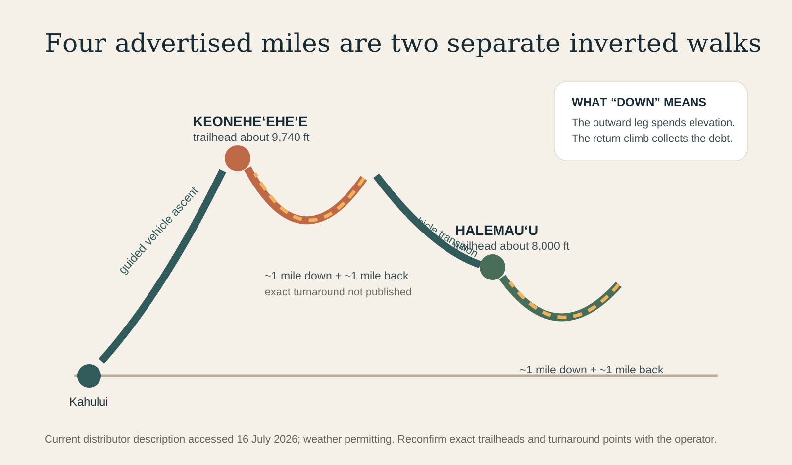
Two walks open one connected summit.
A self-contained field guide through shield building, erosion, moʻolelo, road access, ʻāhinahina, birds, altitude and the decisions hidden behind a four-mile label.
Ways into Haleakalā
Let each system revise the first impression.
Shield, erosion and later fire
The emergent summit understood as a small part of East Maui, with valleys cutting inward and later vents building cones and flows inside the depression.
Wahi pana and responsibility
Moʻolelo, archaeology and continuing Native Hawaiian relationship kept central rather than attached as atmosphere to a scenic hike.
Rare life and hard decisions
ʻĀhinahina, nēnē, ʻuaʻu, cinder, weather and thin air translated into trail discipline, conservative pacing and a willingness to turn around.
Plan from current sources
The mountain, not the brochure, decides the day.
Recheck summit alerts and weather immediately before departure. If buying a guided day, require the live checkout and provider confirmation to identify the exact meeting, trail plan, physical demands, inclusions, route-change policy and cancellation terms.
Check summit conditions