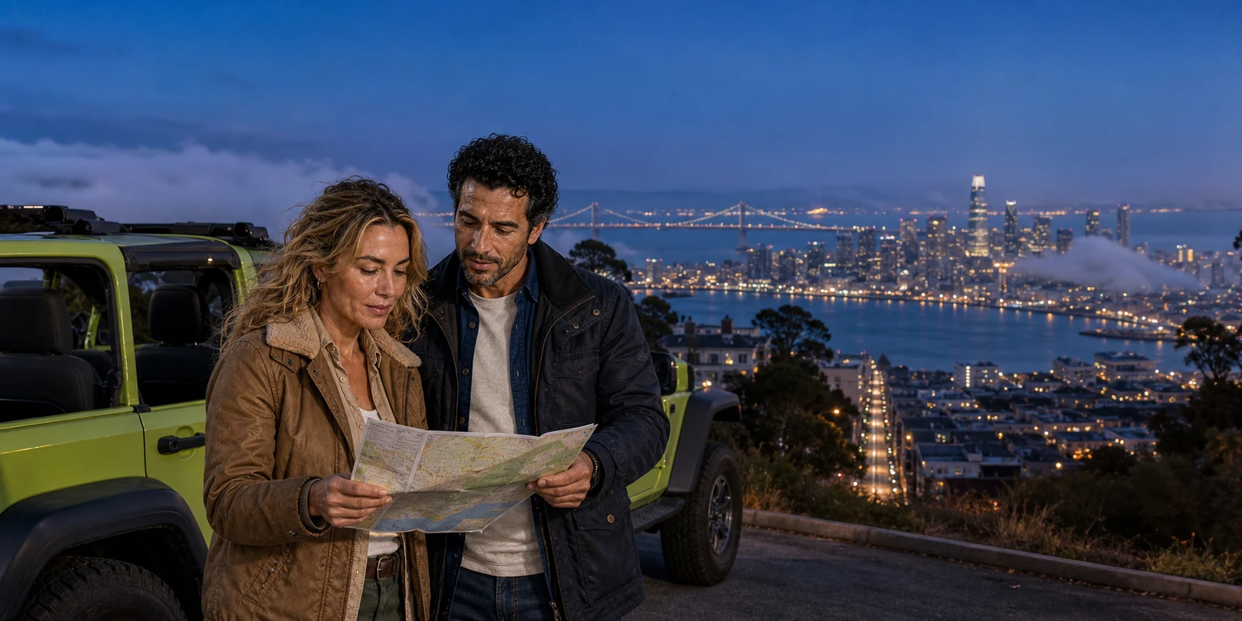
A street route makes San Francisco’s grades and neighbourhood seams physical. A boat turns the peninsula, port and bridges into one system. Darkness promotes lights and infrastructure while hiding the people and materials that give them meaning. The useful question is not which view is best, but what each one lets you understand—and what it edits out.
At Fisherman’s Wharf, a white strip of kerb does more explanatory work than a skyline. It marks active passenger loading, not parking. In a district where deliveries, taxis, coaches, small tour vehicles and people compete for limited space, the curb is part of the city’s movement system rather than an incidental stripe of paint.
From that kerb, San Francisco can be sampled in three exposures. On the road, the body learns the difference between distance and grade: a few blocks may be a serious climb, a turn may suddenly open water, and two famous neighbourhoods can meet across one diagonal avenue without becoming interchangeable. From a boat, individual façades recede while the peninsula, working piers, bridge spans, islands and tidal gate assemble into a legible system. After dark, windows, cables, traffic signals and public art rise to the foreground; masonry, gardens, street life and historical evidence fall away.
A first orientation becomes more useful when the views are compared rather than collected. Streets reveal gradients and neighbourhood boundaries; the boat puts piers and islands into one working system; evening light changes what can be seen and what must be explained. Choose the sequence that answers your questions, then return on foot to the district that deserves more time.
Two physical details help make the journey legible: Red and White Fleet’s public cruises depart from Pier 43½, while Lombard Street’s natural grade is about 27 percent, equivalent to roughly 15 degrees. One identifies the operational handoff from street to water; the other explains why a short block needs eight turns.
Listen while you read
Road first, water second Episode 2960965 asks what changes when an open-air private city route hands the traveller to a one-hour Golden Gate Bay Cruise. Its real value is the sequence: close street scale before distant maritime scale.
The same streets after sundown Follow the evening route through changing light, wind and fog, and weigh the freedom of photo stops against the details that darkness conceals.
01 · Three exposures
A viewpoint always edits

The street view is intimate but fragmented. It supplies kerbs, shopfronts, rooflines, gradients, overheard languages and the practical resistance of a hill. It is excellent at showing adjacency: the moment North Beach’s Italian American institutions meet Chinatown’s association buildings and multilingual signs; the way a monumental fair relic appears at the end of an ordinary residential block; the abrupt transition from visitor waterfront to active loading and fishing infrastructure. But a moving vehicle compresses those relationships. It can show where a district begins without allowing enough time to understand who made it.
The water view is distant but connective. A boat leaving Fisherman’s Wharf makes the northern waterfront read as an edge rather than a sequence of addresses. Fortifications, islands, towers and port structures align with wind and current. The Golden Gate Bridge stops being an isolated object because the strait explains why a crossing was difficult and consequential. Yet distance beautifies. A neighbourhood becomes a façade. Labour becomes a pier. Alcatraz becomes a silhouette even though its most difficult histories live inside buildings and in political acts that cannot be seen from a deck.
The night view is selective in another way. Human vision loses colour and fine detail as illumination drops. What remains bright acquires authority: a dome, a tower, a bridge cable, an office window, a brake light. The effect can clarify urban form, but it can also confuse lighting with importance. A public-art installation may dominate the bay while an unlit site of displacement disappears. The city has not become simpler; the eye has received less evidence.
A good short tour therefore behaves like an orientation, not a verdict. It tells the traveller where to return on foot, by Muni or in daylight. It names what the chosen mode cannot show. A private guide’s most valuable intervention may be deciding not to chase a blocked viewpoint, or explaining why the photographable surface of a district is not its full history.
02 · Three exposures
Before the grid, a living peninsula
Any route that begins San Francisco history with the Gold Rush starts too late. The city occupies the homeland of the Yelamu, a Ramaytush Ohlone tribe whose communities lived on the northern peninsula before Spanish colonisation. Contemporary Ramaytush Ohlone organisations continue cultural, ecological and public responsibilities across the peninsula. That living relationship should not be reduced to a ceremonial sentence before a conventional tour continues unchanged.
The older peninsula was not an empty landscape awaiting streets. Bay shore, tidal wetlands, dunes, grasslands, scrub, freshwater places and coastal resources supported settlement, travel, food systems and managed relationships among people, plants, animals and fire. The Golden Gate connected ocean and estuary long before it carried the name of a bridge. Colonial missions, disease, forced labour, land seizure and later American urbanisation transformed both population and ground. Much of the modern northern waterfront stands on filled or heavily engineered shore.
The point is not to imagine a recoverable pre-city purity from a passing vehicle. It is to recognise that topography is historical evidence. Hills survived because they could not be flattened economically in the same way as dunes and marsh edges. The rectangular grid was imposed across steep terrain and then negotiated with stairways, cable cars, switchbacks, retaining walls and selective cuts. A road tour makes those adaptations physical: the vehicle slows, changes gear, turns away from a direct line and searches for a view that weather may close.
San Francisco’s famous short distances are therefore deceptive. A map measures blocks; a body measures ascent, wind and exposure. On foot, grade changes the time and energy required to cross the city. In a small open vehicle, it changes sightlines and temperature. From water, the hills merge into a layered profile and the local difficulty disappears. The three views are not competing impressions. They are measurements of different urban facts.
03 · Three exposures
The wharf is work beneath the welcome
Many short city routes begin within the Fisherman’s Wharf visitor district, close to the Aquatic Park cove and the northern waterfront. The name invites a nostalgic picture of painted boats and seafood signs. The Port of San Francisco’s maritime planning record keeps another picture in view: fishing vessels, landing, processing, repair, berthing and Pier 45 functions remain part of the area’s water-dependent economy.
That working layer explains details a scenic tour can otherwise treat as clutter. Kerbs are managed because coaches, taxis, deliveries and private vehicles compete for limited space. Piers are not simply viewing platforms. The protected basin, breakwaters, sheds and service areas connect the city to food, freight and maintenance. Even the bay-cruise handoff at Pier 43½ relies on a functioning passenger port, trained crews, boarding systems and a navigable waterfront.
The modern public edge is also a result of political and engineering choices. After the 1989 Loma Prieta earthquake damaged the Embarcadero Freeway, its removal reopened a barrier between downtown and the bay. The current promenade and views are not timeless gifts of geography; they follow a debate about whether the waterfront should primarily move cars, serve maritime uses or operate as public urban space. Those purposes still coexist uneasily.
This makes the wharf a useful threshold. The private road route begins amid the machinery of tourism, then moves through districts where residents live with the effects of visitation. The cruise returns the traveller to infrastructure at a larger scale. Looking for work—the people loading, steering, repairing, delivering and regulating—prevents “waterfront” from becoming a synonym for leisure.
04 · Three exposures
Chinatown and North Beach meet without merging
A vehicle can pass from Chinatown toward North Beach in minutes. That proximity is real. The idea that each can be “covered” in the same minutes is not.
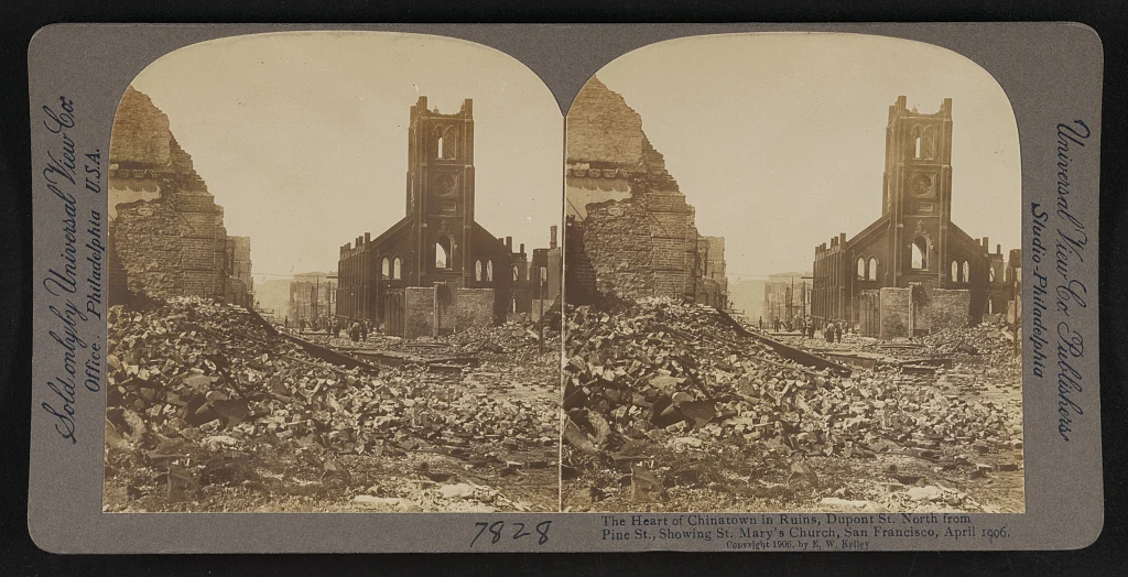
San Francisco’s Chinatown became a centre of Chinese American life under conditions shaped by labour demand, racial violence and exclusionary law. By the late nineteenth century, family, district and benevolent associations, businesses, temples, theatres, newspapers and social institutions sustained a community constrained by segregation. The 1906 earthquake and fire destroyed much of the district. The disaster was followed by a political effort to move Chinese residents away from valuable central land.
Community members, merchants and international interests resisted. Chinatown was rebuilt in place. Some new façades used an intentionally hybrid architectural language—pagoda roofs, balconies and ornamental motifs—to satisfy white expectations of an “Oriental” district while drawing tourism and protecting a territorial claim. To see those forms only as picturesque design is to miss their strategic context. They belong to a history of exclusion and civic survival, not a themed set.
The stereograph above records devastation rather than recovery. Its paired images were made for three-dimensional viewing, turning ruins into a consumable spectacle for distant audiences. Used critically, it can do something else: place people and rubble behind the polished district encountered today. St Mary’s Church survives in the frame as a landmark; the commercial and domestic world around it does not. Rebuilding was human work, not an automatic return of “character.”
North Beach developed a different but equally layered public identity. Italian immigration and enterprise gave the district churches, clubs, food businesses and social networks. In the twentieth century, writers and publishers associated with the Beat movement added another mythology. Columbus Avenue’s diagonal cuts across the grid and helps expose the physical seam between districts. Yet neighbourhood life cannot be inferred from a literary landmark, a café table or an Italian flag.
The road view is strongest when it makes that seam a question. Which signs change? Where does the street wall loosen? How do language, storefront scale and public space shift? It is weakest when the guide turns communities into rapid ethnic labels. The right response to a compressed pass is not to demand a longer lecture while traffic moves. It is to note a return route: walk Portsmouth Square and the surrounding association streets in daylight; cross toward North Beach slowly; spend money with independent businesses; use community museums and published historic-context work to deepen what the windscreen introduced.
05 · Three exposures
A ruin designed to look older than it was
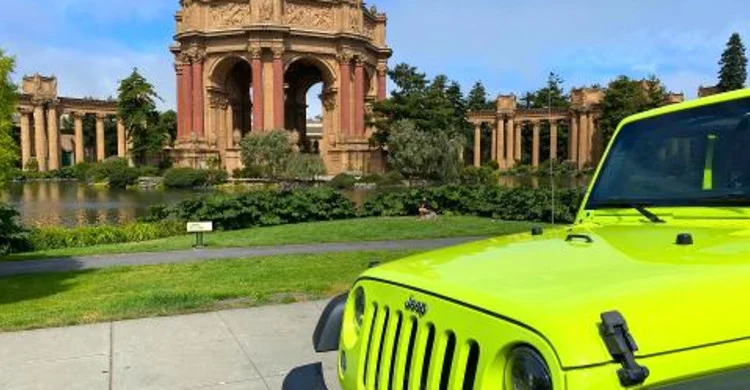
At the Palace of Fine Arts, a quick street route encounters a useful deception. The rotunda and colonnades look like the remains of a classical civilisation. They were designed by Bernard Maybeck for the 1915 Panama-Pacific International Exposition, a temporary world’s fair that advertised San Francisco’s recovery less than a decade after the earthquake and fire.
Maybeck did not simply imitate an intact Roman temple. He created an elegiac composition: an imagined ruin around a lagoon, meant to slow visitors after crowded exhibition halls and invite reflection on beauty’s impermanence. The Fine Arts complex displayed thousands of works, but the surviving public memory is largely architectural. The building designed to seem ancient became one of the fair’s few monumental traces.
Survival is itself a complicated word. Exposition structures were generally built to be temporary. Public affection led to preservation efforts, but the fragile original fabric deteriorated. Major reconstruction later replaced much of it in durable materials while retaining the form. What looks like an antique survivor is therefore an argument made repeatedly by designers, donors, engineers and public agencies about which temporary image of 1915 should remain.
The fair’s recovery story also needs limits. Civic boosters celebrated reconstruction and a Pacific-facing future, but triumphal narratives can obscure displacement, racial hierarchy and unequal access to the city being promoted. Chinatown’s 1906 rebuilding, for example, was not a gift of the same civic consensus. A short route can connect the two histories: one district fought to remain; one exposition projected recovery; both used architecture to negotiate public perception.
The lagoon and colonnade reward a stop because they change at walking speed. Reflections separate from columns. Weathering and repaired surfaces become visible. Birds, joggers, wedding parties and event activity return the monument to ordinary city life. From a moving vehicle, it is a grand backdrop. On foot, it becomes a designed landscape with maintenance needs and competing uses. Current access, event closures and operating hours should always be checked with San Francisco Recreation and Parks rather than inferred from a tour photograph.
06 · Three exposures
Lombard’s curves are engineering, then politics

The original straight hillside had an approximately 27 percent grade: about 27 units of rise for every 100 units of horizontal run, equivalent to roughly 15 degrees. In 1922, eight hairpin turns lengthened the route down the block between Hyde and Leavenworth Streets. They reduced the severity of the descent while making vehicles slow through a narrow residential street. Percent grade measures rise against horizontal distance; it is not an angle in degrees, and the redesigned roadway is not uniformly as steep as the original straight slope.
Planting, paving, retaining elements, drainage and irrigation help create the photographed scene. They also require maintenance. The curves are not proof that Lombard is definitively the “crookedest street in the world,” an advertising superlative with no useful universal test. They are a small piece of residential infrastructure redesigned into a global attraction.
That transformation creates conflict. Vehicles queue for the descent. Pedestrians enter the roadway or stop on steps. Noise, litter, access to homes and the behaviour of commercial traffic have produced repeated management studies and proposals. A guide may choose the block when conditions allow, view it from elsewhere or omit it. That is not necessarily a failure to deliver a classic; it may be responsible route management.
The photograph is also a peculiar reward. From inside a descending vehicle, the eight turns are felt more clearly than they are seen. From below, the compressed curves and planting form the famous façade, but the engineering problem becomes abstract. Walking the public pavements provides another reading, provided visitors respect residents, keep clear of doors and roads, and avoid treating the block as a set built for individual possession.
07 · Three exposures
The Golden Gate joins road and water

The land route commonly reaches the Golden Gate through the Marina and Presidio side of the city, sometimes pausing where conditions permit. The bridge marks the opening between ocean and estuary and carries a regional road over a difficult strait. From the shoreline, its span appears to rest on the landscape; from a vessel, the clearance beneath it makes the crossing’s engineering purpose immediately legible.
Construction began in January 1933, during the Depression, and the bridge opened to vehicle traffic in May 1937. Chief engineer Joseph Strauss did not solve the crossing alone: the suspension design depended on a team of engineers, architects and builders. Its towers carry curved main cables, which transfer the suspended deck’s load to huge shore anchorages through vertical suspender ropes. The deck is supported from above rather than held up by a forest of piers in the shipping channel.
The bridge district’s construction statistics give a 4,200-foot main span between towers and approximately 220 feet of clearance above mean higher high water. Those dimensions explain the boat view: the middle opening leaves room for navigation, while the towers stand outside the central passage. The south tower’s foundation extended below low water, requiring work in an exposed marine environment. Building the image familiar from postcards meant solving difficult foundations before spinning and securing the cables overhead.
Before the south tower could be built offshore, geologist Andrew C. Lawson tested its serpentine foundation rock. The bridge district records a load test that put the equivalent weight of a fully loaded railroad boxcar on an area only 20 inches square. The rock was strong enough. That small patch of tested ground sits behind the enormous public image: the bridge’s visual confidence rests on investigation, calculation and construction work that a scenic overlook cannot show. Engineers Charles A. Ellis and Leon Moisseiff performed essential design calculations, while tests on a scaled tower model checked the structure before full-size construction.
The structure’s apparent stillness is another illusion. A suspension bridge must accommodate wind, traffic and temperature changes; controlled movement belongs to its design. Look from a safe stop for the difference between the main cable’s long curve and the vertical suspenders. At the southern foot, nineteenth-century Fort Point predates the bridge and survives beneath its approach, joining harbour defence to twentieth-century regional transport. The crossing connects these histories physically. For the wider journey across Marin, redwoods and an island landing, San Francisco Across Three Thresholds extends the comparison.
On the street, the bridge is encountered through approach roads, towers, traffic and viewpoint availability. Wind arrives as force and noise. Fog can obscure one tower while the road surface remains clear. A passenger sees suspension cables converge and feels the structure’s scale. On the bay, the roadway becomes a high line and the opening below becomes dominant. The bridge is no longer the route beneath the vehicle; it frames the vessel’s passage between sheltered bay and Pacific water.
This change of position corrects a common visual mistake. Postcards isolate the span against water and headlands, as if the bridge were simply placed in scenery. The cruise shows a working relationship among depth, tide, navigation, fortification, city access and regional movement. It also shows why weather is not a background. Wind and fog are active conditions at the gate.
Beyond the northern loop: choose a question
A short northern route cannot become a complete city tour by adding names. A longer road allocation can change the question altogether: west towards park and ocean, uphill towards the city’s ecological remnants, or south towards neighbourhood art. Decide which extension matters before treating an extra hour as a promise to fit them all. Travel time and a worthwhile stop compete for the same margin.
Golden Gate Park offers a designed landscape rather than the bridge’s maritime threshold. Work began in 1870 under William Hammond Hall on windswept sand dunes in the Outside Lands. Planting, water and maintenance made a large public park possible; its wooded appearance should not be mistaken for untouched forest. The Music Concourse grew from the 1894 Midwinter Exposition, and the park sheltered people displaced by the 1906 earthquake and fire. These layers make a stop more interesting than a drive through greenery. Choose one garden, institution or public landscape to explore at walking speed, and check its own admission and access arrangements separately. The city’s park history supports the chronology, but the ground itself shows how recreation, horticulture and civic refuge share the same space.
Continuing to Ocean Beach changes both scale and exposure. Here the horizon belongs to the Pacific rather than the enclosed bay; surf, wind and an open sandy edge replace piers and city reflections. Treat it as a shore visit. The National Park Service’s Ocean Beach safety information identifies it as a beach unsuitable for swimming. Strong rip currents and cold water are durable hazards, not a reason to chase the water for a photograph. Stay on a safe shore position, heed posted warnings and keep watching the waves. A brief ocean stop can explain why a mild day inside the city is still cold at its western edge.
Twin Peaks offers another comparison, but a panorama depends on visibility. At 922 feet, the paired hills also preserve coastal scrub and grassland within the city. The endangered Mission blue butterfly depends on lupine habitat here; the vegetation beneath the skyline is part of the attraction, even when no butterfly is visible. Use established paths, avoid trampling plants for a camera angle and distinguish the roadside overlook from climbing summit trails. The park department’s description helps identify terrain and access; a vehicle reaching a viewpoint does not make every trail or step suitable for every visitor. On a fog-bound day, a sheltered neighbourhood walk may produce more understanding than a blank summit.
The Mission’s murals ask for time with people’s stories rather than distance from them. Precita Eyes, founded by artists Susan and Luis Cervantes in 1977, supports community mural-making, preservation and education. A painted wall can hold neighbourhood memory, political argument and collective authorship; its setting among homes and businesses matters as much as its colours. An introductory stop is a beginning, not a substitute for looking slowly or joining a locally led interpretation. Read any available artist and project information, respect working doorways and residents, and do not assume a work is anonymous decoration. Precita Eyes provides an entry into that living practice.
These alternatives clarify the first-day choice. Park and ocean reveal a constructed landscape and exposed coast; Twin Peaks combines topography with habitat; the Mission brings the visitor into community expression. Choose one direction with the guide and leave enough time to get out, look and ask a question. An early orientation pays off when it leads to a deliberate return, not when it exhausts a list of landmarks.
08 · Three exposures
Pier 43½ is a handoff, not a footnote
A street-and-cruise day joins two movement systems. A private road vehicle can adjust its stops; a scheduled passenger vessel cannot inherit that flexibility. Once the traveller reaches the waterfront, the cruise operator controls boarding, vessel, narration, safety and return. The change of control is part of the experience, not a minor administrative detail.
That distinction prevents several false assumptions. A private street route does not imply a private boat. A guide’s ability to change a road sequence cannot move a published sailing. Anyone combining the modes needs enough margin to find the correct pier, use facilities and complete current boarding instructions without turning the transfer into a sprint.
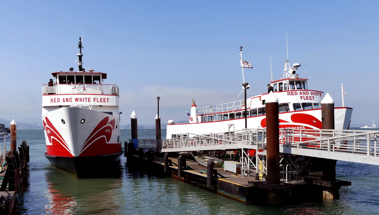
The half-number is real. Pier 43½ sits at Fisherman’s Wharf and serves Red and White Fleet’s public cruises. It should not be confused with lower-numbered piers farther along the Embarcadero. The useful planning habit is simple: identify the operating cruise and its current pier before designing the land route around it.
Cruise duration, departure, vessel, ticket procedure and accessibility arrangements are date-specific operating facts. Check them on the chosen operator’s official page and ticket. The durable editorial point is the handoff itself: road and water produce different knowledge because they are different systems with different constraints.
09 · Three exposures
From the bay, the city becomes a machine
.jpg)
Leaving the pier, the vessel first makes the waterfront continuous. The wharf, Aquatic Park, Fort Mason, the Marina edge, Presidio shoreline and bridge approaches align in a way the street grid cannot provide. Piers project into navigation space. Hills rise behind them. The city appears to sit on the water even where fill, seawalls and engineered edges have remade the shore.
The boat’s wake supplies a moving scale. Other ferries and workboats reveal traffic lanes and speed. Sea lions, birds or marine mammals may be seen, but none should be promised; wildlife chooses its own route. Wind commonly strengthens on exposed decks. Indoor shelter can make the cruise workable in cold conditions, yet windows change photography and the sense of air. A traveller should choose position according to comfort, not an imagined obligation to remain outside.
As the boat approaches the Golden Gate, the bay narrows toward the strait. The bridge’s towers no longer frame a road journey. They mark the line between an estuary and the Pacific. Current, wind and swell become easier to perceive. Fort Point, headlands and military sites recall that the passage was defended as well as crossed.
On the return arc, Alcatraz enters relationship with the city. It is neither remote nor easily reachable without authorised transport. The current sightseeing cruise passes around the island but does not land. That difference must be unambiguous. Passengers see the Cellhouse mass, cliffs, dock and changing skyline relationship; they do not enter the prison, take the Cellhouse audio tour or walk through the history of the 1969–71 Indigenous occupation.
Alcatraz’s most important twentieth-century history extends beyond the prison, which closed in 1963. From November 1969 to June 1971, Native American activists calling themselves Indians of All Tribes occupied the island, demanding recognition of treaty rights and proposing an Indigenous cultural and educational centre. The National Park Service describes an occupation that helped bring Native self-determination into national public view. Seen from a cruise, the island is therefore more than a prison silhouette: it was also a platform from which people challenged the federal government’s treatment of Native nations.
From water, the island’s role as barrier, landmark and navigational object is unusually clear. A traveller who wants its layered military, carceral, ecological and Indigenous histories needs a separate authorised Alcatraz landing and enough time on shore. The three-threshold story develops that decision in depth.
Recorded narration can help identify the moving scene, particularly for a first visit, but it should not turn the rail into a race to photograph names. The bay rewards a simple practice: look outward before lifting the phone, identify the relationship among two or three objects, then make one image that records that relationship. Bridge plus current. Island plus city. Working pier plus visitor deck. The water view becomes explanatory when it resists the isolated icon.
10 · Three exposures
Sunset is a transition, not a guaranteed stop
An evening road format follows a transition rather than a fixed scenic result. “Sundown or night” is the honest distinction: neither phrase promises a red horizon, one exact overlook or clear bridge towers.
The sun’s clock and the tour’s clock meet differently by season. A departure may begin in full daylight and finish after dark, or start when night is already established. Low cloud may hide the solar disc while producing a soft, long blue hour. Fog can enter through the Golden Gate and move across neighbourhoods unevenly. A viewpoint that was open ten minutes earlier may become a wall of grey; another hill may remain clear.
That volatility is an argument for a local guide’s discretion. Chasing a single famous image can waste the transition. A useful guide may choose a lower street where shop light and architecture remain legible, or a hill where the city grid is visible even when the bridge is not. The vehicle’s open top makes changing air and temperature part of the experience, but it also makes wind a comfort and sound issue. Blankets help; they do not turn an open vehicle into climate-controlled transport.
The recurring route candidates—Fisherman’s Wharf, North Beach, Chinatown, the Palace of Fine Arts, Lombard Street, bridge approaches and selected overlooks—are not a checklist. Some work better at a particular light. Chinatown’s public life and architectural detail deserve daylight or early evening. The Palace’s rotunda can become a luminous object after dark, but the lagoon edge and surrounding activity may be harder to read. A bridge overlook is powerful when clear and disappointing when treated as a contractual obligation.
11 · Three exposures
Public light creates a temporary city
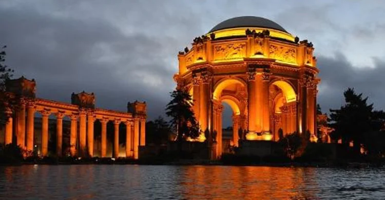
At night, San Francisco’s landmarks do not merely become more dramatic. They become different evidence. The Palace of Fine Arts loses much of its surface condition and designed ruin effect; warm illumination separates arch and dome from the dark landscape. The image is easier to recognise and harder to investigate. A photographer gains graphic form while an architectural reader loses material information.
Street lighting distributes attention unevenly. Commercial corridors remain active. Residential windows imply occupation without revealing it. Brake lights trace grade and congestion. A cable car or bus becomes a moving interior. Public safety depends on more than brightness: pavement condition, crossings, traffic behaviour, visibility, crowding and a traveller’s ability to enter and leave a vehicle all matter.
The Bay Bridge provides another way to read a span. Artist Leo Villareal’s Bay Lights first illuminated the western span’s northern cable plane in March 2013, using 25,000 individually controlled LEDs to produce changing patterns rather than a single static picture. The work translates the cable geometry into a field of points: what seems from a distance to be a solid outline becomes movement across a structural rhythm.
The original installation went dark in 2023. A renewed Bay Lights system returned in March 2026 with 48,000 custom LEDs across its two-sided design, according to Illuminate. That history matters because this is a designed artwork with equipment and maintenance, not a natural feature of the skyline.
For a visit organised around public art, consult the installation’s current information before departure. The more durable viewing practice is to compare the luminous cable plane with the surrounding working bridge: roadway, towers, moving traffic and the dark water below. From one position the pattern is the subject; from another the span’s structure and regional purpose remain more prominent.
The Bay Lights also pose a useful interpretive problem. They make the west span visible as art, but not necessarily as labour, maintenance, toll infrastructure, seismic retrofit or regional commute. The night tour can use that tension. Ask what the lighting reveals about cable geometry, then ask what the display hides about the bridge’s daily work.
12 · Three exposures
Fog is weather, not a mascot

In spring and summer, cool Pacific water and a marine layer frequently meet warmer inland conditions. The Golden Gate acts as a low opening through which cool air and fog enter the bay. Hills then divide, lift and redirect that air. Fog is a physical relationship among ocean, air and terrain, not an even coating over the city.
The western city may be grey while the Mission is bright. A bridge tower can disappear while the waterfront remains visible. Wind at an exposed overlook can feel much colder than a sheltered street a short drive away. September and October are often warmer, but a seasonal tendency is not a forecast.
Open-air touring intensifies these differences. Moving air increases heat loss. Conversation can become difficult at speed. Fine moisture affects glasses and camera lenses. Layers should be reachable rather than packed beneath other belongings. A beanie or secure hat works better than loose headwear; a strap should not become a hazard. If a guest has respiratory, balance, hearing or temperature-regulation needs, the correct question is not whether the tour is generally “accessible.” It is whether this vehicle, step height, seating position, wind exposure and stop pattern work for that person.
Light rain and heavy rain are different operational problems. Travellers should check the forecast, monitor current operator messages for any booked open-air activity and avoid forcing a departure when conditions are judged unsafe.
13 · Three exposures
Darkness can beautify what history complicates
Night touring has an ethical temptation: the city becomes so photogenic that explanation feels like interference. Chinatown’s ornamental rooflines glow while exclusion and rebuilding recede. The Palace becomes a golden fantasy while the exposition’s politics disappear. The wharf becomes reflections and signs while fishing labour withdraws from view. Alcatraz becomes a black mass without the occupation-era messages that challenge a prison-only narrative.
This makes the night view incomplete in a particular direction. A guide can counterbalance it by naming one missing layer at each stop rather than delivering a lecture into the wind: Chinatown’s rebuilding in place after an attempt to displace its residents; the Palace’s origin as a temporary, romantic ruin; the bridge light’s history as a designed public project. Each explanation gives the visible scene a second dimension.
The traveller has responsibilities too. Night photography should not block pavements, building access, cycle lanes or passenger zones. A residential window is not consent. A tripod can convert a narrow public route into a private studio. Flash can disturb people, drivers and wildlife. The best night image often comes from accepting less: a supported camera, a safe position, a slower shutter if practical and no attempt to manufacture emptiness in a living district.
Returning in daylight is not an admission that the night tour failed. It completes the comparison. Revisit one neighbourhood on foot. Read a plaque that was illegible in the dark. Notice how a monumental façade is attached to ordinary service spaces. Take Muni along a route first traversed privately. Orientation earns its value when it produces a more attentive second encounter.
14 · Three exposures
Two formats, two kinds of compression
The city-plus-cruise format and an evening road format should not be compared as if one merely adds a boat and the other merely subtracts daylight.
The day-and-bay combination changes scale deliberately. It suits a first visit that wants neighbourhood orientation and maritime geography in one sequence. The compromise is a longer total commitment and a fixed handoff: private flexibility ends where the published cruise operation begins. A sightseeing circuit around Alcatraz is also not an island landing.
The evening format stays within one road experience. It is more coherent as a study of changing light and can adapt viewpoints without meeting a boat. The compromise is information loss. District history, architecture and gardens are harder to see; a hoped-for sunset may be fog; open-air cold arrives when energy is already lower after a travel day.
Open-top vehicles are not a universal access solution. Before choosing one, establish the actual step height, restraints, seating, storage, weather protection, hearing conditions and ability to transfer; a headline passenger count says little about a particular group’s safe and comfortable fit. A separate cruise requires its own access check from pier approach through boarding, toilets, indoor shelter and return.
Neither format is the only intelligent way to learn the city. Walking provides the richest neighbourhood detail but demands grade management. Muni connects districts without parking and allows selective returns. Cable cars make terrain and nineteenth-century propulsion tangible but have accessibility limits and queues. Ferries and public cruises clarify the waterfront without private road touring. A good decision begins with the information the traveller needs, not the number of icons a product names.
Traveller’s field notes
- Use current instructions for any meeting point. Follow the live ticket and posted curb rules rather than an old episode, map pin or remembered publicity. White zones are for active passenger loading, not waiting or parking.
- Confirm the vehicle as a physical system, not a number. Ask about step height, restraints, row access, seating, storage, wind and transfers for the actual travellers before purchase.
- Plan mobility aids, strollers and luggage end to end. Establish where each item can be stored on the road vehicle and vessel; when the chain is incomplete, choose another format rather than improvising at the curb.
- Children require a live restraint check. Confirm current minimum age, approved child seat, lap-seating prohibition and placement directly with the chosen carrier.
- Dress for moving air. Bring reachable layers even on a warm inland day. Secure loose hats and scarves. The third row is commonly windier; a hearing or neck issue may make another seat preferable.
- Separate land and cruise instructions. A combined day hands travellers from one operator to another. Check boarding margin, ticket procedure, vessel access, facilities and current cruise conditions separately.
- Understand “around Alcatraz.” The one-hour bay cruise does not land. Book an authorised Alcatraz Island departure on another day if the Cellhouse, military history, gardens and Indigenous occupation history are priorities.
- Let conditions edit the route. Traffic can block Lombard, fog can erase a bridge view and events can close streets or monuments. Judge the guide by the quality of the alternative, not by forced adherence to a sample list.
- Choose the mode by information need. Use road for grade and adjacency, water for peninsula and port, and night for lighting and infrastructure. Return on foot or Muni for the people, interiors and material detail each compressed route misses.
- Check current public information. Use SFMTA visitor guidance for fares and service, the live cruise operator for boarding, San Francisco Recreation and Parks for Palace access and the public-art operator for the Bay Lights.
Sources and reporting record
- Private San Francisco City Tour and Bay Cruise and San Francisco City Lights — the two audio routes behind this comparison.
- Association of Ramaytush Ohlone: Original Peoples and about the ARO — Yelamu specificity and contemporary Ramaytush responsibilities.
- Chinese American Historic Context Statement and NPS on Chinatown after 1906 — exclusion, disaster, attempted displacement and rebuilding.
- North Beach Public Life Study — Italian American, Beat and public-realm context.
- Palace of Fine Arts landmark and preservation report — 1915 exposition, Maybeck design, preservation and reconstruction.
- San Francisco Public Works on Lombard Street and the SFMTA management study — eight turns, 27 percent natural grade, 1922 redesign and visitor impacts.
- Port of San Francisco maritime-commerce overview — working fishing, Pier 45 and water-dependent uses.
- National Park Service weather guidance and Presidio climate — fog, wind, seasonal tendencies and short-distance microclimates.
- Golden Gate Bay Cruise — the public sightseeing route and Pier 43½ operation; check the official page for the chosen date.
- The Bay Lights project — the installation’s history, Leo Villareal’s design and the 20 March 2026 relighting.
- The heart of Chinatown in ruins — 1906 stereograph, Library of Congress, no known publication restrictions.
- San Francisco Across Three Thresholds — continue with the Golden Gate, Muir Woods and Alcatraz.

Continue exploring
The question we carry out
If a first route gives you three persuasive versions of San Francisco, which missing evidence will you return for: the neighbourhood at walking speed, the bay as working water, or the history that darkness made beautiful enough to overlook?