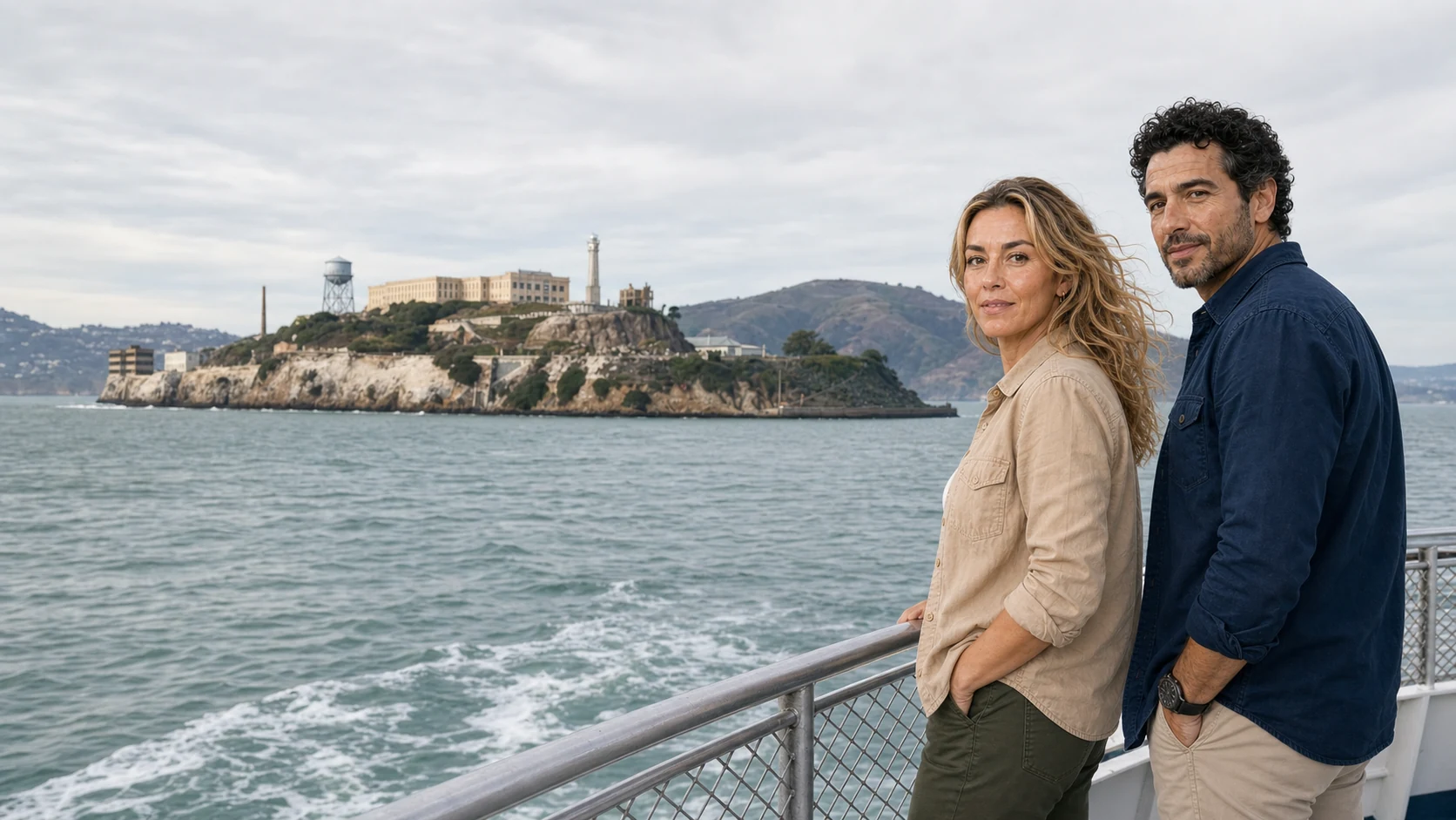
A single day can cross the Golden Gate, enter an old-growth redwood forest and finish inside the Cellhouse on Alcatraz. The appeal is obvious; the risk is turning three consequential places into a checklist. This route works when its transitions become the story.
The first instruction is precise enough to prevent a small urban comedy. The operator's standard meeting point is 2870 Hyde Street, at the corner of Hyde and Jefferson in Fisherman's Wharf. The lime-green open Jeep is a useful landmark; the meeting instructions issued for the booking settle exactly where to wait.
That distinction, recorded by the operator and repeated in The Travel Podcast by ExcursionPass, establishes the bargain before the vehicle moves. This is a day built around handing over logistics: the roads into Marin, access to Muir Woods, a return across the bridge and an assigned Alcatraz ferry. The private guide manages the difficult transitions; the forest and island visits are largely self-guided.
Convenience, however, is not the most interesting thing about the itinerary. San Francisco's identity extends across water, headlands and federal parkland. Drive north and the Golden Gate Bridge stops being a postcard and becomes working infrastructure. Descend into Muir Woods and a place usually represented by a few giant trunks reveals itself as a living system, an Indigenous homeland and a contested conservation project. Cross the bay to Alcatraz and the familiar prison silhouette opens into overlapping histories of fortification, forced assimilation, incarceration, Native activism, gardens and seabird habitat.
These are three thresholds—bridge, forest, island—with three different ideas about movement. One connects. One protects by regulating access. One was repeatedly adapted to control who could enter or leave. Reading those differences is the best argument for putting the places together. It is also the reason not to rush them.
Listen while you read
When logistics become the subject The 21-minute episode tests whether a private Golden Gate and Muir Woods route combined with Alcatraz can turn a difficult set of bookings into one coherent day. Its complete transcript is available in VTT format.
Before the first threshold: what the route actually promises
The road portion normally begins in the morning. The open vehicle heads from Fisherman's Wharf toward the Golden Gate, crosses into Marin, descends to Muir Woods and returns by the coast and Sausalito to the waterfront for the Alcatraz handoff. The operator describes a private Jeep with up to six guests plus the guide, with a self-guided interval in the monument. Its road formats span roughly three to four hours; the booked version, traffic and ferry assignment determine how that time is divided. The ferry crossing, island visit and return to Pier 33 extend the experience into a full day.
“Private” applies to the road tour, not to Muir Woods or Alcatraz. Other visitors share the trails, ferry and Cellhouse. Nor does “combined” mean that one guide narrates every hour: the driver-guide stays with the vehicle at Muir Woods, and Alcatraz is self-paced after the authorised ferry lands. The product's real value is coordination across incompatible systems, not insulation from public places.
The open Jeep is also a substantive choice. It offers clean sightlines and makes wind, temperature and traffic noise impossible to edit out. Blankets help on cold crossings, but they do not turn the vehicle into a climate-controlled coach. Travellers who need quiet transport should weigh that exposure. For a mobility aid, stroller or large bag, establish the actual vehicle's loading, transfer and storage arrangements before choosing the format. Accessible park paths and ferry services do not by themselves establish access to a particular Jeep. The day is adventurous in format even when the logistics are highly managed.
01 · The Golden Gate: a public gamble in fog
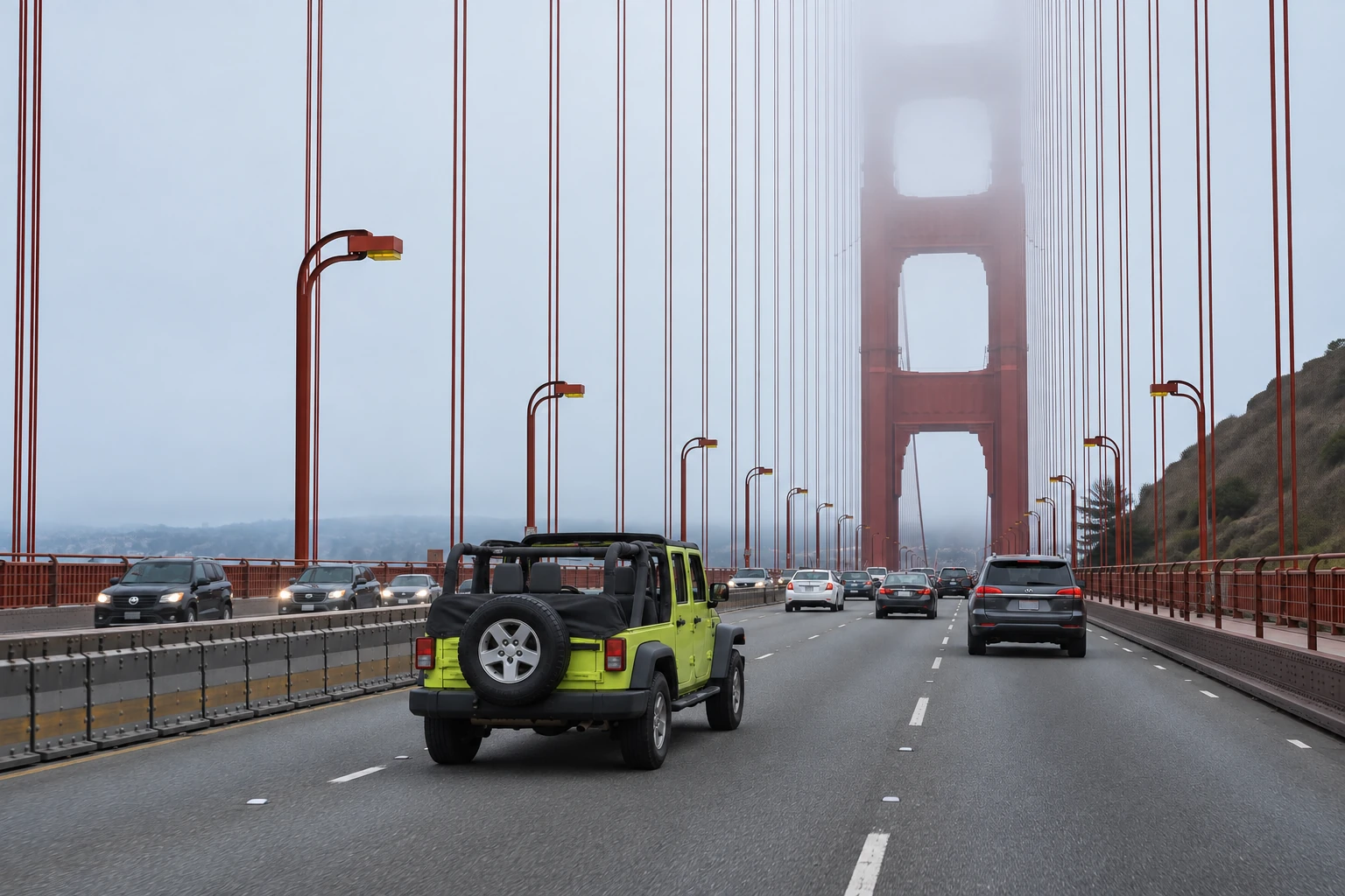
From the northern waterfront, the roadway bends west before the bridge declares its full scale. The city thins, the Presidio opens, and the towers begin to align with the strait. In an open vehicle the sequence is physical: engine noise, colder air and the interruption of the wind. Fog may erase the tower tops or leave the entire span in hard sunlight. Neither condition is a defect. Both belong to a bridge engineered for an unstable coastal boundary.
The strait is only about a mile wide at its narrowest, but it concentrates tides, wind and ocean weather at the entrance to San Francisco Bay. Before the bridge, ferries connected San Francisco with Marin and the North Bay. A fixed crossing promised to reorganise regional movement, yet for decades the idea looked financially reckless and technically implausible. Deep water, strong currents, fog and the need to preserve a major shipping channel made the site unusually demanding. Ferry interests opposed a structure that threatened their business; others doubted the landscape should be interrupted at all.
The bridge did not emerge from one solitary engineer's flash of genius. Joseph B. Strauss became its chief engineer and public advocate, but the design was collaborative. Engineer Charles Alton Ellis performed much of the complex structural analysis; Leon Moisseiff advised on suspension design; O.H. Ammann served on the board of engineers; University of California engineering dean Charles Derleth Jr. reviewed the work; and architect Irving Morrow gave the structure much of its visible discipline. Ellis was dismissed before completion and went without adequate public credit for decades. Remembering him changes the bridge from a hero story into a lesson about how large works are actually made—and how professional recognition can be distributed as unevenly as risk.
The district placed a bet, and local property backed it
The Great Depression made the financing story as consequential as the engineering. In November 1930, voters in the six-county Golden Gate Bridge and Highway District approved a USD 35 million bond issue by 145,057 votes to 46,954. Homes, farms and businesses in the district stood behind that debt. The vote did not produce immediate cash: as the economy worsened, buyers were difficult to find. In 1932, a Bank of America-led syndicate began purchasing the bonds, allowing construction to proceed.
The fact deserves attention because it is easy to inherit infrastructure as if it were inevitable. People voted during financial crisis to put private property behind a regional public project whose success was not assured. Construction began on 5 January 1933. Pedestrians first crossed on 27 May 1937; vehicle traffic began the following day. At opening, the 4,200-foot main span was the longest suspension-bridge span in the world. The bonds were finally retired in 1971 from toll revenues—not general taxation.
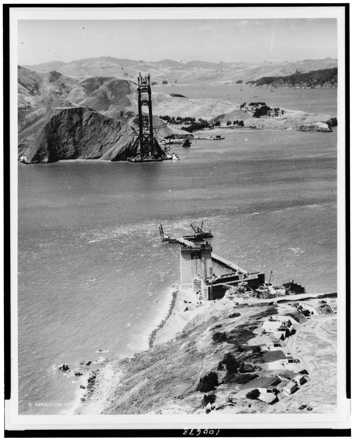
Building outward from both shores required different answers. On the Marin side, the geology offered a comparatively direct foundation. The San Francisco tower stood more than 1,000 feet offshore, where crews built a protective fender and worked down through water to bedrock. Storms damaged the first access trestle and repeatedly tested construction schedules. The two finished towers rise 746 feet above the water. Their height is not decorative excess: the main cables must climb high enough to support a long, navigable central span while transferring enormous tension into anchorages at both ends.
Cable spinning turned thin wire into regional-scale structure. Each of the two main cables contains 27,572 parallel wires compacted into a bundle more than three feet in diameter. End to end, the wire would extend roughly 80,000 miles. Vertical suspender ropes transfer the roadway load to those cables; the cables carry it into towers and anchorages. The sequence is visible from the walkway if the bridge is read as a force diagram: deck to suspender, suspender to cable, cable over tower, tension into land.
Labour belongs inside the engineering story
The monumentality can conceal the job site. Workers erected towers, spun the main cables, placed vertical suspenders and built the roadway high above moving water. Strauss imposed safety measures that were unusually ambitious for the period: hard hats, respirators, glare-free goggles and a net suspended beneath the work area. The net saved 19 men, who became known as the “Halfway-to-Hell Club.” That success is not a reason to sentimentalise the construction. Eleven workers died. Ten were killed together on 17 February 1937 when a scaffold fell through the safety net.
The record makes two points at once. Safety systems can save lives, and major public works still distribute danger downward to the people who build them. A complete bridge history therefore includes ironworkers, riveters, painters, electricians, divers, concrete crews and the people who maintained ferry and maritime traffic around construction. The structure is not only calculations made visible; it is organised labour held over a difficult site.
Why International Orange is more than decoration
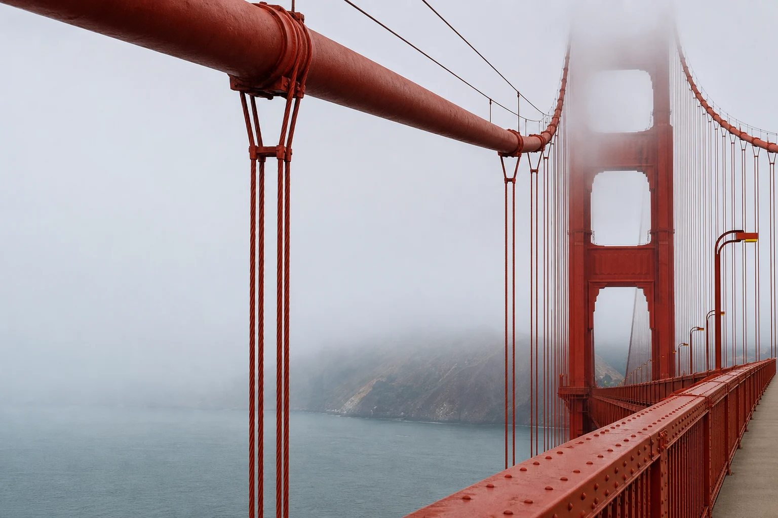
The original proposal imagined a more conventional finish. During construction, however, the steel arrived coated in a red-lead primer that Irving Morrow saw working against sea, sky and headlands. He argued for a related warm colour rather than aluminium paint or black-and-yellow striping. The resulting International Orange gives the bridge contrast in fog without detaching it from the brown and green landscape. Morrow also refined the stepped Art Deco tower portals, railings and lighting. Engineering carries the load; architecture teaches the public how to see it.
The paint is not a one-time skin. Salt air and fog make corrosion control continuous work. Crews inspect steel, prepare damaged surfaces and repaint where needed rather than endlessly coating the entire bridge from one end to the other. Other systems have also changed. A 1951 windstorm led to additional lateral bracing. The original suspender ropes were replaced. The roadway deck was replaced with a lighter orthotropic steel deck in the 1980s, and seismic retrofits have continued in stages. What looks timeless is, in fact, repeatedly renewed.
Those changes also complicate the idea of authenticity. Replacing a deck or suspender rope does not make the bridge less historic; refusing necessary change would make it unsafe. Preservation here means retaining design intent while accepting that a working transportation system is a succession of inspected, repaired and sometimes replaced parts. The same bridge can be a 1937 landmark and a twenty-first-century piece of infrastructure because continuity lies in relationships, records and stewardship rather than in every atom of original material.
The bridge's social history is not finished either. For generations it has been a place of suicide as well as transit. After long debate, the district completed a stainless-steel deterrent barrier along the full span in January 2024. The district reported eight confirmed suicide deaths from the bridge in 2024, compared with a long-term average of about 30 a year before the system. Those numbers are not a tourism anecdote. They show how design choices can acknowledge a public-health responsibility that earlier versions of an admired landmark left unaddressed.
How to cross without reducing the bridge to a stop
The private route's strongest decision is to cross before asking the bridge to pose. The roadway reveals its grade, cable rhythm, maintenance zones and relationship to the headlands. A Marin-side stop, when conditions permit, then lets the structure be seen in context. Fog, traffic, construction and parking can alter which viewpoint is practical. An exact promised photograph is therefore less honest than a well-managed sequence.
Independent visitors should treat parking and walkway access as live conditions. Check the bridge district's current alerts before setting out. Walking or using transit can be more reliable than circling for a space. On the bridge, wear a wind-resistant layer even if Fisherman's Wharf is mild, stay out of bicycle traffic and confirm current walkway hours. In the Jeep, secure hats and light belongings and expect conversation to pause when exposure and road noise rise.
The most useful question on the crossing is not “Where is the best photo?” It is “What keeps this working?” Look for the diameter of the main cable, the repeating suspender ropes, the riveted plates, the maintenance access and the way the deck meets the towers. Then look beyond the steel. The bridge connects because a political district financed it, labourers built it, crews renew it and public decisions continue to change it.
02 · Muir Woods: old growth is a relationship, not an age record
The road into Marin leaves the exposed bridge approaches and folds into the slopes of Mount Tamalpais. The descent to Muir Woods is narrow and curving. A map makes the monument look close to the city; the road makes clear why access must be planned. At the bottom, topography rearranges the day. A sheltered valley, Redwood Creek and a dense canopy replace the strait's horizontal exposure.
Long before the monument had its current name, this watershed was part of the homeland of the Huimen community of Coast Miwok people. Archaeological and tribal histories place Coast Miwok presence in the region over many millennia. The Federated Indians of Graton Rancheria represents Coast Miwok and Southern Pomo people today. Beginning with Spanish colonial expansion and the mission system, Native communities endured forced conversion, displacement, disease, violence and coerced labour. A forest history that starts with a white conservationist in 1908 erases both prior stewardship and survival.
That longer chronology changes how “untouched” should be understood. Old growth is not land outside human history. Coast Miwok communities used fire and other practices to support food plants, habitat and resilient landscapes. The park now works with the Federated Indians of Graton Rancheria as beneficial fire returns to parts of the Mount Tamalpais watershed. Protection is strongest when it recognises that Indigenous care preceded the monument and remains contemporary expertise, not decorative prehistory.
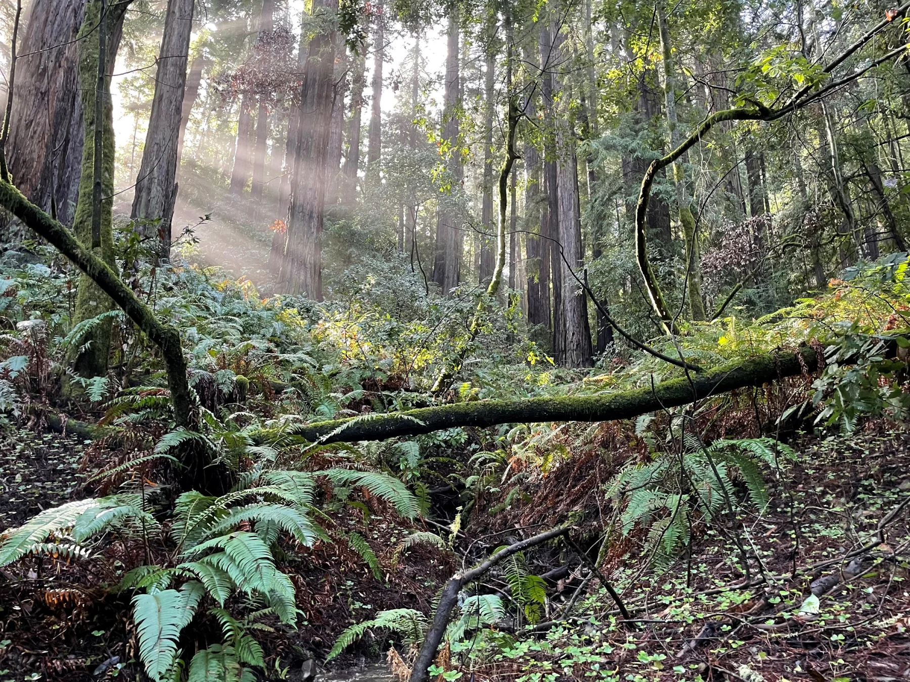
The grove that survived a regional logging economy
Nineteenth-century logging transformed the coast-redwood range around San Francisco Bay. The timber's durability made it valuable for buildings, infrastructure and a growing city. Today, the National Park Service estimates that about 97 percent of the historical old-growth coast-redwood forest has been altered or removed. Muir Woods is compelling not because it was the only forest, but because a portion survived while most comparable stands did not.
The modern preservation story includes people too often compressed into the name “John Muir.” In 1904, members of the California Club, led by Laura Lyon White, began campaigning to protect the grove then known as Redwood Canyon. In 1905, businessman and politician William Kent and his wife, Elizabeth Thacher Kent, bought more than 600 acres, including the forest, to prevent development and logging. They did not act in a vacuum: the 1906 earthquake and fire intensified demand for construction timber, sharpening the threat.
In 1907, the North Coast Water Company sued to obtain an easement for a reservoir that would flood the canyon. William Kent responded by offering 295 acres to the federal government, placing the land beyond the reach of a local condemnation action. President Theodore Roosevelt proclaimed Muir Woods National Monument on 9 January 1908 under the Antiquities Act. The Kents asked that it be named for naturalist John Muir. Muir welcomed the honour and later visited, but he did not discover the grove or lead the campaign that saved it. Laura Lyon White, Elizabeth Kent, the California Club and the legal confrontation with the water company belong in the account.
Preservation did not freeze the valley. A tourist railway once carried visitors over Mount Tamalpais; roads and automobiles changed the pattern again. A 1929 fire burned nearby and entered the monument. Civilian Conservation Corps crews built trails, bridges and facilities between 1933 and 1941. After the Golden Gate Bridge opened, easier road access helped visitation multiply. In May 1945, delegates attending the founding conference of the United Nations gathered in the grove to honour President Franklin D. Roosevelt. Each event attached a new public meaning—and new physical pressure—to a small watershed.
What “old growth” means under the canopy
The headline numbers are useful but incomplete. Muir Woods covers about 550 acres, roughly half of it old-growth coast-redwood forest. The tallest coast redwood in the monument is about 258 feet. Many trees average 600 to 800 years old; some exceed 1,000. Yet age and height do not make a forest by themselves.
Old growth contains several generations at once. Very large living trees share space with younger trunks, canopy openings, snags and fallen logs. Shade-loving sword ferns and redwood sorrel occupy the floor; bay laurel, tanoak, bigleaf maple and red alder appear where light, slope and water allow. Bats and birds use cavities in fire-scarred or dead wood. Fungi and invertebrates break material down. A fallen giant becomes moisture storage, habitat and a platform for new growth rather than “waste” to be removed.
Coast redwoods reproduce through seed, but they can also sprout from burls, roots and the base of a damaged parent. Rings of new trunks may therefore belong to the same genetic individual. Their shallow root systems do not mirror their height; they spread laterally and interlace with neighbouring roots. Scale here is cooperative and horizontal as well as vertical.
Fire belongs in the system too. Thick, tannin-rich bark helps mature coast redwoods resist many low- and moderate-intensity burns. Fire can open gaps, recycle nutrients and affect which species establish. But suppression, invasive plants, accumulated fuels and a changing climate complicate any simple claim that fire is either purely destructive or automatically beneficial. Cultural and prescribed burning require specific weather, expertise and goals. The return of fire stewardship is not an excuse for casual certainty; it is a reason to listen to tribal and ecological knowledge together.
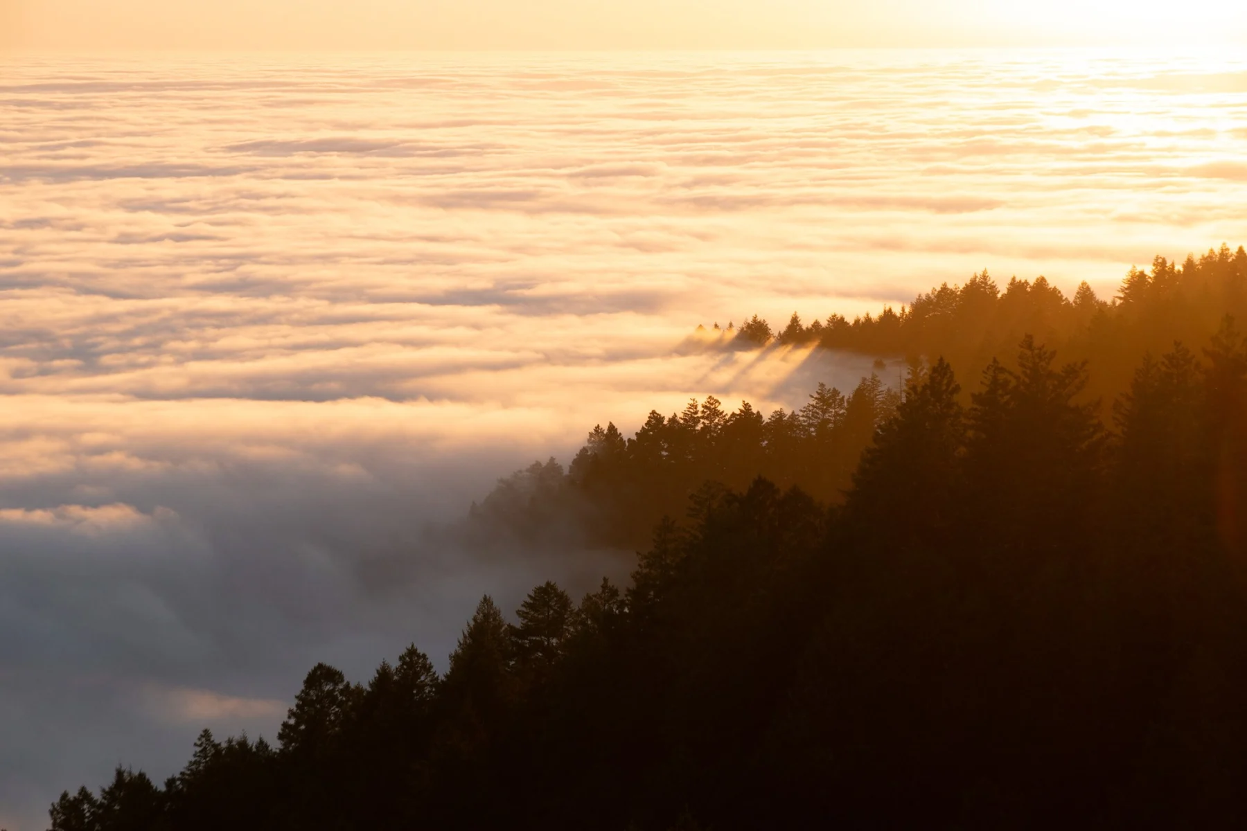
Fog is water moving sideways
The coast-redwood belt occupies a narrow climatic range. Mediterranean summers bring little rain, exactly when tall evergreen trees continue to move water. Coastal fog helps close the gap. Droplets settle on leaves and branches; water enters foliage directly through foliar uptake, and some condenses and drips to plants and soil below. Fog also cools the canopy and reduces evaporation.
Research led by James Johnstone and Todd Dawson found a substantial twentieth-century decline in coastal fog frequency in northern California and southern Oregon. The result does not mean every foggy morning has disappeared, nor does it predict one simple fate for every grove. It identifies a source of drought stress in a warming climate. The forest that visitors experience as cool and damp depends on ocean and atmospheric processes operating far beyond the monument boundary.
Redwood Creek makes the same point at ground level. It flows through the monument and continues toward the Pacific, linking forest, valley and marine systems. Shade keeps water cooler; fallen wood and channel structure create habitat; winter floods move sediment and nutrients. Coho salmon and steelhead depend on the watershed, even though a visitor following the boardwalk may never see a fish. Restoration projects have removed obsolete infrastructure, reconnected parts of the floodplain and improved habitat while redesigning visitor access. Conservation is active repair, not only restraint.
For decades, roads, bridges, parking and armoured banks treated the creek as something to constrain around visitor circulation. That approach protected access in the short term while simplifying the stream. A naturally mobile creek needs room to spill, deposit wood and sediment, and create pools and side channels. The Redwood Renewal programme therefore combines habitat restoration with new bridges, trail surfaces and utility work. Protection now includes undoing earlier protection measures: a restored channel has to function as habitat rather than merely fit between visitor facilities.
The salmon story makes boundaries especially porous. Coho hatch in freshwater, migrate to the ocean and return to reproduce. A problem downstream from the monument can interrupt a life cycle that depends on cold water beneath the redwoods; a change in the grove can affect habitat beyond it. Stewardship belongs to the entire watershed, not to a scenic core enclosed by a park line. The monument offers a concentrated place to learn that connection, but it cannot solve it alone.
The boardwalk is both invitation and limit
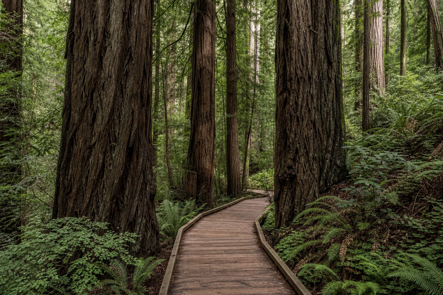
Muir Woods is a popular place that asks visitors to practise quiet. The main trail follows Redwood Creek through the most immediately accessible grove. Raised boardwalk and firm surfaces make the first section broadly usable, protect roots and channel foot traffic. The National Park Service describes nearly two miles of mostly level, firm-surfaced routes; the boardwalk reaches Founders Grove, while later asphalt can be cracked or lifted by roots. Manual wheelchairs are available first come, first served. Conditions beyond the main floor become steeper and less uniform.
The infrastructure is visible because visitation has ecological costs. Foot traffic compacts soil. Noise changes the character of a narrow valley and can affect wildlife as well as people. Parking and road demand spill beyond the entrance. The 2008 creation of a quiet zone in Cathedral Grove acknowledged that silence itself had become a resource requiring social cooperation. Talking softly, silencing devices and allowing space on the boardwalk are not etiquette detached from conservation; they help determine what kind of public place the grove can be.
Arrival at Muir Woods involves two different arrangements. Advance reservations are required for private-vehicle parking and for the seasonal shuttle; they are not universal timed admission tickets for every person. Parking reservations use a 30-minute arrival window. A private tour handles its vehicle arrangements, while independent visitors should reserve through Go Muir Woods and save the confirmation offline. Mobile service is unreliable in the valley. The visitor centre offers limited Wi-Fi and a payphone, useful fallbacks that should not become the basis of a return-transport plan.
Entrance passes are separate from parking and shuttle reservations. Check the National Park Service planning page and the live reservation voucher shortly before travel rather than relying on a recorded amount, then save the details offline.
What one hour can reveal—and what it cannot
An hour can support a meaningful walk if priorities are clear. Follow the main trail rather than racing toward a mileage target. Notice how the creek changes the tree community, compare living bark with a charred cavity, look for a canopy gap and leave time to stand still. The boardwalk can carry a visitor into the ecological argument quickly: roots below, stream beside, trunk at eye level, canopy beyond sight.
Choose the turn before the clock chooses it for you. The National Park Service's main-trail description sets out a two-mile route following both banks of Redwood Creek, with shorter returns across the second or third bridge. That full circuit is longer than a one-hour stop allows for many walkers. The firm valley-floor route also includes changes of surface and short steeper stretches; a visitor using a mobility aid should select a comfortable return with staff rather than assume every metre shares the first boardwalk's conditions.
An hour cannot provide a long loop into Mount Tamalpais, a ranger programme, detailed reading at every display and unhurried observation. Serious hikers and travellers for whom redwoods are the main reason to visit should plan a half day or more. The combined route buys an encounter and a framework, not mastery. The honest decision is whether range matters more than immersion on this particular day.
There is also a visual discipline worth carrying into the grove. Wide-angle photographs exaggerate the distance between trunks; upward views can make every tree appear equally ancient; a person placed at the base proves scale but can turn the forest into a backdrop. Make one image that includes the creek or boardwalk, one that shows dead wood and new growth together, and then put the camera away. A redwood's most consequential relationships—roots, fog uptake, fungi, fire history and watershed—cannot all be made visible in a single frame. Interpretation begins where the heroic portrait fails.
Back to open water: Muir Beach Overlook and Sausalito
The coastal return gives the forest a setting. At Muir Beach Overlook, the Pacific replaces the enclosed valley: wind reaches the low vegetation, sea stacks interrupt the water and a narrow stair route runs toward the outer lookout. This is an overlook above the coast, rather than a promised visit to the beach below. A short stop can reveal the exposure that makes the redwood valley's shelter consequential; the steps need their own access decision.
The concrete observation position adds another layer. It was a coastal-defence fire-control station, where soldiers watched for ships and passed bearings to a plotting centre and gun batteries. It did not house the artillery. The difference connects this seemingly scenic pause to Alcatraz's earlier military role: the bay entrance was watched through a network of positions. Offshore stacks and the mixed rocks inland also disclose a coast formed by erosion and tectonic movement. The view has natural and engineered histories beyond its usefulness as a photograph.
Sausalito brings the road back to the bay's inhabited edge. A drive through the waterfront town is a change of scale—hillside homes and shore roads after the redwoods and cliffs—and should not be mistaken for a long independent visit. Stop length depends on the booked route and the ferry that still lies ahead. If Sausalito itself is the priority, give it separate time rather than make lunch, browsing and the island compete for the same interval.
Its waterfront also explains why the bridge changed more than a journey time. Nineteenth-century development tied land sales to ferry access; rail connections made Sausalito a transfer point between Marin and San Francisco. The Golden Gate crossing later drew traffic away from those terminals. During the Second World War, Marinship transformed the northern waterfront into a shipbuilding centre, producing 93 Liberty ships and tankers in total. Postwar artists and maritime trades helped shape the town that followed. The polished visitor frontage is one part of a working shore, whose transport and industrial history belongs beside its views. On this route, Sausalito completes the argument about crossings before the day hands movement back to a boat.
03 · Across the bay: Alcatraz before the penitentiary
After the Marin drive, the guide returns to San Francisco and hands the day to a fixed ferry departure. Depending on inventory, the drop may leave time near Pier 33 or Pier 39; the voucher, not a sample timetable, governs. Alcatraz City Cruises is the only concessioner authorised by the National Park Service to land tour passengers on the island. Tickets should be booked in advance, but claims that they always sell out a fixed number of weeks or months ahead turn variable inventory into false certainty.
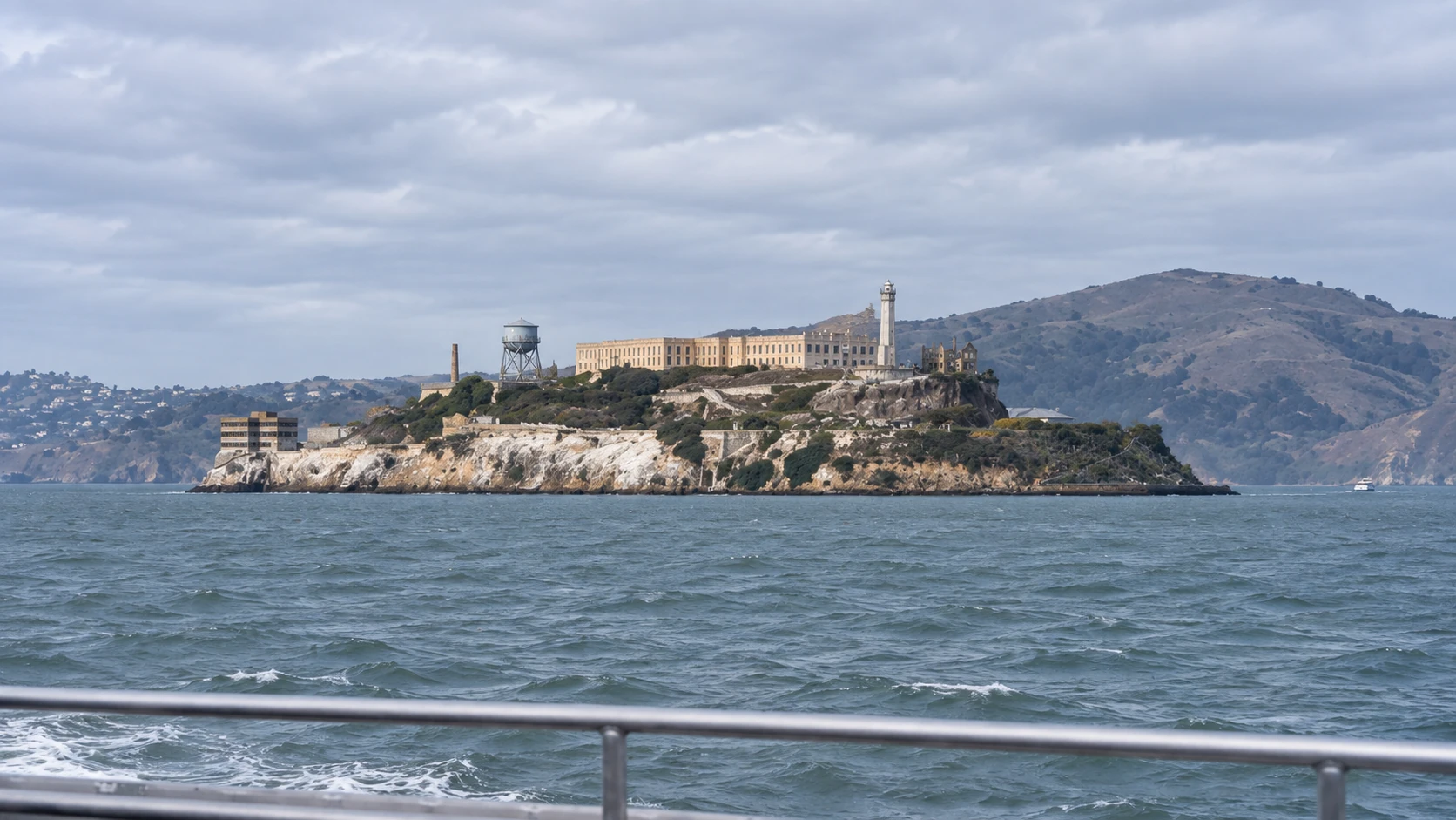
The ferry is not dead time. From the water, Alcatraz appears less like an isolated prison set and more like a layered construction site on a rock: cliffs, retaining walls, dock, power house, former barracks, Cellhouse, lighthouse, gardens and ruined residence. San Francisco remains visible. The short distance intensifies rather than weakens confinement; the city could be seen across cold, tidal water.
The island's English name records a colonial act of naming. Spanish naval officer Juan Manuel de Ayala charted the bay in 1775 and applied a form of alcatraces, usually understood as pelicans or seabirds, to one of its islands; later mapmakers transferred the name to the present Alcatraz. The birds were not incidental. Nesting colonies still force seasonal closures and shape preservation decisions.
Lighthouse, fortress, prison
The United States began fortifying Alcatraz in the 1850s after acquiring California and discovering gold transformed the strategic value of the bay. The first lighthouse on the Pacific coast began operating here in 1854. Troops occupied the fort in 1859. Its batteries held more than 100 cannon positions at their peak, intended to protect the entrance to a booming port. The fort never fired in battle.
Its isolation soon acquired another use. Alcatraz became an official military prison in 1861, first holding soldiers during the Civil War and later a wider military population. Incarceration expanded while the defensive role diminished. The army replaced the old citadel with a reinforced-concrete Cellhouse completed largely by military prisoners in 1912. With hundreds of cells, it was among the largest reinforced-concrete buildings of its time. In 1915 the institution became the Pacific Branch, United States Disciplinary Barracks.
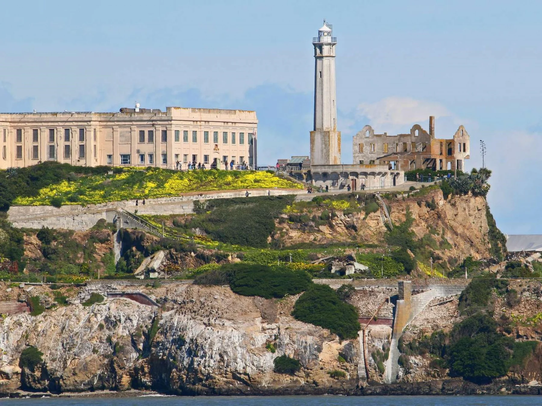
The military period also reaches into the history of federal power over Native nations. Alcatraz held Indigenous prisoners from several conflicts and campaigns, including Paiute, Modoc and Apache men. In 1895, the government imprisoned 19 Hopi men from Oraibi for resisting policies that included compulsory off-reservation schooling and allotment. They were held from January to August, far from their families and homeland. The Hopi Cultural Preservation Office's account centres their refusal to abandon communal land and lifeways. That history makes Alcatraz part of the machinery of forced assimilation decades before the federal penitentiary—and makes the later Native occupations an especially resonant reversal.
04 · The federal prison: discipline, people and uncertainty
The Department of Justice took control in 1933 and opened the federal penitentiary in 1934. Attorney General Homer Cummings and Bureau of Prisons director Sanford Bates wanted a maximum-security institution for prisoners considered disruptive, escape-prone or too influential elsewhere. Warden James A. Johnston enforced a highly regulated regime. Alcatraz was not intended to be the country's largest prison; it was a small institution designed to concentrate control.
More than 1,500 men passed through during the federal years. The celebrity list—Al Capone, George “Machine Gun” Kelly, Alvin Karpis, Robert Stroud—can attract attention, but it distorts scale. Most incarcerated people were not famous, and fame explains little about a system built from counts, silence, restricted movement, work assignments and surveillance. Staff and their families also lived on the island, crossing by boat for school, supplies and ordinary life. Prison and neighbourhood occupied the same rock under radically unequal conditions.
That contrast is important because “island life” did not mean the same thing for everyone. Officers and their families occupied apartments, tended gardens, gathered socially and watched boats move across the bay. Children travelled to school in San Francisco. Incarcerated men heard the city and sometimes saw it from prison windows while their contact with family depended on monitored visits and correspondence. The water was landscape for one community and a component of custody for the other.
Daily regulation was intended to make behaviour legible. Cells were generally about five feet wide, nine feet deep and seven feet high. Men received food, clothing, shelter and medical care; work, correspondence, visits and recreation were privileges governed by conduct. Jobs in the laundry, kitchen and workshops kept the institution operating. The policy of restricted speech associated with the earliest years changed over time, but control of communication remained central. None of these facts makes experience uniform: race, sentence, health, staff decisions and individual relationships shaped how the same rules were lived.
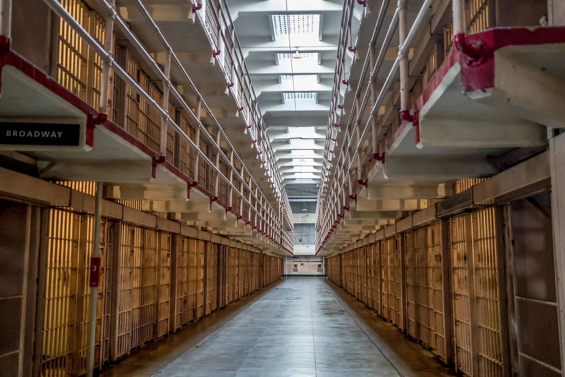
The surviving building is persuasive because its layout communicates without melodrama. Cell blocks stand in parallel. Corridors carry names such as Broadway and Michigan Avenue. Gun galleries allowed armed officers to remain separated from prisoners. A standard cell offered very little private space; routine controlled when doors opened, when men ate and where they moved. The official Doing Time audio tour uses recorded memories from formerly incarcerated men and correctional officers, allowing conflicting positions to remain audible in the same route.
The audio should be treated as testimony, not atmospheric entertainment. In a site marketed through escape stories, first-person recollection can return attention to duration: years composed of repetition, conflict, adaptation and waiting. It also demonstrates why a visitor need not invent sensations or embellish cruelty. The building and documented voices carry sufficient weight.
Escape stories require disciplined uncertainty
The Bureau of Prisons records 14 escape attempts involving 36 men during the federal period. Twenty-three were captured, six were shot and killed, two drowned, and five were listed as missing and presumed drowned. “Presumed” matters. The cold water, currents and distance made escape extremely difficult, but the record does not authorise an absolute claim that no one could have survived.
In May 1946, an attempt to seize weapons led to a multi-day confrontation remembered as the Battle of Alcatraz. Prisoners and correctional officers died, and other officers were wounded. The event is often told as an action sequence; on site, the more useful reading is institutional. A system organised around separation depended on keys, gun galleries, lines of sight and armed response. Once those controls partially failed, the architecture became a battlefield.
The June 1962 escape of Frank Morris and brothers John and Clarence Anglin produced the island's most durable mystery. They enlarged openings at the backs of their cells, used dummy heads to delay discovery and assembled a raft and flotation gear from raincoats. No bodies were recovered, and no survival has been proved. Popular culture rewards a definitive ending; responsible history leaves the outcome unresolved.
Alcatraz closed on 21 March 1963. The island's isolation that appeared to make the prison secure also made it expensive. Fuel, food, water and supplies arrived by boat; salt air damaged buildings; major repairs were needed. The Bureau of Prisons estimated Alcatraz cost roughly three times as much to operate as the federal penitentiary in Atlanta. Closure was an administrative decision about ageing infrastructure and cost, not a final dramatic escape from an infallible prison.
05 · “Indian Land”: occupation and the right to define the island
If a visit ends with the 1963 closure, it stops just before Alcatraz became the stage for one of its most consequential histories. Native activists understood that surplus federal land, treaty language and the island's symbolic visibility could be turned against the government that had confined Indigenous people and pursued termination and relocation policies.
In March 1964, Belva Cottier and a small group of Lakota and other Native activists occupied Alcatraz for several hours and asserted a claim. Their action was brief, but it established a strategy. On 9 November 1969, Mohawk organiser Richard Oakes and other Native activists made another symbolic landing. On 20 November, a larger group began the occupation that lasted until 11 June 1971.
The occupiers used the name Indians of All Tribes. Many were young Native people living or studying in the Bay Area, shaped by federal relocation programmes that had pushed families toward cities while promising opportunity and weakening reservation communities. Oakes and LaNada War Jack were important organisers; no single leader or nation represented everyone who came. That intertribal character was both a source of power and a challenge to governance.
The occupiers proposed an Indigenous cultural centre, university, museum and spiritual centre. They formed a council, organised a school and daycare, handled kitchens and security, and communicated through statements and broadcasts. John Trudell's Radio Free Alcatraz carried the occupation's arguments beyond the island. The claim was not a request to reopen a romantic past. It demanded land, institutions and authority for contemporary Native life.
Daily conditions were difficult. Buildings were deteriorated; electricity and water became unreliable; food and supplies depended on supporters arriving by boat. Participation changed over time. Richard Oakes left after his young stepdaughter Yvonne fell to her death on the island. Fires destroyed several historic buildings in June 1970. Federal authorities cut services and eventually removed the remaining occupiers—five women, four children and six men—on 11 June 1971.
The difficult ending does not cancel the occupation's reach. Alcatraz became a major event in the Red Power movement and a catalyst for later actions, organising and public debate. It helped shift the national conversation away from termination toward self-determination, though no single occupation can be assigned sole credit for a complex policy change. Its most durable achievement may be the insistence that federal places carry Indigenous futures as well as Indigenous pasts.
It also changed who could speak with authority about an abandoned federal site. Government proposals had imagined monuments, commercial development and other new uses. Indians of All Tribes presented a different institution-building programme and used irony to expose the terms on which Native land had historically been taken. News coverage carried that argument nationwide. Visitors, donations and rotating residents made the island an organising hub even when daily administration was strained.
The occupation should not be flattened into either triumph or collapse. Women performed much of the work that sustained food, education, communications and care, while public accounts often foregrounded male spokespeople. Participants disagreed about leadership and strategy. The death of Yvonne Oakes was a family tragedy and a turning point, not a plot device. Supply problems, federal pressure, damaged buildings and changing participation all affected the last months. Holding those tensions together respects the occupiers as political actors rather than turning them into symbols without ordinary responsibilities or conflict.
Visitors can still see occupation-era markings, including the altered arrival message and declarations of Indian land. Preservation creates an ethical question: should paint on a historic building be removed as damage or conserved as evidence? On Alcatraz, the markings are part of the island's history and are interpreted as such. They interrupt the prison brand and refuse the idea that preservation means returning a site to one preferred year.
06 · The island after institutions: gardens, birds and repair
Alcatraz is frequently described as barren, but its ecology is partly wild and partly made. Military families, prison staff and incarcerated gardeners brought soil and planted ornamental gardens on terraces cut into the rock. After closure, many beds went untended for decades. Some plants survived the salt, wind and lack of summer rain. Restoration teams now conserve selected historic gardens without pretending they are native wilderness.
Incarcerated gardeners were essential to that cultivated landscape. Their work altered soil, water and colour on an island where custody otherwise emphasised concrete and stone. Plants such as succulents, geraniums, roses and bulbs were selected, intentionally or through survival, for exposure and summer dryness. The restored gardens therefore hold several histories at once: domestic life for staff families, supervised labour for prisoners, horticultural adaptation and later volunteer conservation. Calling them “pretty” without asking who worked there would miss the point.
Seabirds occupy other parts of the island on their own terms. Western gulls, Brandt's cormorants, pigeon guillemots, black-crowned night herons and other species nest seasonally. The National Park Service closes or limits access to nesting areas, especially from February through September. Ruins can provide ledges and shelter, but people, noise and construction can disturb breeding colonies. Once again, the visitor route is shaped by a protection decision rather than by convenience alone.
That living landscape alters the ruins. Salt, wind, plants and birds continue to work on concrete and steel. Preservation cannot make every structure safe or restore every period at once. The National Park Service and Golden Gate National Parks Conservancy stabilise some buildings, interpret others as ruins and keep certain areas closed. The result is not a perfectly frozen federal prison. It is an island where military, carceral, Indigenous and ecological stories compete for limited space and maintenance.
The current exhibitions reinforce that broader frame. “Welcome to Indian Land” addresses the Native occupations, while “The Big Lockup” places mass incarceration in a wider United States context. Availability can change, so a current park calendar should determine what is open. Their presence nevertheless signals an editorial choice: the Cellhouse is important, but it is not entitled to consume the whole island.
07 · How to visit Alcatraz without letting mythology choose for you
Start interpretation on the ferry. Use the approach to locate the lighthouse, Cellhouse, barracks and ruined warden's residence. At the dock, read the occupation-era arrival message before climbing. If mobility permits, walk slowly up the quarter-mile road; the roughly 130-foot rise is equivalent to climbing a 13-storey building, spread along switchbacks. The S.E.A.T. tram provides accessible transport between dock and Cellhouse for visitors who cannot make that climb. The Cellhouse has an elevator; other paths can be steep or uneven. Braille materials, assistive-listening options and American Sign Language resources are available, but confirm current arrangements before travel.
Inside, use the audio tour without allowing it to become the only voice. Cellhouse architecture, the 1946 battle and escape attempts form one layer. Seek the military-prison and Hopi histories. Make time for the occupation exhibition and surviving markings. Step outside to see gardens, bird closures and the city across the bay. A visit that collects only Capone and the 1962 escape returns with the version of Alcatraz already supplied by popular culture.
Two and a half to three and a half hours on the island is a useful range for the Cellhouse plus selected exhibits, views and gardens. A shorter stay is possible but intensifies choices; a longer stay is valuable for ranger programmes and seasonal openings. Ferries return at intervals, but capacity and schedules change. Check the last return and do not assume a sample time from the podcast remains current.
The National Park Service charges no separate island entrance fee. The required authorised-ferry ticket funds transportation and includes the Cellhouse audio experience; the live concessioner controls price and transaction terms. Buy through the authorised concessioner or a clearly documented package, keep the lead traveller's photo identification available and treat third-party “Alcatraz” cruises that only circle the island as a different product.
08 · The itinerary's real unit is the transition
The combined day creates a geographic sentence: city, bridge, headlands, forest, bridge again, waterfront, bay, island. Each transition alters the terms of the next place. The Golden Gate turns scenery into infrastructure. Muir Woods turns monumental trees into a lesson about time, relationship and managed access. Alcatraz turns an island silhouette into an argument about confinement, sovereignty and whose history gets preserved.
That range is unusually productive, but it is not the same as depth at each site. Traffic may reduce the forest interval. The open Jeep cannot control cold or noise. A fixed ferry departure limits the flexibility of a private morning. Lunch can become a practical waterfront pause rather than a considered meal. The island visit ends at Pier 33 without an included hotel transfer.
These boundaries are not hidden defects when they are understood before booking. They identify the traveller for whom the format works: a first-time visitor, family or small group that values private road transport and wants three Bay Area environments in one coordinated day. The fit is weaker for a solo traveller absorbing the fixed private cost, someone who needs climate-controlled or mobility-equipment-friendly road transport, a serious hiker, or anyone who wants every Alcatraz exhibit and ranger programme.
The alternative is not simply “do it yourself for less.” Independent planning means comparing ferry inventory, Muir Woods parking or shuttle reservations, bridge access, transit time and the sequencing of two federal sites. That work may save money or create more time where it matters most. It can also consume attention. The honest value of the package is not frictionlessness—weather, crowds and conservation rules remain—but reducing administrative friction where it is greatest.
Three ways to allocate the day
Choose the combined private route when range is the priority. It solves the hardest transfer and reservation sequence, provides a guide across the bridge and into Marin, and preserves a self-paced island finish. It works best when every member of the group accepts the open vehicle and limited forest interval.
Separate Muir Woods when the forest is the priority. Use a dedicated half day or full day, reserve parking or shuttle access, and leave room for a longer loop, ranger programme and careful observation. Pair Alcatraz with another waterfront day rather than forcing a fixed ferry into the same sequence.
Separate Alcatraz when layered history is the priority. Take an early ferry, follow military and Native histories as deliberately as the Cellhouse audio, attend a ranger programme and remain through several return windows. Cross the Golden Gate on another day by transit, bicycle, car or a dedicated tour.
No choice is universally superior. The useful measure is whether the allocation matches the reason for travelling. A package can recover hours from planning; only the traveller can decide where attention goes.
Traveller's field notes
- Treat it as a full day. A three-to-four-hour road format is only the first component. Add ferry check-in, the self-paced island visit and the return crossing; use the duration of your booked version.
- Meet exactly where the booking says. The operator's standard point is 2870 Hyde Street at Hyde and Jefferson. Save the issued instructions and leave time to identify the correct vehicle.
- Let the ferry govern the sequence. Departure is assigned according to inventory. Ignore sample times in old recordings or reviews and use the live voucher.
- Carry photo identification. The lead traveller may need ID matching the Alcatraz reservation.
- Wear secure layers. The open bridge, exposed headlands and shaded redwood valley can feel like different seasons. A close-fitting hat is more useful than one the wind can take.
- Travel light and resolve access in advance. Confirm space for bags and mobility aids, the vehicle transfer and each park or ferry stage before booking. A park's accessible route does not establish vehicle access.
- Verify the Muir Woods fee. Parking or tour access is not the same as entrance admission. Unless the live voucher explicitly includes the pass, budget separately.
- Save details offline. Muir Woods has unreliable mobile service. Download the voucher, meeting point and accessibility information before leaving the city.
- Bring water and plan food. Food is restricted to the plaza and café patio at Muir Woods, and the ferry assignment may leave only a short waterfront interval. Follow current site rules rather than eating on trails.
- Respect each protected place. Stay on paths and boardwalks, keep voices low in the grove, never feed wildlife and obey nesting-season closures on Alcatraz.
- Plan the finish. The package ends after the return to Pier 33. Choose transit, taxi/rideshare or a waterfront walk according to current conditions.
Sources and further reading
- Original podcast episode and complete transcript — field notes for the combined route.
- Golden Gate Bridge construction — official chronology, people and safety record.
- Golden Gate Bridge design — official account of Strauss, Ellis, Moisseiff and the suspension design.
- Bridge bonds and International Orange — financing, architecture and colour.
- Foghorns and beacons and bridge maintenance — coastal weather and continuous stewardship.
- Muir Woods history — National Park Service chronology from Coast Miwok homeland to the monument.
- What is old-growth coast redwood forest? and plant communities — age, structure, fog, fire and watershed relationships.
- Fog decline in the coast-redwood region — peer-reviewed climate research by James Johnstone and Todd Dawson.
- Muir Woods: know before you go and accessibility — current reservations, rules and route conditions.
- Alcatraz history and Federal Bureau of Prisons history — military and federal chronologies.
- The Hopi prisoners on Alcatraz — interpreted with research from the Hopi Cultural Preservation Office.
- Federal Bureau of Prisons: Alcatraz — official prison chronology, escape outcomes and unresolved cases.
- We Hold the Rock and Alcatraz occupation — National Park Service accounts of the 1964 and 1969–71 actions.
- Voices of the occupation — oral histories and perspectives from participants.
- Nature on Alcatraz and historic gardens — the island as habitat and cultivated landscape.
- Alcatraz fees, tickets and accessibility — authorised ferry, current planning and access information.
- Golden Gate Bridge under construction, 1934 — Library of Congress image record; no known restrictions on publication.
- Muir Beach Overlook — National Park Service account of the exposed lookout, coastal-defence observation station and landforms.
- Sausalito history — local institutional account of ferry and railway development, Marinship and the postwar waterfront.
Continue exploring
- ExcursionPass Travel Magazine
- United States stories
- San Francisco destination desk
- San Francisco in Three Exposures: Road, Water and Night — the companion reading of city grades, the working bay and public light.
- Los Angeles through the Windshield — another California city read through movement, selective framing and what a compact route leaves outside.
- San Francisco experiences on ExcursionPass
The question we carry out
A well-designed itinerary can return hours to a traveller. The harder test is what those hours contain. If the route removes the work of getting between places, will the visitor use the recovered attention to look more closely—or simply move faster?