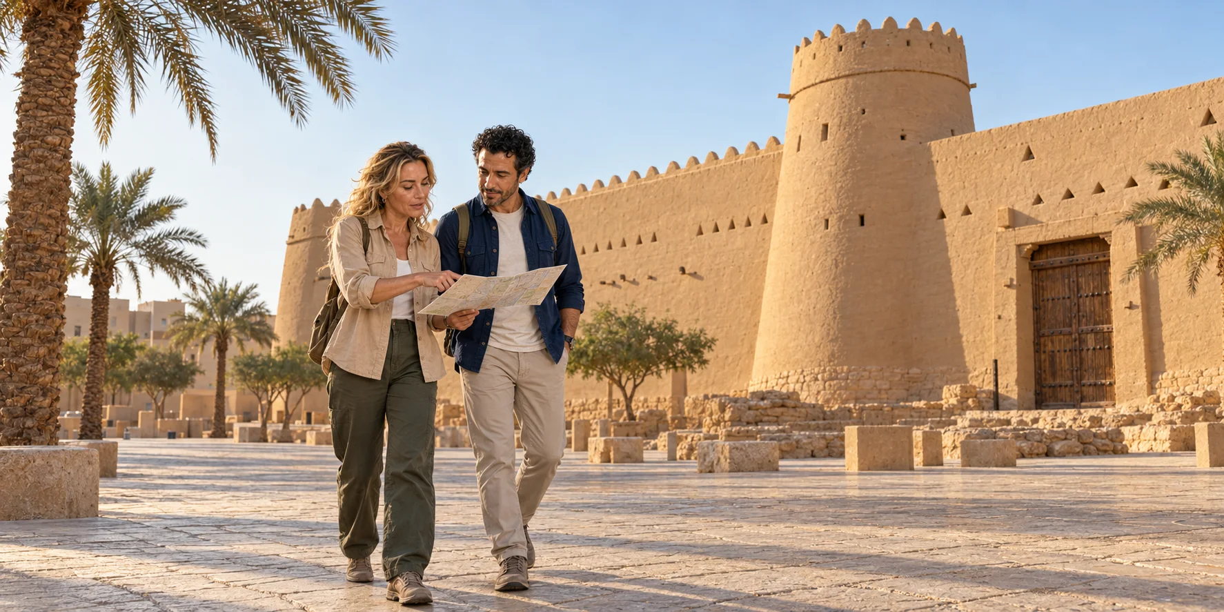
Riyadh is often presented as a collision between mud walls and glass towers. The real city is more demanding. Water and limestone made settlement possible; oasis towns became rival capitals; earthen buildings were abandoned, restored and reconstructed; oil wealth stretched a compact centre into a motorway metropolis; and migrant labour continues to build the next version. This route joins Wadi Hanifa, At-Turaif, Al Masmak, Souq Al Zal, Murabba, the National Museum and Al Faisaliah without pretending that one day resolves their arguments.
01 · Riyadh in layers
Begin with Wadi Hanifa, not the skyline
Riyadh can look improbable from the air: an immense rectilinear city occupying the Najd plateau, crossed by broad roads and punctured by towers. That view encourages an origin story in which modern engineering simply defeated an empty desert. Wadi Hanifa offers a better beginning. The seasonal valley runs along Riyadh's western side through a limestone landscape. Its channels, terraces, tributaries, shallow groundwater and alluvial soils created a chain of cultivable places. Date palms, fields, wells and settlements did not abolish aridity; they organised life around scarce and irregular water.
The name Riyadh is the plural of rawda, gardens or meadows. It points to a landscape relationship before it names the present metropolis. Rain falling across the catchment can move quickly through the wadi, yet long dry periods are normal. Communities therefore depended on a mixture of wells, local runoff, soil knowledge and agricultural maintenance. The useful contrast is not “green oasis versus lifeless desert.” It is between a carefully worked hydrological corridor and the harder plateau around it.
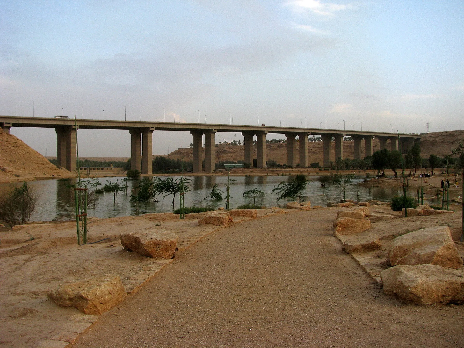

Twentieth-century growth damaged that system. Extraction, dumping, quarrying, roads, sewage and uncontrolled development turned parts of the valley into a service corridor and polluted drain. The Royal Commission's rehabilitation programme removed waste, reorganised flows, treated water through engineered and biological processes, reshaped banks and created public landscapes. That work deserves attention, but it should not be narrated as nature effortlessly “coming back.” Clean water, flood control, habitat, recreation and development remain negotiated metropolitan functions. A photograph of a lake beneath a viaduct captures the truth better than a pristine-desert fantasy: ecology and infrastructure occupy the same frame.
Wadi Hanifa also supplies the route's spatial logic. At-Turaif in Diriyah rose on the valley's western bank. The later walled town of Riyadh developed to the east. Murabba was built beyond those old walls. Modern corridors extended far north and south. The city is not a row of isolated attractions; it is a sequence of decisions about water, defence, rule, movement and land.

02 · Riyadh in layers
Riyadh inherited a much older settlement landscape
The valley story reaches far beyond the Saudi states. Central Arabia's Al-Yamama region supported settlements, cultivation and routes long before the modern capital. Hajr, often identified as a major predecessor within the Riyadh area, appears in early Arabic geographical and historical writing. Manfuha and other communities also formed part of the oasis landscape. Names, boundaries and centres changed; it is too neat to draw one uninterrupted municipal line from Hajr to today's Riyadh.
By the early modern period, several settlements and agricultural areas occupied the basin. Place names such as Mi'kal recall a landscape whose centres shifted over time. In the eighteenth century Dahham bin Dawwas governed Riyadh and contested the expanding state based in nearby Diriyah. Saudipedia's account of Abdulaziz bin Muhammad describes years of fighting and truces before Dahham fled in 1773 and Riyadh came under Saudi rule. The account's language of unification expresses an official perspective; the long contest also makes clear that incorporation was neither effortless nor inevitable. The state took control of an inhabited, productive town with its own interests.
That prehistory of the capital changes what counts as evidence. A date garden can be part of urban history. A well, drainage line or field boundary can matter as much as a palace façade. Place names can preserve relationships after a wall or orchard has vanished. Archaeology and textual history do not always align perfectly, especially when later development removed layers faster than they could be documented.
The same warning applies to maps. A plan of nineteenth-century Riyadh usually shows a compact enclosure with gates, a main mosque, administrative buildings, neighbourhoods and gardens around it. Such a plan is a reconstruction assembled from surveys, memory and later documentation, not an aerial photograph. It is useful for scale: the old town could fit inside a small portion of the present metropolis. It cannot tell us that every lane remained fixed or that residents experienced the city in one uniform way.
Domestic history is particularly easy to lose. Courtyard houses supported cooking, storage, sleep, childcare, hospitality, work and seasonal movement among rooms. Water carrying, food preparation, cleaning, plaster repair and textile work kept the architecture functional. Women, children, servants and enslaved people appear less often in state chronicles than rulers and battles, but they made the settlement habitable. The absence of a named biography from a museum label is not evidence that these lives were marginal to the city's operation.
03 · Riyadh in layers
Diriyah was a capital before Riyadh
At-Turaif is the place to understand why the political history cannot begin at Al Masmak in 1902. Diriyah grew within the Wadi Hanifa oasis and became the centre of the First Saudi State. Its position joined cultivable land, settlement, routes through Najd and a defensible limestone promontory. The UNESCO World Heritage property preserves an extensive earthen capital: palaces, religious buildings, defensive structures, houses, streets and the relationship between the built ridge and the oasis below.
Chronology needs care because present commemoration and historical argument use different starting points. Saudi Arabia's official Founding Day dates the First Saudi State to 1727, when Muhammad ibn Saud assumed power in Diriyah. Many scholarly histories emphasise the 1744 alliance between Muhammad ibn Saud and the religious reformer Muhammad ibn Abd al-Wahhab as the decisive compact that enabled expansion. These statements answer related but not identical questions: when a polity began, and when a political-religious alliance transformed its reach. A responsible account names both rather than making one date erase the other.
From Diriyah, Saudi authority expanded across much of the Arabian Peninsula. The state was neither an inevitable nation waiting to appear nor merely a local village enlarged by faith. It depended on leadership, allegiance, coercion, trade, agriculture, military capacity and religious claims. Its growth altered relationships among towns, tribes, scholars and the Ottoman imperial order. The Saudi foreign ministry's historical chronology records that in 1818 an Ottoman-Egyptian campaign led by Ibrahim Pasha ended the First Saudi State; scholarly histories add the regional and imperial context behind that compressed line. Ruin is therefore part of At-Turaif's historical fabric, not atmospheric decoration.
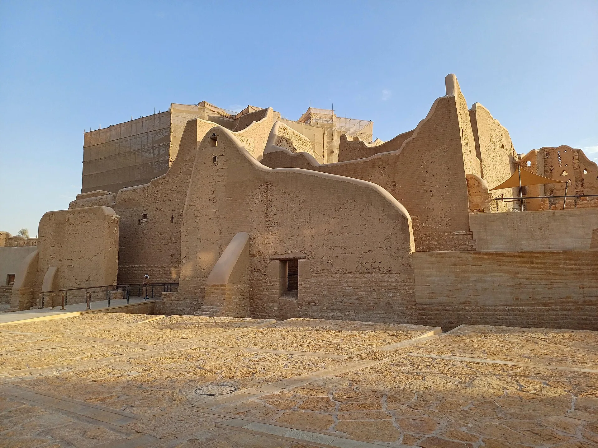

UNESCO's assessment is especially useful because it refuses a simple “frozen in time” claim. Some structures survive as standing ruins; some have been stabilised; some underwent earlier restoration or reconstruction; and the wider setting faces development pressure. Conservation involves deciding how much earthen fabric can be repaired, how new material should be distinguished or integrated, where visitors can walk and which views across the wadi matter to the property's meaning. A smooth wall may be a maintenance surface, not evidence that every centimetre survived the 1818 destruction.
Plan At-Turaif as a site in its own right. Its scale, slopes and layered compounds reward more than a photo stop. Current admission, timed entry, internal route, weather closures, prayer-time arrangements, accessible paths and photography rules belong to the official Diriyah channels for the selected date. Choose the compounds and paths that suit your interests and mobility; leave time to see how the ridge relates to the valley below.
The relationship between heritage and new development is visible around Diriyah. Large cultural, hospitality, retail and residential projects are intended to turn the area into an international destination. Investment can fund conservation, research, craft training and public access. It can also increase land pressure, change sightlines, privilege curated consumption and detach the World Heritage property from everyday valley life. UNESCO's concern with buffer zones and visual integrity is therefore not bureaucratic scenery; it addresses whether a protected capital can still be understood in its oasis setting.
Visitors participate in that tension. A restored lane, scheduled performance or restaurant terrace may create a generous point of entry. It does not become eighteenth-century evidence because its materials look regional. Distinguish the inscribed archaeological property, reconstructed or conserved structures, and contemporary destination facilities. The distinctions do not require contempt for new work. They allow each layer to be judged by the right standard.
04 · Riyadh in layers
Mudbrick is a system, not a primitive material
“Mudbrick” can sound like one weak substance awaiting replacement by concrete. Najdi building practice was a coordinated system. Builders selected earth, mixed it with water and fibrous material where appropriate, formed units or built in lifts, and protected walls with earthen plasters. Stone could create foundations and resist ground moisture. Tamarisk trunks and palm material could span roofs, over which further layers made a usable surface. Timber doors, gypsum decoration and painted or incised motifs introduced craft, status and regional language.
Thick earthen walls slow the movement of heat, but they are not automatic air-conditioning. Their thermal mass can delay daily temperature swings; small or shaded openings reduce direct solar gain; courtyards organise light, air and privacy; compact streets produce shade; and rooms can be occupied differently by season and time of day. Performance depends on wall thickness, moisture, orientation, ventilation, surface maintenance and behaviour. A sealed, neglected earthen room in extreme heat is not comfortable merely because it is old.

Water is the material's partner and threat. Controlled moisture allows earth to be worked and repaired. Uncontrolled rain, leaking pipes, rising damp and failed roof drainage erode it. Maintenance is not evidence that a building is fake; repeated replastering has always been part of earthen architecture. Yet restoration can also replace so much fabric, alter openings or introduce incompatible cement that authenticity becomes a real question. The right visitor's question is not “original or replica?” as a binary. Ask which elements are archaeological, which were rebuilt, what evidence guided the work and how the surface is being maintained now.
Decoration also carries meaning without reducing every triangle to a code. Parapets, ventilation openings, doors and interior gypsum work vary by place, date, function and household. Some features serve structure or climate, some announce status, and some do both. A guide may offer a confident symbolic reading. Treat it as an interpretation unless the building record or a specialist source supports the claim.
05 · Riyadh in layers
The Second Saudi State moved the centre to Riyadh
After the destruction of Diriyah, authority did not move in a straight line to the modern kingdom. In 1824 Turki bin Abdullah established Riyadh as the centre of the Second Saudi State. The shift made a different oasis town the political capital. Internal rivalries and conflict with the Al Rashid rulers of Ha'il eventually ended that state in 1891, and the Al Saud went into exile.
This middle history matters because it prevents two distortions. The first jumps directly from eighteenth-century Diriyah to twentieth-century national unification. The second treats Riyadh as a place created by the 1902 recapture of one fort. By the time Al Masmak entered the kingdom's foundational story, Riyadh already had walls, neighbourhoods, mosques, markets, gardens, administrative buildings and a population living through successive regimes.
The old town's plan responded to walking, animals, privacy, defence and a climate of intense sun. Narrow lanes and attached compounds differed radically from the later superblocks and highways, but they were not static. Buildings were repaired, extended and replaced. Families, craftspeople, merchants, farmers, servants and enslaved people occupied different positions within the urban economy. A palace-and-battle narrative alone makes most of the historical city disappear.
Nor was political authority only a sequence of kings. Religious scholars adjudicated and taught; governors and commanders administered; merchants financed exchange; oasis farmers managed water and palms; craftspeople supplied building and household needs; and negotiated loyalties connected town and countryside. Conflict could reorganise property, tribute and movement. Drought and disease could be as decisive for a household as a change of ruler. The documentary record favours elite decisions, so a complete social portrait is impossible. The correct response is to mark the gap, not fill it with invented “daily life.”
06 · Riyadh in layers
Al Masmak turns one operation into national memory
Al Masmak is a compact fortress rather than an entire old city. Built in the nineteenth century, it has stone foundations, thick earthen walls, palm and tamarisk roof elements, a heavy gate and four cylindrical corner towers. It served changing military and administrative functions before becoming a museum. Its form explains defence at close range: limited openings, controlled entry, high walls, observation points and an internal courtyard.
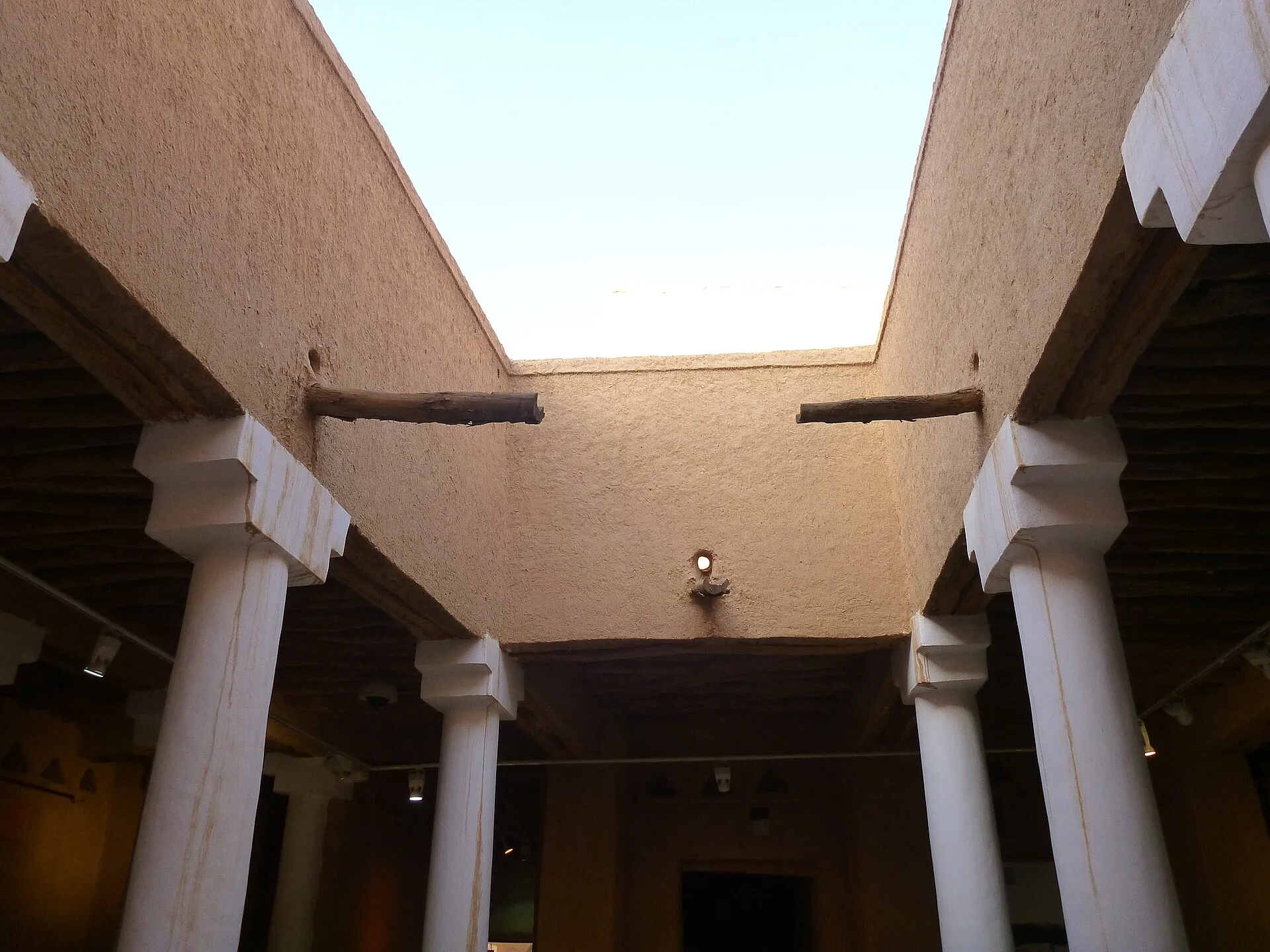

The courtyard clarifies how a fortress also worked as an inhabited compound. Rooms and circulation turn inward around a protected open space, while porticoes temper the sun at their edges. The documented building includes a mosque, reception hall and well as well as defensive towers. The water supply and places of assembly deserve as much attention as the gate: holding a fortified place meant sustaining people inside it. Municipal restoration began in 1980 and the building opened as a museum in 1996, adding another dated layer to its nineteenth-century fabric.
In January 1902 Abdulaziz ibn Saud and a small party entered Riyadh and captured the fort from forces loyal to Ibn Rashid. The operation became the foundational episode in the recovery of Riyadh and the campaigns through which Abdulaziz consolidated territories. In 1932 those conquests and alliances were formalised as the Kingdom of Saudi Arabia. Museum displays, school histories and public commemoration give the Masmak event a clear narrative shape: exile, daring return, victory and unification.
That shape is important evidence about state memory. It should not be confused with a complete transcript of the event or with the experiences of everyone in Riyadh. Details repeated in popular retellings may derive from later testimony and commemoration. The fort can sustain several questions at once: what occurred in 1902; how a military episode was remembered; why the building was restored; and how the surrounding district was cleared, monumentalised and connected to a national story.
Deera Square and the streets around the fort require ethical precision. The area has carried judicial and religious associations as well as heritage and market functions. A visitor should not photograph people as exotic scenery, seek sensational execution stories or treat ordinary worship and commerce as theatre. Stay with the evidence visible in architecture and the interpretation offered by responsible institutions. Current security boundaries and staff instructions override a remembered itinerary.
07 · Riyadh in layers
Souq Al Zal records circulation, not timelessness
Souq Al Zal lies close enough to Al Masmak to walk when heat, crossings and access allow. Its name is associated with rugs and textiles, and its shops and auctions also handle incense, perfume ingredients, traditional clothing, antiques, coffee equipment, decorative objects and modern merchandise. What appears “traditional” may be newly made; what looks local may have travelled through regional or global supply chains; and an old object may have an incomplete provenance.
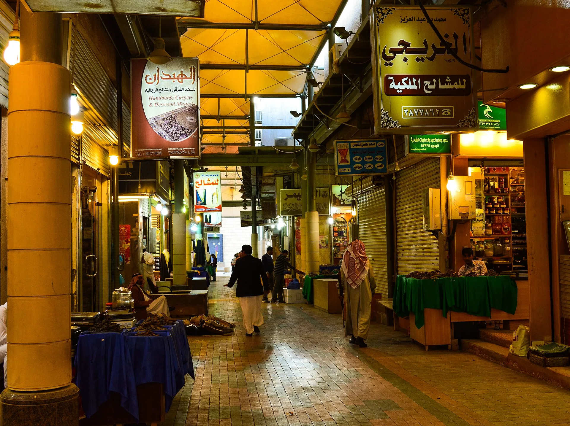

That ambiguity is the market's value. A carpet can lead into questions of weaving, pattern, pastoral mobility, household use and contemporary production. Oud and incense can open a discussion of fragrance, hospitality, trade and religious practice without claiming that one scent defines Saudi identity. A sword or dagger-shaped souvenir may invoke state and regional symbolism while being recently manufactured for sale.
Ask before photographing a person or a shop interior. Bargaining practices vary by seller and object; politeness matters more than performing a script. Ask what materials, age and workmanship justify the price of the particular object. For antiques, wildlife materials, weapons, archaeological objects or culturally protected goods, provenance and export law matter more than the romance of a find. The absence of a warning label is not export permission.
The market also corrects the idea that a capital is built only by rulers and planners. Commerce connects households, makers, wholesalers, migrant workers, shopkeepers and visitors. Yet it would be equally misleading to turn every transaction into spontaneous resistance to central power. Souq Al Zal is evidence of circulation and adaptation; the political conclusion still requires proof.
08 · Riyadh in layers
Murabba moved government beyond the walls
In the 1930s King Abdulaziz commissioned the Murabba complex north of the old walled town. The move was physically modest by today's metropolitan scale—roughly two kilometres—but conceptually large. A royal and administrative compound could occupy more land, accommodate vehicles and communications, and organise governmental functions beyond the dense old centre. The king moved there in 1938.
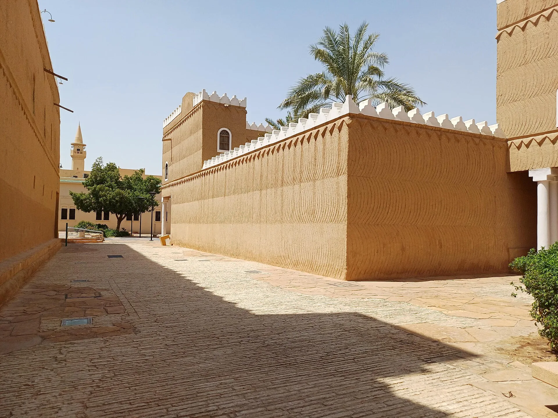

Murabba used stone foundations, earthen walls, palm and tamarisk roof elements, courtyards and decorative forms associated with Najdi building. It was not simply “the last traditional palace.” Electricity, telephones, automobiles, administrative offices and the demands of a consolidating state belonged to its world. Traditional materials and institutional modernisation operated together.
Saudipedia identifies the Najdi builder Hamad bin Qaba with Murabba's construction. Its description of the royal court places service and administrative functions on the ground floor and reception and delegation rooms above, arranged around a central courtyard. That organisation gives a concrete way to read governmental scale: goods and routine work supported the ceremonial business of receiving people. The white gypsum finish, projecting drainage outlets and renewed earthen surfaces also show that the building's appearance depended on maintenance. A courtyard and traditional roof materials could serve a state acquiring cars and telephones; architectural continuity did not require institutional stillness.
The surviving palace now sits within the King Abdulaziz Historical Centre, a landscaped cultural district that includes the National Museum, archives, library functions and public space. The setting can make the transition feel smooth: old Riyadh becomes Murabba, which becomes museum, which becomes modern capital. History was less orderly. Oil revenues accelerated construction; old walls and neighbourhoods were demolished or transformed; government institutions multiplied; foreign expertise and imported materials entered planning; and inhabitants moved through uneven changes in housing, work and mobility.
Use Murabba to ask how administration changes space. Reception rooms, offices, service areas, circulation and courtyards reveal hierarchies, but a floor plan does not automatically explain every social relationship. Avoid assigning fixed gender, class or ceremonial meanings to rooms without building-specific evidence. Current room access and exhibition content can change; the architecture remains the durable subject.
09 · Riyadh in layers
The National Museum edits a much larger history
The National Museum of Saudi Arabia opened at the King Abdulaziz Historical Centre in 1999. Its broad sandstone-coloured form was designed by Moriyama & Teshima, with Raymond Moriyama as the lead architect, and draws on regional landscape and architectural references without pretending to be an earthen palace. The museum's official overview describes a collection of more than four thousand artefacts within an eight-gallery narrative. Its sequence moves through Man and the Universe, Arabian Kingdoms, the Pre-Islamic Era, the Prophet's Mission, Islam and the Arabian Peninsula, the First and Second Saudi States, Unification, and the Hajj and Two Holy Mosques. These are interpretive divisions of a much longer history, rather than equal slices of time.
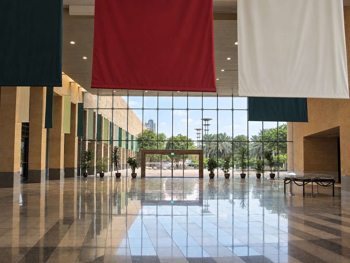

Begin by attending to the change in scale. Geological and prehistoric material places human settlement within landscapes that were not always as arid as they are today. Rocks, fossils and stone tools ask how climate, available materials and living things changed. The section on Arabian kingdoms then narrows the lens to communities, routes and political centres. Instead of reading each object as an isolated treasure, ask what work it did and what connects its findspot to the surrounding landscape.
The museum's collection catalogue identifies braziers from Qaryat al-Faw, a mortar and pestle from Tarout in the Eastern Province, and a memorial inscription from Tayma in the northwest. Their geographical spread matters: Riyadh houses a national collection drawing together distinct regional histories. A mortar and pestle is evidence of processing materials through ordinary work; an inscribed memorial records an act of remembrance in a particular language and social setting. Neither gains a complete biography just by being placed in a case. Read the object label for its date, excavation context and the limits of the identification.
Qaryat al-Faw makes a particularly useful connection back to Wadi Hanifa. The UNESCO account of Al-Faw describes a caravan city on routes connecting Najran with central and eastern Arabia, supported by an irrigation network and an oasis economy. Its inscriptions and archaeological remains record exchanges among different trading and desert groups. The lesson is not that all Arabian oases were alike. It is that trade required places to water, cultivate, store, exchange and reside. An object from the city belongs to those systems as well as to an art-historical category. Al-Faw is far from this city itinerary; the museum supplies a way to encounter its evidence without turning it into a rushed additional stop.
The Pre-Islamic Era and Prophet's Mission sections change the historical frame again. The museum uses a mural tracing the Hijra from Makkah to Madinah to introduce a journey whose religious and political significance reshaped Arabia. Later Islamic material links pilgrimage, writing, knowledge and circulation across a wider world. Keep the distinction between a modern explanatory mural and an excavated object: both communicate history, but only one is physical evidence from the period it depicts.
The final state-history galleries bring the visitor back to places on the Riyadh route. Compare the museum's account of the First and Second Saudi States with the ruined capital at At-Turaif and the shift to Riyadh in 1824. Read Unification alongside Masmak's concentrated story of 1902, remembering that the kingdom was proclaimed in 1932 after further campaigns and alliances. The Hajj and Two Holy Mosques section broadens the frame beyond the capital again: pilgrimage connects movement, infrastructure and religious life rather than ending the story with a single skyline.
An eight-gallery sequence is not eight transparent windows. Selection, translation, lighting, scale models, replicas, maps and transitions create an argument. Archaeological objects can disrupt a purely dynastic history by showing ancient trade, settlement and religious plurality. At the same time, the route toward national unification can make political outcomes appear more inevitable than they were. Read labels for dates, source language and uncertainty. Notice when a model reconstructs a lost building, when an artefact was excavated, and when a gallery shifts from material evidence to commemorative narrative.
The museum also offers the best correction to the podcast's abrupt “mudbrick then glass” edit. Riyadh belongs to longer histories of the Arabian Peninsula: palaeoenvironments, rock art, caravan networks, oasis agriculture, pilgrimage, regional states and imperial encounters. The modern capital did not replace an empty prehistory. Nor can the museum's national frame exhaust local, tribal, religious, migrant and labour histories.
Allow enough time to read rather than race through every gallery. The current official page is the source for opening hours, tickets, closures and any temporary exhibition; check the arrangements for your chosen date. Include walking distances, display lighting, audiovisual sound and seating in your visit planning. Ask the museum about step-free entry, lift operation, wheelchairs, quiet times and sensory needs for the actual visit. Photography permissions may differ by gallery and object.
10 · Riyadh in layers
Oil changed the scale, but policy drew the city
Commercial oil production transformed the Saudi state's resources after the late 1930s, and postwar revenue helped turn Riyadh into the dominant administrative capital. Population increased through internal migration, regional movement and international labour recruitment. Ministries, embassies, universities, hospitals, industrial areas and new housing spread over land that had been fields, gardens or open plateau.
It is tempting to say oil “caused sprawl” and stop. Oil funded rapid expansion and mass motorisation, but planning choices determined the form. From the late 1960s, the Doxiadis plan organised growth through a grid and large superblocks, with a north-south spine and generous road hierarchy. Later plans extended and revised that system. Zoning, land grants, public investment, building types and road design made daily life increasingly dependent on cars. Those were political and professional decisions, not a chemical property of petroleum.
The grid solved some problems. It offered a repeatable framework for extraordinary growth, distributed infrastructure and made parcels legible. It also produced long distances, hostile crossings and isolated land uses. A two-kilometre superblock can be efficient on a regional diagram and exhausting at walking speed. Heritage sites survived not only because old buildings were cherished but also because particular compounds were restored after much surrounding fabric had disappeared.
Growth also altered the house. Detached villas offered space, privacy and vehicle access, while mechanical cooling reduced dependence on compact streets and seasonal room use. Standardised concrete construction accelerated delivery. These changes were not simply a rejection of “tradition”: they answered wealth, land policy, family aspiration, building regulation, new technologies and demographic growth. But their combined effect increased surface area, infrastructure demand and trip length. When contemporary designers quote a Najdi parapet on a sealed glass-and-concrete building, the visual reference may be sincere while the environmental system is entirely different.
Water reveals the metropolitan cost. Modern Riyadh depends on deep groundwater, desalinated water transported inland, treatment plants, storage and distribution at a scale the old oasis could not provide. Wastewater recycling and Wadi Hanifa rehabilitation close part of the loop, but the city remains an energy-intensive hydrological achievement. Landscaping choices matter: shade and planted public space can make outdoor movement possible, while high-consumption planting can burden the same system. “Greening” is therefore a design and resource question, not a self-validating colour.
Roads also distribute opportunity unevenly. A household with several vehicles experiences the grid differently from a worker dependent on a bus, a pedestrian crossing service lanes or a person whose wheelchair route is broken by a kerb. Women gained the legal right to drive in 2018, changing an important barrier to independent mobility, yet access still depends on income, licensing, vehicle availability and the design of destinations. Transport history belongs inside social history.
Riyadh Metro, whose six automated lines are documented by the Royal Commission, is another planning intervention rather than an instant cure. Stations can reduce car dependence where safe walking, buses, shade, legible crossings and nearby destinations complete the trip. The green line links the King Abdulaziz Historical Centre and National Museum area to the wider system; other heritage stops may still require surface transfers. Check the current official journey planner instead of assuming that a station name guarantees a short, comfortable walk.
Heat shapes every transport decision. Riyadh summers are intensely hot; a single temperature cannot represent every month, hour and exposure. Use the National Center for Meteorology forecast when choosing outdoor intervals. The practical response is not a heroic walking itinerary: start early where possible, build in indoor intervals, carry water, protect skin, and treat distance, shade and crossings as real constraints. Weather, air quality and personal health needs vary; current official advice and individual judgment outrank a fixed route.
11 · Riyadh in layers
Al Faisaliah made a new capital visible
Designed by Foster + Partners and completed in 2000, Al Faisaliah became one of Riyadh's first internationally recognisable skyscrapers. Its tapered triangular form, external structural expression and golden sphere created a different landmark language from the low earthen complexes of the old centre. The tower did not prove that the city had finally become modern. By then Riyadh had spent decades building ministries, roads, airports, universities and entire districts. It made that modernity newly visible on a global commercial skyline.
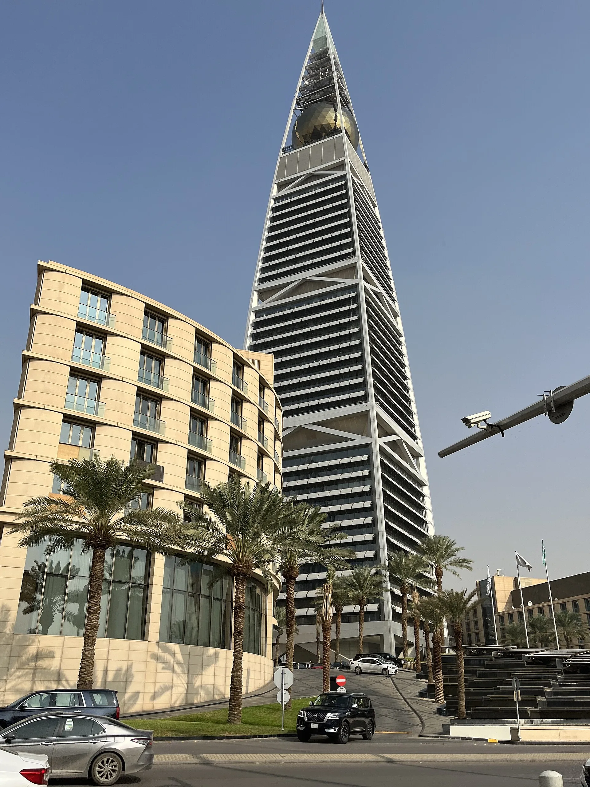

The sphere draws the eye, but the more durable lesson is outside. Steel and glass make structure part of the silhouette. The surrounding podium, hotel and road environment show how a landmark participates in a larger development rather than standing as an autonomous sculpture.
There is another architectural story below the sphere. Artist Brian Clarke collaborated with Foster on a large stained-glass work completed in 2000 for the building. His project record describes 350 panels made with tempered float glass and lead-free connections. Imagery at the base includes plants and camels alongside desalination plants and oil refineries. It brings landscape and industrial systems into the same composition rather than treating the tower as pure abstraction.
That is a useful comparison with Najdi gypsum decoration and crafted doors. Both building traditions use skilled surface work to shape an institution's public character, though their materials, scale, commissions and meanings differ. Clarke's imagery also returns the route to its first question: how water and energy make a city possible. The glass need not be encountered in person for that relationship to enrich an exterior reading. Confirm any lobby, gallery or upper-floor access with the responsible venue before setting out; a mixed-use tower contains privately operated spaces as well as its public silhouette.
From Al Faisaliah, the temptation is to end with a victory shot: mudbrick in the morning, glass at sunset, progress complete. Riyadh does not support that closure. New megaprojects, towers and transport lines continue to redistribute attention and land value. Older centres are curated, reconstructed or displaced. Water and energy demand remain material constraints. The city is not travelling along one line from tradition to modernity; it is selecting, financing and exhibiting several pasts and futures at once.
12 · Riyadh in layers
The city was built by workers as well as plans
Palaces, museums, metros, roads, towers and restored districts are labour histories. Saudi citizens have built and administered the capital, and millions of migrant workers from Asia, Africa and elsewhere have also worked in construction, transport, domestic service, retail, hospitality, maintenance and professional roles. Their contribution is physically everywhere even when heritage displays and skyline photographs leave them out.
That labour has not always been protected fairly. A 2025 Amnesty International investigation into Riyadh Metro construction documented recruitment fees, debt, wage inequality, heat exposure and poor accommodation among interviewed migrant workers. Saudi reforms and a cooperation programme announced by the International Labour Organization in June 2025 are relevant, but a policy announcement and a worker's effective remedy are not the same measure. Nationality, employer, contract and occupation shape experience.
This is not an invitation to photograph workers without consent or to turn an individual into a symbol. It is a requirement to describe urban transformation honestly. A temperature-controlled museum depends on cleaners, technicians and guards. Earthen conservation depends on specialist craftspeople and repeated maintenance. Automated trains depend on construction crews, operators, software, electricity and station staff. The city is made by systems of work, not by renderings alone.
13 · Riyadh in layers
Heritage is reconstruction, selection and continuing use
Riyadh's major heritage sites perform different kinds of authenticity. At-Turaif preserves a ruined capital through archaeology, stabilisation and selective reconstruction. Al Masmak is a restored fortress and museum whose national meaning exceeds its physical footprint. Souq Al Zal is a living commercial environment with old and new goods. Murabba is a maintained palace complex embedded in a twentieth-century historical centre. Wadi Hanifa is rehabilitated ecology and infrastructure.
These differences should shape the questions asked on site:
- What survives? Look for foundations, wall fabric, roof elements, doors, surfaces, wear and relationships that can be tied to a period.
- What was repaired or rebuilt? Ask what evidence guided the intervention and whether new work protects or obscures older fabric.
- What is still used? A market, landscape, mosque or public garden has obligations to present communities that a museum object does not.
- Who authored the interpretation? Official labels, UNESCO assessments, family accounts, guides and academic histories have different evidence and purposes.
- What is absent? Demolished neighbourhoods, women and domestic life, servants, enslaved people, migrants, craftspeople and maintenance workers rarely occupy equal space in monumental narratives.
Conservation is not automatically virtuous at every scale. Rebuilding can sustain craft, public memory and a legible urban anchor. It can also sanitise conflict, displace current uses or turn a district into a consumption zone. Conversely, refusing all reconstruction can leave vulnerable earthen remains to erode and make public understanding harder. The credible position is specific: document the fabric, intervention, purpose and community effect rather than declaring “authentic” as a mood.
14 · Riyadh in layers
Plan the route as three connected days
The podcast presents a single private city tour. The intellectual route can be completed independently or with a qualified guide, but it is stronger when divided rather than rushed.
- Wadi Hanifa and At-Turaif: Start with landscape and the First Saudi State. These are geographically linked but large enough to demand their own half or full day. Confirm Diriyah admission, internal transport, route length and current restrictions. Use Wadi Hanifa to read water management, not as an automatic picnic promise.
- Al Masmak, Deera Square and Souq Al Zal: Read the old political and commercial centre at walking scale. Heat, road crossings, worship, market activity and security boundaries determine the real route. Keep cameras away from people who have not consented.
- Murabba, the National Museum and modern Riyadh: Give the museum time, then compare Murabba's compound with the historical centre and Al Faisaliah's skyline logic. Metro or car transfers may be useful, but confirm the last segment and accessible path.
Modest dress is a public expectation. The official public-decorum guidance asks visitors to respect local values and dress modestly. Loose clothing that covers arms and legs is a practical conservative choice for this route. Check the posted requirements of each site, particularly when entering religious or governmental settings, and follow staff instructions.
Accessibility must be route-specific. Ask about step-free drop-off points, kerbs, paving, ramps, lifts, thresholds, courtyard surfaces, seating, toilets, heat exposure and the distance between arrival and entrance. An air-conditioned vehicle does not make an earthen palace step-free. A museum lift does not solve an unshaded crossing. Evaluate every transfer and site on its own physical conditions.
The audio also mentions desert excursions, dune bashing, quad bikes, camel rides, caves, gazelles and the Edge of the World. Treat these as separate outings with different landscapes, risks and cultural questions; none describes the heritage route through central Riyadh.
15 · Riyadh in layers
Listen to the field notes, then test the frame
The 18-minute, 50-second episode follows the city-tour sequence through Diriyah, Al Masmak, Souq Al Zal, Murabba and the National Museum, with the modern skyline as a point of comparison. Hear it before choosing which parts of the route deserve the most time, or return to it after a visit to compare the spoken itinerary with the relationships you noticed on the ground.
Carry a few questions along the route. Why did one oasis capital replace another? What does a fort gain when it becomes the scene of national origin? How do earthen buildings work and who maintains them? What does a museum arrange into sequence? Who paid for, planned and built the roads and skyline? Those questions give each stop a purpose and connect the journey across the city.
Riyadh's compressed time is not a trick in which the visitor crosses centuries by driving twenty minutes. The distance between At-Turaif, Al Masmak, Murabba and Al Faisaliah contains destruction, restoration, oil revenue, state formation, migration, planning, labour and continuous maintenance. Read those processes together and the capital stops being a before-and-after photograph. It becomes a city making arguments with water, earth, concrete, steel and memory.