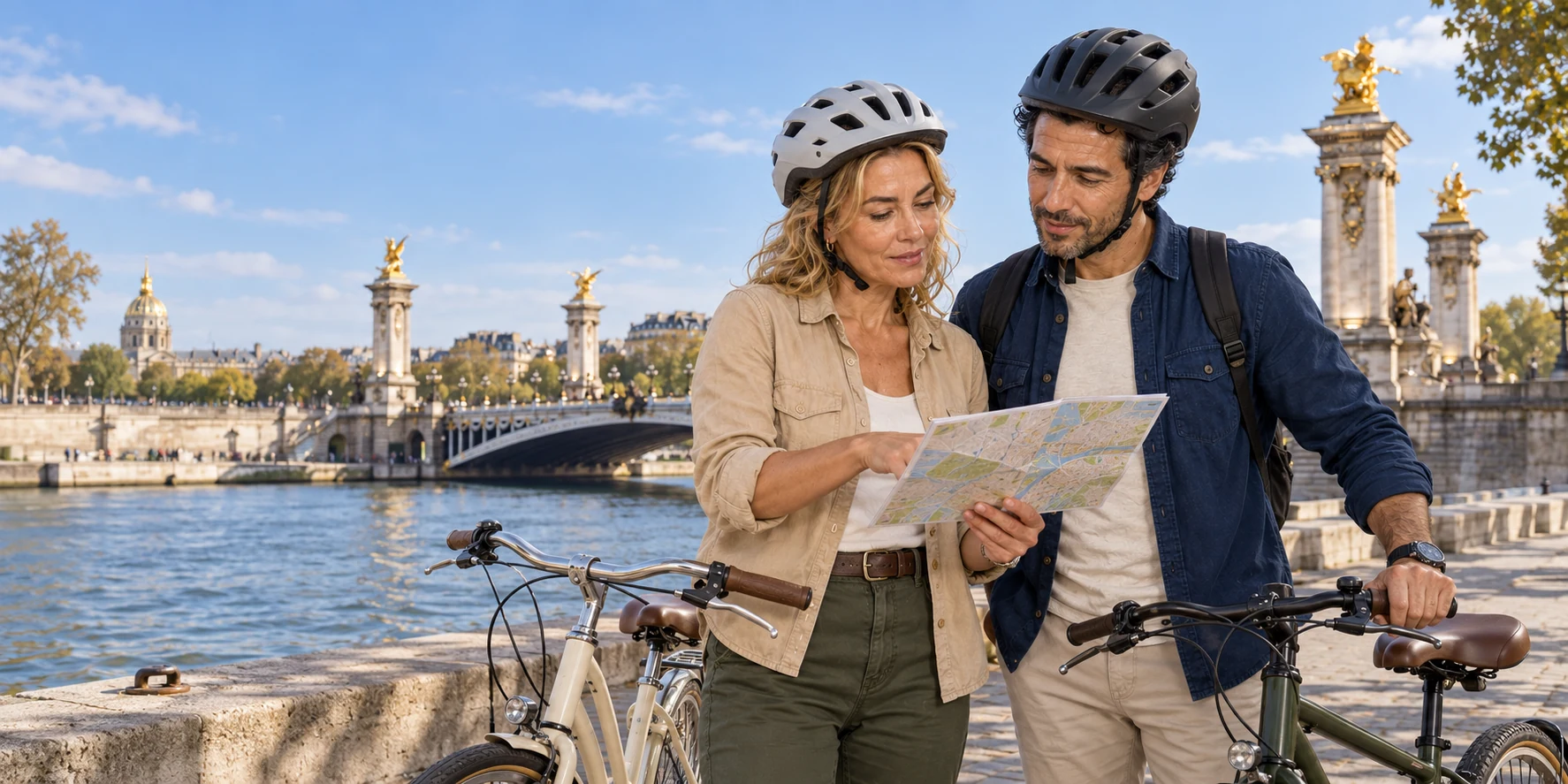
A bicycle can join Notre-Dame, the Louvre, the Eiffel Tower and the great exhibition buildings into one intelligible city. Its real gift is not checklist speed but continuity—provided we distinguish river from avenue, protected lane from mixed street, and an exterior orientation from a monument visit.
01 · Paris city field guide
The useful promise is orientation, not conquest
The phrase “Paris highlights” invites a bad mental picture: a race among icons, with a bicycle used to collect more photographs per hour. A strong orientation ride does something subtler. It shows why the icons occupy their particular places, how the Seine and two historic axes organise the centre, and where apparently separate chapters of Paris touch one another.
A useful broad orientation begins near Place Saint-Michel and joins Notre-Dame, the Musée d’Orsay, the river, Pont Alexandre III and Les Invalides, Rue Cler, the Eiffel Tower, the Grand and Petit Palais, the Champs-Élysées edge, Place de la Concorde, the Tuileries and the Louvre. Its value is durable: medieval island, royal institution, railway age, universal exhibitions, monumental avenue, palace and public garden become parts of one city rather than isolated pins.
That is a lot to see from outside. It is not the same as visiting any one place. A stop beside Notre-Dame cannot contain the cathedral’s liturgy, sculpture, fire, restoration and interior. A view of the Eiffel Tower does not explain its ironwork, elevators and summit access. The Louvre’s courtyard is not the museum. The correct promise is a table of contents whose entries have already been connected by geography and chronology.
This distinction protects the day from disappointment. If a reader wants two hours inside the Louvre, a tower ascent or sustained neighbourhood detail, those should be separate decisions. The bicycle day answers a first-order question: How does central Paris fit together? It should answer that question generously, then let the next day begin with a better map in the mind.

02 · Paris city field guide
Start at Saint-Michel: Paris is a city of crossings
Place Saint-Michel is a useful orientation point because it is central and recognisable, and it is an unusually revealing place to begin reading Paris. The fountain and square sit on the Left Bank beside the bridge to the Île de la Cité. From here, a rider is immediately asked to understand banks, islands and crossings rather than a simple east–west avenue.
The Seine does not divide Paris into two self-contained halves. Bridges turn it into a repeated negotiation. The medieval city grew around navigable water, defensible islands, trade, institutions and crossings. Later rulers formalised quays and vistas; engineers channelled the river; railway companies placed terminals and tracks near it; motor traffic claimed its banks; recent governments returned stretches to walking and cycling. Every layer used the same corridor differently.
The Left Bank and Right Bank labels are useful only when paired with flow. Facing downstream toward western Paris, the Right Bank is to the north and the Left Bank to the south. The Île de la Cité interrupts the division. A bicycle route may cross, recross or run beside the water. That movement is not a navigational nuisance. It is the basic urban lesson.
Saint-Michel also makes a safety point early. A grand plaza is not automatically cycling space, and a pavement is not a default route. Paris rules prohibit ordinary cycling on sidewalks unless a marked arrangement permits it; children under eight are the narrow general exception. A responsible group begins with clear instructions about mounting, signals, junctions and regrouping. The first useful sign of a good tour is not speed. It is whether uncertainty is resolved before the group enters moving traffic.
03 · Paris city field guide
Notre-Dame is an island landmark and a restored working cathedral
Notre-Dame is often treated as a skyline object. From a bicycle, its stronger lesson is location. The cathedral occupies the eastern part of the Île de la Cité, a site tied to religious authority and the long life of the island at the centre of Paris. The river touches it on both sides; bridges bind it to both banks. It is not merely beside the route. It explains why the route keeps returning to crossings.
Maurice de Sully, bishop of Paris, initiated the Gothic cathedral in the twelfth century. Construction and alteration continued over generations. The west front, flying buttresses, towers, transepts and sculptural programmes were not one instantaneous design. Centuries later, revolutionary damage and neglect altered the building and its contents. The nineteenth-century restoration led by Eugène Viollet-le-Duc and Jean-Baptiste Lassus repaired, reimagined and added, including the spire that became central to the modern silhouette.
The fire of 15 April 2019 destroyed the roof structure and spire and damaged vaults and interior spaces. The restoration that followed was not a matter of replacing one picturesque feature. It required stabilisation, archaeology, material study, craft, structural work, fire protection and decisions about how a living cathedral should reopen. Notre-Dame reopened in December 2024. The cathedral’s official history provides the essential chronology; its official reservation portal explains the entry and reservation framework.
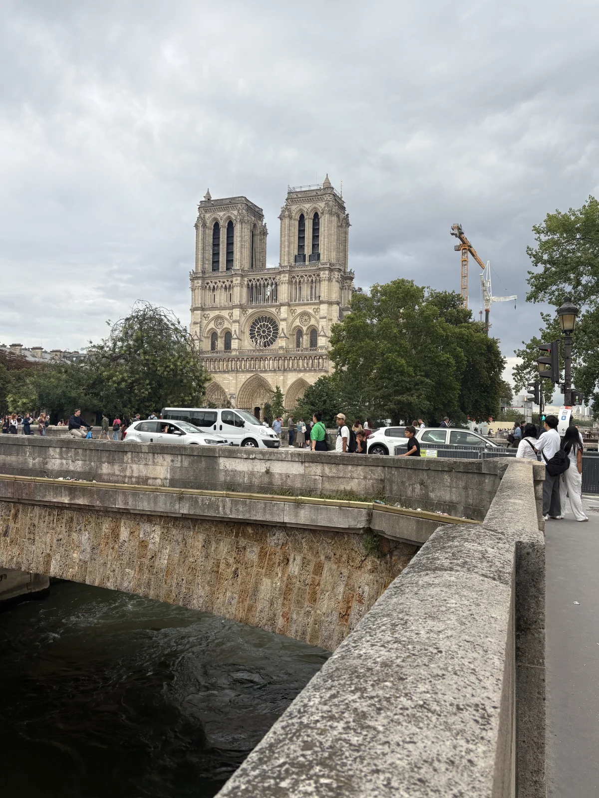

An exterior stop should therefore do three things. It should locate the cathedral on the island, establish its long and revised chronology, and make clear that a later interior visit is a different experience. Entry to the cathedral is currently free, with an official optional reservation system, but security, worship and crowd management are live conditions. The bicycle does not grant privileged access and should never be parked as though the forecourt were a private staging ground.
There is also an ethical difference between looking at restoration and consuming disaster. The 2019 fire is not a suspense anecdote for a guide to embellish. It is a documented event followed by years of skilled work. The current building carries medieval fabric, nineteenth-century restoration, twenty-first-century reconstruction and an active religious function at once. That layered continuity is a better story than the claim that Notre-Dame has simply been “returned to how it was.”
04 · Paris city field guide
The Seine is infrastructure before it is scenery
Paris markets the Seine as reflection, romance and evening light. Those qualities are real, but the river first made demands. It carried goods and waste, threatened floods, required bridges and embankments, divided land and created valuable frontage. The stone quays that now look timeless are engineered edges. Navigation, channelisation and successive bridge projects transformed a living watercourse into an urban system.
UNESCO’s Paris, Banks of the Seine site joins a corridor from the historic centre toward the Eiffel Tower, including islands, quays, bridges, major public buildings and monuments. The listing matters because it recognises a relationship, not just an inventory. Notre-Dame, the Louvre, Invalides, Grand Palais and the Eiffel Tower form a sequence through urban design and river views. The boundary was modified in 2024, another reminder that even official heritage definitions are managed rather than natural.
The lower banks also record a recent reversal. During the twentieth century, planners adapted the Seine to motor traffic. The right-bank expressway opened in 1967; a proposed counterpart on the Left Bank was abandoned in the 1970s. From the early 2000s, temporary and then permanent projects returned central stretches to pedestrians, leisure and cycling. Legal and political fights accompanied that change. A quiet riverside segment is therefore not simply “old Paris without cars.” It is new public space made from former road infrastructure.
Between the royal riverfront and the motor-road era came the nineteenth-century remaking of the wider city. Napoleon III appointed Georges-Eugène Haussmann prefect of the Seine in 1853. New and extended boulevards, sewers, water systems, stations, parks and standardised street furniture did not create Paris from nothing; they cut through, connected and displaced an existing city while accelerating projects begun under earlier regimes. The Musée Carnavalet’s history of the Haussmannian transformations is a useful guard against the myth of one planner authoring every visible avenue. On this ride, the Saint-Michel fountain and broad approaches, exhibition-era crossings and engineered embankments belong to different campaigns that later transport systems tied together.
This history makes the bicycle an unusually revealing vehicle. It can travel far enough to show how quays, ramps, bridges and upper streets interlock. It also exposes the incompleteness of the transformation. One segment may be separated from traffic; another may share space with walkers; a bridge approach may return riders to a busy junction. The experience is neither the old expressway nor a continuous park.
The lower quays remain working infrastructure rather than a guaranteed sightseeing lane. Riders should follow signed access and dismount wherever cycling is not permitted or pedestrians have priority. The durable lesson is that Paris has repeatedly redesigned its river edge; the practical lesson is that the legal street in front of you matters more than an old route video.
05 · Paris city field guide
Musée d’Orsay: an electric station that became a museum
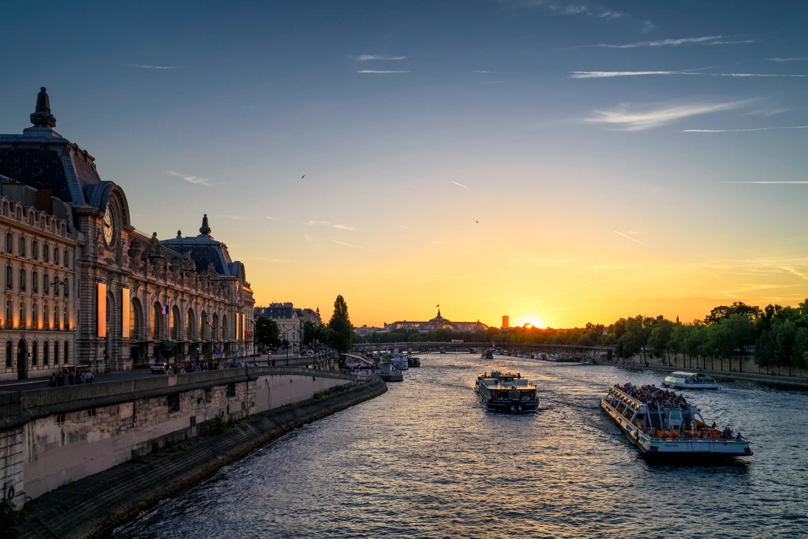
The Musée d’Orsay is a powerful orientation stop because its façade gives away the building’s first life. Victor Laloux designed the Gare d’Orsay for the Compagnie d’Orléans in the late 1890s, and it opened for the 1900 Exposition Universelle. The ornate stone envelope belongs to official Paris; the metal structure and railway function belong to industrial modernity.
Electric trains helped make the central terminal possible. Without the smoke and steam associated with long-distance locomotives, the railway could approach the historic core in a form suitable to a prestigious urban site. Platforms, tracks, hotel and passenger circulation were integrated behind a façade designed not to offend its monumental neighbours. The clock still announces the original programme.
Changing railway technology made the station’s platforms too short for newer trains. Long-distance use declined, and the building passed through other functions before its conversion to a museum. The Musée d’Orsay opened in 1986, turning an infrastructure shell into a setting for art largely from 1848 to 1914. That date range and the 1900 building speak to each other: the museum occupies one of the technological and architectural environments created by the period it interprets.
.jpeg)
An exterior bicycle stop can make this transformation legible without promising paintings, galleries or the famous interior clock view. Those require a separate visit. The museum’s architecture history provides the station-to-museum sequence.
Orsay also shifts the ride’s chronology. Notre-Dame demonstrated centuries of religious building and restoration. Orsay demonstrates reuse: a transport technology becomes obsolete, but its architecture acquires a new public life. Paris is not a sequence of preserved originals. It is a sequence of adaptations.
06 · Paris city field guide
Pont Alexandre III and Invalides make power visible across the water
Pont Alexandre III is a bridge and a stage set for a relationship. Its low steel arch crosses the Seine without blocking the long views between the Invalides esplanade on the south and the Grand and Petit Palais on the north. Four pylons, gilded sculptures, lamps, nymphs and maritime ornament transform an engineering crossing into ceremonial architecture.
The bridge was inaugurated for the 1900 Exposition Universelle and named for Tsar Alexander III, marking the Franco-Russian alliance. Its political symbolism should not be reduced to decoration. The crossing joined major exhibition grounds on both banks and presented international modernity through a surface language of abundance, movement and state friendship.
Invalides supplies an older line of authority. Louis XIV founded the Hôtel des Invalides in 1670 as an institution for wounded and retired soldiers. Liberal generosity and political control coexisted: the monarchy provided care while giving a visible institutional form to military service. Libéral Bruant designed the main complex; Jules Hardouin-Mansart later created the royal chapel and great dome. Napoleon’s remains were transferred beneath the dome in the nineteenth century, adding imperial memory to a royal veterans’ foundation.
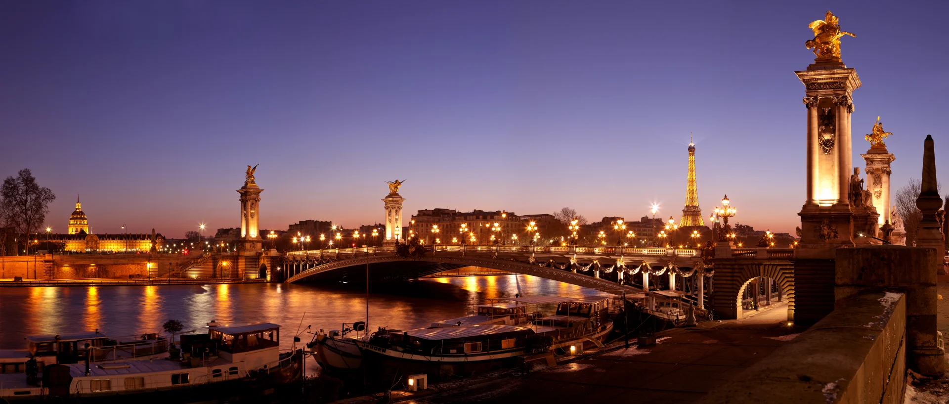

From the bridge area, a rider can grasp two Parisian habits. First, monuments are aligned to produce distant relationships, not merely impressive façades at close range. Second, later regimes reuse earlier symbols. Invalides moved from Louis XIV’s military institution to Napoleonic mausoleum and national museum complex. Pont Alexandre III added a late-nineteenth-century diplomatic layer across its view.
The best stop is not necessarily on the narrowest or most crowded part of the bridge. Bikes, pedestrians, photographs, traffic and group interpretation compete for space. A guide who chooses a quieter nearby point may protect both the explanation and other users. “We stopped at Pont Alexandre III” should describe the subject, not license obstruction.
07 · Paris city field guide
Rue Cler is a change of scale, not a guaranteed meal ritual
After palaces, cathedrals and exhibition structures, a neighbourhood street is editorially useful. Rue Cler in the 7th arrondissement is known for food shops, cafés and market activity. A pause there changes the scale from state monument to everyday provisioning and gives the group practical rest.
That does not make the street an untouched village. It is an active commercial environment in a wealthy central district, shaped by residents, workers and visitors. Delivery, opening patterns and the character of individual businesses change. A route may allow time for a snack; it does not confer local status or guarantee a particular purchase.
A pause near Rue Cler can make room for water, food and a change of pace, but it should not be treated as a guaranteed meal ritual. The practical value is rest; the editorial value is noticing that Paris lives between monuments.
For families and heat-sensitive riders, the break is also diagnostic. Fatigue often appears after repeated starts and stops rather than during one continuous ride. Use the pause to assess water, concentration, saddle comfort and the remaining route.
08 · Paris city field guide
The Eiffel Tower is a hinge, not the whole story
The Eiffel Tower was constructed for the 1889 Exposition Universelle, on the Champ de Mars at the western edge of the route’s main monument field. From a bicycle, its great practical quality is orientation. It appears, disappears behind buildings or trees, and returns from new angles. The tower turns position into a visible relationship.
Its silhouette begins with an engineering problem. In 1884, Maurice Koechlin and Émile Nouguier developed a very tall iron pylon from the logic of metal viaduct piers: four widely spaced legs, joined by a lattice and converging toward the top. Their curved outline answered wind forces as well as the tower’s weight. Architect Stephen Sauvestre refined the project’s architectural presentation before Gustave Eiffel carried it forward for the exhibition. The Eiffel Tower’s account of Koechlin’s work makes the collaborative origin clear.
From outside, look at the contrast between the massive spread at ground level and the thinning upper frame. Open ironwork allows views through the structure; it does not make the structure weightless. The tower belongs to the same age of railway bridges and exhibition engineering that the route reveals at Orsay and Pont Alexandre III. A later ascent adds different questions—how elevators follow inclined legs, why each platform changes the view, and how the summit changes the visit—explored in Inside the Eiffel Tower.
The tower’s 1889 date also prepares the eye for 1900. Moving from Champ de Mars toward Pont Alexandre III and the Grand Palais, the rider crosses between two universal exhibitions that remade western Paris. Temporary halls disappeared, but transport works, bridges, museums, public spaces and monuments survived or were reused. The route is therefore not a random set of famous objects. It is partly a landscape of exhibition urbanism.
An exterior bicycle stop should be candid about distance and access. A photograph near the base does not include ascent. Security perimeters, gardens and queues shape movement. Exact bicycle parking and group positioning change. If tower entry matters, schedule it as a separate timed commitment and confirm the controlling official information rather than assuming the ride can simply flow into an elevator queue.
The most useful question to carry away is not “Did I get the shot?” It is “From which later places can I still read the tower?” Pont Alexandre III, the Seine corridor, Trocadéro and distant axes will answer differently. The tower becomes a hinge in the mental map rather than a trophy at its centre.
09 · Paris city field guide
Grand and Petit Palais: exhibition Paris becomes a public inheritance
The Grand Palais was built in roughly three years for the 1900 Exposition. Its exterior uses monumental masonry and classical language; behind and above it, an enormous steel-and-glass roof creates a very different volume. The building reconciled official ceremony with the engineering demands of a vast exhibition hall.
Across the avenue, the Petit Palais formed part of the same ensemble, and Pont Alexandre III completed the connection across the river. The three works made arrival itself an exhibit. Visitors moved between national display, fine arts, industry, transport and the city’s staged international image.
The Grand Palais was also a collaborative design rather than a single architect’s signature. Henri Deglane developed the principal façade and nave; Albert Louvet worked on the intermediate section and stair; Albert Thomas designed the rear part. Charles Girault coordinated the ensemble. That division helps explain the building’s double character: a ceremonial stone frontage joins spaces whose dimensions and circulation depend on modern metal construction.
Girault also designed the Petit Palais, opened for the 1900 exhibition and made the City of Paris’s fine-arts museum in 1902. Its scale is smaller, but the programme is not slight. The great entrance grille is part of Girault’s design, while the painting, sculpture and mosaics were developed over the following decades, from 1903 to 1925. Art does not merely hang inside; it helps make the building.
In the garden peristyle, Paul Baudouin’s frescoes turn months, hours and seasons into a decorative rhythm. Facchina’s mosaics add another material register underfoot. Those details, documented in the Petit Palais’s history, connect the grand exhibition façade to an intimate courtyard and an extended craft programme. From an exterior stop, compare the two palaces’ entrances and rooflines. A separate museum visit can then reveal what the river panorama cannot: the smaller building’s garden, collections and decorated surfaces.
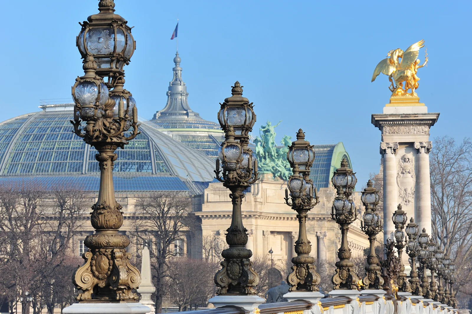

The Grand Palais has accommodated art, horse shows, technical exhibitions, fashion and public events, but its afterlife also includes the First World War, when it served as a military hospital and rehabilitation setting. A hall built to display cultural and industrial achievement could be turned toward the damaged bodies of war. The official Grand Palais history traces these changes of purpose. Later conservation of its structure, services and circulation belongs to the same problem: how to keep an enormous inherited hall useful while preserving its masonry, metalwork and glass.
A bicycle stop outside is valuable precisely because the façade does not disclose the whole building. Ask the eye to separate stone screen, metal frame and glazed roof. Notice how lamps and gilded sculpture repeat across the bridge. Conservation is part of the building’s continuing history, not visual noise to edit out.
10 · Paris city field guide
The Champs-Élysées does not run along the Seine
A common shorthand loosely places the Champs-Élysées “along the Seine.” That is not the geography. The avenue begins at Place de la Concorde and runs northwest toward the Arc de Triomphe. It belongs to the historic western axis extending from the Louvre and Tuileries through Concorde, not to the riverbank itself.
Keeping river corridor and avenue distinct makes the city easier to understand. From the Grand Palais area, the route can approach the lower Champs-Élysées or its edge, then descend toward Concorde and the Tuileries. The river remains close, but the avenue is a different line. Keeping the two lines separate explains more of Paris than merging them into a vague zone of monuments.
The western axis began in royal garden design and expanded through successive planning. André Le Nôtre extended the visual logic of the Tuileries westward in the seventeenth century. Later, Place de la Concorde, the avenue, the Arc de Triomphe and beyond transformed the line into a national and imperial stage. Parades, political gatherings, commerce and traffic repeatedly remade its meaning.
For a cyclist, prestige does not reduce traffic complexity. Wide views can coexist with demanding junctions, buses, turning vehicles, pedestrians and temporary controls. The correct route is whatever legal, current street arrangement the guide uses—not the straightest line on a postcard. If an itinerary names the Champs-Élysées, ask whether it rides on the avenue, touches the lower gardens, crosses near it or simply interprets the axis. Those are materially different experiences.
11 · Paris city field guide
Concorde and the Tuileries compress regime change
Place de la Concorde is a large urban hinge between river, avenue and garden. Its name suggests settlement, but its history contains repeated renaming and violence. Created as Place Louis XV, it displayed royal authority. During the Revolution it became Place de la Révolution and the site of executions including Louis XVI and Marie Antoinette. The present name reflects a later political desire for concord without erasing the conflicts embedded in the space.
The Egyptian obelisk at its centre adds another timeline. Méhémet Ali, ruler of Egypt, gave France the two obelisks at the entrance to Luxor’s temple; only one made the journey to Paris. Transport required a purpose-built ship and years of work. On 25 October 1836, machinery, ropes and capstans raised it into place at Concorde. The Centre des monuments nationaux’s account turns an apparently immovable object back into an engineering operation.
The monument connects ancient Egyptian kingship, nineteenth-century diplomacy and the European removal and display of antiquities. A diplomatic gift explains the immediate transfer; it does not exhaust the questions raised by the object’s new setting. Its hieroglyphic surface and Parisian pedestal belong to different histories, and reading both is more useful than treating the obelisk as generic decoration.
Jacques-Ignace Hittorff’s subsequent design helped organise the square around this centre. The two fountains address seas and rivers, while rostral columns recall maritime power and eight statues represent French cities. The official history of Concorde’s design reveals a deliberate national geography around an imported ancient monument. From a safe stopping place, identify square, obelisk, fountains and the garden axis together; interpreting the space does not require cycling into its busiest traffic streams.
East of the square, the Tuileries Garden returns the route to the Louvre. Catherine de’ Medici initiated a palace and garden here in 1564. André Le Nôtre redesigned the garden in 1664, strengthening the long central perspective and creating terraces, basins and ordered planting. It later became a public garden. The Tuileries Palace itself was burned during the Paris Commune in 1871 and demolished in 1883, leaving an absence in the axis between the Louvre and garden.
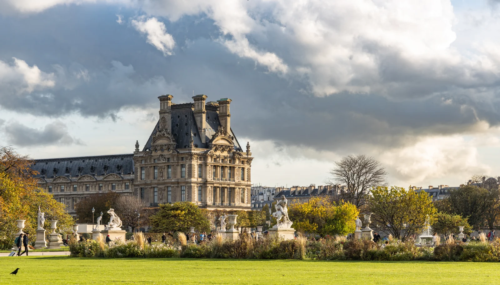

The Louvre’s history of the Tuileries lets a rider understand why the landscape feels both complete and strangely open. The missing palace is part of the present composition. The garden’s chairs, sculpture, paths and leisure also prevent it from being reduced to royal geometry. Public occupation has become one of its defining materials.
Cycling rules within pedestrian garden space must be followed, and a group may skirt, dismount or use nearby legal routes rather than ride through the most crowded paths. The interpretation survives those operational choices. Concorde and Tuileries demonstrate that an axis can outlive the regimes and buildings that created it.
12 · Paris city field guide
The Louvre is a palace that became a museum, not a pyramid with queues
The Louvre’s glass pyramid is a useful orientation marker, but the surrounding buildings contain a much longer argument. The site began as a medieval fortress under Philip Augustus near the city’s western edge. Successive rulers transformed and expanded it into a royal palace. Wings, courtyards and façades accumulated across reigns, architects and political programmes.
When Louis XIV moved court and government to Versailles, the Louvre did not cease to matter. Artists, academies and collections occupied parts of the complex. During the Revolution, it opened as a public museum in 1793. Later regimes expanded both building and collections, sometimes through war, empire and contested acquisition. The Louvre’s palace history is necessary because “the museum” is itself a historical reuse.
I. M. Pei’s pyramid, inaugurated in 1989, reorganised access through the Cour Napoléon and made a modern intervention the public face of the institution. Its geometry does not imitate the palace; it creates a deliberate contrast while solving circulation at immense visitor scale. A guide can use the courtyard to discuss medieval fortress, royal palace, revolutionary museum and modern infrastructure without claiming to have visited a gallery.
That boundary is crucial. The Louvre’s collections cannot be meaningfully “covered” from the exterior, and an interior visit cannot be improvised after four hours of cycling unless a timed plan, bicycle arrangements and physical energy are already protected. The orientation ride should make the reader more selective: decide whether the next visit will centre on one collection, one period, the building’s history or a short set of works.
Reaching the Louvre closes the monumental sequence, rather than establishing where a particular tour ends. The route described by the operator returns toward its Saint-Michel starting area after the Louvre; the actual meeting and return points belong to the departure arrangements. Saint-Michel began at an island crossing. The ride followed institutions and exhibitions westward, then returned through the royal axis to a palace converted into a museum. The city map now holds chronology as well as direction.
13 · Paris city field guide
Paris is more cyclable, but the network is not one kind of space
Paris has changed rapidly for bicycles. The City’s 2021–2026 cycling plan expanded infrastructure, made temporary pandemic-era lanes permanent and targeted difficult junctions. A City report published in 2026 counted 1,607 kilometres of bicycle itinerary at the end of 2025.
The City’s 2025 cycling report, published in 2026, distinguishes approximately 486 kilometres of cycle tracks and greenways, 145 kilometres of painted lanes, 169 kilometres of bus lanes open to cycling, 435 kilometres of contraflow streets, 126 kilometres on streets closed to general motor traffic, 16 kilometres of vélorues and 231 kilometres of pedestrian routes. These are rounded categories in a dated municipal inventory, not a promise about the surface beneath tomorrow’s wheels.
The greenway distinction is especially important. A greenway excludes ordinary motor traffic but can accommodate pedestrians and other non-motorised users; it is not necessarily a bicycle-only lane. A pedestrian route requires walking pace and priority for people on foot. Contraflow permission describes a direction of travel, not a protective barrier. The network supports cycling through several different arrangements, and each requires its own reading of space, signs and other users.

The distinction explains why two riders can report very different versions of Paris. One may follow a protected corridor with dedicated signals; another may share a bus lane, navigate a contraflow street, cross a construction diversion or slow to walking pace beside pedestrians. Both are using the network.
The City’s current safety guidance rejects several common shortcuts. Ordinary cyclists cannot treat the sidewalk as an escape from traffic. Phones held in the hand and headphones or earbuds are prohibited while riding. In the absence of a cycle facility, riders use the roadway and keep to the right as conditions permit. Local signs and signals govern.
This makes guide quality observable. A guide should describe the next segment before it begins, use clear hand or verbal signals, place less confident riders appropriately, stop where the whole group can leave traffic, count riders after complex crossings and adapt to works. “Follow me” is not a complete traffic-management system.
14 · Paris city field guide
Safety is a chain of small decisions
The French national rules and Paris guidance establish a floor. A bicycle needs two effective brakes, a bell, reflectors and lights in required conditions. Helmets are mandatory for children under twelve, whether riding or carried, and recommended for older riders. A high-visibility vest has a specific legal requirement outside built-up areas at night or in poor visibility; it should not be misreported as universally mandatory for every daytime Paris ride. The official Service-Public bicycle-equipment guidance gives the national requirements.
Legal compliance is not the whole safety chain. Fit comes first. A rider should understand both brakes, be able to start without swerving, stop under control and look behind while maintaining direction. Loose straps, bags and clothing should stay clear of wheels. A helmet, if worn, must sit level and fit correctly; dangling on a handlebar contributes nothing.
Group behaviour comes next. Leave enough stopping space. Do not overlap wheels. Signal potholes and doors. At a signal change, do not rush to preserve the group at the cost of the law; the guide should have a regrouping plan. A split group is an operating problem, not a reason for the trailing rider to take a risk.
Weather and fatigue change the chain. Rain affects braking and road markings. Heat reduces concentration. Bright sun produces deep shade under trees and bridges. Crowds can force dismounting. A participant who is anxious in ordinary urban traffic is not transformed by the word “tour.” The relevant question is whether the route, group management and rider skill fit one another.
Emergency planning should be plain rather than dramatic. A guided ride needs a clear response to a puncture, a minor fall, a separated rider or someone who cannot continue. Participants should know how the group communicates and where it regroups before entering traffic.
15 · Paris city field guide
Families need a complete equipment chain, not a minimum age slogan
A family booking decision depends on more than whether “children are welcome.” It requires a suitable bicycle or carrier, correct fit, the child’s ability and confidence, the actual street environment, group pace, helmet provision, break pattern and an alternative if the child cannot continue.
Before choosing any family cycling format, establish which equipment is available, the manufacturer limits, how fit is assessed, whether a child rides independently on mixed streets, whether helmets of the correct size are reserved, who installs and checks an attachment, and what happens if the equipment is unsuitable. State the child’s current height, weight and riding experience accurately.
The route itself matters. A child who rides comfortably in a park may not be ready for repeated starts at urban junctions. A trailer or seat changes bicycle handling. A family also needs water, sun protection, a toilet strategy and a realistic response to fatigue. Group size can affect how quickly a guide detects a problem.
There is no shame in choosing a different orientation format. Walking with transit, a river cruise or a private adapted route may keep more attention available for the city. Suitability is not a test of courage; it is a match between a real person and a real chain of conditions.
16 · Paris city field guide
What a responsible guided ride should make clear
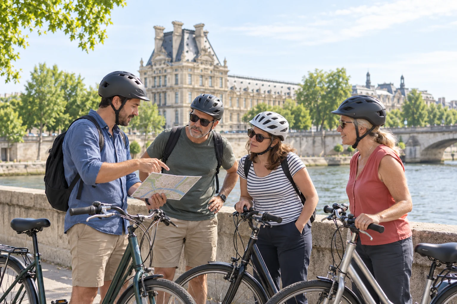
A guided bicycle orientation earns its place by joining interpretation to group management. A guide can connect geography, history and safe movement while preserving later visits for depth, but the reader should still understand the format rather than infer it from a photograph or a list of landmarks.
Before choosing a guided ride, establish:
- where it begins and ends, and how the guide is identified;
- approximate duration and how much riding occurs in mixed streets;
- bicycle type, fit process, helmet availability and storage for belongings;
- language and group size;
- suitable child or adaptive equipment, when needed;
- food, water, break and toilet arrangements;
- the response to a late arrival, puncture, fall or rider unable to continue;
- accessibility needs across the whole experience.
These answers determine whether the format fits the rider. Hearing instructions, controlling the bicycle and remaining with the group are practical requirements that deserve a clear discussion before committing.
Accessibility is a chain through the whole day. Consider the journey to the meeting point, any steps or steep links between upper street and lower quay, getting onto the actual bicycle, grip and braking, balance, hearing or seeing group instructions, fatigue, toilets and the return journey. Flat ground resolves only one part of that chain. Ask about an adaptation in concrete terms, including how it is fitted and what happens if a rider cannot continue. An alternative built around a shorter walk, suitable transit or an independently checked vehicle can preserve the same historical interests without requiring the same physical tasks.
17 · Paris city field guide
Guided tour, bike share, walking or river: choose the missing relationship

Choose a guided bicycle orientation when continuity and interpretation matter more than interiors. It is strongest for a confident urban rider on a first or second day who wants to understand scale before making deeper choices. The group handles the narrative and much of the route decision; the rider still accepts traffic, pace and fixed transitions.
Choose independent bike share when the bicycle is primarily transport. Vélib’ can connect selected places without returning to a rental shop, but live bicycle and dock availability, account setup, time charging, bike condition and route choice belong to the user. Use Vélib’s official release-and-return tutorial alongside the current service instructions. At the end, check that the system confirms a successful return; leaving a bicycle beside a dock does not by itself finish a hire. A bike-share trip does not arrive with historical interpretation or group support.
Choose walking with transit when street texture, interiors or one neighbourhood deserves priority. The apparent inefficiency is the point: walking reveals thresholds, shopfronts, façade details and changes of sound that a moving bicycle can skip. Transit lets the itinerary jump between two or three deliberate clusters without pretending to trace every connection.
Choose a river cruise when the primary question is how bridges, façades and monuments address the Seine. The lower viewpoint can make the river’s sequence unusually clear. The trade-off is distance from street life, little control over pauses and a narrower account of the city away from the banks. Verify boarding accessibility, commentary, seating and river conditions.
Choose a panoramic bus when avoiding balance and continuous walking matters more than street-level intimacy. The raised viewpoint can explain boulevards and distant alignments while weather protection and fixed stops reduce some friction. Traffic, route diversions, stairs to the upper deck, audio quality and the gap between stop and monument remain real constraints. A bus shows the road network especially well; it is less effective at lower-quay life and small crossings.
A strong first day can combine formats without cramming them. Use a bicycle orientation to understand the relationships, then stop. On another day, walk the Île de la Cité, enter Notre-Dame, visit one Louvre collection, examine the Eiffel Tower’s structure, or stay in the Latin Quarter. The map gains value only when it supports attention.
18 · Paris city field guide
How to use four hours without pretending it is four days
The intellectual rhythm of a good ride is simple. Move long enough for distance to register. Stop where a relationship can be seen. Give one or two ideas enough time to become memorable. Resume before the stop turns into a compressed lecture. Repeat.
At Saint-Michel and Notre-Dame, the relationship is island and crossing. At Orsay, it is station and adaptive reuse. At Pont Alexandre III, it is bridge, exhibition and aligned institutions. At Invalides, it is royal military welfare and later imperial memory. At the Eiffel Tower and Grand Palais, it is the urban afterlife of universal exhibitions. At Concorde and the Tuileries, it is the survival of an axis through revolution and lost architecture. At the Louvre, it is palace, museum and modern access.
That sequence already contains enough history for one ride. Give a documented story time to explain a mechanism: Orsay’s changing railway use makes technological obsolescence visible; the obelisk’s journey shows how much work hides behind an apparently permanent monument; a road returned to public riverbank reveals a change in urban priorities. Remembering one of those processes is more useful than collecting another hurried landmark name.
Photographs should follow the same discipline. Take one image that records a relationship rather than ten near-duplicates of a monument. Bridge and dome. Station and river. Garden and missing palace line. A bicycle parked legally outside the frame is often more honest than arranging a group across a crowded viewpoint.
Finally, preserve recovery time. Four hours of listening, starting, stopping and scanning streets is active concentration. Do not place an inflexible museum slot immediately after the scheduled end without room for delay, return formalities, food and a change of pace. Orientation works best when the rest of the day lets the map settle.
19 · Paris city field guide
The Seine is the spine; the bridges are the grammar
By the end of this route, the river should no longer be a blue line between attractions. It is the infrastructure that concentrated crossings, institutions, transport, display and political attention. Notre-Dame uses an island. Orsay turns a riverside terminal into a museum. Pont Alexandre III joins two exhibition landscapes. Invalides and the Grand Palais face across water. The Eiffel Tower announces itself along the corridor. The Louvre and Tuileries hold another axis just inland.
The bicycle makes those relationships bodily. Distance is felt but not allowed to dominate. A bridge becomes a choice; a lower quay becomes evidence of changed transport policy; a mixed street interrupts the fantasy of seamless protection. The city is legible because movement has consequences.
That is also why the ride’s limitations matter. Exterior stops cannot replace interiors. More cycling infrastructure does not make every segment identical. A child-friendly slogan cannot replace equipment and route verification. Accuracy is not a footnote to orientation. It is the basis of it.
The best outcome is not that Paris feels finished. It is that the next decision becomes specific. Return to Notre-Dame for worship and restored craft. Read the Eiffel Tower as structure. Enter the Louvre with one collection in mind. Walk the western axis without confusing it with the Seine. Follow a later story into the Latin Quarter at neighbourhood scale.
The bicycle has then done its real work. It has not conquered Paris. It has turned a famous skyline into a city whose parts can be related, questioned and revisited.
20 · Paris city field guide
Listen to the field notes
In Paris Highlights Guided Bike Tour by ExcursionPass, the presenters follow the broad landmark sequence and raise the practical questions that shape this feature: what a bicycle reveals, where exterior orientation ends and which riders benefit from the format.
21 · Paris city field guide
Continue exploring Paris
For a close reading of the route’s most visible landmark, continue with Inside the Eiffel Tower: How Structure, Elevators and the Summit Change the Visit. The two stories are deliberately complementary: one builds the city map; the other slows down inside a single structure.
About the illustrated scenes
The opening map-reading scene and Louvre-side discussion are generated editorial illustrations, not photographs of an actual tour. The opening scene uses the approved ExcursionPass presenter references and a Pont Alexandre III photograph by Dimitri Destugues for place research. This reconstructed illustration is released under CC BY-SA 3.0; the photographic reference has the same licence. The second scene depicts fictional adults and unbranded bicycles. Documentary photographs retain their individual linked credits and licences.