
01 · Juno coast field guide
Begin with a connected coast
The word “Juno” makes a complicated place sound singular. It was a military sector several kilometres wide, divided into named assault areas and anchored by three inhabited coastal towns. It was also one part of a larger Allied operation, not an isolated Canadian battle. Today it is a working coast where homes, shops, dunes, sea defences, memorials, buried concrete and a national museum occupy the same geography.
That is why a visit should not begin as a checklist. Courseulles-sur-Mer, Bernières-sur-Mer and Saint-Aubin-sur-Mer are not three interchangeable beach stops. Each had different exits, defensive positions and assault units. The fields inland were not empty space between the landing and a cemetery. They were the ground over which the beachhead had to become a defensible lodgement. The Juno Beach Centre is not a substitute for the landscape, and the landscape cannot explain itself without the documentary record the museum preserves.
The Canadian story is central without being exclusive. According to the Juno Beach Centre's synthesis, roughly 21,000 Allied personnel came ashore in the Juno sector on 6 June 1944. About 14,000 were Canadian. British troops made up approximately one third of the landing force, while British naval, armoured and specialist units worked alongside Canadian formations. Canadian sailors and aircrew participated across the wider operation. “Canadian-led” is accurate. “Canadian-only” is not.
A coherent route therefore moves through relationships. The sea explains the timing problem. The beaches explain exposure and obstacles. The towns explain why a landing immediately became close combat among buildings and civilians' homes. Inland roads explain operational ambition and congestion. Bunkers explain the occupation and the incomplete defensive system. The cemetery returns a campaign measured in formations to people identified by name. The museum asks what Canada was before, during and after the war, and how veterans chose to build a place of public memory on the coast where they had served.
The pressure of fitting Juno into a long day from Paris creates a useful field question. A day is not successful because it accumulates the most famous names. It succeeds when the chosen stops change the reader's understanding of one another—and when the schedule leaves enough attention for that change to happen.

02 · Juno coast field guide
Before Juno was a codeword
The communities on this coast had lived under German occupation since 1940. Requisition, shortages, censorship, arrests, restrictions and the presence of military authorities shaped daily life. Residents did not experience the coast as a future battlefield waiting to be liberated. It remained a place of work, family, fishing, trade and local obligation under a violent regime.
German coastal construction transformed that place. The Atlantic Wall was not a continuous wall and never achieved the uniform strength suggested by propaganda. It was a layered system of strongpoints, guns, machine-gun positions, observation posts, minefields, obstacles and trenches, with gaps determined by terrain, time, labour and material. Some works were substantial; others were unfinished, improvised or thinly held. A surviving bunker is evidence of this system, but it cannot represent the whole system by itself.
Construction had its own human cost. The Organisation Todt, military engineers, contractors and coerced labour built defences across occupied Europe. Concrete directs attention toward engineering—wall thickness, fields of fire, protected entrances—but it can conceal the conditions under which a position was created. Reading a fortification responsibly means asking who ordered it, whose land it occupied, which population lived around it and what part it was meant to play in the machinery of occupation.
The defenders at Juno belonged largely to the German 716th Infantry Division, operating within a command structure shaped by uncertainty about where the main invasion would come. They served the armed forces of Nazi Germany on occupied French ground. A full account can describe their positions and choices without romanticising the regime or creating moral symmetry with liberation.
French civilians faced a different danger as the invasion approached. Allied attacks on railways, roads, bridges and communications were intended to isolate the battlefield and delay German reinforcement. They also killed civilians and destroyed homes. Resistance networks supplied intelligence, sabotaged infrastructure and supported Allied operations at immense personal risk, but resistance was not universal or politically simple. Occupied communities included active resisters, collaborators and many people navigating fear, scarcity and compromised choices.
This context changes the visible coast. A house in Bernières could be a family home, a landmark for soldiers approaching through smoke and a firing position. A road inland could carry German reinforcements, Canadian armour, ambulances and displaced residents in succession. Liberation did not restore a clean prewar landscape at the moment troops crossed the sea wall. It began another period of fighting, destruction, displacement and reconstruction.
03 · Juno coast field guide
The plan was a beachhead, not a national race
Operation Overlord aimed to establish and expand an Allied lodgement in Normandy. The seaborne assault, Operation Neptune, stretched across five landing sectors: Utah and Omaha in the west, Gold, Juno and Sword farther east. Airborne forces landed beyond the flanks. Naval and air forces covered the crossing and sought to isolate the battlefield. The beaches were different operational problems designed to become one connected front.
At Juno, the principal Canadian formations were the 3rd Canadian Infantry Division and the 2nd Canadian Armoured Brigade. Infantry brigades, amphibious and conventional tanks, field artillery, engineers, signals, medical services and logistics had interdependent tasks. The Royal Canadian Navy contributed ships, landing craft crews and sailors across the operation, while Royal Canadian Air Force squadrons supported the invasion in the air. British naval, armoured, commando and specialist contributions were woven into the Canadian-led sector.
Numbers vary when sources count different categories. The Juno Beach Centre describes more than sixty warships in the Canadian naval contribution to D-Day, while Veterans Affairs Canada gives a broader total of 109 Royal Canadian Navy vessels and about 10,000 sailors for the operation. Those totals should not be forced into false agreement: “warships,” “vessels,” the Juno sector and the overall Canadian contribution are not identical sets. The reliable conclusion is the important one—Juno depended on a vast naval system that extended far beyond the soldiers visible on the shore.
The intended first-day objective lay beyond the coastal towns, around the road and rail lines north-west of Caen. Reaching it would protect the beachhead, help link Juno with Gold and Sword and create room for later operations. But plans do not move across maps; units move through water, exits, traffic and resistance. The main objective known as Oak was not taken on 6 June. In the evening, British Second Army commander Miles Dempsey ordered Canadian forces to consolidate around an intermediate line known as Elm rather than extend a narrow salient while flanks remained uncertain.
That command context matters because Juno is often praised as the beach where Canadians advanced “furthest inland.” Some units did penetrate more than eleven kilometres, farther than forces from the other beaches in places. It was a substantial operational achievement. It was not a race whose winner demonstrated superior national character. Different beaches had different terrain, resistance, objectives and connections. A long advance without secure flanks and supply could become a vulnerability. The achievement makes more sense when read as part of a coalition plan than as a medal table.
Weather and tide complicated every dependency. Planners needed obstacles exposed for demolition teams but enough rising water for following craft. Rough seas delayed, scattered and sickened troops. Smoke, spray and current reduced visibility. Amphibious tanks did not arrive everywhere in the intended first order. Naval and air bombardment suppressed some positions without erasing the defence. Minesweepers opened approaches, engineers attacked obstacles and exits, infantry crossed exposed ground, and medical and supply units followed into an environment that was still under fire.
No single technology “won” the beach. A tank without a usable exit could not exploit success. An exit without infantry control remained exposed. Infantry without ammunition, communications or casualty evacuation could not sustain an advance. A landing craft had to find its place in rough water, discharge people and equipment, then survive the return. The operation was a chain of tasks in which broken links had to be repaired by adaptation.

04 · Juno coast field guide
Courseulles-sur-Mer: harbour, houses and the western approach
At the western side of Juno, Courseulles-sur-Mer placed assault troops against beaches, harbour structures, strongpoints and a town. The Regina Rifle Regiment landed on Nan Green with support including tanks of the 1st Hussars. The Royal Winnipeg Rifles came ashore farther west in the Mike areas. The geography meant that overcoming the waterline was only the first problem. Harbour mouths, sea defences, walls and buildings created channels and fields of fire; streets carried the fight directly into an inhabited place.
The Reginas' account gives the broad movement a human interruption. At 11:00, the battalion's war diary recorded residents welcoming troops with flowers and bringing out wine while the soldiers still had work ahead. That encounter does not describe every civilian's response or mean the town had become safe. It shows liberation arriving amid an unfinished operation: a civilian gesture of welcome and an infantry unit obliged to keep moving occupied the same street and moment.
Amphibious tanks were intended to give the infantry immediate fire support. The sea did not deliver a uniform result. Some tanks reached the shore; others were delayed, damaged or landed in a different relationship to the first troops. Engineers worked on obstacles and routes while infantry attacked strongpoints and moved through the town. The details differed from company to company. “The tanks arrived” and “the infantry landed” are too broad to explain what happened on a beach divided by hundreds of metres and minutes.
Courseulles is useful because its harbour prevents the beach from appearing as a blank arena. A port is a working junction between land and water. On D-Day it was an obstacle and objective; after the war it again became part of civilian and maritime life. That return does not erase the military layer. It gives the visitor a visible example of overlapping functions—the same coast as defence line, landing ground, home and workplace.
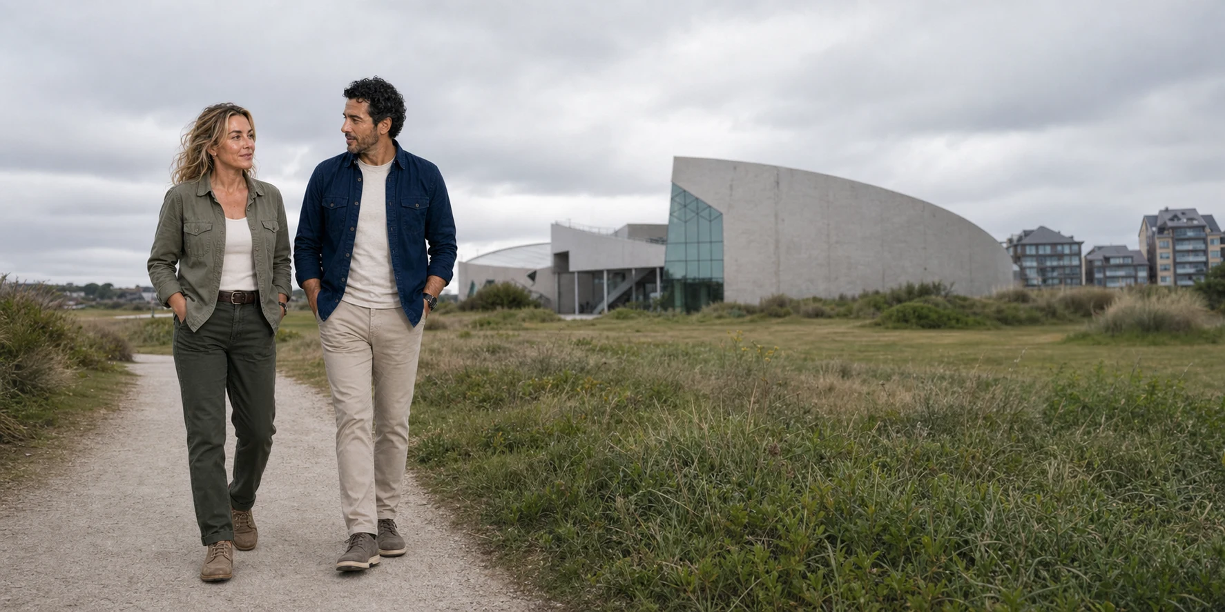
The town also anchors the present-day institutional story. The Juno Beach Centre stands on the seaward side, beside Juno Park and surviving German positions. That concentration can make Courseulles feel like the obvious summary stop, but it is more valuable as a starting point. The museum gives national and campaign context. The park exposes the material defence. The harbour and town show that landing troops had to move from open sand into a built environment. Bernières and Saint-Aubin then reveal how the same sector changed eastward.
05 · Juno coast field guide
Bernières-sur-Mer: an image that needs its landscape
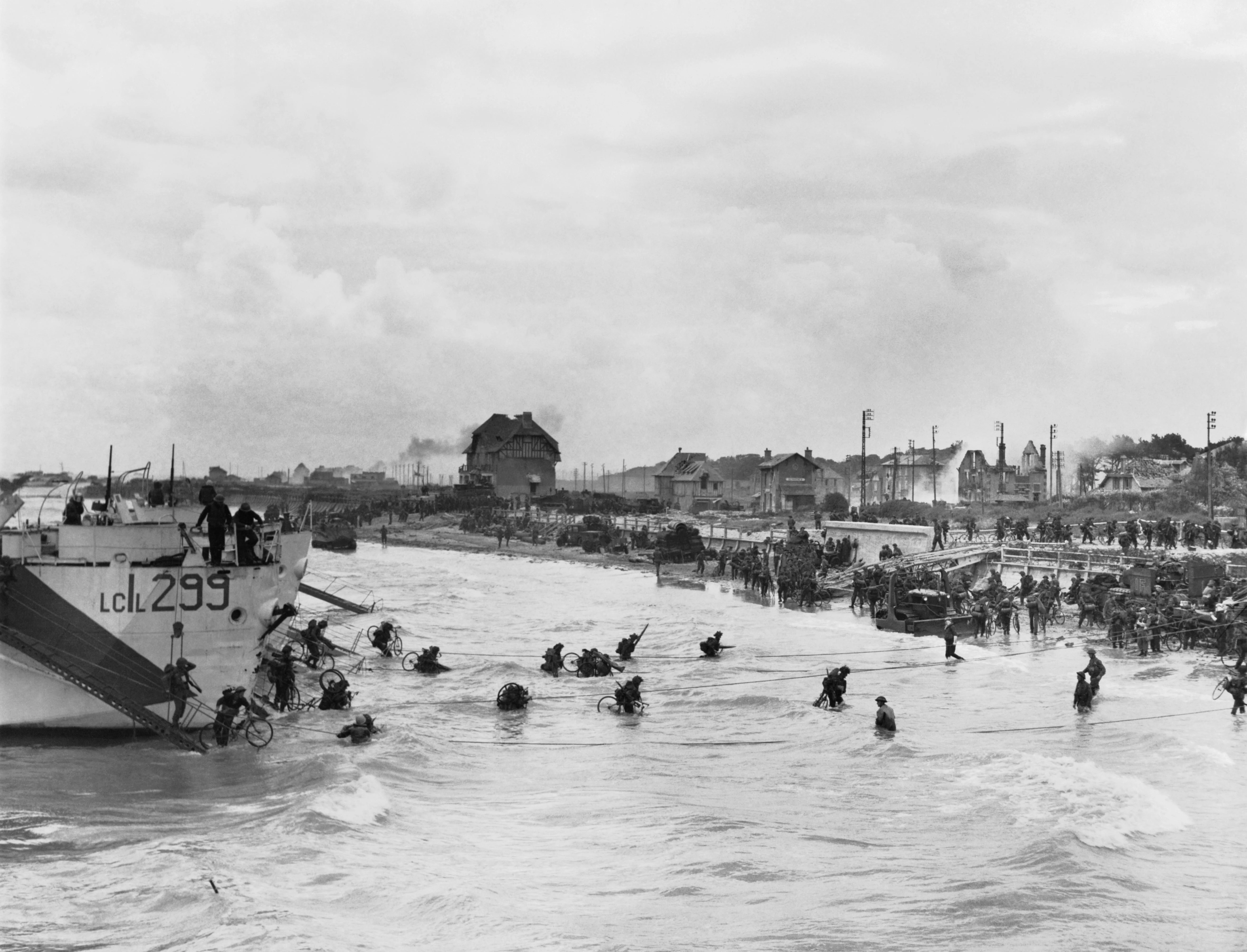
Bernières-sur-Mer supplied one of the most recognisable Canadian photographs of the landings. From a landing craft, the camera looks across shallow water toward troops carrying bicycles and equipment around the beach exit. Houses stand beyond the sea wall; smoke and damage interrupt the town. The image is often used as if it were “Juno Beach,” singular. In fact it records one place and phase within the larger assault.
The Queen's Own Rifles of Canada came ashore at Bernières around 08:15 in the Nan White area. Intended armoured support had not yet arrived in the first moments, and the leading companies faced defended ground between the water, sea wall and houses. The Juno Beach Centre's regimental history records 61 members killed and 82 wounded on D-Day. The unit fought through the town and later advanced through villages including Basly and Anguerny.
The companies' different experiences explain why even that short account needs care. “B” Company landed directly before a heavily defended position; “A” Company got off the beach but was checked by mortar fire. Following craft carrying “C” and “D” Companies struck underwater mines. German guns delayed both the Queen's Own and Le Régiment de la Chaudière, which came ashore behind them. When that obstacle was overcome, the Chaudières moved past and continued inland. One beach exit carried successive assaults and reserves, rather than one clean movement from landing to victory.
The numbers identify scale but not sequence. Soldiers reached the beach in different craft and at different points. Officers and non-commissioned officers were killed or separated. Beach exits had to be opened, landmarks recognised and orders adapted. Reserve units of the 9th Canadian Infantry Brigade later came ashore through Bernières, adding bodies, bicycles, vehicles and equipment to an already congested route. The archival photograph captures that pressure: water and sand in the foreground, a constricted opening, a town immediately beyond and movement continuing under uncertain conditions.
The bicycles deserve interpretation rather than novelty. They were intended to give infantry greater mobility inland. On a clear road, a bicycle could move a soldier faster without fuel. In surf, rubble, wire and congestion, it could become another weight to carry. The image therefore records the friction between a logistical idea and the ground on which it had to function. It is not a comic detail, and it does not prove how every bicycle was used after the frame.
Bernières also shows how a famous object can dominate memory. The timber-framed house visible near the beach became a landmark in later retellings. Recognisable architecture helps visitors connect an archival record to present ground, but the temptation is to make one surviving house carry the experiences of an entire town. The more responsible reading moves outward: which exit did the troops need, what resistance covered it, where did the road lead, who lived nearby, and how did later waves pass through?

06 · Juno coast field guide
Saint-Aubin-sur-Mer: the battle continued past the beach exit
At the eastern side of Juno, the North Shore (New Brunswick) Regiment landed at Saint-Aubin-sur-Mer in the Nan Red area. Support from the Fort Garry Horse was affected by the same difficult approach that disrupted armour elsewhere. The troops faced beach defences and a fortified town, then moved toward further resistance inland.
Saint-Aubin matters because it prevents the story from ending at an opened exit. The strongpoint at Tailleville, inland from the beach, held the North Shores for hours. The ground between shore and objective contained walls, roads, fields and defensive positions that could not be understood from the waterline. The regimental account records 34 killed and 90 wounded on D-Day. Again, those figures should lead back to the work of particular companies and the people inside them, not merely create a comparison with neighbouring units.
An unusually intimate surviving record belongs to this landing. In film of North Shore soldiers leaving a craft, a man wearing a wedding ring briefly pats the soldier ahead of him on the back; another turns toward the camera. The Centre identifies the man who turns as Private George Herman Baker, serving in Major Archie MacNaughton's company. The footage records a small gesture between people about to enter danger. It cannot tell us what either man said or felt, but it breaks the abstraction of a formation into individual bodies, equipment and a moment of contact.
The three towns belonged to one assault plan, but each generated its own local memory. Canadian formations had regional and linguistic identities: men arrived from Saskatchewan, Manitoba, Ontario, Quebec, New Brunswick and elsewhere. Unit names connected distant Canadian communities to specific Norman streets. Families later encountered “Courseulles,” “Bernières,” “Saint-Aubin” or “Tailleville” not as travel names but as places in service records, telegrams and casualty notices.
For a present visitor, giving each town attention creates a better mental map than collecting isolated plaques. Courseulles links harbour, museum and western assault. Bernières connects the archival image to the central landing and reserve route. Saint-Aubin connects the eastern beach to a prolonged inland fight. The towns together show why Juno cannot be reduced to a single pin labelled “Canadian beach.”

07 · Juno coast field guide
From the seawall to the inland objective
The landing was only useful if people and equipment could move beyond it. Engineers cleared or marked lanes through obstacles, attacked walls and helped open routes for vehicles. Military police and beach groups organised traffic amid wreckage, casualties and arriving waves. Signals personnel tried to rebuild communications. Medical units established a chain from first aid to evacuation. Artillery, ammunition, fuel and food had to cross the same limited exits used by infantry and armour.
Congestion was therefore not an incidental inconvenience. It was an operational condition. A disabled vehicle could block a route. A unit landed away from its designated point might cross another unit's path. A late tank could still provide decisive support, but its arrival changed the sequence. A radio failure could force a runner into exposed ground. A casualty could require several people to stop their assigned movement and create a route back toward the water.
Once beyond the towns, Canadian forces entered agricultural country of villages, fields, hedges and roads. Some advance elements reached positions more than eleven kilometres inland. The Canadian War Museum uses that depth to show the extent of the day's penetration. It should also prompt a supply question: could the ground be held, reinforced and connected to neighbouring sectors? A spearhead on a map is not the same as a secure line.
The first-day objective near the Caen–Bayeux railway was ambitious. Caen itself, central to the Allied plan, did not fall on D-Day. German resistance and counterattacks continued. Canadian troops consolidated, linked with British forces and prepared for the battle that followed. The operational story changes when 6 June is treated as the beginning of the Normandy campaign rather than a self-contained victory ceremony.
This also changes the role of a cemetery on the route. Many people buried in Normandy died after the landings, in the fighting toward Caen, the struggle around airfields and villages, and the later campaign toward Falaise. A “D-Day cemetery” can therefore be a misleading shorthand. Bény-sur-Mer Canadian War Cemetery contains many dead of the 3rd Canadian Division from the opening phase, but its landscape points into the campaign, not only back toward the sea.
08 · Juno coast field guide
Count people carefully
Casualty figures for Juno differ because sources count different boundaries. The clearest defined figure from the Juno Beach Centre and Veterans Affairs Canada is for the Canadian Army in the Juno sector on D-Day: 340 killed, 574 wounded and 47 captured. Canadian paratroopers and aircrew died elsewhere in the operation. Naval losses and later deaths create still other categories. A broad national total should never be substituted silently for a beach-sector Army total.
The Juno Beach Centre's research counts 381 Canadian soldiers and airmen killed on D-Day: the 340 Army dead in the Juno sector, nineteen Canadian paratroopers and twenty-two airmen. The broader figure answers a different question from the beach-sector total. The distinction matters because totals can create the appearance of precision while hiding what is being counted: date of death, service branch, geographical sector, wounds that later proved fatal or missing people. A casualty total also includes wounded and captured personnel; it does not mean everyone in that total died.
Numbers are necessary to understand scale. They are dangerous when used as a scoreboard between beaches or countries. Terrain, defensive strength, unit tasks and operational circumstances differed. A lower total does not mean a landing was easy; a higher one does not make suffering more nationally meaningful. Nor can Allied casualty figures stand alone. British troops fought and died in the Juno sector. German personnel were killed, wounded or captured. Norman civilians died during bombardment and ground fighting, lost homes and lived through occupation and liberation.
Military units included more kinds of labour than the surviving photographs usually show. Stretcher-bearers and medical personnel treated wounds in exposed places. Signals teams carried lines and messages. Sailors navigated small landing craft through rough water. Engineers worked among mines and obstacles. Drivers and mechanics kept vehicles moving. Cooks, clerks and supply personnel made sustained operations possible. Some work was gendered out of the landing image but essential to the wider war: Canadian women served in uniformed support branches, nursing services, factories, farms and homes, while women in occupied France carried family and resistance responsibilities under danger.
The most honest movement is from total to person. A regimental figure should lead to a war diary, casualty record or biography. A cemetery row should lead to one name, one age, one unit and, where evidence permits, one family connection. The Canadian Virtual War Memorial and Commonwealth War Graves Commission records help with that work. They should be consulted before arrival if a specific grave matters; a rushed search on site can turn a person's history into a logistical problem.
09 · Juno coast field guide
D-Day did not end on the beach
The beachhead remained vulnerable after nightfall. German formations counterattacked as Allied forces tried to connect sectors and move toward Caen. Fighting continued through villages where civilians had sheltered, fled or returned to damaged homes. The bocage and built landscape restricted visibility and movement. Artillery and aerial attack affected military positions and civilian space together.
Canadian prisoners also faced a crime that belongs in the central account of the campaign. In the days after the landing, members of the 12th SS Panzer Division murdered Canadian prisoners at several locations, including near Authie and Buron and at the Abbaye d'Ardenne. The Juno Beach Centre's documented account treats these killings as a series of war crimes. Capture did not always remove a soldier safely from danger. The murders form part of the campaign's history and of the later work of investigation, accountability and remembrance, beyond the visible beaches.
Norman civilians likewise experienced liberation through danger. Towns and farms were damaged. Families were killed or displaced. The battle for Caen lasted for weeks; the city suffered severe destruction. The campaign moved through Falaise and beyond before German forces were driven from much of Normandy. Canadian losses accumulated far after the date marked on most visitor itineraries.
The landscape still produces evidence. Human remains and military objects continue to be found. Canada's Department of National Defence uses records, archaeology, anthropology and DNA in its Casualty Identification Program. Investigators seek to restore a name and arrange burial with the person's unit and family; the available evidence does not always permit an identification. Visitors who find possible human remains, ammunition or military material should not disturb it. Location and context are part of the evidence, and unexploded ordnance can remain lethal. Keep away and report a suspected hazard to local authorities.
Treating D-Day as an opening rather than a conclusion makes the route less triumphal and more intelligible. The goal was not to occupy a beach. It was to establish the conditions for a campaign that would help liberate Western Europe from Nazi rule. The military achievement and the suffering involved can be held in the same account without weakening either.
10 · Juno coast field guide
Juno Park: concrete, sand and archaeology
Beside the Juno Beach Centre, Juno Park preserves part of German Strongpoint 31. The Centre describes a defended area extending roughly 1,500 metres and containing about thirty positions, including three anti-tank guns and twelve machine guns. Those figures refer to a system, not thirty intact rooms waiting to be explored. Sand, postwar clearance, erosion, construction and conservation have changed what survives and what is visible.
Two structures help make the layers legible. An R666 observation bunker supported the control of defensive fire. A command post built in 1941 served the 6th Company of the 736th Infantry Regiment by D-Day. It contained buried rooms and a connection to the observation bunker. Parts were rediscovered after the Centre opened. The moving dune had concealed evidence and also helped preserve it.
The structures also have a documented postwar chronology. The observation bunker's access was cleared when the park was created in 2004. Volunteers rediscovered the buried command post in 2010; the town and Centre then secured it for visitors, and it opened in 2014. The wartime command post had been linked to the observation bunker by a covered tunnel. A small machine-gun emplacement, called a Tobruk, was uncovered in 2015 and excavated before opening in 2019. These dates describe work that recovered and interpreted evidence, rather than a defence complex left continuously open since the war.
The sequence resists a common mistake: assuming that visible concrete froze in 1944. A fortification has a construction history, a wartime use, a postwar afterlife and a conservation present. Sand can accumulate or wash away. Water can flood a room. Salt and vegetation attack materials. Archaeologists and conservators decide what to excavate, stabilise, document or leave covered. A bunker is not more authentic because visitors can enter every space.
Access reflects those choices. Juno Park itself can be visited, but entry into the German command post and observation bunker is through the Juno Beach Centre's guided park tour. The tour is outdoors and the bunker route is not wheelchair accessible. Current schedules and age guidance can change, so the official Juno Park page must own those details. “The museum is accessible” does not mean “every bunker on the site is accessible.”
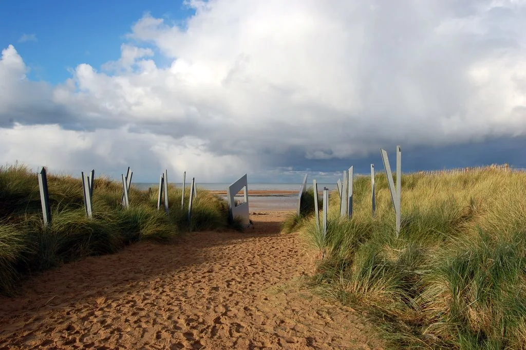
The park is also a dune habitat. The Centre monitors biodiversity, removes invasive species and documents flooding and climate pressure on the fortifications. The metal obstacle forms and paths seen today are part of an interpreted landscape, not a licence to leave the path or climb concrete. Conservation protects both historical evidence and living coastal systems.

11 · Juno coast field guide
The Juno Beach Centre was built by veterans, not inherited from the war
The Juno Beach Centre opened on 6 June 2003. Its origins lie in the work of Canadian veteran Garth Webb and a group of veterans, families, volunteers and supporters who believed that Canada's role in the Second World War needed a permanent interpretive institution on the Normandy coast. It is operated by a Canadian nonprofit association.
Webb had landed at Juno as a lieutenant with the 14th Field Regiment, Royal Canadian Artillery. Returning for the fiftieth anniversary in 1994, he and fellow veterans found little on the coast that could explain Canada's wartime involvement to their children and grandchildren. With his partner Lise Cooper, Webb led the initiative and fundraising for a permanent centre. Courseulles-sur-Mer supplied land with the support of mayor Jean-Louis de Mourgues. The Centre's account of Webb makes its origin concrete: veterans recognised an interpretive absence and worked with families and a French town to fill it.
That date and origin matter. The building is not a wartime bunker adapted into a museum. It is a deliberate postwar intervention, created almost six decades after the landing by people confronting how living memory would pass into institutional memory. The Centre is simultaneously a national museum, an educational project, a memorial endeavour and a participant in managing the physical Juno site.
Canadian architect Brian K. Chamberlain designed the building around five points. The Centre's explanation of its architecture connects that pentagonal form to the maple leaf, the Order of Canada and the five landing beaches. Its sloping points also suggest a turning pinwheel. Wood, steel and concrete support a titanium exterior chosen to reflect the surrounding beach. These are intended symbols and material choices, rather than something a visitor must guess from the façade.
The architecture creates a modern threshold between parking and beach, interior exhibition and exterior archaeology. A bunker was designed to observe, protect and fire; this later building was designed to collect, teach and commemorate. Both occupy the same coastal setting, but they ask their occupants to do very different things. Reading the Centre as a deliberate intervention makes that difference visible before the first display case.
The permanent exhibitions place the war within Canadian society. That choice keeps D-Day from becoming a detached action film. Mobilisation affected politics, industry, training, families and arguments over service. Canadian forces fought in other theatres before and after Normandy. The country that emerged from the war was changed, and its later memory of service did not remain fixed. A useful museum visit asks not only what happened on the beach but why later Canadians selected objects, testimonies and stories to explain it.
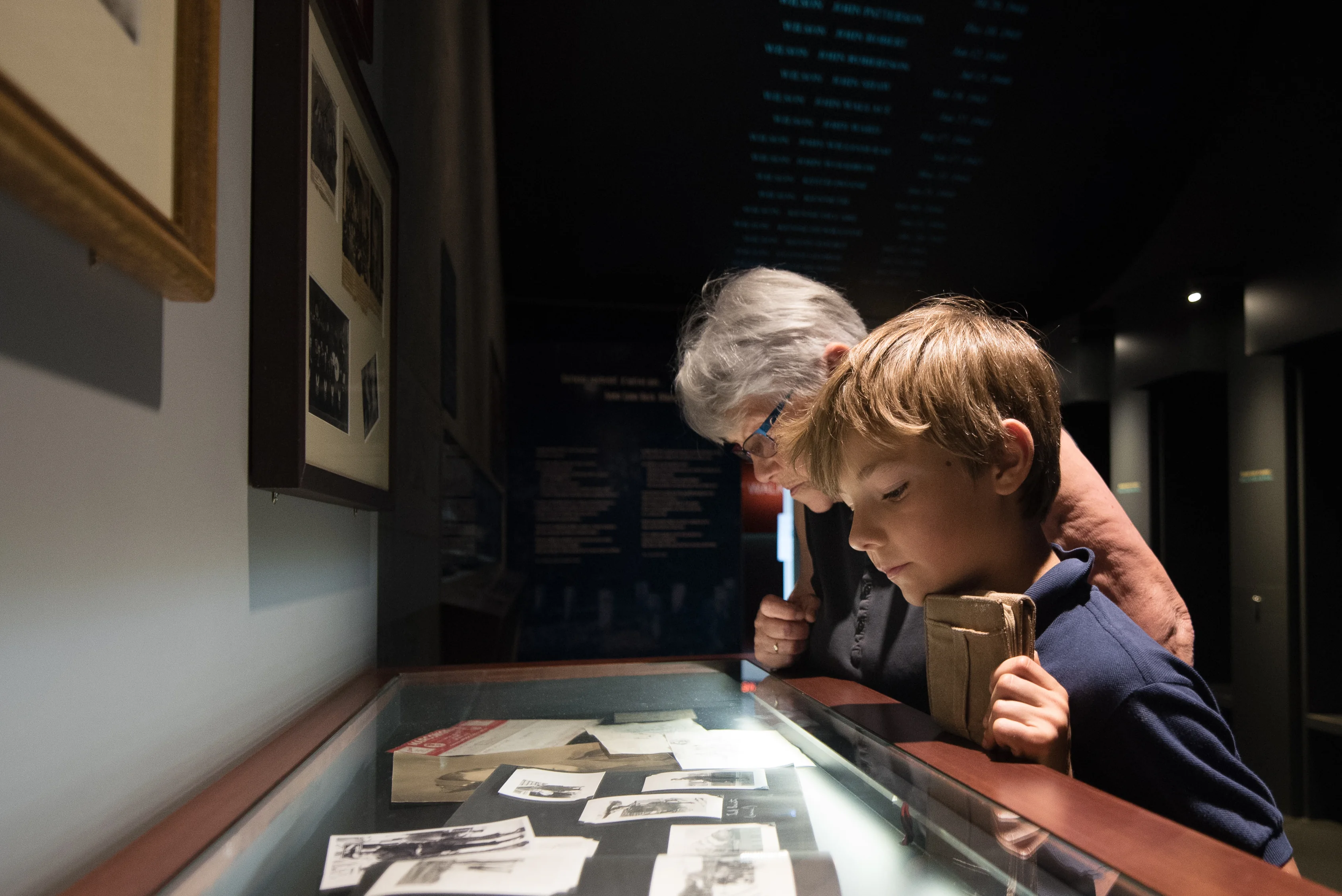
Objects make scale personal, but an object is not automatically self-explanatory. A uniform needs a wearer and context. A letter needs a writer, recipient and date. A photograph needs provenance. A vehicle can explain design and logistics but may attract attention away from the people who operated or maintained it. Exhibition design—the sequence of rooms, use of sound, lighting, media and places to pause—shapes which evidence visitors notice.
The Centre currently recommends allowing substantial time for the museum itself; its practical information frames a visit in hours rather than as a ten-minute stop. That is an important planning signal, not a fixed contractual duration. If a day also includes all three towns, Juno Park and a cemetery, the museum cannot receive unlimited time. Decide whether its Canadian social history is central to the day. If it is, protect that time before adding more distant sites.
12 · Juno coast field guide
Bény-sur-Mer: an army becomes 2,049 headstones
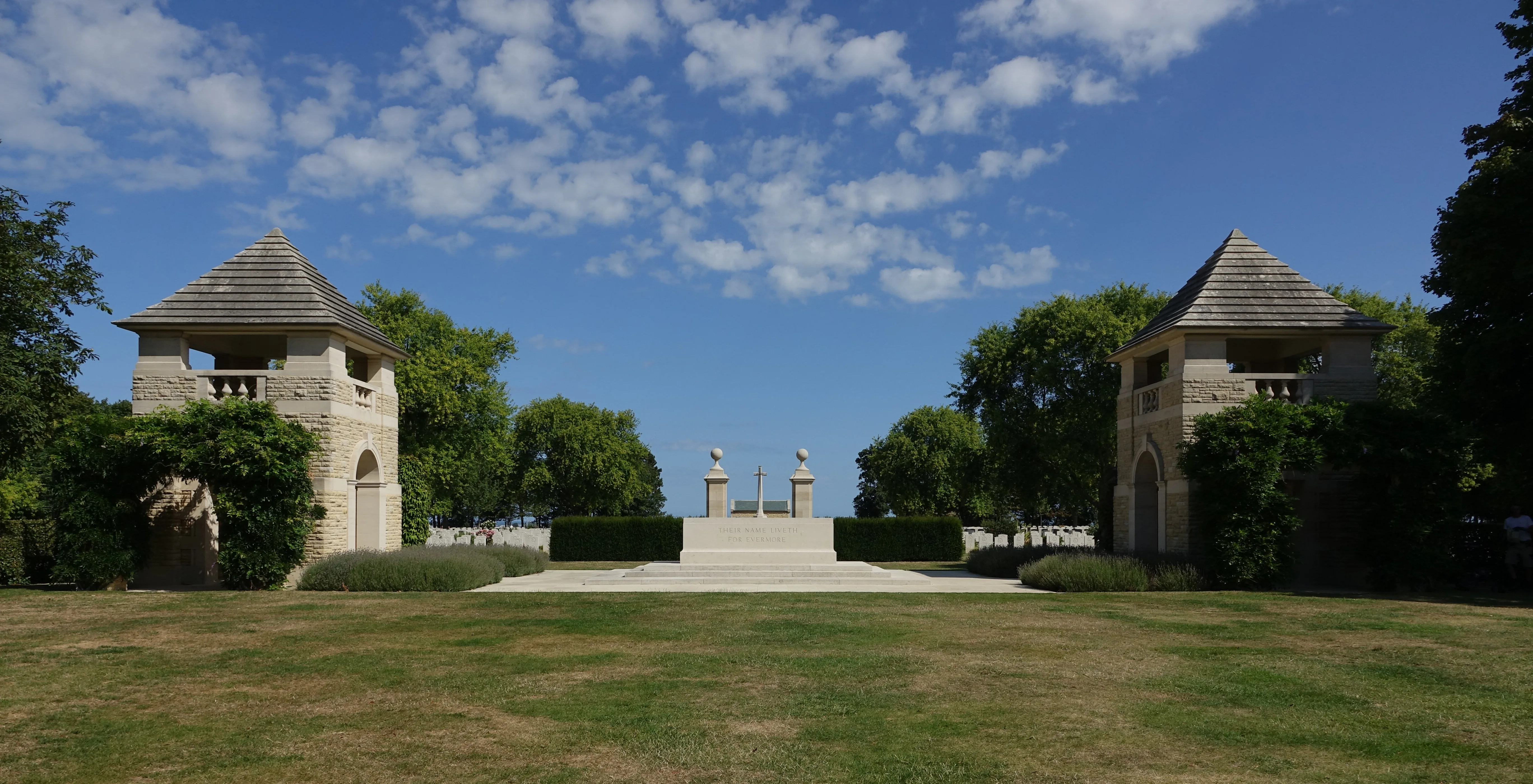
Bény-sur-Mer Canadian War Cemetery is not in Bény-sur-Mer itself. It lies near the village of Reviers, inland from Juno. Veterans Affairs Canada records 2,049 headstones, many marking men of the 3rd Canadian Division who died during the opening phase of the Normandy campaign, as well as fifteen airmen. The geographical correction is practical and historical: the cemetery belongs to the inland landscape through which forces moved, not to a beach-side memorial complex.
The cemetery's design creates a controlled transition. Paired entrance towers, formal planting, the Stone of Remembrance and Cross of Sacrifice organise views and movement. Rows of pale headstones establish visual equality. The Canadian War Museum's account of war-grave design explains the rejection of rank-based distinctions in the physical markers. At the same time, each stone restores difference through name, unit, date, age, emblem and, in many cases, a family-selected inscription.
The architecture therefore performs two tasks that can seem opposed. It makes the scale of collective loss visible, and it refuses to let the dead remain only a total. From a distance the pattern communicates scale. Close enough to read, one stone interrupts the pattern with a person. Moving between those scales is the core experience, and it should not be hurried into a final photograph before the return drive.
The site also shows that commemoration is sustained work. Local residents have long cared for relationships with Canadian graves and families. Horticulture, stone conservation, records and visitor services continue long after formal dedication. The cemetery looks serene because people maintain it, not because the war left an untouched field of permanent order.
Research before arrival can make a short visit more specific. The Canadian Virtual War Memorial and Commonwealth War Graves Commission database can identify a grave location and service record. Regimental archives and family documents may add context. Do not promise that every life can be reconstructed equally. Records are uneven, family histories may remain private and the absence of a vivid biography does not make a grave less significant.
Conduct is part of interpretation. Walk rather than perform solemnity for a camera. Do not sit on markers, stage flags or use a grave as a background prop. Do not attach objects or remove items left by others. Veterans Affairs Canada advises that mementos may be left where permitted but should never be fixed to a headstone. There are no visitor food services at the cemetery, and ground may be wet or uneven. Plan basic needs so discomfort does not turn the site into an obstacle to be completed.


13 · Juno coast field guide
Memory is still contested ground
Memorial landscapes are not created once and then removed from politics. In 2022, the Juno Beach Centre led a public campaign against a proposed residential development near the site. The Centre argued that the project threatened the landscape and its ability to interpret the beach. In its account of the campaign, the Centre describes an agreement involving Canadian and French authorities that protected the adjacent land from the proposed development. That outcome protected an area the institution considered essential to the setting; the larger question of how a living town accommodates housing, heritage and public space remains.
The episode reveals a durable question: what counts as the setting of a historic event? Is it only a legal parcel containing a bunker? Does a sight line matter? Does ordinary housing diminish memory, or is continued civilian life part of the coast's meaning? Who decides how much development a living town can accept? Conservation requires historical evidence, environmental study, planning law and local participation—not only the emotional power of a famous name.
The physical coast raises another set of decisions. Dunes move. Storms and rising water affect buried structures. Habitat protection can conflict with unrestricted foot access. Stabilising every bunker may be impossible or ecologically damaging. Leaving every structure to decay would lose evidence. The Juno Beach Centre's biodiversity work treats vegetation, invasive species, flooding and archaeology as connected responsibilities.
In 2026, UNESCO inscribed the Beaches of the D-Day Landings, Normandy, 1944 on the World Heritage List under criterion (vi). The serial property comprises six components: Utah, Omaha, Gold, Juno and Sword, plus Pointe du Hoc. Its significance joins the landings' multinational coordination and human sacrifice to surviving physical traces and subsequent remembrance. The defined property does not make every museum, cemetery or inland battlefield in Normandy part of the inscription.
Recognition does not complete conservation. The inscription decision calls for stronger protection, consistent monitoring, management of visitor pressure and assessment of development impacts. The practical tension is familiar at Juno: evidence, habitat, local life and access depend on decisions made around the beach as well as on it.
Living communities remain part of the answer. Beaches are used for walking and recreation. Boats use harbours. People inhabit houses visible in wartime photographs. Respect does not require freezing the coast in permanent mourning. It requires recognising when ordinary life and memorial conduct share space—and when a protected dune, cemetery or bunker imposes a clear limit.
14 · Juno coast field guide
Accessibility is a chain, not a label
The Juno Beach Centre provides a strong accessibility starting point. Its exhibition spaces are on one level, seating is available, guide dogs are admitted, and the Centre lists visual, hearing and sensory supports. Those features can make the museum workable for visitors who would struggle with an open battlefield. They do not automatically make the entire Juno route accessible.
Juno Park is outdoors. Sand, grass, weather exposure and uneven surfaces change the experience. The guided bunker route includes spaces the Centre identifies as inaccessible to wheelchairs and difficult for some people with limited mobility. A cemetery may have level-looking formal axes yet still include long distances, wet ground and no food service. Beaches can require crossing dunes, walls or slopes. The accessible question must be asked for every link.
Transport is another link. “Small vehicle” says nothing about step height, door width, transfer assistance, wheelchair storage, restraint systems or the time allowed to board. A train may be accessible while the onward rural bus or final walk is not. A self-drive car can solve one problem and create another at parking or beach access. Ask for measurements and procedures that match the person's actual equipment and support needs.
Energy and sensory load deserve equal planning. A long Paris return day places extended travel around an emotionally and cognitively dense route. Museum audio, enclosed bunkers, wind, crowd noise and repeated walking can accumulate. A quieter visitor may understand more from the museum plus one town and cemetery than from every famous stop. A child or adult who needs a break is not failing the history.
A robust plan creates alternatives before the day. If the bunker is inaccessible, use Juno Park's exterior interpretation and the fortification diagram. If the beach path is too demanding, protect museum time and choose a town viewpoint reachable from the vehicle. If the cemetery distance is too great, identify the one grave or architectural axis that carries the purpose. Accessibility is not measured by how much discomfort a visitor endures.
15 · Juno coast field guide
Three route formats, three kinds of responsibility
A guided day from Paris concentrates responsibility with a transport and interpretation provider. It can connect the coast, towns, museum and cemetery for a traveller who does not want to drive. The trade-off is structural: several hours of road travel surround the sites, and the group shares one pace. Ask how much time belongs to the museum, whether all three towns are actually visited, how the cemetery is handled and what walking is required. Never infer hotel pickup, a particular vehicle or an accessible service from the words “small group.”
A Normandy base changes the ratio. Sleeping in Bayeux, Caen or another local centre reduces the same-day transfer burden and makes it possible to separate the museum from a wider coastal route. It offers room for weather, research, a slower cemetery visit and a second day in another national sector. It also requires accommodation and local transport planning. For families, mobility needs or serious regimental research, that additional time is often more valuable than adding another stop to a Paris day.
Independent public transport is possible only as a chain. Trains connect Paris with Caen and Bayeux; regional services continue toward Courseulles, and the Juno Beach Centre gives current route guidance and a final walk. Schedules, stop names and connections change. A missed onward service can consume the museum time the route was designed to protect. Build from the official Juno Beach Centre directions and SNCF journey planner, then verify every connection for the exact travel date.
Self-drive offers the most control over the three towns and inland sites. It also places navigation, parking, weather decisions and return fatigue on the driver. The coast's short distances can be deceptive: a few kilometres contain many memorials, restricted roads and reasons to stop. Do not plan a dense route that requires speeding between closing times. The driver should be able to attend to the road after an emotionally demanding cemetery visit.
Choose by the constraint that matters most. If one available day and live interpretation matter most, a verified guided route can be rational. If depth, accessibility or family pace matters most, a Normandy base is stronger. If independence matters most, design a deliberately narrow route rather than trying to reproduce a coach itinerary. None of these formats is morally superior, and no provider can guarantee what the weather or a visitor will feel.

16 · Juno coast field guide
Build a day that can absorb what it teaches
A focused Juno day needs a hierarchy. Start with the question that brought you: a family regiment, Canadian national history, fortification archaeology, cemetery research or the relation between coast and inland advance. Protect the site that answers it best, then add stops that supply missing relationships.
For a first Canadian-sector visit, the Juno Beach Centre and Courseulles landscape form a reliable core. The museum establishes Canada and the campaign; Juno Park adds the surviving defensive system; the town and coast show the threshold between sea and civilian space. Bernières or Saint-Aubin should then be chosen for a specific reason, not because both names fit on a list. Bény-sur-Mer cemetery closes the distance between operation and person, but it need not be forced into the final ten minutes of the day.
A deeper route uses all three towns. It begins with Courseulles, reads the central Bernières landing and reserve route, then gives Saint-Aubin and Tailleville their own place in the sequence. Inland roads and villages become meaningful because the visitor knows what moved through them. This route needs more time than the map suggests. Parking, walking, reading and simply changing attention between evidence environments are part of the schedule.
Food, toilets and weather clothing belong to historical planning because they protect attention. The coast is exposed, and conditions can change across a day. Carry layers appropriate to the forecast and choose footwear for the actual surfaces. Do not turn physical discomfort into a ritual imitation of military suffering. A present visitor is not reproducing a soldier's experience, and claiming otherwise trivialises the difference.
Children benefit from a clear frame: these were real towns, people fought here, people died, and the cemetery is a place where families may still grieve. Give them one object, map or person's record to follow. Avoid graphic detail they are not ready to process. Build in ordinary breaks. The goal is neither entertainment nor compulsory solemnity; it is enough structure for honest questions.
At every stop, distinguish three kinds of statement. Historical facts require sources. Current operations—hours, guided access, transport and closures—require a live official check. Personal response belongs to the visitor and should not be promised in advance. A route becomes more trustworthy when those categories remain separate.
17 · Juno coast field guide
Conduct keeps the evidence available
Stay on paths in protected dunes and obey closures around fortifications. Do not climb, enter or remove material from a bunker because an opening looks accessible. Concrete can be unstable, water may conceal hazards and the site may protect archaeological context or habitat. Suspected ammunition or human remains must be left untouched and reported to authorities.
Inside the museum, follow photography and baggage rules. Objects in cases are records, not decorative confirmation of a story already known. Read the label before assigning an identity or event to an object. Temporary exhibitions can be valuable, but their presence, title and dates should be checked live rather than embedded in an evergreen itinerary.
At the cemetery, lower voices and give other visitors room. Personal photography can coexist with remembrance; staged performance is different. Avoid repeated takes, flags used as costumes or props, and poses against headstones. Never move a tribute to improve a composition. If a family or ceremony is present, their access takes priority over your image.
The towns require another kind of respect. Homes visible in archival photographs are not public museum interiors. Roads and pavements serve residents. Do not block doors, trespass for a matching camera angle or assume every local person wants to discuss the war. Ordinary life on the coast is not an interruption of memory. It is part of what liberation made possible.
The simplest rule is to ask what an action takes from the place. If it removes context, damages habitat, intrudes on grief, obstructs a resident or converts a grave into content, choose a different action. Responsible conduct is not an ornamental etiquette section. It is how evidence and shared access survive the visit.
18 · Juno coast field guide
Check the live day, not an old itinerary
Evergreen history and live operations have different owners. Before travelling, use the Juno Beach Centre's practical page for opening, admission, baggage, parking and arrival guidance. Use the Juno Park tour page for bunker access and current restrictions. Use the Centre's accessibility page for the museum's facilities and contact the site when an individual need depends on exact measurements or assistance.
Use Veterans Affairs Canada's memorial planning guidance for the cemetery. Check grave locations in official records before departure. Confirm trains with SNCF and local onward transport with the current regional operator. Do not rely on a podcast, old review or cached map for a final connection.
For the neighbouring U.S. sector—Omaha Beach, Pointe du Hoc, the Overlord Museum and Normandy American Cemetery—read ExcursionPass's separate guide to Normandy's American D-Day landscape. The reciprocal view is useful precisely because one national sector cannot stand in for the whole operation.
19 · Juno coast field guide
Listen: a field route, then a deeper landscape
In the ExcursionPass Travel Podcast episode, the route begins with the practical strain of travelling from Paris to Juno Beach, the Juno Beach Centre, surviving coastal bunkers and Bény-sur-Mer cemetery. Listen for the route questions: how much a long day can hold, why explanation between stops matters and why a cemetery needs time rather than a hurried final appearance.
The episode is most useful for the shape of the day: the distance from Paris, the value of explanation between stops and the need to leave enough time at a cemetery. Its documented places are the Juno Beach Centre, Juno Park and Bény-sur-Mer Canadian War Cemetery near Reviers. The lasting question is larger than any itinerary: what makes a difficult day worth the distance?
The answer is not emotional certainty. No guide can promise that a visitor will feel transformed, and no amount of discomfort reproduces military experience. The value lies in connections made visible: Canadian formations within an Allied operation, three towns within one sector, a bunker within occupation, a cemetery within a longer campaign and a museum within the continuing work of memory.
20 · Juno coast field guide
Leave with a question larger than the beach
Juno rewards a visitor who lets the landscape become less simple. The coast was not empty before the landing. The assault was Canadian-led and multinational. The deepest advance did not finish the objective. A bunker is both military engineering and occupied ground. A cemetery is both formal national design and thousands of individual lives. A museum is both a repository and a decision by veterans about what later generations should be able to learn.
That complexity does not diminish the achievement of 6 June. It explains what the achievement required: coordination across services and countries, adaptation when plans failed, movement from exposed beaches through inhabited towns, and the creation of a lodgement strong enough to continue the campaign. It also explains the cost borne by service personnel, prisoners, families and Norman civilians.
The best route is therefore not necessarily the fullest. It is the one with enough structure to move from sea to town, town to inland ground, operational scale to one name, and historical evidence to present responsibility. If the day cannot hold every layer, leave one out honestly and return with a better question.
Juno is more than a landing because the shore does not contain its meaning. The story continues in roads toward Caen, in the buried rooms of Strongpoint 31, in records still used to identify the missing, in 2,049 headstones near Reviers, in a museum founded by veterans and in communities that continue to live beside the evidence. A responsible visit does not close that story. It learns where to keep reading.