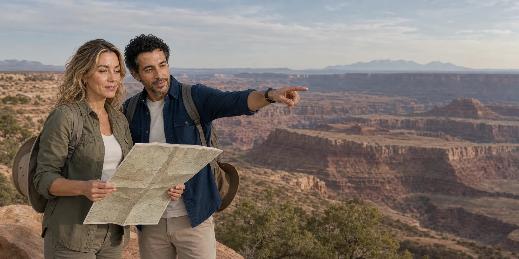
The most useful correction to a two-park checklist comes before the first viewpoint: Arches and Canyonlands are not two collections of red-rock landmarks. They are adjacent lessons in scale. At Arches, attention contracts around a joint, a fin, a thin span and the weakness that will eventually bring it down. At Canyonlands, attention expands across a mesa edge, a pale bench, tributary canyons and two rivers working far below. One park rewards looking through stone. The other teaches the distance between rim and river.
That distinction also changes the journey. Moab is close to both parks, but Salt Lake City is not. Any two-day itinerary beginning in the state capital must absorb a long transfer to southeast Utah, an overnight stay, a day or substantial part-day in each landscape, and a long return. “Two days” is not the same as “two full park days.” The sequence can be coherent, but only when the road time remains visible and travellers accept what will be left out.
For travel in 2026, Arches does not require advance timed-entry reservations for ordinary entry. That does not remove the need to plan: entrance congestion and full parking can still shorten a visit. Devils Garden Campground and Fiery Furnace trips have separate reservation or permit requirements. The useful starting point is the park you can actually reach, the walk you can comfortably complete and the hours left after the highway.
A reliable journey begins with current park rules and a route that counts distance, water, rest, trail surfaces and the overnight honestly. Adventure language cannot make cliffs or dehydration less dangerous. The better question is what a two-day route must contain if it is to make two landscapes intelligible rather than merely photographed.
01
The real first landmark is the time budget
Salt Lake City and Moab are separated by a substantial highway journey, broadly southeast through central Utah toward the US 191 corridor. Traffic, weather, construction, food stops and the actual meeting point change the duration. The itinerary therefore has to be read as a chain rather than as two park names joined by an ampersand.
A defensible version looks like this: meet in Salt Lake City at an exact address; travel to Moab with planned fuel, food and toilet stops; visit one park after accounting for the transfer; check into independently confirmed accommodation; start the second day with food, water and fuel already organized; visit the other park; then return to Salt Lake City at a stated approximate time. It is possible that an operator reverses the park order because of weather, parking or season. That flexibility can be valuable. It should not become an excuse to leave the route undefined.
The podcast’s proposed route uses Moab as the overnight base and names Delicate Arch, Balanced Rock, the Windows area, Mesa Arch and Island in the Sky among its intended landmarks. Those names do not amount to a timed itinerary. Delicate Arch can mean the three-mile round-trip trail from Wolfe Ranch, a distant view from the lower viewpoint, or a shorter but still incomplete view from the upper viewpoint. “Mesa Arch” implies a 0.6-mile loop on uneven slickrock near a cliff-edge arch. “Island in the Sky” is an entire district with a scenic road, visitor centre, overlooks and trails. Each interpretation consumes different time and asks different things of a traveller.
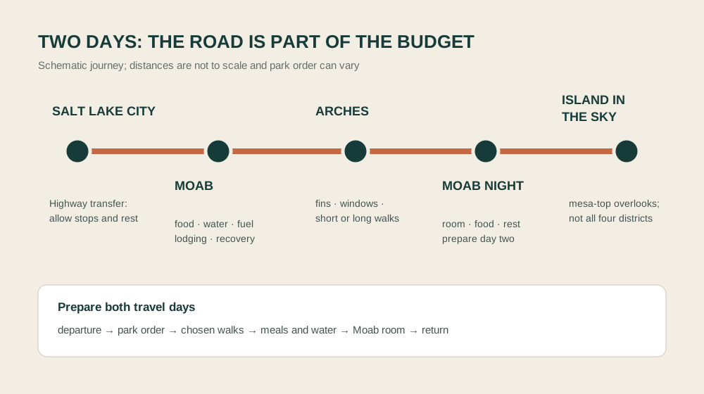
The overnight is equally structural. Travellers need a confirmed room, check-in rules that fit the expected arrival, luggage handling, an accessible-room match if required, breakfast or an alternative before an early start, and a plan if they return after restaurant hours. A vague “Moab overnight” is not an itinerary; it is unfinished planning.
The disciplined planning question is therefore not “Can five icons fit?” It is “Which encounters remain meaningful after the road, meals, toilets, parking, rest and overnight are counted?” One long walk can legitimately replace several pullouts. A scenic-road version can legitimately omit Delicate Arch’s full trail. The dishonest version keeps every landmark in the headline while quietly shrinking each one into a windscreen glimpse.
02
Arches begins under the rock, with salt
Arches National Park protects more than 2,000 documented natural stone arches, as well as fins, towers, balanced rocks and windows. The concentration is extraordinary, but counting openings is the least interesting way to understand them. The landscape begins with layers deposited in very different environments and later deformed from below.
Hundreds of millions of years ago, a restricted inland basin repeatedly evaporated, leaving a thick sequence of salt and related deposits now called the Paradox Formation. Later sediments buried that evaporite layer under immense weight. Salt behaves differently from brittle sandstone: under pressure and over geologic time it can flow, bulge and withdraw. That movement helped create anticlines, faults and zones of fracture in the overlying rock around Moab.
The visible red architecture is largely Jurassic sandstone. The Navajo Sandstone records vast dune fields. The Dewey Bridge Member of the Carmel Formation often forms a darker, weaker base. The Slick Rock Member of the Entrada Sandstone supplies much of the massive red rock that becomes fins and arches. The Moab Member of the Curtis Formation caps some features with a paler, more resistant layer. These are not simply stacked colours. Grain size, cement, bedding and fracture pattern make the layers respond differently to water, gravity and temperature.
Uplift of the Colorado Plateau raised the region and gave erosion more energy. Removal of overlying rock reduced pressure on buried sandstone, which expanded and fractured. Water entered joints. Freeze-thaw cycles, salt crystal growth, chemical weathering, runoff and gravity enlarged weaknesses. Parallel fractures isolated long, narrow walls: fins. Where a weaker layer or fracture zone retreats through a fin, an opening can form. The National Park Service counts a stone opening as an arch when it measures at least three feet in one direction. The label describes geometry, not age or permanence.
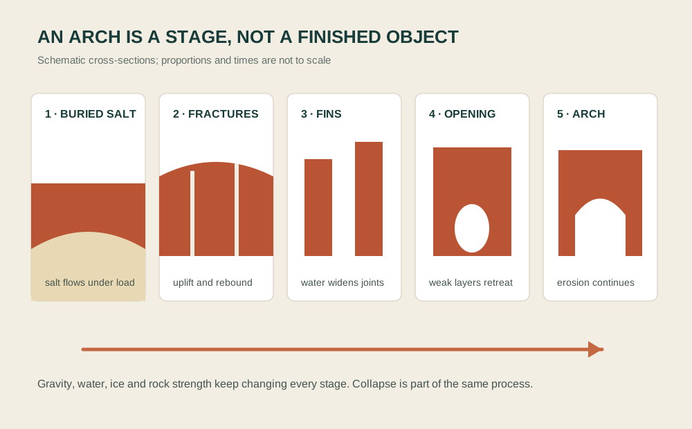
This is why “the wind carved the arches” is inadequate. Wind moves abrasive sand and contributes to surface weathering, but water and gravity do much of the decisive work: opening fractures, moving sediment, exploiting weak beds and removing failed rock. The result is not a sculptor finishing a stable object. It is a mass temporarily able to carry its own load around a void.
Rockfall makes that temporariness public. Landscape Arch lost a large slab in 1991, and visitors watched sections fall. Wall Arch collapsed in 2008. Those events did not damage a completed landscape; they revealed its operating system. Park management therefore prohibits climbing, scrambling, walking or standing on named arches and certain prominent features. A photograph taken on top of an arch is not proof of privileged access. It is evidence of an avoidable load on a fragile form.
03
Reading the Arches road as a sequence
The paved scenic road climbs quickly from the visitor centre into a changing set of landforms. Park Avenue and Courthouse Towers introduce tall walls and monoliths before most named arches appear. The early stops are valuable because they train the eye to see joints, vertical faces, fallen blocks and the difference between a wall that remains continuous and one beginning to separate into fins.
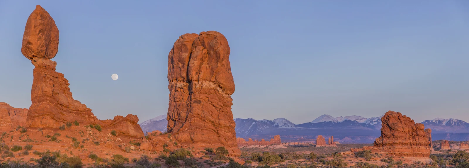
Balanced Rock is not an arch. A resistant block of Entrada Sandstone sits above a weaker pedestal of Dewey Bridge material, producing a top-heavy form whose future depends on differential erosion. The short path can therefore do more than deliver a forced-perspective photograph. It shows how two adjacent layers weather at unequal rates. The picnic area across the road also supplies tables and toilets, which may matter more to a two-day route than another five-minute stop.
The entire formation stands about 128 feet high. Its upper block remains attached to the pedestal; it is not a loose boulder balanced by luck. A smaller companion, nicknamed “Chip Off the Old Block,” collapsed in the winter of 1975–76. That documented change supplies the right way to read the surviving form: one stage in the erosion of a layered rock mass, with no timetable visitors can predict. The first portion of the short path is paved; the full loop has uneven ground.
The Windows Section offers several openings within a compact road branch, but the paths are not identical. The Windows loop crosses steps, slopes, rock and exposed ground. Double Arch begins with a relatively short route, yet the approach and the rock beneath the opening can still be uneven. The park describes only portions of certain trails as paved or barrier-free; rain, snow and washouts can change surfaces. A guide should state the actual distance and turnaround point rather than saying the section “works for everyone.”
North Window and South Window are adjacent openings through a broad rock wall. Turret Arch adds a separate upright form nearby, while Double Arch is reached from another path: its two spans share a rock structure rather than making a single doubled doorway. Looking between those forms explains why “the Windows” is a small landscape to explore, not one aperture to tick off. The first 100 yards toward North Window are described by NPS as barrier-free; steps and other obstacles follow.
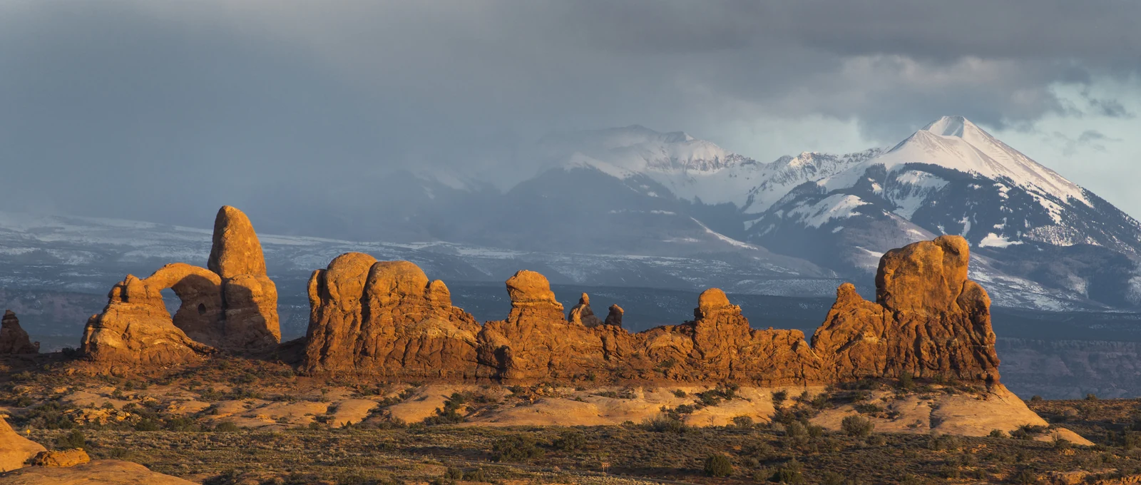
Delicate Arch requires the clearest distinction. The main trail is about three miles round trip with roughly 480 feet of elevation gain. It crosses open slickrock with limited shade and finishes on a sloping rock bowl near exposed edges. The route can be strenuous in heat, ice, wind or crowding. The lower viewpoint offers a distant line of sight with a short accessible route; the upper viewpoint requires more walking and still does not become the classic approach. Travellers are not failing the park if they choose a viewpoint. They are choosing a different encounter.
The opening itself is about 46 feet high and 32 feet wide. Its freestanding setting, with a rock bowl below and mountains beyond, accounts for much of the familiar image’s force. Earlier names included “Cowboy’s Chaps” and “Old Maid’s Bloomers”; “delicate” appeared in a description associated with a 1934 scientific expedition. The word is an observation about the form, not an assurance that standing beneath it is the aim of every visit.
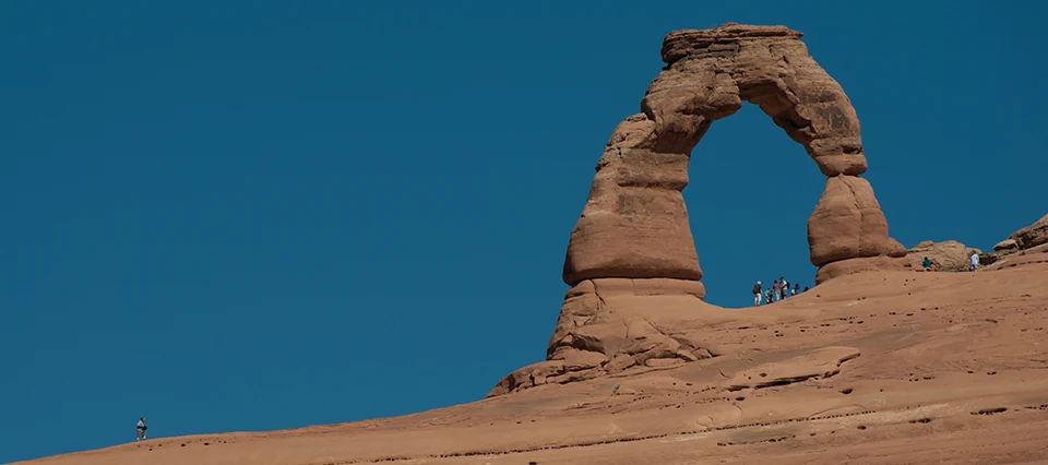
Devils Garden extends the story from a single landmark to a dense network of fins and openings. The path to Landscape Arch is comparatively developed, while routes beyond become more primitive, with narrow fins, route finding and exposure. It is not a casual extra after a full Delicate Arch hike. Devils Garden Campground, the only campground in the park, has its own reservation requirement during the main season and should never be confused with the lodging promised or excluded from a Moab-based product.
The correct Arches day can therefore take several forms. A geology-first scenic loop might combine Park Avenue, Balanced Rock, the Windows and a Delicate Arch viewpoint. A walking-first day might devote its best conditions to the Delicate Arch trail and omit Devils Garden. A lower-mobility route might emphasize the scenic road, accessible visitor centre, Balanced Rock picnic facilities, designated viewpoints and frequent rest. The park is not diminished by choosing. It becomes legible.
04
Canyonlands asks the eye to zoom out
Canyonlands National Park preserves 337,598 acres divided by the Green and Colorado rivers into four districts: Island in the Sky, the Needles, the Maze and the rivers themselves. They meet on a map but not on a convenient road network. The National Park Service warns that driving between districts takes two to six hours, and most visitors should not attempt more than one in a day.
That fact corrects a common itinerary blur. A two-day tour that says “Canyonlands” from Moab is most plausibly referring to Island in the Sky, the northern mesa-top district about 40 minutes from town. It is not quietly including the Needles, the Maze, Horseshoe Canyon, the river confluence at water level or the White Rim backcountry road. Backcountry roads, river journeys and other districts require their own route, time and permit planning.
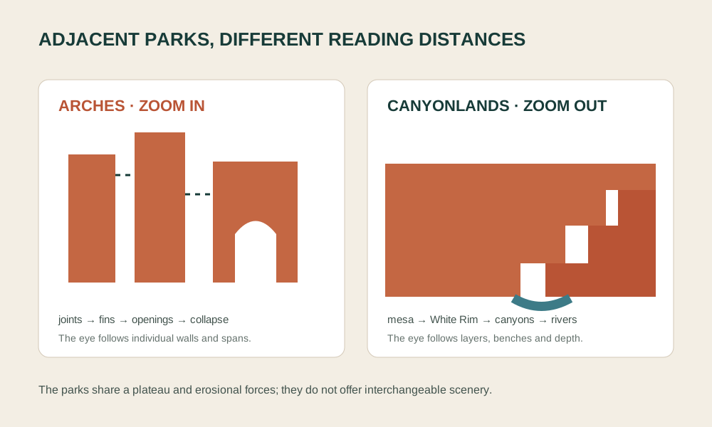
Island in the Sky stands more than 1,000 feet above the surrounding terrain. From the mesa top, the dominant forms are not individual arches but nested surfaces. A relatively level rim breaks into cliffs. Below it lies the pale White Rim bench. Tributary canyons cut the bench into peninsulas and islands of rock. The Green and Colorado rivers occupy still deeper trenches and meet south of the mesa.
Those stairs come from unequal rock resistance. Sediments arrived from ancient mountains, deserts, shorelines, rivers and shallow seas. Burial turned them into sandstone, shale and limestone. Uplift raised the plateau. Rivers that had once carried sediment into low ground began incising through the rising surface. Harder beds remained as cliffs and benches while weaker beds retreated into slopes. Thunderstorm runoff, frost, groundwater and gravity widened the river-cut framework.
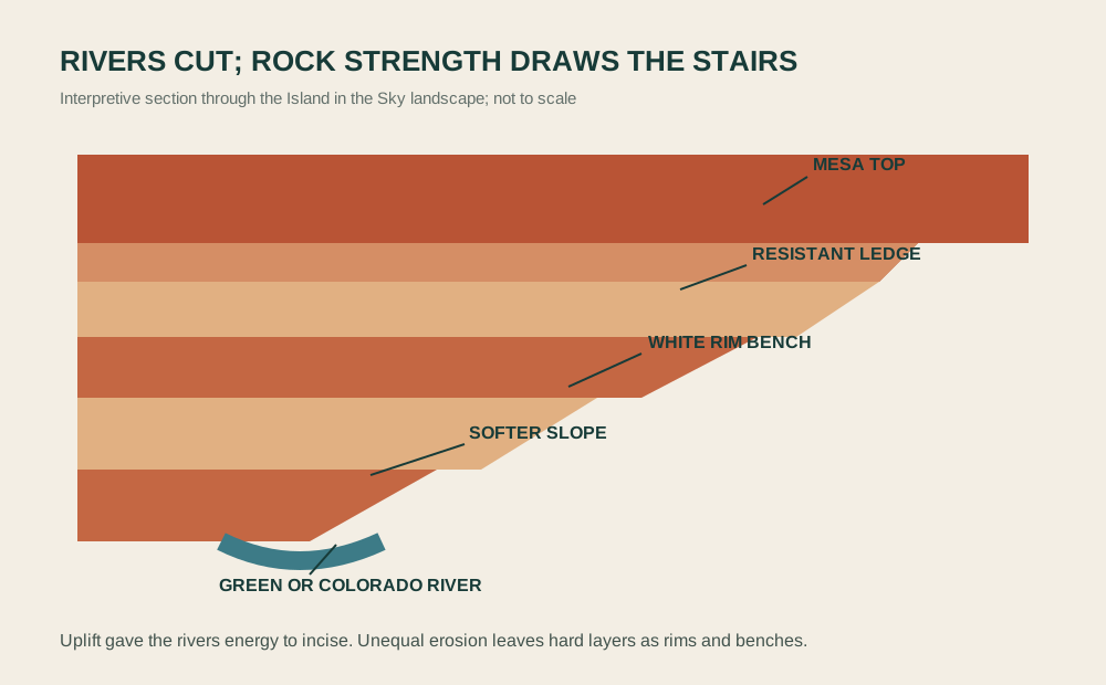
The Green and Colorado are not decoration at the bottom of a scenic view. They have moved sediment, supported plant and animal communities, created travel corridors and crossings, and shaped human histories for thousands of years. Modern dams regulate both rivers beyond the park, but Canyonlands protects their confluence and significant free-flowing reaches. Water remains the organizing fact even where it appears as a thin distant line.
Mesa Arch is a small opening set at a huge edge. The 0.6-mile loop is commonly called easy because it is short and has limited elevation change, but the surface is rock and sand, the arch is near a cliff, and sunrise popularity can concentrate people in a narrow space. Its interpretive value is not that it resembles the grand openings at Arches. It frames the canyon scale below and shows an arch forming within a different visual system.
Its span is about 27 feet. Sunrise can illuminate the underside with reflected warm light, but the canyon framed by the opening remains the larger subject. The clockwise approach has fewer steps than the other side of the loop; it still includes rough ground and does not make the route wheelchair accessible. Choose a place to stand before raising a camera, and leave enough space for others to turn away from the edge.
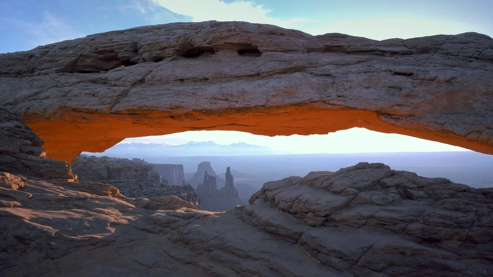
Grand View Point provides the broadest closing perspective for many short visits. The paved overlook is wheelchair accessible, and an unpaved out-and-back trail continues along the rim for about 1.8 miles round trip. Those are separate experiences. Green River Overlook turns the view toward a different drainage and is also wheelchair accessible. Buck Canyon Overlook provides another accessible mesa-top perspective. The current NPS itinerary for two hours combines Grand View Point, Green River Overlook and Mesa Arch; a commercial route that adds longer walks must subtract something else.
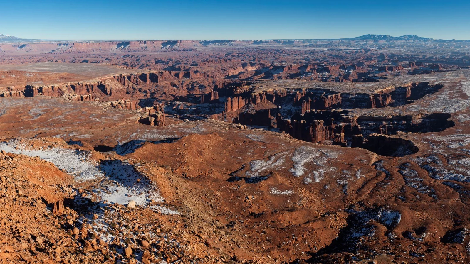
An Island in the Sky route should remain flexible enough to respond to official access, smoke, storms and full parking without turning one photograph into the purpose of the day. Green River Overlook, Buck Canyon Overlook and the visitor-centre area can still explain mesa, bench and canyon relationships when another stop is unavailable.
05
The land was never empty
Describing these parks as alien, untouched or empty makes geology simpler by erasing people. Canyonlands is a living cultural landscape in which human presence reaches back more than 10,000 years. The park recognizes ancestral and traditional relationships with a long list of Tribal Nations, including the Hopi Tribe, Navajo Nation, Southern Ute Indian Tribe, Ute Indian Tribe, Ute Mountain Ute Tribe, Paiute nations, Zuni and multiple Pueblo communities. The list is not a claim that every nation tells the same history or uses every place in the same way.
Hunter-gatherer communities moved through the region in seasonal rounds, making tools, gathering plants and hunting. Later farming communities cultivated maize, beans and squash and built villages in parts of the Colorado Plateau. Archaeologists use terms such as Ancestral Puebloan and Fremont-era to describe material patterns, but living peoples hold their own histories of descent, migration and continuity. Around 1300 CE, communities changed and moved in response to drought, social relationships and other forces. Ute and Paiute histories cannot be reduced to a late arrival after an “abandoned” archaeological past; NPS interpretation notes Ute beliefs of descent from Fremont-era farmers and the continuing sacred importance of places across Canyonlands.
At Arches, a multi-year ethnographic study brought representatives of the Pueblo of Zuni, Hopi Tribe, Southern Ute Indian Tribe, Ute Indian Tribe, Paiute Indian Tribe of Utah and Kaibab Band of Paiute Indians into the park. Participants described the Moab valley and Colorado River crossing as a region of travel and trade. They identified arches, spires, plants, minerals and views of the La Sal Mountains as parts of living cultural and ceremonial relationships. Some described arches as portals and spires as sentient beings. Those accounts do not convert sacred meaning into a tourist script. They demonstrate why a formation cannot be exhausted by a geologic label.
Visitors will encounter rock markings, structures and artefacts in the wider region. The correct action is restraint: stay on established routes, never touch or trace a panel, do not enter or climb on a structure, leave objects in place and avoid broadcasting precise coordinates for vulnerable sites. A guide who offers a “secret” cultural stop without authorization is not adding value. The guide is creating risk.
Non-Indigenous history also follows Indigenous routes. A major north-south crossing near Moab helped shape later trade corridors and the Old Spanish Trail. Ranching, prospecting and uranium exploration left roads and structures that later influenced park access. Arches became a national monument in 1929 after local promoters and railroad interests argued for protection and tourism; Congress made it a national park in 1971. Canyonlands was established by Congress in 1964 to preserve superlative scenic, scientific and archaeological features around the Green–Colorado confluence. Protection and promotion were intertwined from the beginning.
That history complicates the word “wilderness.” Most of Arches is recommended wilderness, and 86 percent of Canyonlands is managed as recommended wilderness, but neither landscape is a place without human history. Wilderness management can limit mechanized access and preserve solitude while still recognizing ancient routes, cultural practices, ranching traces and living Tribal relationships. The ethical visitor does not need to choose between nature and history. The parks exist because both are inseparable.
06
Roads, crowds and conservation are part of the view
Park roads make enormous landscapes appear easy. At Arches, a paved road links the entrance to the Windows, Delicate Arch trailhead and Devils Garden. At Island in the Sky, a paved fork reaches Grand View Point and Upheaval Dome. Those roads concentrate visitors, reduce some access barriers and create the possibility of a short scenic visit. They also concentrate emissions, noise, parking demand, wildlife conflicts and wear around a limited set of trailheads.
Arches has wrestled with congestion for years. Its earlier timed-entry pilots were one response, not a permanent identity. The 2026 decision to lift advance reservations does not mean capacity disappeared. NPS warns that vehicles may be diverted when the park or particular areas become congested. The parking page publishes estimates rather than guarantees: Wolfe Ranch can fill early, the Windows lot has limited oversize capacity, and a traveller who leaves a full lot cannot assume an immediate return space.
The practical response is not a rigid internet “hack.” It is a hierarchy. First, check current Arches conditions and the 2026 reservation notice. Second, agree which walk has priority. Third, identify a lower-demand substitute that preserves the article’s purpose—geology, scale or accessible viewing—rather than chasing the same full lot repeatedly. Fourth, never stop in a traffic lane or create a roadside trail.
Canyonlands disperses use across districts but makes each district a separate journey. Island in the Sky’s overlooks can feel plentiful until parking or weather removes one. Unpaved roads below the rim require different vehicles, permits and skills; they are not implied by a paved sightseeing route. Shafer Trail and White Rim Road are not casual extensions of Mesa Arch: drivers need a suitable vehicle, the applicable permit, current road knowledge and enough time and supplies for the route they actually choose. Commercial services additionally require the relevant park authorization.
Conservation operates at foot level too. Biological soil crust is a living community of cyanobacteria, lichens, mosses and other organisms that stabilizes soil, retains moisture and supports desert plants. A dark, bumpy patch may look like dirt. One shortcut can break structure that took decades to develop. Stay on trails, bare rock or durable surfaces; do not widen paths to pass a crowd. Water-filled potholes in sandstone are also habitat, not stepping stones or washing basins.
Dark skies and natural sound are protected resources, not optional evening entertainment. Arches and Canyonlands are International Dark Sky Parks. Excess light from vehicles, lodging and the Moab corridor can affect what visitors see and how wildlife behaves. A two-day route from Salt Lake City may not include a dark-sky program, especially if safe sleep and an early start matter more. It should still avoid presenting headlight glare, drone footage or loud roadside gatherings as harmless access to an “empty” night.
07
Moab carries the journey
The two parks occupy most of the imagery; Moab carries most of the services. It is where travellers find lodging, restaurants, groceries, fuel, medical care, guides, equipment, waste facilities and the road junctions to both parks. Arches has no restaurant, lodge or fuel station. Canyonlands has no food, lodging or fuel in the park, and the nearest full services to Island in the Sky are in Moab, 32 miles from its visitor centre. Calling the town a “base camp” is useful only if the people and infrastructure inside the metaphor remain visible.
Tourism supplies jobs, business income and tax revenue that supports public services. Grand County’s 2026 tourism budget material describes an economy in which direct, indirect and induced visitor spending accounts for roughly four-fifths of local activity. That dependence is not an instruction to maximize visitor volume at any cost. It is a reason to understand how accommodation, guiding, retail, public safety and park management connect.
Housing shows the other side. The 2023 Moab Area Affordable Housing Plan describes a persistent mismatch between housing supply and need, intensified by second homes, rising prices, inflation and changing patterns of temporary living. The plan treats housing for residents and employees as the foundation of community life. Seasonal labour, service schedules and traveller expectations meet inside that shortage. The person cleaning a room, preparing breakfast before dawn or staffing an emergency response also needs a stable place to live.
Traffic concentrates on US 191 and the junctions north of town. A guided vehicle may reduce the number of rental cars in the parks if it genuinely consolidates travellers, but “private” can also mean one vehicle for a very small group. The environmental comparison depends on occupancy, vehicle type, starting distance and route, not the label. A compact Moab-based route can create a smaller transport burden than a lightly occupied vehicle driven from Salt Lake City, even when both are sold as convenient.
Water is scarce before a bottle becomes empty. The Colorado River and local groundwater support residents, businesses and visitors in an arid climate. Hotels wash linens; restaurants serve peak crowds; landscapes need irrigation; travellers refill containers and create wastewater. Conservation does not require a visitor to accept unsafe dehydration. It means choosing efficient lodging where possible, reusing towels, fixing expectations about daily laundry and carrying water in refillable containers rather than treating the town as an infinite supply depot.
Waste also moves through a system. Moab and Grand County publish guidance for human waste outside developed facilities, including W.A.G. bag use and disposal. Inside Arches and Island in the Sky, established toilets are the first choice. A commercial day should plan toilet stops before departure and at official facilities, never ask a group to improvise beside a trailhead, and carry out all ordinary waste. “Leave no trace” is not just campsite etiquette; it is scheduling.
The simplest useful actions are concrete. Book and keep a confirmed room rather than arriving with a vague lodging promise. Eat at local businesses at times that fit their real hours. Buy food and refill water before entering the parks. Use official toilets. Do not park in residential areas to solve a full commercial lot. Do not ask staff for “secret” sites. Protect biological soil crust and report closures honestly in reviews instead of treating resource protection as a service failure.
08
Plan entry, services and the district you will visit
Arches and Canyonlands are generally open 24 hours a day, year-round, but visitor-centre hours, roads, trails and facilities vary. An open park is not the same as an open trailhead, staffed desk or safe route.
For Arches in 2026:
- No advance timed-entry reservation is required for ordinary park entry. Congestion can still produce entrance lines, temporary diversion and full parking.
- Devils Garden Campground reservations remain necessary for stays from March through October, and Fiery Furnace entry requires the applicable reservation or permit.
- Ordinary entrance fees and annual passes are different products. Check the Arches fee rules, including pass eligibility and commercial-group provisions, for the format you will use.
- The park and scenic road are generally open 24 hours. The visitor centre follows seasonal hours. Drinking water is available year-round at the visitor centre and Devils Garden Campground and seasonally at Devils Garden Trailhead.
- There are no restaurants, lodges or fuel stations in the park. Picnic areas with tables and nearby toilets include the visitor centre, Balanced Rock, Panorama Point, Delicate Arch Viewpoint and Devils Garden.
- Cellular coverage is intermittent. Do not build the meeting, accessibility or emergency plan around a text message sent from the trail.
For Canyonlands and Island in the Sky:
- Timed entry is not required. The district’s paved roads and the park are generally open 24 hours, subject to alerts, weather and temporary access controls.
- Island in the Sky is one of four districts. There is no direct road connecting it to the Needles or Maze.
- An ordinary Canyonlands entrance pass is separate from ordinary Arches admission. The regional annual pass covers both parks, plus Natural Bridges and Hovenweep, for qualifying non-commercial use; its current eligibility is limited to U.S. citizens and residents. Other annual passes have their own eligibility and coverage. Read the Canyonlands fee and pass rules before choosing a pass, and check commercial-tour provisions separately.
- Water is available outside the Island in the Sky Visitor Center from spring through fall and inside during opening hours; winter access is more limited. There is no drinking water on trails or at Willow Flat Campground.
- There is no food, lodging or fuel in the park. Toilets are available at the visitor centre and selected overlooks.
- NPS recommends at least one gallon, or four litres, of water per person per day in Canyonlands. Plan for the route, heat, delays and the return, with reserve water in the vehicle; this is not a ceiling on individual needs.
Use the official Arches planning pages and Canyonlands planning pages close to travel for hours, pass eligibility, facilities and route conditions.
09
Food, water, toilets, fuel and the room form one chain
Neither park has a restaurant, and Canyonlands has no food for sale. Arches’ bookstore may carry limited hiking snacks, but that is not lunch provision. Buy the day’s food in Moab, account for dietary needs before departure and keep anything perishable at a safe temperature.
Water needs the same precision. Start with enough for the route, keep reserve water in the vehicle and confirm that any planned refill point fits visitor-centre hours. Keep food as well as water available, and build rest into the route instead of relying on a supplement or drink to compensate for a rushed day.
Toilets should appear in the itinerary before they become urgent. Arches has toilets at the visitor centre and many major trailheads or picnic areas. Island in the Sky has accessible toilets at its visitor centre and overlooks, but facilities are separated by driving. A guide should identify the last reliable toilet before a longer walk and state whether a proposed stop is a real facility or merely a roadside pullout.
Fuel is a Moab task. There is no fuel inside either park. Depart with adequate range and a contingency for delay. An electric vehicle needs a charging plan that accounts for highway distance, temperature, elevation, hotel access and queuing. Choose charging locations before departure and allow time for the vehicle’s real charging speed. A charger icon is not a reservation.
The room completes the chain. Confirm the required night, location, parking and luggage rules, accessible-room details where needed, breakfast hours and the cancellation terms of the accommodation itself. The best base is not necessarily the most scenic one; it is the room that makes the second morning workable.
10
Heat, storms and cliffs require choices, not fear
Southeast Utah is high desert. Spring and fall often bring the most comfortable daytime temperatures, but large day–night swings are normal. Summer highs can exceed 100°F, and exposed rock radiates heat. Winter brings freezing nights, snow and ice that can remain on shaded slickrock. A forecast for Moab is useful but may not describe wind, lightning or surface conditions at a higher mesa-top viewpoint.
Heat planning begins with route design. Move the longest exposed walk into the coolest safe part of the day. Carry water rather than relying on a distant refill. Eat enough to support exertion. Wear breathable coverage, a brimmed hat and sun protection. Schedule rest before someone becomes unwell. If a participant develops confusion, fainting or altered behaviour, treat it as an emergency and seek professional help; do not continue for the sake of a landmark.
Thunderstorms create a different set of decisions. Lightning is dangerous on open slickrock, isolated high points and exposed rims. Rain can make sandstone and clay slippery, fill potholes and produce flash floods in drainages far from the visible storm. Return to the vehicle when official guidance or conditions require it. Never enter flowing water across a road, and do not shelter beneath a rockfall-prone overhang simply because it is dry.
Cliff risk is ordinary rather than cinematic. Many Canyonlands overlooks and the end of the Delicate Arch trail have unguarded edges. Wet, icy or sandy rock reduces traction. A person concentrating on a phone can step backward without reading the terrain. The correct group system keeps children close, avoids crowding a narrow rim, stops before dark when route finding becomes uncertain and accepts a distant view when wind or balance makes the edge unsuitable.
Rockfall is also normal geology. Do not linger beneath visibly unstable blocks, climb on arches or enter closed areas. A crack does not allow a visitor to predict the time of failure; the absence of a crack does not certify stability. Park closures and signs translate expert monitoring and recent events into a simple instruction: follow them.
Wildlife is not a promised sighting. Ravens, lizards, mule deer, bighorn sheep and many smaller animals live in the region, but a two-day scenic route may see none. Never feed wildlife, approach for a close photograph or leave food accessible. The most consequential living surface may be the biological soil crust underfoot, which needs distance even though it will never pose for a camera.
The go/no-go check on each morning is short: official park alerts; National Weather Service forecast and radar; air quality or smoke if relevant; road and construction status; priority trail surface; group health; water; vehicle readiness; and a substitute route. A private tour’s main value may be a guide who makes that substitution early and explains why. A guarantee to defeat weather would be evidence of poor judgment.
11
Accessibility must run from curb to hotel room
The parks publish useful Arches access information and Canyonlands access information. Arches Visitor Center has accessible parking, a paved approach, push-button entrance, accessible restrooms and exhibits designed for wheelchair viewing. The scenic road reaches famous formations. Portions of some trails and viewpoints are paved or described as barrier-free, although grades, temporary washouts, rock and weather can create obstacles. All park toilets are described as wheelchair accessible.
At Island in the Sky, the visitor centre, toilets, water fountain, patio and picnic tables have accessible elements, although the front door does not have a push-button opener. Buck Canyon Overlook, Green River Overlook and Grand View Point Overlook are identified as wheelchair accessible. The Grand View geology-talk location begins from a paved sidewalk but the program itself may sit on gravel with boulder seating. Mesa Arch is short, not wheelchair accessible by virtue of distance alone.
Both visitor centres offer a non-motorized all-terrain wheelchair, pushed by an assistant, on a first-come basis. It must return before the centre closes that day; the checkout includes a waiver, identification, proof of insurance and ranger instruction. Arches lists Landscape Arch, Double Arch and the lower Delicate Arch viewpoint among recommended routes. Island in the Sky lists Mesa Arch, White Rim Overlook and Murphy Point. These are equipment-specific possibilities, not declarations that the trails are barrier-free. Check chair fit, the assistant’s ability, permitted routes and the return deadline against the parks’ detailed access guidance; do not build an itinerary around an unconfirmed loan.
Those official facts do not make every itinerary accessible. Accessibility is an end-to-end chain: the departure curb; the step or lift into the vehicle; wheelchair or mobility-device storage; securement and seat-belt geometry; ability to remain seated for long transfers; toilet timing; assistance on gravel or slickrock; shade and cooling; medication storage; hotel entrance, bed and bathroom; emergency communication; and the return. A paved overlook cannot compensate for a vehicle or room that does not fit the traveller.
Travellers should plan from functional needs rather than rely only on a diagnosis: maximum step height, ability to transfer, chair dimensions and weight, need to remain in the chair, walking distance, surface tolerance, rest frequency, hearing or visual communication, heat sensitivity, service animal and overnight requirements. For a guided trip, match those needs to the actual vehicle and route; for a self-drive visit, match them to the group’s car, room and selected overlooks.
Sensory and communication access matter too. Both parks offer large-print and braille versions of their brochures. Canyonlands has tactile exhibits and can provide recorded exhibit descriptions at Island in the Sky; audio tours are available for scenic roads. Captioning and assistive support may be available for programs, and Canyonlands requests advance notice for an ASL interpreter. A commercial guide still needs a way to face the group, reduce wind noise, share essential instructions visually and check understanding without singling someone out.

Low-walking routes can be excellent rather than lesser versions of the parks. At Arches, the visitor centre, scenic road, Balanced Rock area, selected picnic facilities and Delicate Arch lower viewpoint can build a coherent geology story. At Island in the Sky, accessible overlooks can reveal the mesa, bench and canyon sequence without a rim trail. The success measure is understanding and comfort, not step count.
12
Choose the format that protects the subject
A private two-day journey from Salt Lake City makes sense for travellers who want to avoid self-driving, have only one overnight and value a guide who can interpret two scales of geology. Its costs are long vehicle hours, limited weather recovery and dependence on an exact operational chain. It is the least forgiving format when the meeting point, room or return time remains vague.
A self-drive Moab stay of two to four nights offers more flexibility. One day can move with weather; Delicate Arch can receive a dedicated cool period; Island in the Sky can be paired with a separate rest day or local museum visit. The traveller accepts driving, parking, alert checking and vehicle responsibility. For many people, that extra night produces more depth than a private label.
A one-park day is the strongest choice when time, heat, children or mobility makes two parks superficial. Choose Arches for close reading of fins, openings and short scenic-road stops. Choose Island in the Sky for large-scale views, accessible overlooks and the rivers’ geometry. The omission is honest and reversible: the other park can become a future journey instead of a blurred afternoon.
A low-walking scenic-road format can retain the whole thesis if the operator plans transfers, rest and facilities. It does not need to promise Delicate Arch’s main trail or Mesa Arch. A no-hike day can still compare Entrada fins with Canyonlands’ stair-stepped rock and connect both to the Colorado Plateau.
13
Build the departure chain before committing
Whether the route is guided or independent, settle these choices before the first highway mile:
- Base and time budget: decide whether Salt Lake City is essential, confirm the Moab night and reserve enough road time that one park is not reduced to a rushed photograph.
- Park order: name the Island in the Sky district, choose the exact Arches and Canyonlands stops and identify which walk version each person will attempt.
- Food, water and fuel: buy supplies in Moab, set the reserve carried in the vehicle and place toilet and rest stops before the longest exposed section.
- Room and luggage: confirm the room, breakfast plan, parking, luggage and any access equipment before the early second morning.
- Mobility chain: match the vehicle, room, surfaces, walking distances, shade and toilets to the group rather than to a generic difficulty label.
- Alternatives: choose a shorter walk and a replacement overlook so weather, smoke, a full lot or fatigue does not force a bad decision.
- Official checks: consult Arches alerts, Canyonlands alerts, the National Weather Service forecast and radar, Utah highway conditions and visitor-centre hours close to travel.
- Offline plan: save maps and essential confirmations because mobile coverage is unreliable.
The day is successful when the group can explain why an arch exists temporarily, why Canyonlands looks like descending stairs, why the rivers and Moab organize the journey, and which human relationships the word “landscape” must include. A photograph of every headline landmark is optional. A safe return, a truthful route and an understood place are not.
Listen to the original recording
Episode 2993992, “Arches and Canyonlands Two-Day Private Tour from Salt Lake City,” follows the two-day route through the Moab base and its named park stops.