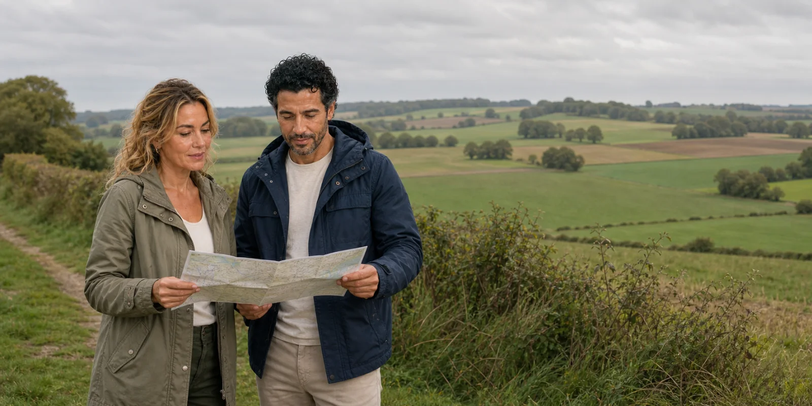
The Somme can look disarmingly ordinary: chalk under crops, villages returned to the map, church spires above quiet roads. A serious visit begins by learning to read that ordinary ground.
01 · Somme memory landscape
The first fact is the field
The Somme does not announce itself as a preserved battlefield. Roads cross productive farmland. Villages have houses, schools and municipal buildings rather than ruined silhouettes. Tree lines soften ridges that military maps reduce to contours. A traveller can pass a position that cost hundreds of lives without seeing a wall, a weapon or even an obvious rise in the ground.
That apparent emptiness is the first interpretive problem. It is tempting to imagine that the war has vanished and that only the monuments remain. The reverse is more useful: the modern landscape is the surface under which the campaign still has a physical logic. Chalk made deep excavation possible. Slight ridges opened or denied fields of observation. Sunken roads, quarries, drainage, woods and village high points structured movement. Railways and road networks fed armies on a scale that no single trench photograph can explain. Farmers later restored the same land because it had been their livelihood before it became a military zone.
The Battle of the Somme was a joint British and French offensive fought from 1 July to 18 November 1916. It lasted 141 days, not one catastrophic morning. Its first day remains central because the British Army suffered 57,470 casualties, including 19,240 dead. Yet making that day the whole story hides the French role, the German defenders, the months of fighting that followed, the evolution of tactics, the colonial and dominion forces, and the civilians whose homes and fields occupied the same space.
The route in this feature is therefore not a list of “must-sees.” Each stop answers a different question. Lochnagar reveals underground engineering. Beaumont-Hamel makes ground and unit memory legible. Thiepval turns absence into architecture. Péronne brings enemy societies and civilian lives into the frame. Villers-Bretonneux prevents 1916 from swallowing Australia’s distinct 1918 story. Amiens restores the civic and architectural world for which the war was fought.

02 · Somme memory landscape
Before the offensive: a coalition plan altered by Verdun
The offensive grew from Allied strategy for 1916. Britain and France intended coordinated pressure on the Central Powers, with the Somme as the Western Front component of a wider programme. The German attack on Verdun in February changed the balance. France committed enormous resources to that battle, and the Somme plan became increasingly British-led while retaining a substantial French army south of the river.
That shift matters. Britain’s prewar regular army had already suffered heavily, and the forces assembled in 1916 included many formations raised after 1914. Some battalions drew recruits from the same town, workplace or social network. Popular memory later called many of them “Pals” battalions, a structure that could concentrate loss within one community. The French Army brought longer mass-war experience but was under the pressure of Verdun. German forces had held and developed this sector since 1914.
The British command relationship also resists caricature. Field Marshal Douglas Haig commanded the British Expeditionary Force; General Henry Rawlinson commanded the Fourth Army that carried much of the first-day attack. Their discussions involved objectives, artillery method, the depth of the advance and the degree to which infantry could move beyond a destroyed defensive system. The Imperial War Museums’ command account shows planning, disagreement and adaptation rather than a single unchanging order issued in ignorance.
None of that excuses the human cost. It changes the question from “Why did nobody know?” to more demanding ones. What did commanders know about the German system? What could artillery actually destroy? How quickly could inexperienced formations exploit gaps? What were the alternatives while France fought at Verdun? How did industrial capacity, communications and coalition obligations shape decisions? A landscape visit is valuable precisely because it makes those constraints visible without asking the visitor to accept every decision made within them.
03 · Somme memory landscape
The defence was a system, not a parapet
The stereotype of the Western Front is a pair of ditches separated by mud. On the Somme, German positions were networks. Front lines were supported by communication trenches, strongpoints, dugouts, wire, artillery, reserve positions and defended villages. Chalk could be excavated into deep shelters. A preliminary bombardment might smash the surface while leaving men alive below it, able to emerge when the fire lifted.
Wire was another hard test. Artillery needed the correct ammunition, fusing, accuracy and observation to cut it reliably. Shells could bury or rearrange strands without creating a clean lane. Counter-battery work had to locate and suppress German guns. Infantry communications depended on runners, visual signals, telephones whose wires were easily broken and, later, limited wireless systems. Plans made at headquarters encountered smoke, dust, noise, lost officers and terrain that looked different at ground level.
Logistics were as decisive as tactics. Every gun required shells moved forward; every formation required food, water, medical evacuation, replacement equipment and labour. Railheads fed light railways, roads and carrying parties. Horses remained essential. Pioneer and labour units built, repaired and transported under systems marked by imperial hierarchy and racial inequality. A traveller who looks only at the firing trench misses the infrastructure that made months of operations possible.
This is why small changes in elevation matter. A rise that seems trivial from a car window may have controlled observation across open ground. A village could be both a civilian home and a defensible knot of cellars, walls and roads. A wood could conceal movement, become an artillery reference and then be reduced, regrow and receive a name that carries a unit’s memory. “The Somme” is shorthand for many local problems linked by a vast supply system.
04 · Somme memory landscape
1 July 1916: catastrophe, variation and the danger of one story
The first day is often narrated as a uniform advance into uninterrupted machine-gun fire. It was catastrophic, but not uniform. Outcomes varied along the front. South of the Albert–Bapaume road, where British and French artillery arrangements, experience and tactical circumstances differed, forces achieved more. Elsewhere attacks failed against surviving positions and uncut wire. Local success could become untenable when neighbouring units did not advance or communication broke.
The scale of British loss makes abstraction difficult: 57,470 casualties in one day. Yet casualty is not a synonym for death; the total includes killed, wounded, missing and prisoners. Precision matters because careless language can inflate horror rather than explain it. The number of dead is already terrible without collapsing every category.
The offensive continued because Allied commanders still had strategic obligations, because limited gains had been made, because German forces were also under severe pressure, and because neither side possessed an easy method for breaking a fortified front. Later attacks changed bombardment patterns, objectives and infantry methods. Tanks appeared in combat for the first time near Flers-Courcelette in September, but the early machines were few and unreliable. They were not a sudden solution.
By 18 November, the maximum Allied advance was measured in miles rather than a strategic breakthrough. Casualties across all sides exceeded a million in the broad accounting used by the Imperial War Museums. The campaign relieved some pressure on Verdun and imposed heavy losses on the German Army, but its territorial result was limited. Those facts support debate; they do not resolve it into a slogan.

05 · Somme memory landscape
Lochnagar: the war beneath the war
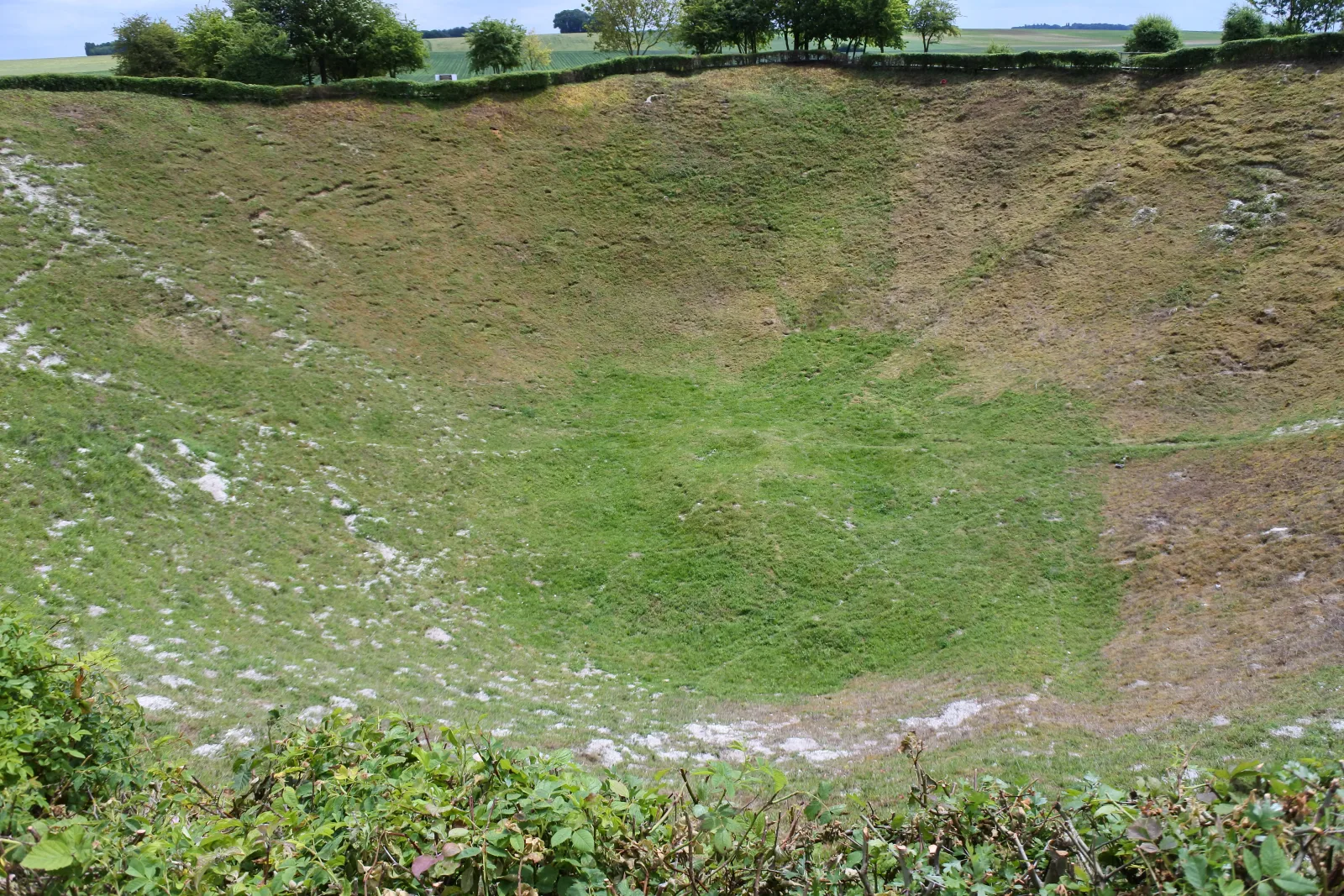
Near La Boisselle, Lochnagar Crater interrupts the agricultural surface with an absence. It was created by one of the mines detonated beneath German positions shortly before the infantry attack on 1 July. The Lochnagar Foundation records a shaft about 90 feet deep, a gallery roughly 300 yards long and two chambers loaded with a total of 60,000 pounds—about 27 tonnes—of ammonal. The mine exploded at 7:28 a.m., two minutes before the main assault.
The work crossed two Royal Engineers units: 185 Tunnelling Company began the tunnel in November 1915; 179 took over in March 1916. The foundation describes two adjacent chambers around 60 feet apart. Reading a section and a plan together helps: depth, horizontal approach and chamber spacing are different measurements. Contemporary pilot Cecil Lewis later described the detonation from the air in Sagittarius Rising. His vantage captures the extraordinary vertical plume; the surviving crater tells the longer story of the land left below it.
The numbers describe a remarkable engineering project, but they should not be mistaken for a claim of tactical success. Tunnelling companies worked in compressed, unstable and acoustically dangerous conditions. They had to navigate by survey underground while listening for enemy counter-miners. Spoil had to be concealed. Air, water and roof support demanded constant work. The mine was one element in a broader plan, not a weapon capable of removing the whole defence.
The resulting crater is about 100 metres across and 21 metres deep. Its dimensions make the mine comprehensible in a way that a tonnage cannot. The rim also makes a visitor responsible for conduct. This is not a climbing feature or a dramatic selfie platform. Stay on the permitted path, respect barriers, keep children close and do not remove objects from the ground. Suspected ordnance or military material should never be touched.
Lochnagar survived partly through individual stewardship. Richard Dunning bought the site in 1978 when there was a risk that it would be filled. The foundation and its supporters developed it as a place of remembrance and reconciliation. That postwar history is part of the site. Preservation did not happen automatically; someone had to decide that a void in productive land carried public meaning.


06 · Somme memory landscape
Beaumont-Hamel: one regiment, many scales of loss
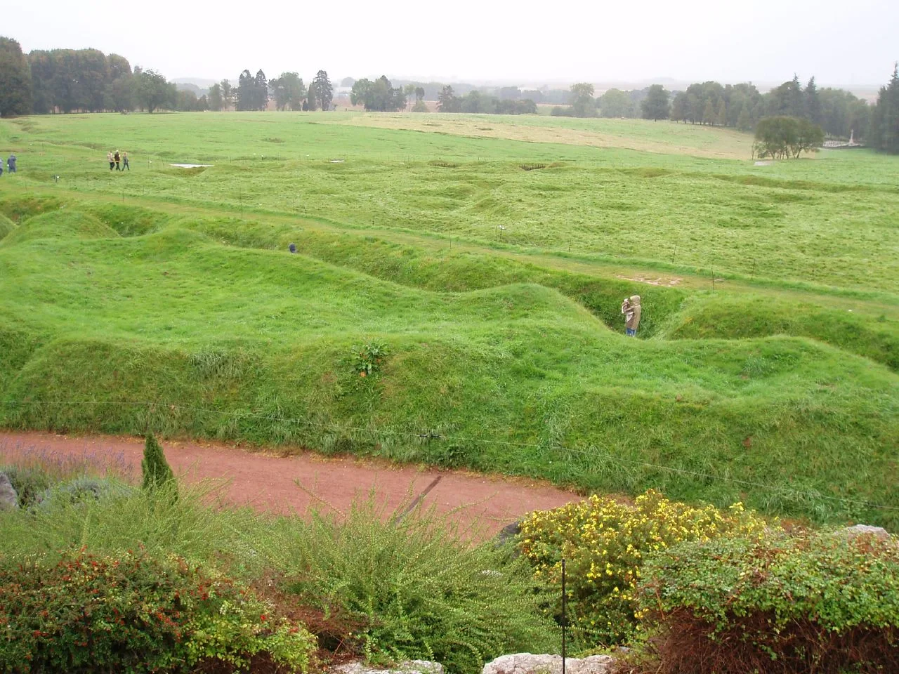
The Beaumont-Hamel Newfoundland Memorial preserves more ground than most sites on the route. Veterans Affairs Canada describes a 30-hectare landscape with trenches, shell holes, memorials and the preserved approach toward the German line. The bronze caribou stands above the ground associated with the Newfoundland Regiment’s attack. The so-called Danger Tree marks a point connected to severe fire and later remembrance; it is a memorial symbol, not an untouched tree from the morning itself.
Newfoundland was not yet a Canadian province in 1916. It was a dominion with its own regiment and its own political community. That distinction matters because later Canadian framing can unintentionally absorb a separate wartime identity. The unit went forward after earlier attacks had failed. Many men had to move over exposed ground from a support position because communication trenches were congested or under fire.
The current official Canadian account gives the scale carefully. Roughly 800 men went into the attack; more than 700 were killed, wounded or missing, and only 68 answered roll call the next day. Different figures in older records can answer different questions—who advanced, who was on the battalion strength, and who was counted on a later roll—so a responsible account keeps the stated group visible rather than treating every total as interchangeable.
The turns are part of the engineering. Fire trenches were divided into short bays by thick earth traverses; communication trenches changed direction instead of exposing one long corridor. Those breaks divided a continuous line into short compartments, limiting the distance an attacker could fire along the trench. They offered protection, not immunity: bombardment could collapse walls, obstruct movement and isolate a bay. Compare the preserved plan with the fieldwork diagrams collected by Historic England: geometry here is a survival measure before it is a visual pattern.
The park makes those figures spatial. Preserved trench lines show that “going over the top” was not an abstract movement from one straight line to another. Routes bent, crossed and narrowed. A fold in the ground could hide or expose. A point that takes minutes to walk in safety could become impossible under observed fire.
Yet Beaumont-Hamel should not become a single-national enclosure. Other formations fought across the same sector, including the 29th Division to which the Newfoundland Regiment belonged. German soldiers occupied the positions being attacked. French civilians had lived in the surrounding communes. The caribou gives a precise entry into memory; it should open the landscape rather than close it.

07 · Somme memory landscape
Scotland, Ireland, England and the limits of a regional label
The Somme is crowded with unit geographies. Memorials and cemetery registers connect battalions to Scottish, Irish, English and Welsh places; the South African memorial at Delville Wood and the Ulster Tower near Thiepval make other collective memories visible. These associations are meaningful, but their labels can oversimplify the people inside a unit.
Recruitment patterns, reorganisations, replacements and imperial movement complicated identities. A division might carry a national or regional title without every man sharing it. Units that began with a strong local character changed after casualties. Officers and specialists moved. Irish participation crossed later political boundaries and should not be forced into a retrospective single story. Scottish memory at places such as Longueval and Delville Wood belongs within a British, imperial and local French landscape, not outside it.
The useful question at a memorial is therefore not only “Which nation?” Ask which formation, on what date, under whose command, attacking or defending which position, and with what later commemorative sponsor. A national flag can tell you who maintains a story now; it does not by itself explain the 1916 order of battle.
08 · Somme memory landscape
Australians and New Zealanders: timing is part of truth
Australian and New Zealand memory is prominent on the Somme, but it needs chronology. Australian divisions fought at Pozières and Mouquet Farm from July 1916, after the opening day. The Australian Imperial Force was a volunteer force; more than 400,000 Australians enlisted during the war. The word “volunteer” explains the legal basis of service, not a single motive shared by every recruit.
Pozières sat on high ground along the Albert–Bapaume road. Its capture and the later struggle toward Mouquet Farm produced enormous Australian casualties. The ground became central to Australian memory because the fighting was sustained, because formations rotated through it and because losses touched communities far from Europe. It should not be retrofitted into the Newfoundland attack or the Lochnagar explosion: these are connected parts of the campaign, not one simultaneous scene.
The scale is sharper when the dates and categories stay attached. The Australian War Memorial’s account of Pozières places Australian forces there from 23 July and records about 23,000 casualties over 42 days, including 6,800 men killed or dead from wounds. Those figures belong to the Pozières fighting, not to the whole Somme campaign and not to the first day. Mouquet Farm, farther along the ridge, became a subsequent objective rather than an interchangeable name for the village battle.
The New Zealand Division entered the Somme battle in mid-September. New Zealand History records about 18,000 New Zealanders involved, nearly 6,000 wounded and more than 2,100 killed; more than half of those killed had no known grave. Māori soldiers served within the New Zealand Pioneer Battalion on the Western Front alongside Pākehā and Pacific personnel. Their labour on roads, trenches and communications was operationally vital, even when military hierarchy and later popular memory gave combat arms more attention.
Indian cavalry and other Indian Army personnel, South Africans, Canadians, Newfoundlanders and men of the British West Indies Regiment also belong in the wider Somme account. The IWM’s Empire and Commonwealth study is useful precisely because it shows participation without pretending equal treatment. Some men were directed into labour roles through racial assumptions; recognition, pay, promotion and postwar memory were uneven.
Aboriginal Australians also served in the Australian Imperial Force despite policies and recruiters that could exclude them. The Australian War Memorial’s Indigenous service project estimates that about 1,000 Aboriginal men served in the First World War. Those accepted into the AIF received the same military pay as other soldiers, but that equality inside the force did not confer equal citizenship at home. Veterans could return to discrimination in voting, wages, land and public recognition. A national memorial route that celebrates volunteer service without naming those barriers reproduces the exclusion in a more polished form.
“ANZAC” is consequently too small a label for the whole landscape, just as “British” can be too blunt. Use the national memorials as doors into precise stories, then keep the doors open.
09 · Somme memory landscape
French, German and civilian Somme
The French Army’s place in the offensive is easy to miss on an English-language memorial route concentrated north of the river. French forces attacked south of the Somme and achieved significant first-day gains. They brought experience and artillery methods shaped by two years of war, but they were also carrying the weight of Verdun. A complete account does not use French success simply to condemn British failure; it asks how sectors, resources, objectives and opposing positions differed.
German soldiers are equally at risk of becoming a faceless defensive mechanism. They belonged to units with their own recruitment regions, commanders, casualties and correspondence. They built formidable positions because their army had chosen and held ground, because field engineering evolved, and because survival demanded depth. Many died in bombardments, counterattacks and later phases. German cemeteries, often visually different from Commonwealth sites, complicate a route built only from the attackers’ monuments.
Civilian experience is more difficult to see. Northern French communities faced occupation, requisition, forced labour, flight and destruction. Across wartime France, around two million people were displaced in the refugee history synthesised by 1914–1918 Online. That national figure is not a count for the Somme alone; it supplies the scale within which local evacuation and return occurred.
Villages were not empty tactical symbols before armies assigned them names on situation maps. Houses, farms, churches, schools, workshops and family property stood where strongpoints and artillery targets later appeared. After the armistice, inhabitants and outside labour cleared rubble, located remains, dealt with unexploded material and restored agricultural production. Rebuilding a village could mean reproducing an earlier street line, adopting a new plan or using compensation and standardised materials under severe pressure.
The modern field is therefore not a return to a timeless rural normal. It is a repaired landscape whose productivity depends on generations of postwar work.
10 · Somme memory landscape
Albert and Péronne: two museums, two ways of knowing
Two museums frequently compressed into one sentence perform different jobs in different towns. The Musée Somme 1916 is in Albert, beside the basilica—not in Péronne. Its entrance leads down 62 steps into a tunnel about ten metres below street level. The passage was adapted as an air-raid shelter in 1938, then developed as a museum that opened on 1 July 1992. Along roughly 250 metres, objects and weapons appear beside reconstructed trench scenes. The underground setting conveys enclosure and material scale, but the displays are interpretation inside a reused tunnel: they are not an untouched 1916 trench.
That distinction changes both understanding and access. Albert is useful for visitors who want to examine equipment and move through an immersive reconstruction before trying to read the open ground. The official museum information also states that the stair descent makes the tunnel inaccessible to wheelchair users. This is a property of the site, not a reason to label an entire traveller or battlefield route “inaccessible.” It is a reason to check the museum’s current access information and choose a different interpretive stop when the stairs are a barrier.
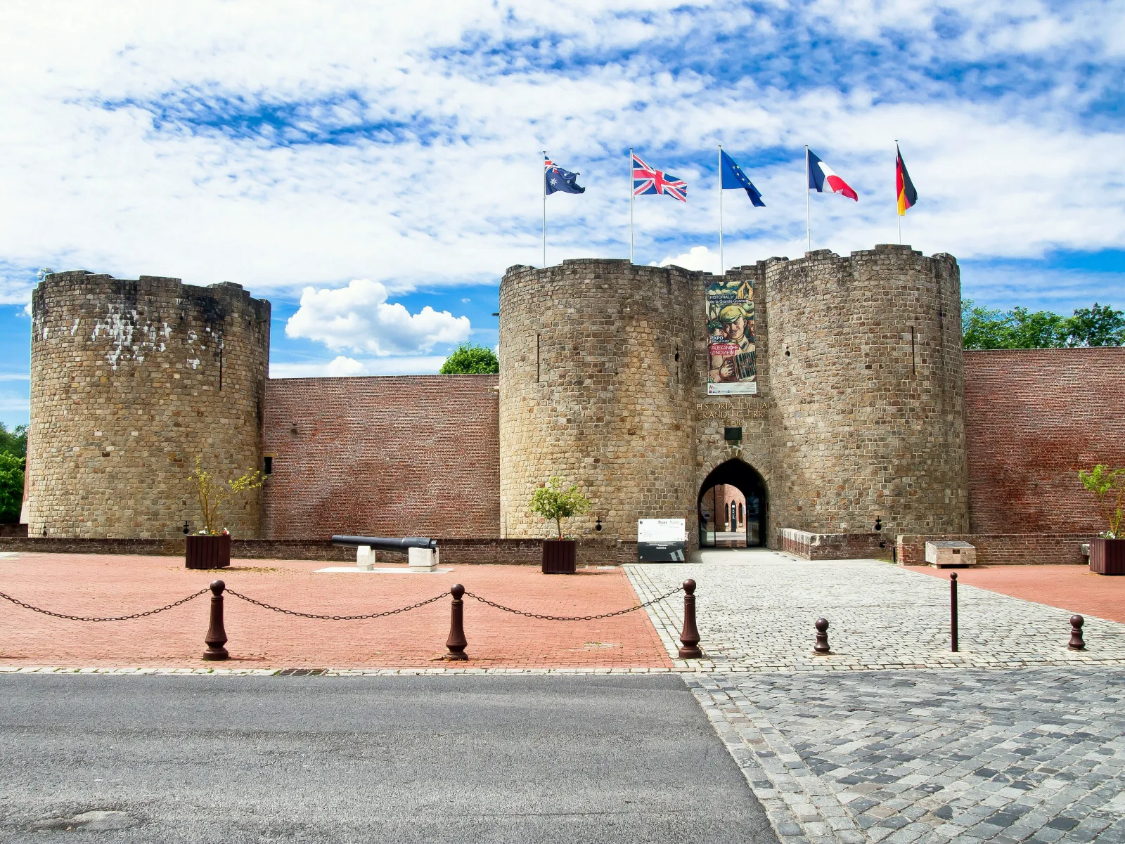
The Historial de la Grande Guerre is in Péronne. It occupies the grounds of the medieval castle and a modern extension by Henri Ciriani. Its method is comparative rather than subterranean. French, German and British military and civilian cultures meet across five permanent galleries and audiovisual spaces. Uniforms, printed matter, domestic objects, art and propaganda make it possible to compare how whole societies mobilised, endured and represented the war.
The choice is therefore not between a “real” museum and a lesser one. Albert uses an underground route and reconstruction to make material conditions graspable. Péronne uses original collections, spatial design and cross-national comparison to challenge a single-army account. A traveller with time for only one should choose by question, mobility and route geography. A tour description that names both must still confirm which one the actual itinerary includes; they cannot be treated as the same stop.
11 · Somme memory landscape
Péronne Historial: put three societies in the same room
The Historial de la Grande Guerre at Péronne is the route’s best structural correction to a one-army day. Opened in 1992, it joins a thirteenth-century castle to a modern building by architect Henri Ciriani. The relationship is deliberate: a low, pale, geometrically controlled museum extension enters into conversation with fortified masonry and water.
Inside, the comparative method places French, German and British military and civilian cultures beside one another. Uniforms, printed material, domestic objects, propaganda and art can be read across national systems. The museum’s collection extends far beyond equipment. This is crucial because the war was fought by industrial states that mobilised clothing, food, education, gender expectations, news, grief and artistic production.
Ciriani’s display design is also interpretation. Objects set into floor-level wells change how bodies gather and look. Horizontal presentation resists the triumphant verticality of a trophy hall. Light, concrete, voids and controlled sight lines create distance without pretending neutrality. Architecture tells the visitor that comparison requires space.
A museum visit before the open sites gives names and systems to the ground. A museum visit later lets physical distances correct assumptions formed indoors. Either order is defensible. What matters is allowing enough time to compare rather than rushing through the rooms as a wet-weather substitute for monuments.

12 · Somme memory landscape
Thiepval: when a name does not mark a grave
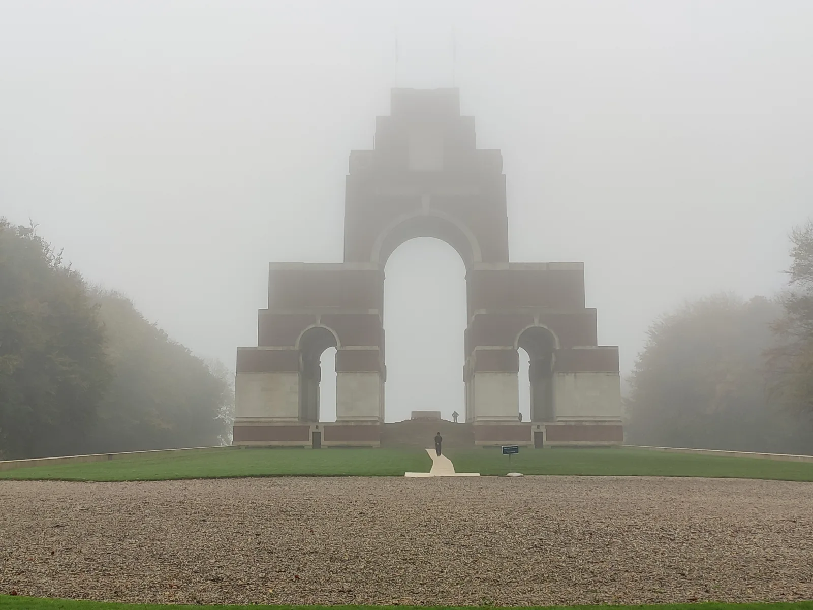
The Thiepval Memorial to the Missing is an architecture of names. The Commonwealth War Graves Commission records more than 72,000 British and South African casualties of the Somme who died before 20 March 1918 and have no known grave. A name on the memorial does not mean that no remains were ever found; it means there was no identified grave to carry that individual commemoration when the record was established, subject to later identification work.
That distinction is essential for family research. A grave names a burial place. A memorial inscription commemorates a person without a known grave. Some soldiers have both a service record and a burial record; others survive in partial paperwork assembled after loss and administrative disruption. Identification projects can change the record, and the CWGC database is more authoritative than a copied online family tree.
Edwin Lutyens designed Thiepval as interlocking arches and piers rising about 45 metres. Sixteen massive piers carry name panels. The repeated openings frame sky and landscape rather than enclosing a conventional room. Seen from a distance, the mass is unmistakable; up close, the building dissolves into thousands of individual inscriptions.
Beside it, the Anglo-French cemetery contains 600 burials—equal numbers from the two armies—most unidentified. Its symmetry is a diplomatic and commemorative statement. The memorial opened in 1932, long after the battle, within a landscape already being organised through cemeteries, roads, pilgrimages and national institutions.
The wider cemetery system also needs precision. The Commonwealth War Graves Commission adopted equality of treatment as a founding principle and developed a common headstone form rather than monuments scaled to a family’s wealth or military rank. “Common” does not mean that every stone says or signifies the same thing. Regimental badges, religious emblems, service details and optional family inscriptions preserve individual differences within the shared architecture. Nor was the system uniformly equal in practice: the CWGC’s own historical inequalities review documents how many non-European war dead did not receive the same forms of named commemoration.
Burial overseas was a policy choice shaped by scale, logistics, battlefield conditions, imperial administration and an argument that common cemeteries would avoid class distinctions. It should not be reduced to “repatriation was impossible.” Families contested the policy, and its burden was not experienced equally. The resulting landscape can be both a major work of public commemoration and evidence of decisions made for the bereaved rather than by them.
Visitor conduct can be simple. Speak quietly around people reading names. Do not lean equipment against panels or treat steps as a stage. If a family is tracing an inscription, give them space. Photography is generally part of public remembrance, but a close image of another person’s grief should never be taken without permission.

13 · Somme memory landscape
The work of identification
Finding one person in the Somme landscape is a research task, not a promise that a guide or website can improvise on the day. Begin with full name, service number if known, unit and date of death. Separate family tradition from documentary evidence. Search the CWGC casualty record, the relevant national service archive, unit war diaries and contemporary maps. Watch for initials, spelling variants, reburial records and units that changed designation.
The date of death can place a person within a battle phase, but it does not automatically identify the exact point where they fell. A battalion front covered space; a diary may record headquarters knowledge rather than every company movement. Later maps can use changed trench names. Remains recovered after the war might have been moved into a concentration cemetery. A modern roadside coordinate should be presented as a research conclusion with a confidence level, not as unquestionable fact.
If the record leads to Thiepval or another memorial to the missing, the inscription is the destination. If it leads to a cemetery, confirm the plot, row and grave reference before travel. Save an offline copy because rural data coverage is not a research method. For complex cases, a specialist researcher can be more useful than a general sightseeing tour—especially if the goal is to reconcile contradictory family documents.
Dernancourt Communal Cemetery Extension illustrates why the record must lead the route. It lies south of Albert and includes graves connected to several periods of fighting; New Zealand History records New Zealand burials there. A family name in Dernancourt is not a decorative addition to a northern circuit through Beaumont-Hamel and Thiepval. Confirm the individual casualty record and grave reference, then calculate the detour and give the cemetery enough time. If that means removing a famous stop, the family record should win.
No responsible guide can guarantee a revelation merely because a surname is supplied on the morning. Useful pre-visit work leaves an audit trail: the casualty database establishes the commemorative record; the service file and unit identify the formation; the war diary narrows the unit’s position and action; trench maps and concentration records test later movement; and family documents expose spelling changes or a mistaken oral tradition. A guide can interpret that evidence on the ground. The evidence should not be replaced by the performance of discovery.
Research also has an ethical edge. A soldier’s file may contain medical, disciplinary or family information that descendants have never discussed. The goal is not to manufacture a heroic arc. It is to restore context without forcing a life into a predetermined story.
14 · Somme memory landscape
Villers-Bretonneux: do not move 1918 into 1916
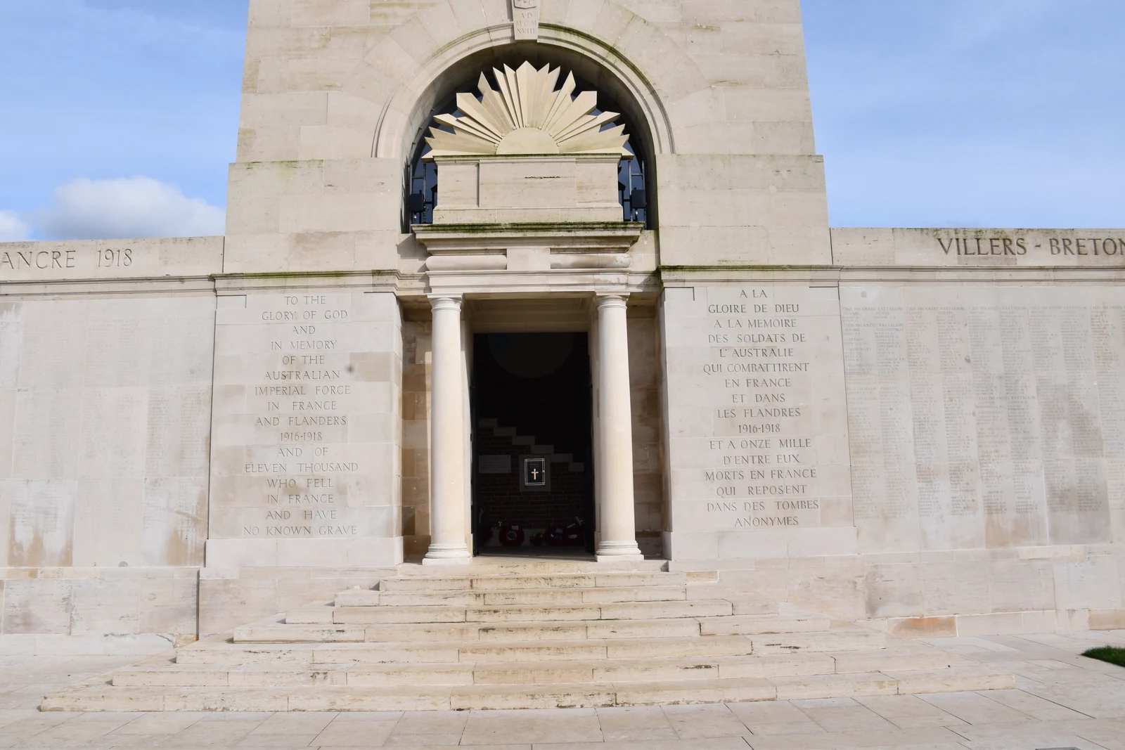
Villers-Bretonneux belongs on this route because it reveals how memory compresses time. The town is strongly associated with Australia, but its defining Australian battle occurred in April 1918, not during the opening of the 1916 Somme offensive.
German forces captured Villers-Bretonneux on 24 April during the spring offensives. Australian brigades, supported within a broader British and Allied operation, counterattacked that night and retook the town. The action helped protect Amiens, a critical rail and logistics centre. It was a different strategic moment from 1916: the German Army was attacking after forces became available from the Eastern Front, and the Allies were working toward more unified command.
The Australian National Memorial stands outside the town. Also designed by Lutyens and dedicated in 1938, it commemorates 10,796 Australian soldiers who died in France and have no known grave. The adjacent Sir John Monash Centre interprets Australian service on the Western Front. Its placement behind the memorial creates a sequence from cemetery and names to national historical explanation.
Inside the centre, Morning Star performs a different kind of interpretation. Artists Lyndell Brown and Charles Green designed the 2017 work and the Australian Tapestry Workshop wove it at a scale of five by two and a half metres, using more than 370 wool tones. Its imagery links the places soldiers fought with remembered and imagined spaces carried from home. Woven colour gives that connection a physical form, complementing the centre’s screen-based interpretation without dictating a visitor’s response.
The Franco-Australian Museum, in Victoria School in the town, has another task again. Its four-part sequence uses uniforms, photographs, letters and personal objects to connect military history with the destruction and rebuilding of Villers-Bretonneux and the long civic relationship with Australia. It should not be described as a generic weapons display, and it should not be confused with the digital interpretation behind the national memorial. The museum’s current practical information identifies first-floor galleries served by a lift; visitors should still check the live page for arrangements on their date.
The association continued through education and commemoration, contributing to the familiar bond between Villers-Bretonneux and Australian communities. That bond is real, but it should not erase French civilians who lived through occupation, destruction and rebuilding, or the British and other Allied units in the operations around the town.
Villers-Bretonneux also points forward to the Battle of Amiens beginning on 8 August 1918. Tanks, aircraft, artillery, infantry and deception were coordinated more effectively than in 1916. The battle opened the Allied Hundred Days advance. The contrast is valuable: armies learned, technology changed and command developed, though no method made industrial war humane.

15 · Somme memory landscape
Amiens Cathedral: the civilian scale of survival
Amiens Cathedral is not an emotional palate cleanser after battlefields. Treating it that way would reduce a living religious and civic monument to an itinerary device. It belongs because it restores the scale of the society at risk and the architectural time that war interrupts.
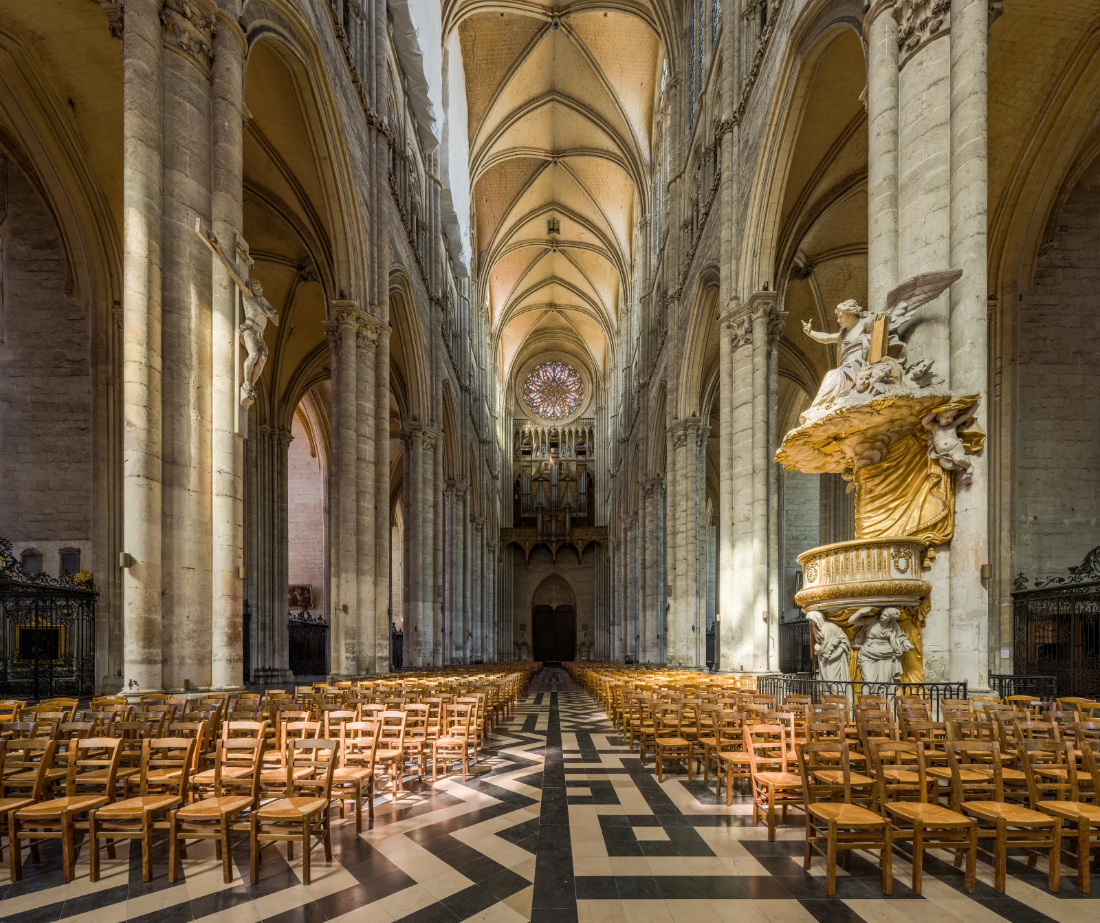
The cathedral was built mainly between 1220 and 1288. Its rapid main campaign helped produce the structural and stylistic coherence recognised by UNESCO. Pointed arches, rib vaults, flying buttresses and carefully organised elevations move loads while admitting extraordinary height and light. The western sculpture presents a dense theological and social programme. The nave is not simply “Gothic atmosphere”; it is a coordinated work of geometry, masonry, labour, finance and worship.
Amiens was a major logistics centre in both world wars. Its rail connections made the city strategically important. The cathedral survived, though the urban community around it endured bombardment and wartime disruption. Seeing the nave after the open fields changes the historical scale: the Somme campaign was not fought in an isolated military zone but near cities, institutions, transport systems and centuries of accumulated craft.
The cathedral remains a place of worship. Check official visiting information for the selected date, dress and behave for a functioning church, and respect services. A quiet interior visit can be intellectually demanding rather than merely restorative: look at how columns gather ribs, how side aisles manage movement and how the building turns stone into a framework for public memory.

16 · Somme memory landscape
Agriculture, reconstruction and the danger below
After the war, maps identified zones of devastation across northern and eastern France. Some land was judged too damaged for rapid return. Elsewhere residents, contractors, state agencies and military teams cleared rubble and ordnance, rebuilt roads and restored fields. The process was neither quick nor final.
Agriculture gives the Somme its modern appearance and continues to encounter the material war. Metal, ammunition and human remains are still recovered. The important visitor rule is stable even when annual statistics vary: never pick up a shell, fuse, grenade, cartridge or unfamiliar metal object. Do not move it for a photograph. Withdraw without disturbing the object and keep others away. Report its location to the police, gendarmerie or local mairie. Do not approach it to place a marker or collect a souvenir.
Leaving marked paths can also damage crops and expose visitors to unstable ground. A field edge is not public simply because a map shows a historical position beyond it. Ask permission where access is private, close gates, keep dogs controlled and follow local route signs.
Conservation has to negotiate competing values. A trench can be archaeological evidence, a grave context, a habitat and a fragile earthwork. Cutting vegetation may reveal form but accelerate erosion. Stabilisation can preserve a feature while changing its material appearance. Visitor access can fund care and cause wear. Sites such as Lochnagar and Beaumont-Hamel have different ownership, legal frameworks and maintenance practices; “preserved battlefield” does not describe one uniform condition.
The landscape also forces a question about authenticity. A reconstructed trench can teach dimensions and movement, but it is not untouched 1916 fabric. A replanted wood may carry the same name but not the same trees. A rebuilt village may follow an earlier street while every wall postdates destruction. Honest interpretation labels these layers. Reconstruction does not make a place false; hiding reconstruction does.
17 · Somme memory landscape
Cemeteries, memorials and emotional pacing
A day that includes several cemeteries can flatten difference through repetition. White headstones, clipped grass and uniform planting are powerful, but each cemetery has a formation history: wartime burials, postwar concentrations from scattered graves, national rules and later identifications. Read the entrance register and cemetery plan before moving row by row.
Names and symbols require care. Commonwealth headstones normally carry service details and a religious emblem where appropriate; some include a family-selected inscription. Unidentified burials use formulas of uncertainty. German cemeteries may group names differently and use darker crosses or plaques. French national cemeteries follow their own visual and religious conventions. Design is part of the politics of mourning.
The planting is part of that design, not proof that nature has “healed” the war. Grass, borders, trees and sight lines are maintained through continuing horticultural labour. Conservation does not mean restoring every surface to an imaginary first day: stone weathers, trees age, species respond to climate and safe access requires intervention. The CWGC’s conservation policy allows change and patina while requiring care for the ensemble. Beauty here is made and maintained; it neither cancels violence nor gives every visitor the same emotional response.
Do not schedule grief as if it were a transport connection. A person following a relative’s record may need longer than expected at one panel and no time at another site. Children may respond through questions, silence, restlessness or delayed emotion. Give them accurate language without graphic spectacle: people fought here; many were killed or wounded; families did not always know where someone was buried; communities built these places to remember.
Build ordinary needs into the plan. Food, water, toilets, weather protection and time away from memorial spaces are not disrespectful. Fatigue reduces attention and driving safety. One museum and two carefully chosen outdoor sites can produce more understanding than six rushed stops.
18 · Somme memory landscape
What to ask of a guide
A specialist guide can connect unit records to contour and challenge family assumptions, but “specialist” should be tested. Ask which archives and maps support the route, whether research is completed before the day, how uncertainty is communicated and whether the guide distinguishes 1916 from 1918. A confident story is not necessarily a documented one.
For a general route, ask what proportion of the day is spent in transit, whether Péronne or another museum is included, how long is allocated at major sites, and what happens when a traveller needs a slower pace. For a family-history route, provide documents early and ask for a written statement of what can and cannot be located.
Accessibility must be site-specific. “Battlefield tour” can include level museum floors, gravel car parks, grass, steep crater edges, uneven preserved trenches and long approaches. Ask about walking distance, gradients, surfaces, steps, seating and accessible toilets at each intended stop. If transport is being arranged, confirm the actual vehicle, boarding height, securement or restraint needs and space for mobility equipment. Do not accept a generic destination label as a product-specific answer.
A guide should also know when not to speak. Interpretation is valuable; constant narration can prevent the visitor from observing the ground and reading names.
19 · Somme memory landscape
Four ways to build the visit
A long day from Paris
A Paris departure can work for a first orientation when time is limited. Its constraint is the amount of road travel relative to site time. Verify the actual stops rather than assuming every attraction named in a general description is included. A route containing Lochnagar, Beaumont-Hamel, Thiepval, Péronne, Villers-Bretonneux and Amiens is intellectually coherent, but fitting all six into one day risks converting explanation into arrival photographs.
Vimy is not an extra Somme stop. The Canadian National Vimy Memorial stands north of Arras in the Pas-de-Calais, on a different battlefield and a different geographical axis. It deserves a route built around Vimy Ridge, Arras and nearby sites rather than a hurried insertion into a Somme circuit. If a commercial itinerary lists Vimy and multiple Somme museums in the same day, ask for the actual driving sequence and time on site before treating the list as a promise.
Before arranging a day from Paris, confirm the departure and return points, included admissions, meal arrangements and time allocated at each site. Compare time on the ground with time in the vehicle: a longer list of stops can leave less room for the question that brought you here.
An Amiens or Somme base
Staying in Amiens, Albert, Péronne or another local base creates room for two shorter days. Amiens has direct rail connections with Paris; the SNCF route page should be checked for the selected date because schedules change. Rail alone does not connect every rural site, so plan local transport separately.
A base makes it easier to place the Historial on one day, follow a family record on another and stop when concentration fades. It also allows the cathedral to be visited on its own terms rather than as the last item before a return drive.
Self-drive
Self-drive offers maximum control over sequence and duration. It also transfers research, navigation, parking and fatigue to the driver. Download maps, keep site names in French as well as English, and do not stop on a narrow road merely because a historical map marks a position nearby. Public parking and marked access take priority over proximity.
The Somme department’s walking and cycling pages provide a current official planning start. Conditions and route design can change, so use live local information for the selected day.
A specialist research day
This is the strongest format for a named person, unit or action. It may omit famous monuments that do not answer the research question. That is a virtue. A battalion route through two fields, one cemetery and an archive can be a fuller day than a regional highlights circuit.

20 · Somme memory landscape
A practical sequence that preserves meaning
If the route begins at Lochnagar, the day opens with engineering and the difficulty of reading ordinary ground. Beaumont-Hamel then adds preserved movement and a precise dominion story. Thiepval expands one unit’s loss into the problem of tens of thousands without known graves. This sequence grows from earthwork to individual record to public architecture.
Péronne changes the register. The museum restores French, German, British and civilian material cultures and gives indoor time for comparison. Villers-Bretonneux then advances the clock to 1918, using Australian memory to show that “the Somme” is also a region revisited by later operations. Amiens closes not with relief but with civic scale: rail, stone, worship, engineering and a city that outlived both wars.
The order can be reversed. A museum first may help a new visitor; a family grave first may be non-negotiable; weather and opening hours can dictate the day. The principle is stable: each stop should change what the next one means.
Check each site’s official visitor page shortly before travel, then make the sequence around confirmed access and the time you need. Firm footwear and weather protection matter on grass and chalk paths; leave enough flexibility to shorten the outdoor circuit when footing or concentration deteriorates.
21 · Somme memory landscape
Put the dates beside the map
Two apparently similar days can answer different questions. A northern circuit through La Boisselle, Beaumont-Hamel and Thiepval follows much of the terrain associated with 1 July 1916. A route from Albert to Péronne and Villers-Bretonneux adds comparative museum history and Australia’s 1918 memory. Neither is a complete geographical account of every phase of the war. The choice works best when the places serve the question rather than when one itinerary tries to contain every national memorial.
Keep a modern road map beside a dated historical map. The first establishes how you can move today; the second locates units and positions at a particular moment. A cemetery’s date range may extend beyond the battle that made the surrounding village famous. A name on a memorial can lead to a different place from the battlefield named in a family letter. Connecting those records before departure turns a detour into a reasoned choice.
For a first visit, write down one question for each stop: how did mining alter the attack, how did the ground shape movement, how are the missing commemorated, what happened to civilian society, and how does a later national memory relate to the earlier campaign? Leave time to revise the answer after looking. A landscape becomes intelligible through those connections, not through the number of arrivals recorded in one day.
22 · Somme memory landscape
The argument the landscape makes
The Somme cannot be reduced to “futility,” though futile actions occurred and terrible decisions deserve scrutiny. It cannot be converted into a story of inevitable learning, though tactics and combined-arms methods developed. It is not solely British, Australian, Newfoundland, French or German, though each of those histories has places of exceptional clarity. It is not only military, because occupation, displacement, agriculture and reconstruction shaped the same ground.
The route’s architecture makes that plurality visible. A crater preserves force through a void. Trenches preserve movement through damaged earth. Thiepval converts administrative absence into inscribed mass. Péronne uses a museum to compare societies. Villers-Bretonneux gives Australia a national memorial while fixing memory to French soil. Amiens Cathedral carries an older system of structure, labour and belief through the age of industrial war.
The best visit does not finish every question. It leaves the traveller able to ask better ones: Which date? Which unit? Whose map? Known grave or memorial name? Original fabric or reconstruction? National story or coalition operation? Public path or private field? Durable fact or temporary condition?
Once those distinctions become habitual, the fields are no longer empty. They are not made dramatic by imagination. They become legible through evidence.
23 · Somme memory landscape
Listen: two routes through the Somme
Two conversations explore the Somme: Somme Battlefields Day Trip from Paris with Australian Memorial and Private World War I Battlefield Somme Tour. Listen alongside the dates and places discussed here, from Lochnagar to the museums, memorials and family records.
24 · Somme memory landscape
Sources and further reading
The central factual framework comes from the Imperial War Museums on the Somme, Veterans Affairs Canada at Beaumont-Hamel, the Commonwealth War Graves Commission at Thiepval, the Historial de la Grande Guerre, the Sir John Monash Centre, New Zealand History and UNESCO’s Amiens Cathedral record.