
New Orleans’s oldest surviving neighborhood is often sold as a perfectly preserved French city, a birthplace of jazz and a stage for ghosts. The real place is more demanding—and far more interesting. Its grid sits on Indigenous knowledge of high ground; its celebrated architecture is the product of fire, empire, Caribbean practice and continuous repair; its pleasures grew alongside slavery, segregation and hard labor. Walk slowly enough and the Quarter stops being scenery. It becomes an argument about who gets remembered.
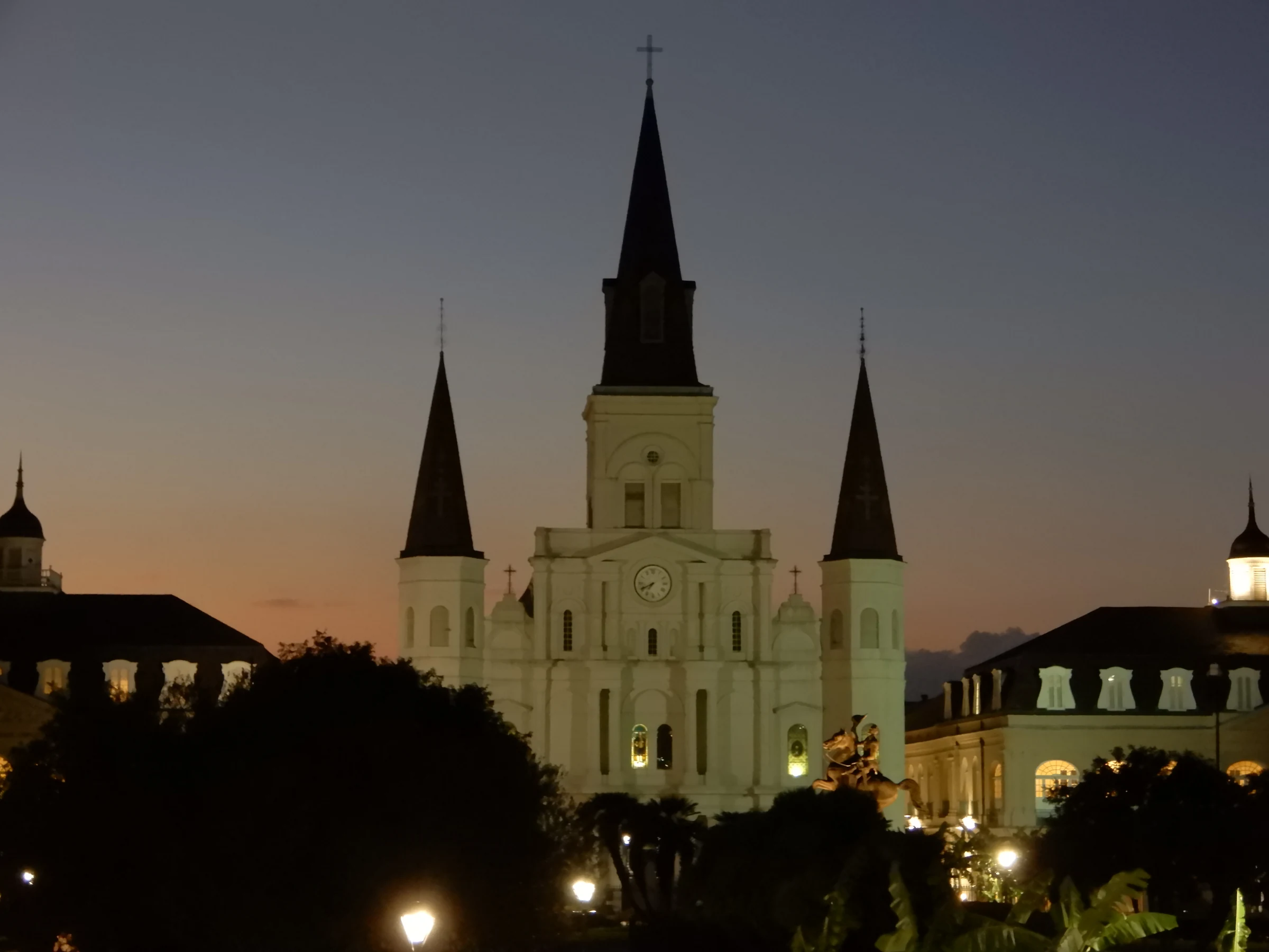
Stand at the river side of Jackson Square and the French Quarter appears to resolve itself into a postcard. St. Louis Cathedral rises on the center line. The Cabildo and Presbytère hold either side. The Pontalba buildings stretch along the square in matching rows. Iron fences, clipped planting and the Andrew Jackson monument complete the symmetry. Turn around and the Mississippi is close enough to explain why the city exists.
The composition feels inevitable. It is not.
The square began as a colonial place of arms, not a garden. The cathedral’s present silhouette is nineteenth-century. The flanking buildings were rebuilt, repurposed and absorbed into a museum system. The matching apartments arrived around 1850. The equestrian monument followed. The river levee, rail tracks, market, port traffic and later Moonwalk changed how the city met the water. Even the name “Jackson Square” replaced Place d’Armes, attaching the space to a United States general and president whose victory at New Orleans—and whose record of slaveholding and Indigenous removal—belong to the same historical field.
This is the first rule of the Quarter: what looks like one scene is a stack of decisions.
Two episodes of The Travel Podcast by ExcursionPass approach that stack from opposite directions. Quarter Notes follows the civic and everyday route: Jackson Square, Royal and Chartres Streets, the Old Ursuline Convent, literature, music and the river. Blood & Brick follows documented violence and the way crime becomes night-tour narrative. Read together, they ask a better question than either “What should I see?” or “Is it haunted?”
What does a city gain—and what does it conceal—when lived history becomes an experience for sale?
Listen while you read
Two walks, one contested neighborhood
Two walks, one contested neighborhood Blood & Brick supplies the darker route and its central question: how can a walk discuss murder, vice and enslavement without turning victims into atmosphere? Complete transcript.
Quarter Notes supplies the architectural and cultural route: the square, fires, streets, convent, writers, music and river edge. Complete transcript.
01 · French Quarter
Before the grid, a path through water
New Orleans was founded by the French in 1718, but the place was not discovered in 1718. Indigenous peoples had lived with and moved through the Mississippi delta’s ridges, bayous, lakes and seasonal water long before European settlement. Their geographic knowledge included the Bayou St. John route, a portage that shortened travel between the Mississippi and Lake Pontchartrain. That connection helped make the site strategically attractive to colonial planners.
The distinction matters because maps can make occupation look like origin. A European grid appears on paper and the land before it becomes blank. In reality, the delta was engineered by the river over thousands of years and understood through Indigenous movement, settlement, trade and naming. The natural levee beside the Mississippi offered relatively high ground in an overwhelmingly wet landscape. “High” here is relational, not mountainous: a narrow ridge safer than adjacent backswamp, still exposed to storms, river change, fire and disease.
Jean-Baptiste Le Moyne de Bienville chose the site in 1718. Surveyor Adrien de Pauger’s early-1720s plan regularized it into the rectangular pattern that still organizes the Quarter. Streets met the river at an angle because the grid answered the curving bank. The central place of arms opened toward the water; church, government, barracks, storage and market functions clustered around it. The plan tied defense, ceremony, religion and commerce to a working port.
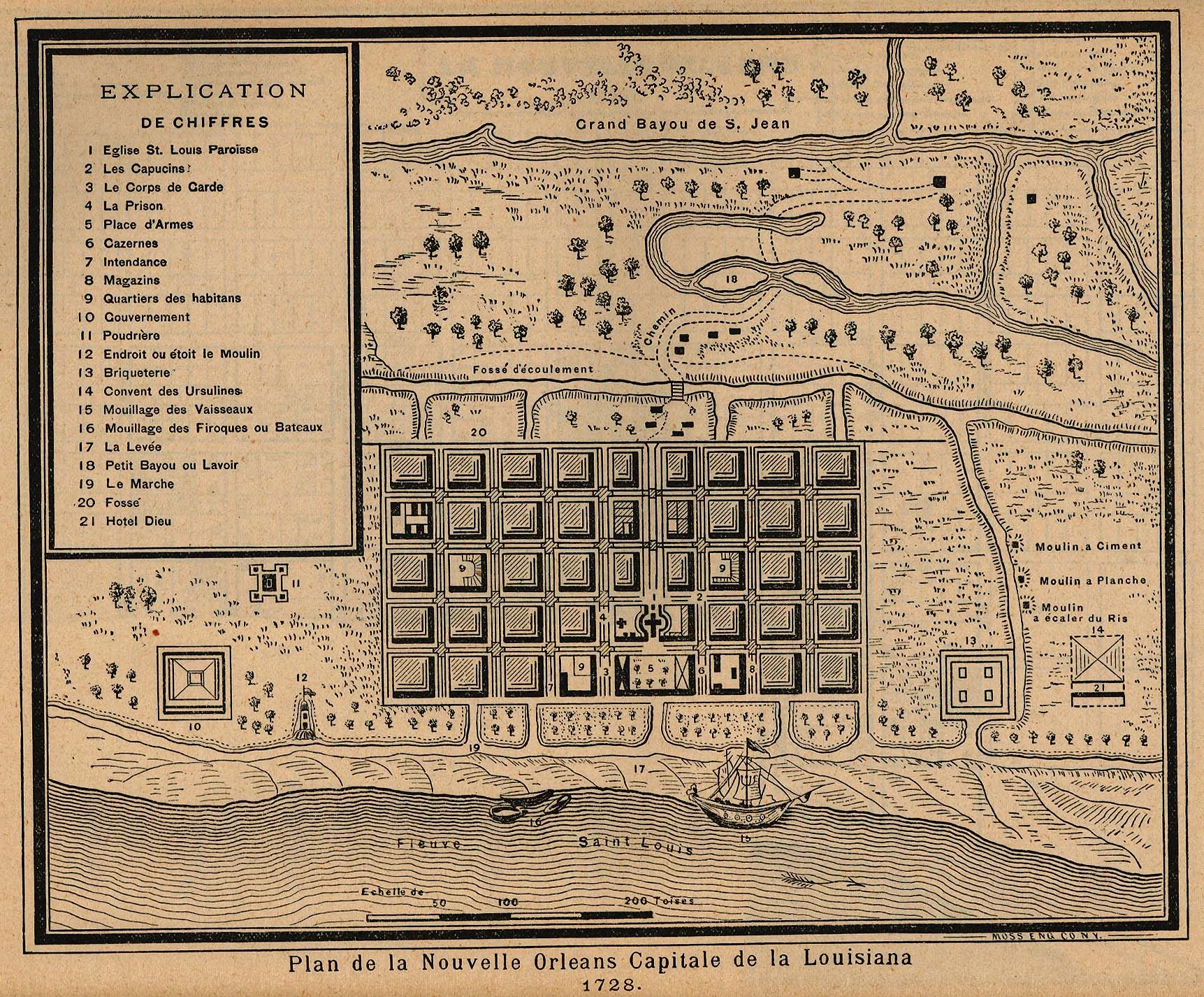

The old plan already contains a useful warning against nostalgia. The riverfront is not a scenic promenade. It is the settlement’s supply line. Boats, warehouses, landing places and levee appear as working infrastructure. Beyond the blocks lie drainage ditches, brickyards, gardens and the routes toward Bayou St. John. The square is one piece of a colonial machine that depended on land seizure, imperial rivalry, coerced labor and Atlantic commerce.
“French Quarter” is therefore a later English name for a neighborhood whose first colonial plan was French but whose surviving fabric is not simply French. Spain governed Louisiana from the 1760s until 1803. The United States acquired it through the Louisiana Purchase. Migrants arrived from Saint-Domingue, Africa, the Caribbean, Europe and the United States. Creole communities formed across legal and racial categories. Each regime altered rules, institutions, building practices and the balance of power without erasing what came before.
Walk the grid today and the river’s logic remains. Decatur, Chartres, Royal and Bourbon run roughly parallel to the bank; cross streets carry movement toward or away from it. The Quarter’s official historic-district boundaries extend approximately from Canal Street to Esplanade Avenue and from the river to North Rampart Street. But historical systems ignore neat borders. Congo Square lies just beyond. Storyville was upriver. Tremé, the Marigny, the port and the back-of-town neighborhoods supplied labor, music, food and social networks that tourist accounts often fold into the Quarter as if the oldest grid generated everything by itself.
02 · French Quarter
Fire did not make the Quarter “Spanish” overnight
The most repeated architectural story goes like this: the French built a wooden city; two great fires destroyed it during Spanish rule; Spanish authorities rebuilt it in brick; therefore the Quarter looks Spanish. Each clause contains part of the truth. Together they become too smooth.
On Good Friday in 1788, a fire burned through 856 buildings. A second major fire in 1794 destroyed more than 200. The disasters did occur under Spanish government, and officials tightened rules intended to reduce the speed and reach of future fires. The Historic New Orleans Collection’s reconstruction of both fires helps separate the scale of destruction from the too-neat national-style story that followed. Masonry party walls, stuccoed surfaces and tile roofs gained importance. Construction pushed toward denser, more fire-resistant forms. Yet regulation did not instantly replace every French building with a Spanish one, and “Spanish architecture” does not explain the labor, climate or Caribbean knowledge embedded in the result.
Rebuilding happened through available materials, builders and habits moving around the Atlantic world. Courtyards brought light, air, work and service into deep lots. Thick masonry and stucco helped with fire and weather. Shutters moderated sun and rain. Detached service buildings reduced some household hazards while keeping kitchens, storage and labor within the property. Galleries and balconies extended rooms toward street or courtyard. Creole cottages, townhouses, commercial buildings and later American forms stood side by side.
The terms are worth learning because they make looking more exact. The city’s Vieux Carré design guidance is unusually useful here: a gallery is supported from below by columns or posts, while a balcony projects from the wall without supports reaching the ground. The distinction is structural, not decorative. The famous metalwork is also not one timeless type. Wrought iron, cast iron and later replacements differ in date, production and strength. An elaborate cast-iron gallery may belong to nineteenth-century American industrial manufacture rather than to the Spanish colonial period a visitor expects.

The house is therefore best read as a section through social life. Front rooms face public display and commerce. Passages reach inward. Courtyards manage air, water, animals, deliveries and domestic work. Rear dependencies contain kitchens, storage and quarters. Enslaved and free workers made these properties function, yet architectural tours have often described courtyards as romantic refuges without asking who cooked, carried water, cleaned, repaired or slept around them.
The fires changed building practice, but so did later wealth, subdivision, neglect, renovation, code enforcement and fashion. Many “old” façades include nineteenth- and twentieth-century alterations. Some structures survived by changing use repeatedly. Others were rebuilt behind retained walls or reassembled through restoration. The honest pleasure is not in identifying a pure national style. It is in watching a dense port city adapt materials and forms to heat, rain, fire, commerce and unequal domestic life.
03 · French Quarter
Jackson Square: power made symmetrical
Return to the square and read its edges as institutions.
The Cabildo was the seat of Spanish municipal government. Its present building took shape after the fires and hosted Louisiana’s transfer to the United States in 1803. The purchase agreement had been signed in Paris; the Cabildo was the setting for the local transfer ceremony, not the negotiation of the treaty. It became a courthouse and, eventually, part of the Louisiana State Museum.
The Presbytère was designed in 1791 by Gilberto Guillemard, a French-born architect working for the Spanish government, to balance the Cabildo across the cathedral. Construction stopped with one story in 1798; the building was completed in 1813, under American rule. It never became the clerical residence suggested by its name, serving commercial and courthouse uses instead. The mansard roofs on the two civic buildings were nineteenth-century additions. Look below them: Doric pilasters on the Presbytère’s lower level and Ionic ones above make the classical ordering legible. Symmetry here is not evidence of identical function or a single construction date. It is urban theater joining church and government on one front.
St. Louis Cathedral occupies a much-altered sacred site. Earlier churches were damaged and replaced; the building visible today incorporates nineteenth-century reconstruction. Its central position expresses Catholic authority under colonial rule and remains active religious space. That continuing use matters. A church is not simply an exterior stop or an automatically accessible museum. Services, funerals, maintenance and institutional decisions outrank an itinerary.
The square itself was the Place d’Armes, used for military assembly, official proclamation, punishment and public exchange. During the nineteenth century it was landscaped and renamed for Andrew Jackson. The transformation from open colonial ground to fenced garden changed behavior as well as appearance. Movement became more controlled. The central monument established a heroic national narrative. The paired Pontalba blocks gave the edges residential and commercial regularity.

Micaela Almonester, Baroness de Pontalba, drove the apartment project that now bears her name. She inherited property and wealth from Andrés Almonester y Roxas, whose donations helped rebuild the square’s institutions and whose household and fortune belonged to a slaveholding society. After a marriage in France marked by litigation and her father-in-law’s attempt to kill her, she returned to direct a major New Orleans building project. Her own sketches survive; so does an 1849 contract bearing the crossed-out name of architect James Gallier and her emphatic “Nul.” The blocks emerged through changing builders, overruns and disputes rather than one effortless master plan. The buildings completed around 1850 placed shops below and residences above, introducing a unified urban wall on both sides of the square. Their cast-iron galleries are often treated as the essence of colonial New Orleans even though they belong to a later moment of industrial fabrication and American-era city growth.
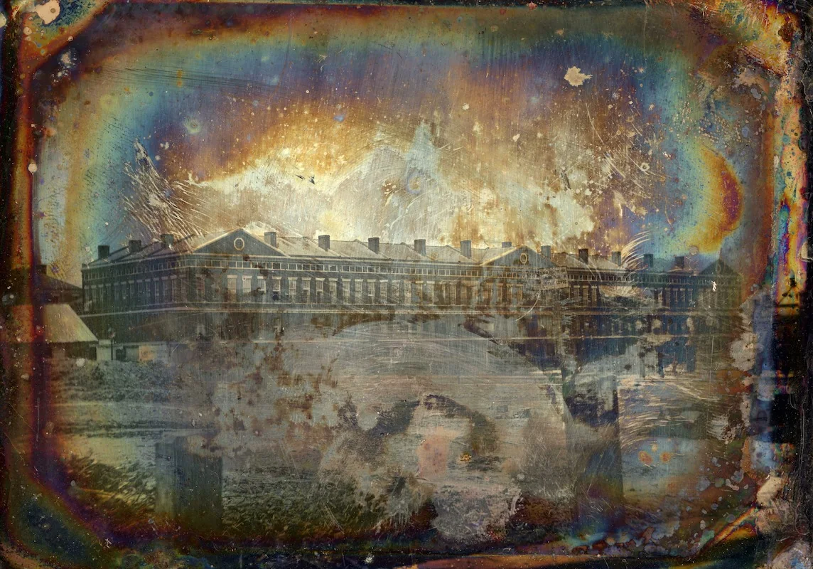

The river-facing side completes the argument. The French Market and levee were zones of food, freight and labor. Later rail lines and flood-control work intensified separation from the water. The Moonwalk, named for Mayor Maurice “Moon” Landrieu, turned part of the edge into a promenade. The name commemorates a city leader, not an Apollo astronaut. Today a visitor can move from cathedral axis to river view in minutes, but the intervening landscape has been remade repeatedly for port, rail, road, flood protection and recreation.
Jackson Square is thus not the Quarter’s undisturbed heart. It is the neighborhood’s most legible edit: empire becomes museum, place of arms becomes garden, apartments become icons, working riverfront becomes overlook. The edit is beautiful. Beauty is not innocence.
04 · French Quarter
The Ursulines and the limits of a founding story
Walk down Chartres Street toward the Old Ursuline Convent and the tone changes. The building’s long, restrained façade and steep roof resist the Quarter’s popular image of riotous ironwork. Designed in the 1740s and completed in the early 1750s, it is one of the most important surviving French-colonial buildings in the Mississippi Valley.
The Ursuline nuns arrived in 1727. Their history includes education, nursing and religious work at a time when colonial institutions were fragile. They treated people during epidemics and taught girls in a society that gave women limited public authority. These are consequential achievements. The familiar celebratory version, however, often stops before the harder part: the convent existed within and participated in a slave society.
Prayer books and institutional records studied by The Historic New Orleans Collection show the nuns teaching catechism to enslaved students while the order itself held people in slavery. Education was not evenly distributed. Religious instruction could coexist with coerced labor and racial hierarchy. To say this is not to cancel the medical or educational record. It is to describe the institution whole.
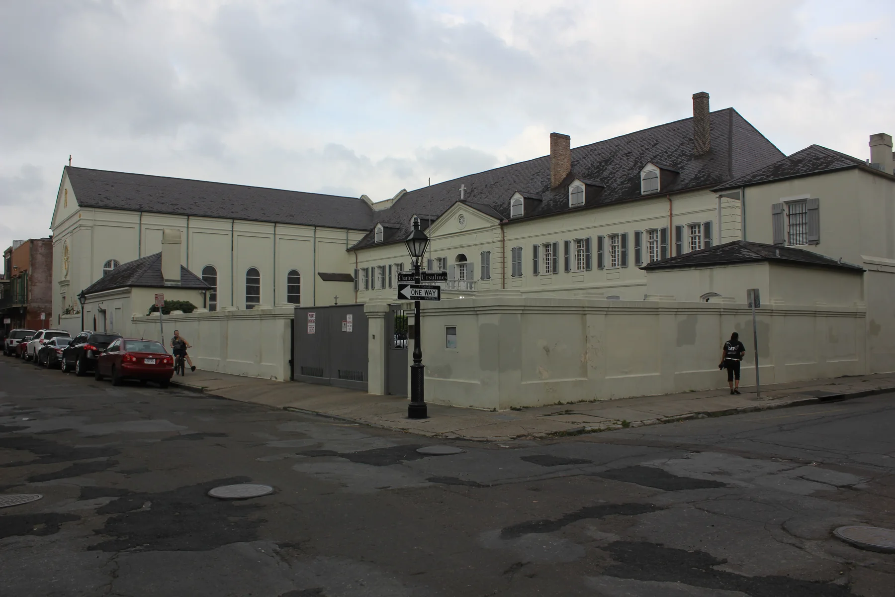

The convent also shows why exterior-only looking can be valuable. Roof pitch, dormers, shutters, masonry and the relationship of main block to chapel can be read from the street. But a façade cannot disclose the full institution. Museum access and exhibitions change, so the live Old Ursuline Convent Museum page should determine whether an interior visit fits the day. If it does, enter with a question larger than “Is this the oldest?” Ask what survival lets the institution explain—and what documentation has had to recover from behind the official story.
The same method applies elsewhere. Age superlatives are fragile. “Oldest continuously operating,” “oldest building,” “first apartment” and similar claims depend on definitions, rebuilding and boundaries. A careful guide should make the definition visible. The visitor does not lose wonder by exchanging a slogan for a precise building history. The wonder becomes durable.
05 · French Quarter
A port built through slavery and freedom
No account of French Quarter culture is adequate if enslaved labor appears only as a tragic sidebar. Slavery shaped the city’s buildings, households, food, transport, markets, law and wealth.
New Orleans was both a port in the Atlantic slave system and a major center of the domestic trade after the United States ended legal transatlantic importation in 1808. Enslaved people were bought and sold through businesses, yards, hotels and offices. Families were separated through sales into the expanding plantation economy. The Historic New Orleans Collection’s Purchased Lives research uses advertisements, letters and testimony to restore people to records that once treated them as inventory.
In 1840, roughly 23,000 enslaved people lived in New Orleans. Urban slavery could involve domestic service, skilled craft, dock work, food selling, construction, transport and hired labor. A person might move through the streets with more apparent mobility than someone on a plantation and still remain legally property, vulnerable to sale and violence. “Urban flexibility” is not freedom.
The city also sustained one of the largest free communities of African descent in the United States. Free people of color owned property and businesses, formed families and mutual-aid networks, served in militias, pursued education and shaped music, craft and political life. Their circumstances differed enormously. Some owned enslaved people. All lived within legal systems that hardened racial restrictions, especially under American rule. The category complicates a binary picture of the city without softening the power of slavery.
Street commerce makes these structures visible at human scale. Rose Nicaud is remembered as a woman born enslaved who sold coffee near the French Market and later purchased her freedom. The broad shape of her story survives; some details have been retold more confidently than the record allows. She should not become a cheerful mascot for café culture. Her labor speaks to enterprise under constraint, the importance of women vendors and the ways freedom could be pursued in a marketplace built within slavery.
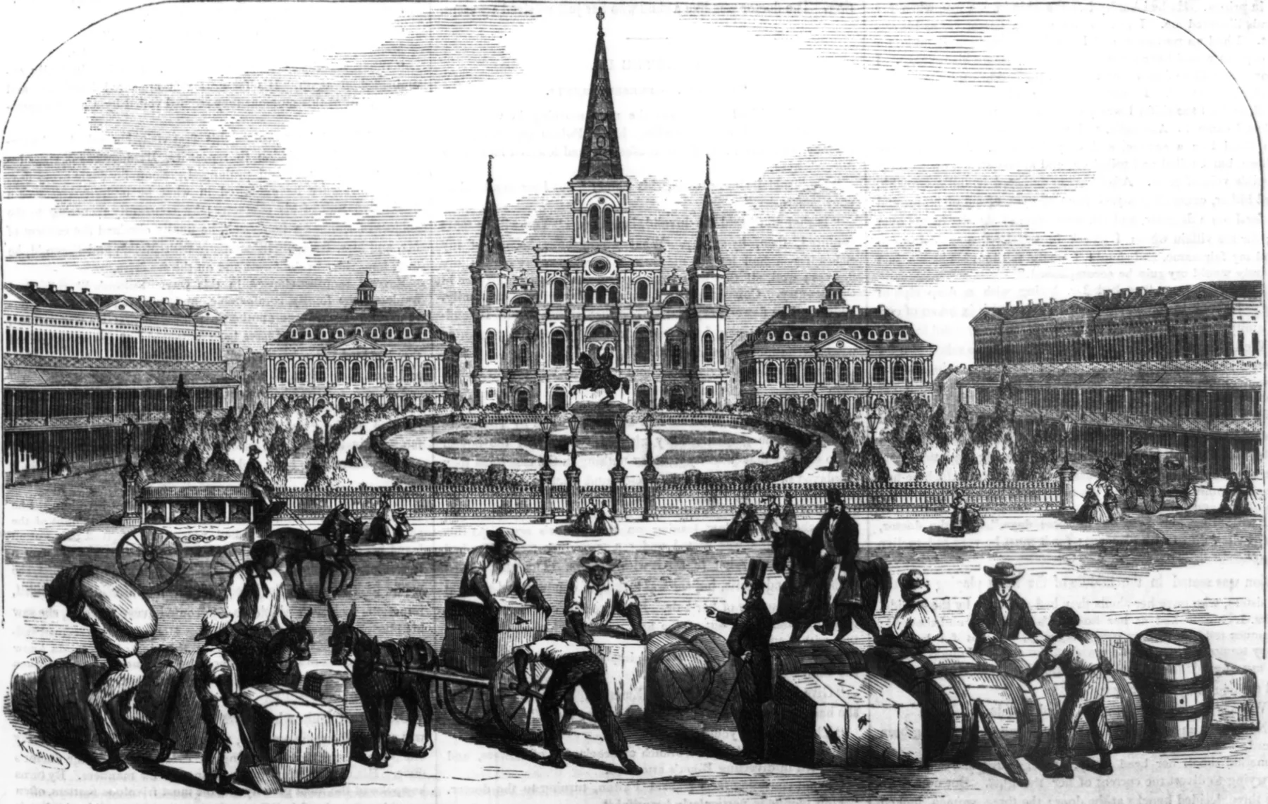
The square illustration of 1858 carries this tension in plain sight. The landscaped garden and ordered apartments sit behind barrels, carts, animals and workers at the riverfront. The image does not label legal status or name the people. It does prevent architecture from floating free of labor.
This changes how a visitor reads a courtyard, market or townhouse. Do not ask only who owned it. Ask who maintained it, which trades made its materials, where water and food arrived, where servants or enslaved people worked, which doors separated movement and which records preserve names. The Quarter becomes less picturesque for a moment and more fully inhabited.
06 · French Quarter
Congo Square is essential—and outside the Quarter
North Rampart Street marks the historic district’s landward edge. Cross it toward Louis Armstrong Park and Congo Square, and a useful correction begins: one of the places most essential to understanding French Quarter music is not inside the French Quarter.
During the eighteenth and nineteenth centuries, enslaved and free people of African descent gathered in and around the area on permitted days to trade, socialize, dance and make music. Names and boundaries changed over time. The gatherings preserved and transformed African and Caribbean practices under conditions of surveillance and slavery. They entered a wider musical ecology that included churches, military bands, parades, theaters, dance halls, homes, benevolent societies and street performance.
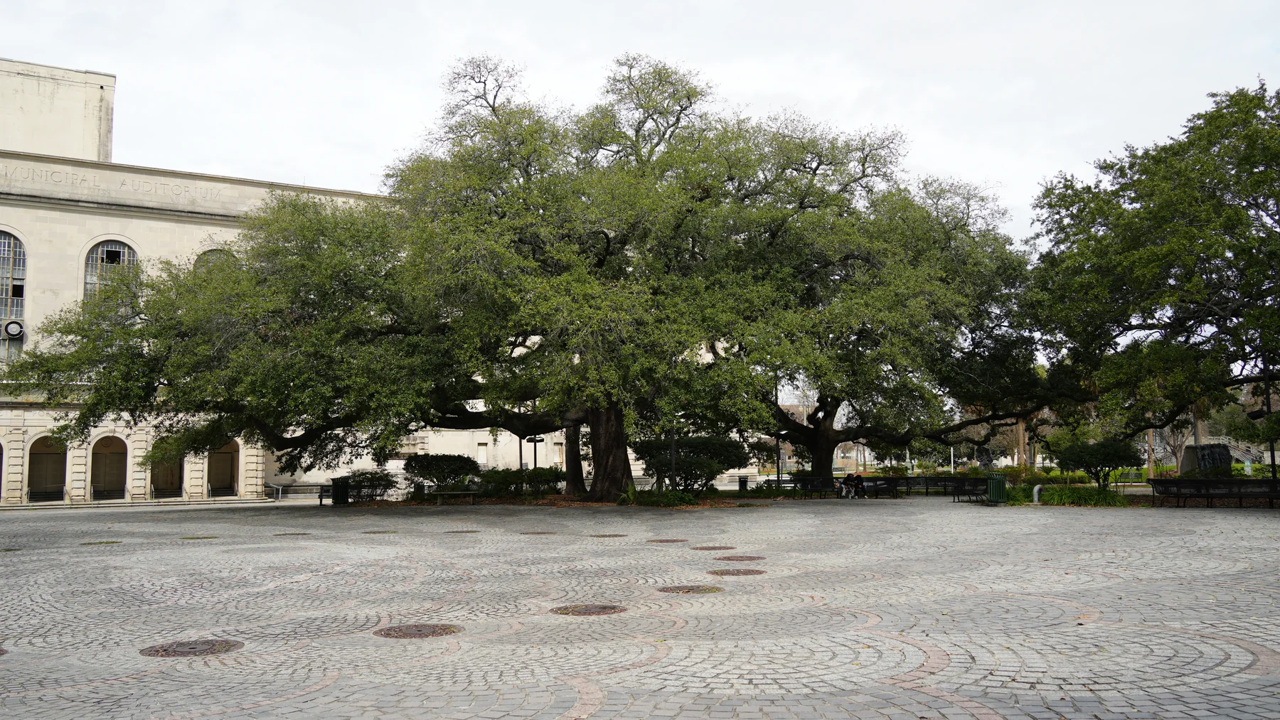

It is tempting to draw a straight line from an African drum in Congo Square to jazz in a Bourbon Street club. History is not that tidy. Jazz emerged in New Orleans around the turn of the twentieth century through African American creativity meeting blues, ragtime, brass-band practice, sacred music, dance repertory, Caribbean rhythm and improvising ensemble traditions. Musicians lived and worked across the city. The National Park Service’s jazz history and neighborhood map make the point spatially: places beyond the Quarter are not supporting characters in a Quarter origin story.
Storyville, the regulated vice district that operated from 1897 to 1917, lay just upriver of the Quarter. It did employ musicians and became entangled with jazz mythology. It was not the music’s single birthplace. The “Tango Belt” brought dance halls, theaters and associated entertainment into the Quarter, especially around Iberville Street. The Basin Street area, the lakefront, Tremé and Central City formed other working musical landscapes. After World War II, Bourbon Street developed a different nightclub economy. Preservation Hall, established in the early 1960s, created another model for presenting and supporting traditional New Orleans jazz. These moments are connected, not interchangeable.
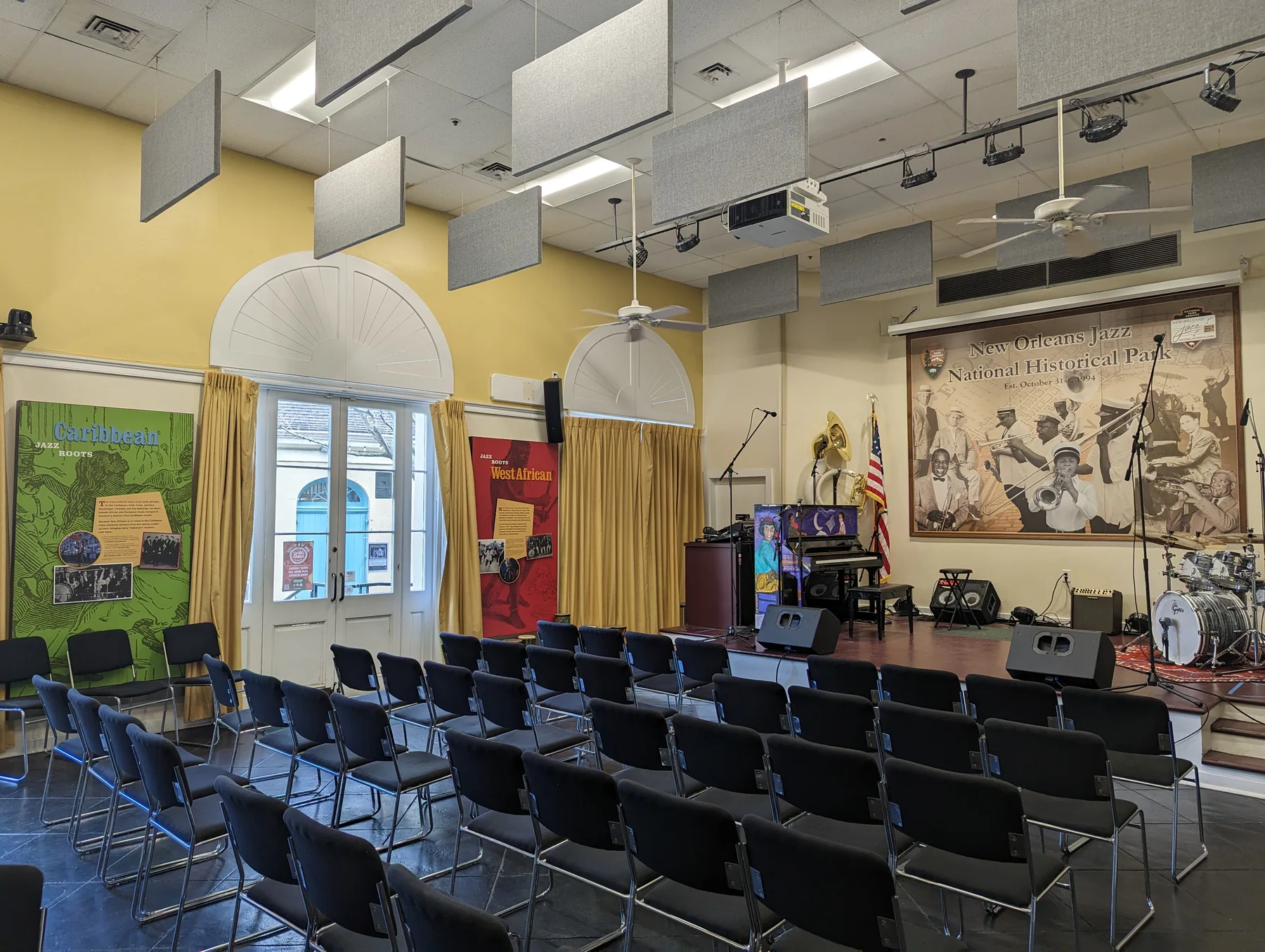

For the visitor, the implication is practical and ethical. Listen in the Quarter, but do not claim the Quarter as sole owner of the music. Pay attention to who is performing, whether a venue supports musicians, what kind of tradition is being presented and which histories are used to market it. A set can be joyful without being timeless. A brass band can participate in living culture without serving as ambient soundtrack for someone else’s vacation. For a useful comparison, Lisbon’s Alfama field guide shows how fado, river geography and a preserved district also become flattened when one photogenic neighborhood is asked to stand for an entire city.
07 · French Quarter
Literature found a workshop, not a theme park
Pirate’s Alley runs beside the cathedral toward Royal Street. Its paving, scale and theatrical name seem designed for literary mythology. The name itself accumulated after the alley existed; tales of pirates meeting there are far easier to repeat than to document. The street’s more secure literary connection is work.
William Faulkner lived nearby in 1925, initially with Sherwood Anderson in the Pontalba buildings and then with artist William Spratling at 624 Orleans Alley, now commonly called Pirate’s Alley. His sketches appeared in the Times-Picayune and The Double Dealer. Anderson encouraged the young poet toward prose, and Faulkner worked on his first novel, Soldiers’ Pay. A Lake Pontchartrain sailing trip fed the setting of Mosquitoes; he and Spratling later collaborated on the caricature volume Sherwood Anderson and Other Famous Creoles. The small building associated with him is now a bookshop. The point is not that New Orleans “made” Faulkner in one romantic season. It is that an inexpensive, social, cosmopolitan neighborhood gave a young writer room to test a voice through friends, editors and actual publication.
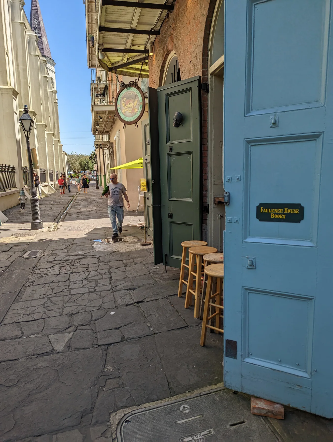

Tennessee Williams arrived in December 1938, aged twenty-seven, and rented an attic room at 722 Toulouse Street. He worked in his landlady’s Quarter Eat Shop as waiter, cashier, host and publicity writer. His observations of the rooming house became material for fiction and drama; a project begun as Dead Planet, the Moon! eventually became Vieux Carré, produced in 1977. The long interval matters: a place can supply material without the work arriving fully formed. He lived at several addresses, returned repeatedly and eventually owned a home in the Quarter. A Streetcar Named Desire uses real transit names and a recognizably New Orleans geography, but its violence, class, sexuality and performance cannot be reduced to a photo at one doorway. The work belongs to a city extending beyond the Quarter and to a playwright who repeatedly revised his own place within it.
Literary tourism is most useful when it recovers conditions of making: where writers could afford to live, whom they met, which magazines or theaters connected them, and how a city’s social conflicts entered form. It becomes thin when a plaque substitutes for reading. Pirate’s Alley earns a pause because its compact space holds church, commerce, tourism and literary memory in one cross-section. The optional extension is a book, not a fabricated anecdote.
08 · French Quarter
Gallatin Street: before the ghost script
Near the downriver end of today’s French Market, a vanished street once concentrated one of the Quarter’s hardest reputations. Gallatin Street stood close to the working riverfront. Nineteenth-century lodging, saloons, sex work, theft, violence and policing clustered there because sailors, transient workers, low-cost rooms and port commerce clustered there. Vice had a geography.
That explanation is more useful than saying the street was cursed. Places of entertainment and danger are produced by wages, housing, law, migration and power. Gallatin was only two blocks long; one ran between Hospital Street, now Governor Nicholls, and Barracks. Its successor name is French Market Place. The market, nearby Mint, wharves and Pontchartrain Railroad brought people, cheap accommodation and cash into this small area.
Municipal campaigns against vice often moved it rather than eliminated it. The 1857 “Lorette Law” taxed sex workers and brothel keepers, restricted where they could operate and imposed racial separation. Brothel keeper Eliza Costello challenged the fee; in 1859 the Louisiana Supreme Court struck down the ordinance on licensing grounds. Later versions continued the effort to control the trade’s visibility and geography. Storyville eventually formalized regulation in another district. During New Deal redevelopment, the city acquired Gallatin’s riverside properties in 1935 and demolished them, renamed the street in 1936 and opened a market pavilion in 1938. The present market landscape includes a deliberate removal of the older port neighborhood.
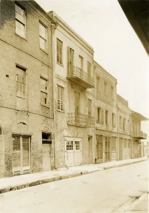

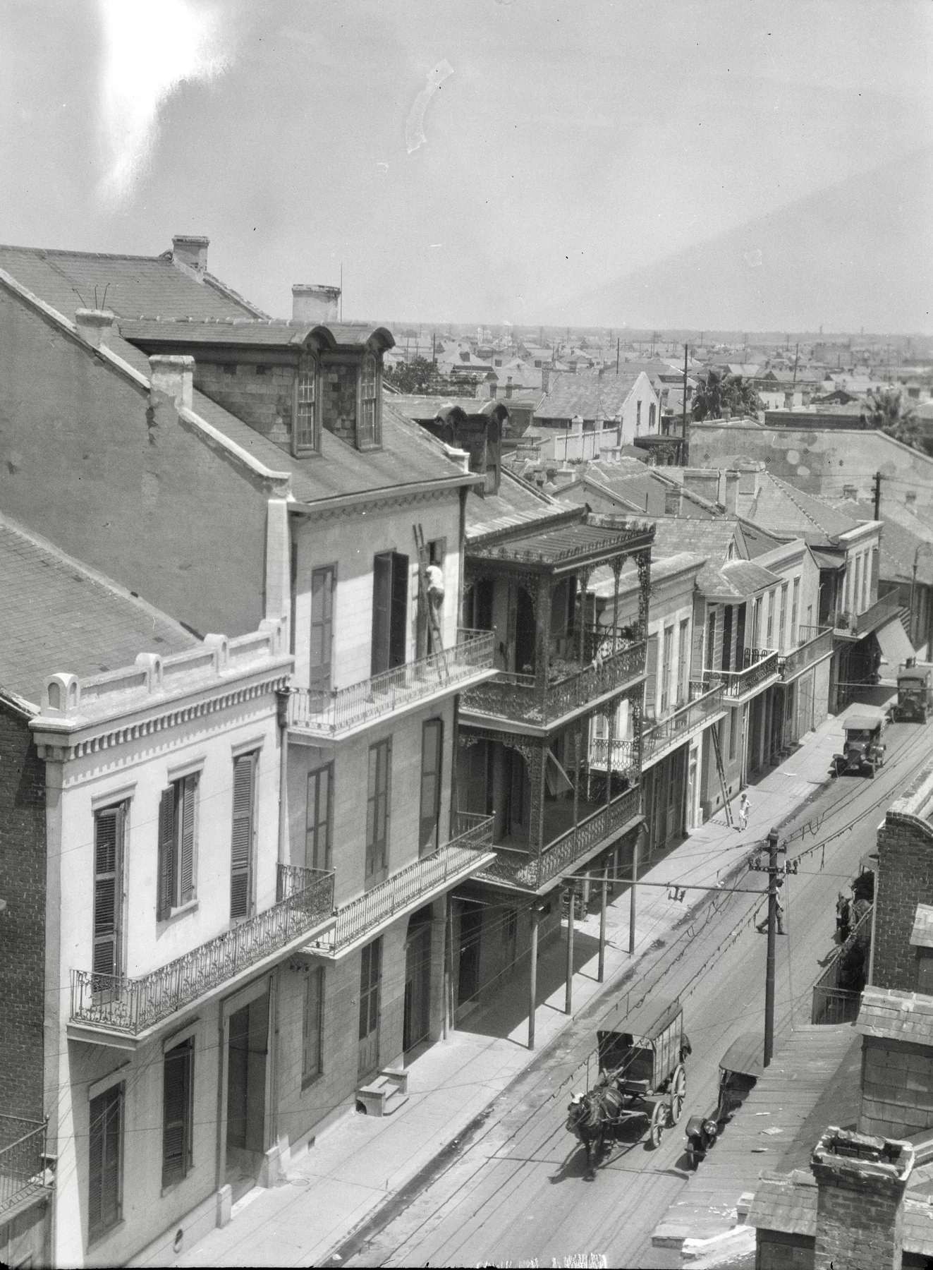
The photograph is especially valuable because disappearance invites exaggeration. Modest façades, shuttered openings and projecting galleries replace the cinematic den. Their condition records long use and disinvestment. Demolition then cleared not merely “bad” buildings but material evidence of how the port’s poor and transient populations lived.
This is where a macabre walk can do serious work. It can map the relationship between port labor and policing, explain why certain businesses gathered, distinguish a documented address from a later tale and show how redevelopment edits memory. Darkness may help a visitor attend to sound and scale. It does not make an unsupported story true.
09 · French Quarter
Crime is not folklore when the victims were real
New Orleans night tours often combine verified crime, rumor, spiritual traditions and supernatural entertainment. The categories can coexist if they are labeled. Trouble begins when evidence and performance are made indistinguishable.
The 1927 “trunk murders” concerned two women with names and lives: Theresa and Leonide Moity, sisters-in-law from New Iberia who had married brothers Henry and Joseph. On October 27, their bodies were discovered at 715 Ursulines Street. Leonide had submitted a story to a women’s magazine; the manuscript and its rejection slip survived among the case’s records. That trace of a woman seeking publication deserves attention alongside the sensational newspaper coverage. Henry Moity was captured aboard the freighter Gem after a crew member recognized the tattoo described in the press. Separate trials produced two concurrent life sentences. The records establish a crime and a prosecution; they do not justify invented final conversations or newspaper insinuations that blame the victims. The press sensation is itself part of the history: crime became a commodity long before walking tours.
The LaLaurie house requires even greater discipline. After a fire on April 10, 1834, rescuers entered the quarters of enslaved people in Delphine LaLaurie’s household and found seven people who had suffered severe abuse. They were taken to the Cabildo for care. Historian Carolyn Morrow Long distinguishes contemporary evidence from later embellishment: newspaper accounts, a judge’s deposition and diplomatic correspondence support the central event, while many elaborate horror stories appeared through repetition much later. The victims’ names have not been recovered from those accounts. That absence is part of the violence of the archive, not permission to invent identities or dialogue. A tale centered on supernatural revenge can displace the clearest fact: enslaved people were tortured within a legal and social order that treated them as property. They deserve more historical attention than the building’s celebrity owners or alleged ghosts.
The 2006 killing of Addie Hall by Zack Bowen is recent intimate-partner violence, not antique gothic material. Bowen killed and dismembered Hall and later died by suicide. Contemporaneous reporting located the couple within the strain and dislocation after Hurricane Katrina, but context is not excuse and a relationship is not romantic because it ended catastrophically. A tour should not diagnose either person from a distance, invent paranormal aftermath or treat their home as a thrill stop without acknowledging the proximity of survivors and community trauma.
Voodoo demands a separate boundary. Louisiana Voudou, also spelled Voodoo, developed through African religious traditions, Catholic practice and Caribbean migration within a slaveholding city. Saint-Domingue refugees arriving through Cuba in 1809 added Haitian influences, but Louisiana Voodoo and Haitian Vodou are not interchangeable names for one uniform practice. Historical gatherings included prayers, singing, drumming, dance, meals and healing. Hoodoo describes a related field of individual conjure and rootwork, rather than simply another name for the same communal religion. Neither is a synonym for violent crime.
Marie Laveau was born free in New Orleans in 1801, in a family whose earlier generations had experienced slavery and secured freedom. Her St. Ann Street home became a center of religious and community life. She combined Catholic devotion with spiritual leadership, helped people in need and ministered to prisoners. Her biography also includes ownership and sale of enslaved women; reducing her to either a saint or a sinister caricature erases that difficult social history. She died in 1881. Familiar stories about supernatural powers, a hairdressing intelligence network or a seamless succession by “Marie Laveau II” require more evidence than their frequent repetition supplies.
The tradition continues beyond her biography. The Louisiana State Museum’s account of Louisiana Voodoo presents contemporary practitioners, including Queen Kalindah Laveaux, and places healing, ancestors and community within a living religious world. A shop window or cemetery tour cannot stand for all of it. Treat a sacred practice as a practice of people, and ask permission before photographing ritual activity. Conflating religion with horror repeats racial caricature; respectful curiosity leaves space for beliefs and boundaries a visitor may not share.
The reader can use four questions on any dark-history walk:
- What is the source? A court record, newspaper, oral tradition and guide script do different work.
- Who is centered? Victims and affected communities should not disappear behind a notorious property owner.
- What is labeled? Documented fact, inference, disputed tradition and theatrical speculation need separate language.
- What is the pleasure? Curiosity about law, memory and place is different from delight in another person’s suffering.
The goal is not to drain the night of mystery. It is to keep mystery from impersonating evidence.
10 · French Quarter
Preservation saved a setting—and created a product
By the early twentieth century, parts of the Quarter were neglected, subdivided or threatened by demolition. Artists, architects, residents and preservationists argued that the district possessed collective value. Louisiana created the Vieux Carré Commission in stages; effective 1936 legislation gave it unusual authority over exterior architectural changes within the district.
The governing idea is the tout ensemble: the whole setting produced by buildings, roofs, courtyards, streets, scale and details. Protecting one landmark while allowing the surrounding fabric to fragment would miss the neighborhood’s value. A 1941 court case helped establish the significance of that collective setting. The commission’s jurisdiction extends from Iberville Street to Esplanade Avenue, between North Rampart Street and the Mississippi; it is not identical to every broader definition of the historic Quarter. This district-scale approach became influential in American preservation.
It also carries tension. Preservation can protect residents from destructive development and keep craft knowledge alive. It can also increase property value, regulate ordinary household change, favor an idealized visual period and turn a mixed neighborhood into a tourism product. The saved façade may shelter a home, a bar, a hotel, a luxury rental or a shop selling the image of preservation itself.
Academic work on New Orleans tourism describes culture not as a fixed substance either preserved or destroyed, but as something reorganized through labor, land, marketing and political power. Musicians, cooks, guides, cleaners, service workers and residents produce the visitor experience. Their ability to live near the place, move through it and shape its future is part of heritage. A district can be visually intact and socially hollowed.
The current preservation challenge is therefore broader than paint color. Intense rain, heat, humidity, termites, hurricanes and subsidence continually stress old fabric. Accessibility changes may meet narrow sidewalks, thresholds and protected elevations. Delivery, waste, nightlife and emergency access compete for small streets. Tourism supports livelihoods while adding noise, congestion and demand for short-term accommodation. Good stewardship has to balance the building, the block and the living community.
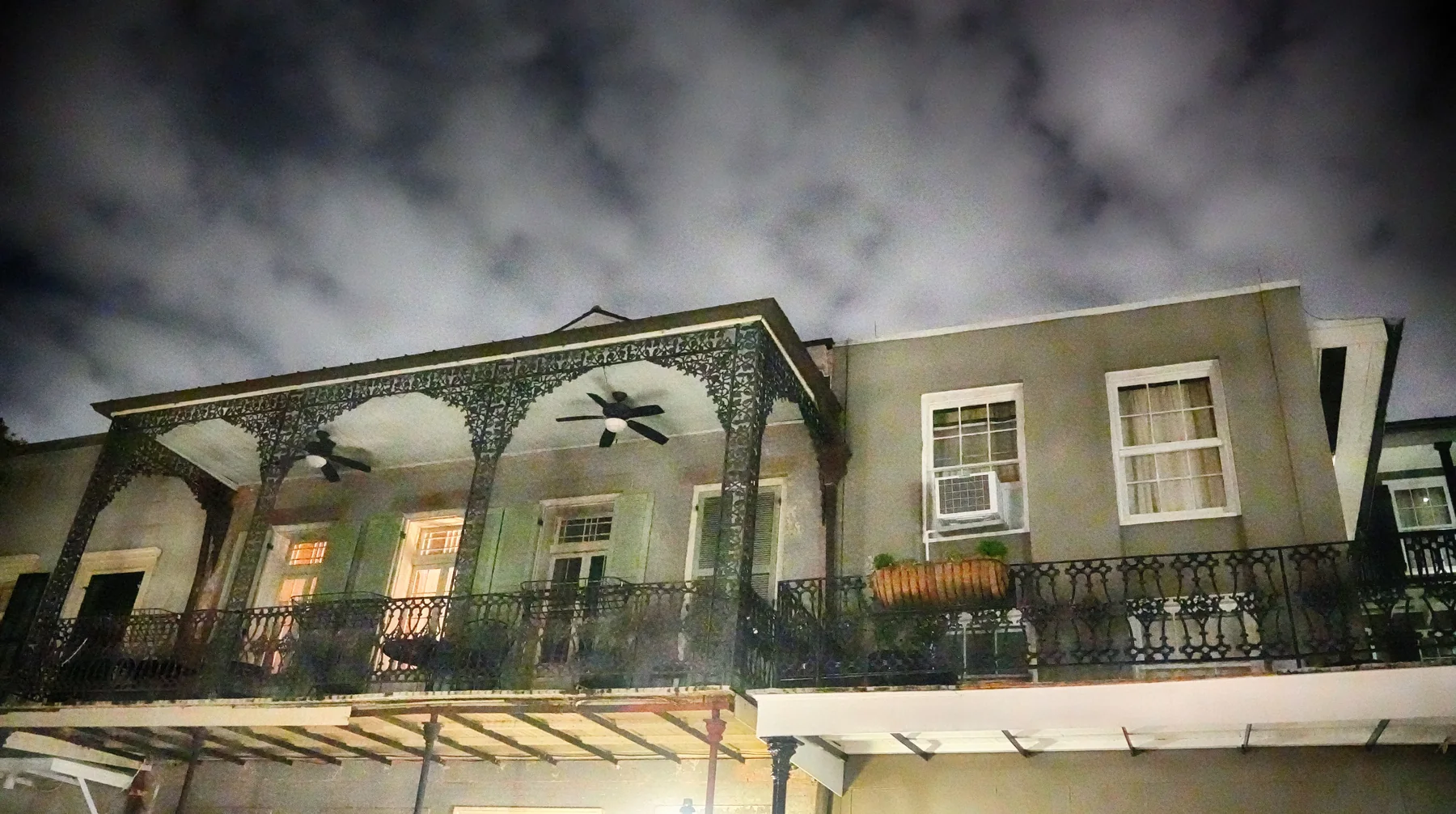

The strongest visitor response is not abstention from pleasure. It is attention to consequence. Use locally owned businesses when possible. Pay musicians. Keep voices down near homes at night. Do not block doors or photograph residents through windows. Treat a gallery as part of a building, not a public stage. Remember that the scene continues after the tour group turns the corner.
11 · French Quarter
The river is an engineered landscape
Before choosing a route, give the river one more look. The Mississippi is not a blue border added to the postcard; it is a moving sediment-and-water system that made the ridge, carried the port and repeatedly threatened the settlement.
The levee is both protection and distance
European engineers began an artificial levee at New Orleans around the city’s founding. The early embankment also served as a road. As settlement extended along the river, landholders were required to build and maintain levee sections. The system grew piece by piece, then through local boards and increasingly federal engineering. It allowed denser settlement and commerce on the floodplain while narrowing where high water could go.
The Mississippi in its less constrained condition overflowed, shifted and distributed sediment across the delta. Levees defend people and property, but they also separate much of the floodplain from the river’s sediment. Navigation works, spillways, floodways and control structures later joined the embankments. The disastrous 1927 flood exposed the inadequacy of confidence in levees alone and drove a larger federal flood-control program.
This engineering history changes the meaning of the Moonwalk. The visitor is not standing on a natural bank looking at an untouched river. The high edge, port installations and managed channel belong to a vast system. River flood protection is also not identical to hurricane storm-surge protection, and neither abolishes risk. New Orleans lives with river level, rainfall, drainage, coastal wetland loss, subsidence and tropical weather interacting at different scales.
The Quarter occupies relatively high natural-levee ground, but “high” should not become a safety slogan. The wider Mississippi Deltaic Plain faces subsidence and sea-level rise; local rates and elevations vary. Hard surfaces and intense rain can produce street flooding even away from a river flood. A saved building must manage roof water, masonry moisture, drainage and ground movement as well as architectural detail.
This is preservation as daily engineering. Gutters, flashing, shutters, plaster, mortar, termite control, ventilation and pumps are not beneath the romance of the Quarter. They are the means by which old fabric continues. Climate pressure increases the cost and urgency of that work, especially for residents and institutions without limitless capital.
From the river, look back toward the cathedral and notice the rise. Then look downstream toward the port and upstream toward the bridges and business district. The famous view sits inside regional infrastructure, not outside it. The settlement’s beauty and its vulnerability begin with the same fact: it occupies a river-built delta.
12 · French Quarter
A route that lets the layers accumulate
The Quarter rewards a route with returns rather than a checklist. Begin on the river side of Jackson Square while the central composition is easy to see. Move to the levee or Moonwalk to recover the port logic. Then return through the square and compare each institutional edge.
At the Cabildo, ask how colonial government became state museum. At the Presbytère, notice designed symmetry and changed use. At St. Louis Cathedral, respect active worship and compare the present nineteenth-century silhouette with the earlier square. Along the Pontalba buildings, distinguish the cast-iron gallery from the colonial scene it is made to represent.
Walk down Chartres Street to the Old Ursuline Convent. The quieter façade gives the eye a reset after the square. Continue toward the French Market, but treat food and retail as contemporary urban life, not an untouched colonial custom. Look for the former Gallatin Street context and remember that redevelopment changed the riverfront.
Turn back along Royal Street. In daylight, the street makes architecture and commerce legible: galleries, shopfronts, courtyards glimpsed through passages, music and delivery work. A performer is not a free audio installation. Leave space, listen intentionally and pay if you stay.
Use Pirate’s Alley as a short literary hinge rather than a pirate-proof site. From there, cross toward North Rampart Street and continue outside the historic district to Congo Square. That final movement is crucial. It prevents the Quarter from claiming the whole history of New Orleans music and places the preserved grid inside a wider Black cultural geography.
The sequence is physically compact but conceptually dense. It can occupy half a day or more if museums and interiors are open. Trying to complete it in one continuous march defeats the method. The architecture becomes legible when attention alternates: distance for urban form, doorway scale for material, pause for context, interior only where access and interest justify it.
13 · French Quarter
Choosing between two guided walks—and walking alone
The two podcast walks suggest different ways to approach the neighborhood.
The Quarter Notes walk is the broader orientation. Its episode follows Jackson Square, architecture, the Ursuline story, literature, music and the river. It is the better conceptual fit for a first visit when the main need is to turn façades into a working city.
Blood & Brick organizes its route around violence, vice and darker public memory. A walk in that vein suits a reader prepared to ask how the guide knows a story and how victims are treated. Its subject matter may be unsuitable for children or for anyone who would find accounts of violence distressing.
When choosing a guided walk, read its topic and route alongside its duration, age rules, meeting instructions and access provisions. Ask whether museum interiors are included or whether the walk stays on public streets. Architecture, literary history and violent crime require different kinds of attention, even when the routes share a starting square.
A guided walk earns its value when the guide can point to evidence in front of the group, connect separate blocks, answer uncertainty honestly and adapt the route to weather or street conditions. A small group can make questions easier; it does not automatically make interpretation better. A night start changes sound, temperature and visibility; it does not create historical permission.
Walking independently is a strong choice for readers who want architecture, museums or photography at their own pace. The National Park Service French Quarter visitor center, the Louisiana State Museum’s Cabildo information and the Old Ursuline Convent Museum can anchor primary interpretation. Live pages should decide hours, programs, tickets and closures.
The best format may be mixed: a morning independent architecture walk, one museum, time away from the Quarter, then a well-sourced guided route after dark. “Connection over consumption,” the Quarter Notes episode’s useful phrase, does not require rejecting commerce. It requires making commerce serve attention.
14 · French Quarter
Traveller’s field notes
Heat, storms and footwear
New Orleans heat is not an ornamental detail. High humidity reduces the body’s ability to cool through evaporation. Choose a pace that allows water and shade, especially around midday. The City’s NOLA Ready heat guidance should outrank generic packing advice on the day.
Summer thunderstorms can develop quickly. Galleries and trees provide shade but are not safe lightning shelter. If thunder is audible, move into a substantial building and follow National Weather Service thunderstorm guidance. Tropical systems, flash flooding and emergency instructions require a larger plan; visitors can monitor NOLA Ready alerts.
Sidewalks are often narrow, cracked, interrupted or crowded. Flagstone and paving can become slick after rain. Wear stable shoes. A route described as wheelchair- or stroller-possible is not the same as a uniformly accessible surface. Confirm the exact guided route with the operator, and ask museums about ramps, lifts, seating and accessible entrances before arrival.
Getting there and moving onward
The Quarter is walkable in scale but does not need to be approached by car. Streetcars, buses and ferries can connect it to other parts of the city. Routes, service changes and fare products are mutable; use the New Orleans Regional Transit Authority rather than an old screenshot. Ride-hail pickup and tour meeting points may shift during events or street closures.
Use marked crossings and allow time to cross busy streets at the district’s edges. Narrow pavements, uneven surfaces and crowded corners can slow a route; choose a crossing with usable curb access rather than following the shortest line on a map.
Plan visits around access
Check official museum and transport pages when planning a visit. For a guided walk, use its booking instructions for the meeting place, timing and terms. Build the day around the places you most want to understand, with room for a museum visit, a rest and the walk beyond North Rampart to Congo Square.
Do not assume every courtyard, church or residential gallery is publicly accessible. Exterior looking is often the respectful and historically productive choice. Do not turn an occupied house into a crime-scene selfie. If a guide’s story seems extraordinary, ask what kind of source supports it. A responsible guide should welcome the question.
Evidence & sources
Evidence before atmosphere
The Quarter presents several kinds of truth at once. A surviving building records materials and adaptation; an archive can recover a name or transaction; oral tradition carries meanings that written power may have ignored; a later legend shows what visitors wanted the past to become. None should impersonate the others. The links throughout this story lead to the institutions, records and current planning pages that let a traveller keep looking without surrendering the whole explanation to another site.
The same distinction governs practical choices. Museums and official visitor pages own live access; booking surfaces own commercial terms; weather and emergency authorities own current alerts. History remains inside the walk, while mutable conditions stay connected to the source that can actually change them.
The question we carry out