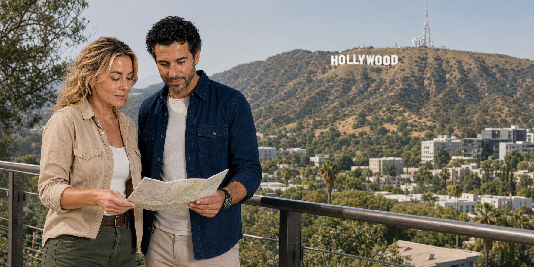
The first Los Angeles most travelers meet is not a place. It is an edit. A hillside sign cuts to a line of pavement stars; stainless-steel curves cut to palms; a hotel entrance cuts to a sunset boulevard. Film, television, advertising, music videos, news and social feeds have made the city familiar before arrival. The familiarity is powerful enough to feel like knowledge.
A city tour works inside that illusion. Its moving window selects a foreground. The guide supplies a voice-over. A screen may place an old scene beside the building outside. A photo stop freezes one recognized image. Four hours later, a passenger can possess a workable mental map—and still know almost nothing about how a neighborhood functions after the vehicle has gone.
That is not a failure if orientation is the stated purpose. It becomes a failure when a sampler is confused with comprehension. Los Angeles rewards a more disciplined question: what can this format reveal at speed, what does it necessarily crop out, and what should a first visit do next?
A half-day sightseeing circuit can link Downtown Los Angeles, Angelino Heights, Hollywood, the Sunset Strip, Beverly Hills, Rodeo Drive, a Hollywood Sign viewpoint and the Original Farmers Market. The east-to-west movement supplies a way to read geography: civic centre to entertainment district, independent city to independent city, public landmark to private neighborhood. Treat it as a family of possible encounters. Route order, the distinction between a stop and a passing view, and the choice of a lawful viewpoint determine what any particular journey actually includes.
Begin with the city the montage cannot hold

Calling Los Angeles “the desert” is an attractive shortcut and a poor map. The metropolitan landscape is a Mediterranean-climate region shaped by a coastal plain, alluvial basins and valleys, abrupt mountain ranges, river systems engineered and re-engineered over time, and a long urban edge facing the Pacific. Dry summers and recurring drought matter. So do winter rain, flood risk, marine air, mountain passes and large differences in heat from coast to inland neighborhoods.
Nor is “Los Angeles” one government. The City of Los Angeles covers a vast, irregular territory and is divided by official community plans. Los Angeles County contains many incorporated cities and unincorporated communities. A short westbound tour can cross from the City of Los Angeles into the independent City of West Hollywood, back through other municipal boundaries depending on the route, and into the independent City of Beverly Hills. Policing, parking, planning, street design, business rules and film-permit responsibilities can change while the boulevard name continues.
The route’s main places belong to different geographic systems:
- Downtown Los Angeles sits near the city’s historic civic and commercial core, east of the neighborhoods that tourism marketing calls Hollywood.
- Angelino Heights, northwest of Downtown, preserves a concentration of late-nineteenth-century residential fabric on hilly streets.
- Hollywood is both a City of Los Angeles neighborhood and a global shorthand for an industry whose studios, workers and suppliers spread far beyond it.
- West Hollywood is a separate, compact city incorporated in 1984 after a coalition that included renters, older residents, Russian-speaking immigrants and LGBTQ communities sought local control.
- Beverly Hills is another independent city, planned around water, real-estate development and a garden-city ideal before film and luxury retail amplified its image.
These distinctions are not administrative trivia. They explain why a film permit, bus lane, protest, nightclub rule, protected bicycle lane or preservation decision cannot be attributed to a generic “LA” authority. They also expose the tour’s central visual trick: one continuous windshield makes several cities look like a single scene.
The route is a loop of arguments, not a list of icons
A half-day circuit can place the Hollywood Sign viewpoint, Hollywood Boulevard, Beverly Hills, Rodeo Drive, Sunset Strip, Downtown, Walt Disney Concert Hall, Angelino Heights and the Original Farmers Market in one mental map. It cannot give each place equal depth. Some sights may be approached on foot; others are understood from a public viewpoint or in motion. The distinction matters more than the number of names on an itinerary.
“Visit Walt Disney Concert Hall,” for example, can describe an interior program, a plaza walk or a narrated view from Grand Avenue—three different encounters. “See the Hollywood Sign” does not mean approach the letters; the sign stands on protected terrain in Griffith Park and is read from lawful viewpoints at a distance. “Beverly Hills” does not confer access to a private home, and a film location visible from a street may be closed, altered or in ordinary use.
The Original Farmers Market is a useful counterweight to the route’s monuments. It began in July 1934, when a dozen farmers and other merchants sold from trucks at Third and Fairfax; permanent stalls followed that autumn. Before the market, the Gilmore property supported a dairy, then oil extraction. An automobile-oriented landscape grew around it: racing, a baseball ground and, in 1948, a drive-in cinema. Food retail and entertainment were already sharing land long before the adjacent Grove shopping development.
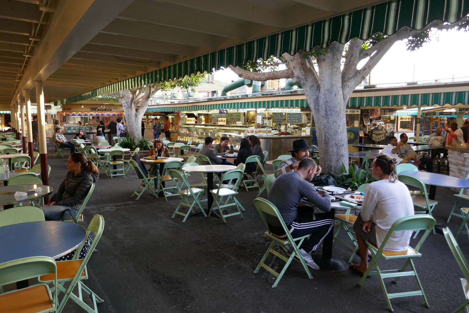
The difference between market and shopping complex is useful on foot. Rather than treating the whole district as one photo stop, look at how individual counters, narrow passages and shared eating spaces distribute attention. A market break also has a time budget: finding food, ordering, eating and reaching the regrouping point are separate tasks. Choose a meal that fits the available interval instead of assuming the stop includes an unhurried restaurant lunch. The market’s enduring interest is this mixture of everyday commerce and visitor consumption, not a claim that every stall or surrounding business has remained unchanged since 1934.
Traffic, legal loading and the simple act of regrouping change how much of any sequence survives in practice. A responsible itinerary shortens an element rather than turning a published duration into pressure to speed. Read the circuit as a transect across the metropolis, then decide which one or two places deserve a separate return.
Downtown: the view after a city was remade

Downtown is where the moving-window format can be most deceptive. A polished sequence of City Hall, the Cathedral of Our Lady of the Angels, Walt Disney Concert Hall and the towers of Bunker Hill reads as a civic skyline. It is also a record of choices about land, housing, culture, finance and who was moved to create the view.
Bunker Hill began as an elevated residential district close to the commercial city. Large Victorian houses were subdivided as the neighborhood changed, and its residents included older people, low-income tenants, workers, artists and immigrant communities. Angels Flight, opened in 1901, connected Hill Street with the top of the hill. The funicular’s two cars became both practical infrastructure and a recurring screen image.
By the mid-twentieth century, officials and business leaders treated Bunker Hill as a redevelopment problem. The city acquired properties through eminent domain, displaced residents and cleared most of the older neighborhood. Superblocks, parking structures, office towers, plazas and cultural institutions replaced the fine-grained streets over decades. Angels Flight was dismantled in 1969 and later rebuilt a half-block from its original alignment. To say only that Downtown “modernized” erases the tenants and businesses for whom redevelopment meant removal.
Walt Disney Concert Hall belongs to this later Bunker Hill. Designed by Frank Gehry and opened in 2003 as a home for the Los Angeles Philharmonic, its stainless-steel exterior turns changing light into part of the composition. From a vehicle, it is easy to reduce the building to a gleaming curve. The more revealing questions concern circulation and institution: how the hall meets Grand Avenue, how an interior organized around the orchestra differs from the exterior image, and how a major cultural investment sits within a district remade by clearance.
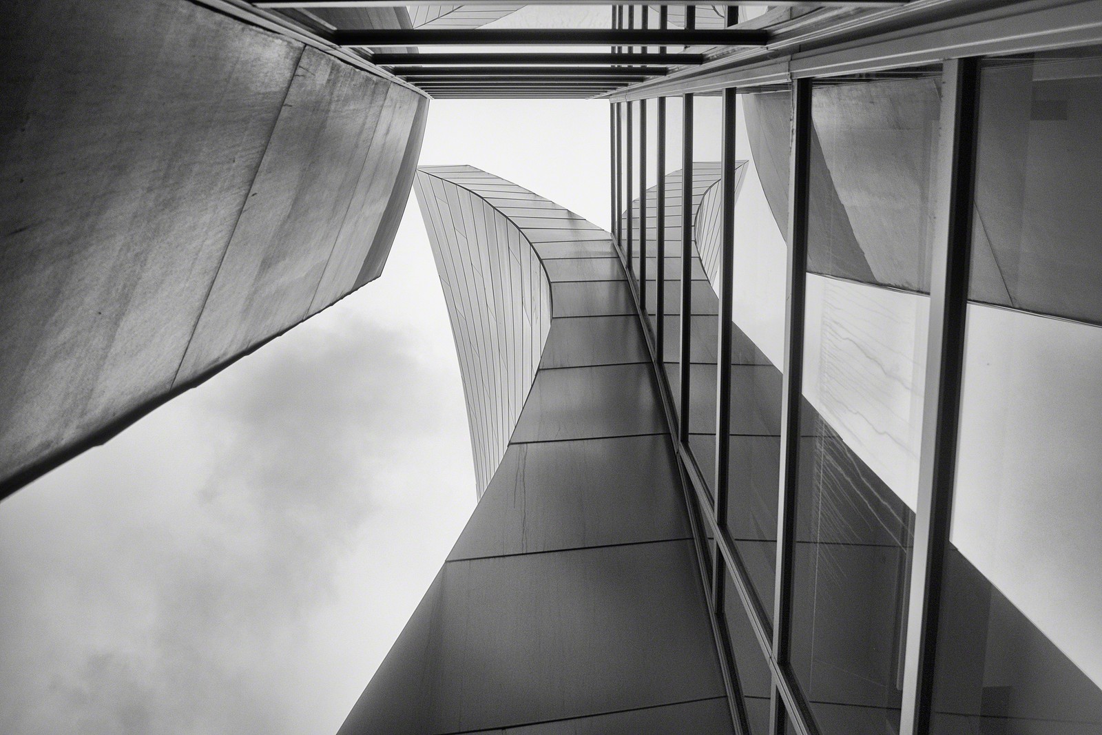
The Philharmonic’s account of the design starts with Lillian Disney’s 1987 gift and explains a building developed from its musical interior outward. The auditorium seats its audience around the orchestra in a vineyard arrangement, rather than isolating the stage behind a proscenium. Douglas fir surfaces and acoustic design by Yasuhisa Toyota belong to the musical instrument that the silver exterior encloses. Testing used a one-tenth-scale model filled with nitrogen to reproduce sound behaviour at a reduced scale: an engineering problem hidden behind the apparently free-form silhouette.
The roof garden’s A Rose for Lilly fountain, made with broken Delft china, is a smaller memorial within the monumental building. These details reward a return on foot. Exterior circulation, a venue tour and a performance each reveal a different hall; none can substitute for the other. The Philharmonic’s venue-tour information is the place to check the interior encounter you want. A photograph of the atrium helps explain the building’s layers, but it cannot convey how the auditorium sounds.
The nearby Civic Center gathers government buildings and symbolic space. Los Angeles City Hall, completed in 1928, was a collaboration: John Parkinson developed the architectural design, Albert C. Martin the structure, and John C. Austin the working drawings and project administration. Classical entrance columns meet a setback tower and stepped crown. The combination makes civic authority look both established and modern. It is the seat of a city whose municipal boundaries do not contain the whole metropolis—a particularly useful distinction to keep in mind when the building becomes a screen shorthand for “Los Angeles.”
The Cathedral of Our Lady of the Angels, dedicated in 2002, offers another answer to the problem of a monumental building beside fast-moving traffic. In the cathedral’s account, Rafael Moneo, commissioned in 1996, treated the Hollywood Freeway as a river connecting people. That was the architect’s metaphor, not a description of comfortable pedestrian access. Inside, a slightly rising ambulatory leads toward the nave; Spanish alabaster filters daylight rather than giving a transparent view through the windows. Light and the act of moving through the building express the cathedral’s Catholic understanding of a spiritual journey. A passing glimpse of its walls misses this deliberate progression from approach to interior.
Its John Nava tapestries also complicate the division between old craft and contemporary media. The Communion of Saints series presents 135 saints and blesseds and twelve unnamed figures, including children. Nava used contemporary models and developed the images through painting and digital work; the files informed weaving at Flanders Tapestries in Belgium. Textile surfaces contribute to the interior’s acoustic character as well as its imagery. The saints are therefore not simply old pictures applied to a new church: the work joins living faces, digital preparation and woven material. If religious art is your priority, allow time to read bodies, clothing and relationships across the sequence, while respecting the building’s use for worship.
Government, concert hall and cathedral can make Downtown appear ceremonially complete. Street life, housing, transit access and the connections between superblocks remain different questions. A visitor can admire the buildings and still ask who reaches their public spaces easily, which activities require an interior visit, and where the district’s residential history has gone.
Angelino Heights supplies the sharpest nearby contrast. Developed in the 1880s, it retains Queen Anne and other Victorian-era homes, especially around Carroll Avenue. In 1983 it became Los Angeles’s first Historic Preservation Overlay Zone. Preservation here does not turn private houses into public attractions. Residents’ entrances, porches and windows remain private, even when a production has used an exterior. A guide can identify architectural features and explain the preservation system without converting someone’s home into a celebrity prop.
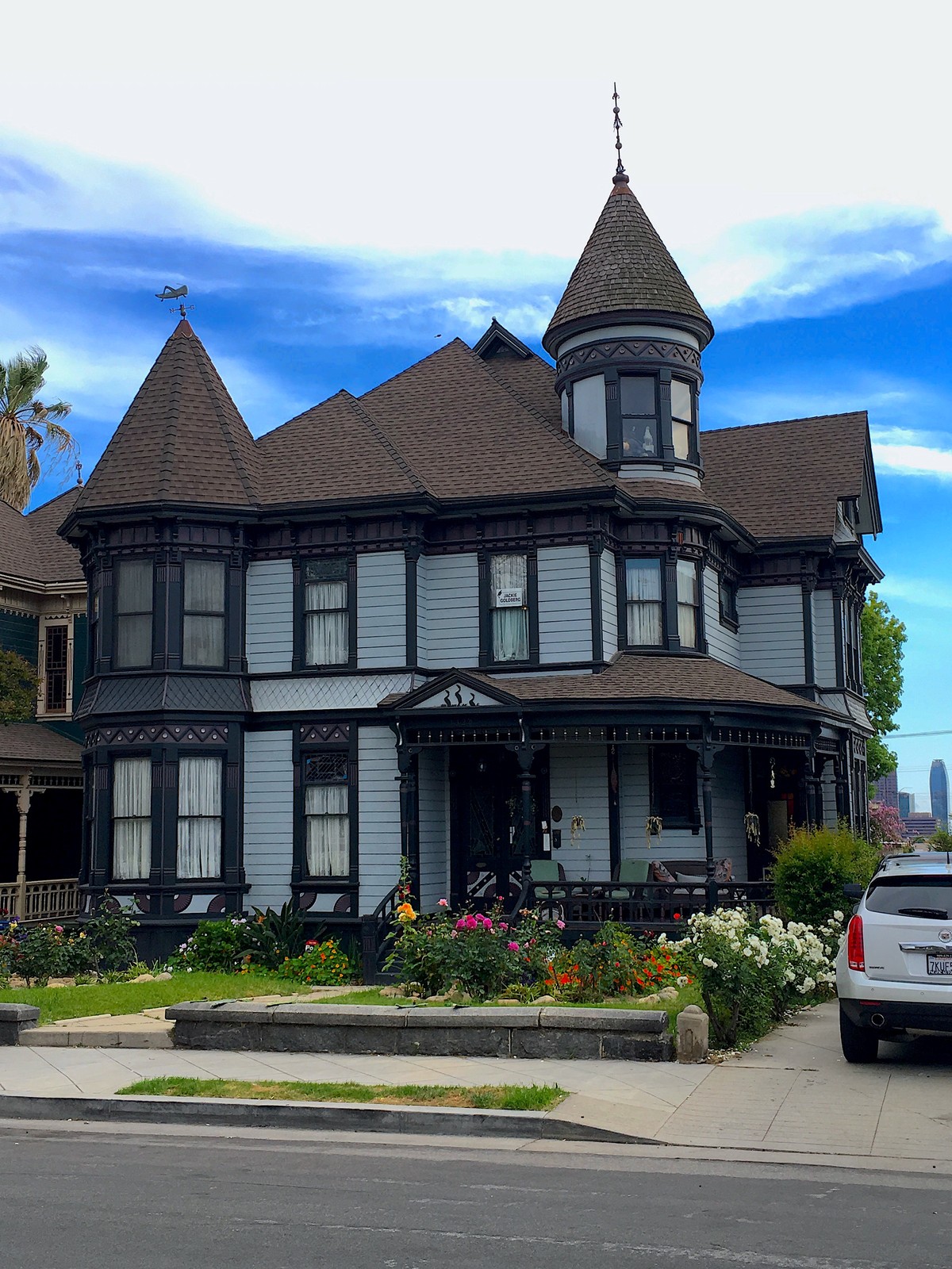
Victorian is a period label, not one uniform style. Projecting bays break up a flat wall; turrets alter the roofline; timber trim turns structural edges into patterned surfaces. The Conservancy’s account of the nearby Innes House describes Eastlake details, stained-glass-bordered window panes and the restoration movement of the 1970s. It also explains a less visible tool: a preservation easement protects specified features through a legal agreement. That works alongside the district’s planning controls; it is not the same as opening a house to visitors. Reading a façade from the public sidewalk can reveal design and conservation without requiring an interior, a celebrity story or an invitation to approach a porch.
Hollywood is a labor system disguised as a proper noun

The Hollywood Sign and Walk of Fame are unusually effective symbols because each compresses an industry into a surface. The sign began in 1923 as “HOLLYWOODLAND,” an illuminated real-estate advertisement. It was designed to sell hillside lots, not to celebrate cinema. The “LAND” was later removed, and preservation campaigns rebuilt the decaying structure in 1978. Its journey from property marketing to protected civic icon mirrors Los Angeles’s talent for letting one image replace its original transaction.
For the visitor, the important distinction is between seeing the letters and reaching them. The City’s viewing guidance identifies Griffith Observatory and Hollywood & Highland as places to see the Sign. The letters stand on Mount Lee; walking on a park trail does not create permission to approach them. The Sign is not illuminated at night, so a night itinerary should not be chosen on the expectation of glowing letters. For a daytime stop, ask whether you want the distant city-and-hills composition, a closer view of the lettering or time to understand the landscape. Those are different photographic and walking decisions; a quick roadside glimpse is not equivalent to a park visit.
The Walk of Fame is another made object, not a spontaneous archive of merit. The Hollywood Chamber of Commerce developed the concept in the 1950s as a way to reinforce the district’s glamour. Construction began in 1960; the first installation eventually contained 1,558 stars. The Chamber’s history distinguishes the 1958 trial stars from the first permanent star, installed for producer Stanley Kramer in March 1960. The dedication came that November, with the original installation completed in 1961. A pavement ceremony and the creation of the whole walk were different milestones. Selection, sponsorship, ceremony and maintenance continue under rules. The pavement therefore records promotion, institutional choice and changing entertainment categories as much as artistic achievement.
Neither landmark explains how motion pictures are made. A production connects writers, researchers, directors, producers, performers, cinematographers, production designers, art departments, set builders, grips, electricians, costumers, hair and makeup artists, sound crews, location teams, drivers, editors, visual-effects artists, musicians, publicists, laboratory and data workers, caterers and many more. Some work is visible on set; much of it occurs in offices, workshops, post-production houses, warehouses and remote systems spread across the region.
The landscape of production soon exceeded the Hollywood neighborhood. Major facilities developed in Culver City, Burbank, Studio City, Universal City and elsewhere. Paramount remains a large studio presence in Hollywood, while the economic geography of screen work extends across Southern California and beyond. A boulevard drive cannot map that network by pointing to a few former studio gates.
Labor history is equally central. IATSE locals represent many crafts behind the camera; SAG-AFTRA represents performers and media professionals; writers, directors, musicians, teamsters and other workers bargain through their own organizations. Strikes make normally invisible dependencies visible. In 2023, writers and performers challenged compensation structures and the use of generative artificial intelligence; the resulting performer agreement introduced consent and compensation guardrails for digital replicas. The “dream factory” metaphor is useful only if the word factory keeps its workers.
On-location filming also changes ordinary neighborhoods. FilmLA’s permit guidance requires insurance, approvals and—in affected areas—community notification or surveys. Location managers negotiate access, parking, equipment, hours and special conditions. Residents and businesses may gain income or face disruption. A film scene is therefore not simply found; it is planned, permitted, lit, recorded and edited through legal and social relationships.
Hollywood Boulevard’s theatres provide a concrete way to read the distinction between making a film and selling an encounter with it. The Egyptian Theatre opened in October 1922. Grauman’s movie-palace model made the forecourt, themed presentation and arrival part of the show before an audience entered the auditorium. The Chinese Theatre, opened in 1927, extended that strategy through Meyer & Holler’s fanciful interpretation of Chinese architecture, imported objects and a dramatic roofline. These are Hollywood constructions of cultural imagery, not a guide to Egyptian or Chinese building traditions.
The Chinese Theatre’s conversion for IMAX exhibition in 2013 shows why preservation cannot mean freezing every technical system. Projection, sound, screen size and seating geometry change while a building retains its historic public identity. Its handprint forecourt and the Walk of Fame pavement are separate attractions, with different traditions. For a return visit, decide whether you want to examine the exterior, enter an auditorium or watch a film. Recognizing the roof from a vehicle answers none of those questions by itself.
The best guide narration makes these systems visible. It treats a theater as an exhibition business, a studio wall as a workplace boundary, a preserved façade as a policy outcome and a star as a promotional institution. Celebrity trivia can entertain, but it should not displace labor, craft and neighborhood life.
A screen can reveal the edit
A screen-equipped city tour can place a film excerpt beside the street that supplied its location. The useful comparison is conceptual rather than technological: the screen shows how a production selected and transformed the place outside.
When used well, a clip does more than say “a movie happened here.” It can demonstrate five transformations:
- Framing excludes adjacent buildings, traffic and people outside the camera angle.
- Production design adds signs, dressing, vehicles, lighting and temporary surfaces.
- Performance and sound give an ordinary location emotional meaning.
- Editing joins places that may be miles apart and compresses time.
- Reuse gives the same building multiple screen identities across decades.
A temporal comparison can also reveal physical change. An old street view beside the present landscape may show a demolished structure, a repurposed theater, a widened road or vegetation growth. But interpretation should distinguish what the clip proves from what the guide supplies. A façade visible in a scene does not establish who lived there, why a building changed, or how residents experienced production.
A comparison need not be long to be revealing, but its shortness alone does not settle copyright. The US Copyright Office explains that there is no fixed number of words, notes or percentage that automatically makes a use fair. Licensed images, public-domain material or a properly assessed excerpt can support interpretation. Captions, a transcript and adjustable audio let more passengers follow the same argument; a screen that offers only sound or only small text creates a new barrier inside the vehicle.
There is also a deeper media-literacy lesson. The view outside the window is not neutral reality while the screen is “fiction.” The route, seat, speed, tinted glass, commentary and traffic have already framed the street. The honest tour lets the two constructions interrogate each other.
Sunset Boulevard changes government while keeping its name
The Sunset Strip is the 1.2-mile section of Sunset Boulevard within West Hollywood, running east from the Beverly Hills boundary toward Havenhurst Avenue. That municipal fact matters because the Strip’s mythology predates the city that now governs it. Clubs, hotels, billboards, restaurants and music venues developed in an unincorporated county area between Los Angeles and Beverly Hills, a position that shaped regulation and nightlife.
The Strip’s music geography is more specific than a roll call of celebrity sightings. The Whisky a Go Go opened in 1964 and became associated with the Doors and other performers; the Rainbow Bar & Grill, opened in 1972, became a gathering place around the music scene, with Lemmy a particularly enduring association. A performance venue and a restaurant hangout produce different kinds of musical culture. Stage work, rehearsal, recording, publicity, conversation and fan pilgrimage belong to overlapping networks. Passing a sign cannot tell you which of those activities took place there—or give you the sound of a particular night.
One documented story explains why the pavement matters. In the Los Angeles Public Library’s history of Pandora’s Box, the youth club stood on a traffic island at Sunset and Crescent Heights. Noise, parking, crowds and a curfew became points of conflict. A protest on 12 November 1966 helped turn the Strip into an argument over who could occupy public space. Buffalo Springfield’s For What It’s Worth grew from that setting; its later use as a general protest anthem can obscure the local dispute. The club was demolished in 1967. This was not simply musicians behaving rebelliously: it involved businesses, young people, regulation and the use of a street.
Venues and genres changed. The labor behind nightlife—musicians, sound engineers, bartenders, cleaners, security staff, cooks and drivers—rarely appears in a celebrity drive-by. A return for music should therefore begin with the performance or history you want to understand, rather than a hope that a famous person will materialize at a doorway.
West Hollywood incorporated in 1984. Local history emphasizes rent control and a coalition of renters, seniors, LGBTQ residents and Russian-speaking immigrants. The city now regulates development, public realm and outdoor advertising. Its Sunset Arts & Advertising Program acknowledges that billboards have shaped the Strip since the 1920s while setting rules for newer digital displays. The result is not merely spectacle; it is municipal policy treating commercial imagery as part of urban design.
Beverly Hills begins another civic story. The city’s official history starts with water and Tongva use of the area known as the Gathering of the Waters. The 1838 Mexican land grant to María Rita Valdez Villa, oil exploration, real-estate subdivision and Wilbur D. Cook’s curving garden-city plan preceded its global association with stars. The Beverly Hills Hotel opened in 1912, and the city incorporated in 1914. The city’s own chronology places the defeated proposal to annex it to Los Angeles in 1923, a separate event. Oil prospecting did not yield the expected fortune; subdivision and a managed landscape offered another way to make the land valuable. Cook’s curving streets and planted civic image gave property development a distinctive form before celebrity residence supplied its most widely exported story.
Tongva history also belongs to the present. The Tongva-led Taraxat Paxaavxa Conservancy, founded in 2022, works on land stewardship and cultural revitalization in Tovaangar. It identifies itself as a nonprofit organization, rather than a tribal government. That contemporary work challenges a tour narrative in which Indigenous people appear only before the city begins. Water, land tenure and the right to tell a place’s history did not cease to matter when a luxury landscape replaced earlier uses. For visitors, the practical distinction is between learning through publicly offered interpretation and treating community cultural life as an attraction available on demand.
Rodeo Drive’s luxury image was made over time through retail tenancy, architecture, hospitality, promotion and film exposure. A storefront is simultaneously a business, workplace and stage set for consumption. The labor that sustains the image includes sales, alterations, logistics, cleaning, security, landscaping and hospitality. The surrounding city also has schools, apartments, offices, public parks and civic services. A tour focused on wealth can make these ordinary systems disappear.
Private-home narration creates particular risks. Ownership changes; famous addresses are repeated inaccurately; hedges conceal residents for a reason; and a past film association does not create public access. A responsible route stays with public streets, verified civic history and visible urban form. It does not encourage surveillance, trespass or the idea that a gate is evidence.
Four hours buys a first map, not a neighborhood
Four hours sounds generous until it is divided honestly. Meeting or pickup consumes time. Moving between Downtown and the western stops consumes time. Legal loading, parking, traffic signals and regrouping consume time. A Hollywood Boulevard walk, Beverly Hills photo, Farmers Market break and viewpoint stop compete with narration and road distance. The exact allocation changes with route order and traffic, so invented percentages would create false precision. The important fact is structural: every added stop reduces the depth available at the others.
The moving vehicle is excellent at relative orientation. A passenger can understand that Downtown lies east of Hollywood, that the hills interrupt the grid, that West Hollywood and Beverly Hills are independent cities, and that Third and Fairfax belongs to a different commercial landscape from Rodeo Drive. The same vehicle is weak at street-level duration. It cannot show how a place changes between morning and evening, how a transit transfer feels, how far an accessible entrance sits from a platform, or how residents use a block when no tour is present.
Choose one question to carry through the circuit. Follow how image-making alters property value. Compare the civic spaces of Downtown and Beverly Hills. Track where entertainment appears as production, exhibition, nightlife and tourism. Notice how road width, shade and pedestrian space change across jurisdictions. A question converts a list of landmarks into a readable transect.
Then choose one place for a separate return. Hollywood Boulevard rewards a walk that includes theaters, labor and preservation rather than only stars. Downtown needs time for Bunker Hill, the historic core and transit connections. West Hollywood makes sense after dark only when current transport and safety planning are explicit. The Original Farmers Market deserves attention to merchants and food without treating it as a generic lunch court. No half-day loop can substitute for all four.
The “best” transport depends on what must remain visible

A guided minivan solves several first-day problems at once: navigation, commentary, a long east–west connection and limited legal stops. The passenger can look rather than drive. The trade-offs are a fixed group, substantial seated time, motion sensitivity, glass between traveler and street, a traffic-dependent schedule and access conditions determined by one vehicle.
Public transit supports a different understanding. Metro bus and rail require the traveler to make transfers and walk the last segment, but they reveal distance, station geography and the ordinary movement system. Metro’s accessibility guide describes wheelchair-accessible buses and rail lines, lifts, station routes, announcements and securement. That system-level provision does not mean every sidewalk, elevator or attraction entrance will be available on a particular day; live service and elevator alerts still matter. A transit day also favors fewer neighborhoods over a continuous icon loop.
Self-driving offers control over stops but imposes navigation, parking, traffic, fatigue and responsibility for every legal loading choice. A visitor who wants to see the city may spend the day studying mirrors and signs. Rideshare removes parking but not congestion, waiting, curb access or repeated costs. Neither format automatically lowers emissions; party size, vehicle, deadheading, distance and occupancy matter.
Hop-on/hop-off buses offer a legible tourist network and the possibility of stopping, but frequency, route loops, upper-deck heat, audio access and boarding geometry must be checked. Walking is the deepest option inside one compact district and the weakest way to connect the whole route. An accessible private format can tailor boarding, securement, pacing and communication, but only when those features are specified by the actual operator rather than assumed from the word “private.”
No single mode is the ultimate shortcut. Use the minivan for an initial transect when the group accepts its access conditions. Use Metro and walking for fewer neighborhoods with more street time. Use a car only when the stops justify the driving work. Add a dedicated accessible service when the ordinary chain cannot be verified. The correct comparison is not speed alone; it is how much of the city each mode allows the traveler to notice.
California offers a useful comparison in San Francisco’s road, water and night itinerary: changing the medium and the light changes which city becomes visible. Los Angeles asks the same question through a screen and a windshield. In both places, the best overview prepares a more deliberate second encounter.
Accessibility and safety are properties of the whole chain
An accessible station or attraction does not automatically make the journey between them accessible. The chain begins at the meeting curb, continues through the vehicle door, seat and restraints, and reaches every pavement, grade, toilet and viewpoint used along the way. Travelers who need step-free access should match the actual vehicle and walking segments to their requirements before choosing a format; a generic label such as “minivan” or “private” is not a specification.
For a traveler who uses a wheelchair or mobility aid, the useful questions concern the whole path: whether boarding is step-free or requires transfer; whether securement and mobility-aid storage are available; what surfaces, grades, curb ramps, shade, seating and toilets appear at stops; whether an inaccessible viewpoint has an equivalent alternative; and whether narration is supported by amplification, captions, written material or visual description. Families likewise need the actual child-restraint policy, not an inference from an age label.
Los Angeles heat and air quality vary substantially between the coast, basin and inland areas. City heat guidance and South Coast AQMD’s neighborhood-scale air-quality information provide better day-of-travel evidence than a region-wide weather icon. These checks belong to any outdoor itinerary, regardless of transport mode.
Hollywood Boulevard is also a living transport corridor. LADOT’s safety and mobility project added protected bicycle space, center-turn treatments and pedestrian improvements after documenting serious collisions. Tour loading and photo behavior should respect current curb rules and bicycle paths. No guide’s confidence can substitute for a legal stop or safe crossing.
Motion sickness requires individual planning. The CDC’s travel-health guidance explains a mismatch between sensed movement and visual information. Looking toward the horizon and avoiding reading or visual scanning can offer partial protection; none is a guarantee. A screen-led road trip may be a poor fit if looking at displays regularly triggers symptoms. Discuss your own prevention options with a healthcare professional, and choose a format in which you can comfortably follow the interpretation.
Choose the format that answers your question
A narrated half-day circuit is useful for a first-time visitor who wants a geographic overview, accepts a sampler and values film-location comparison. A route that includes Downtown and Angelino Heights also prevents Hollywood and Beverly Hills from becoming the entire city. Its value lies in orientation, not in collecting the greatest number of icons.
Choose a different format when a single attraction requires real time or admission; when the group needs access features that the selected vehicle cannot provide; when motion sensitivity makes a screen-equipped road circuit unsuitable; or when the purpose is to understand one neighborhood rather than recognize many. Walking and Metro favor depth and ordinary movement. A guided vehicle favors continuity across long distances. A tailored accessible service can resolve specific boarding and pacing needs when those features are agreed in advance.
Whichever mode you choose, distinguish outside-the-vehicle stops from narrated views, interior admission from a building exterior, and a route outline from a guaranteed sequence. That small discipline protects time for the parts of Los Angeles that matter most to you.
Listen for the question behind the itinerary
The ExcursionPass Travel Podcast returns to windows and screens as ways of encountering Los Angeles. It asks whether multimedia can make a sprawling city coherent. That is the right starting question.
The tension between moving image and moving vehicle gives a first visit a useful test. Does each sight become more intelligible, or only more recognizable? A route that explains why a street changes government, how a concert hall works or whose homes disappeared beneath a skyline leaves you with questions worth pursuing after the circuit ends.
Listen, then watch the edit. When the sign appears, remember the real-estate advertisement. When the stars appear, remember the selection institution and the workers without pavement names. When Disney Hall flashes silver, remember Bunker Hill’s displaced tenants. When a film clip matches a façade, look for everything outside its frame. When the route crosses an invisible boundary, ask which city now governs the street.
A good first-day tour does not finish Los Angeles. It makes the city harder to mistake for its own trailer.
Podcast: City Tour of Los Angeles, Hollywood and Beverly Hills by ExcursionPass · Episode transcript